
Tropical system in the Gulf expected to gradually strengthen the next couple of days off the Florida Panhandle and Alabama coasts. Instances of flash flooding will be possible through Thursday along the eastern and central Gulf Coast. Severe thunderstorms will develop and move along a cold front crossing the Upper Midwest, and through the Ohio Valley/Mid-Atlantic on Tuesday. Read More >
Please provide feedback for this page to the Fire Weather Program Leader.
|
|
RAWS Point ForecastsAntietam NB 180303 Catoctin 180302 Cedarville 181510 Fort Valley 440402 Green Ridge 180201 NPS HQ Luray 440901 Kearneysville 462901 Augusta 461102 Patuxent 181501 Prince William 441531 Sawmill Ridge 441906 Susquehanna 180701 Upper Tract 463501
Area NWS Fire Weather Forecasts
NWS Sterling Fire Weather Planning forecasts are sent 2 times per day, just prior to 1:00 AM and PM. Red Flag Warning and Special Weather Statement Criteria Issued in coordination with the state agencies when near red flag criteria are expected.
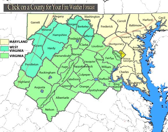
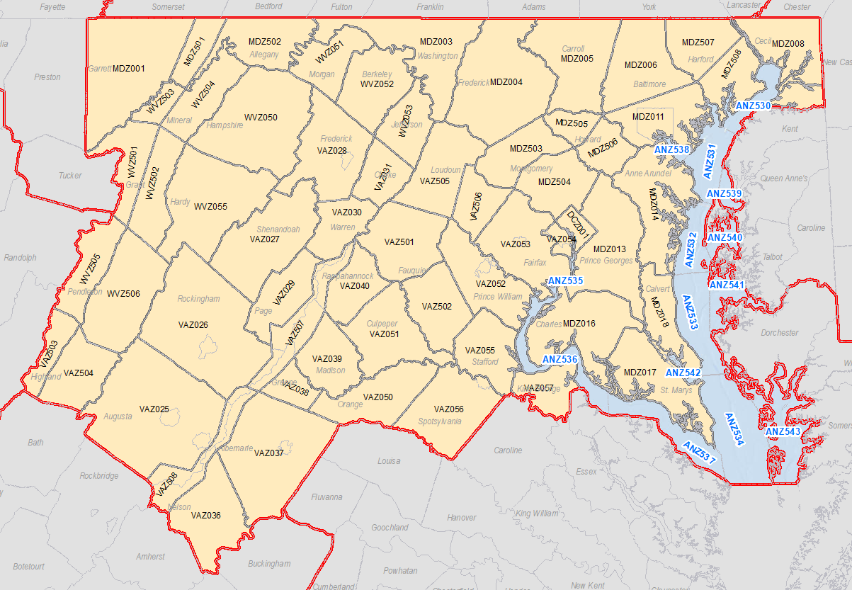
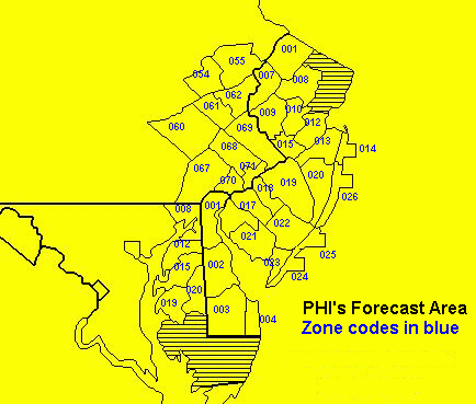
NWS Sterling Latest Red Flag Warning / Fire Weather Watch - if recently issued/available NWS Sterling Fire Weather Forecast - available year round (map of area with fire weather zones) NWS Sterling Fire Weather Matrix (how to decode)
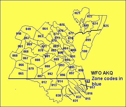
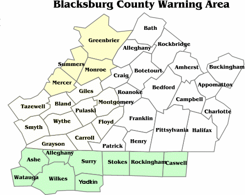
NWS Wakefield Fire Weather Forecast (map of area) NWS Blacksburg Fire Weather Forecast (map of area) NWS Mt. Holly Fire Weather Forecast (map of area) Graphical Fire Weather Forecast ------------------------------------------------------------------------------------------------------------------------------------------------------------------------- Fire Danger
Today Tomorrow
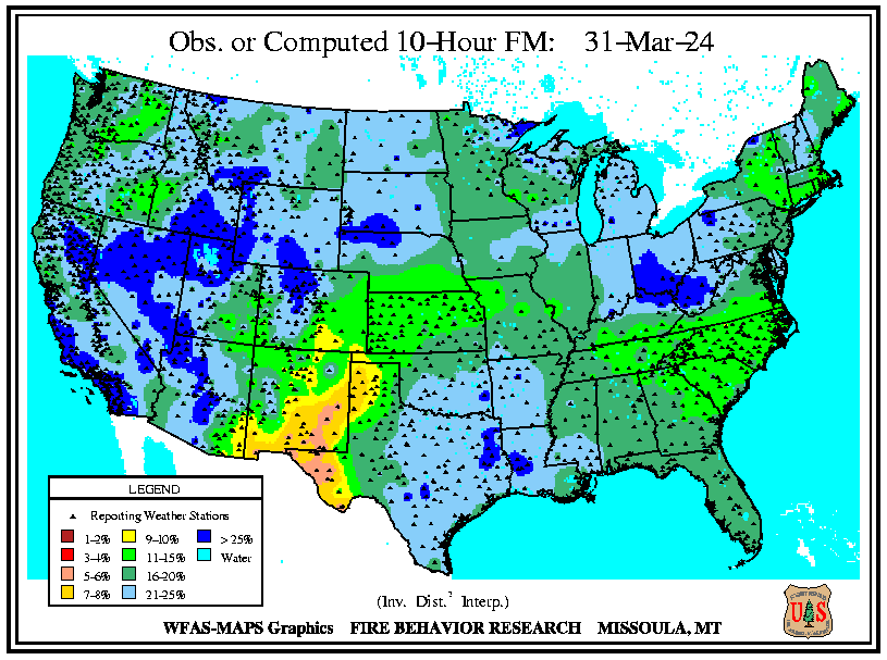
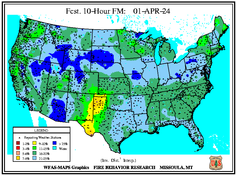
10 Hour Fuel Moisture
Today Tomorrow
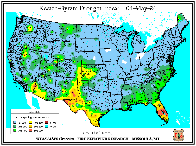
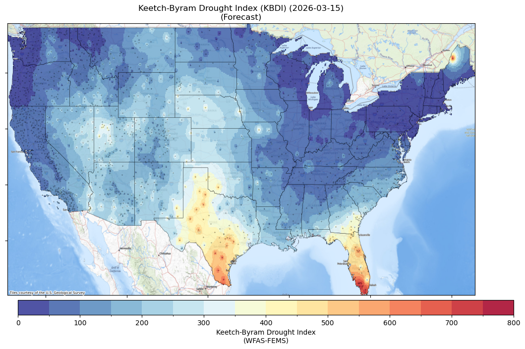
KBDI
Today Tomorrow
------------------------------------------------------------------------------------------------------------------------------------------------------------------------- Coordination Centers Southern Area Coordination Center (SACC) Eastern Area Coordination Center (EACC)
Satellite Resources CIRA SLIDER Page (GOES AND VIIRS Imagery) Hazard Mapping System Fire and Smoke Product (quality controlled product that includes GOES, VIIRS, and soon Sentinel-3 fire detections) JPSS Imagery (select: CIMSS: VIIRS Imagery Viewer & Sector USA 4 Real Earth: VIIRS NDVI Imagery) Other Useful Links USFS Wildland Fire Assessment System National Interagency Fire Center Daily Situation Report E-mail NWS Sterling Fire Weather Program Leader
Product Browser
|


 Coastal Flood
 FAQ
FAQ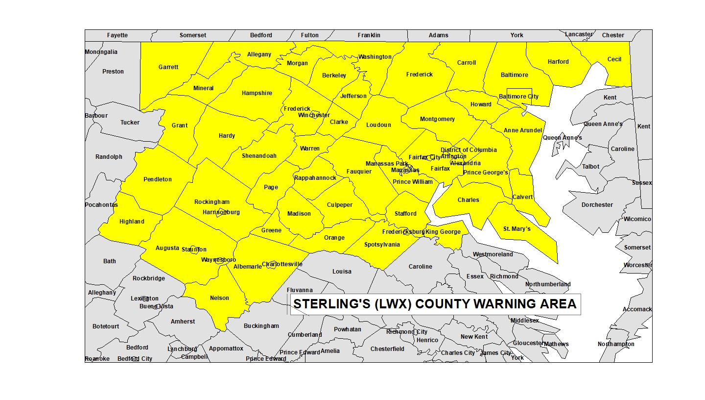