Latest Aviation Discussion:
.AVIATION /15Z THURSDAY THROUGH MONDAY/...
VFR and mostly dry conditions will likely continue through Fri.
Smoke aloft will result in a hazy appearance of the sky through
Fri. Vsby reductions of 5-6 SM are possible for the metros
(especially Baltimore TAF sites) today and Fri with lower vsbys
(2-4 SM) tonight into Fri as smoke mixes south and closer to
the sfc behind a weak front. Winds will vary between N/NW and SW
over the next few days as that front sits nearby. A t-storm
can't be ruled out this late afternoon and evening, mainly east
of the Blue Ridge and in nrn MD but confidence is very low. Did
maintain a PROB30 between 20-24z at both BWI/MTN where the
confidence seems the highest for storm development off the bay
breeze. Can't rule out a t-stprm near the mtns Fri afternoon.
Periods of sub-VFR restrictions can be expected this weekend
in any t-storms. The greatest coverage of storms likely Sat,
potentially lingering into Sun. Possible early morning low CIGS
or patchy fog with afternoon/evening convection. Winds will
remain light overall with chaotic motions in/around t-storms.
AVIATION...DHOF/CPB/EST
Update as of: 1001 AM EDT Thu Jul 16 2026
This discussion and more can be found in the Area Forecast Discussion.
Aviation Forecasts
The National Weather Service (NWS) Weather Forecast Office (WFO-LWX), in Sterling, VA has responsibility for six Terminal Aerodrome Forecasts or TAFs in Virginia, Maryland and the eastern West Virginia panhandle. Click on each map below to view the latest decoded TAF Note: maps are not for official aviation use. FAA VFR charts are available here.
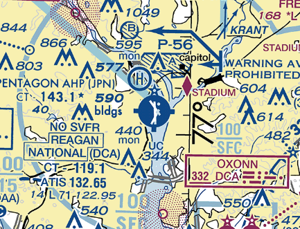
REAGAN NATIONAL (DCA)
TERMINAL FORECAST (DCA)
24 HRS OF OBSERVATIONS
FAA DETAILS
TABULAR FORECAST
DCA TAF BOARD
DULLES (IAD)

TERMINAL FORECAST (IAD)
24 HRS OF OBSERVATIONS
FAA DETAILS
TABULAR FORECAST
IAD TAF BOARD
BALTIMORE (BWI)

TERMINAL FORECAST (BWI)
24 HRS OF OBSERVATIONS
FAA DETAILS
TABULAR FORECAST
BWI TAF BOARD
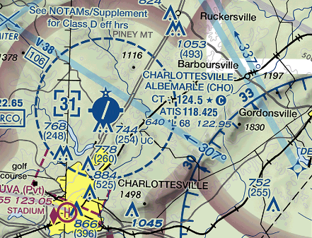
CHARLOTTESVILLE (CHO)
TERMINAL FORECAST (CHO)
24 HRS OF OBSERVATIONS
FAA DETAILS
TABULAR FORECAST
CHO TAF BOARD
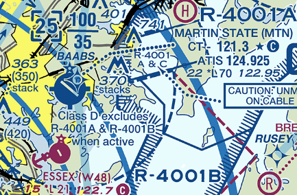
MARTIN STATE (MTN)
TERMINAL FORECAST (MTN)
24 HRS OF OBSERVATIONS
FAA DETAILS
TABULAR FORECAST
MTN TAF BOARD
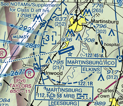
MARTINSBURG (MRB)
TERMINAL FORECAST (MRB)
24 HRS OF OBSERVATIONS
FAA DETAILS
TABULAR FORECAST
MRB TAF BOARD
Center Weather Service Unit Products
The Leesburg VA Center Weather Service Unit (CWSU/ZDC) covers the NWS Sterling, VA County Warning Area. Use the buttons on the map or....CLICK HERE to view ZDC's web site. For complete AVIATION WEATHER CENTER products click here.
Interactive Aviation Map (mouse over & CLICK for Observations)
See Complete MESONET MAP & OBS
Decoded/Raw Text
- 24 hour decoded observations for Virginia Portion of our CWA...
- 24 hour decoded observations for Maryland Portion of our CWA...
- 24 hour decoded observations for West Virginia Portion of our CWA...
Surface Weather Maps
Wind Rose Data
- Washington Reagan-National (DCA) wind rose data...
- Dulles International (IAD) wind rose data...
- Baltimore-Washington International (BWI) wind rose data...
Miscellaneous


 Coastal Flood
 FAQ
FAQ