
Dangerous and extreme heat will remain across portions of the central U.S. this week, persisting across the mid to lower Mississippi Valley, Gulf Coast, southern Plains and portions of Texas. A heat wave over the Southwest U.S. will peak this weekend. Heavy to excessive rainfall may produce flash flooding from the Delmarva Peninsula north into the Hudson Valley today and tonight. Read More >
Baltimore/Washington Area Hydrology Page
What's NEW?
View our timeline of historic flood events in the region!
Check out the DC-area Potomac Inundation Maps!
Latest drought information
Click on a tab below to view associated information!
|
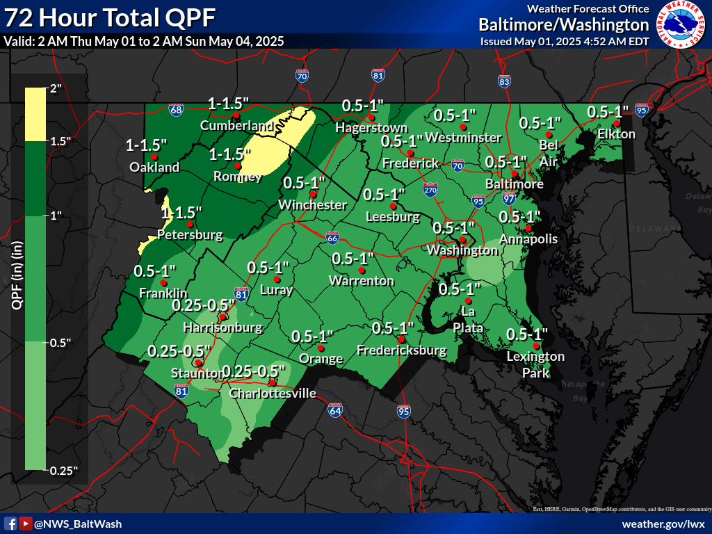
Local Precipitation Forecasts
(Hover over or click/tap on the timeframes to change the image.) |
|
|
|
National Precipitation Forecasts, Days 1 through 3 (click to enlarge)
Please note: The below forecasts represent a basin average and may not represent local maxima. Images from the NWS Weather Prediction Center (WPC) |
||
 Day 1 Rainfall |
 Day 2 Rainfall |
 Day 3 Rainfall |
|
||
Temperature/Precipitation Observations
Probabilistic Precipitation Forecast for the next 3 Days
Experimental - Leave feedback
Most likely Forecast Precipitation over the next 3 Days
Reasonable Low End Forecast Precipitation over the next 3 Days
Reasonable Worst Case Forecast Precipitation over the next 3 Days


 Coastal Flood
 FAQ
FAQ