
A heat wave over the Southwest will intensify this week, peaking and expanding into the Intermountain West and northern High Plains this weekend. Critical to extremely critical fire weather conditions are forecast from the Northwest and the northern Great Basin this weekend. Particularly Dangerous Situation Red Flag Warnings have been issued. Read More >
199
AXUS71 KLWX 231347
DGTLWX
DCC001-MDC001-003-005-009-013-015-017-021-023-025-027-031-033-037-
043-510-VAC003-013-015-043-047-059-061-069-079-091-099-107-113-
125-137-139-153-157-165-171-177-179-187-510-540-600-630-660-683-
790-820-840-WVC003-023-027-031-037-057-065-071-301400-

Drought Information Statement
National Weather Service Baltimore MD/Washington DC
947 AM EDT Thu Jul 23 2026

For the latest Drought Information Statement from the National
Weather Service in Baltimore MD/Washington DC, see:
www.weather.gov/media/lwx/DGT/DGT_LWX_07232026.pdf

For the latest accessible, text-only Drought Information
Statement from the National Weather Service in Baltimore
MD/Washington DC, see:
www.weather.gov/media/lwx/DGT/DGT_LWX_07232026.txt

National Weather Service Baltimore MD/Washington DC Drought
Information Statement web page:
www.weather.gov/lwx/DroughtInformationStatement

$$
Current drought status for our area: (Graphics update every Thursday)

Graphics by State:


Modeled Soil Moisture Percentiles, courtesy University of Washington: (click to enlarge)

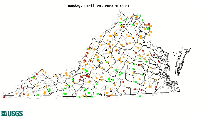
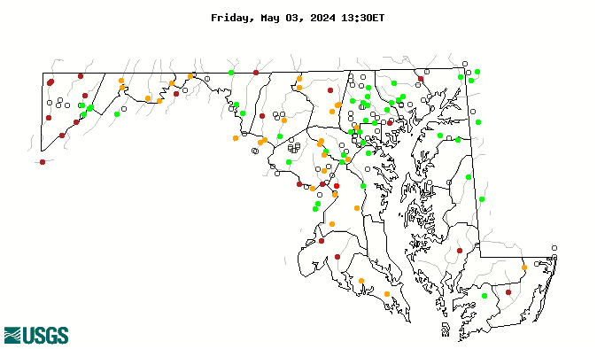
Streamflow Percentiles: (graphics update daily)
Outlook
Rainfall (or melted snowfall), in inches, for the next seven days: (graphic updates twice daily)

Seasonal Drought Outlook:


 Coastal Flood
 FAQ
FAQ