
Hot to extremely hot daytime temperatures remain in place across coastal southern California and the interior Northwest, with the Northwest carrying the potential for record-breaking high temperatures. A combination of monsoonal moisture and tropical moisture ahead of tropical cyclone Lorena will bring a marginal to slight risk of excessive rainfall across the southwest U.S. this week. Read More >
Baltimore/Washington Area Hydrology Page
What's NEW?
View our timeline of historic flood events in the region!
Check out the DC-area Potomac Inundation Maps!
Latest drought information
Click on a tab below to view associated information!
River Observations
Hover over a location to see its name. Click on any point to see information for that site.
River Forecasts
Hover over a location to see its name. Click on any point to see information for that site.
Scroll below the map to see major rivers at a glance.
Temperature/Precipitation Observations
|
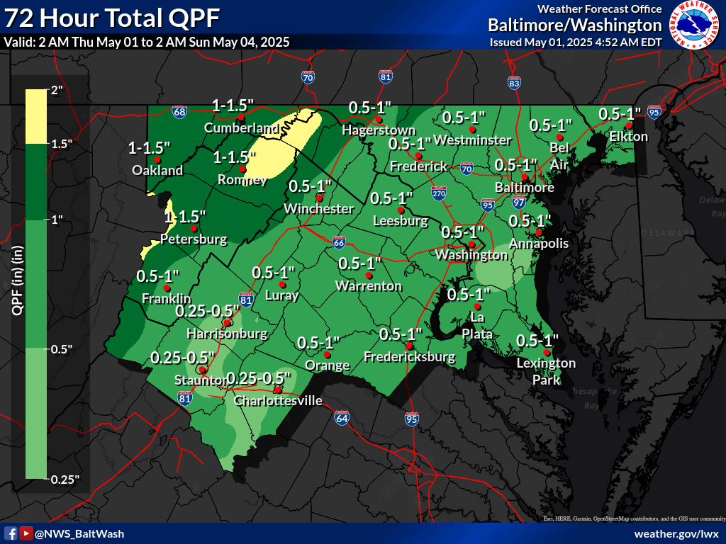
Local Precipitation Forecasts
(Hover over or click/tap on the timeframes to change the image.) |
|
|
|
National Precipitation Forecasts, Days 1 through 3 (click to enlarge)
Please note: The below forecasts represent a basin average and may not represent local maxima. Images from the NWS Weather Prediction Center (WPC) |
||
 Day 1 Rainfall |
 Day 2 Rainfall |
 Day 3 Rainfall |
|
||


 Coastal Flood
 FAQ
FAQ