Overview
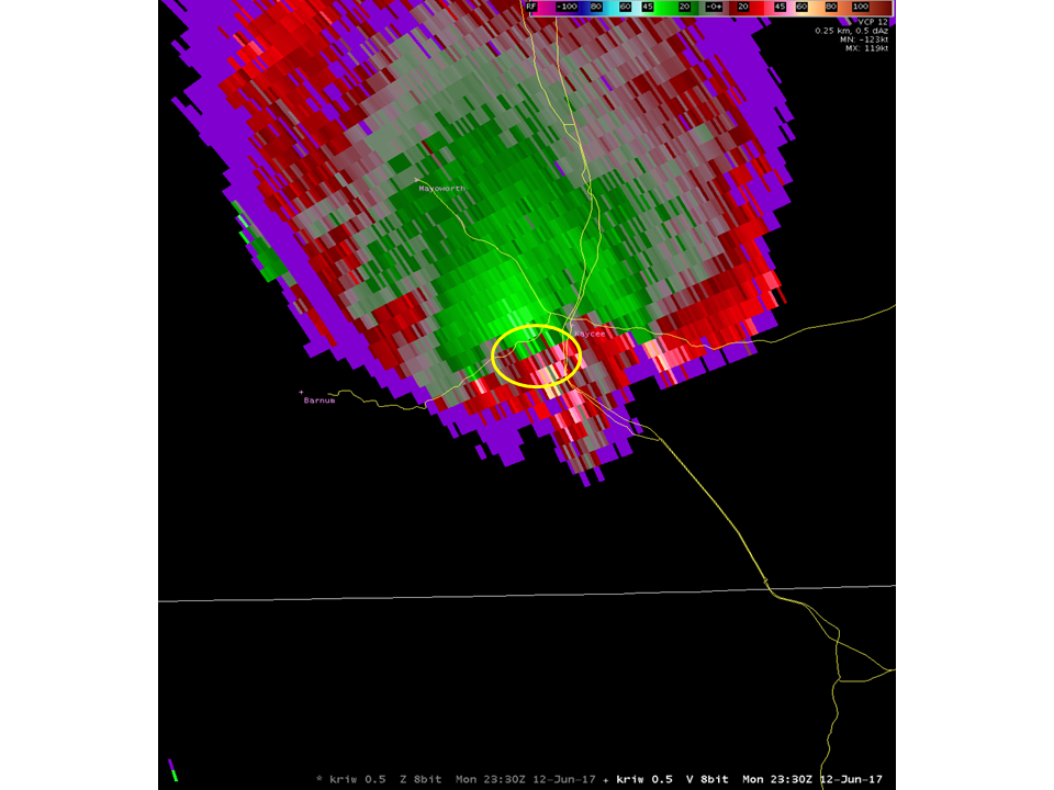
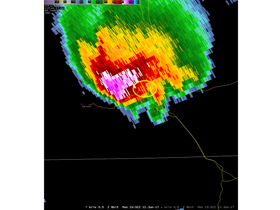
An active weather system over the Great Basin brought conditions conducive for severe weather over northern and eastern portions of Wyoming on Monday, June 12th. Heat, moisture and wind shear was greatest in these areas. Storms initially formed near Casper, WY around 12:30pm, moving NNW into southern Johnson County. These storms gradually turned into supercells by 3:00 – 4:00pm, with other convection starting to form in the Big Horn Basin. The first tornadic storm developed around 5:00pm over SW Johnson County, near Barnum. 1” to 1.75” hail was reported near Barnum by 5:15pm, increasing to 2.5” by 5:30pm 5 miles SW of Kaycee. This storm then proceeded to produce multiple vortices, as it neared Kaycee and Mayoworth. Reports of tornadoes came in between 5:35 and 5:50pm, as the storm slowly moved to the NNE.
Tornadoes:
|
Tornado - LOCATION
Track Map 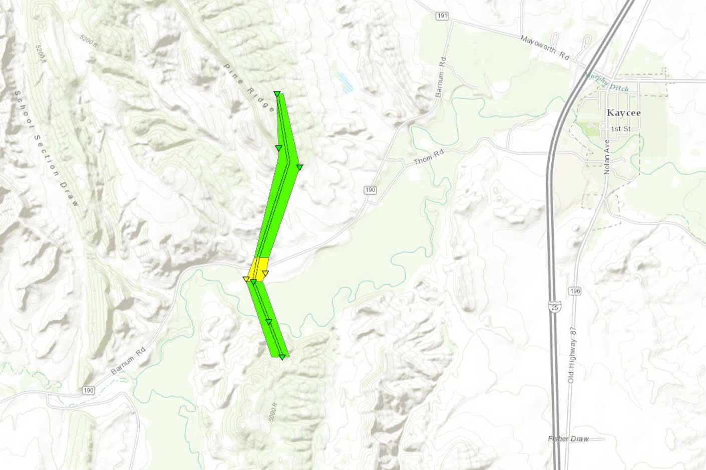 
|
||||||||||||||||
The Enhanced Fujita (EF) Scale classifies tornadoes into the following categories:
| EF0 Weak 65-85 mph |
EF1 Moderate 86-110 mph |
EF2 Significant 111-135 mph |
EF3 Severe 136-165 mph |
EF4 Extreme 166-200 mph |
EF5 Catastrophic 200+ mph |
 |
|||||
Photos & Video:
 |
 |
 |
 |
| Kaycee Tornado (Source: Mark_Malli) |
Kaycee Tornado (Source: Mark_Malli) |
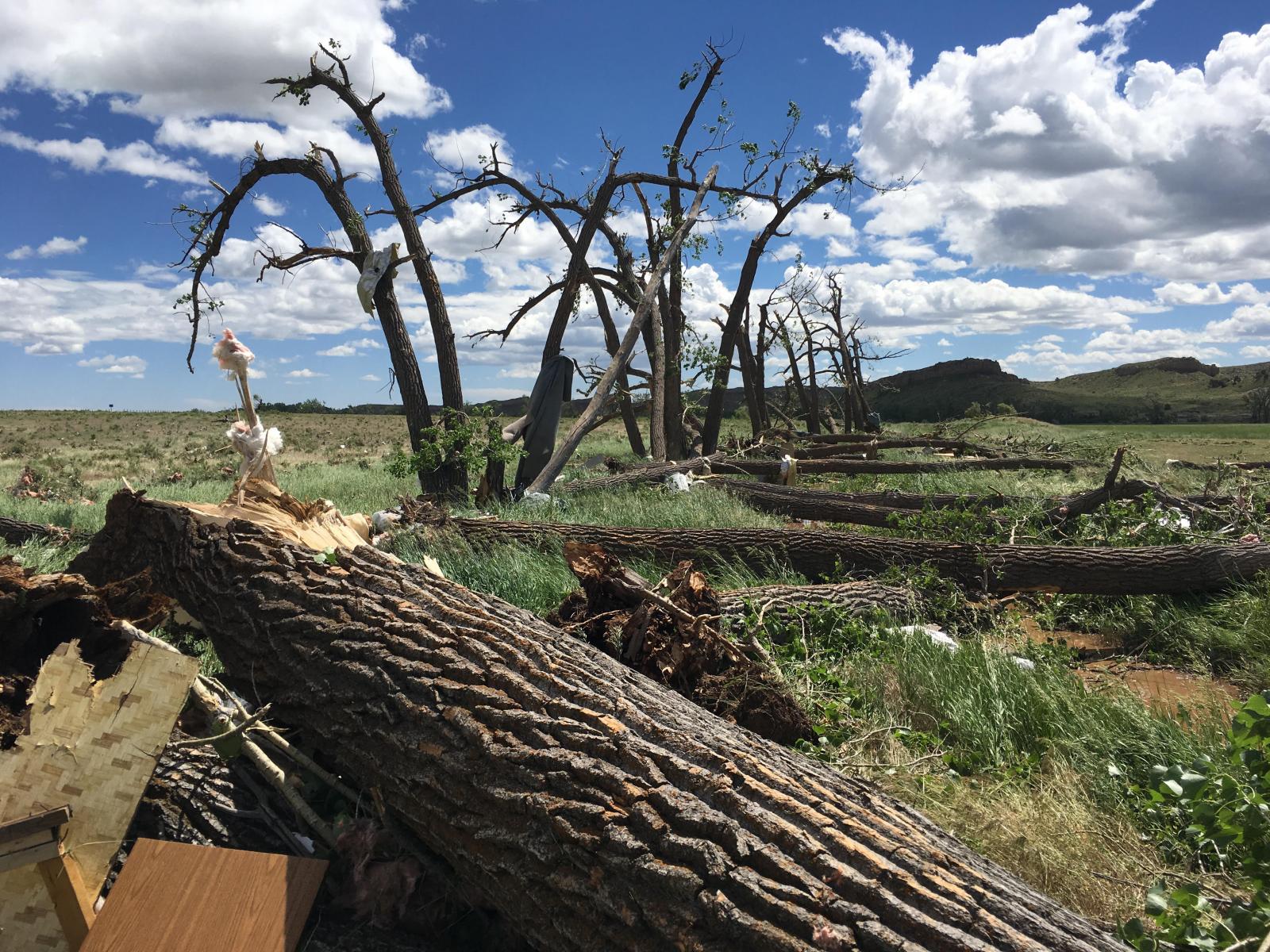
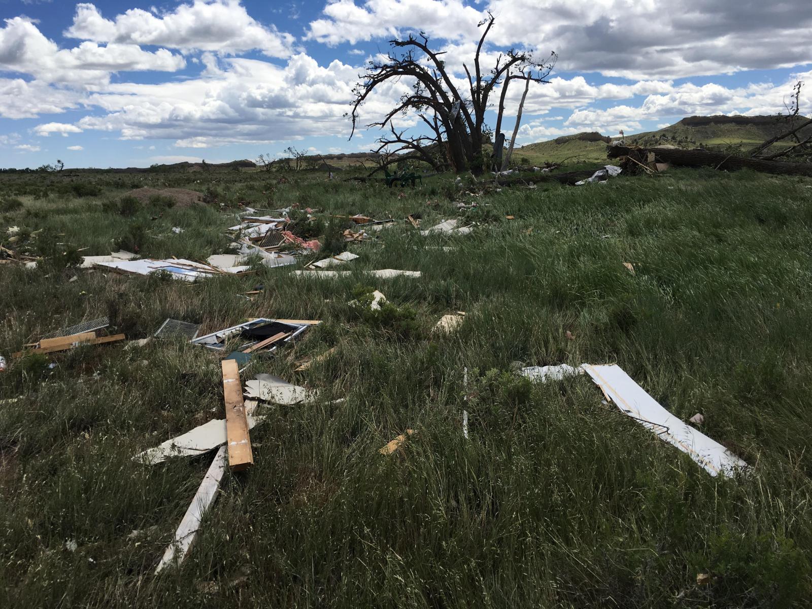
Damage Photo (Source: NWS Riverton) |
Damage Photo (Source: NWS Riverton) |
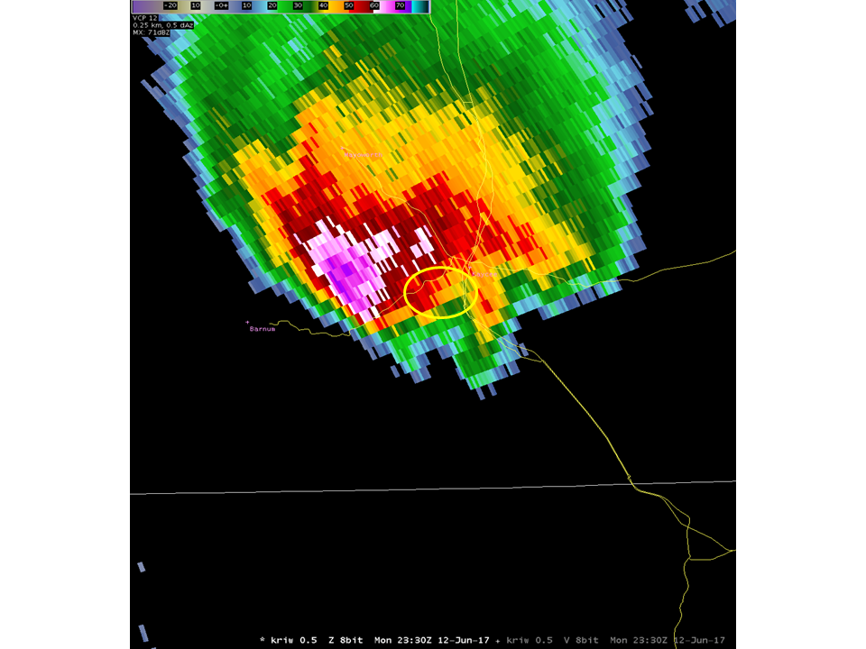
Radar:
 |
 |
 |
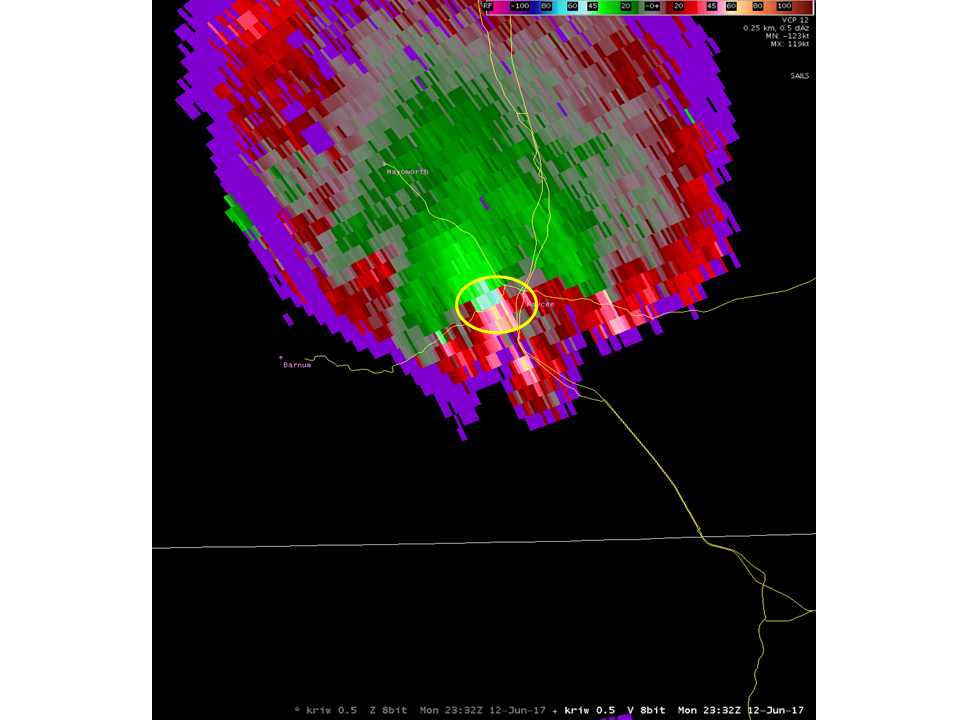 |
| 530 PM Reflectivity | 530 PM Storm Relative Velocity | 532 PM Reflectivity | 532 PM Storm Relative Velocity |
 |
Media use of NWS Web News Stories is encouraged! Please acknowledge the NWS as the source of any news information accessed from this site. |
|


 Follow us on YouTube