Extreme heat continues today from the central Plains to the lower Mississippi River Valley, over southeast Montana, and from southern California into the Southwest Deserts. Extreme Heat Warnings remain in effect. Severe thunderstorms capable of strong to severe wind gusts and large hail are possible across the Great Lakes into the Ohio Valley today into tonight. Read More >
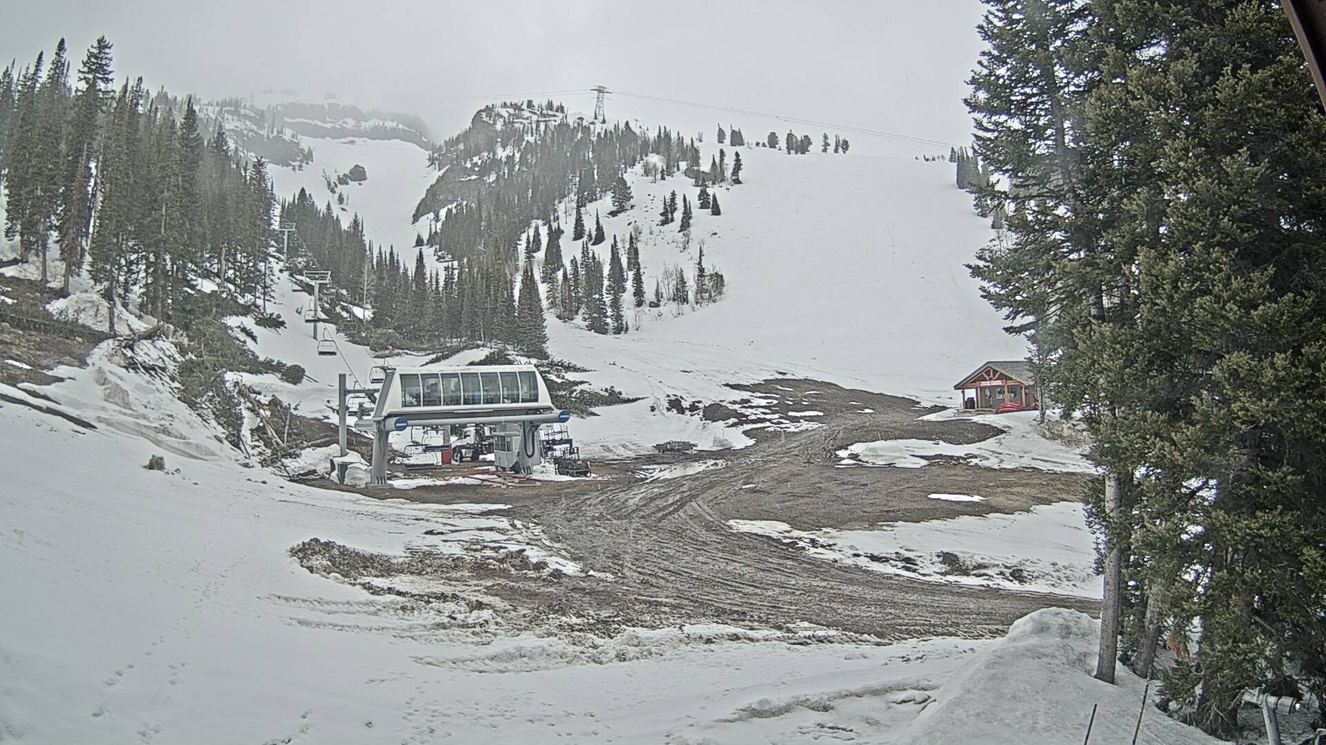
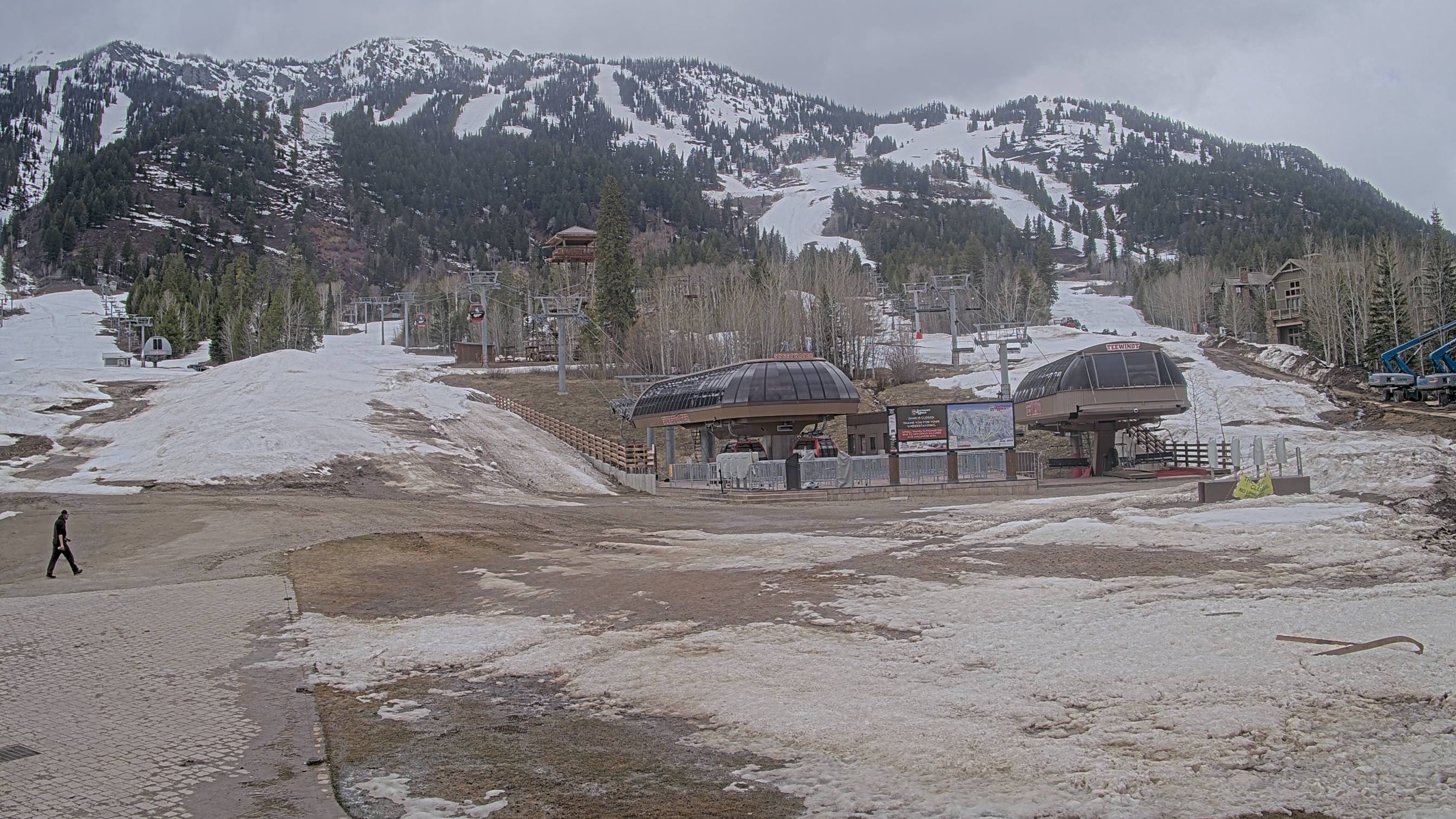
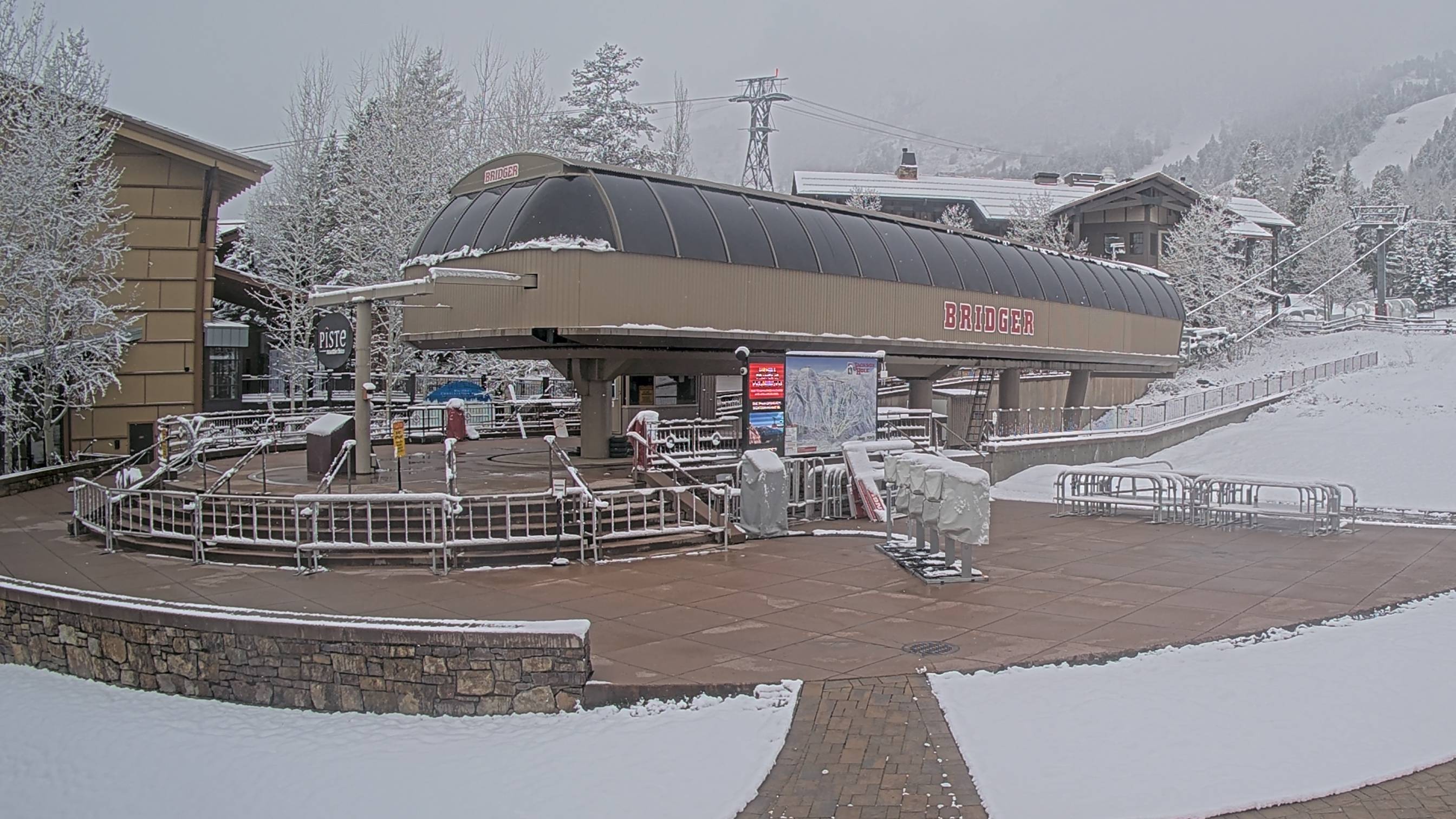
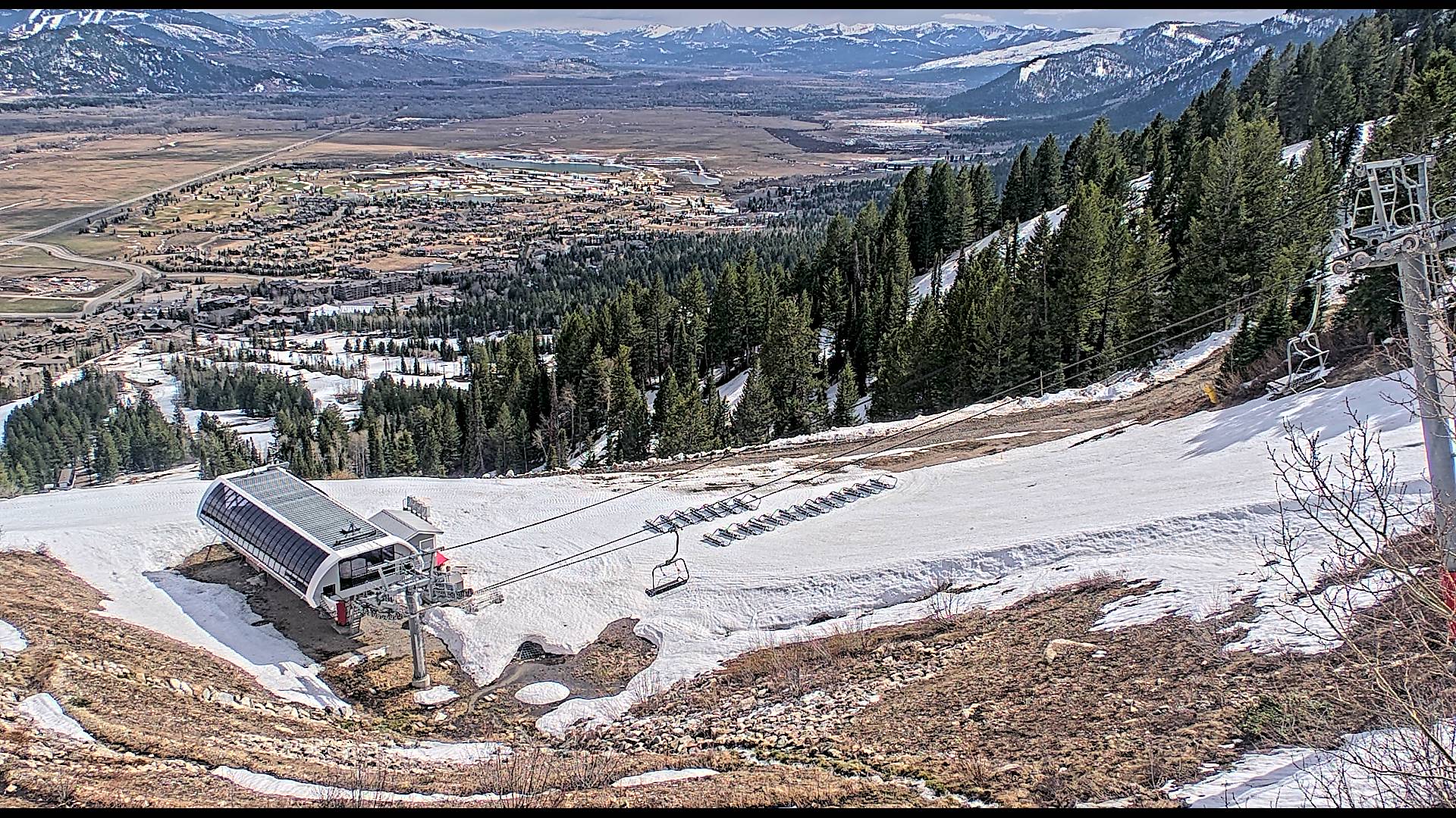
For current avalanche forecasts, conditions, and advisories go to Bridger-Teton Avalanche Center or Gallatin National Forest Avalanche Center
Want more details on snow potential? Check out our Probabilistic Snow Page!
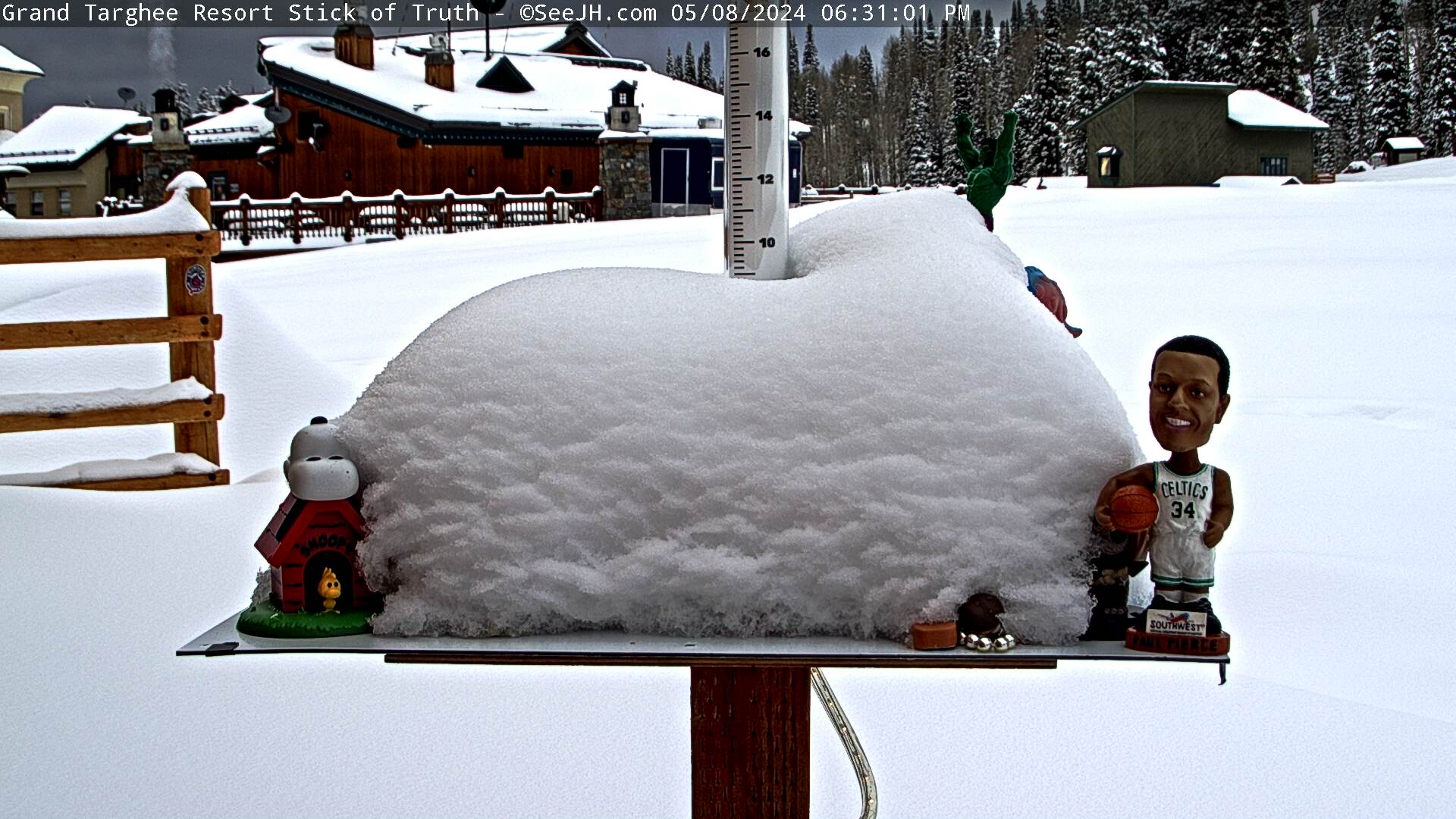
Click on image to enlarge

768
FWUS45 KRIW 271014
AVGRIW
Avalanche Weather Guidance
National Weather Service Riverton WY
414 AM MDT Mon Jul 27 2026
.DISCUSSION...
This product is currently automated with no discussion,
and will not be refreshed with all forecast updates.
Please see https://weather.gov/riw/AvalancheWeather for more detailed information.
...RENDEZVOUS MOUNTAIN (10,318 ft) Teton County WY...
Date Monday 07/27/26 Tuesday 07/28/26
Time (LT) 06 09 12 15 18 21 00 03 06 09 12 15 18 21 00 03 06
6a 9a 12 3p 6p 9p 12 3a 6a 9a 12 3p 6p 9p 12 3a 6a
Cloud Cover OV OV OV BK BK BK SC FW FW CL FW SC SC SC SC SC SC
Cloud Cover (%) 90 90 90 60 60 50 45 20 15 5 15 50 40 35 35 30 45
Temperature 52 52 54 55 55 50 50 48 46 51 61 62 58 51 49 47 46
Max/Min Temp 60 44 64 45
DewPoint Temp 38 41 41 40 41 41 38 39 36 38 39 37 38 39 37 35 35
Humidity 58 66 61 56 58 72 64 70 68 61 44 39 47 63 62 64 66
Wind Dir SW SW W W W NW S S S S SW W W N NE NE NE
Wind (mph) 4 4 3 2 3 5 4 5 6 4 4 5 4 3 4 5 5
Wind Gust (mph) 9 9 9 11 13 11
Precip Prob (%) 10 40 40 10 20 10 5 0 5 0 20 40 5 5 5 5 10
Precip Type R R T T T T
6 Hour QPF 0.01 0.01 0.00 0.00 0.00 0.02 0.00 0.00
12 Hour QPF 0.02 0.00 0.02 0.00
Low End QPF MM 0.00 0.00 MM
High End QPF MM 0.00 0.11 MM
6 Hour Snow 0.0 0.0 0.0 0.0 0.0 0.0 0.0 0.0
12 Hour Snow 0.0 0.0 0.0 0.0
Low End Snow MM MM MM MM
High End Snow MM MM MM MM
Snow Level (kft) 15.2 15.0 15.0 15.2 15.1 15.0 14.6 14.3 14.4 14.3 14.5 14.8 14.9 14.7 14.6 14.4 14.3
Snow Ratio (:1) 0 0 0 0 0 0 0 0 0 0 0 0 0 0 0 0 0
Snow Density (%) 0 0 0 0 0 0 0 0 0 0 0 0 0 0 0 0 0
Date Wed 07/29/26 Thu 07/30/26 Fri 07/31/26 Sat 08/01/26 Sun 08/02/26
Time (LT) 12 18 00 06 12 18 00 06 12 18 00 06 12 18 00 06 12 18
12 6p 12 6a 12 6p 12 6a 12 6p 12 6a 12 6p 12 6a 12 6p
Cloud Cover SC SC FW FW FW FW FW CL CL CL FW FW CL FW FW FW FW FW
Cloud Cover (%) 45 40 20 5 10 10 5 5 5 0 5 10 5 10 10 10 5 10
Temperature 60 54 47 44 60 62 51 47 64 65 52 48 66 67 54 50 65 64
Max/Min Temp 62 43 65 46 68 47 70 48 67
DewPoint Temp 40 38 37 34 33 29 28 27 29 24 23 22 26 23 21 20 24 22
Humidity 48 55 68 69 36 28 41 45 27 21 32 35 22 19 27 30 21 20
Wind Dir SW W NE NE SW W E E W W E SE SW W SE S W W
Wind (mph) 4 4 4 5 4 4 5 5 5 5 5 4 6 6 4 5 10 13
Wind Gust (mph) 10 12 11 11 11 11 16 13 11 11 16 16 11 11 21 26
Precip Prob (%) 60 10 0 0 0 0 0 0 0 0 0 0 0 0 0 0 0 0
Precip Type R T
12 Hour QPF 0.05 0.01 0.00 0.00 0.00 0.00 0.00 0.00 0.00
Low End QPF MM MM MM MM MM MM MM MM MM
High End QPF MM MM MM MM MM MM MM MM MM
12 Hour Snow 0.0 0.0 0.0 0.0 0.0 0.0 0.0 0.0 0.0
Low End Snow MM MM MM MM MM MM MM MM MM
High End Snow MM MM MM MM MM MM MM MM MM
Snow Level (kft) 14.3 14.4 13.9 13.4 13.7 14.0 13.7 13.5 13.6 13.8 13.5 13.3 13.6 14.1 13.8 13.4 13.5 13.6
Snow Ratio (:1) 0 0 0 0 0 1 1 1 1 1 1 1 1 1 1 1 1 1
Snow Density (%) 0 0 0 0 0 100 100 100 100 100 100 100 100 100 100 100 100 100
...TETON VILLAGE (6,410 ft) Teton County WY...
Date Monday 07/27/26 Tuesday 07/28/26
Time (LT) 06 09 12 15 18 21 00 03 06 09 12 15 18 21 00 03 06
6a 9a 12 3p 6p 9p 12 3a 6a 9a 12 3p 6p 9p 12 3a 6a
Cloud Cover OV OV OV BK BK BK BK FW FW CL FW SC SC SC SC FW SC
Cloud Cover (%) 90 85 85 55 55 50 50 20 20 5 10 45 40 35 30 25 45
Temperature 61 65 76 82 81 70 66 61 57 65 82 87 84 71 65 60 56
Max/Min Temp 84 55 88 56
DewPoint Temp 47 52 56 52 52 51 49 48 46 50 54 48 49 49 48 46 44
Humidity 59 62 50 36 37 51 55 63 67 59 38 26 30 46 54 59 65
Wind Dir N S E NW W NW NW SW W SE S W SW SE E E E
Wind (mph) 0 1 2 2 2 2 1 1 1 1 3 4 3 2 1 1 1
Wind Gust (mph) 10 10 8 9 14 11
Precip Prob (%) 10 40 30 20 20 10 5 0 5 0 10 30 5 5 5 5 10
Precip Type R R T T T T
6 Hour QPF 0.01 0.02 0.00 0.00 0.00 0.02 0.00 0.00
12 Hour QPF 0.03 0.00 0.02 0.00
Low End QPF MM 0.00 0.00 MM
High End QPF MM 0.00 0.07 MM
6 Hour Snow 0.0 0.0 0.0 0.0 0.0 0.0 0.0 0.0
12 Hour Snow 0.0 0.0 0.0 0.0
Low End Snow MM MM MM MM
High End Snow MM MM MM MM
Snow Level (kft) 15.2 15.0 15.0 15.3 15.1 15.0 14.6 14.4 14.4 14.3 14.5 14.8 14.8 14.7 14.6 14.4 14.4
Snow Ratio (:1) 0 0 0 0 0 0 0 0 0 0 0 0 0 0 0 0 0
Snow Density (%) 0 0 0 0 0 0 0 0 0 0 0 0 0 0 0 0 0
Date Wed 07/29/26 Thu 07/30/26 Fri 07/31/26 Sat 08/01/26 Sun 08/02/26
Time (LT) 12 18 00 06 12 18 00 06 12 18 00 06 12 18 00 06 12 18
12 6p 12 6a 12 6p 12 6a 12 6p 12 6a 12 6p 12 6a 12 6p
Cloud Cover SC SC FW FW FW FW CL CL CL CL CL FW CL FW FW FW FW FW
Cloud Cover (%) 40 40 15 5 5 10 5 5 5 0 5 10 5 10 10 10 5 10
Temperature 80 81 64 54 81 87 67 57 85 91 67 58 87 93 69 59 86 90
Max/Min Temp 86 54 90 56 93 57 95 58 93
DewPoint Temp 54 50 49 44 48 38 40 38 43 33 35 34 40 31 34 33 38 31
Humidity 41 34 58 69 32 18 37 49 23 13 30 40 19 11 27 37 18 12
Wind Dir S SW E N SW W E E W W E E SW W E S W W
Wind (mph) 3 3 1 0 3 3 2 2 5 4 2 1 5 5 2 2 9 10
Wind Gust (mph) 9 12 9 10 14 11 14 13 21 23
Precip Prob (%) 60 10 0 0 0 0 0 0 0 0 0 0 0 0 0 0 0 0
Precip Type R T
12 Hour QPF 0.05 0.01 0.00 0.00 0.00 0.00 0.00 0.00 0.00
Low End QPF MM MM MM MM MM MM MM MM MM
High End QPF MM MM MM MM MM MM MM MM MM
12 Hour Snow 0.0 0.0 0.0 0.0 0.0 0.0 0.0 0.0 0.0
Low End Snow MM MM MM MM MM MM MM MM MM
High End Snow MM MM MM MM MM MM MM MM MM
Snow Level (kft) 14.3 14.4 13.9 13.4 13.7 14.0 13.7 13.5 13.6 13.8 13.5 13.3 13.6 14.1 13.8 13.5 13.5 13.6
Snow Ratio (:1) 0 0 0 0 0 1 1 1 1 1 1 1 1 1 1 1 1 1
Snow Density (%) 0 0 0 0 0 100 100 100 100 100 100 100 100 100 100 100 100 100
...SURPRISE MEADOWS (9,593 ft) Teton County WY...
Date Monday 07/27/26 Tuesday 07/28/26
Time (LT) 06 09 12 15 18 21 00 03 06 09 12 15 18 21 00 03 06
6a 9a 12 3p 6p 9p 12 3a 6a 9a 12 3p 6p 9p 12 3a 6a
Cloud Cover OV OV OV BK BK BK SC FW FW CL FW SC SC SC SC SC SC
Cloud Cover (%) 90 85 80 60 65 55 50 20 20 5 10 50 40 35 35 25 40
Temperature 58 60 59 62 61 57 57 54 53 60 64 66 64 58 56 55 54
Max/Min Temp 65 52 68 53
DewPoint Temp 36 42 46 43 43 41 39 38 35 39 42 38 39 37 37 36 35
Humidity 44 52 61 49 51 55 51 54 51 46 44 35 40 46 48 48 49
Wind Dir SW SW W W W SW SW S S S SW W SW N E NE E
Wind (mph) 6 5 4 5 5 5 5 6 6 8 6 10 8 5 5 6 6
Wind Gust (mph) 12 12 13 13 11 12 13 17 19 16 11 12 12
Precip Prob (%) 20 40 40 20 20 5 5 0 5 0 20 30 5 5 5 5 10
Precip Type R R R T T T T
6 Hour QPF 0.02 0.02 0.00 0.00 0.00 0.01 0.00 0.00
12 Hour QPF 0.04 0.00 0.01 0.00
Low End QPF MM 0.00 0.00 MM
High End QPF MM 0.00 0.11 MM
6 Hour Snow 0.0 0.0 0.0 0.0 0.0 0.0 0.0 0.0
12 Hour Snow 0.0 0.0 0.0 0.0
Low End Snow MM MM MM MM
High End Snow MM MM MM MM
Snow Level (kft) 15.1 15.1 15.1 15.3 15.1 14.9 14.6 14.3 14.3 14.3 14.5 14.8 14.8 14.7 14.6 14.3 14.3
Snow Ratio (:1) 0 0 0 0 0 0 0 0 0 0 0 0 0 0 0 0 0
Snow Density (%) 0 0 0 0 0 0 0 0 0 0 0 0 0 0 0 0 0
Date Wed 07/29/26 Thu 07/30/26 Fri 07/31/26 Sat 08/01/26 Sun 08/02/26
Time (LT) 12 18 00 06 12 18 00 06 12 18 00 06 12 18 00 06 12 18
12 6p 12 6a 12 6p 12 6a 12 6p 12 6a 12 6p 12 6a 12 6p
Cloud Cover SC SC FW FW FW FW FW FW CL CL FW FW CL FW FW FW FW FW
Cloud Cover (%) 40 45 20 5 5 10 5 5 5 5 5 10 5 10 10 10 5 10
Temperature 63 61 55 52 64 67 58 55 68 70 59 56 69 73 60 57 68 69
Max/Min Temp 67 51 69 53 72 55 75 56 72
DewPoint Temp 44 41 38 34 37 31 28 27 32 26 23 22 29 26 22 21 27 22
Humidity 49 48 53 51 36 26 32 34 26 19 25 26 22 17 23 24 21 17
Wind Dir SW W E NE W W E E W W E SE SW W S S W W
Wind (mph) 5 8 5 8 6 8 8 9 11 10 9 9 11 12 9 9 18 23
Wind Gust (mph) 14 18 13 16 16 13 16 24 19 14 16 25 25 16 17 36 42
Precip Prob (%) 60 20 0 0 0 5 0 0 0 0 0 0 0 0 0 0 0 0
Precip Type R T
12 Hour QPF 0.05 0.01 0.00 0.00 0.00 0.00 0.00 0.00 0.00
Low End QPF MM MM MM MM MM MM MM MM MM
High End QPF MM MM MM MM MM MM MM MM MM
12 Hour Snow 0.0 0.0 0.0 0.0 0.0 0.0 0.0 0.0 0.0
Low End Snow MM MM MM MM MM MM MM MM MM
High End Snow MM MM MM MM MM MM MM MM MM
Snow Level (kft) 14.3 14.4 13.8 13.4 13.6 14.0 13.7 13.5 13.6 13.8 13.5 13.3 13.6 14.1 13.8 13.4 13.5 13.6
Snow Ratio (:1) 0 0 0 0 0 1 1 1 1 1 1 1 1 1 1 1 1 1
Snow Density (%) 0 0 0 0 0 100 100 100 100 100 100 100 100 100 100 100 100 100
...JACKSON AIRPORT (6,451 ft) Teton County WY...
Date Monday 07/27/26 Tuesday 07/28/26
Time (LT) 06 09 12 15 18 21 00 03 06 09 12 15 18 21 00 03 06
6a 9a 12 3p 6p 9p 12 3a 6a 9a 12 3p 6p 9p 12 3a 6a
Cloud Cover OV OV OV BK BK BK SC FW FW CL FW SC SC SC SC FW SC
Cloud Cover (%) 90 85 80 60 65 55 45 20 15 5 10 50 50 35 30 25 40
Temperature 58 62 74 81 80 69 63 56 53 62 78 85 83 70 62 57 53
Max/Min Temp 83 52 87 53
DewPoint Temp 47 48 52 48 48 50 48 46 45 46 47 42 44 47 47 45 44
Humidity 66 61 46 32 32 51 59 70 75 56 34 22 25 44 58 64 72
Wind Dir E NE NE N W E NE NE NE S SW W SW SE E E E
Wind (mph) 1 1 3 4 4 3 2 2 2 1 4 8 5 3 2 2 2
Wind Gust (mph) 11 10 16 12
Precip Prob (%) 10 40 30 30 20 10 5 0 5 0 20 30 5 5 5 5 10
Precip Type R R T T T T
6 Hour QPF 0.01 0.01 0.00 0.00 0.00 0.01 0.00 0.00
12 Hour QPF 0.02 0.00 0.01 0.00
Low End QPF MM 0.00 0.00 MM
High End QPF MM 0.00 0.07 MM
6 Hour Snow 0.0 0.0 0.0 0.0 0.0 0.0 0.0 0.0
12 Hour Snow 0.0 0.0 0.0 0.0
Low End Snow MM MM MM MM
High End Snow MM MM MM MM
Snow Level (kft) 15.2 15.0 15.0 15.3 15.1 15.0 14.6 14.5 14.4 14.3 14.5 14.8 14.8 14.8 14.6 14.4 14.4
Snow Ratio (:1) 0 0 0 0 0 0 0 0 0 0 0 0 0 0 0 0 0
Snow Density (%) 0 0 0 0 0 0 0 0 0 0 0 0 0 0 0 0 0
Date Wed 07/29/26 Thu 07/30/26 Fri 07/31/26 Sat 08/01/26 Sun 08/02/26
Time (LT) 12 18 00 06 12 18 00 06 12 18 00 06 12 18 00 06 12 18
12 6p 12 6a 12 6p 12 6a 12 6p 12 6a 12 6p 12 6a 12 6p
Cloud Cover SC SC FW FW FW FW CL CL CL CL CL FW CL FW FW FW CL FW
Cloud Cover (%) 35 45 15 5 5 15 5 5 5 5 5 10 5 15 10 10 5 15
Temperature 78 80 61 52 78 86 64 54 83 89 65 55 85 92 66 56 84 88
Max/Min Temp 85 51 88 53 92 54 94 55 91
DewPoint Temp 50 46 48 45 43 33 39 38 38 28 34 33 35 25 32 32 31 25
Humidity 37 30 62 76 29 15 40 55 20 11 31 43 17 9 28 40 15 10
Wind Dir S SW SE N SW W E E W W E SE SW W E S W W
Wind (mph) 4 6 2 0 3 4 3 1 8 6 3 1 8 8 3 2 14 16
Wind Gust (mph) 13 9 11 16 12 17 14 24 27
Precip Prob (%) 50 20 0 0 0 0 0 0 0 0 0 0 0 0 0 0 0 0
Precip Type T T
12 Hour QPF 0.05 0.01 0.00 0.00 0.00 0.00 0.00 0.00 0.00
Low End QPF MM MM MM MM MM MM MM MM MM
High End QPF MM MM MM MM MM MM MM MM MM
12 Hour Snow 0.0 0.0 0.0 0.0 0.0 0.0 0.0 0.0 0.0
Low End Snow MM MM MM MM MM MM MM MM MM
High End Snow MM MM MM MM MM MM MM MM MM
Snow Level (kft) 14.2 14.4 13.9 13.4 13.7 14.1 13.7 13.5 13.6 13.8 13.5 13.3 13.6 14.1 13.8 13.5 13.5 13.6
Snow Ratio (:1) 0 0 0 0 0 1 1 1 1 1 1 1 1 1 1 1 1 1
Snow Density (%) 0 0 0 0 0 100 100 100 100 100 100 100 100 100 100 100 100 100
...SNOW KING MOUNTAIN (7,810 ft) Teton County WY...
Date Monday 07/27/26 Tuesday 07/28/26
Time (LT) 06 09 12 15 18 21 00 03 06 09 12 15 18 21 00 03 06
6a 9a 12 3p 6p 9p 12 3a 6a 9a 12 3p 6p 9p 12 3a 6a
Cloud Cover OV OV OV BK BK BK BK SC FW CL FW SC SC SC SC FW SC
Cloud Cover (%) 85 85 85 65 65 60 65 35 20 5 15 50 45 40 30 20 40
Temperature 62 64 76 82 82 71 67 62 57 64 83 88 84 72 66 61 56
Max/Min Temp 85 55 89 55
DewPoint Temp 46 47 49 47 48 48 46 47 45 46 47 42 43 46 45 44 43
Humidity 55 54 39 29 30 44 47 58 64 52 28 20 24 39 47 53 62
Wind Dir E NW N NW W E SE SE SE S SW W W SE E E E
Wind (mph) 2 3 3 5 4 4 4 3 3 2 4 8 5 3 3 3 3
Wind Gust (mph) 9 13 11
Precip Prob (%) 10 20 10 20 20 10 5 5 5 0 5 20 5 5 5 5 5
Precip Type R T T T
6 Hour QPF 0.00 0.01 0.00 0.00 0.00 0.02 0.00 0.00
12 Hour QPF 0.01 0.00 0.02 0.00
Low End QPF MM 0.00 0.00 MM
High End QPF MM 0.00 0.08 MM
6 Hour Snow 0.0 0.0 0.0 0.0 0.0 0.0 0.0 0.0
12 Hour Snow 0.0 0.0 0.0 0.0
Low End Snow MM MM MM MM
High End Snow MM MM MM MM
Snow Level (kft) 15.2 15.1 15.0 15.3 15.2 15.0 14.8 14.6 14.5 14.4 14.5 14.9 15.0 14.8 14.6 14.6 14.5
Snow Ratio (:1) 0 0 0 0 0 0 0 0 0 0 0 0 0 0 0 0 0
Snow Density (%) 0 0 0 0 0 0 0 0 0 0 0 0 0 0 0 0 0
Date Wed 07/29/26 Thu 07/30/26 Fri 07/31/26 Sat 08/01/26 Sun 08/02/26
Time (LT) 12 18 00 06 12 18 00 06 12 18 00 06 12 18 00 06 12 18
12 6p 12 6a 12 6p 12 6a 12 6p 12 6a 12 6p 12 6a 12 6p
Cloud Cover SC SC FW CL FW FW CL CL CL CL CL FW CL FW FW FW FW FW
Cloud Cover (%) 35 45 20 5 5 15 5 5 5 5 5 5 5 15 10 10 5 15
Temperature 81 82 64 54 81 89 67 57 86 92 69 58 88 94 70 59 87 91
Max/Min Temp 87 53 91 56 95 57 97 57 94
DewPoint Temp 47 45 45 43 40 34 35 36 36 30 30 32 33 29 29 31 30 27
Humidity 30 27 50 66 23 14 30 45 17 11 23 37 14 10 22 34 13 10
Wind Dir S SW E E W W E E W NW E SE SW W SE S W W
Wind (mph) 4 6 3 2 4 5 4 3 6 6 3 3 6 6 3 3 11 11
Wind Gust (mph) 12 11 13 12 13 12 20 20
Precip Prob (%) 50 10 0 0 0 0 0 0 0 0 0 0 0 0 0 0 0 0
Precip Type T T
12 Hour QPF 0.07 0.01 0.00 0.00 0.00 0.00 0.00 0.00 0.00
Low End QPF MM MM MM MM MM MM MM MM MM
High End QPF MM MM MM MM MM MM MM MM MM
12 Hour Snow 0.0 0.0 0.0 0.0 0.0 0.0 0.0 0.0 0.0
Low End Snow MM MM MM MM MM MM MM MM MM
High End Snow MM MM MM MM MM MM MM MM MM
Snow Level (kft) 14.3 14.5 13.9 13.5 13.7 14.1 13.8 13.5 13.7 13.9 13.5 13.3 13.7 14.2 13.8 13.5 13.6 13.7
Snow Ratio (:1) 0 0 0 0 0 1 1 1 1 1 1 1 1 1 1 1 1 1
Snow Density (%) 0 0 0 0 0 100 100 100 100 100 100 100 100 100 100 100 100 100
...TARGHEE FREDS MOUNTAIN (9,840 ft) Teton County WY...
Date Monday 07/27/26 Tuesday 07/28/26
Time (LT) 06 09 12 15 18 21 00 03 06 09 12 15 18 21 00 03 06
6a 9a 12 3p 6p 9p 12 3a 6a 9a 12 3p 6p 9p 12 3a 6a
Cloud Cover OV OV OV BK BK BK SC FW FW CL FW BK SC SC SC SC SC
Cloud Cover (%) 85 90 75 50 65 60 30 20 10 5 10 55 35 40 30 35 35
Temperature 60 61 63 66 65 59 58 55 54 61 69 69 66 59 58 56 54
Max/Min Temp 68 53 71 54
DewPoint Temp 40 42 43 43 43 44 40 39 37 40 40 39 38 40 39 38 37
Humidity 48 50 48 44 44 57 51 54 53 45 35 33 36 49 49 50 53
Wind Dir S SE W W W SE SE SE SE S SW W SW E E E E
Wind (mph) 4 4 4 4 4 5 6 8 8 5 6 8 4 4 6 6 6
Wind Gust (mph) 10 11 11 11 13 14 12
Precip Prob (%) 30 40 40 10 10 5 0 0 5 0 20 30 5 5 5 5 10
Precip Type R R R T T T T
6 Hour QPF 0.01 0.00 0.00 0.00 0.00 0.02 0.00 0.00
12 Hour QPF 0.01 0.00 0.02 0.00
Low End QPF MM 0.00 0.00 MM
High End QPF MM 0.00 0.10 MM
6 Hour Snow 0.0 0.0 0.0 0.0 0.0 0.0 0.0 0.0
12 Hour Snow 0.0 0.0 0.0 0.0
Low End Snow MM MM MM MM
High End Snow MM MM MM MM
Snow Level (kft) 15.0 15.1 15.0 15.1 15.0 14.8 14.5 14.2 14.2 14.3 14.4 14.7 14.8 14.7 14.5 14.2 14.3
Snow Ratio (:1) 0 0 0 0 0 0 0 0 0 0 0 0 0 0 0 0 0
Snow Density (%) 0 0 0 0 0 0 0 0 0 0 0 0 0 0 0 0 0
Date Wed 07/29/26 Thu 07/30/26 Fri 07/31/26 Sat 08/01/26 Sun 08/02/26
Time (LT) 12 18 00 06 12 18 00 06 12 18 00 06 12 18 00 06 12 18
12 6p 12 6a 12 6p 12 6a 12 6p 12 6a 12 6p 12 6a 12 6p
Cloud Cover SC BK FW FW CL FW FW CL CL CL CL FW CL FW FW FW CL FW
Cloud Cover (%) 45 50 15 5 5 10 5 5 0 5 5 10 5 10 10 10 5 15
Temperature 68 63 56 52 68 71 60 55 72 74 61 56 73 76 62 57 71 71
Max/Min Temp 69 52 71 55 75 56 77 57 74
DewPoint Temp 43 40 40 36 35 31 30 29 32 26 25 24 30 27 24 23 28 25
Humidity 40 43 54 55 30 23 32 37 23 17 25 29 20 16 23 27 20 18
Wind Dir SW SW E E W SW SE SE W W SE SE SW W SE S W SW
Wind (mph) 5 5 5 6 6 4 6 5 9 4 6 5 9 6 4 5 12 14
Wind Gust (mph) 12 12 13 11 12 11 18 13 11 18 16 11 11 25 29
Precip Prob (%) 60 20 0 0 0 5 0 0 0 0 0 0 0 0 0 0 0 0
Precip Type R T
12 Hour QPF 0.03 0.01 0.00 0.00 0.00 0.00 0.00 0.00 0.00
Low End QPF MM MM MM MM MM MM MM MM MM
High End QPF MM MM MM MM MM MM MM MM MM
12 Hour Snow 0.0 0.0 0.0 0.0 0.0 0.0 0.0 0.0 0.0
Low End Snow MM MM MM MM MM MM MM MM MM
High End Snow MM MM MM MM MM MM MM MM MM
Snow Level (kft) 14.3 14.3 13.8 13.3 13.6 13.9 13.7 13.5 13.6 13.8 13.5 13.3 13.6 14.0 13.8 13.4 13.4 13.5
Snow Ratio (:1) 0 0 0 0 0 1 1 1 1 1 1 1 1 1 1 1 1 1
Snow Density (%) 0 0 0 0 0 100 100 100 100 100 100 100 100 100 100 100 100 100
...GRANITE HOT SPRINGS (8,999 ft) Teton County WY...
Date Monday 07/27/26 Tuesday 07/28/26
Time (LT) 06 09 12 15 18 21 00 03 06 09 12 15 18 21 00 03 06
6a 9a 12 3p 6p 9p 12 3a 6a 9a 12 3p 6p 9p 12 3a 6a
Cloud Cover OV OV OV BK BK SC OV SC FW FW FW SC SC SC SC FW SC
Cloud Cover (%) 75 90 90 65 60 50 75 35 15 10 15 45 45 35 35 20 35
Temperature 51 55 70 72 70 58 54 50 47 54 75 75 71 59 53 50 47
Max/Min Temp 75 45 78 46
DewPoint Temp 40 45 46 44 44 45 43 43 41 44 44 40 40 43 40 39 39
Humidity 65 68 43 37 39 62 65 77 79 68 33 28 33 55 62 67 73
Wind Dir E E SW W SW NE E SE SE SE SW W SW S E E E
Wind (mph) 3 3 3 4 4 4 5 5 5 5 4 6 5 3 4 4 4
Wind Gust (mph) 10 10 11 12 14 12
Precip Prob (%) 10 20 10 30 30 10 5 5 5 0 10 30 10 10 10 10 5
Precip Type R T T R T
6 Hour QPF 0.00 0.02 0.00 0.01 0.00 0.01 0.00 0.00
12 Hour QPF 0.02 0.01 0.01 0.00
Low End QPF MM 0.00 0.00 MM
High End QPF MM 0.01 0.09 MM
6 Hour Snow 0.0 0.0 0.0 0.0 0.0 0.0 0.0 0.0
12 Hour Snow 0.0 0.0 0.0 0.0
Low End Snow MM MM MM MM
High End Snow MM MM MM MM
Snow Level (kft) 15.3 15.2 15.2 15.5 15.4 15.2 14.9 14.7 14.6 14.5 14.6 14.9 15.0 15.0 14.7 14.6 14.7
Snow Ratio (:1) 0 0 0 0 0 0 0 0 0 0 0 0 0 0 0 0 0
Snow Density (%) 0 0 0 0 0 0 0 0 0 0 0 0 0 0 0 0 0
Date Wed 07/29/26 Thu 07/30/26 Fri 07/31/26 Sat 08/01/26 Sun 08/02/26
Time (LT) 12 18 00 06 12 18 00 06 12 18 00 06 12 18 00 06 12 18
12 6p 12 6a 12 6p 12 6a 12 6p 12 6a 12 6p 12 6a 12 6p
Cloud Cover SC SC FW CL CL FW FW CL CL FW FW FW CL FW FW FW FW FW
Cloud Cover (%) 30 50 25 0 5 15 10 0 5 5 5 5 5 15 15 5 5 15
Temperature 75 69 52 45 74 76 55 48 79 79 56 50 80 81 57 50 79 79
Max/Min Temp 77 44 79 46 83 47 85 48 82
DewPoint Temp 46 42 42 38 38 33 32 31 35 31 28 26 31 27 26 25 31 27
Humidity 35 37 68 75 27 21 41 51 20 17 34 39 17 14 30 37 17 15
Wind Dir SW W NE E W W E SE W NW E SE SW W E S W W
Wind (mph) 4 6 3 4 5 6 4 4 9 8 4 4 9 9 3 4 13 13
Wind Gust (mph) 12 14 13 13 18 16 18 17 9 24 26
Precip Prob (%) 60 10 0 0 0 0 0 0 0 0 0 0 0 0 0 0 0 0
Precip Type R T
12 Hour QPF 0.11 0.01 0.00 0.00 0.00 0.00 0.00 0.00 0.00
Low End QPF MM MM MM MM MM MM MM MM MM
High End QPF MM MM MM MM MM MM MM MM MM
12 Hour Snow 0.0 0.0 0.0 0.0 0.0 0.0 0.0 0.0 0.0
Low End Snow MM MM MM MM MM MM MM MM MM
High End Snow MM MM MM MM MM MM MM MM MM
Snow Level (kft) 14.5 14.6 14.0 13.5 13.7 14.2 13.9 13.5 13.7 14.0 13.6 13.4 13.7 14.3 13.9 13.6 13.7 13.8
Snow Ratio (:1) 0 0 0 0 0 1 1 1 1 1 1 1 1 1 1 1 1 1
Snow Density (%) 0 0 0 0 0 100 100 100 100 100 100 100 100 100 100 100 100 100
...BLIND BULL SUMMIT (9,020 ft) Lincoln County WY...
Date Monday 07/27/26 Tuesday 07/28/26
Time (LT) 06 09 12 15 18 21 00 03 06 09 12 15 18 21 00 03 06
6a 9a 12 3p 6p 9p 12 3a 6a 9a 12 3p 6p 9p 12 3a 6a
Cloud Cover OV OV OV BK SC FW BK SC FW FW SC BK FW SC FW FW SC
Cloud Cover (%) 85 90 85 70 35 25 60 35 15 10 35 55 25 25 25 25 45
Temperature 60 64 69 71 68 62 60 57 55 62 73 72 69 62 59 56 54
Max/Min Temp 73 53 75 53
DewPoint Temp 39 43 48 49 48 46 43 44 41 44 44 45 44 44 42 40 39
Humidity 45 47 47 46 48 56 53 61 60 52 36 38 41 52 54 55 57
Wind Dir S W W SW W NE E SE SE SE SW W W N S SE SE
Wind (mph) 4 5 6 6 5 5 8 6 6 5 5 8 5 4 4 5 5
Wind Gust (mph) 10 11 12 13 12 11 13 12 12 12 13 11 10 10 11
Precip Prob (%) 5 10 5 20 20 10 5 5 0 0 10 30 10 10 5 5 20
Precip Type T T T R
6 Hour QPF 0.00 0.04 0.01 0.00 0.00 0.04 0.00 0.00
12 Hour QPF 0.04 0.01 0.04 0.00
Low End QPF MM 0.00 0.00 MM
High End QPF MM 0.02 0.15 MM
6 Hour Snow 0.0 0.0 0.0 0.0 0.0 0.0 0.0 0.0
12 Hour Snow 0.0 0.0 0.0 0.0
Low End Snow MM MM MM MM
High End Snow MM MM MM MM
Snow Level (kft) 15.3 15.4 15.3 15.4 15.6 15.3 15.2 15.0 14.8 14.7 15.0 15.3 15.3 15.0 14.7 14.8 14.8
Snow Ratio (:1) 0 0 0 0 0 0 0 0 0 0 0 0 0 0 0 0 0
Snow Density (%) 0 0 0 0 0 0 0 0 0 0 0 0 0 0 0 0 0
Date Wed 07/29/26 Thu 07/30/26 Fri 07/31/26 Sat 08/01/26 Sun 08/02/26
Time (LT) 12 18 00 06 12 18 00 06 12 18 00 06 12 18 00 06 12 18
12 6p 12 6a 12 6p 12 6a 12 6p 12 6a 12 6p 12 6a 12 6p
Cloud Cover SC SC FW FW CL FW FW CL CL CL FW FW CL FW FW FW FW FW
Cloud Cover (%) 35 30 15 5 5 10 5 5 0 5 5 10 5 10 15 10 5 10
Temperature 72 67 57 53 72 74 60 56 77 78 62 57 78 79 63 58 77 76
Max/Min Temp 74 52 77 54 80 55 82 56 80
DewPoint Temp 46 44 42 38 37 36 32 30 35 32 28 26 32 31 27 25 32 29
Humidity 40 44 57 57 28 25 35 37 22 19 27 30 19 17 25 28 19 18
Wind Dir W W NE SE W W SE S W W S SE W W S SW W W
Wind (mph) 6 6 4 4 9 8 5 5 11 10 4 6 10 10 5 6 14 14
Wind Gust (mph) 13 14 10 17 16 11 11 20 18 20 18 11 26 26
Precip Prob (%) 60 10 0 0 0 0 0 0 0 0 0 0 0 0 0 0 0 0
Precip Type R T
12 Hour QPF 0.09 0.01 0.00 0.00 0.00 0.00 0.00 0.00 0.00
Low End QPF MM MM MM MM MM MM MM MM MM
High End QPF MM MM MM MM MM MM MM MM MM
12 Hour Snow 0.0 0.0 0.0 0.0 0.0 0.0 0.0 0.0 0.0
Low End Snow MM MM MM MM MM MM MM MM MM
High End Snow MM MM MM MM MM MM MM MM MM
Snow Level (kft) 14.6 14.7 14.0 13.7 13.9 14.3 13.9 13.5 13.8 14.1 13.6 13.4 13.8 14.4 13.9 13.6 13.9 14.0
Snow Ratio (:1) 0 0 0 0 0 1 1 1 1 1 1 1 1 1 1 1 1 1
Snow Density (%) 0 0 0 0 0 100 100 100 100 100 100 100 100 100 100 100 100 100
...DEADMAN PEAK (9,770 ft) Lincoln County WY...
Date Monday 07/27/26 Tuesday 07/28/26
Time (LT) 06 09 12 15 18 21 00 03 06 09 12 15 18 21 00 03 06
6a 9a 12 3p 6p 9p 12 3a 6a 9a 12 3p 6p 9p 12 3a 6a
Cloud Cover OV OV OV BK SC FW BK SC FW FW SC BK SC SC FW FW SC
Cloud Cover (%) 85 85 85 70 45 25 55 25 15 10 35 60 35 30 25 25 45
Temperature 64 60 62 65 64 59 60 58 57 56 67 67 64 59 58 58 57
Max/Min Temp 69 55 71 55
DewPoint Temp 37 42 44 45 44 43 41 41 39 41 42 41 40 40 39 39 39
Humidity 37 51 52 48 49 55 49 54 51 56 40 39 41 50 50 50 50
Wind Dir S W W W NW NE SE SE S SE W W W E SE SE SE
Wind (mph) 8 6 5 5 5 6 10 10 11 6 5 6 5 5 8 9 9
Wind Gust (mph) 11 11 11 11 12 11
Precip Prob (%) 5 10 10 20 10 10 5 5 0 0 10 30 10 10 5 5 20
Precip Type T T T R
6 Hour QPF 0.00 0.02 0.00 0.00 0.00 0.02 0.00 0.00
12 Hour QPF 0.02 0.00 0.02 0.00
Low End QPF MM 0.00 0.00 MM
High End QPF MM 0.01 0.12 MM
6 Hour Snow 0.0 0.0 0.0 0.0 0.0 0.0 0.0 0.0
12 Hour Snow 0.0 0.0 0.0 0.0
Low End Snow MM MM MM MM
High End Snow MM MM MM MM
Snow Level (kft) 15.3 15.3 15.2 15.3 15.6 15.2 15.1 14.9 14.8 14.7 15.0 15.2 15.2 14.9 14.7 14.7 14.8
Snow Ratio (:1) 0 0 0 0 0 0 0 0 0 0 0 0 0 0 0 0 0
Snow Density (%) 0 0 0 0 0 0 0 0 0 0 0 0 0 0 0 0 0
Date Wed 07/29/26 Thu 07/30/26 Fri 07/31/26 Sat 08/01/26 Sun 08/02/26
Time (LT) 12 18 00 06 12 18 00 06 12 18 00 06 12 18 00 06 12 18
12 6p 12 6a 12 6p 12 6a 12 6p 12 6a 12 6p 12 6a 12 6p
Cloud Cover SC SC FW CL FW FW FW CL CL CL FW FW CL FW FW FW FW FW
Cloud Cover (%) 40 35 15 5 5 10 5 5 0 5 5 5 5 10 15 10 5 15
Temperature 65 63 56 56 66 69 60 58 70 72 63 60 71 74 64 61 70 72
Max/Min Temp 70 53 73 55 76 57 78 59 76
DewPoint Temp 43 41 39 37 35 31 30 29 31 28 25 24 28 26 24 23 27 25
Humidity 44 45 53 49 31 24 32 33 23 19 23 25 20 17 22 23 20 17
Wind Dir W W E SE W W SE SE W W SE SE W W S SW W W
Wind (mph) 5 6 6 6 8 8 6 5 9 9 5 5 9 9 5 5 12 12
Wind Gust (mph) 11 13 14 14 12 11 18 17 11 18 17 23 23
Precip Prob (%) 60 10 0 0 0 0 0 0 0 0 0 0 0 0 0 0 0 0
Precip Type R T
12 Hour QPF 0.07 0.01 0.00 0.00 0.00 0.00 0.00 0.00 0.00
Low End QPF MM MM MM MM MM MM MM MM MM
High End QPF MM MM MM MM MM MM MM MM MM
12 Hour Snow 0.0 0.0 0.0 0.0 0.0 0.0 0.0 0.0 0.0
Low End Snow MM MM MM MM MM MM MM MM MM
High End Snow MM MM MM MM MM MM MM MM MM
Snow Level (kft) 14.5 14.6 14.0 13.6 13.8 14.3 13.9 13.5 13.7 14.1 13.6 13.4 13.8 14.4 13.9 13.6 13.8 13.9
Snow Ratio (:1) 0 0 0 0 0 1 1 1 1 1 1 1 1 1 1 1 1 1
Snow Density (%) 0 0 0 0 0 100 100 100 100 100 100 100 100 100 100 100 100 100
...MOUNT COFFIN (10,870 ft) Lincoln County WY...
Date Monday 07/27/26 Tuesday 07/28/26
Time (LT) 06 09 12 15 18 21 00 03 06 09 12 15 18 21 00 03 06
6a 9a 12 3p 6p 9p 12 3a 6a 9a 12 3p 6p 9p 12 3a 6a
Cloud Cover OV OV OV BK SC SC BK SC SC FW SC BK SC FW FW SC SC
Cloud Cover (%) 85 85 85 65 30 40 55 40 35 15 40 70 35 25 20 25 45
Temperature 59 57 58 60 60 56 56 54 54 57 61 60 59 56 55 54 53
Max/Min Temp 64 52 65 52
DewPoint Temp 35 38 41 43 43 42 40 40 39 41 40 40 39 41 40 38 37
Humidity 40 48 53 54 53 60 54 58 56 55 45 48 48 58 57 54 54
Wind Dir SW SW W W W N S S S SW W W NW NW NW W W
Wind (mph) 6 8 9 10 9 8 6 6 6 6 8 9 8 6 5 5 5
Wind Gust (mph) 12 14 16 19 19 12 13 18 16 12
Precip Prob (%) 10 10 10 40 30 20 5 10 10 0 20 40 10 10 5 5 5
Precip Type T T R R T T T
6 Hour QPF 0.00 0.01 0.00 0.00 0.00 0.02 0.00 0.00
12 Hour QPF 0.01 0.00 0.02 0.00
Low End QPF MM 0.00 0.00 MM
High End QPF MM 0.03 0.17 MM
6 Hour Snow 0.0 0.0 0.0 0.0 0.0 0.0 0.0 0.0
12 Hour Snow 0.0 0.0 0.0 0.0
Low End Snow MM MM MM MM
High End Snow MM MM MM MM
Snow Level (kft) 15.4 15.4 15.5 15.5 15.7 15.5 15.3 15.2 15.0 15.0 15.3 15.5 15.5 15.1 14.9 15.1 14.9
Snow Ratio (:1) 0 0 0 0 0 0 0 0 0 0 0 0 0 0 0 0 0
Snow Density (%) 0 0 0 0 0 0 0 0 0 0 0 0 0 0 0 0 0
Date Wed 07/29/26 Thu 07/30/26 Fri 07/31/26 Sat 08/01/26 Sun 08/02/26
Time (LT) 12 18 00 06 12 18 00 06 12 18 00 06 12 18 00 06 12 18
12 6p 12 6a 12 6p 12 6a 12 6p 12 6a 12 6p 12 6a 12 6p
Cloud Cover SC SC FW FW FW FW CL CL CL FW FW FW CL FW FW FW FW FW
Cloud Cover (%) 45 30 10 10 5 15 5 5 0 5 5 10 5 10 15 15 5 15
Temperature 63 58 54 51 62 65 57 54 66 68 58 56 67 70 60 57 67 67
Max/Min Temp 65 50 67 53 70 54 72 55 71
DewPoint Temp 42 39 39 34 30 30 30 28 27 25 26 24 25 25 24 22 23 23
Humidity 46 49 56 53 30 27 35 36 23 20 29 29 20 18 25 25 19 19
Wind Dir SW W NW NW W NW NW SW W NW W S W W W W W W
Wind (mph) 9 11 8 6 12 11 6 6 14 14 8 6 13 14 10 10 20 20
Wind Gust (mph) 17 23 13 12 21 20 12 12 26 25 13 12 25 25 16 17 35 36
Precip Prob (%) 60 5 0 0 0 0 0 0 0 0 0 0 0 0 0 0 0 0
Precip Type R
12 Hour QPF 0.07 0.01 0.00 0.00 0.00 0.00 0.00 0.00 0.00
Low End QPF MM MM MM MM MM MM MM MM MM
High End QPF MM MM MM MM MM MM MM MM MM
12 Hour Snow 0.0 0.0 0.0 0.0 0.0 0.0 0.0 0.0 0.0
Low End Snow MM MM MM MM MM MM MM MM MM
High End Snow MM MM MM MM MM MM MM MM MM
Snow Level (kft) 14.7 14.8 14.1 13.8 14.0 14.4 13.9 13.6 13.9 14.3 13.7 13.6 13.9 14.5 14.0 13.7 14.0 14.1
Snow Ratio (:1) 0 0 0 0 0 1 1 1 1 1 1 1 1 1 1 1 1 1
Snow Density (%) 0 0 0 0 0 100 100 100 100 100 100 100 100 100 100 100 100 100
...COMMISSARY RIDGE (9,340 ft) Lincoln County WY...
Date Monday 07/27/26 Tuesday 07/28/26
Time (LT) 06 09 12 15 18 21 00 03 06 09 12 15 18 21 00 03 06
6a 9a 12 3p 6p 9p 12 3a 6a 9a 12 3p 6p 9p 12 3a 6a
Cloud Cover OV OV OV BK SC BK BK SC SC FW SC BK SC FW FW SC SC
Cloud Cover (%) 80 85 85 60 30 50 55 40 30 20 40 65 40 20 20 30 45
Temperature 62 63 72 71 70 61 60 58 57 62 73 72 71 61 59 57 56
Max/Min Temp 76 55 77 55
DewPoint Temp 36 41 44 43 42 44 42 42 41 43 41 41 40 44 43 40 39
Humidity 38 44 36 36 36 54 52 56 54 49 31 33 33 53 56 52 52
Wind Dir SW SW W W W N E SE S S SW W NW N E E E
Wind (mph) 4 5 8 9 9 6 8 6 6 5 8 8 6 5 6 5 5
Wind Gust (mph) 10 11 16 18 18 12 13 13 12 12 13 17 14 11 11
Precip Prob (%) 10 5 10 30 20 10 5 5 10 0 20 40 10 10 5 5 5
Precip Type T T T T T
6 Hour QPF 0.00 0.01 0.00 0.00 0.00 0.02 0.00 0.00
12 Hour QPF 0.01 0.00 0.02 0.00
Low End QPF MM 0.00 0.00 MM
High End QPF MM 0.02 0.14 MM
6 Hour Snow 0.0 0.0 0.0 0.0 0.0 0.0 0.0 0.0
12 Hour Snow 0.0 0.0 0.0 0.0
Low End Snow MM MM MM MM
High End Snow MM MM MM MM
Snow Level (kft) 15.5 15.4 15.4 15.5 15.7 15.5 15.3 15.2 15.0 15.0 15.2 15.5 15.4 15.0 15.0 15.1 14.8
Snow Ratio (:1) 0 0 0 0 0 0 0 0 0 0 0 0 0 0 0 0 0
Snow Density (%) 0 0 0 0 0 0 0 0 0 0 0 0 0 0 0 0 0
Date Wed 07/29/26 Thu 07/30/26 Fri 07/31/26 Sat 08/01/26 Sun 08/02/26
Time (LT) 12 18 00 06 12 18 00 06 12 18 00 06 12 18 00 06 12 18
12 6p 12 6a 12 6p 12 6a 12 6p 12 6a 12 6p 12 6a 12 6p
Cloud Cover SC SC FW FW FW FW CL CL CL FW CL FW FW FW FW FW FW FW
Cloud Cover (%) 40 30 10 5 5 15 5 5 0 5 5 10 5 10 10 10 10 15
Temperature 75 70 58 54 74 77 60 58 78 81 62 59 80 82 64 61 79 80
Max/Min Temp 77 53 79 56 83 57 85 58 83
DewPoint Temp 44 40 41 36 33 32 32 30 30 27 27 25 27 24 25 24 26 25
Humidity 33 34 53 50 22 19 35 34 17 14 26 27 14 12 23 24 14 13
Wind Dir SW W N E W NW E S W NW E SE W W SE SW W W
Wind (mph) 9 10 5 4 11 9 5 5 12 12 4 4 12 12 5 4 17 18
Wind Gust (mph) 17 20 11 10 19 19 11 12 24 24 10 10 23 23 11 11 31 35
Precip Prob (%) 50 5 0 0 0 0 0 0 0 0 0 0 0 0 0 0 0 0
Precip Type T
12 Hour QPF 0.05 0.00 0.00 0.00 0.00 0.00 0.00 0.00 0.00
Low End QPF MM MM MM MM MM MM MM MM MM
High End QPF MM MM MM MM MM MM MM MM MM
12 Hour Snow 0.0 0.0 0.0 0.0 0.0 0.0 0.0 0.0 0.0
Low End Snow MM MM MM MM MM MM MM MM MM
High End Snow MM MM MM MM MM MM MM MM MM
Snow Level (kft) 14.7 14.8 14.1 13.8 14.0 14.3 13.9 13.6 13.9 14.3 13.7 13.6 13.9 14.5 14.0 13.7 14.0 14.1
Snow Ratio (:1) 0 0 0 0 0 1 1 1 1 1 1 1 1 1 1 1 1 1
Snow Density (%) 0 0 0 0 0 100 100 100 100 100 100 100 100 100 100 100 100 100
...WILLOW CREEK SNOTEL (8,200 ft) Lincoln County WY...
Date Monday 07/27/26 Tuesday 07/28/26
Time (LT) 06 09 12 15 18 21 00 03 06 09 12 15 18 21 00 03 06
6a 9a 12 3p 6p 9p 12 3a 6a 9a 12 3p 6p 9p 12 3a 6a
Cloud Cover OV OV OV OV SC SC SC FW SC FW SC BK FW FW FW SC SC
Cloud Cover (%) 90 85 85 70 40 30 50 25 25 15 30 55 20 25 25 30 45
Temperature 61 69 79 79 71 61 59 57 55 68 82 81 72 61 58 56 55
Max/Min Temp 83 53 85 54
DewPoint Temp 38 45 50 49 49 47 43 44 41 45 47 48 46 46 43 41 40
Humidity 43 42 36 35 45 61 56 62 59 44 29 31 40 57 58 58 57
Wind Dir S SW SW SW NW E SE S S S SW W W E SE SE SE
Wind (mph) 8 8 8 8 6 8 10 10 10 6 9 9 8 8 9 9 9
Wind Gust (mph) 13 13 12 14 14
Precip Prob (%) 5 5 5 20 10 10 5 5 0 0 10 30 10 10 5 5 10
Precip Type T T T T
6 Hour QPF 0.00 0.03 0.00 0.00 0.00 0.01 0.00 0.00
12 Hour QPF 0.03 0.00 0.01 0.00
Low End QPF MM 0.00 0.01 MM
High End QPF MM 0.01 0.13 MM
6 Hour Snow 0.0 0.0 0.0 0.0 0.0 0.0 0.0 0.0
12 Hour Snow 0.0 0.0 0.0 0.0
Low End Snow MM MM MM MM
High End Snow MM MM MM MM
Snow Level (kft) 15.3 15.4 15.2 15.4 15.6 15.3 15.1 15.0 14.9 14.8 15.1 15.4 15.4 15.0 14.8 15.0 14.8
Snow Ratio (:1) 0 0 0 0 0 0 0 0 0 0 0 0 0 0 0 0 0
Snow Density (%) 0 0 0 0 0 0 0 0 0 0 0 0 0 0 0 0 0
Date Wed 07/29/26 Thu 07/30/26 Fri 07/31/26 Sat 08/01/26 Sun 08/02/26
Time (LT) 12 18 00 06 12 18 00 06 12 18 00 06 12 18 00 06 12 18
12 6p 12 6a 12 6p 12 6a 12 6p 12 6a 12 6p 12 6a 12 6p
Cloud Cover SC SC FW FW CL FW CL CL CL CL FW FW CL FW FW FW FW FW
Cloud Cover (%) 35 25 10 5 5 10 5 5 0 5 5 10 5 10 15 10 5 10
Temperature 82 71 57 53 82 79 59 56 86 82 62 58 88 84 63 59 86 81
Max/Min Temp 84 52 87 54 90 56 92 57 90
DewPoint Temp 48 46 42 36 39 38 33 31 38 34 28 26 35 31 27 24 33 31
Humidity 31 41 57 53 22 23 37 38 18 18 27 29 15 15 25 26 15 16
Wind Dir SW W E SE W W SE SE W NW SE SE W W SE S W W
Wind (mph) 9 9 9 9 10 10 10 9 13 12 8 9 12 12 8 8 16 18
Wind Gust (mph) 14 16 17 17 16 14 21 19 20 20 26 28
Precip Prob (%) 60 5 0 0 0 0 0 0 0 0 0 0 0 0 0 0 0 0
Precip Type R
12 Hour QPF 0.15 0.01 0.00 0.00 0.00 0.00 0.00 0.00 0.00
Low End QPF MM MM MM MM MM MM MM MM MM
High End QPF MM MM MM MM MM MM MM MM MM
12 Hour Snow 0.0 0.0 0.0 0.0 0.0 0.0 0.0 0.0 0.0
Low End Snow MM MM MM MM MM MM MM MM MM
High End Snow MM MM MM MM MM MM MM MM MM
Snow Level (kft) 14.5 14.7 14.0 13.7 13.9 14.3 13.9 13.5 13.8 14.2 13.6 13.5 13.8 14.4 13.9 13.7 13.9 14.0
Snow Ratio (:1) 0 0 0 0 0 1 1 1 1 1 1 1 1 1 1 1 1 1
Snow Density (%) 0 0 0 0 0 100 100 100 100 100 100 100 100 100 100 100 100 100
...LAVA MOUNTAIN (10,430 ft) Fremont County WY...
Date Monday 07/27/26 Tuesday 07/28/26
Time (LT) 06 09 12 15 18 21 00 03 06 09 12 15 18 21 00 03 06
6a 9a 12 3p 6p 9p 12 3a 6a 9a 12 3p 6p 9p 12 3a 6a
Cloud Cover OV OV OV OV SC BK BK BK FW FW FW SC SC SC SC FW SC
Cloud Cover (%) 75 90 85 75 45 60 70 50 20 5 20 50 40 40 35 20 25
Temperature 59 57 60 62 61 58 57 54 54 59 66 68 65 59 57 55 53
Max/Min Temp 65 51 68 52
DewPoint Temp 41 41 44 43 43 43 42 42 40 42 37 35 37 38 40 39 36
Humidity 51 54 55 50 51 57 58 64 60 54 34 30 36 46 52 54 53
Wind Dir SW SW W W S SE SE S S SW W W W NW E NE E
Wind (mph) 4 5 6 6 5 6 8 6 5 5 8 9 8 6 5 5 5
Wind Gust (mph) 11 14 14 14 11 16 19 18
Precip Prob (%) 10 40 50 40 40 10 5 5 0 0 10 30 10 10 5 5 5
Precip Type R T T R T T
6 Hour QPF 0.01 0.10 0.01 0.00 0.00 0.03 0.00 0.00
12 Hour QPF 0.11 0.01 0.03 0.00
Low End QPF MM 0.00 0.00 MM
High End QPF MM 0.01 0.10 MM
6 Hour Snow 0.0 0.0 0.0 0.0 0.0 0.0 0.0 0.0
12 Hour Snow 0.0 0.0 0.0 0.0
Low End Snow MM MM MM MM
High End Snow MM MM MM MM
Snow Level (kft) 15.1 15.3 15.2 15.5 15.3 15.1 14.9 14.7 14.4 14.4 14.6 15.0 14.9 15.0 14.7 14.5 14.5
Snow Ratio (:1) 0 0 0 0 0 0 0 0 0 0 0 0 0 0 0 0 0
Snow Density (%) 0 0 0 0 0 0 0 0 0 0 0 0 0 0 0 0 0
Date Wed 07/29/26 Thu 07/30/26 Fri 07/31/26 Sat 08/01/26 Sun 08/02/26
Time (LT) 12 18 00 06 12 18 00 06 12 18 00 06 12 18 00 06 12 18
12 6p 12 6a 12 6p 12 6a 12 6p 12 6a 12 6p 12 6a 12 6p
Cloud Cover SC BK FW CL FW FW FW CL FW FW CL FW FW FW FW FW FW FW
Cloud Cover (%) 35 55 20 5 5 20 10 5 5 10 5 5 5 15 15 5 10 15
Temperature 64 61 54 51 65 67 57 54 69 71 59 55 70 73 60 57 70 71
Max/Min Temp 67 50 68 52 72 53 75 55 73
DewPoint Temp 37 40 40 37 32 30 32 31 27 25 28 29 26 24 26 25 25 23
Humidity 36 46 59 58 29 25 38 41 21 18 30 37 19 16 27 29 18 16
Wind Dir W W NW NE W W E SE W NW E S W W SE SW W W
Wind (mph) 6 9 5 5 10 5 2 2 9 8 3 3 10 8 1 3 12 12
Wind Gust (mph) 14 19 20 16 11 11 23 20 12 13 23 20 10 12 29 29
Precip Prob (%) 60 30 0 0 0 0 0 0 0 0 0 0 0 0 0 0 0 0
Precip Type R R
12 Hour QPF 0.12 0.03 0.00 0.00 0.00 0.00 0.00 0.00 0.00
Low End QPF MM MM MM MM MM MM MM MM MM
High End QPF MM MM MM MM MM MM MM MM MM
12 Hour Snow 0.0 0.0 0.0 0.0 0.0 0.0 0.0 0.0 0.0
Low End Snow MM MM MM MM MM MM MM MM MM
High End Snow MM MM MM MM MM MM MM MM MM
Snow Level (kft) 14.4 14.6 14.0 13.5 13.6 14.2 13.8 13.5 13.7 14.1 13.6 13.4 13.7 14.3 13.9 13.5 13.7 13.8
Snow Ratio (:1) 0 0 0 0 0 1 1 1 1 1 1 1 1 1 1 1 1 1
Snow Density (%) 0 0 0 0 0 100 100 100 100 100 100 100 100 100 100 100 100 100
...GROUSE MOUNTAIN (9,400 ft) Teton County WY...
Date Monday 07/27/26 Tuesday 07/28/26
Time (LT) 06 09 12 15 18 21 00 03 06 09 12 15 18 21 00 03 06
6a 9a 12 3p 6p 9p 12 3a 6a 9a 12 3p 6p 9p 12 3a 6a
Cloud Cover OV OV OV OV BK BK BK SC FW FW FW SC SC SC SC FW SC
Cloud Cover (%) 80 90 85 70 55 55 55 30 20 5 20 40 50 40 30 20 30
Temperature 60 60 61 63 64 58 57 55 53 60 68 68 65 59 57 56 54
Max/Min Temp 68 52 71 53
DewPoint Temp 41 42 46 45 43 43 41 41 39 41 40 38 37 39 39 38 37
Humidity 50 52 57 52 47 57 56 60 60 49 36 33 36 47 50 51 53
Wind Dir S S W W SW SE SE SE SE S W W W N SE E E
Wind (mph) 4 4 4 4 4 5 6 5 6 4 5 8 5 3 4 4 5
Wind Gust (mph) 10 10 11 13 12 12 13 12 12 10 14 17 14 10 11 10 11
Precip Prob (%) 10 40 50 40 20 10 5 5 0 0 10 30 10 10 5 5 5
Precip Type R T T T T
6 Hour QPF 0.01 0.04 0.00 0.00 0.00 0.01 0.00 0.00
12 Hour QPF 0.05 0.00 0.01 0.00
Low End QPF MM 0.00 0.00 MM
High End QPF MM 0.00 0.10 MM
6 Hour Snow 0.0 0.0 0.0 0.0 0.0 0.0 0.0 0.0
12 Hour Snow 0.0 0.0 0.0 0.0
Low End Snow MM MM MM MM
High End Snow MM MM MM MM
Snow Level (kft) 15.1 15.0 15.1 15.5 15.2 15.1 14.8 14.6 14.4 14.4 14.5 14.8 14.9 14.9 14.7 14.4 14.5
Snow Ratio (:1) 0 0 0 0 0 0 0 0 0 0 0 0 0 0 0 0 0
Snow Density (%) 0 0 0 0 0 0 0 0 0 0 0 0 0 0 0 0 0
Date Wed 07/29/26 Thu 07/30/26 Fri 07/31/26 Sat 08/01/26 Sun 08/02/26
Time (LT) 12 18 00 06 12 18 00 06 12 18 00 06 12 18 00 06 12 18
12 6p 12 6a 12 6p 12 6a 12 6p 12 6a 12 6p 12 6a 12 6p
Cloud Cover SC BK FW CL FW FW CL CL FW FW CL FW FW FW FW FW FW FW
Cloud Cover (%) 40 55 15 5 10 20 5 5 10 10 5 5 10 15 10 10 10 15
Temperature 68 62 55 52 66 69 57 55 70 73 59 55 72 75 61 57 71 72
Max/Min Temp 70 51 71 53 75 54 77 56 75
DewPoint Temp 41 40 40 37 34 31 31 32 29 27 26 30 28 24 25 26 25 23
Humidity 38 45 57 57 30 24 37 41 22 18 28 38 19 15 25 30 18 16
Wind Dir W W SE E W W E SE W NW E SE W W SE S W W
Wind (mph) 5 6 4 4 6 6 6 5 9 6 6 6 9 8 4 5 11 11
Wind Gust (mph) 13 17 10 10 17 14 12 12 19 17 13 12 20 18 10 11 25 27
Precip Prob (%) 50 30 0 0 0 0 0 0 0 0 0 0 0 0 0 0 0 0
Precip Type T R
12 Hour QPF 0.10 0.01 0.00 0.00 0.00 0.00 0.00 0.00 0.00
Low End QPF MM MM MM MM MM MM MM MM MM
High End QPF MM MM MM MM MM MM MM MM MM
12 Hour Snow 0.0 0.0 0.0 0.0 0.0 0.0 0.0 0.0 0.0
Low End Snow MM MM MM MM MM MM MM MM MM
High End Snow MM MM MM MM MM MM MM MM MM
Snow Level (kft) 14.4 14.5 14.0 13.5 13.6 14.1 13.8 13.5 13.7 14.0 13.6 13.3 13.7 14.2 13.8 13.5 13.6 13.7
Snow Ratio (:1) 0 0 0 0 0 1 1 1 1 1 1 1 1 1 1 1 1 1
Snow Density (%) 0 0 0 0 0 100 100 100 100 100 100 100 100 100 100 100 100 100
...TOGWOTEE MOUNTAIN LODGE (8,710 ft) Teton County WY...
Date Monday 07/27/26 Tuesday 07/28/26
Time (LT) 06 09 12 15 18 21 00 03 06 09 12 15 18 21 00 03 06
6a 9a 12 3p 6p 9p 12 3a 6a 9a 12 3p 6p 9p 12 3a 6a
Cloud Cover OV OV OV BK BK BK BK FW FW FW FW SC BK SC SC FW FW
Cloud Cover (%) 75 95 85 60 60 60 50 25 10 5 15 30 55 40 35 25 25
Temperature 61 63 68 71 71 62 60 58 56 63 74 75 74 63 61 58 57
Max/Min Temp 74 54 77 56
DewPoint Temp 42 47 48 46 45 45 42 43 41 45 41 38 41 41 40 38 39
Humidity 50 55 48 41 40 54 52 58 57 51 31 26 30 44 46 48 50
Wind Dir S SE W W W SE SE SE SE S W W W E E E E
Wind (mph) 2 2 3 4 4 3 4 3 4 3 5 6 5 2 3 3 3
Wind Gust (mph) 8 8 10 13 12 11 11 10 10 13 17 16 9 10 9 9
Precip Prob (%) 20 30 40 40 20 10 5 5 0 0 10 30 10 10 10 10 5
Precip Type R R R T T T
6 Hour QPF 0.01 0.03 0.00 0.00 0.00 0.02 0.00 0.00
12 Hour QPF 0.04 0.00 0.02 0.00
Low End QPF MM 0.00 0.00 MM
High End QPF MM 0.00 0.07 MM
6 Hour Snow 0.0 0.0 0.0 0.0 0.0 0.0 0.0 0.0
12 Hour Snow 0.0 0.0 0.0 0.0
Low End Snow MM MM MM MM
High End Snow MM MM MM MM
Snow Level (kft) 15.1 15.1 15.1 15.5 15.2 15.0 14.8 14.5 14.3 14.3 14.5 14.8 14.9 15.0 14.6 14.4 14.3
Snow Ratio (:1) 0 0 0 0 0 0 0 0 0 0 0 0 0 0 0 0 0
Snow Density (%) 0 0 0 0 0 0 0 0 0 0 0 0 0 0 0 0 0
Date Wed 07/29/26 Thu 07/30/26 Fri 07/31/26 Sat 08/01/26 Sun 08/02/26
Time (LT) 12 18 00 06 12 18 00 06 12 18 00 06 12 18 00 06 12 18
12 6p 12 6a 12 6p 12 6a 12 6p 12 6a 12 6p 12 6a 12 6p
Cloud Cover SC BK FW CL FW FW FW CL FW FW FW FW FW FW FW FW FW FW
Cloud Cover (%) 40 60 20 5 5 20 5 5 5 10 5 5 5 15 15 5 5 15
Temperature 73 70 59 55 73 76 61 57 77 80 63 58 79 82 64 60 78 79
Max/Min Temp 76 54 77 55 81 57 83 59 81
DewPoint Temp 41 43 41 38 37 34 32 33 34 30 28 31 31 28 25 26 30 27
Humidity 32 38 52 53 27 22 33 40 21 16 26 36 17 14 23 27 17 15
Wind Dir W SW SE E W W E SE W NW E SE W W SE S W W
Wind (mph) 4 5 2 2 5 5 5 4 8 6 5 5 9 8 4 4 12 12
Wind Gust (mph) 12 16 9 9 16 14 10 18 16 11 11 19 18 10 25 26
Precip Prob (%) 50 30 0 0 0 0 0 0 0 0 0 0 0 0 0 0 0 0
Precip Type T R
12 Hour QPF 0.09 0.01 0.00 0.00 0.00 0.00 0.00 0.00 0.00
Low End QPF MM MM MM MM MM MM MM MM MM
High End QPF MM MM MM MM MM MM MM MM MM
12 Hour Snow 0.0 0.0 0.0 0.0 0.0 0.0 0.0 0.0 0.0
Low End Snow MM MM MM MM MM MM MM MM MM
High End Snow MM MM MM MM MM MM MM MM MM
Snow Level (kft) 14.3 14.5 13.9 13.4 13.6 14.1 13.8 13.5 13.7 13.9 13.6 13.3 13.7 14.2 13.8 13.5 13.6 13.7
Snow Ratio (:1) 0 0 0 0 0 1 1 1 1 1 1 1 1 1 1 1 1 1
Snow Density (%) 0 0 0 0 0 100 100 100 100 100 100 100 100 100 100 100 100 100
...BROOKS LAKE LODGE (9,340 ft) Fremont County WY...
Date Monday 07/27/26 Tuesday 07/28/26
Time (LT) 06 09 12 15 18 21 00 03 06 09 12 15 18 21 00 03 06
6a 9a 12 3p 6p 9p 12 3a 6a 9a 12 3p 6p 9p 12 3a 6a
Cloud Cover OV OV OV OV SC BK BK SC FW CL FW SC SC SC SC FW SC
Cloud Cover (%) 70 90 80 80 40 55 65 35 10 5 20 45 45 40 35 20 25
Temperature 58 62 66 69 66 59 57 55 54 62 71 73 69 60 57 55 54
Max/Min Temp 71 52 74 53
DewPoint Temp 42 44 47 47 46 44 44 44 43 43 39 37 39 40 40 39 39
Humidity 56 51 50 46 48 58 61 67 65 50 31 27 34 48 53 55 56
Wind Dir W W W NW S E E SE E SW W W W NW E E E
Wind (mph) 1 3 4 4 4 3 3 2 2 2 5 6 5 3 2 2 2
Wind Gust (mph) 6 10 12 13 12 10 10 9 8 9 14 17 16 11 9 8 8
Precip Prob (%) 20 30 40 40 40 10 5 5 0 0 10 30 10 10 10 10 5
Precip Type R R T T R T T
6 Hour QPF 0.01 0.13 0.01 0.00 0.00 0.03 0.00 0.00
12 Hour QPF 0.14 0.01 0.03 0.00
Low End QPF MM 0.00 0.00 MM
High End QPF MM 0.01 0.08 MM
6 Hour Snow 0.0 0.0 0.0 0.0 0.0 0.0 0.0 0.0
12 Hour Snow 0.0 0.0 0.0 0.0
Low End Snow MM MM MM MM
High End Snow MM MM MM MM
Snow Level (kft) 15.1 15.2 15.2 15.5 15.3 15.0 14.9 14.6 14.4 14.3 14.7 15.0 15.0 15.0 14.7 14.5 14.5
Snow Ratio (:1) 0 0 0 0 0 0 0 0 0 0 0 0 0 0 0 0 0
Snow Density (%) 0 0 0 0 0 0 0 0 0 0 0 0 0 0 0 0 0
Date Wed 07/29/26 Thu 07/30/26 Fri 07/31/26 Sat 08/01/26 Sun 08/02/26
Time (LT) 12 18 00 06 12 18 00 06 12 18 00 06 12 18 00 06 12 18
12 6p 12 6a 12 6p 12 6a 12 6p 12 6a 12 6p 12 6a 12 6p
Cloud Cover SC BK FW CL FW FW FW CL CL FW CL FW CL FW FW FW FW FW
Cloud Cover (%) 35 55 15 5 5 20 10 5 5 10 5 5 5 15 15 5 5 15
Temperature 70 67 55 51 70 72 58 54 74 75 59 55 75 77 61 57 75 75
Max/Min Temp 73 50 74 53 77 53 79 55 78
DewPoint Temp 39 44 41 38 34 33 33 33 30 29 29 31 29 26 27 27 26 24
Humidity 32 43 60 60 26 24 39 45 20 18 32 40 18 15 27 31 16 15
Wind Dir W W N NE W NW E SE W NW E SE W W SE SW W W
Wind (mph) 5 5 2 2 8 5 3 2 9 6 3 3 9 6 2 3 12 11
Wind Gust (mph) 13 18 8 8 19 14 10 10 20 18 10 11 20 17 9 11 26 28
Precip Prob (%) 60 30 0 0 0 0 0 0 0 0 0 0 0 0 0 0 0 0
Precip Type R R
12 Hour QPF 0.12 0.03 0.00 0.00 0.00 0.00 0.00 0.00 0.00
Low End QPF MM MM MM MM MM MM MM MM MM
High End QPF MM MM MM MM MM MM MM MM MM
12 Hour Snow 0.0 0.0 0.0 0.0 0.0 0.0 0.0 0.0 0.0
Low End Snow MM MM MM MM MM MM MM MM MM
High End Snow MM MM MM MM MM MM MM MM MM
Snow Level (kft) 14.4 14.6 14.0 13.5 13.6 14.2 13.8 13.5 13.7 14.1 13.6 13.4 13.7 14.3 13.9 13.5 13.7 13.8
Snow Ratio (:1) 0 0 0 0 0 1 1 1 1 1 1 1 1 1 1 1 1 1
Snow Density (%) 0 0 0 0 0 100 100 100 100 100 100 100 100 100 100 100 100 100
...BAIRD SNOW (8,900 ft) Bonneville County ID...
Date Monday 07/27/26 Tuesday 07/28/26
Time (LT) 06 09 12 15 18 21 00 03 06 09 12 15 18 21 00 03 06
6a 9a 12 3p 6p 9p 12 3a 6a 9a 12 3p 6p 9p 12 3a 6a
Cloud Cover OV OV OV BK BK BK BK SC FW CL FW SC SC SC SC SC BK
Cloud Cover (%) 95 75 75 55 70 55 50 30 25 0 15 50 30 30 35 30 55
Temperature 64 62 63 67 66 61 62 59 58 62 69 71 67 61 61 58 57
Max/Min Temp 69 55 72 56
DewPoint Temp 42 44 45 44 44 43 42 43 41 42 42 42 41 42 42 40 41
Humidity 45 52 51 44 45 52 47 55 54 47 38 35 38 49 49 52 55
Wind Dir SE E SE W W E E SE SE E S W SW E E E E
Wind (mph) 9 8 6 6 6 11 12 11 12 10 8 9 8 9 12 11 11
Wind Gust (mph) 14
Precip Prob (%) 20 20 10 10 20 10 5 5 10 0 0 10 10 10 10 10 5
Precip Type R T T T T
6 Hour QPF 0.00 0.01 0.00 0.00 0.00 0.01 0.00 0.00
12 Hour QPF 0.01 0.00 0.01 0.00
Low End QPF MM 0.00 0.00 MM
High End QPF MM 0.00 0.11 MM
6 Hour Snow 0.0 0.0 0.0 0.0 0.0 0.0 0.0 0.0
12 Hour Snow 0.0 0.0 0.0 0.0
Low End Snow MM MM MM MM
High End Snow MM MM MM MM
Snow Level (kft) 15.2 15.0 15.0 15.2 15.3 15.0 14.6 14.6 14.5 14.4 14.6 14.9 15.0 14.7 14.6 14.5 14.5
Snow Ratio (:1) 0 0 0 0 0 0 0 0 0 0 0 0 0 0 0 0 0
Snow Density (%) 0 0 0 0 0 0 0 0 0 0 0 0 0 0 0 0 0
Date Wed 07/29/26 Thu 07/30/26 Fri 07/31/26 Sat 08/01/26 Sun 08/02/26
Time (LT) 12 18 00 06 12 18 00 06 12 18 00 06 12 18 00 06 12 18
12 6p 12 6a 12 6p 12 6a 12 6p 12 6a 12 6p 12 6a 12 6p
Cloud Cover SC SC FW FW CL FW FW FW CL CL FW FW CL FW FW FW FW FW
Cloud Cover (%) 35 45 25 10 5 10 10 5 0 5 10 10 5 15 15 15 5 10
Temperature 67 65 59 55 68 72 62 58 73 75 64 60 74 77 66 61 72 73
Max/Min Temp 71 54 73 56 76 58 79 59 75
DewPoint Temp 44 41 41 40 36 32 31 32 32 26 25 25 29 26 24 25 28 26
Humidity 43 42 51 56 31 23 31 37 22 16 23 26 19 15 20 25 19 17
Wind Dir SW W E E W NW E E W W E SE SW W SE S W W
Wind (mph) 6 9 12 12 6 6 11 10 9 8 9 9 8 9 8 8 11 14
Wind Gust (mph) 13 17 18 16 14 14 17 17 13 23 26
Precip Prob (%) 50 10 0 0 0 0 0 0 0 0 0 0 0 0 0 0 0 0
Precip Type T T
12 Hour QPF 0.04 0.01 0.00 0.00 0.00 0.00 0.00 0.00 0.00
Low End QPF MM MM MM MM MM MM MM MM MM
High End QPF MM MM MM MM MM MM MM MM MM
12 Hour Snow 0.0 0.0 0.0 0.0 0.0 0.0 0.0 0.0 0.0
Low End Snow MM MM MM MM MM MM MM MM MM
High End Snow MM MM MM MM MM MM MM MM MM
Snow Level (kft) 14.3 14.5 13.8 13.4 13.7 14.1 13.8 13.5 13.6 13.8 13.5 13.3 13.7 14.1 13.8 13.5 13.5 13.6
Snow Ratio (:1) 0 0 0 0 0 1 1 1 1 1 1 1 1 1 1 1 1 1
Snow Density (%) 0 0 0 0 0 100 100 100 100 100 100 100 100 100 100 100 100 100
...PINE CREEK PASS SNOTEL (6,720 ft) Teton County ID...
Date Monday 07/27/26 Tuesday 07/28/26
Time (LT) 06 09 12 15 18 21 00 03 06 09 12 15 18 21 00 03 06
6a 9a 12 3p 6p 9p 12 3a 6a 9a 12 3p 6p 9p 12 3a 6a
Cloud Cover OV OV OV BK BK BK BK FW FW CL FW BK SC SC SC SC SC
Cloud Cover (%) 95 80 75 65 60 60 55 20 20 0 15 55 30 25 35 25 40
Temperature 66 71 77 81 80 70 67 62 61 72 84 83 80 70 65 61 60
Max/Min Temp 83 59 86 59
DewPoint Temp 45 48 47 48 48 46 44 45 44 46 45 44 44 45 44 43 44
Humidity 47 44 35 31 33 42 44 53 54 39 26 25 28 40 46 51 55
Wind Dir SE SE SE W SW SE S SE SE SE SW SW S SE E E E
Wind (mph) 3 3 4 4 3 4 4 4 4 4 5 6 4 4 4 4 4
Wind Gust (mph) 10 12 10 11 12 11 11 10 13 14 10 11 12 10 10
Precip Prob (%) 20 30 30 10 20 5 5 0 10 0 10 30 5 5 5 5 10
Precip Type R R R T T T
6 Hour QPF 0.01 0.00 0.00 0.00 0.00 0.03 0.00 0.00
12 Hour QPF 0.01 0.00 0.03 0.00
Low End QPF MM 0.00 0.00 MM
High End QPF MM 0.00 0.11 MM
6 Hour Snow 0.0 0.0 0.0 0.0 0.0 0.0 0.0 0.0
12 Hour Snow 0.0 0.0 0.0 0.0
Low End Snow MM MM MM MM
High End Snow MM MM MM MM
Snow Level (kft) 15.2 15.0 15.0 15.0 15.1 14.8 14.4 14.3 14.4 14.3 14.5 14.7 14.7 14.7 14.5 14.3 14.4
Snow Ratio (:1) 0 0 0 0 0 0 0 0 0 0 0 0 0 0 0 0 0
Snow Density (%) 0 0 0 0 0 0 0 0 0 0 0 0 0 0 0 0 0
Date Wed 07/29/26 Thu 07/30/26 Fri 07/31/26 Sat 08/01/26 Sun 08/02/26
Time (LT) 12 18 00 06 12 18 00 06 12 18 00 06 12 18 00 06 12 18
12 6p 12 6a 12 6p 12 6a 12 6p 12 6a 12 6p 12 6a 12 6p
Cloud Cover SC SC FW FW CL FW FW CL CL CL FW FW CL FW FW FW CL FW
Cloud Cover (%) 40 45 25 10 5 5 10 5 0 0 10 10 5 5 15 10 5 10
Temperature 82 78 63 58 83 86 67 61 87 89 69 63 89 91 71 64 86 87
Max/Min Temp 84 57 87 60 91 61 93 63 89
DewPoint Temp 48 46 44 42 40 35 35 35 35 30 29 29 34 27 28 27 31 26
Humidity 31 32 49 56 22 16 30 38 16 12 22 28 14 10 20 25 14 11
Wind Dir SW SW SE E W SW SE SE W SW SE SE SW W SE S W SW
Wind (mph) 4 4 4 4 4 4 5 5 6 5 5 5 6 5 4 4 9 10
Wind Gust (mph) 11 12 12 10 10 11 13 16 12 13 11 16 13 11 10 19 23
Precip Prob (%) 50 10 0 0 0 0 0 0 0 0 0 0 0 0 0 0 0 0
Precip Type T T
12 Hour QPF 0.01 0.00 0.00 0.00 0.00 0.00 0.00 0.00 0.00
Low End QPF MM MM MM MM MM MM MM MM MM
High End QPF MM MM MM MM MM MM MM MM MM
12 Hour Snow 0.0 0.0 0.0 0.0 0.0 0.0 0.0 0.0 0.0
Low End Snow MM MM MM MM MM MM MM MM MM
High End Snow MM MM MM MM MM MM MM MM MM
Snow Level (kft) 14.3 14.4 13.7 13.3 13.6 14.0 13.7 13.5 13.6 13.7 13.4 13.3 13.6 14.0 13.8 13.5 13.3 13.5
Snow Ratio (:1) 0 0 0 0 0 1 1 1 1 1 1 1 1 1 1 1 1 1
Snow Density (%) 0 0 0 0 0 100 100 100 100 100 100 100 100 100 100 100 100 100
...GARNS MOUNTAIN (9,015 ft) Teton County ID...
Date Monday 07/27/26 Tuesday 07/28/26
Time (LT) 06 09 12 15 18 21 00 03 06 09 12 15 18 21 00 03 06
6a 9a 12 3p 6p 9p 12 3a 6a 9a 12 3p 6p 9p 12 3a 6a
Cloud Cover OV OV BK BK BK BK SC FW FW CL CL SC SC SC SC SC SC
Cloud Cover (%) 90 80 70 60 65 60 40 20 10 0 5 45 35 35 30 30 35
Temperature 65 64 69 72 71 66 64 60 59 66 75 75 71 66 63 60 58
Max/Min Temp 74 58 77 58
DewPoint Temp 44 45 44 44 45 43 42 42 41 43 41 41 40 43 42 42 41
Humidity 46 50 40 37 39 44 45 52 52 44 30 30 33 43 47 51 54
Wind Dir S SE SW SW S S S S S S SW SW S SE SE SE SE
Wind (mph) 4 5 6 6 5 6 8 8 8 6 8 9 6 8 8 5 6
Wind Gust (mph) 10 11 13 16 13 13 14 13 13 13 17 19 14 16 14 12 13
Precip Prob (%) 20 30 30 5 10 5 5 0 5 0 10 20 5 5 5 5 10
Precip Type R R R T T
6 Hour QPF 0.00 0.00 0.00 0.00 0.00 0.01 0.00 0.00
12 Hour QPF 0.00 0.00 0.01 0.00
Low End QPF MM 0.00 0.00 MM
High End QPF MM 0.00 0.10 MM
6 Hour Snow 0.0 0.0 0.0 0.0 0.0 0.0 0.0 0.0
12 Hour Snow 0.0 0.0 0.0 0.0
Low End Snow MM MM MM MM
High End Snow MM MM MM MM
Snow Level (kft) 15.1 15.0 14.9 14.9 15.1 14.6 14.3 14.2 14.3 14.2 14.4 14.6 14.6 14.6 14.3 14.2 14.3
Snow Ratio (:1) 0 0 0 0 0 0 0 0 0 0 0 0 0 0 0 0 0
Snow Density (%) 0 0 0 0 0 0 0 0 0 0 0 0 0 0 0 0 0
Date Wed 07/29/26 Thu 07/30/26 Fri 07/31/26 Sat 08/01/26 Sun 08/02/26
Time (LT) 12 18 00 06 12 18 00 06 12 18 00 06 12 18 00 06 12 18
12 6p 12 6a 12 6p 12 6a 12 6p 12 6a 12 6p 12 6a 12 6p
Cloud Cover SC SC FW FW CL FW FW CL CL CL CL FW CL FW FW FW CL FW
Cloud Cover (%) 45 40 20 5 5 5 5 5 0 0 5 5 0 5 10 10 5 10
Temperature 72 70 61 56 74 76 64 60 78 80 66 61 80 82 67 62 77 78
Max/Min Temp 75 56 78 59 82 60 84 61 79
DewPoint Temp 44 43 43 40 38 33 32 33 34 28 27 27 31 26 26 26 30 27
Humidity 37 38 51 55 27 21 30 36 20 15 23 27 17 13 21 25 18 15
Wind Dir SW SW SE SE W SW SE SE W SW SE SE SW SW SE S SW SW
Wind (mph) 6 8 8 6 5 5 8 6 10 8 8 6 9 8 6 6 13 17
Wind Gust (mph) 13 16 14 13 12 14 16 13 20 17 16 14 20 19 14 14 27 34
Precip Prob (%) 50 10 0 0 0 0 0 0 0 0 0 0 0 0 0 0 0 0
Precip Type T
12 Hour QPF 0.02 0.00 0.00 0.00 0.00 0.00 0.00 0.00 0.00
Low End QPF MM MM MM MM MM MM MM MM MM
High End QPF MM MM MM MM MM MM MM MM MM
12 Hour Snow 0.0 0.0 0.0 0.0 0.0 0.0 0.0 0.0 0.0
Low End Snow MM MM MM MM MM MM MM MM MM
High End Snow MM MM MM MM MM MM MM MM MM
Snow Level (kft) 14.2 14.3 13.7 13.2 13.5 13.9 13.7 13.4 13.5 13.7 13.4 13.3 13.5 13.9 13.8 13.4 13.2 13.4
Snow Ratio (:1) 0 0 0 0 0 1 1 1 1 1 1 1 1 1 1 1 1 1
Snow Density (%) 0 0 0 0 0 100 100 100 100 100 100 100 100 100 100 100 100 100
...BIG ELK MOUNTAIN (8,734 ft) Bonneville County ID...
Date Monday 07/27/26 Tuesday 07/28/26
Time (LT) 06 09 12 15 18 21 00 03 06 09 12 15 18 21 00 03 06
6a 9a 12 3p 6p 9p 12 3a 6a 9a 12 3p 6p 9p 12 3a 6a
Cloud Cover OV OV OV BK BK BK SC FW SC CL FW BK SC SC SC SC BK
Cloud Cover (%) 95 80 70 60 65 60 50 25 30 5 15 60 45 30 30 35 55
Temperature 66 64 67 70 69 65 65 61 60 65 73 73 69 65 63 61 60
Max/Min Temp 72 59 75 59
DewPoint Temp 42 43 43 42 43 43 42 43 41 42 40 40 39 43 42 43 43
Humidity 42 46 41 36 39 45 43 52 50 43 30 30 34 44 47 51 53
Wind Dir SE E SW W W S SE SE S SE S W S SE E E E
Wind (mph) 9 6 8 8 6 11 12 11 12 10 6 9 8 10 11 11 11
Wind Gust (mph) 12 14
Precip Prob (%) 10 10 10 10 20 10 5 5 20 0 0 10 10 10 10 10 5
Precip Type T T T R
6 Hour QPF 0.01 0.00 0.00 0.00 0.00 0.01 0.00 0.00
12 Hour QPF 0.01 0.00 0.01 0.00
Low End QPF MM 0.00 0.00 MM
High End QPF MM 0.00 0.10 MM
6 Hour Snow 0.0 0.0 0.0 0.0 0.0 0.0 0.0 0.0
12 Hour Snow 0.0 0.0 0.0 0.0
Low End Snow MM MM MM MM
High End Snow MM MM MM MM
Snow Level (kft) 15.3 15.1 15.1 15.3 15.3 14.9 14.7 14.6 14.6 14.5 14.8 14.8 15.0 14.7 14.6 14.5 14.6
Snow Ratio (:1) 0 0 0 0 0 0 0 0 0 0 0 0 0 0 0 0 0
Snow Density (%) 0 0 0 0 0 0 0 0 0 0 0 0 0 0 0 0 0
Date Wed 07/29/26 Thu 07/30/26 Fri 07/31/26 Sat 08/01/26 Sun 08/02/26
Time (LT) 12 18 00 06 12 18 00 06 12 18 00 06 12 18 00 06 12 18
12 6p 12 6a 12 6p 12 6a 12 6p 12 6a 12 6p 12 6a 12 6p
Cloud Cover SC SC FW FW FW FW FW FW CL CL FW FW CL FW FW FW FW FW
Cloud Cover (%) 35 50 20 15 5 15 5 10 0 5 5 10 5 15 15 15 5 15
Temperature 70 69 62 58 73 75 65 61 77 78 67 62 79 80 68 63 76 76
Max/Min Temp 73 57 76 60 80 61 81 62 78
DewPoint Temp 41 42 42 41 35 30 32 33 32 23 25 28 27 25 24 27 27 23
Humidity 35 37 48 54 25 19 29 35 19 13 20 27 15 13 19 25 16 14
Wind Dir S SW E E SW SW SE SE W W SE SE SW W SE S W W
Wind (mph) 6 8 11 12 5 9 10 9 10 10 8 8 10 10 6 6 13 14
Wind Gust (mph) 13 16 18 16 13 17 17 12 12 23 27
Precip Prob (%) 60 10 0 0 0 0 0 0 0 0 0 0 0 0 0 0 0 0
Precip Type R
12 Hour QPF 0.04 0.01 0.00 0.00 0.00 0.00 0.00 0.00 0.00
Low End QPF MM MM MM MM MM MM MM MM MM
High End QPF MM MM MM MM MM MM MM MM MM
12 Hour Snow 0.0 0.0 0.0 0.0 0.0 0.0 0.0 0.0 0.0
Low End Snow MM MM MM MM MM MM MM MM MM
High End Snow MM MM MM MM MM MM MM MM MM
Snow Level (kft) 14.3 14.5 13.8 13.4 13.7 14.1 13.8 13.5 13.6 13.8 13.5 13.4 13.7 14.2 13.9 13.5 13.5 13.6
Snow Ratio (:1) 0 0 0 0 0 1 1 1 1 1 1 1 1 1 1 1 1 1
Snow Density (%) 0 0 0 0 0 100 100 100 100 100 100 100 100 100 100 100 100 100
...SYLVAN PASS (8,420 ft) Park County WY...
Date Monday 07/27/26 Tuesday 07/28/26
Time (LT) 06 09 12 15 18 21 00 03 06 09 12 15 18 21 00 03 06
6a 9a 12 3p 6p 9p 12 3a 6a 9a 12 3p 6p 9p 12 3a 6a
Cloud Cover OV OV OV BK BK OV SC FW FW CL FW FW FW SC SC FW FW
Cloud Cover (%) 70 70 75 65 55 80 30 20 10 0 5 20 10 40 35 20 20
Temperature 52 60 71 74 72 62 54 50 47 61 77 80 76 62 55 51 48
Max/Min Temp 77 46 81 47
DewPoint Temp 43 45 45 43 41 45 43 41 39 42 40 37 37 40 41 39 38
Humidity 71 58 39 33 33 53 65 72 75 49 26 21 24 44 59 63 69
Wind Dir S SW SW W SW S S S S S SW W W SW SE S SE
Wind (mph) 4 6 10 9 8 4 4 4 5 6 11 12 11 5 4 4 4
Wind Gust (mph) 11 14 19 19 17 12 11 12 12 14 21 25 23 13 12 11 11
Precip Prob (%) 40 20 5 20 10 5 0 0 0 0 0 0 5 5 5 5 5
Precip Type R R T T
6 Hour QPF 0.03 0.01 0.00 0.00 0.00 0.01 0.00 0.00
12 Hour QPF 0.04 0.00 0.01 0.00
Low End QPF MM 0.00 0.00 MM
High End QPF MM 0.00 0.07 MM
6 Hour Snow 0.0 0.0 0.0 0.0 0.0 0.0 0.0 0.0
12 Hour Snow 0.0 0.0 0.0 0.0
Low End Snow MM MM MM MM
High End Snow MM MM MM MM
Snow Level (kft) 14.8 14.8 14.8 14.8 14.7 14.5 14.4 14.1 13.8 13.9 14.2 14.5 14.5 14.3 14.3 14.0 13.8
Snow Ratio (:1) 0 0 0 0 0 0 0 0 0 0 0 0 0 0 0 0 0
Snow Density (%) 0 0 0 0 0 0 0 0 0 0 0 0 0 0 0 0 0
Date Wed 07/29/26 Thu 07/30/26 Fri 07/31/26 Sat 08/01/26 Sun 08/02/26
Time (LT) 12 18 00 06 12 18 00 06 12 18 00 06 12 18 00 06 12 18
12 6p 12 6a 12 6p 12 6a 12 6p 12 6a 12 6p 12 6a 12 6p
Cloud Cover SC BK FW CL FW FW FW FW FW FW FW FW FW FW FW FW FW FW
Cloud Cover (%) 50 55 25 5 15 10 15 10 10 10 10 5 10 10 20 10 5 15
Temperature 75 72 53 46 75 77 55 48 78 80 55 48 81 82 57 50 80 79
Max/Min Temp 80 45 81 46 84 47 86 49 84
DewPoint Temp 40 42 43 40 36 32 36 35 34 30 35 34 31 28 32 31 28 26
Humidity 28 34 70 78 24 19 49 60 20 16 47 58 16 14 38 48 15 14
Wind Dir W SW S S W SW SE S W W E S W W S S W SW
Wind (mph) 9 9 4 4 10 8 8 6 11 9 8 8 12 12 10 10 16 18
Wind Gust (mph) 18 20 11 11 20 18 13 13 24 18 13 13 25 23 17 17 32 35
Precip Prob (%) 40 20 0 0 5 5 0 0 0 0 0 0 0 0 0 0 0 0
Precip Type T T
12 Hour QPF 0.02 0.00 0.00 0.00 0.00 0.00 0.00 0.00 0.00
Low End QPF MM MM MM MM MM MM MM MM MM
High End QPF MM MM MM MM MM MM MM MM MM
12 Hour Snow 0.0 0.0 0.0 0.0 0.0 0.0 0.0 0.0 0.0
Low End Snow MM MM MM MM MM MM MM MM MM
High End Snow MM MM MM MM MM MM MM MM MM
Snow Level (kft) 14.0 14.1 13.8 13.2 13.4 13.8 13.7 13.4 13.6 13.9 13.7 13.2 13.5 13.9 13.7 13.3 13.4 13.5
Snow Ratio (:1) 0 0 0 0 0 1 1 1 1 1 1 1 1 1 1 1 1 1
Snow Density (%) 0 0 0 0 0 100 100 100 100 100 100 100 100 100 100 100 100 100
...HEDGES PEAK (9,675 ft) Park County WY...
Date Monday 07/27/26 Tuesday 07/28/26
Time (LT) 06 09 12 15 18 21 00 03 06 09 12 15 18 21 00 03 06
6a 9a 12 3p 6p 9p 12 3a 6a 9a 12 3p 6p 9p 12 3a 6a
Cloud Cover BK OV OV OV OV OV FW FW FW CL FW FW FW SC FW FW FW
Cloud Cover (%) 60 75 90 85 75 70 25 15 10 5 10 15 20 45 25 25 20
Temperature 55 61 69 71 71 63 58 53 51 61 73 75 74 64 57 53 51
Max/Min Temp 73 51 76 51
DewPoint Temp 43 44 41 38 40 42 42 41 40 42 37 32 33 37 39 39 39
Humidity 65 54 36 30 32 47 55 64 67 49 27 21 22 37 51 58 63
Wind Dir SW S SW SW SW SW S S S S SW W SW SW S S SE
Wind (mph) 4 6 10 9 8 6 6 5 5 6 11 12 10 6 6 5 5
Wind Gust (mph) 12 20 19 18 13 13 11 11 12 23 26 23 13 13 11
Precip Prob (%) 20 5 5 10 5 10 5 0 0 0 0 5 5 5 0 0 0
Precip Type R T
6 Hour QPF 0.01 0.00 0.00 0.00 0.00 0.02 0.00 0.00
12 Hour QPF 0.01 0.00 0.02 0.00
Low End QPF MM 0.00 0.00 MM
High End QPF MM 0.00 0.06 MM
6 Hour Snow 0.0 0.0 0.0 0.0 0.0 0.0 0.0 0.0
12 Hour Snow 0.0 0.0 0.0 0.0
Low End Snow MM MM MM MM
High End Snow MM MM MM MM
Snow Level (kft) 14.7 14.4 14.2 14.3 14.7 14.3 14.1 14.0 13.7 13.8 14.2 14.4 14.5 14.1 14.0 13.7 13.7
Snow Ratio (:1) 0 0 0 0 0 0 0 0 0 0 0 0 0 0 0 0 0
Snow Density (%) 0 0 0 0 0 0 0 0 0 0 0 0 0 0 0 0 0
Date Wed 07/29/26 Thu 07/30/26 Fri 07/31/26 Sat 08/01/26 Sun 08/02/26
Time (LT) 12 18 00 06 12 18 00 06 12 18 00 06 12 18 00 06 12 18
12 6p 12 6a 12 6p 12 6a 12 6p 12 6a 12 6p 12 6a 12 6p
Cloud Cover BK BK FW CL FW FW FW FW FW FW FW CL FW FW FW FW FW FW
Cloud Cover (%) 60 55 20 5 15 10 15 10 10 10 10 5 10 15 15 10 5 15
Temperature 71 69 55 49 72 75 58 52 75 77 59 52 78 80 60 53 76 76
Max/Min Temp 74 49 76 51 78 51 82 52 79
DewPoint Temp 37 39 42 40 34 29 35 35 32 27 34 34 30 25 30 30 28 23
Humidity 29 34 61 71 25 18 42 52 21 16 39 50 17 13 32 41 17 14
Wind Dir SW W S S W W S S W W SE S SW SW S S SW W
Wind (mph) 9 9 6 5 10 6 5 5 10 8 5 6 11 10 8 8 16 13
Wind Gust (mph) 17 19 12 20 17 12 21 17 11 12 24 24 16 16 31 29
Precip Prob (%) 40 20 0 0 0 5 0 0 5 0 0 0 0 0 0 0 0 0
Precip Type T T
12 Hour QPF 0.02 0.00 0.00 0.00 0.00 0.00 0.00 0.00 0.00
Low End QPF MM MM MM MM MM MM MM MM MM
High End QPF MM MM MM MM MM MM MM MM MM
12 Hour Snow 0.0 0.0 0.0 0.0 0.0 0.0 0.0 0.0 0.0
Low End Snow MM MM MM MM MM MM MM MM MM
High End Snow MM MM MM MM MM MM MM MM MM
Snow Level (kft) 13.9 14.1 13.7 13.1 13.3 13.8 13.7 13.3 13.5 13.9 13.8 13.2 13.5 13.8 13.7 13.2 13.2 13.5
Snow Ratio (:1) 0 0 0 0 0 1 1 1 1 1 1 1 1 1 1 1 1 1
Snow Density (%) 0 0 0 0 0 100 100 100 100 100 100 100 100 100 100 100 100 100
...GRIZZLY (7,470 ft) Park County WY...
Date Monday 07/27/26 Tuesday 07/28/26
Time (LT) 06 09 12 15 18 21 00 03 06 09 12 15 18 21 00 03 06
6a 9a 12 3p 6p 9p 12 3a 6a 9a 12 3p 6p 9p 12 3a 6a
Cloud Cover BK OV OV OV OV OV FW FW FW CL CL FW SC SC SC FW FW
Cloud Cover (%) 60 80 90 80 75 80 20 15 10 5 5 10 30 45 25 20 20
Temperature 53 60 73 75 75 66 58 52 48 60 76 79 78 67 58 52 49
Max/Min Temp 77 48 80 49
DewPoint Temp 46 46 45 41 42 45 45 45 42 43 41 37 37 41 43 42 41
Humidity 77 60 37 30 31 47 61 76 79 54 29 22 23 39 58 68 74
Wind Dir S S SW SW SW SW S S SE S SW SW SW S S SE SE
Wind (mph) 2 4 9 9 6 4 4 3 3 4 10 12 9 4 4 3 3
Wind Gust (mph) 19 20 18 10 10 11 21 25 21 10
Precip Prob (%) 20 5 5 5 5 5 5 0 0 0 0 5 5 5 0 0 0
Precip Type R
6 Hour QPF 0.02 0.00 0.00 0.00 0.00 0.00 0.00 0.00
12 Hour QPF 0.02 0.00 0.00 0.00
Low End QPF MM 0.00 0.00 MM
High End QPF MM 0.00 0.04 MM
6 Hour Snow 0.0 0.0 0.0 0.0 0.0 0.0 0.0 0.0
12 Hour Snow 0.0 0.0 0.0 0.0
Low End Snow MM MM MM MM
High End Snow MM MM MM MM
Snow Level (kft) 14.6 14.2 14.0 14.4 14.7 14.2 14.0 13.9 13.7 13.7 14.0 14.3 14.5 14.1 13.9 13.7 13.7
Snow Ratio (:1) 0 0 0 0 0 0 0 0 0 0 0 0 0 0 0 0 0
Snow Density (%) 0 0 0 0 0 0 0 0 0 0 0 0 0 0 0 0 0
Date Wed 07/29/26 Thu 07/30/26 Fri 07/31/26 Sat 08/01/26 Sun 08/02/26
Time (LT) 12 18 00 06 12 18 00 06 12 18 00 06 12 18 00 06 12 18
12 6p 12 6a 12 6p 12 6a 12 6p 12 6a 12 6p 12 6a 12 6p
Cloud Cover BK BK FW CL FW FW FW FW FW FW FW FW FW FW FW FW CL FW
Cloud Cover (%) 50 50 20 5 10 10 20 15 10 10 10 5 5 15 15 10 5 15
Temperature 75 74 56 47 75 79 58 50 79 82 59 50 81 85 61 51 79 81
Max/Min Temp 79 47 80 49 84 49 86 50 83
DewPoint Temp 43 42 46 42 39 35 39 38 37 31 37 36 34 29 33 32 32 27
Humidity 32 32 68 83 27 20 49 63 22 16 44 58 18 13 35 48 18 14
Wind Dir SW W SE SE W SW SE SE W W E SE SW SW S S SW W
Wind (mph) 8 8 3 2 9 6 3 3 9 6 3 4 11 10 4 4 14 13
Wind Gust (mph) 17 19 19 13 19 14 23 21 10 10 28 28
Precip Prob (%) 30 10 0 0 0 5 5 5 0 0 0 0 0 0 0 0 0 0
Precip Type T T
12 Hour QPF 0.01 0.00 0.00 0.00 0.00 0.00 0.00 0.00 0.00
Low End QPF MM MM MM MM MM MM MM MM MM
High End QPF MM MM MM MM MM MM MM MM MM
12 Hour Snow 0.0 0.0 0.0 0.0 0.0 0.0 0.0 0.0 0.0
Low End Snow MM MM MM MM MM MM MM MM MM
High End Snow MM MM MM MM MM MM MM MM MM
Snow Level (kft) 13.7 14.0 13.6 13.1 13.2 13.7 13.7 13.3 13.4 13.9 13.8 13.2 13.4 13.8 13.6 13.2 13.1 13.4
Snow Ratio (:1) 0 0 0 0 0 1 1 1 1 1 1 1 1 1 1 1 1 1
Snow Density (%) 0 0 0 0 0 100 100 100 100 100 100 100 100 100 100 100 100 100
...TALUS (7,900 ft) Teton County WY...
Date Monday 07/27/26 Tuesday 07/28/26
Time (LT) 06 09 12 15 18 21 00 03 06 09 12 15 18 21 00 03 06
6a 9a 12 3p 6p 9p 12 3a 6a 9a 12 3p 6p 9p 12 3a 6a
Cloud Cover OV OV OV BK BK OV FW FW FW CL FW FW FW SC FW FW FW
Cloud Cover (%) 75 95 80 55 55 75 20 15 10 5 10 20 10 50 25 25 25
Temperature 52 60 69 73 72 60 55 50 48 60 75 77 75 61 56 51 49
Max/Min Temp 75 48 79 49
DewPoint Temp 43 47 49 47 46 48 43 42 40 45 45 40 41 44 42 40 40
Humidity 70 63 49 39 40 64 65 75 75 57 34 27 30 54 60 66 70
Wind Dir S S SW W S S S SE SE S SW W SW S SE E E
Wind (mph) 2 3 4 3 2 2 3 3 3 3 5 6 4 2 2 2 2
Wind Gust (mph) 9 13 13 12 8 9 14 18 16 8
Precip Prob (%) 30 20 10 10 5 5 5 0 0 0 5 20 5 5 5 5 5
Precip Type R R T T
6 Hour QPF 0.04 0.00 0.00 0.00 0.00 0.02 0.00 0.00
12 Hour QPF 0.04 0.00 0.02 0.00
Low End QPF MM 0.00 0.00 MM
High End QPF MM 0.00 0.06 MM
6 Hour Snow 0.0 0.0 0.0 0.0 0.0 0.0 0.0 0.0
12 Hour Snow 0.0 0.0 0.0 0.0
Low End Snow MM MM MM MM
High End Snow MM MM MM MM
Snow Level (kft) 14.8 14.9 14.8 14.8 14.7 14.5 14.3 14.0 13.9 14.0 14.3 14.4 14.5 14.4 14.3 14.0 14.0
Snow Ratio (:1) 0 0 0 0 0 0 0 0 0 0 0 0 0 0 0 0 0
Snow Density (%) 0 0 0 0 0 0 0 0 0 0 0 0 0 0 0 0 0
Date Wed 07/29/26 Thu 07/30/26 Fri 07/31/26 Sat 08/01/26 Sun 08/02/26
Time (LT) 12 18 00 06 12 18 00 06 12 18 00 06 12 18 00 06 12 18
12 6p 12 6a 12 6p 12 6a 12 6p 12 6a 12 6p 12 6a 12 6p
Cloud Cover BK SC FW CL FW FW FW FW CL CL CL CL CL CL FW FW CL CL
Cloud Cover (%) 50 40 15 5 10 5 5 5 5 0 5 5 5 5 10 5 5 5
Temperature 74 71 54 47 74 77 56 49 78 81 58 50 80 83 59 51 78 79
Max/Min Temp 77 47 79 48 83 49 85 51 82
DewPoint Temp 46 45 44 40 41 36 36 34 39 34 34 32 37 32 31 29 34 31
Humidity 37 39 69 76 30 23 47 56 25 18 40 50 21 16 34 42 20 17
Wind Dir SW S SE E W W SE SE W W E SE SW W S S SW SW
Wind (mph) 4 3 2 2 4 3 3 3 6 3 3 3 6 5 3 4 10 11
Wind Gust (mph) 13 13 14 11 18 11 19 16 9 10 24 27
Precip Prob (%) 40 20 0 0 0 5 5 0 0 0 0 0 0 0 0 0 0 0
Precip Type T T
12 Hour QPF 0.02 0.00 0.00 0.00 0.00 0.00 0.00 0.00 0.00
Low End QPF MM MM MM MM MM MM MM MM MM
High End QPF MM MM MM MM MM MM MM MM MM
12 Hour Snow 0.0 0.0 0.0 0.0 0.0 0.0 0.0 0.0 0.0
Low End Snow MM MM MM MM MM MM MM MM MM
High End Snow MM MM MM MM MM MM MM MM MM
Snow Level (kft) 14.2 14.2 13.7 13.2 13.4 13.8 13.7 13.4 13.6 13.8 13.6 13.2 13.6 13.8 13.7 13.3 13.3 13.5
Snow Ratio (:1) 0 0 0 0 0 1 1 1 1 1 1 1 1 1 1 1 1 1
Snow Density (%) 0 0 0 0 0 100 100 100 100 100 100 100 100 100 100 100 100 100
...MOUNT GLORY (10,227 ft) Teton County WY...
Date Monday 07/27/26 Tuesday 07/28/26
Time (LT) 06 09 12 15 18 21 00 03 06 09 12 15 18 21 00 03 06
6a 9a 12 3p 6p 9p 12 3a 6a 9a 12 3p 6p 9p 12 3a 6a
Cloud Cover OV OV OV BK BK BK BK FW FW CL FW BK SC SC SC SC SC
Cloud Cover (%) 90 85 85 60 65 50 60 20 20 5 15 50 40 30 40 30 45
Temperature 63 61 65 69 67 61 63 59 57 61 72 71 68 61 61 59 56
Max/Min Temp 72 54 75 55
DewPoint Temp 42 46 47 47 46 45 43 43 41 44 45 41 42 42 41 41 40
Humidity 47 57 53 46 47 56 48 56 55 53 38 34 39 50 48 51 55
Wind Dir SE SE E W W E SE SE SE SE SW W SW SE E E E
Wind (mph) 2 3 3 2 1 2 3 3 4 3 3 4 2 2 2 2 3
Wind Gust (mph) 8 9 9 8 10 10 10 10 10 10 12 9 9 9 9 10
Precip Prob (%) 20 30 20 10 20 10 5 0 10 0 10 30 5 5 10 10 10
Precip Type R R T T T T T
6 Hour QPF 0.00 0.01 0.01 0.00 0.00 0.03 0.00 0.00
12 Hour QPF 0.01 0.01 0.03 0.00
Low End QPF MM 0.00 0.00 MM
High End QPF MM 0.01 0.08 MM
6 Hour Snow 0.0 0.0 0.0 0.0 0.0 0.0 0.0 0.0
12 Hour Snow 0.0 0.0 0.0 0.0
Low End Snow MM MM MM MM
High End Snow MM MM MM MM
Snow Level (kft) 15.2 14.9 15.0 15.1 15.2 15.0 14.6 14.5 14.4 14.4 14.6 14.9 14.9 14.7 14.6 14.4 14.4
Snow Ratio (:1) 0 0 0 0 0 0 0 0 0 0 0 0 0 0 0 0 0
Snow Density (%) 0 0 0 0 0 0 0 0 0 0 0 0 0 0 0 0 0
Date Wed 07/29/26 Thu 07/30/26 Fri 07/31/26 Sat 08/01/26 Sun 08/02/26
Time (LT) 12 18 00 06 12 18 00 06 12 18 00 06 12 18 00 06 12 18
12 6p 12 6a 12 6p 12 6a 12 6p 12 6a 12 6p 12 6a 12 6p
Cloud Cover SC SC SC FW FW FW FW FW CL CL FW FW FW FW FW FW FW FW
Cloud Cover (%) 45 45 25 10 5 10 10 5 5 5 10 10 5 10 15 10 5 10
Temperature 69 68 59 54 71 72 63 58 75 76 65 60 76 78 67 61 75 75
Max/Min Temp 74 53 76 56 79 58 81 59 78
DewPoint Temp 45 45 41 39 39 33 32 32 34 28 26 26 31 27 25 25 29 26
Humidity 42 44 51 56 31 24 31 37 22 17 23 27 19 15 20 25 18 16
Wind Dir S SW E E W W E E W W E SE SW W SE S W W
Wind (mph) 3 3 2 3 3 2 4 4 4 3 3 3 4 4 3 3 6 8
Wind Gust (mph) 9 11 9 10 10 10 11 11 14 13 10 11 14 14 10 11 18 21
Precip Prob (%) 60 10 0 0 0 0 0 0 0 0 0 0 0 0 0 0 0 0
Precip Type R T
12 Hour QPF 0.07 0.01 0.00 0.00 0.00 0.00 0.00 0.00 0.00
Low End QPF MM MM MM MM MM MM MM MM MM
High End QPF MM MM MM MM MM MM MM MM MM
12 Hour Snow 0.0 0.0 0.0 0.0 0.0 0.0 0.0 0.0 0.0
Low End Snow MM MM MM MM MM MM MM MM MM
High End Snow MM MM MM MM MM MM MM MM MM
Snow Level (kft) 14.3 14.4 13.8 13.4 13.7 14.0 13.8 13.5 13.6 13.8 13.5 13.3 13.6 14.1 13.8 13.5 13.5 13.6
Snow Ratio (:1) 0 0 0 0 0 1 1 1 1 1 1 1 1 1 1 1 1 1
Snow Density (%) 0 0 0 0 0 100 100 100 100 100 100 100 100 100 100 100 100 100
...FERRY PEAK (9,612 ft) Lincoln County WY...
Date Monday 07/27/26 Tuesday 07/28/26
Time (LT) 06 09 12 15 18 21 00 03 06 09 12 15 18 21 00 03 06
6a 9a 12 3p 6p 9p 12 3a 6a 9a 12 3p 6p 9p 12 3a 6a
Cloud Cover OV OV OV BK BK BK BK SC FW FW FW SC SC SC FW SC BK
Cloud Cover (%) 95 80 75 60 55 50 60 35 25 5 20 50 30 35 25 30 55
Temperature 65 65 68 71 70 64 63 59 58 65 74 74 71 64 62 60 58
Max/Min Temp 73 57 76 58
DewPoint Temp 44 47 49 47 49 48 44 44 43 46 47 44 45 46 44 43 43
Humidity 46 52 51 43 47 56 50 58 57 50 38 34 40 52 51 54 57
Wind Dir SE NE SW W SW NE E E SE E S W S E E E E
Wind (mph) 4 5 4 5 4 6 6 6 6 6 5 6 5 4 5 5 6
Wind Gust (mph) 11 11 11 10 12 12 12 13 11 10 11 11
Precip Prob (%) 5 10 10 20 20 10 5 5 5 0 0 10 10 10 10 10 10
Precip Type T T
6 Hour QPF 0.00 0.00 0.00 0.00 0.00 0.00 0.00 0.00
12 Hour QPF 0.00 0.00 0.00 0.00
Low End QPF MM 0.00 0.00 MM
High End QPF MM 0.01 0.12 MM
6 Hour Snow 0.0 0.0 0.0 0.0 0.0 0.0 0.0 0.0
12 Hour Snow 0.0 0.0 0.0 0.0
Low End Snow MM MM MM MM
High End Snow MM MM MM MM
Snow Level (kft) 15.2 15.2 15.1 15.3 15.4 15.1 14.9 14.7 14.6 14.5 14.6 15.1 15.0 14.8 14.6 14.6 14.6
Snow Ratio (:1) 0 0 0 0 0 0 0 0 0 0 0 0 0 0 0 0 0
Snow Density (%) 0 0 0 0 0 0 0 0 0 0 0 0 0 0 0 0 0
Date Wed 07/29/26 Thu 07/30/26 Fri 07/31/26 Sat 08/01/26 Sun 08/02/26
Time (LT) 12 18 00 06 12 18 00 06 12 18 00 06 12 18 00 06 12 18
12 6p 12 6a 12 6p 12 6a 12 6p 12 6a 12 6p 12 6a 12 6p
Cloud Cover SC SC FW FW CL FW CL FW CL CL CL FW CL FW FW FW CL FW
Cloud Cover (%) 30 30 10 15 5 10 5 5 0 5 5 10 5 10 10 15 5 10
Temperature 72 71 61 56 74 77 64 59 78 80 65 60 79 81 67 62 77 78
Max/Min Temp 75 56 78 58 82 59 83 61 80
DewPoint Temp 48 47 44 41 41 36 34 34 38 31 29 28 35 31 28 27 33 30
Humidity 42 42 54 57 31 23 33 39 24 17 26 29 20 16 23 26 20 17
Wind Dir SW SW E E SW W E E W NW E E SW W E S W W
Wind (mph) 5 6 5 5 5 8 9 6 9 9 6 5 8 8 4 4 11 13
Wind Gust (mph) 11 13 11 12 13 12 17 14 11 16 14 21 23
Precip Prob (%) 50 10 0 0 0 0 0 0 0 0 0 0 0 0 0 0 0 0
Precip Type T T
12 Hour QPF 0.07 0.01 0.00 0.00 0.00 0.00 0.00 0.00 0.00
Low End QPF MM MM MM MM MM MM MM MM MM
High End QPF MM MM MM MM MM MM MM MM MM
12 Hour Snow 0.0 0.0 0.0 0.0 0.0 0.0 0.0 0.0 0.0
Low End Snow MM MM MM MM MM MM MM MM MM
High End Snow MM MM MM MM MM MM MM MM MM
Snow Level (kft) 14.4 14.5 13.9 13.5 13.8 14.2 13.8 13.5 13.7 13.9 13.5 13.4 13.7 14.2 13.9 13.5 13.6 13.7
Snow Ratio (:1) 0 0 0 0 0 1 1 1 1 1 1 1 1 1 1 1 1 1
Snow Density (%) 0 0 0 0 0 100 100 100 100 100 100 100 100 100 100 100 100 100
...BEAVER MOUNTAIN (9,737 ft) Teton County WY...
Date Monday 07/27/26 Tuesday 07/28/26
Time (LT) 06 09 12 15 18 21 00 03 06 09 12 15 18 21 00 03 06
6a 9a 12 3p 6p 9p 12 3a 6a 9a 12 3p 6p 9p 12 3a 6a
Cloud Cover OV OV OV BK BK BK OV SC FW FW SC BK SC SC SC FW SC
Cloud Cover (%) 85 85 90 65 60 60 70 35 25 5 30 55 45 35 25 20 40
Temperature 59 60 67 72 72 65 62 57 54 60 72 77 74 66 61 57 54
Max/Min Temp 75 53 78 53
DewPoint Temp 44 44 46 43 44 45 45 46 44 45 43 40 40 42 44 43 43
Humidity 58 56 47 35 36 48 54 66 70 57 35 26 29 42 53 59 66
Wind Dir SE NE W NW N E E E SE E SW SW NW S E E E
Wind (mph) 3 4 4 4 4 5 8 8 8 5 4 8 5 5 6 6 5
Wind Gust (mph) 10 11 10 14 12
Precip Prob (%) 5 10 10 20 20 10 5 5 5 0 10 30 5 5 10 10 10
Precip Type T T T T
6 Hour QPF 0.00 0.01 0.00 0.00 0.00 0.00 0.00 0.00
12 Hour QPF 0.01 0.00 0.00 0.00
Low End QPF MM 0.00 0.00 MM
High End QPF MM 0.01 0.10 MM
6 Hour Snow 0.0 0.0 0.0 0.0 0.0 0.0 0.0 0.0
12 Hour Snow 0.0 0.0 0.0 0.0
Low End Snow MM MM MM MM
High End Snow MM MM MM MM
Snow Level (kft) 15.3 15.2 15.2 15.4 15.4 15.2 15.0 14.8 14.7 14.5 14.7 14.9 15.1 14.9 14.7 14.7 14.7
Snow Ratio (:1) 0 0 0 0 0 0 0 0 0 0 0 0 0 0 0 0 0
Snow Density (%) 0 0 0 0 0 0 0 0 0 0 0 0 0 0 0 0 0
Date Wed 07/29/26 Thu 07/30/26 Fri 07/31/26 Sat 08/01/26 Sun 08/02/26
Time (LT) 12 18 00 06 12 18 00 06 12 18 00 06 12 18 00 06 12 18
12 6p 12 6a 12 6p 12 6a 12 6p 12 6a 12 6p 12 6a 12 6p
Cloud Cover SC SC FW FW CL FW CL CL CL FW CL FW CL FW FW FW FW FW
Cloud Cover (%) 30 40 15 5 5 15 5 5 5 5 5 10 5 15 10 10 5 15
Temperature 71 72 59 52 72 79 62 55 76 81 64 56 77 84 65 57 76 81
Max/Min Temp 77 51 80 53 84 55 86 55 84
DewPoint Temp 43 41 44 42 35 29 35 36 31 24 30 31 27 24 29 30 25 22
Humidity 37 32 58 68 26 16 36 49 19 12 28 38 16 11 26 35 15 11
Wind Dir SW W E E W W E E W NW E E SW W SE S W W
Wind (mph) 4 6 4 4 5 5 4 3 8 8 3 3 6 8 3 3 11 12
Wind Gust (mph) 13 11 12 10 17 16 16 17 23 24
Precip Prob (%) 60 10 0 0 0 0 0 0 0 0 0 0 0 0 0 0 0 0
Precip Type R T
12 Hour QPF 0.07 0.01 0.00 0.00 0.00 0.00 0.00 0.00 0.00
Low End QPF MM MM MM MM MM MM MM MM MM
High End QPF MM MM MM MM MM MM MM MM MM
12 Hour Snow 0.0 0.0 0.0 0.0 0.0 0.0 0.0 0.0 0.0
Low End Snow MM MM MM MM MM MM MM MM MM
High End Snow MM MM MM MM MM MM MM MM MM
Snow Level (kft) 14.4 14.6 14.0 13.5 13.8 14.2 13.9 13.5 13.7 14.0 13.5 13.4 13.8 14.3 13.9 13.6 13.7 13.8
Snow Ratio (:1) 0 0 0 0 0 1 1 1 1 1 1 1 1 1 1 1 1 1
Snow Density (%) 0 0 0 0 0 100 100 100 100 100 100 100 100 100 100 100 100 100
$$
BELOW IS A WEATHER ELEMENT KEY FOR THIS PRODUCT
DAY 1 THROUGH DAY 3...
MAX/MIN TEMP or MIN/MAX TEMP(F).....MAXIMUM/MINIMUM AIR TEMPERATURE
TEMP(F).............................AIR TEMPERATURE
DEWPT(F)............................DEW POINT TEMPERATURE
RH(%)...............................RELATIVE HUMIDITY
WIND DIR(8 POINT COMPASS)...........WIND DIRECTION
WIND SPD(MPH).......................WIND SPEED
CLOUDS(CAT).........................CLOUD COVER CATEGORY
CL.....CLEAR/SUNNY.......................0% to =< 10%
FW.....MOSTLY CLEAR/MOSTLY SUNNY......> 10% to =< 30%
SC.....PARTLY CLOUDY/PARTLY SUNNY.....> 30% to =< 60%
BK.....MOSTLY CLOUDY..................> 60% to =< 80%
OV.....CLOUDY.........................> 80% to =< 100%
CLOUDS(%)...........................CLOUD COVER AS A PERCENTAGE
POP 12HR(%).........................PROBABILITY FOR ACCUMULATING PRECIPITATION
QPF 12HR(IN.).......................AMOUNT OF LIQUID PRECIPITATION
SNOW 12HR(MIN-MAX - IN.)............RANGE OF SNOWFALL
WEATHER...
TYPE...
RAIN...........RAIN
RAIN SHWRS.....RAIN SHOWERS
SPRINKLES......SPRINKLES
TSTMS..........THUNDERSTORMS
DRIZZLE........DRIZZLE
SNOW...........SNOW
SNOWSHWRS......SNOW SHOWERS
FLURRIES.......SNOW FLURRIES
SLEET..........SLEET
FRZG RAIN......FREEZING RAIN
FRZG DRZL......FREEZING DRIZZLE
COVERAGE...
IS.............ISOLATED
SC.............SCATTERED
NM.............NUMEROUS
O..............OCCASIONAL
S..............SLIGHT CHANCE
C..............CHANCE
L..............LIKELY
WD.............WIDESPREAD
D..............DEFINITE
AR.............AREAS
PA.............PATCHY
OBVIS...............................OBSTRUCTION TO VISIBILITY
F.......FOG
PF......PATCHY FOG
F+......DENSE FOG
PF+.....PATCHY DENSE FOG
H.......HAZE
BS......BLOWING SNOW
K.......SMOKE
BD......BLOWING DUST
VA......VOLCANIC ASH
DAY 4 THROUGH DAY 7...
MAX/MIN TEMP or MIN/MAX TEMP(F).....MAXIMUM/MINIMUM AIR TEMPERATURE
TEMP(F).............................AIR TEMPERATURE
DEWPT(F)............................DEW POINT TEMPERATURE
PWIND DIR(8 POINT COMPASS)..........PREDOMINANT WIND DIRECTION IN 12HR PERIOD
WIND CHAR(MAX SUSTAINED IN 12HR)....WIND CHARACTERISTIC
LT.....LIGHT; < 8 MPH
GN.....GENTLE; 8 - 14 MPH
BZ.....BREEZY; 15 - 22 MPH
WY.....WINDY; 23 - 30 MPH
VW.....VERY WINDY; 31 - 39 MPH
SD.....STRONG/DAMAGING; >= 40 MPH
AVG CLOUDS(CAT).....................AVERAGE CLOUD COVER CATEGORY
SEE DAY 1 THROUGH 3 WEATHER DESCRIPTIONS
POP 12HR(%).........................PROBABILITY FOR ACCUMULATING PRECIPITATION
WEATHER...
SEE DAY 1 THROUGH 3 WEATHER DESCRIPTIONS
Click on image to enlarge
24 Hour Observed Snowfall Analysis
This is an estimate of the amount of snow that has fallen over the past 24 hours.
48 Hour Observed Snowfall Analysis
This is an estimate of the amount of snow that has fallen over the past 48 hours (two days).
72 Hour Observed Snowfall Analysis
This is an estimate of the amount of snow that has fallen over the past 72 hours (three days).
Click on image to enlarge
Snow Water Equivalent (SWE)
SWE is commonly used for measuring snowpack. This is how much water would be measured if the snow on the ground was completely melted.
Snow Water Equivalent (SWE) Percent of Normal
This represents current basin-wide SWE values compared to average values for this date. Values above (below) 100% represent more than (less than) average snowpack for this date.
Click on image to enlarge
|
|
|
|
|
|
|
|
Forecast Resources:
 SPC HREF Ensemble Viewer (Cloud Layers)
 NBM 1D Viewer
 MesoWest Observations (including downloadable historical)
 IDSS Forecast Points
 DESI (Dynamic Ensemble-based Scenarios for IDSS)
 WSUP Map Viewer