
Flash flooding threatens areas from the Tennessee Valley to the Carolinas as storms repeat along a stalled front. Monsoonal storms may trigger flooding in the Southwest. Dangerous heat expands across the Desert Southwest, Plains, mid-Mississippi Valley and Southern Tier. Critical fire weather for interior Pacific Northwest. Cooler, drier air brings brief relief to the Great Lakes and Northeast. Read More >
Western and Central Wyoming
Weather Forecast Office
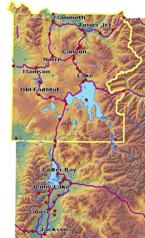
Home > Yellowstone and Grand Teton National Parks Detailed Forecasts
Forecasts
Severe Weather
Forecast Discussion
User Defined Forecast
Fire Weather
Activity Planner
Hourly Forecasts
Snow and Avalanche
Aviation Weather Decision Support
Hydrology
SnoTel Page
Rivers and Lakes
Weather Safety
SkyWarn
StormReady
NOAA Weather Radio
Preparedness
US Dept of Commerce
National Oceanic and Atmospheric Administration
National Weather Service
Western and Central Wyoming
12744 West U.S. Hwy 26
Riverton, WY 82501
307-857-3898
Comments? Questions? Please Contact Us.

