An upper level trough coinciding with surface frontal boundaries will focus showers and thunderstorms from the Great Lakes region into the Ohio and Tennessee Valley's, central and southern Plains. Instances of flash flooding, damaging winds and large hail are possible. Meanwhile, increasing waves and rip currents for portions of the eastern seaboard this week as tropical Atlantic is active. Read More >
Western and Central Wyoming
Weather Forecast Office
![]()
Detailed aviation weather information and forecasts can be found at the Aviation Weather Center: https://www.aviationweather.gov
Pilot Weather Briefings call 1-800-992-7433
|
|
| Wyoming Aviation Forecast Products |
|
|
Select an Airport to Get TAF |
Tactical Decision Aids |
|
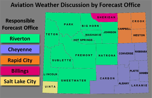
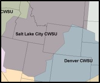
Click on the map for the latest aviation discussion
|
|
|
Aviation briefings covering Wyoming
|
|
Additional Aviation Products and Links |
|
If you have any suggestions or comments, please email nws.riverton@noaa.gov |
Forecasts
Severe Weather
Forecast Discussion
User Defined Forecast
Fire Weather
Activity Planner
Hourly Forecasts
Snow and Avalanche
Aviation Weather Decision Support
Hydrology
SnoTel Page
Rivers and Lakes
Weather Safety
SkyWarn
StormReady
NOAA Weather Radio
Preparedness
US Dept of Commerce
National Oceanic and Atmospheric Administration
National Weather Service
Western and Central Wyoming
12744 West U.S. Hwy 26
Riverton, WY 82501
307-857-3898
Comments? Questions? Please Contact Us.