
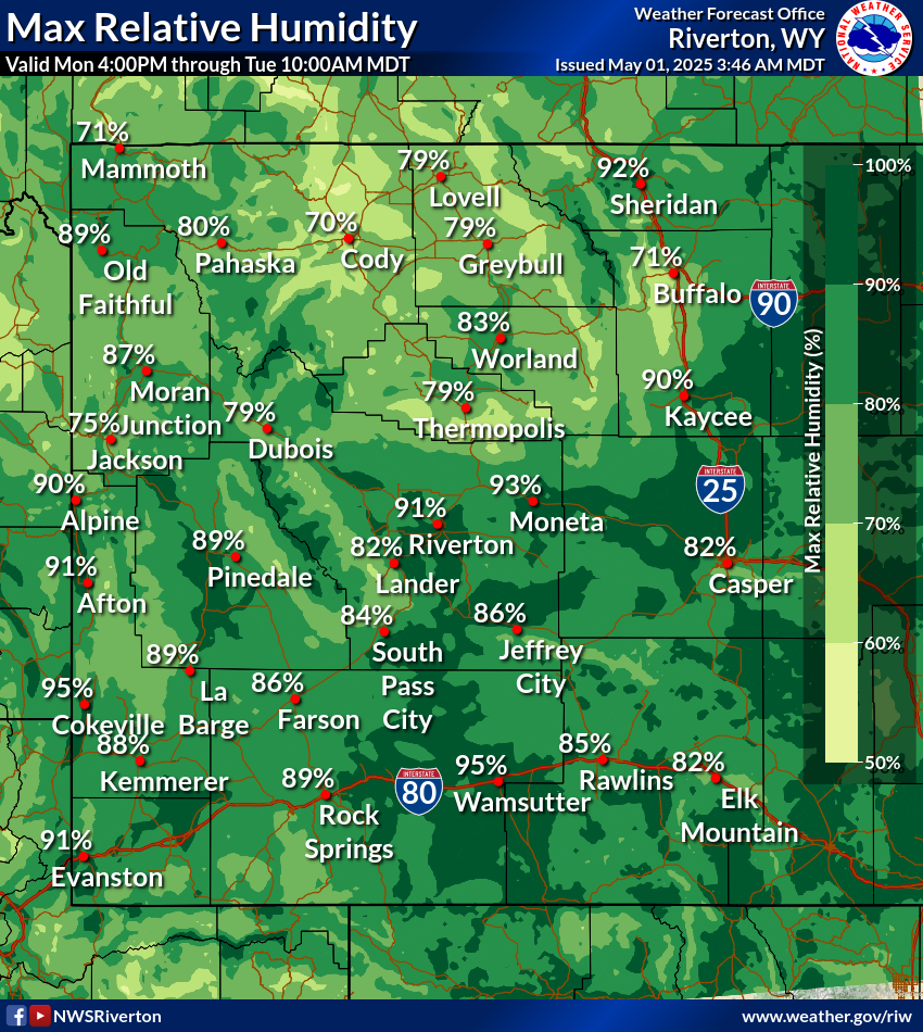
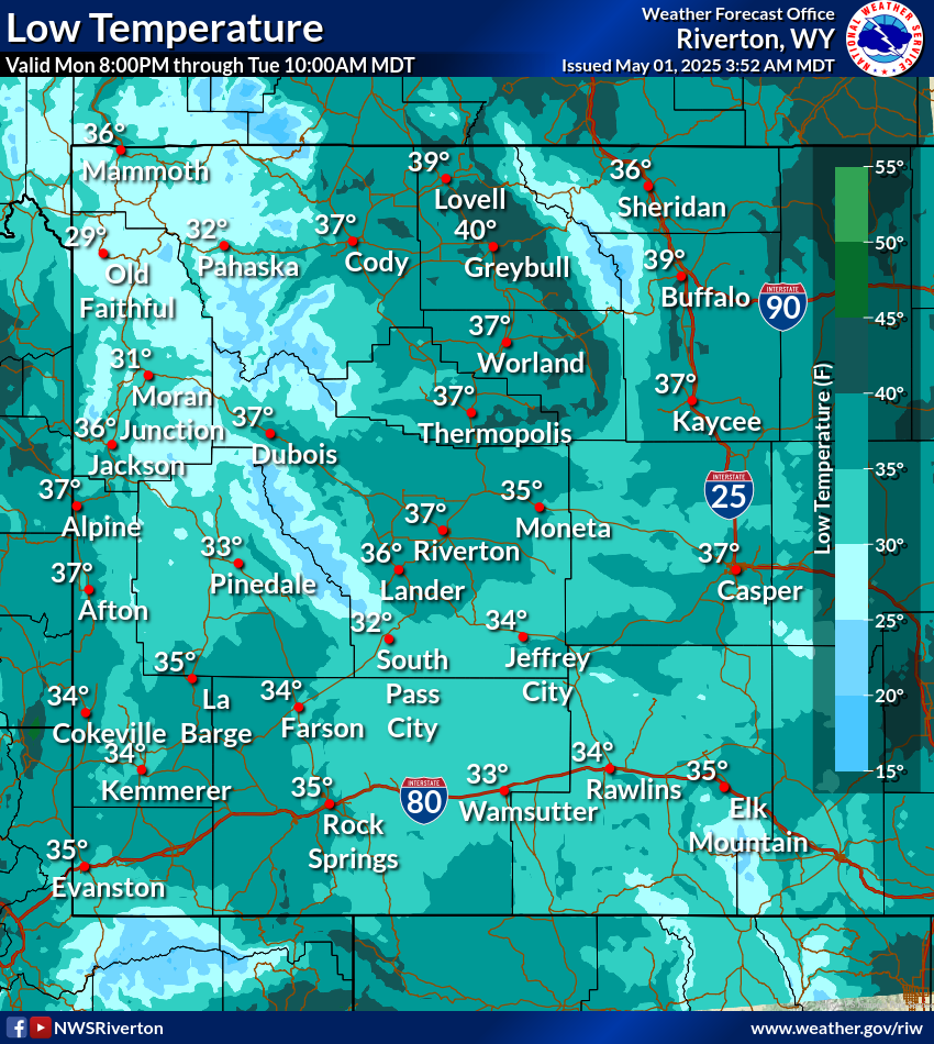
Numerous severe thunderstorms are expected across a broad region from the Ohio Valley to the Mid-Atlantic and Northeast States today into tonight. Swaths of damaging wind gusts are expected and some tornadoes are possible. Bertha is expected to bring tropical storm conditions to portions of the Gulf Coast from the Florida Panhandle westward to southeastern Louisiana later today and Wednesday. Read More >
Western and Central Wyoming
Weather Forecast Office
Western & Central WY Graphical DSS Images
Be sure to check the issued date/time on the images to ensure up-to-date information
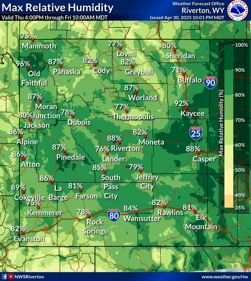
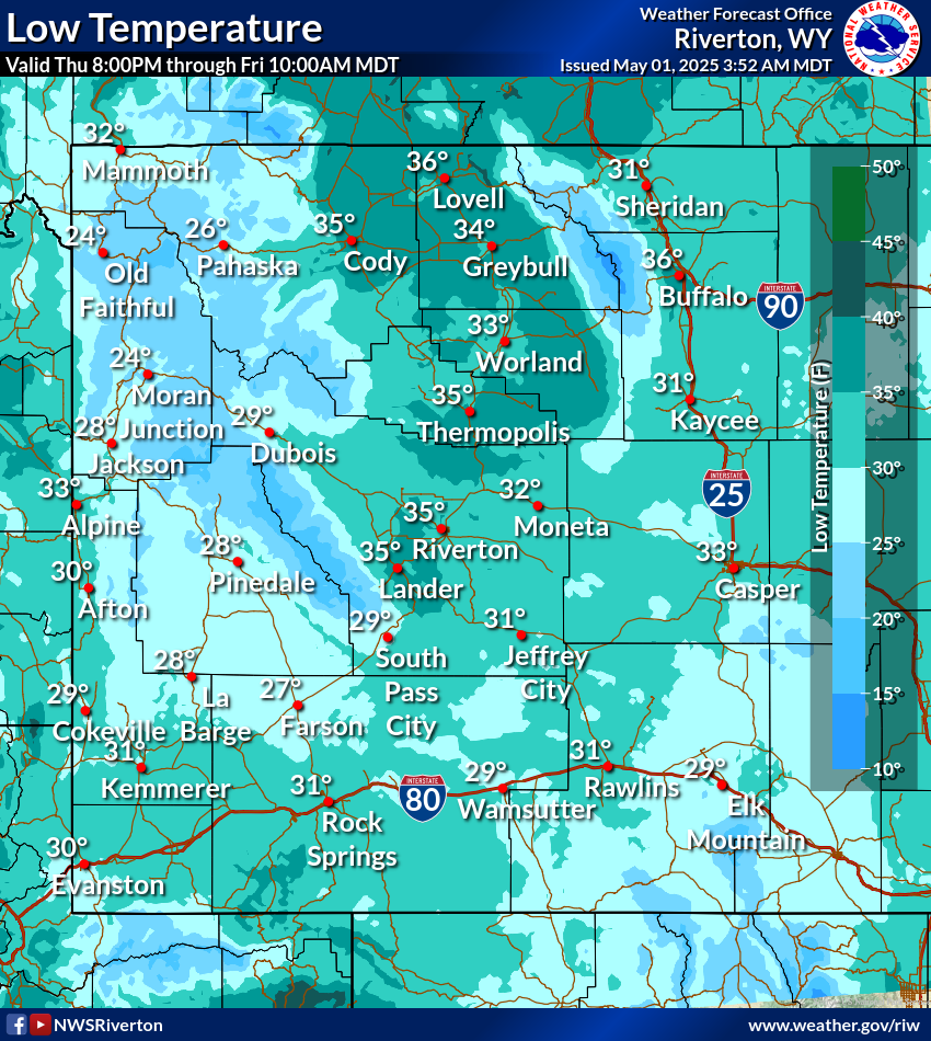
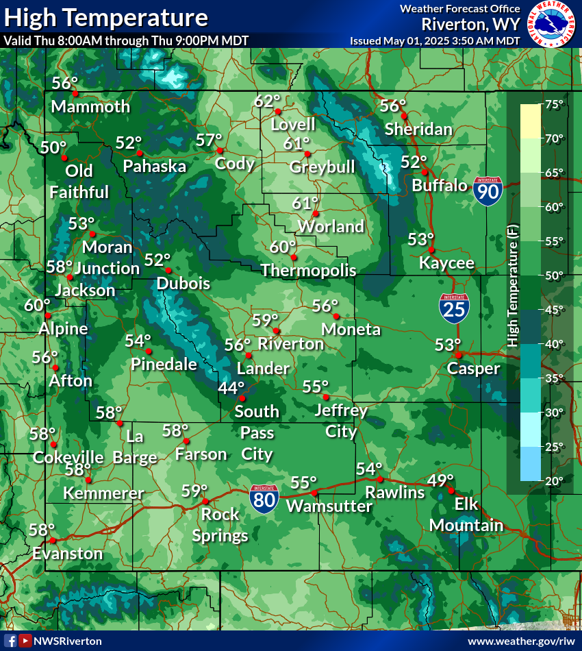
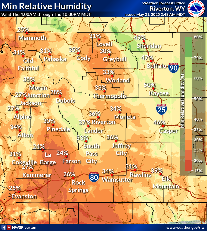
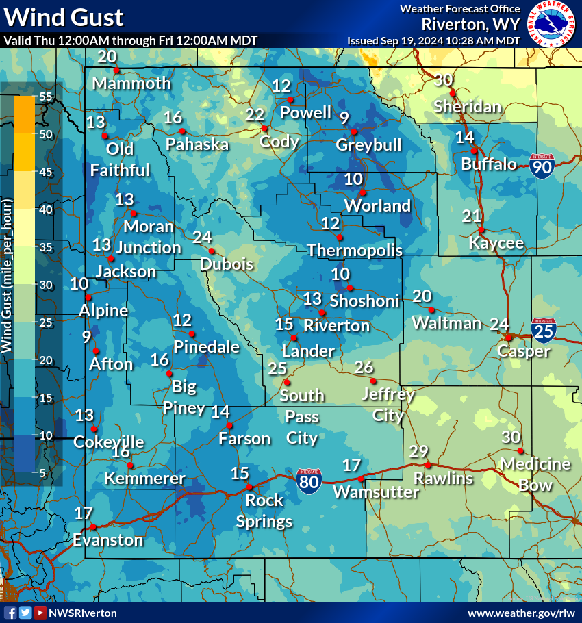
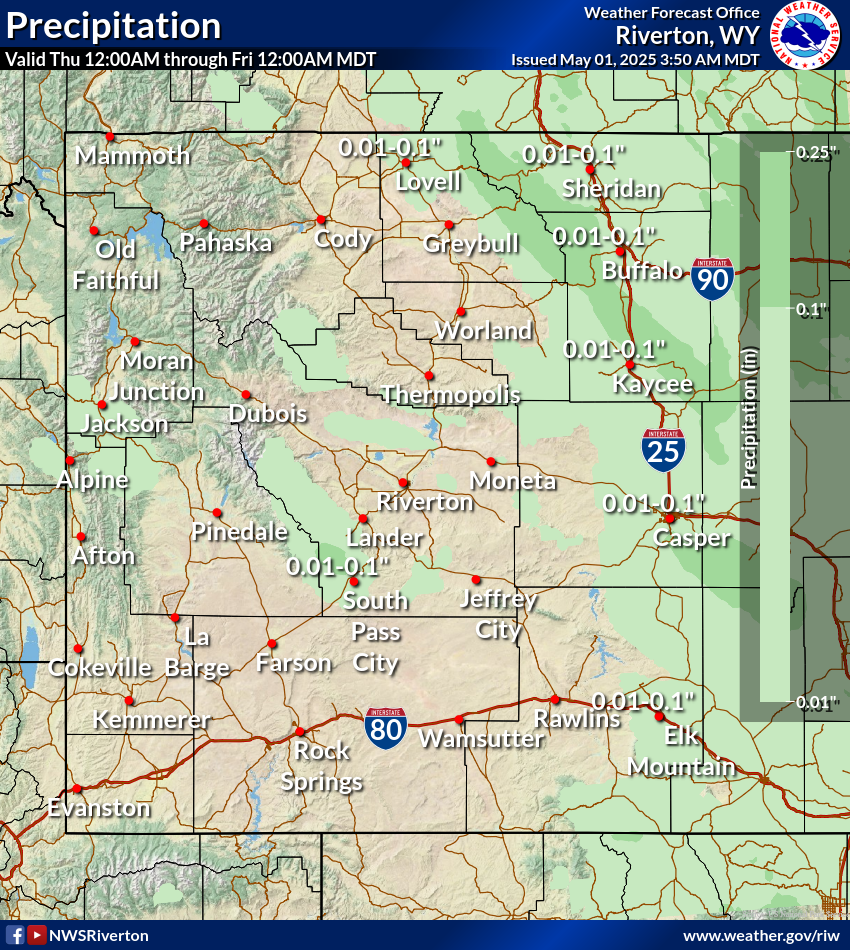
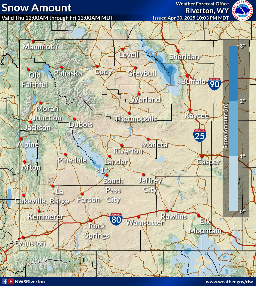
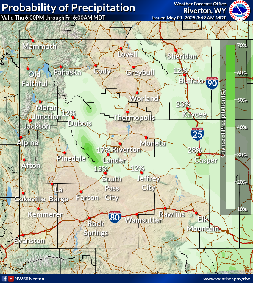
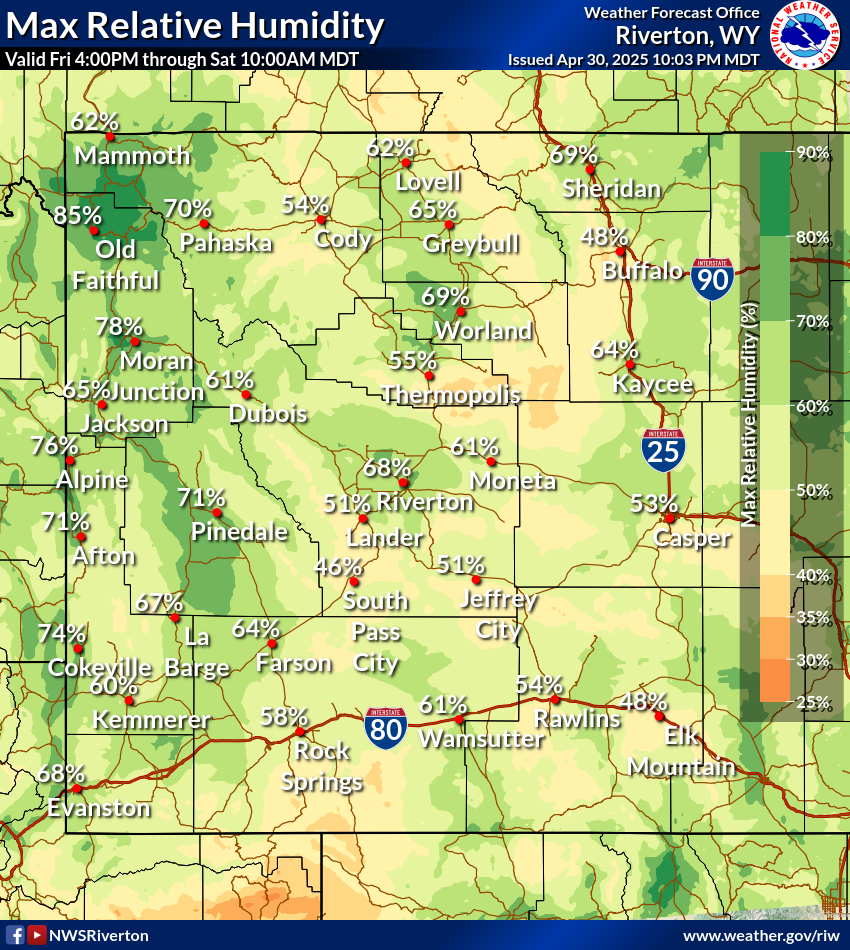
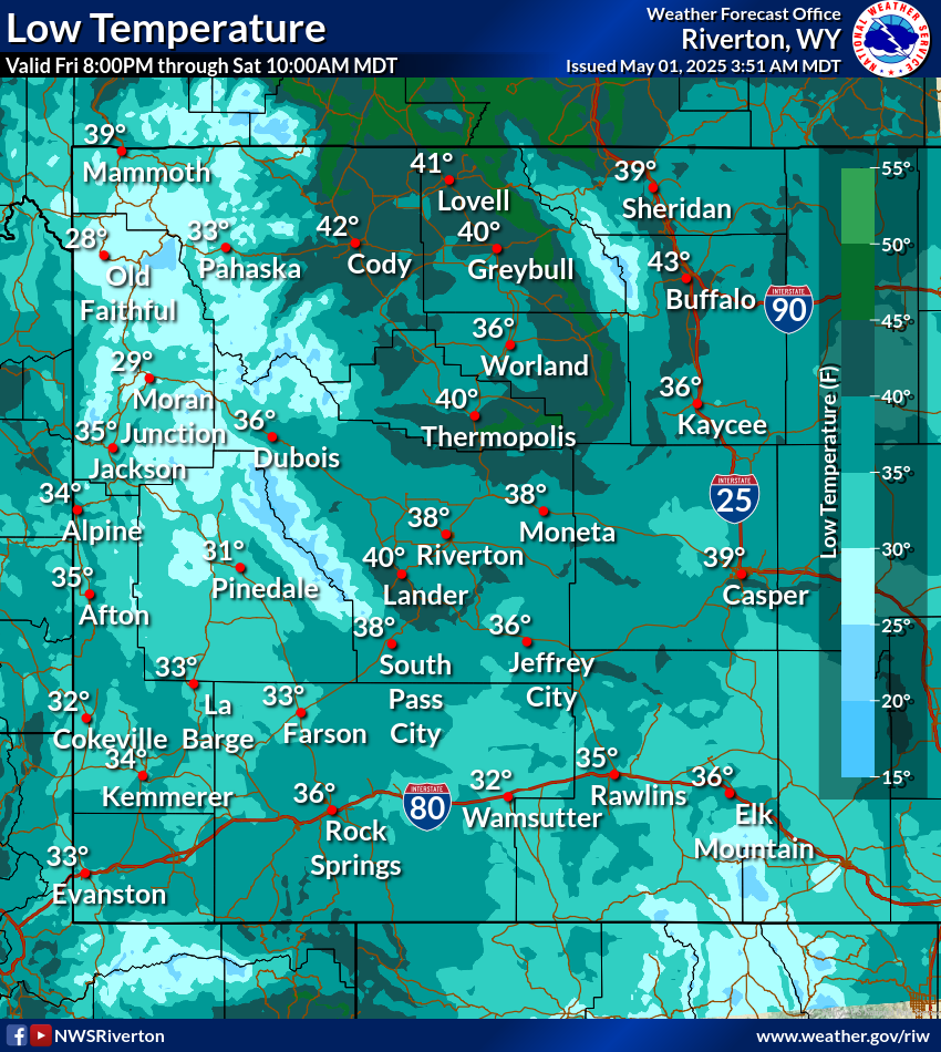
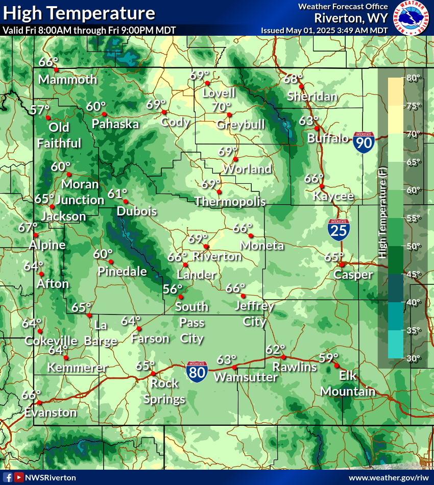
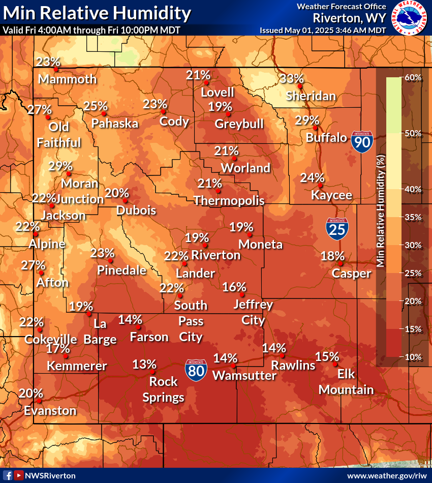
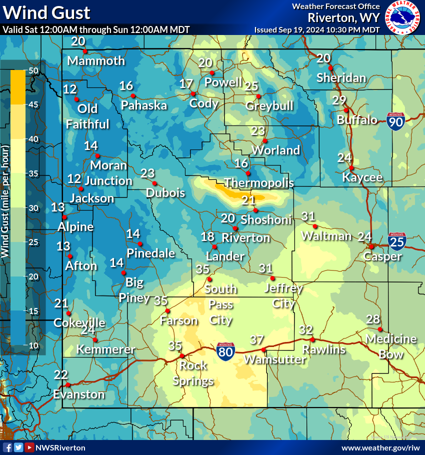
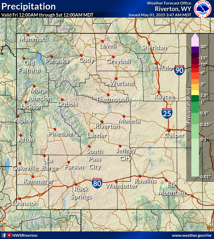
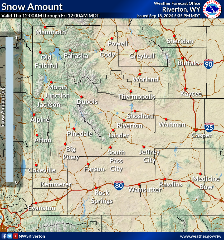
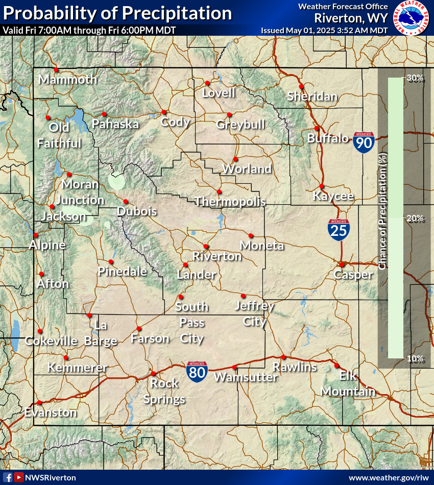
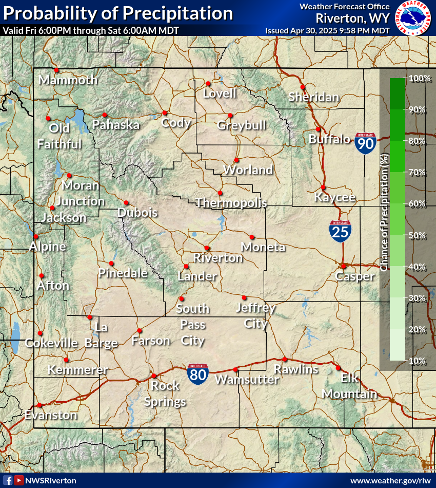
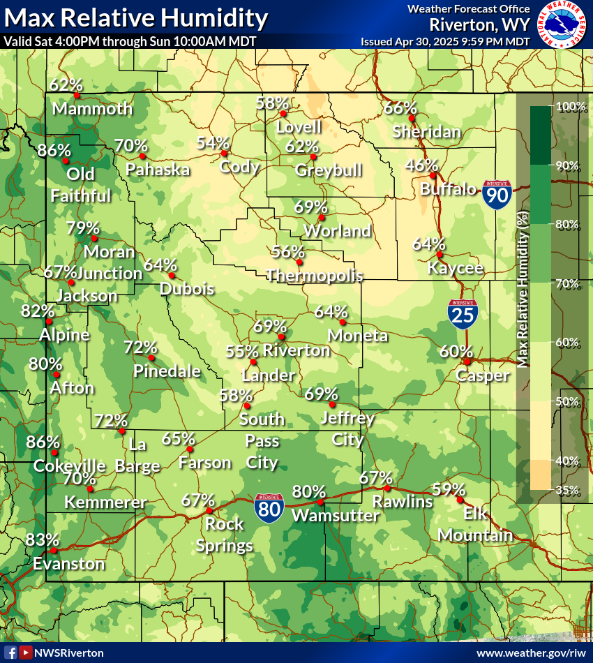
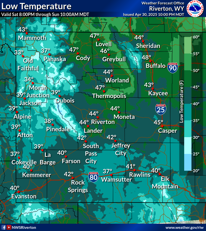
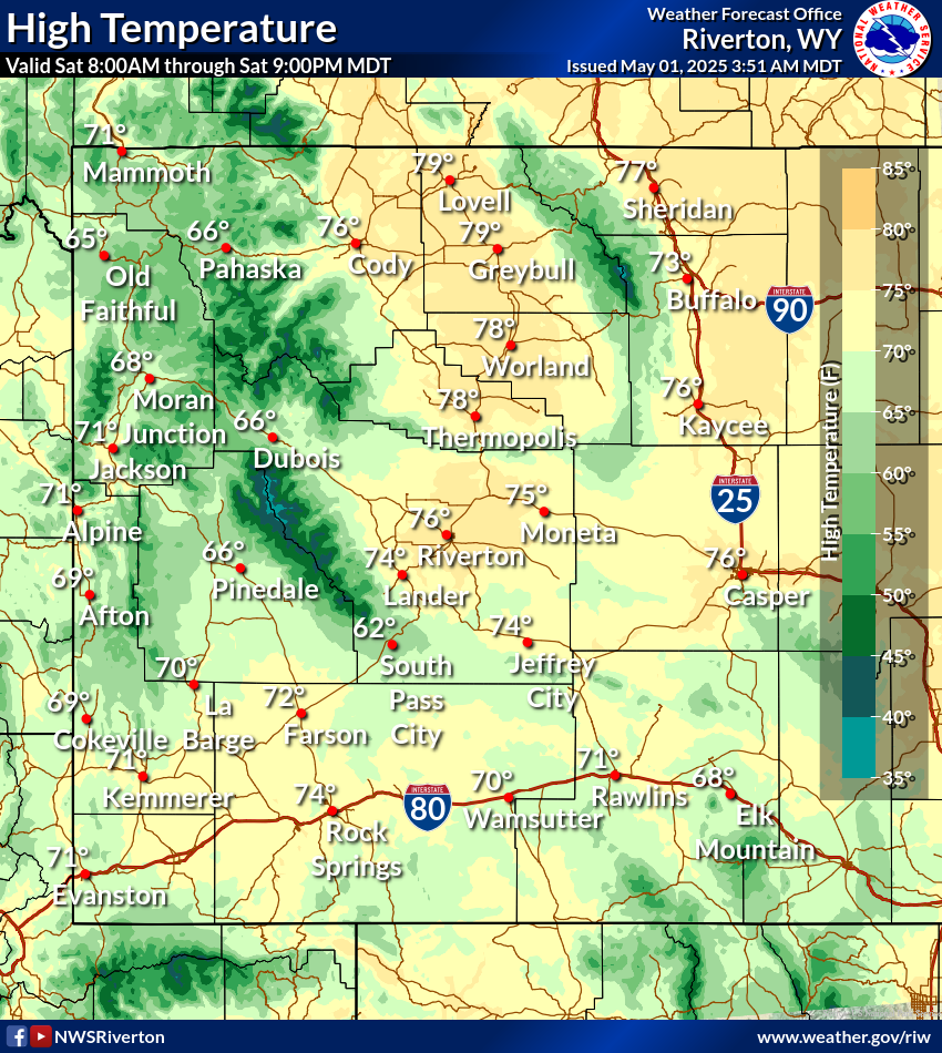
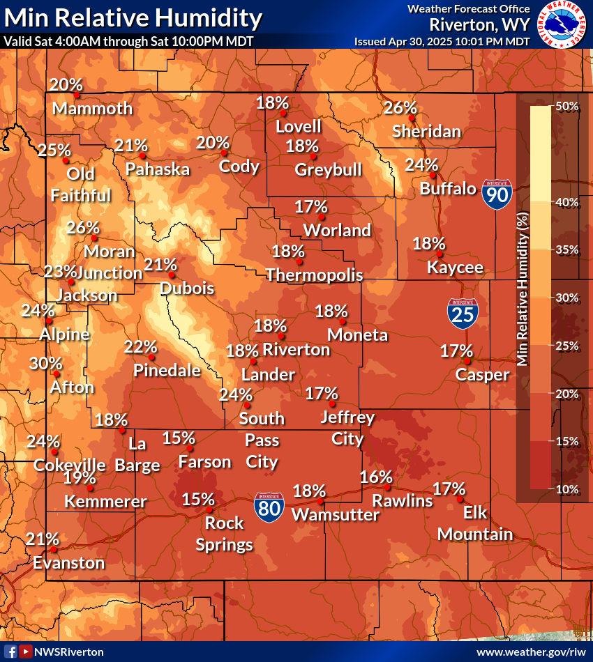
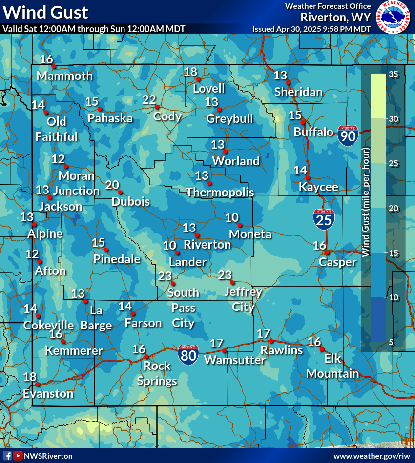
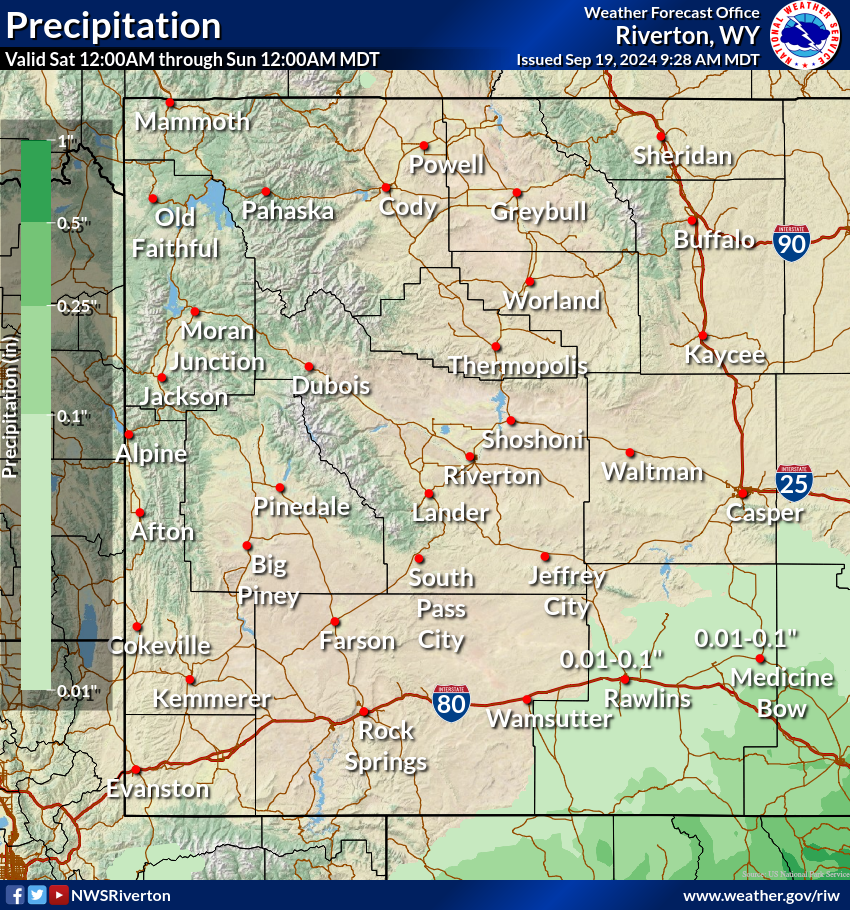
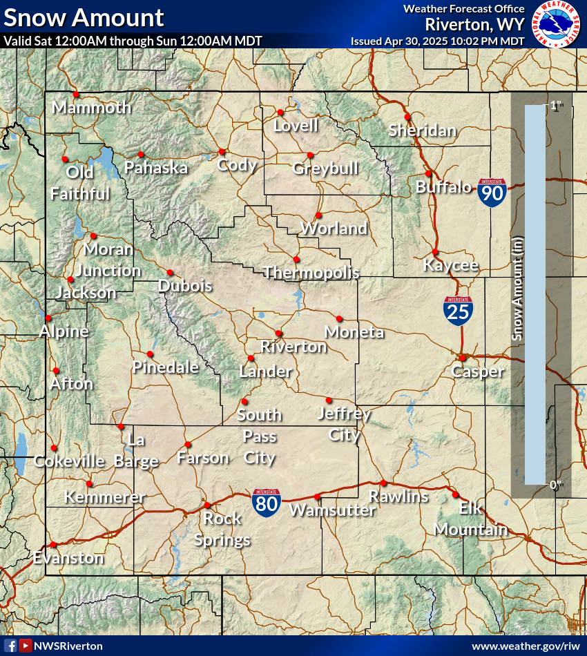
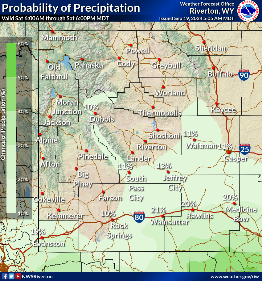
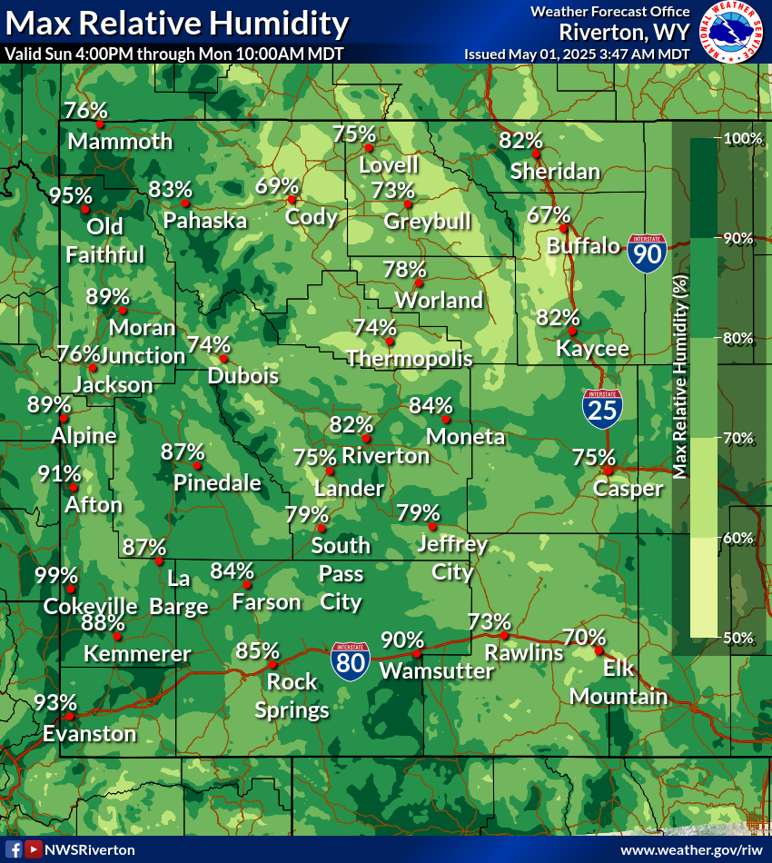
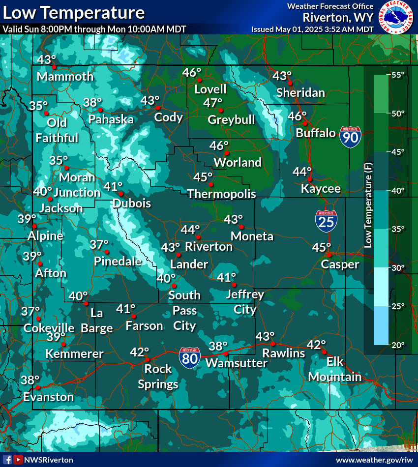
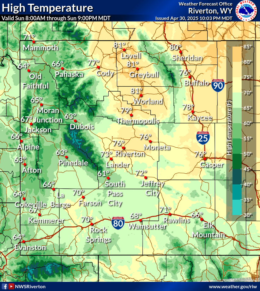
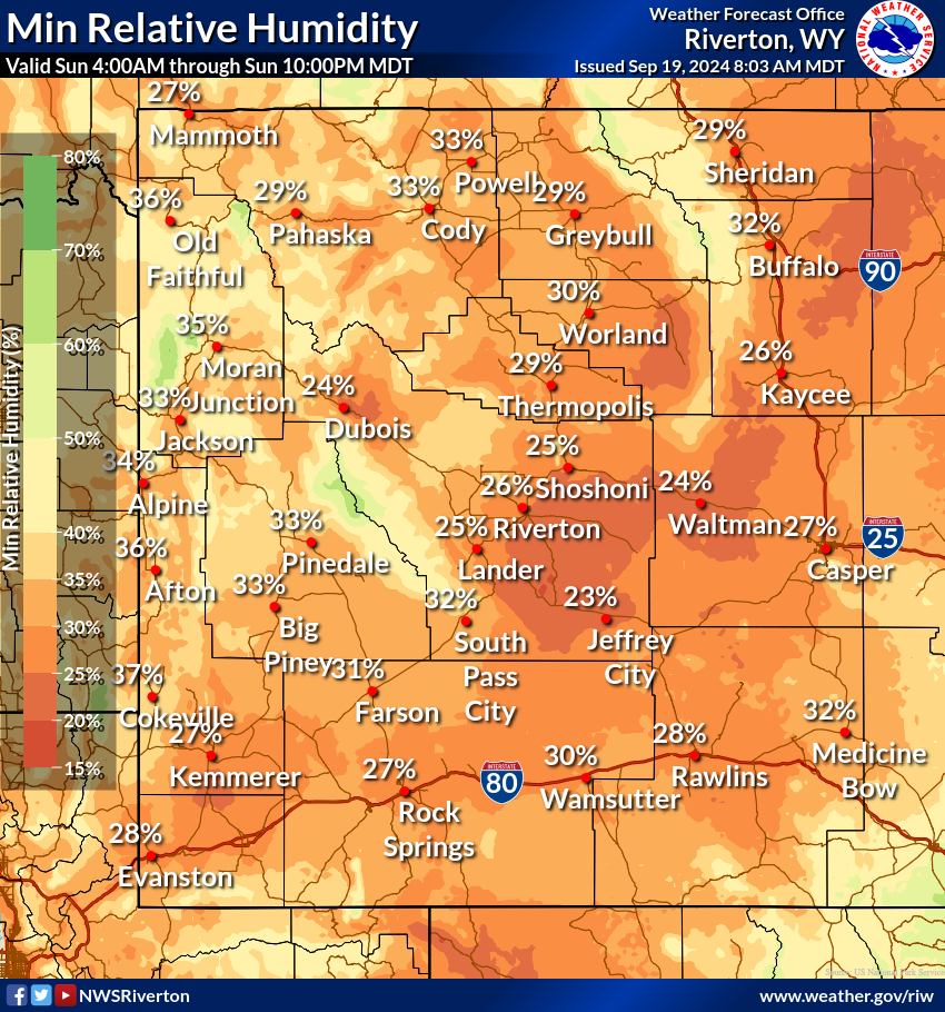
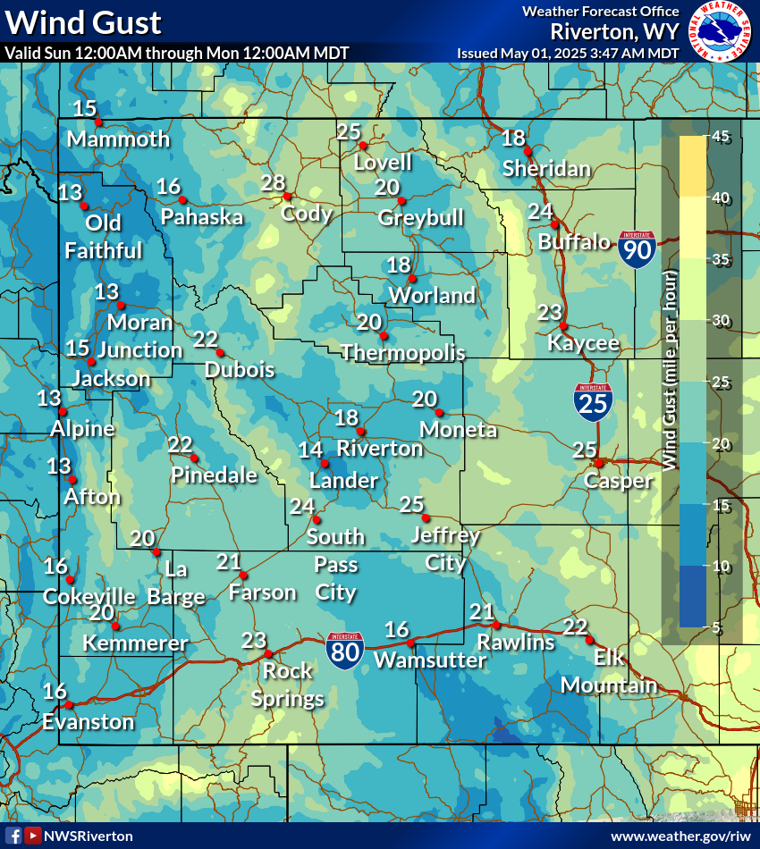
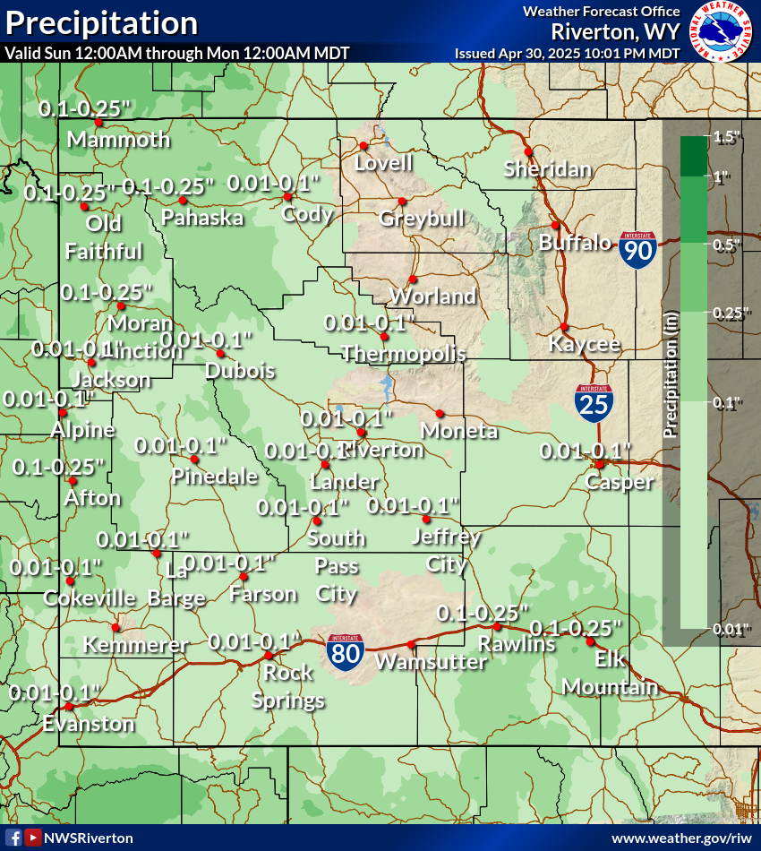
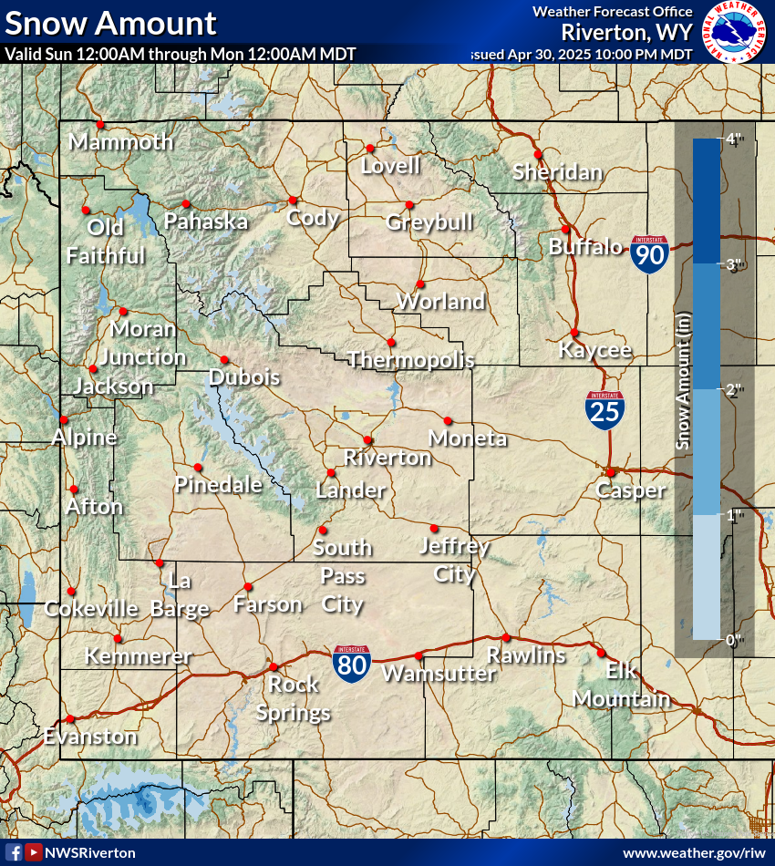
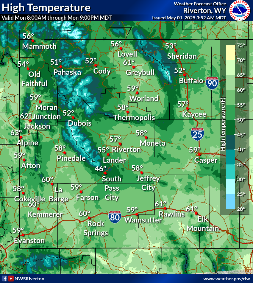
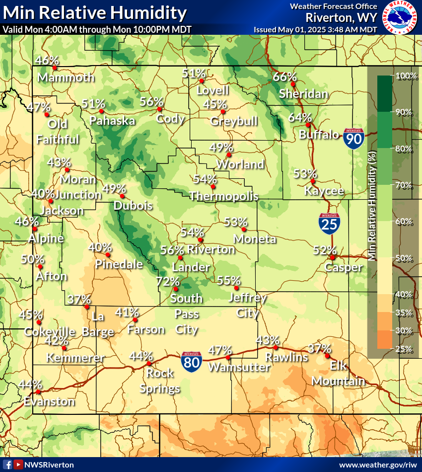
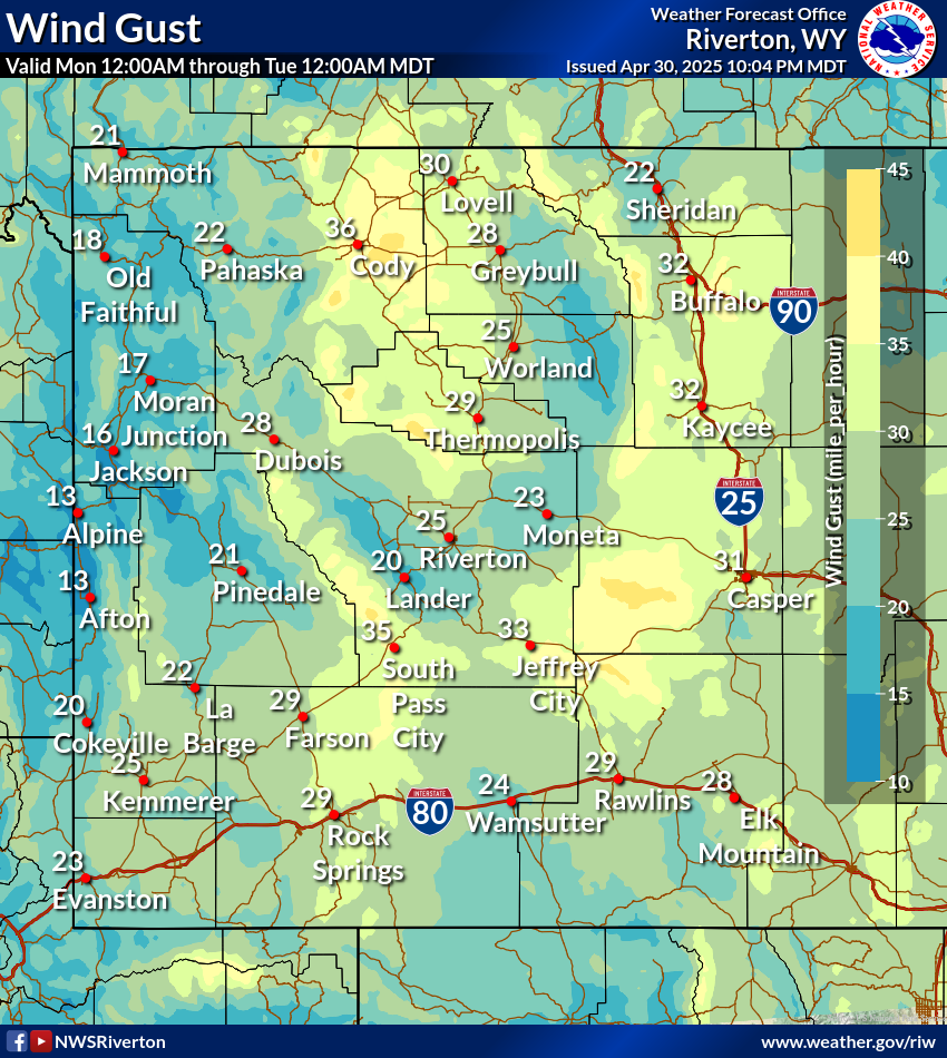
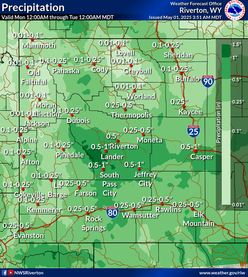
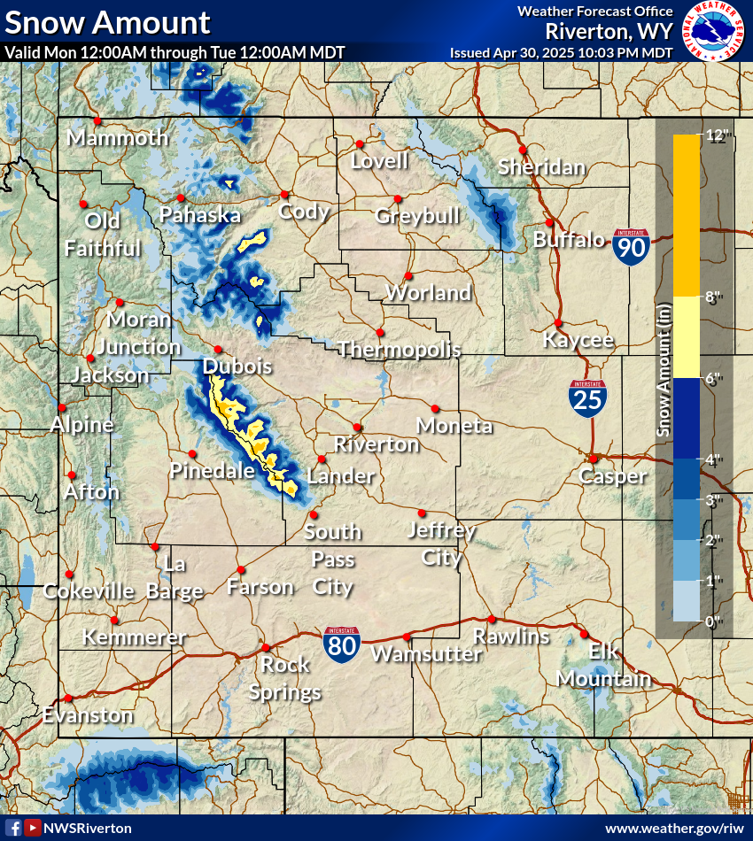
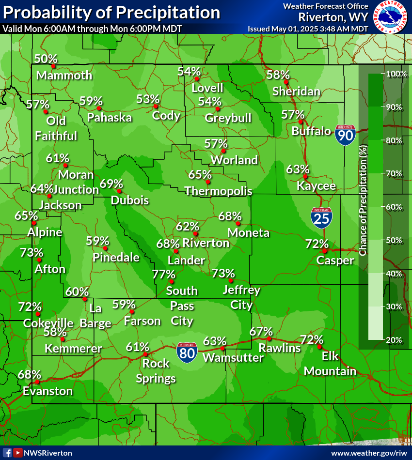
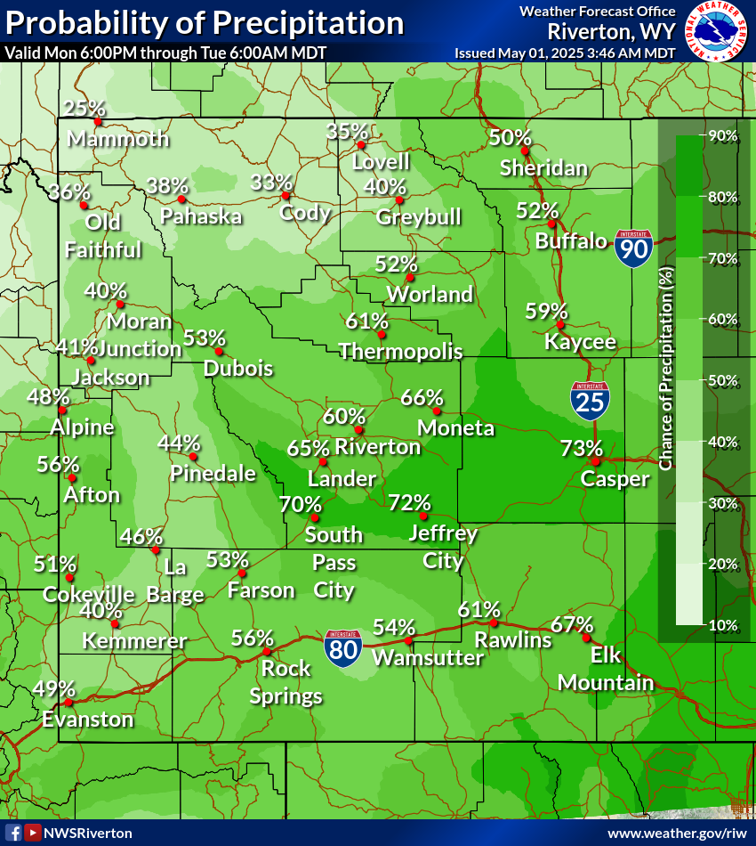
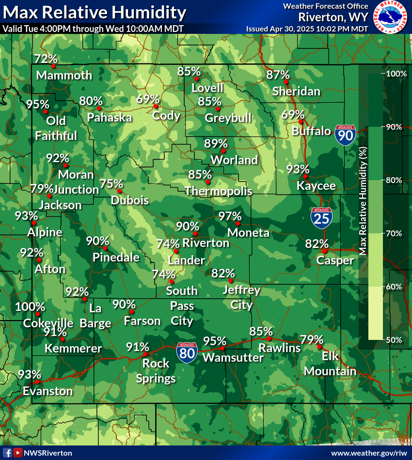
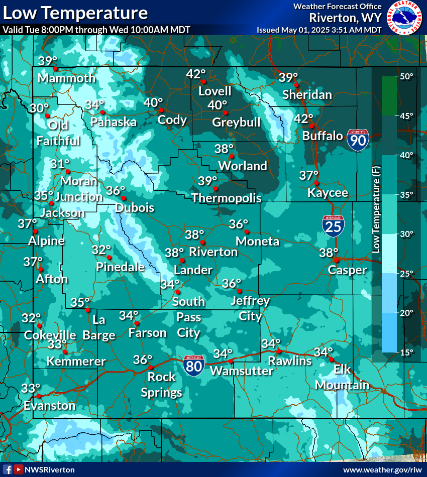
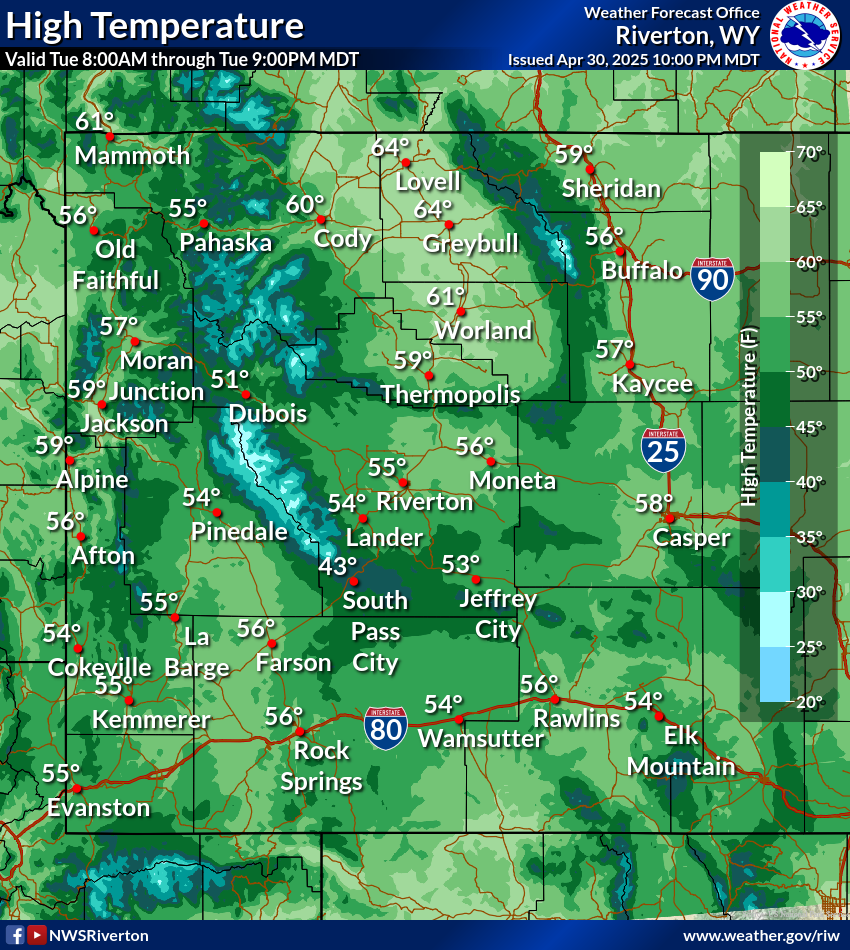
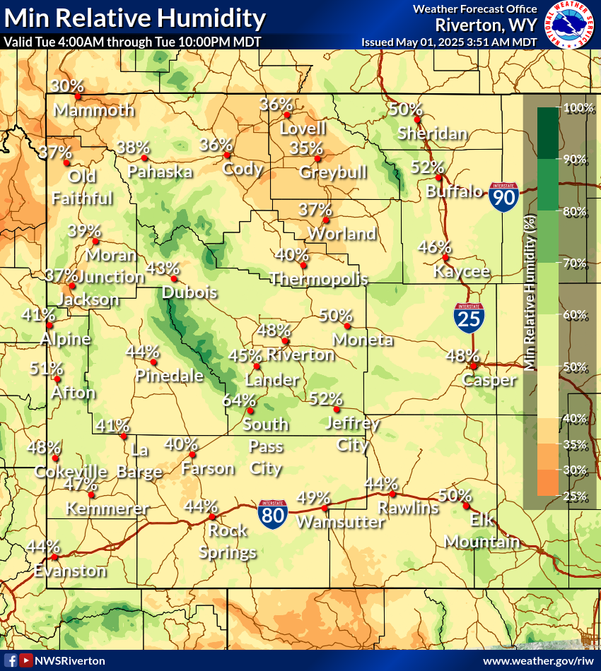
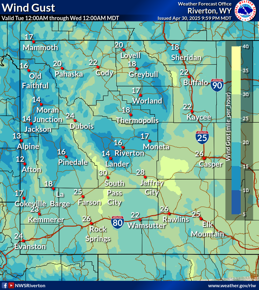
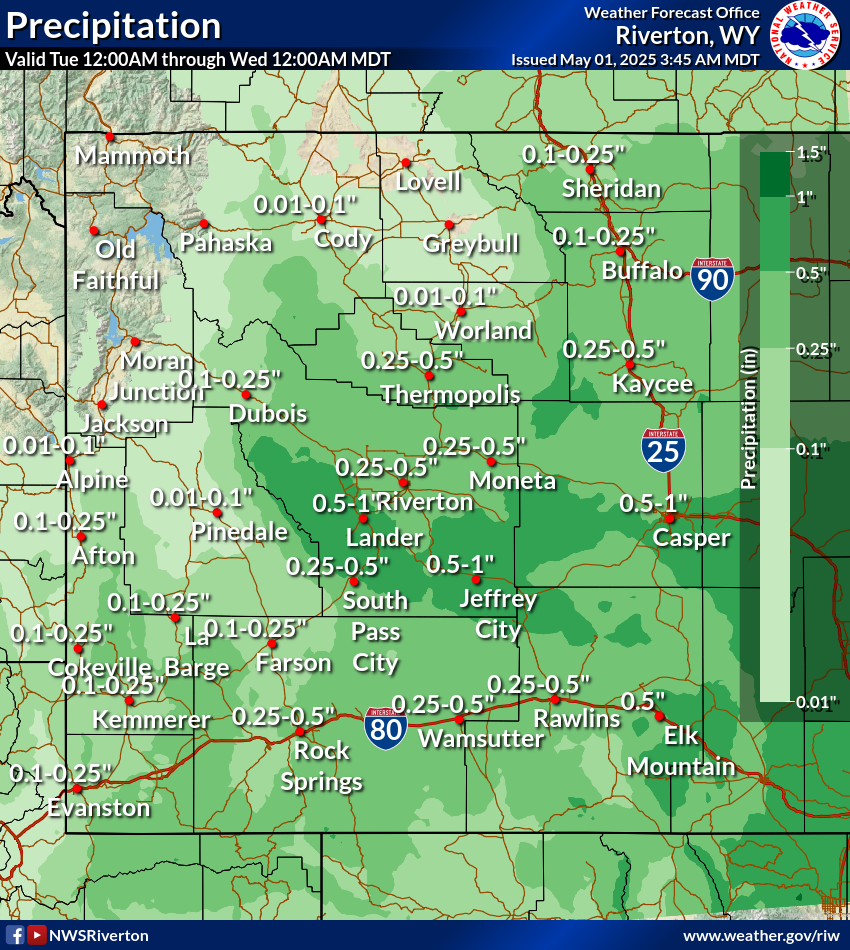
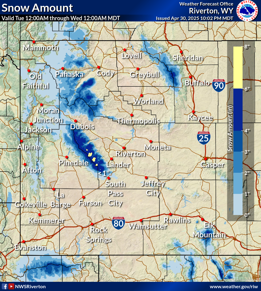
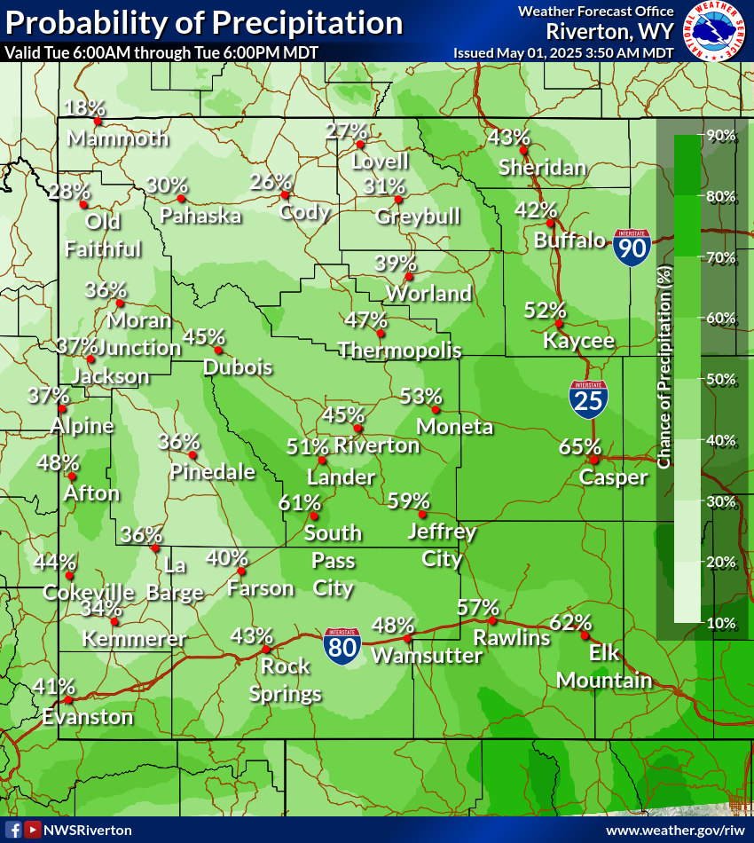
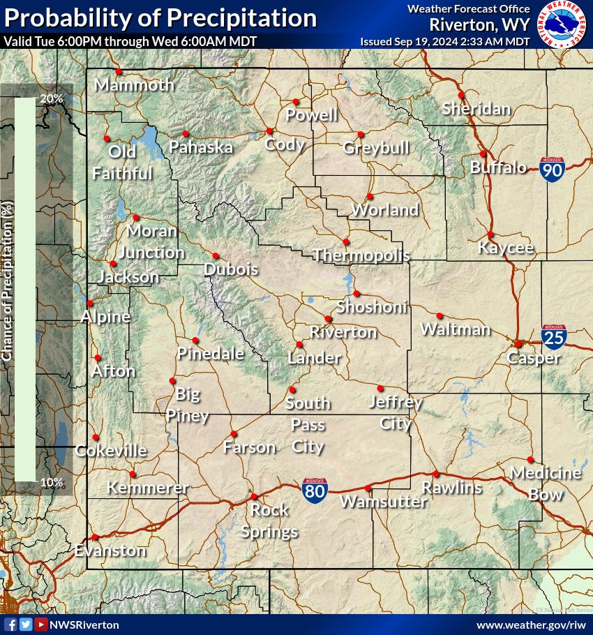
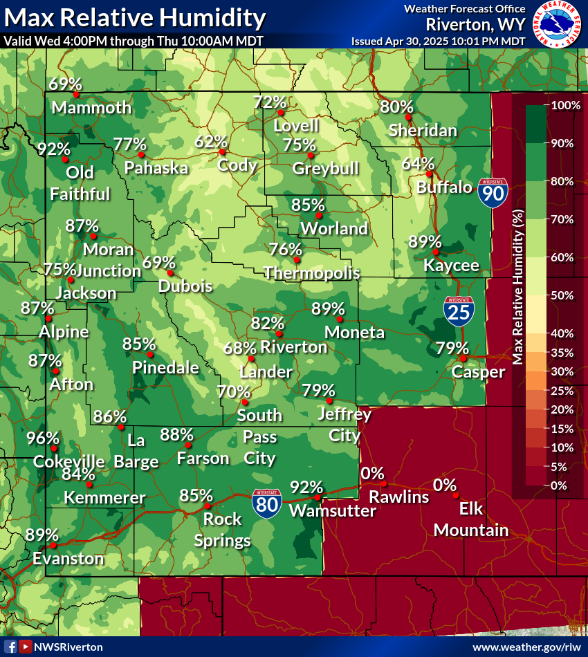
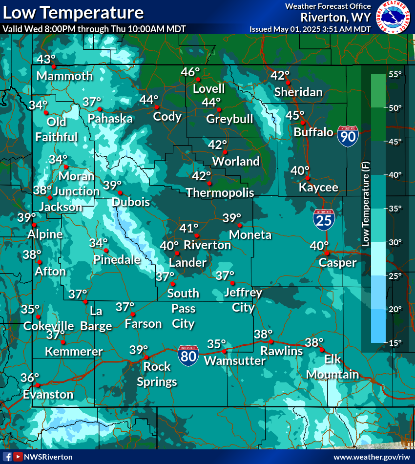
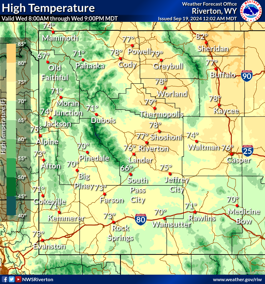
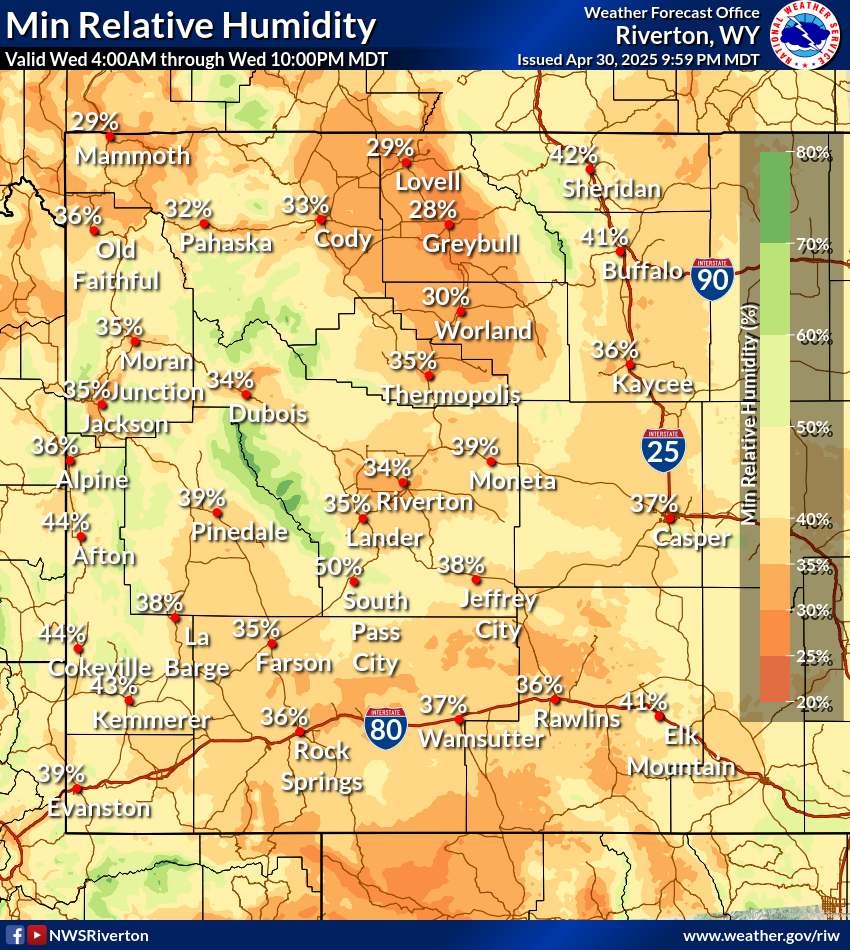
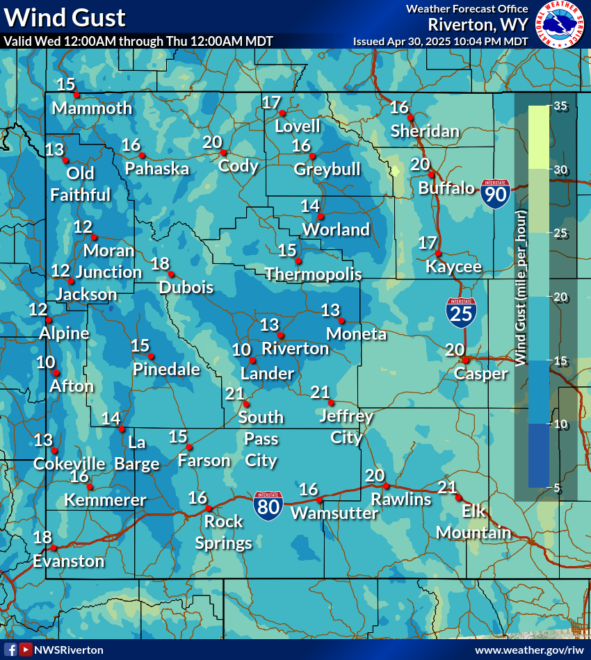
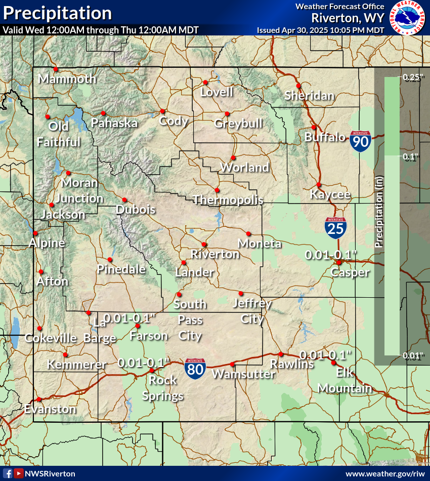
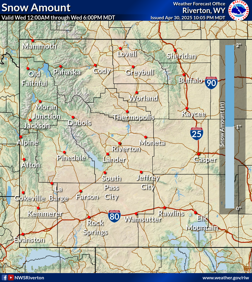
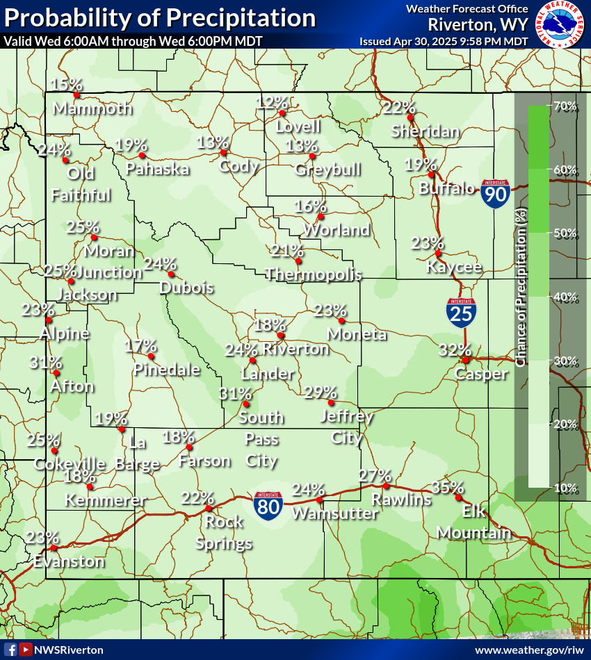
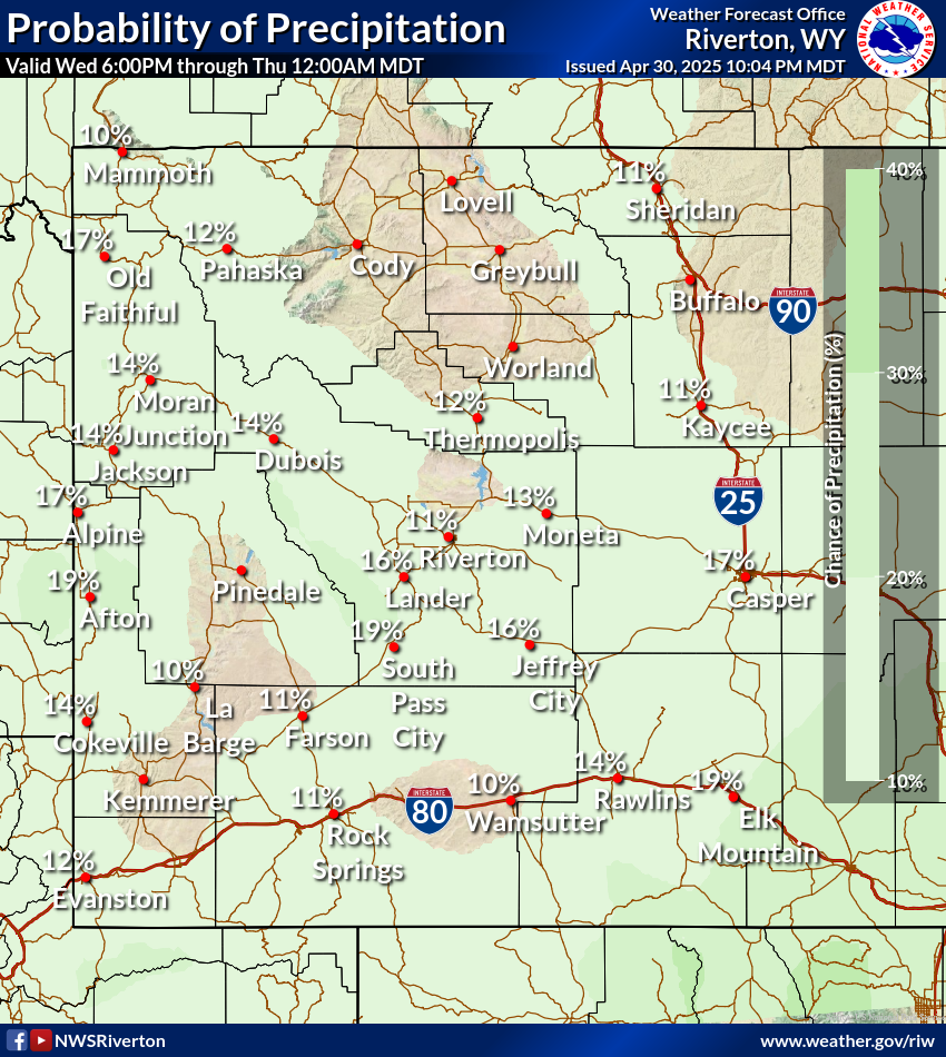
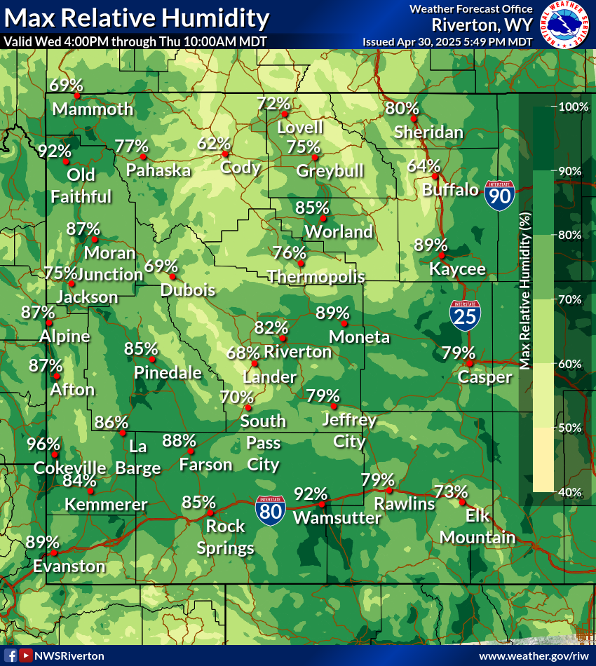
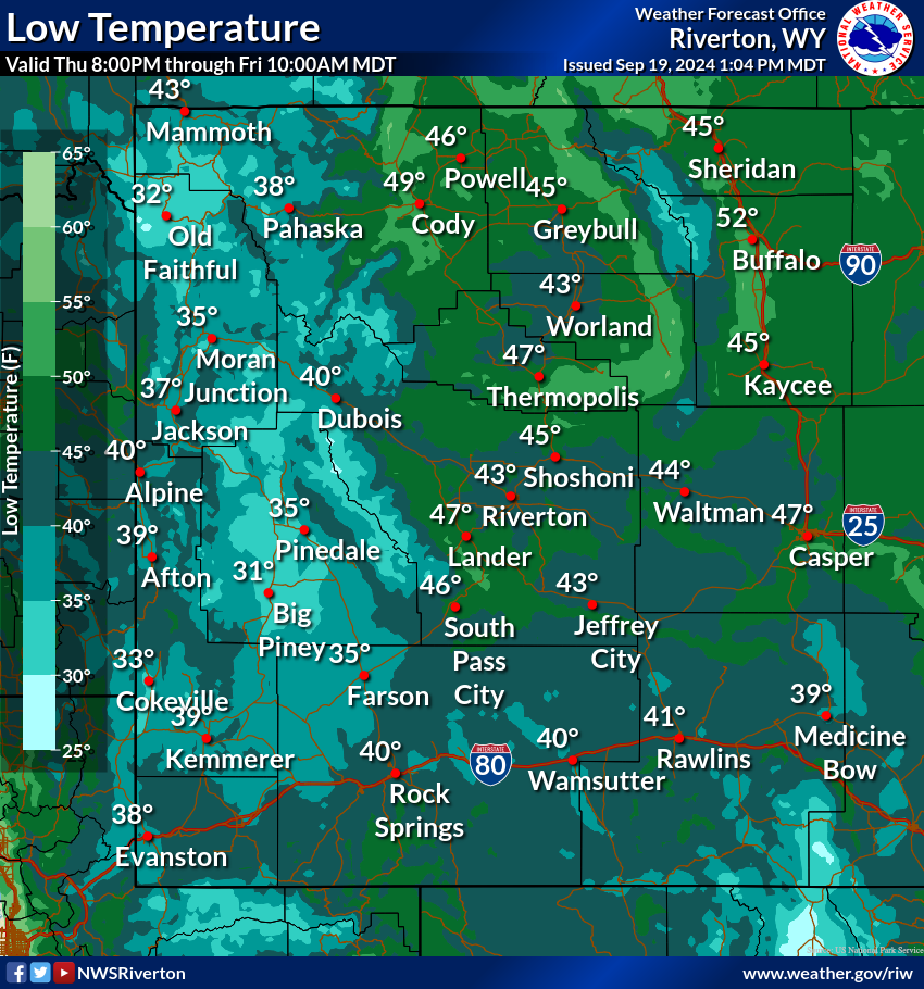
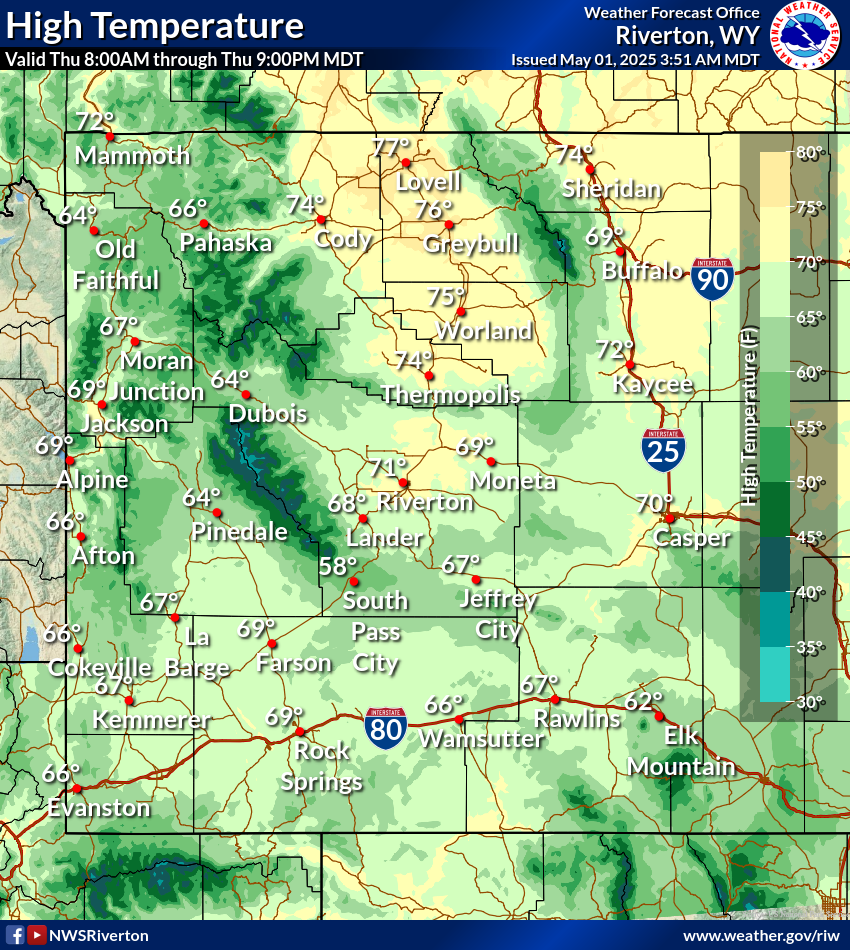
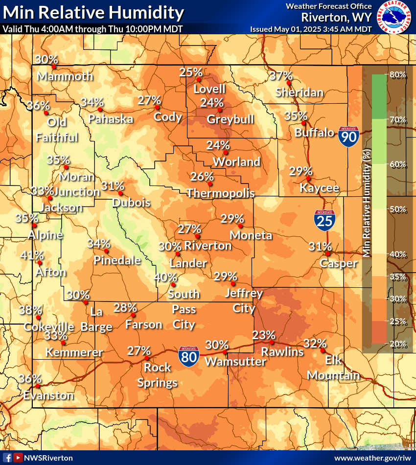
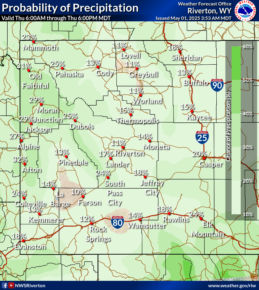
| MaxRH | MinT | MaxT | MinRH | WindGust | QPF | SnowAmt | PoP | PoP Night |
 Day1 |
 Day1 |
 Day1 |
 Day1 |
 Day1 |
 Day1 |
 Day1 |
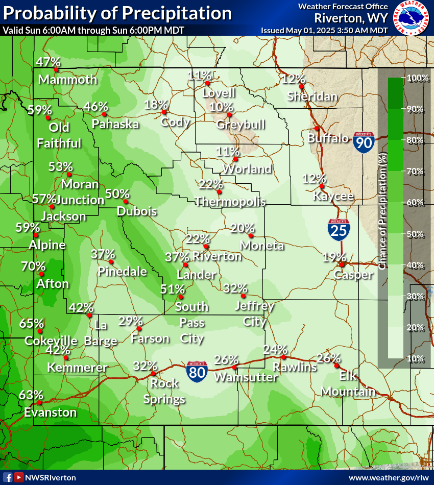
 Today |
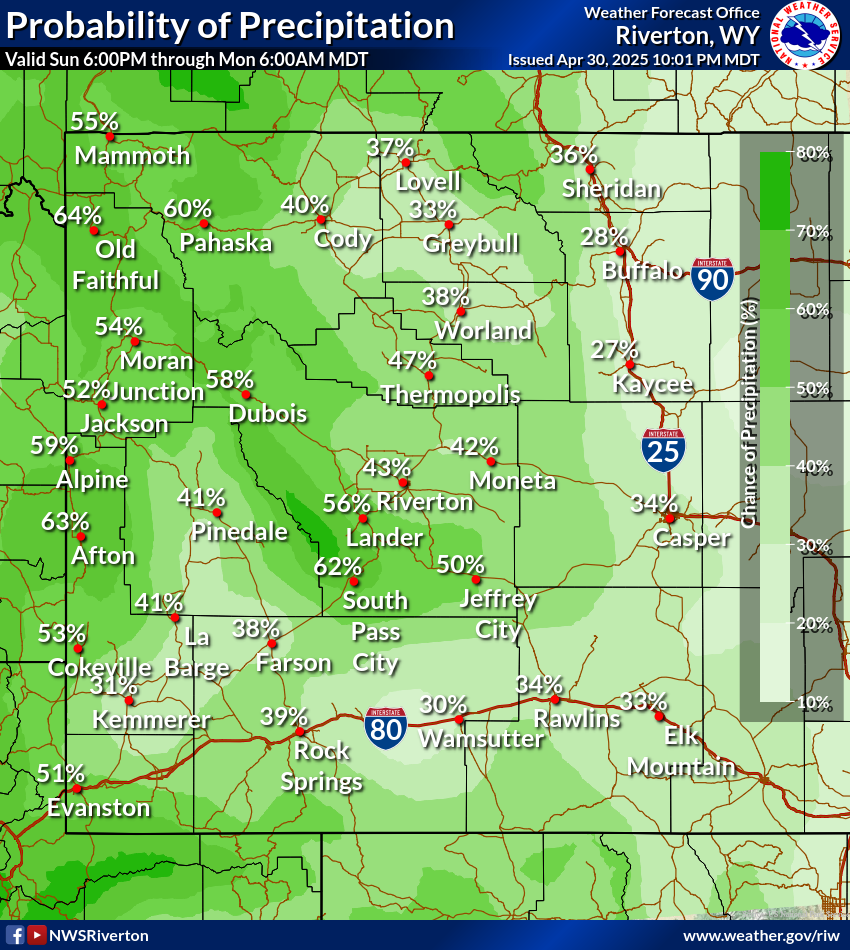
 Tonight |
 Day2 |
 Day2 |
 Day2 |
 Day2 |
 Day2 |
 Day2 |
 Day2 |
 Tomorrow |
 TomorrowNight |
 Day3 |
 Day3 |
 Day3 |
 Day3 |
 Day3 |
 Day3 |
 Day3 |
 Day3 |
 Day3Night |
 Day4 |
 Day4 |
 Day4 |
 Day4 |
 Day4 |
 Day4 |
 Day4 |
 Day4 |
 Day4Night |
 Day5 |
 Day5 |
 Day5 |
 Day5 |
 Day5 |
 Day5 |
 Day5 |
 Day5 |
 Day5Night |
 Day6 |
 Day6 |
 Day6 |
 Day6 |
 Day6 |
 Day6 |
 Day6 |
 Day6 |
 Day6Night |
 Day7 |
 Day7 |
 Day7 |
 Day7 |
 Day7 |
 Day7 |
 Day7 |
 Day7 |
 Day7Night |
 Day8 |
 Day8 |
 Day8 |
 Day8 |
 Day8 |
 Day8 |
Forecasts
Severe Weather
Forecast Discussion
User Defined Forecast
Fire Weather
Activity Planner
Hourly Forecasts
Snow and Avalanche
Aviation Weather Decision Support
Hydrology
SnoTel Page
Rivers and Lakes
Weather Safety
NOAA Weather Radio
Preparedness
SkyWarn
StormReady
US Dept of Commerce
National Oceanic and Atmospheric Administration
National Weather Service
Western and Central Wyoming
12744 West U.S. Hwy 26
Riverton, WY 82501
307-857-3898
Comments? Questions? Please Contact Us.

