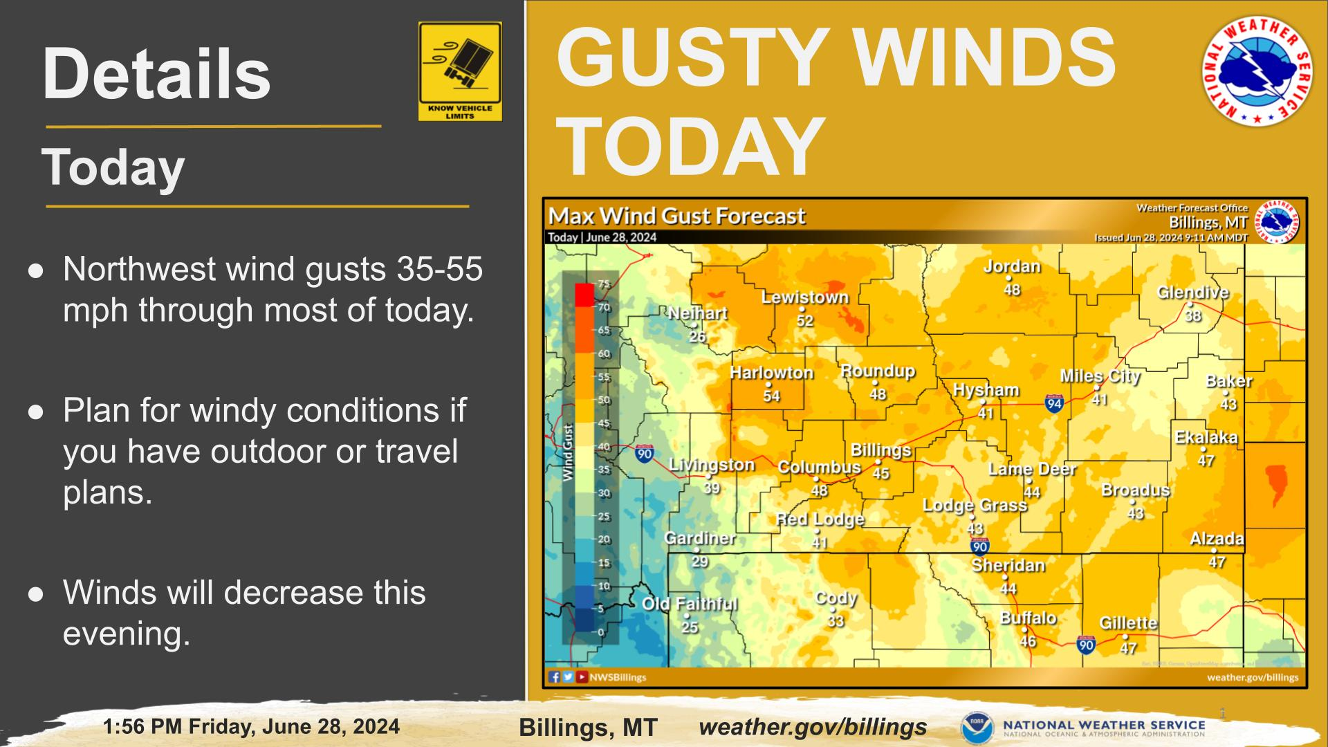
Isolated to scattered thunderstorms this afternoon and evening will be capable of producing very heavy rain, strong wind gusts, and hail. Stay weather aware and be sure to seek shelter if threatening weather approaches.
Isolated to scattered thunderstorms this afternoon and evening will be capable of producing very heavy rain, strong wind gusts, and hail. Stay weather aware and be sure to seek shelter if threatening weather approaches.
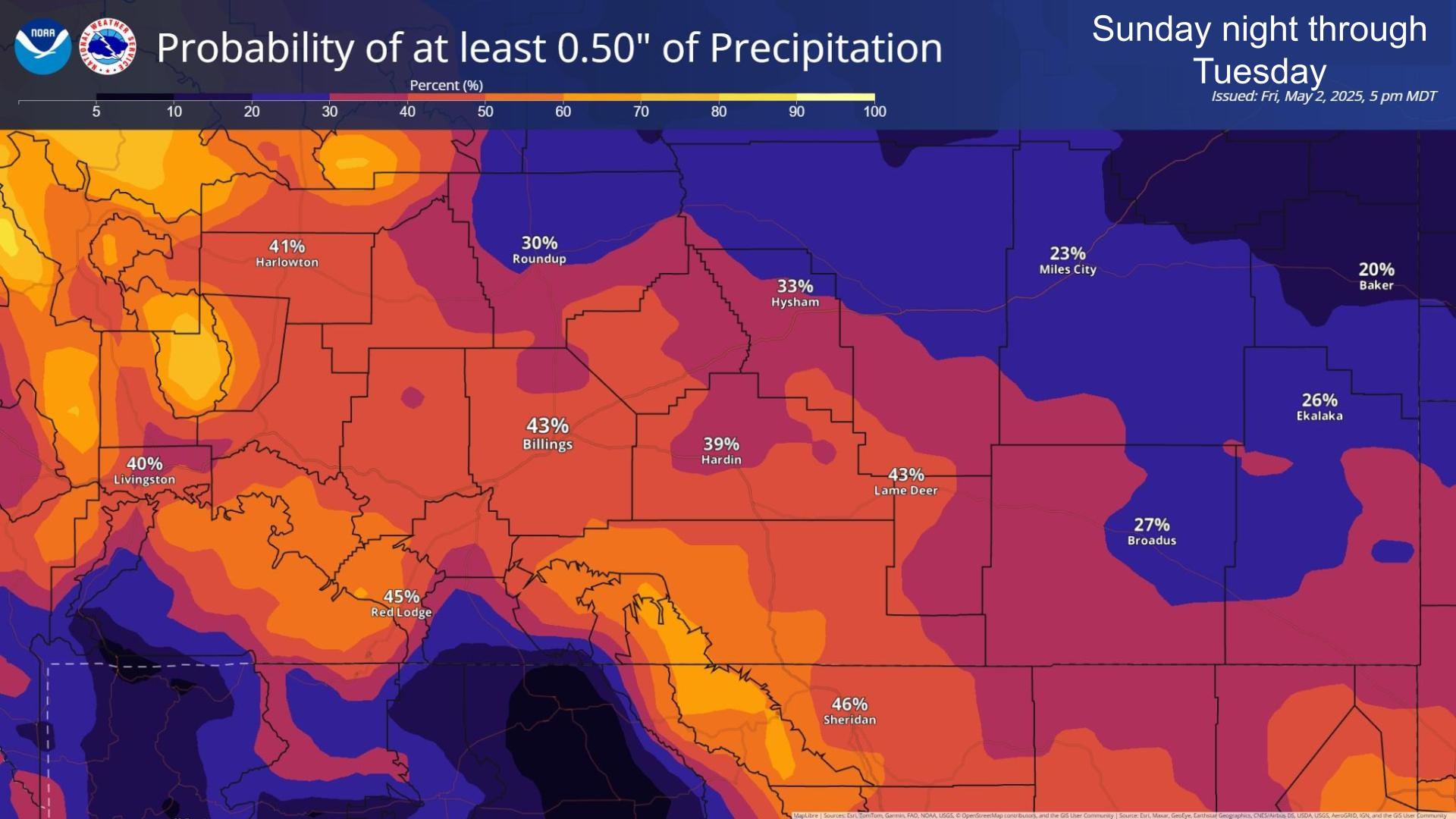
Slow moving thunderstorms will be capable of producing very heavy rainfall this afternoon and evening. Stay weather aware and be sure to have multiple ways to receive warnings.


 Weather Stats