
Widespread, life-threatening considerable flash flooding is expected in south-central Texas through at least Friday. Catastrophic river flooding and rapid rises on small streams, arroyos, and typically dry washes are expected in the Texas Hill Country. Wildfire smoke is impacting air quality across much of the Great Lakes region into the Northeast U.S. with Air Quality Alerts in effect. Read More >
July 17, 2015 SEVERE WEATHER
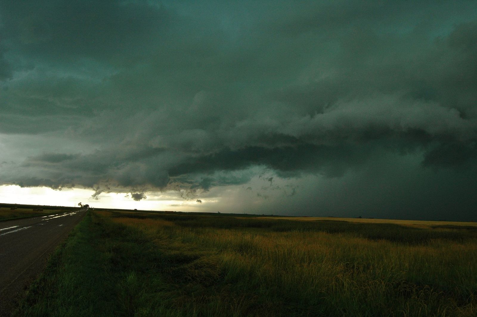
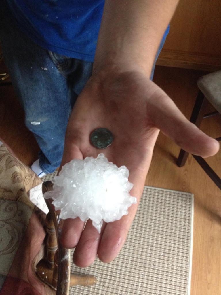
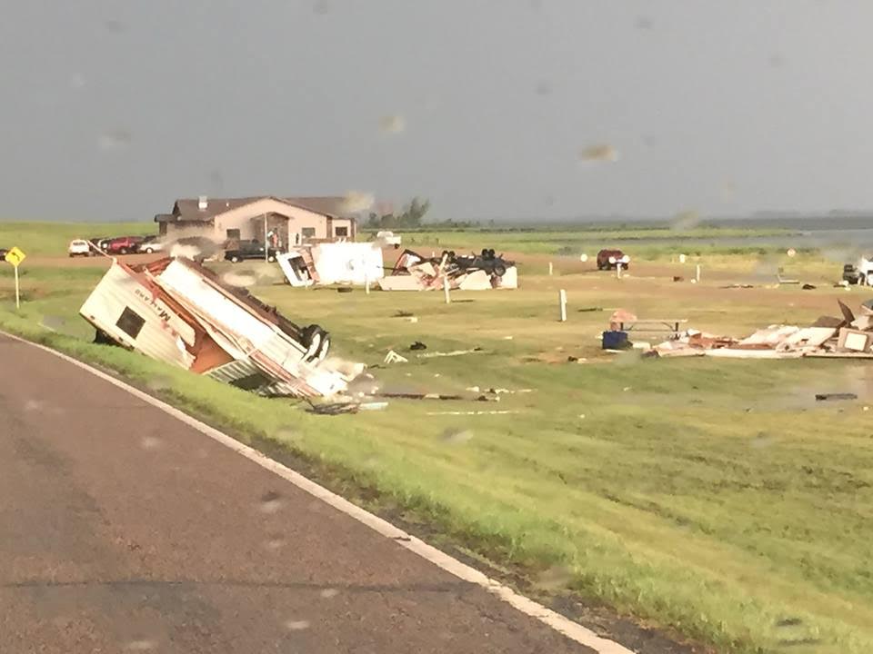
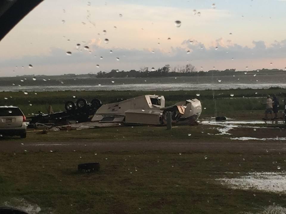
On Friday, July 17th, 2015, a warm and humid air mass produced severe weather across northeast South Dakota and west central Minnesota. One of the initial storms formed over McPherson County and produced baseball size hail in Leola. Further east, in Marshall, Roberts and Day counties, the storms formed with strong rotation and developed into numerous wall clouds and funnel clouds producing a brief EF-0 tornado touchdown in Langford. In Bristol, damage was done to a gas station canopy and grain bin along highway 12. Large hail broke car windows in Webster, with numerous injuries reported from broken glass. Several campers were overturned at a campground near Waubay, and two fires were reported due to downed power lines. Other strong storms were noted in Clark, Codington, Hamlin, Grant, Deuel, and Big Stone counties. There are radar animations of radar reflectivity and storm relative motion from this event at the end of this summary.
For the official storm summary report, visit:
https://nwschat.weather.gov/p.php?pid=201507191544-KABR-NOUS43-PNSABR
For all of the severe weather reports, visit:
https://nwschat.weather.gov/lsr/#ABR/201507171050/201507180459/0101
Storm Photos
Photos From McPherson County
 |
 |
|
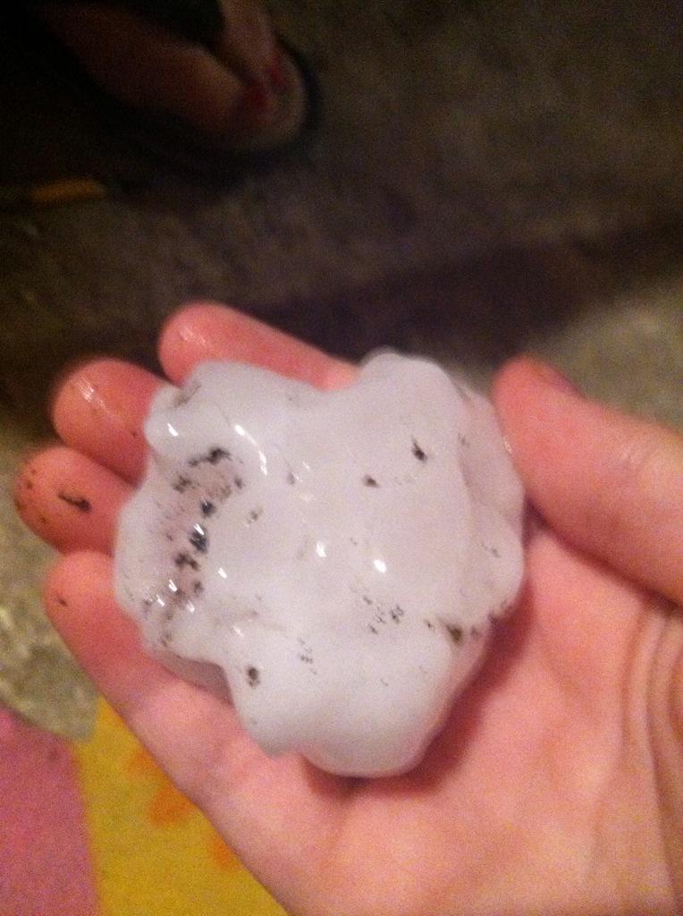
Baseball Size Hail In Leola Image courtesy: Lindsey Gill |
Storm Photo Near Wetonka Image courtesy: Ron Keller |
Photos From Marshall County
 |
.png) |
|
Large Hail In Britton Image courtesy: Aaron Henricks |
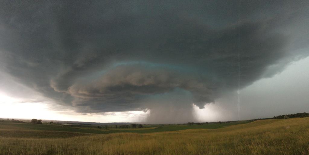
Tornado NE of Langford Image courtesy: Lance Johnson |
Photos From Day County
 |
 |
|
Rolled Campers Bitter Lake Lodge |
Rolled Campers Bitter Lake Lodge |
 |
 |
|
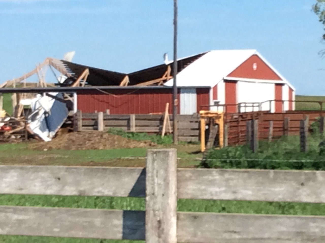
Barn Damage Southeast Of Waubay |
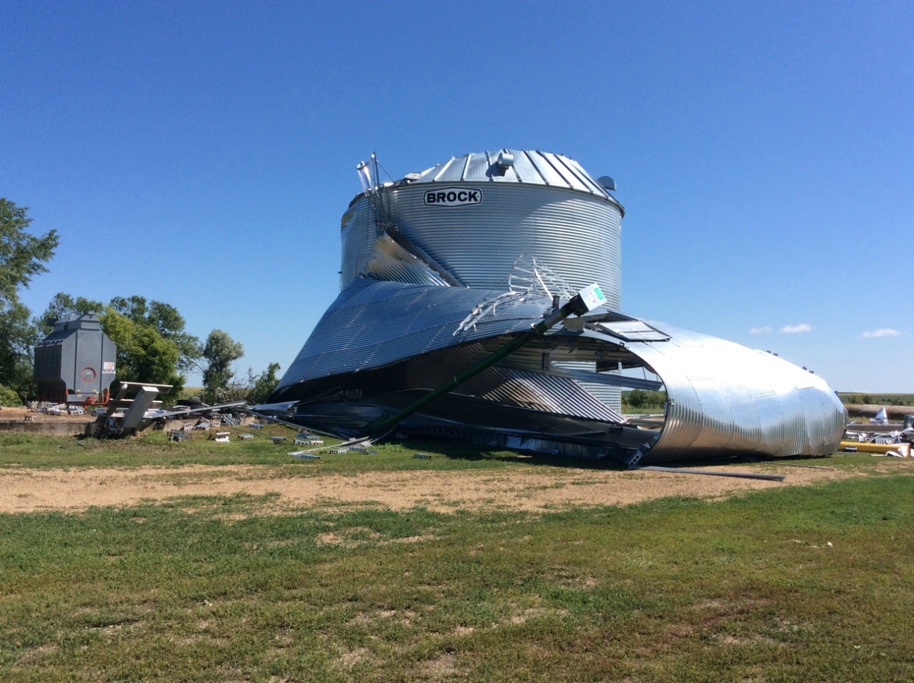
Grain Bin Damage Southeast Of Waubay |
 |
 |
|
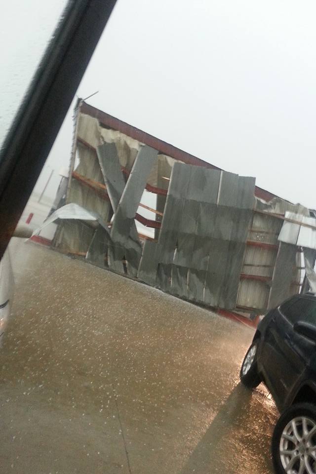
Gas Station Canopy Damage in Bristol Image courtesy: Khristian Banley |
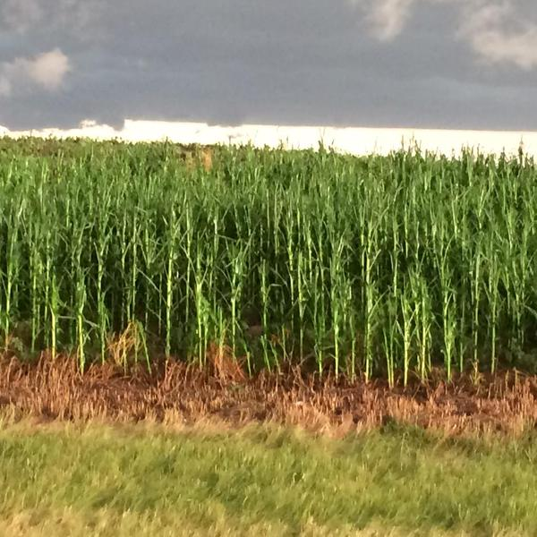
Crop Damage Near Webster Image courtesy: @duckdman |
Photos From Roberts County
 |
 |
|
Tennis Ball Size Hail In Sisseton: Image courtesy: @Thirstrapmatt |
Supercell Near Sisseton: Image courtesy: Patrick Gulan |
 |
|
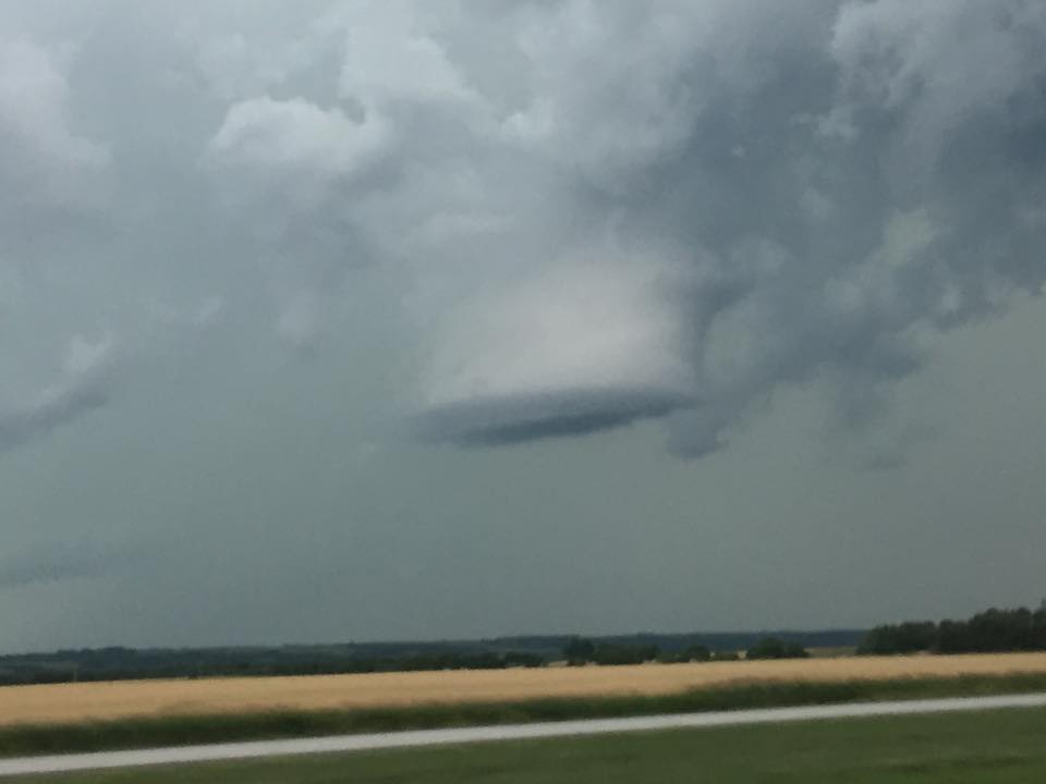
Wall Cloud Looking West of Summit |
Radar Images
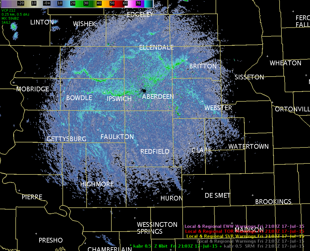
Radar reflectivity from 4 PM CDT July 17th to 6:30 PM CDT July 17th.
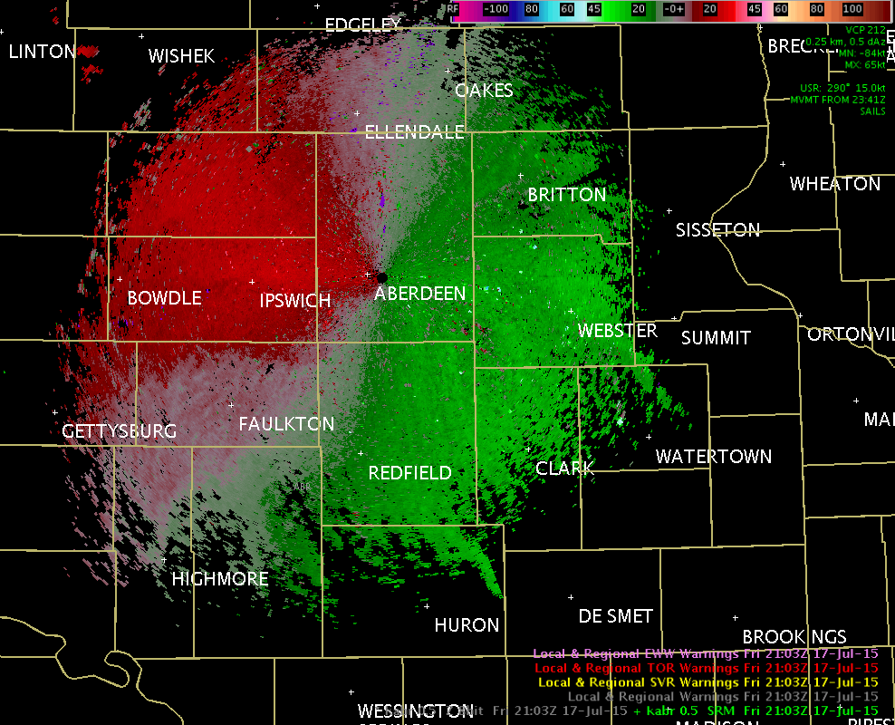
Radar storm relative motion from 4 PM CDT July 17th to 6:30 PM CDT July 17th.

Radar reflectivity from 6:30 PM CDT July 17th to 8:45 PM CDT July 17th.
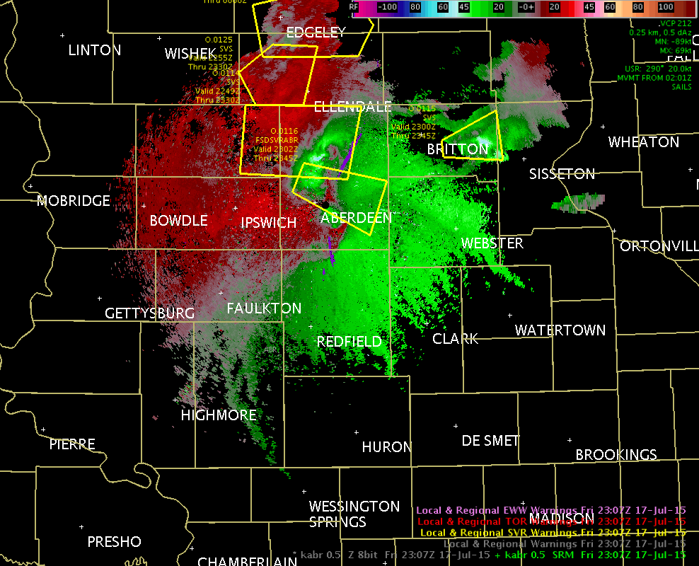
Radar storm relative motion from 6:30 PM CDT July 17th to 8:45 PM CDT July 17th.
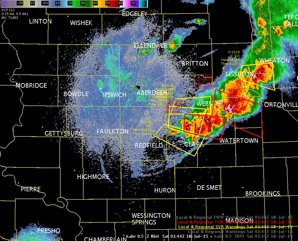
Radar reflectivity from 8:45 PM CDT July 17th to 11 PM CDT July 17th.
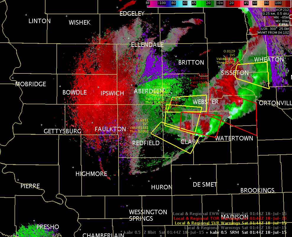
Radar storm relative motion from 8:45 PM CDT July 17th to 11 PM CDT July 17th.

