
Record setting heat is expected over the next several days from the Intermountain West through the northern Plains. Furthermore, fire weather concerns increase with dry and breezy conditions. Meanwhile, heavy rainfall and severe thunderstorm threats for the Ohio/Tennessee Valleys, central Appalachians and Southeast today. The threat shifts to central Gulf Coast and across central Texas this week. Read More >
Overview
|
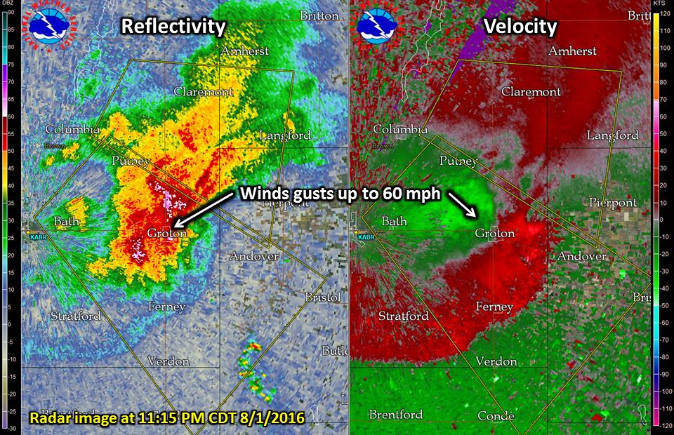
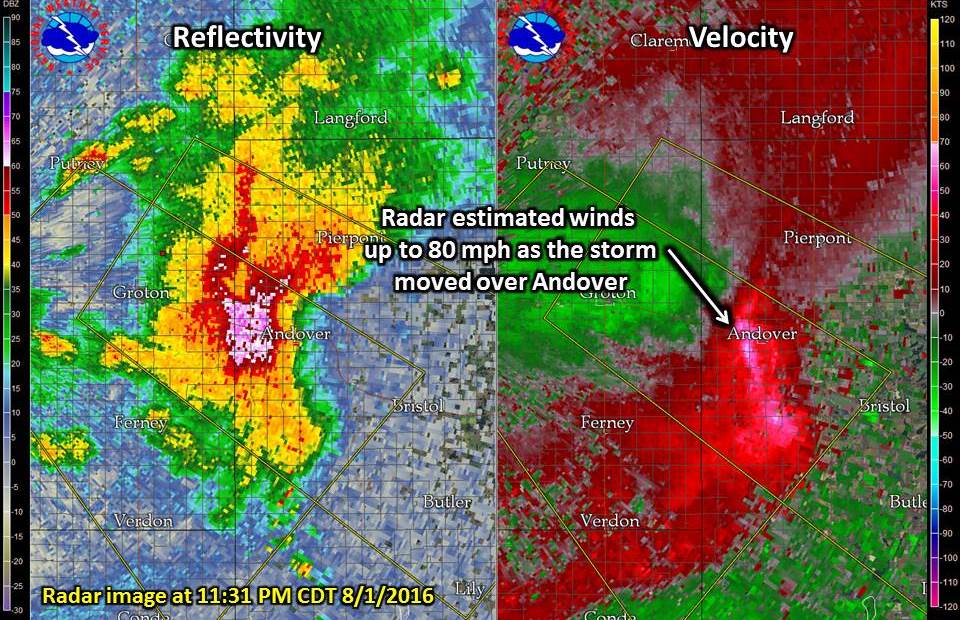
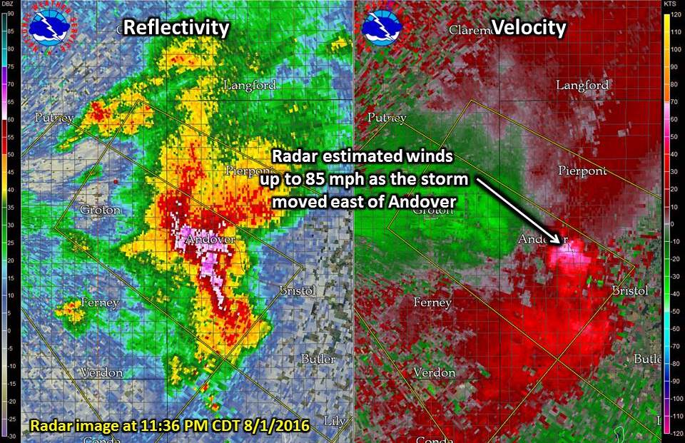
A cluster of severe thunderstorms dropped southeast out of North Dakota and across northeastern Brown and western Day Counties, producing large hail and winds of 80-90 mph during the late evening of August 1, 2016. The combination of the hail and winds led to significant damage to trees, crops, and buildings in and around Andover. The following pictures come from an NWS Storm Survey of the damage during the morning and early afternoon of August 2, 2016. |
 Storm reports across Brown and Day Counties during the late evening hours on August 1, 2016 |
Wind & Hail:
Wind
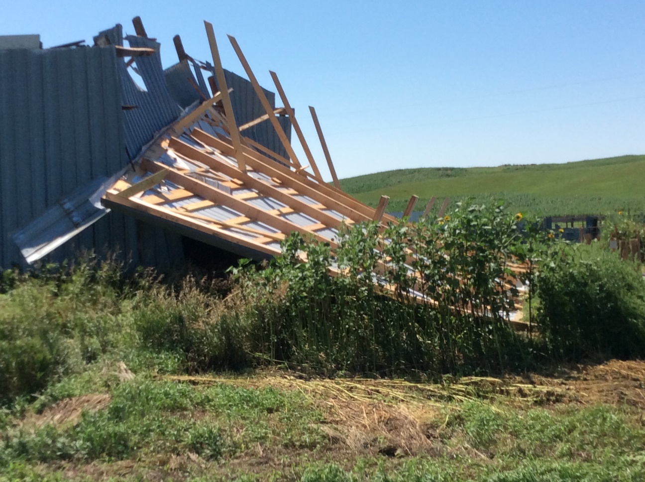
The strong winds associated with the thunderstorm were estimated to reach 80-90 mph, possibly exceeding those values in isolated locations, as the storm moved through the Andover area. This led to extensive tree and crop damage, along with damage to several buildings. Additional building and tree damage was noted to the west and south of Bristol.
 |
 |
 |
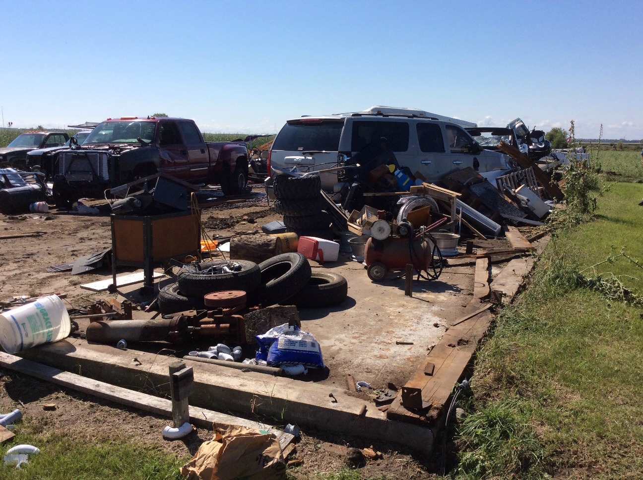 |
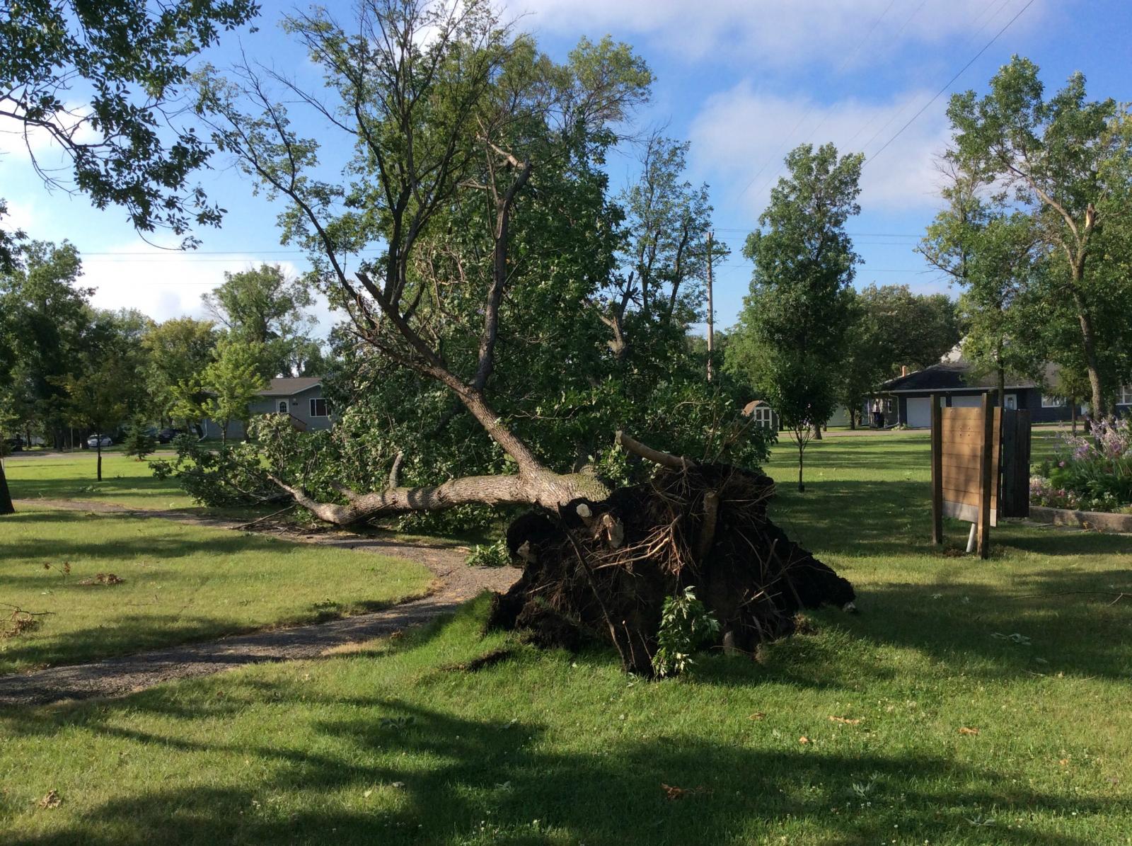
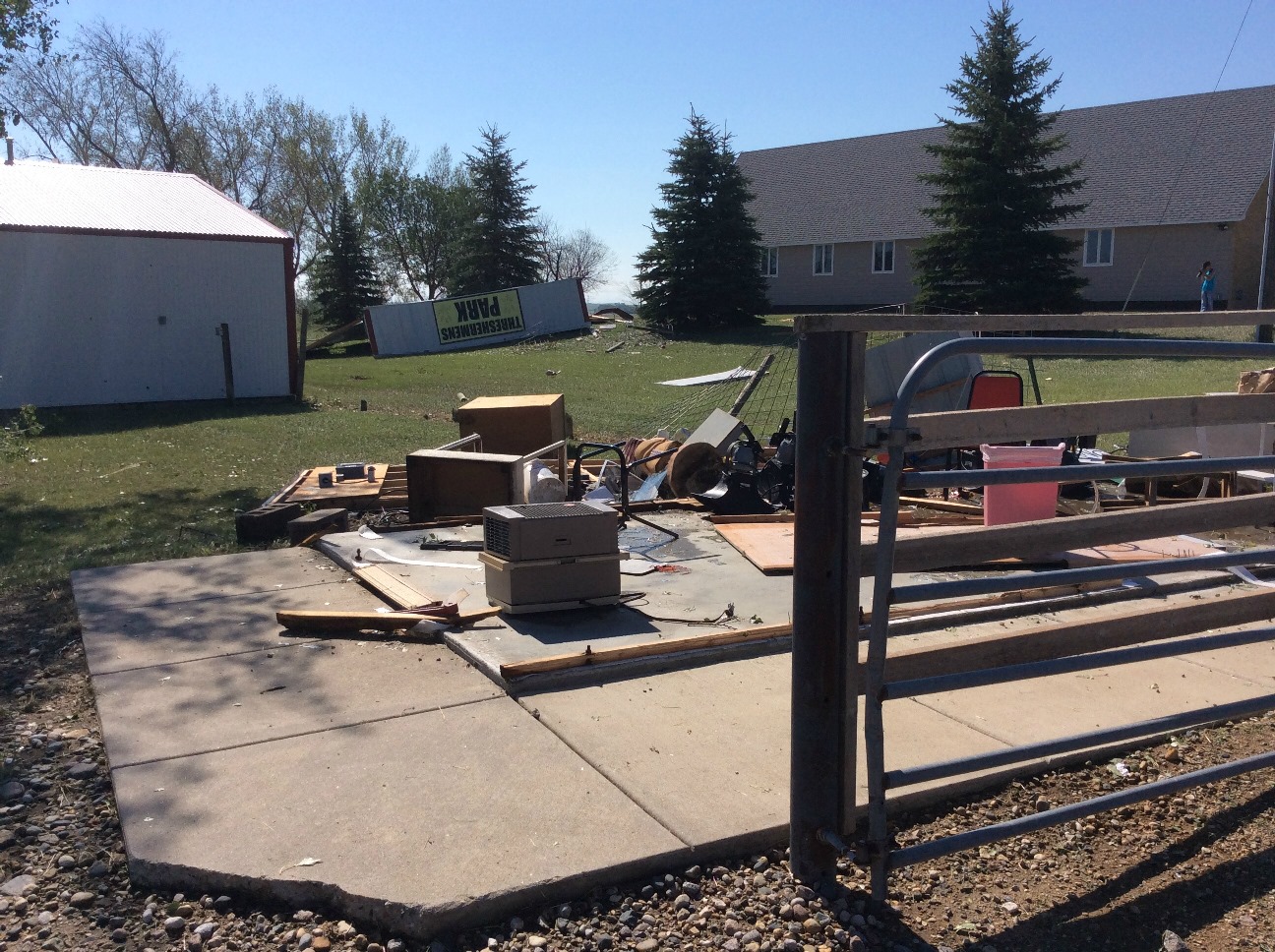
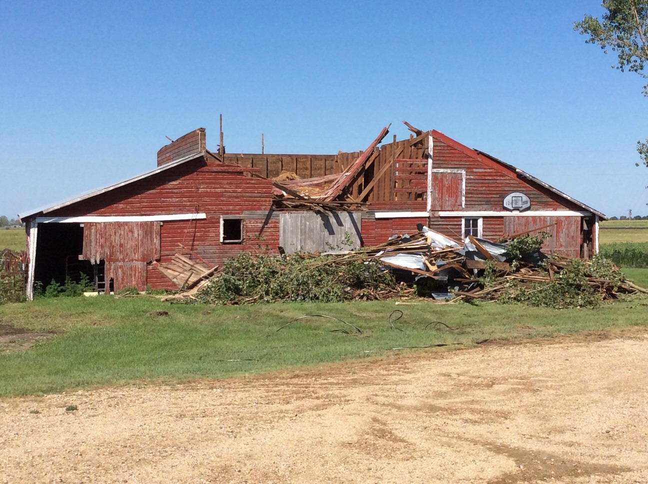
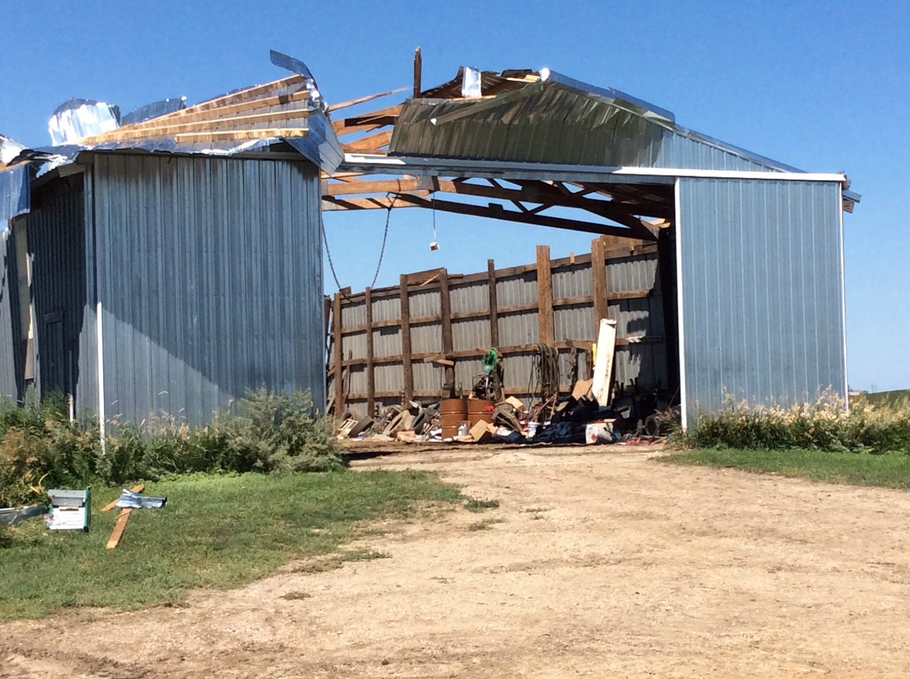
| Tree uprooted in a park off Main Street in Groton | Threshermen's Park building (Andover) removed from foundation and moved over 100 feet. | Damage to a barn located 1 mile east of Andover | Metal outbuilding removed from foundation 1 mile east of Andover |
 |
 |
 |
 |
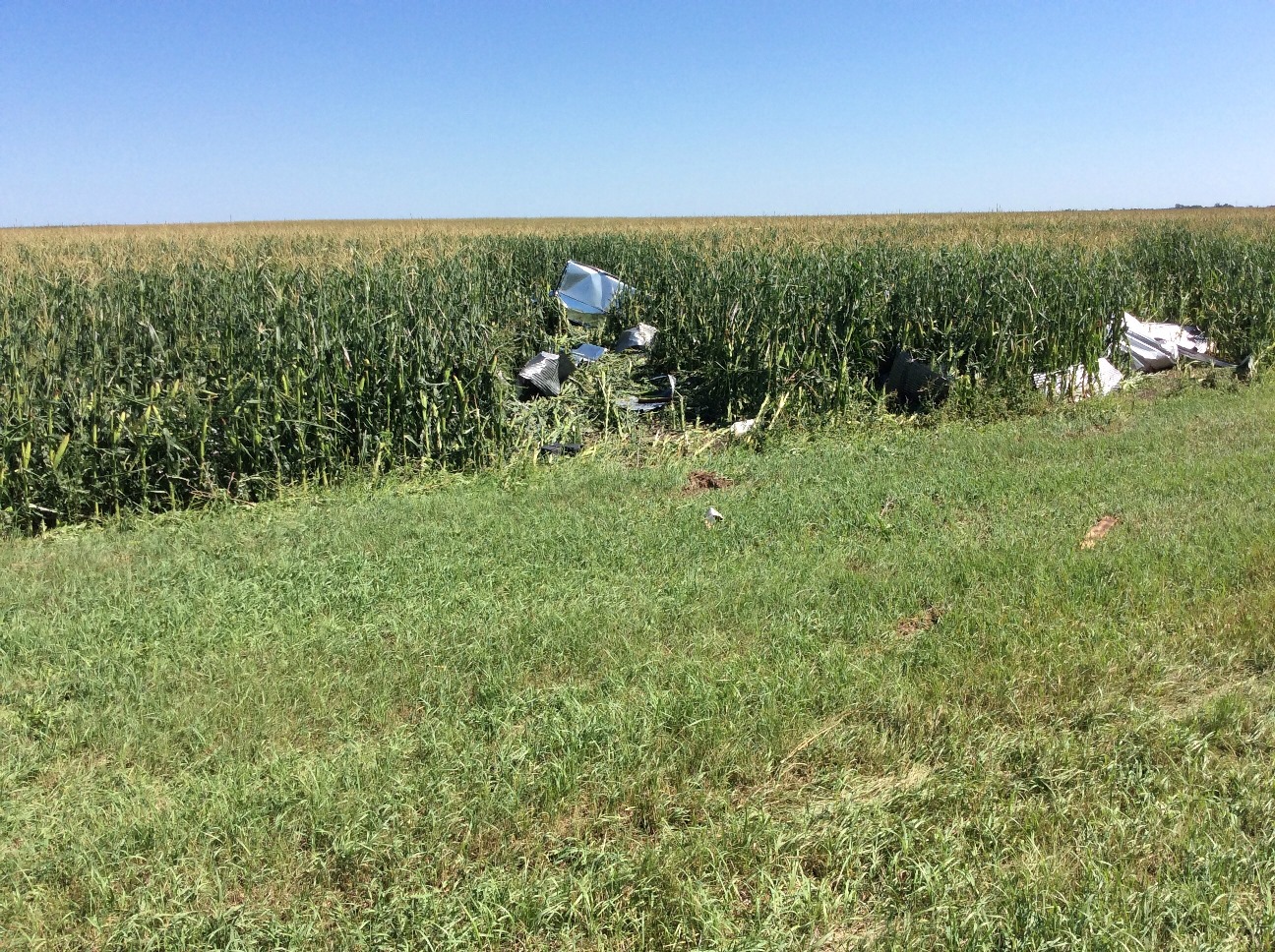
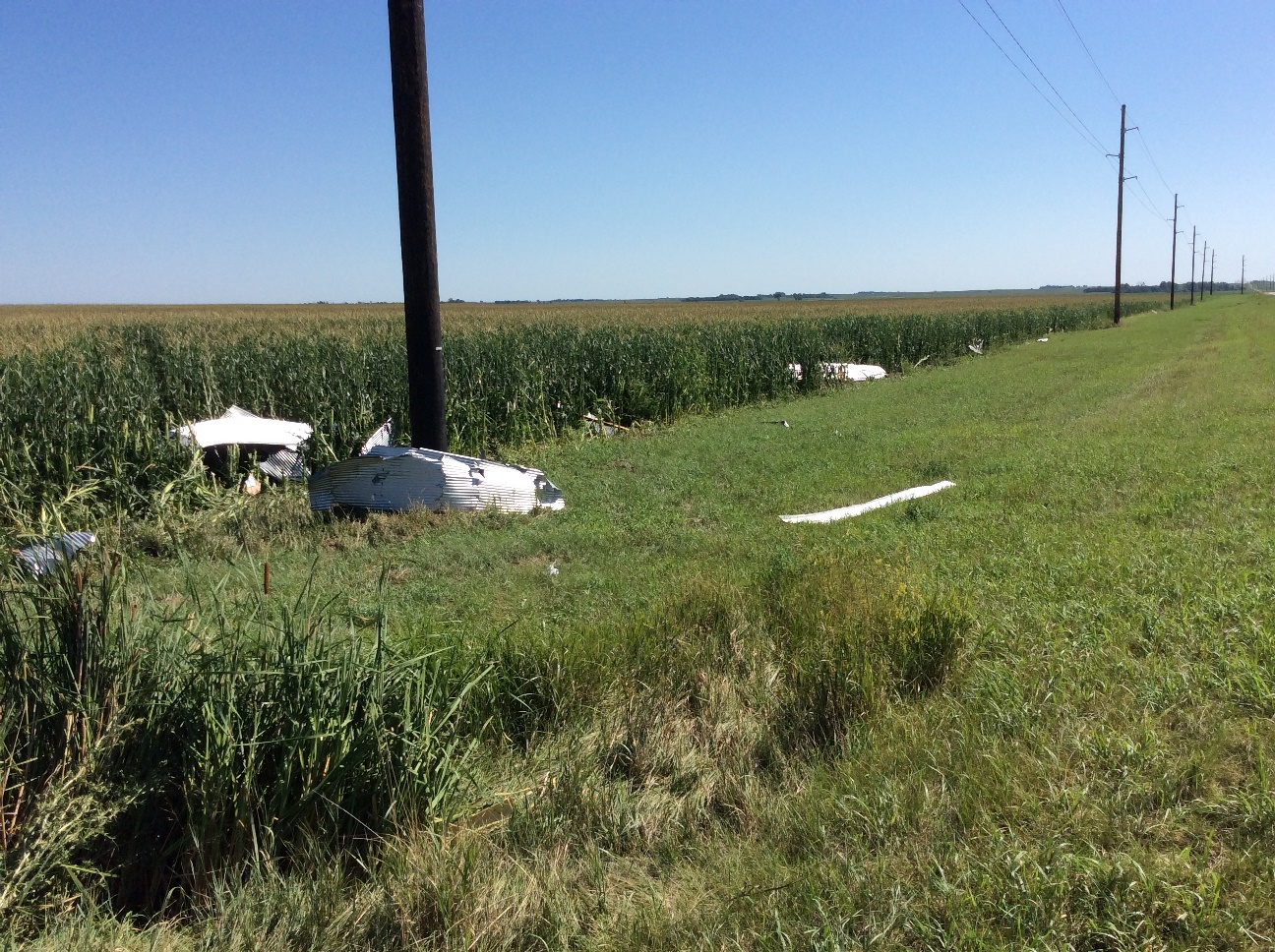
| Metal from the outbuilding 1 mile east of Andover was thrown northeast across Highway 12 | Metal from the outbuilding 1 mile east of Andover was thrown northeast across Highway 12. Some of the metal was up to two tenths of a mile away from the building | Roof removed from an outbuilding 3 miles west-northwest of Bristol | Wall of a building resting on a second building 3 miles west-northwest of Bristol |
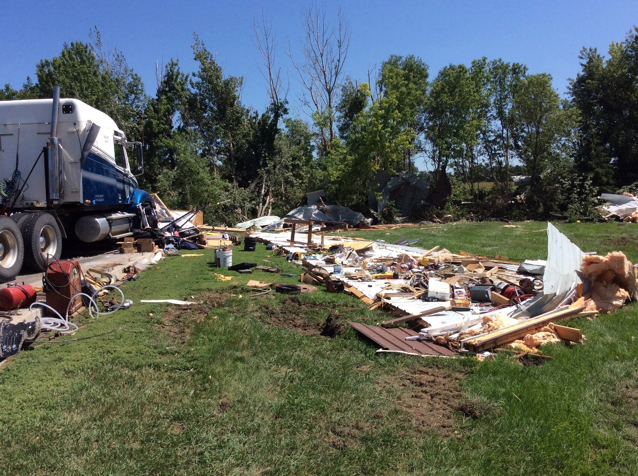 |
| Building removed from foundation and moved to the east, 3 miles north of Andover |
Hail
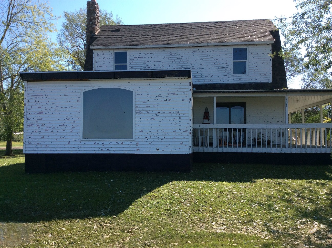
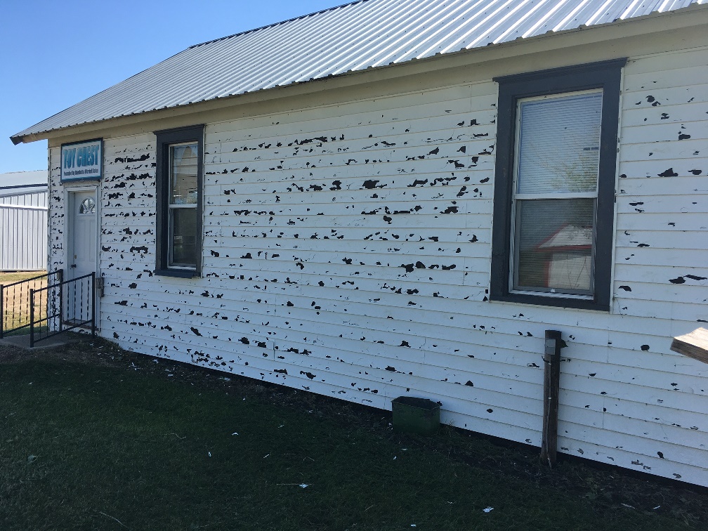
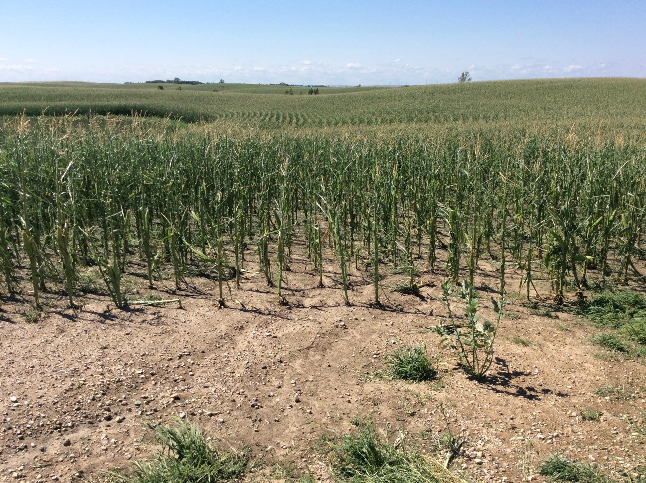
Hail up to the size of golf balls were reported with the storm and when driven eastward by 80-90 mph winds, the hail produced damage to the siding of several buildings around Andover. In addition to the building damage, corn and bean crops were damaged or destroyed by both the hail/wind to the northwest and southeast of Andover.
 |
 |
 |
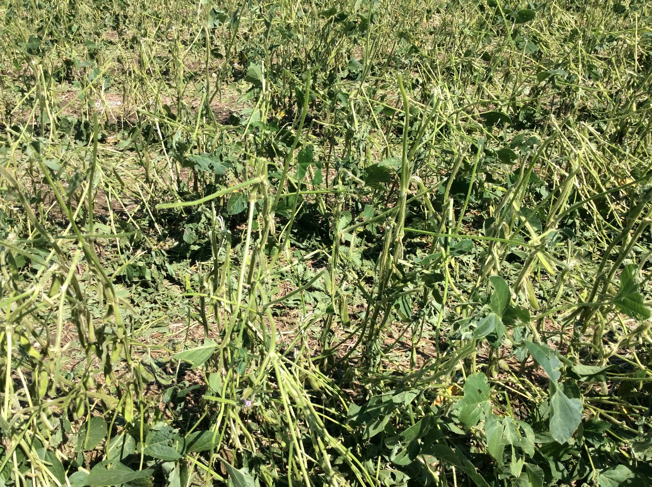 |
| Wind driven hail damage to a house on the west side of Andover | One of the several buildings in Threshermen's Park in Andover that were damaged by hail. | Hail damaged corn 4.5 miles northwest of Bristol | Soybean crop damage from hail 4.5 miles northwest of Bristol |
 |
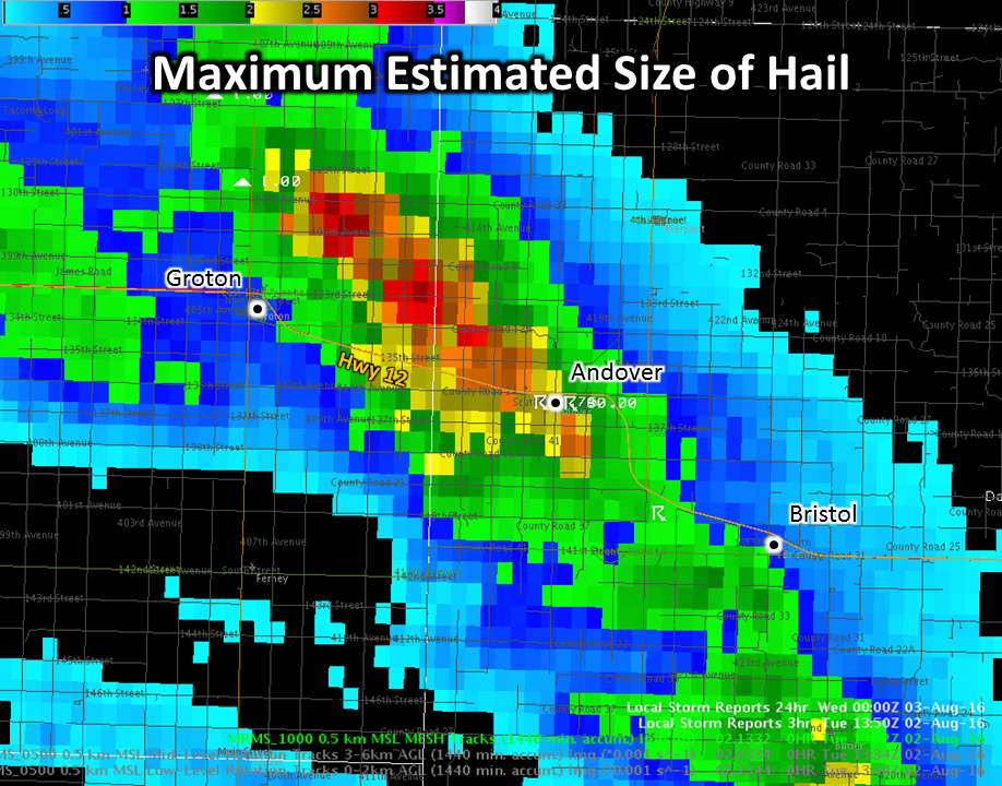 |
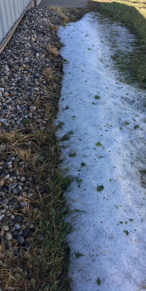
| Hail still on the ground in Threshermen's Park around 12 hours after it fell | MRMS estimate of the maximum hail size from the Groton to Andover area. Estimates indicate that hail over 3" in diameter fell to the north of Highway 12. |
Radar:
Radar images as the storm moved from Groton to Bristol
 |
 |
 |
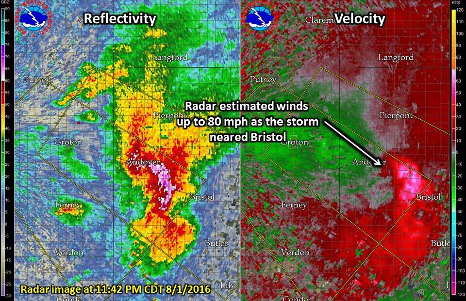 |
| Radar Image as the storm moved through Groton around 11:15 PM | Radar Image as the storm moved over Andover around 11:31 PM | Radar Image as the storm moved east of Andover around 11:36 PM | Radar Image as the storm neared Bristol around 11:42 PM |
 |
Media use of NWS Web News Stories is encouraged! Please acknowledge the NWS as the source of any news information accessed from this site. |
|

