Widespread life-threatening flash and urban flooding continues in south-central Texas, with considerable flooding impacts possible across central Texas. Wildfire smoke is impacting air quality across much of the Great Lakes region into southern New England and the Mid-Atlantic. Monsoonal thunderstorms may produce isolated to scattered flash flooding across the Southwest into the Great Basin. Read More >
Overview
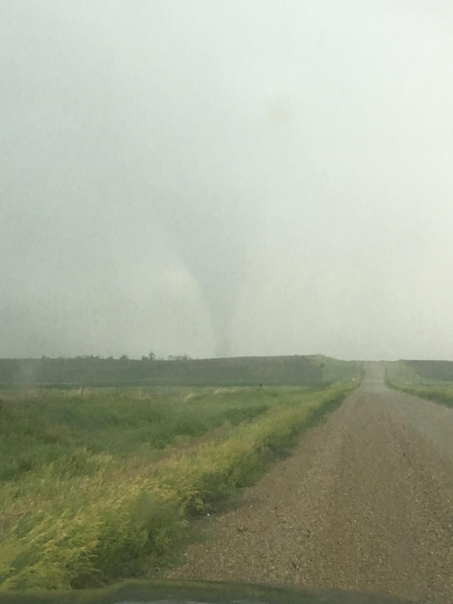
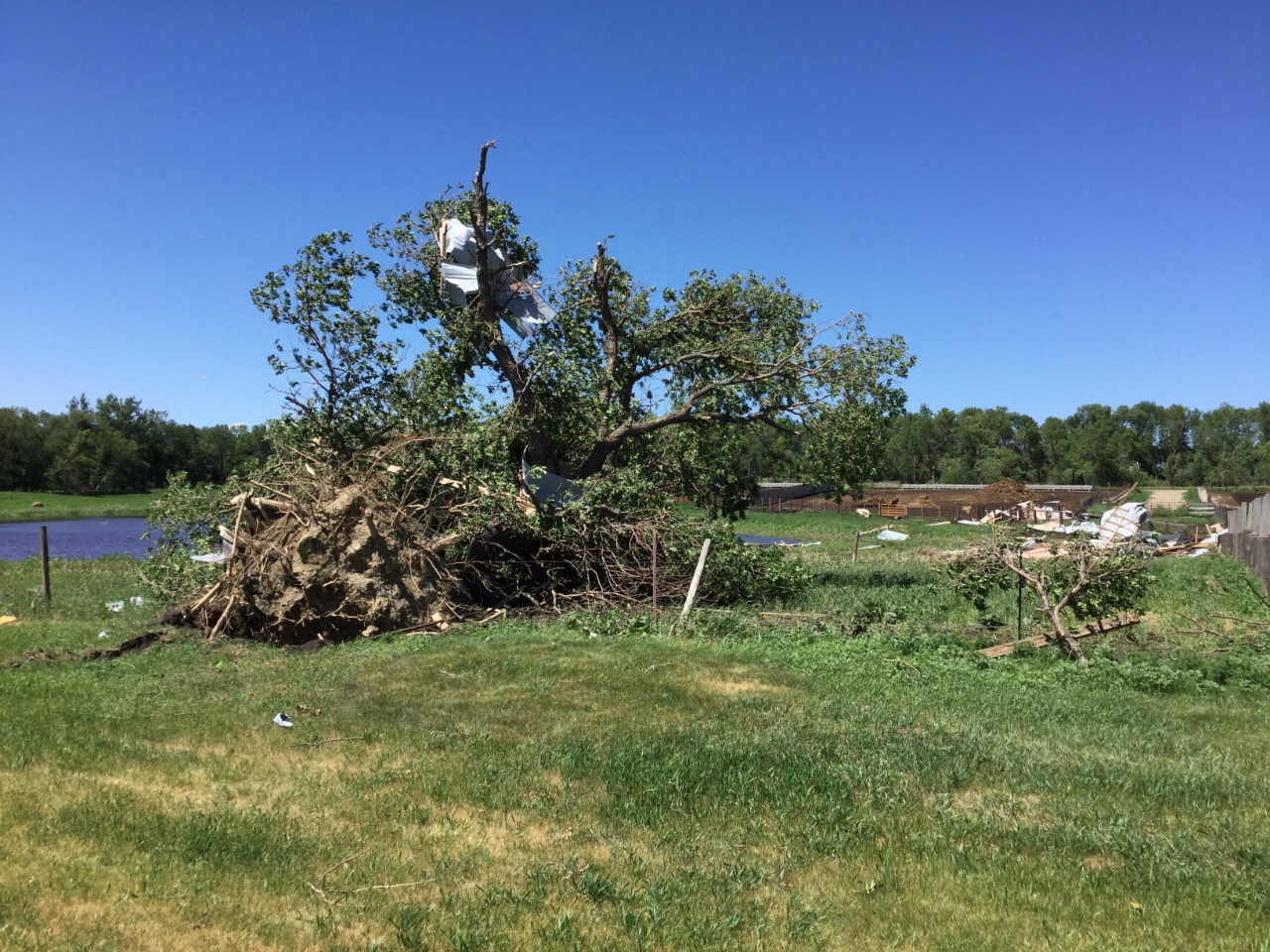
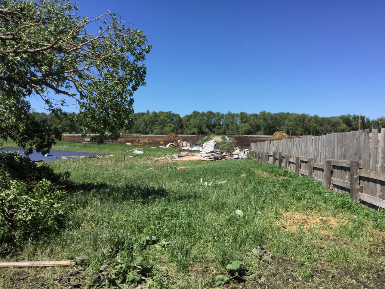
On the afternoon of Tuesday, June13th, a warm and very humid airmass had set up across eastern South Dakota and western Minnesota in advance of a cold front. During the mid afternoon hours storms rapidly developed over central and eastern South Dakota, between Pierre and Aberdeen. These storms quickly strengthened and produced large hail, damaging winds, and eventually tornadoes across the region. The storms evolved into mainly a wind and tornado event around 7pm CDT. Widespread wind damage occurred across northeastern South Dakota and into west central MN as the storms formed a line and moved northeast. Storms quickly exited through Traverse and Big Stone Counties by 10 pm CDT. Several tornadoes were reported to have briefly touched down, causing EF-0 and EF-1 damage.
Tornadoes:
|
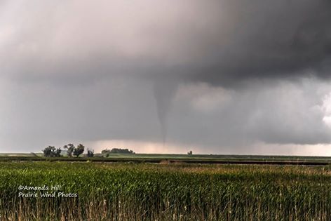
Tornado - 8.3S Rockham, SD
Track Map  
|
||||||||||||||||
|
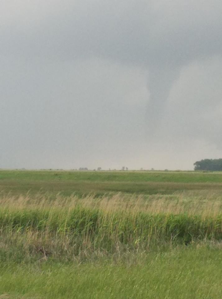
Tornado - 4.9 SW Zell, SD
Track Map 
|
||||||||||||||||||||||||
|
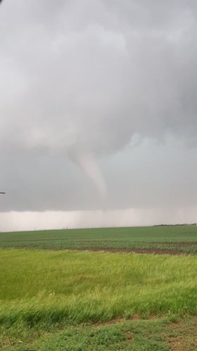
Tornado - 2 SSW Zell, SD
Track Map 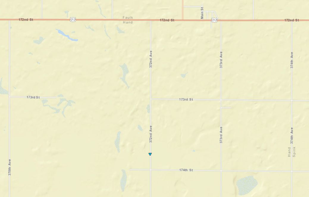
|
||||||||||||||||
|
Tornado - 4 S Groton, SD
Track Map 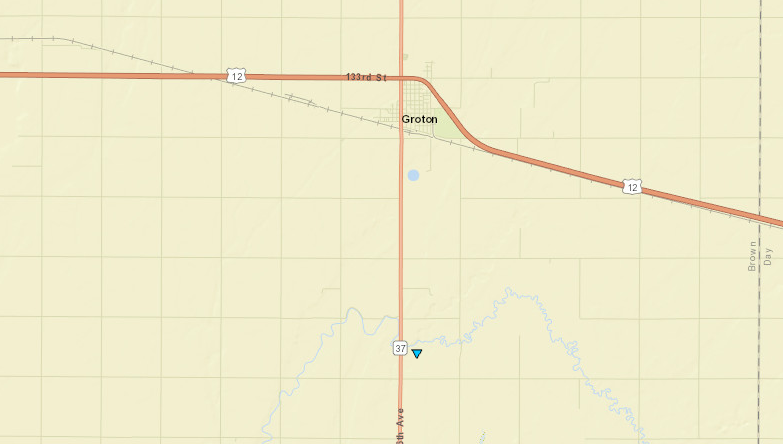
|
|||||||||||||||||||||||
|
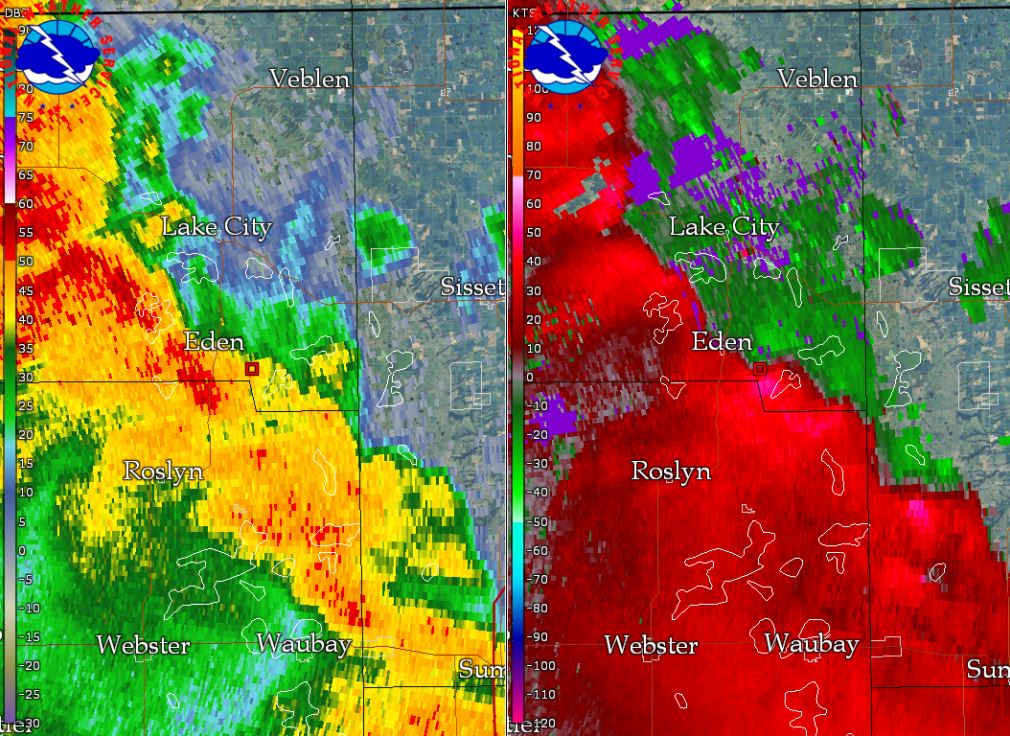
Tornado - 3E Eden, SD
Track Map 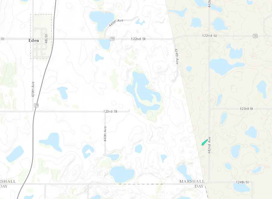
|
|||||||||||||||||
|
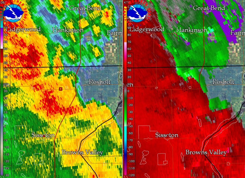
Tornado - 2WSW New Effington, SD
Track Map 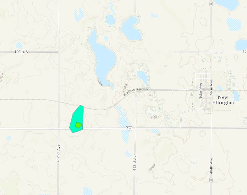
|
|||||||||||||||||||
|
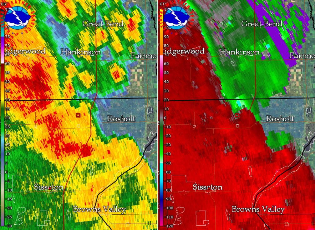
Tornado - 2N New Effington, SD
Track Map 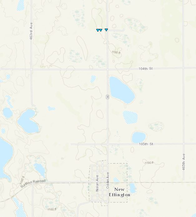
|
|||||||||||||||||
|
Tornado - 4N Clinton, MN
Track Map 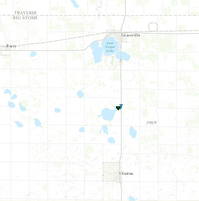
|
|||||||||||||||||
|
Tornado - 2NW Johnson, MN
Track Map 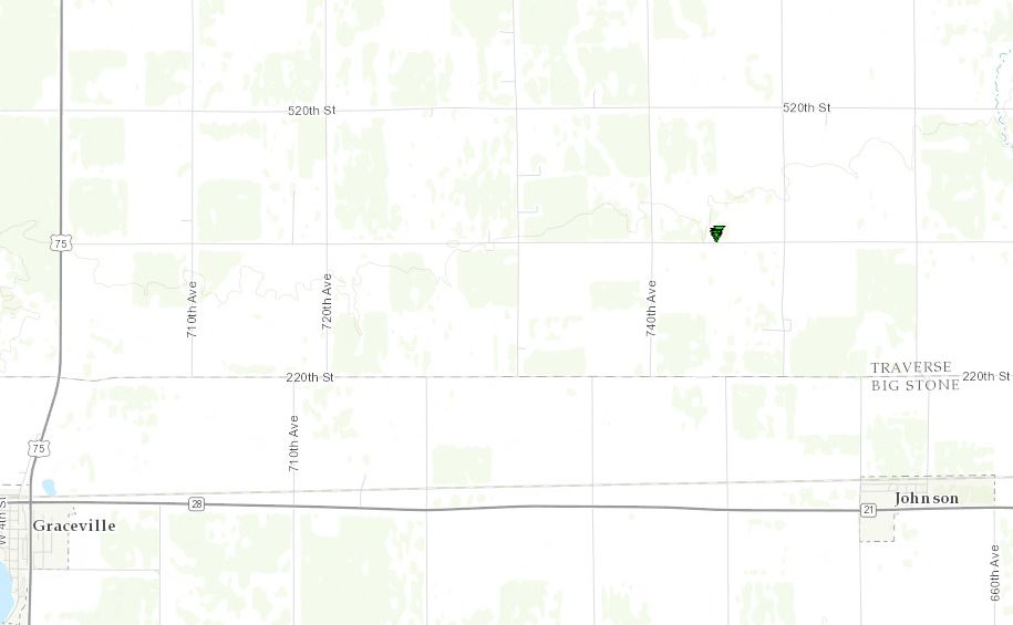
|
|||||||||||||||||
|
Tornado - 2SE Holmquist, SD
Track Map 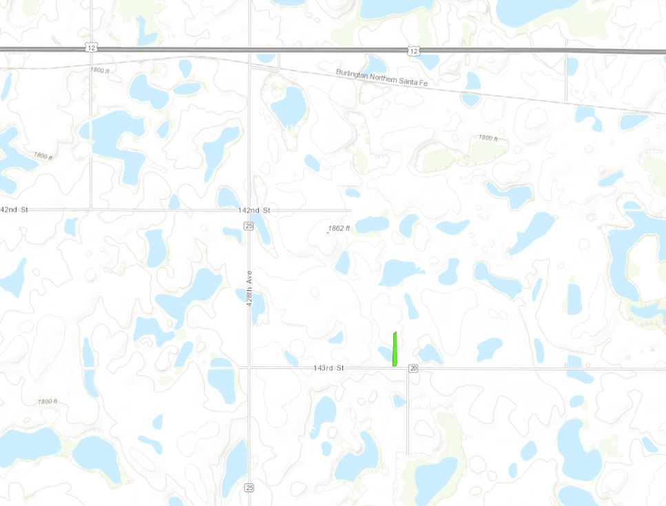
|
||||||||||||||||||||||
The Enhanced Fujita (EF) Scale classifies tornadoes into the following categories:
| EF0 Weak 65-85 mph |
EF1 Moderate 86-110 mph |
EF2 Significant 111-135 mph |
EF3 Severe 136-165 mph |
EF4 Extreme 166-200 mph |
EF5 Catastrophic 200+ mph |
 |
|||||
Photos & Video:
Clark, SD Straight-Line Wind - Trained Spotter recorded a 92 mph gust 4.5 miles south of Clark, SD.
 |
 |
 |
 |
| Department of Highway Roof peeled back (Clark PD) | Uprooted tree in Clark, SD (Clark PD) | Uprooted tree in Clark, SD (Clark PD) | Pickup Truck after a tree fell on it. (Clark PD) |
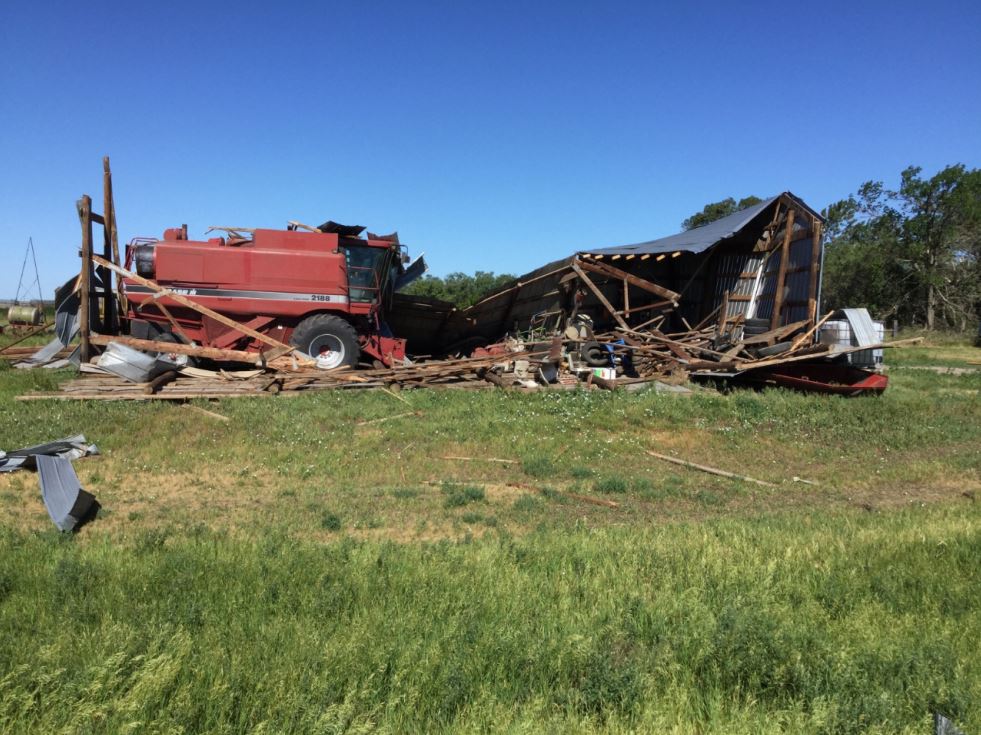
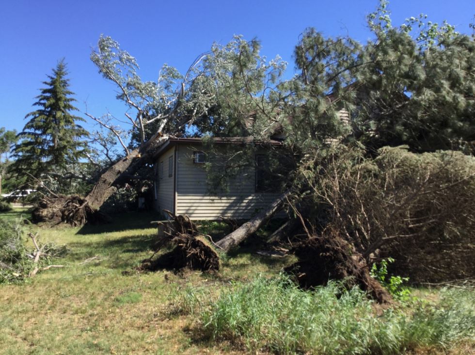
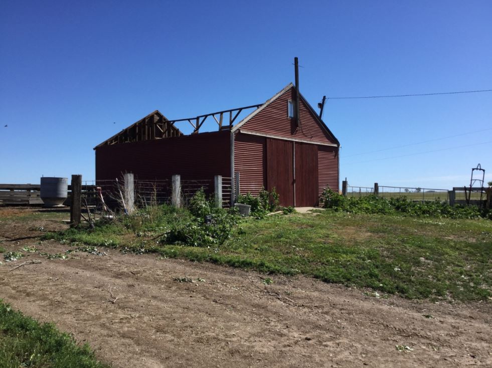
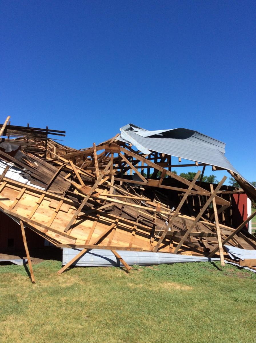
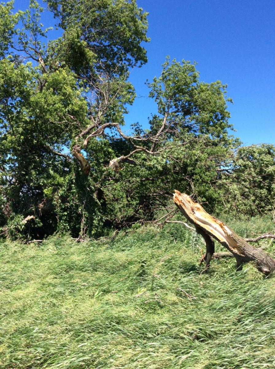
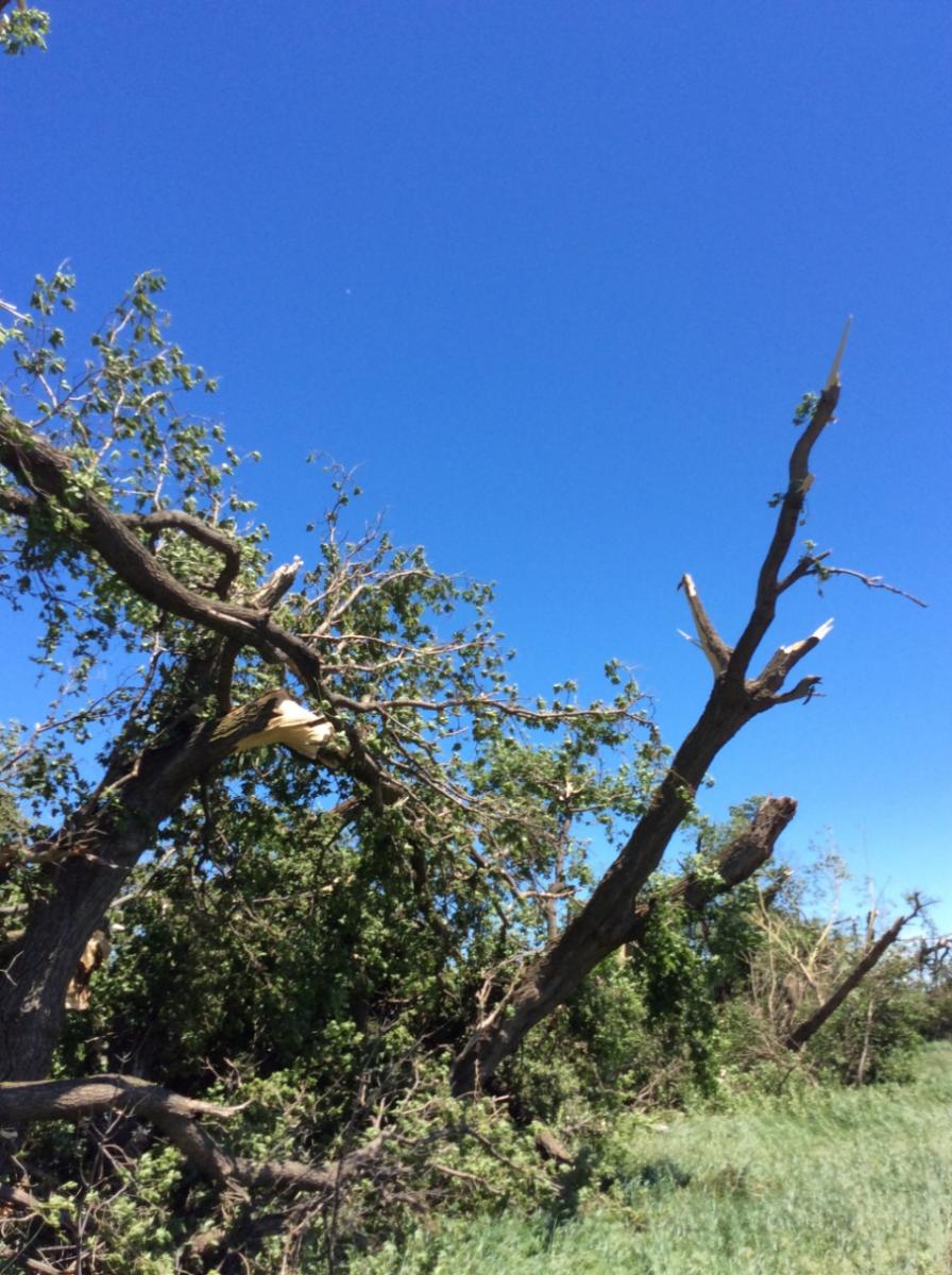
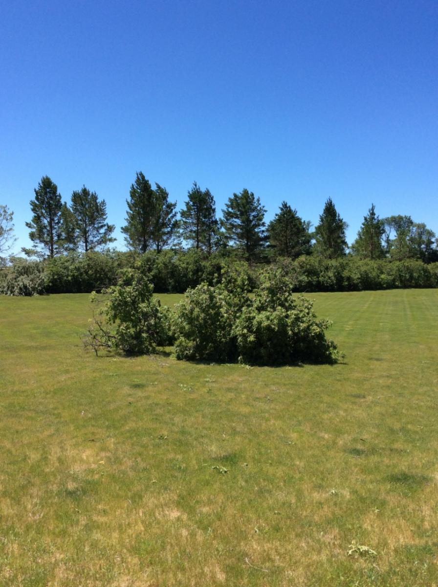
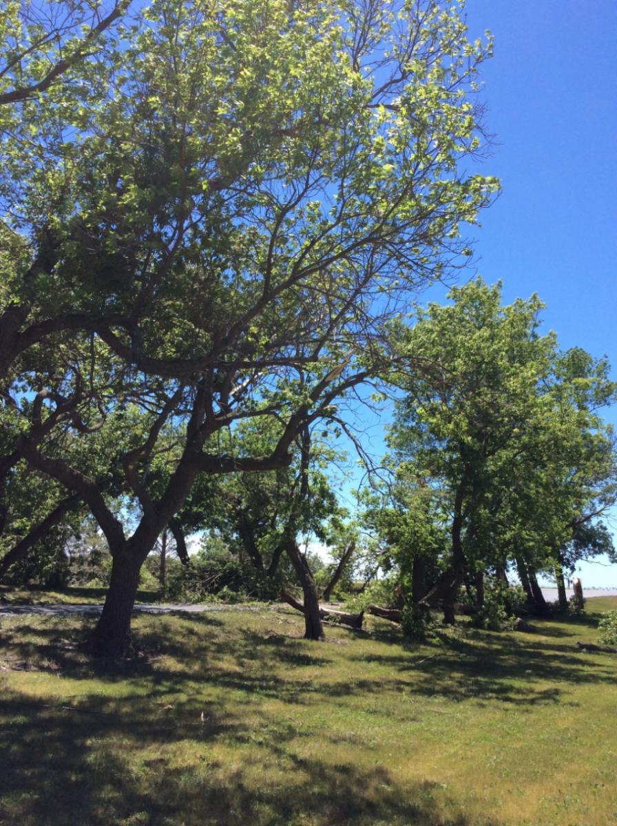
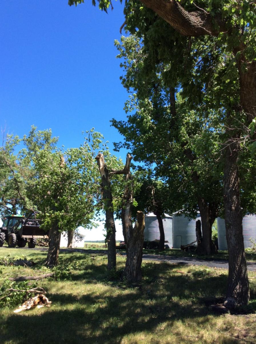
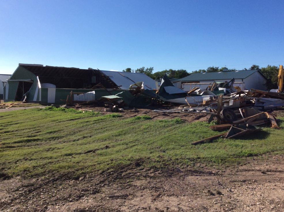
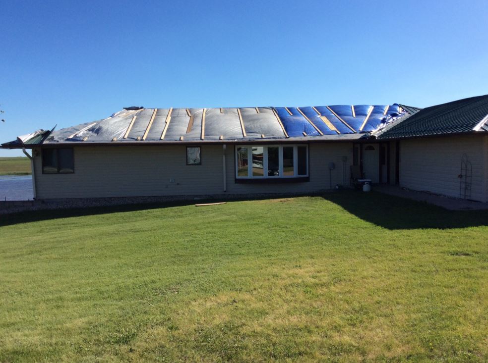
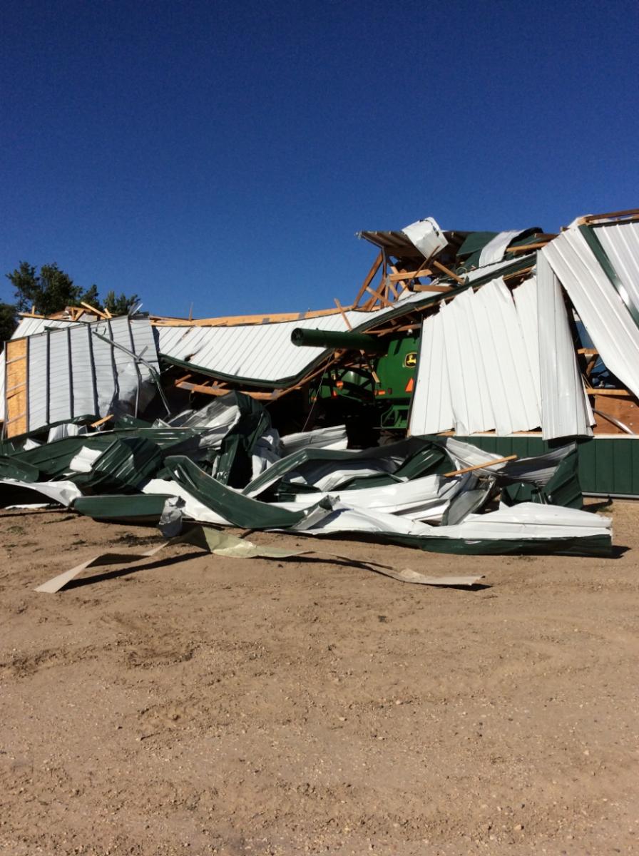
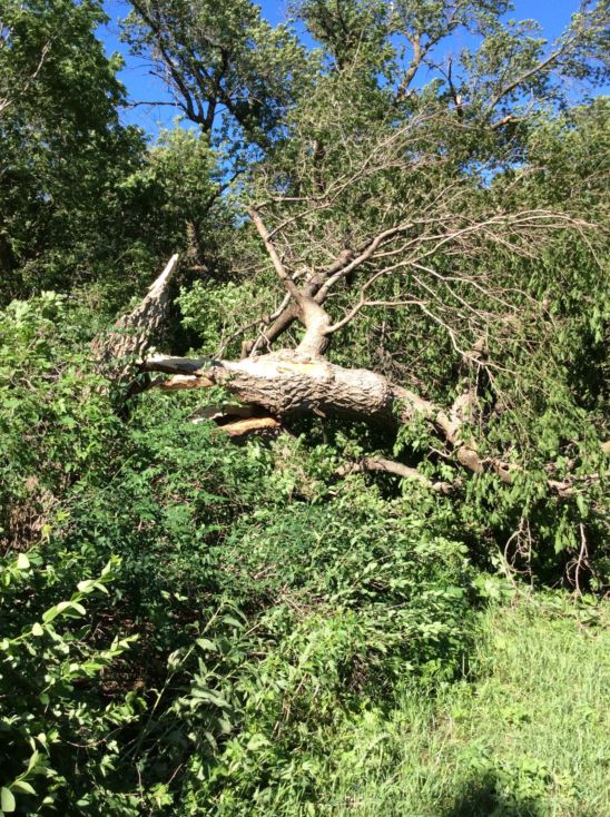
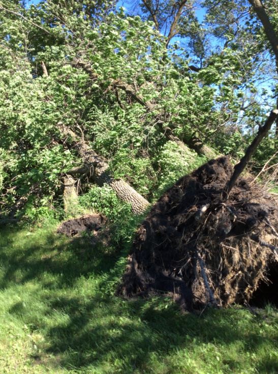
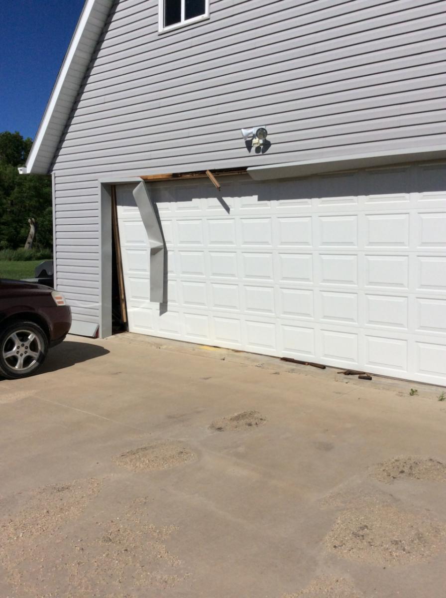
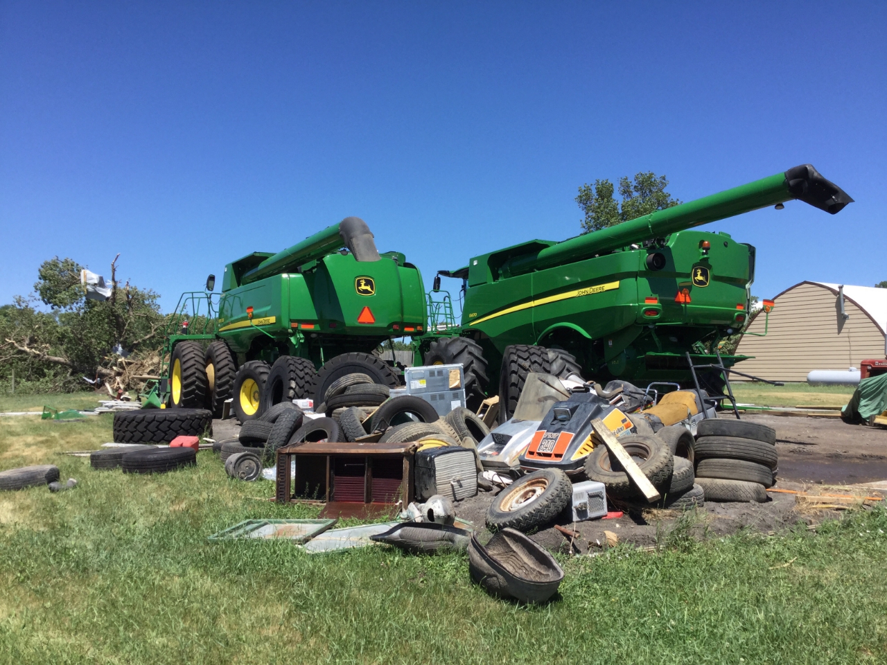
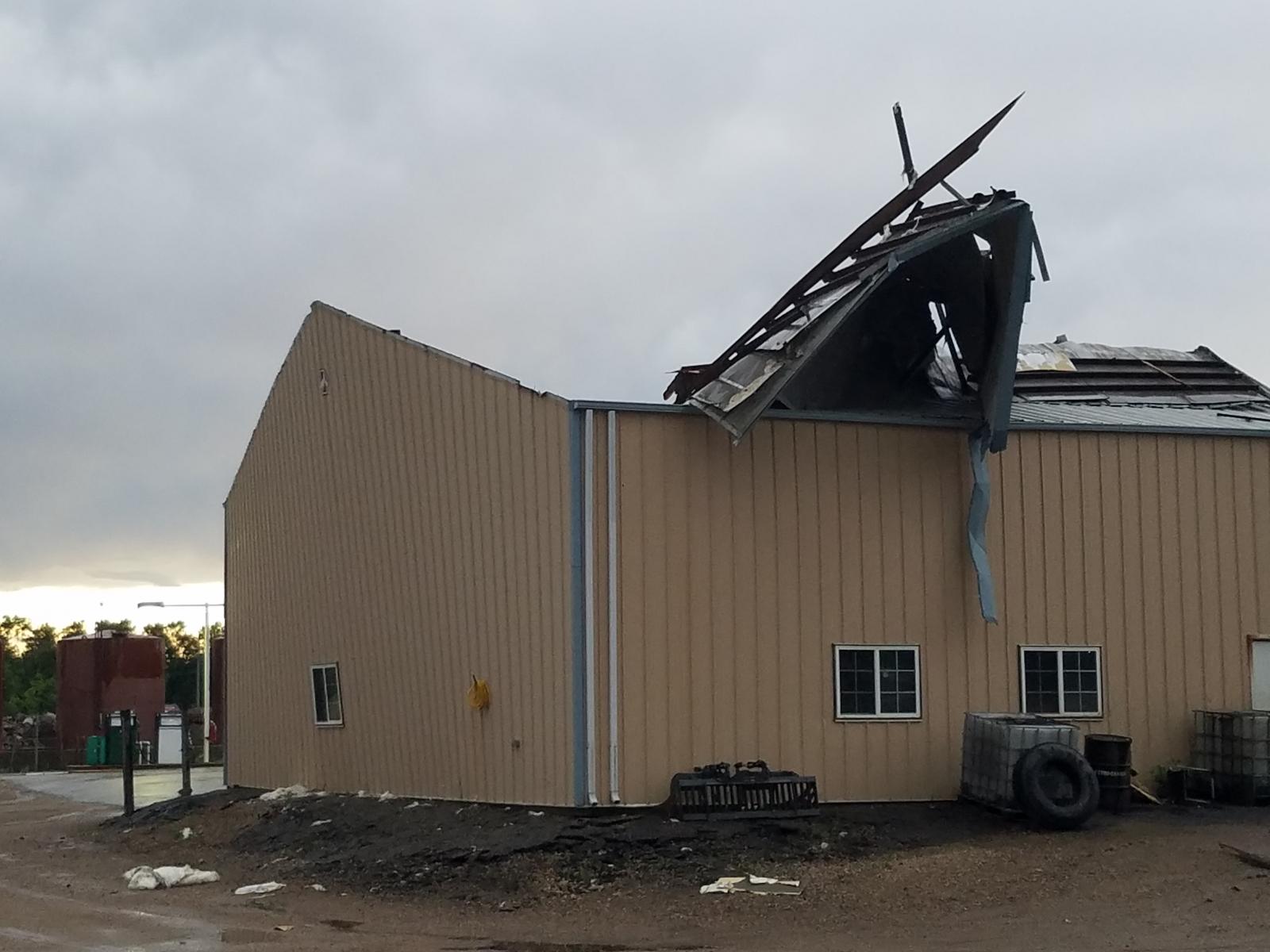
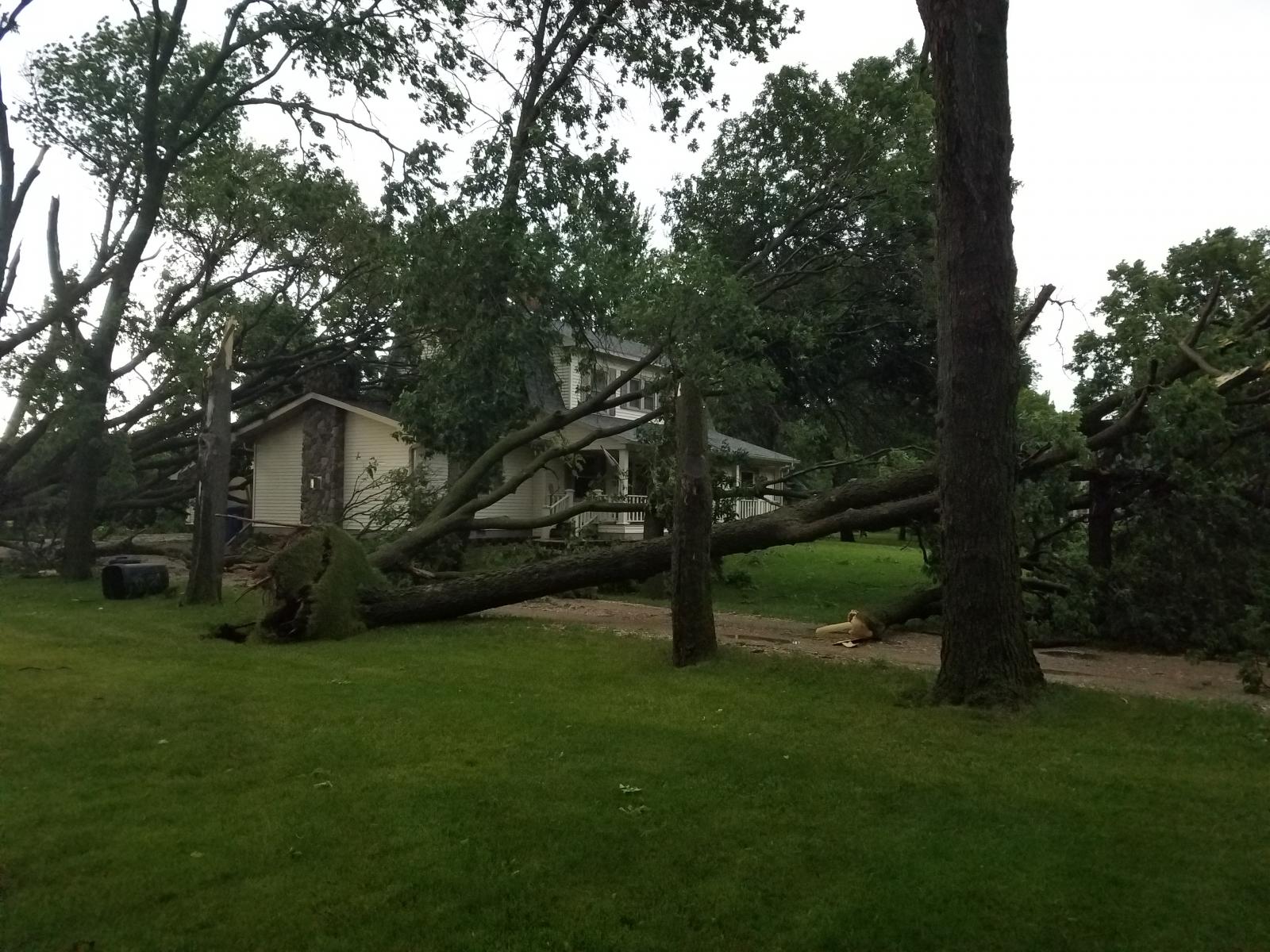
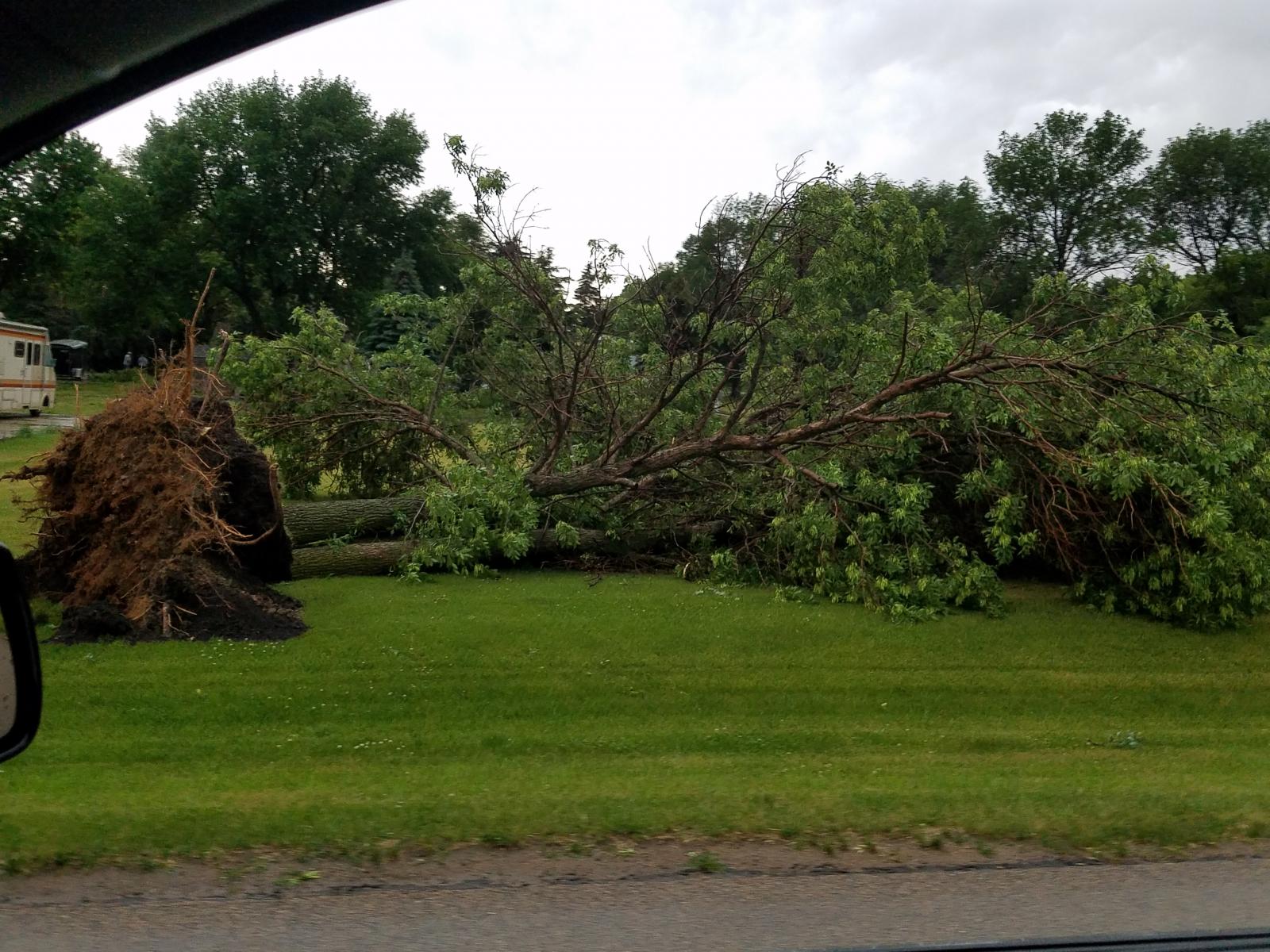
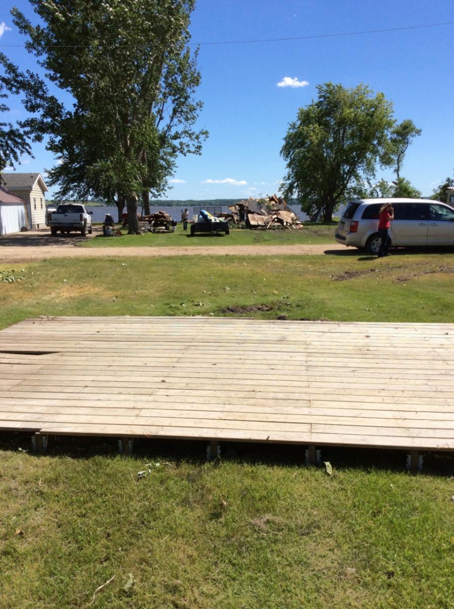
More Straight-Line Wind Damage, etc. These winds can be, and were during this event, as strong as tornadic winds. Many other locations not shown suffered considerable damage as well.
 |
 |
 |
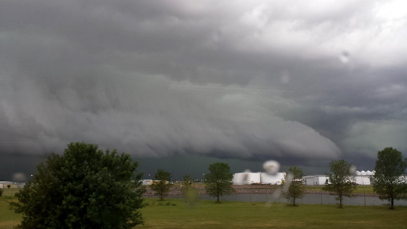 |
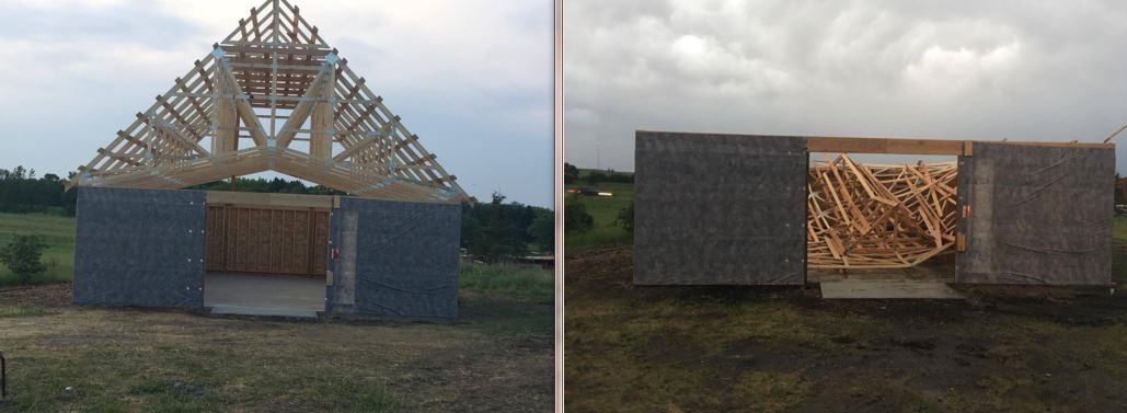
| Before and after of a chapel under construction in Sisseton. Credit: Teena Flowers Lykins | A cabin on Lake Traverse was destroyed (NWS Storm Survey) | Open-faced shed destroyed 2NW Johnson, MN (NWS Storm Survey) | Shelf cloud approaching Aberdeen at 7pm, as seen from the NWS office |
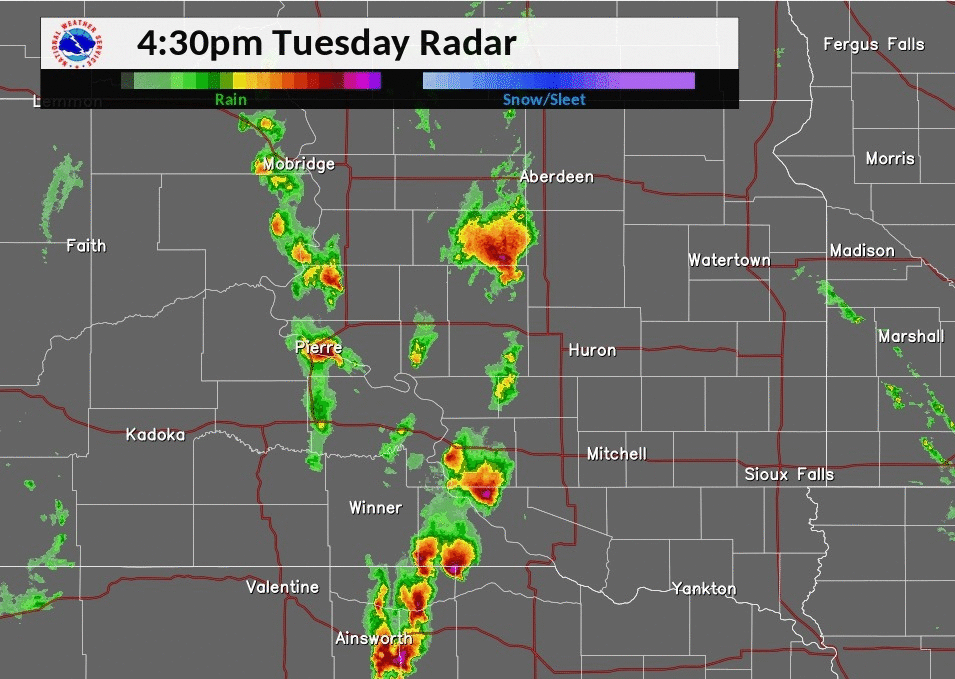
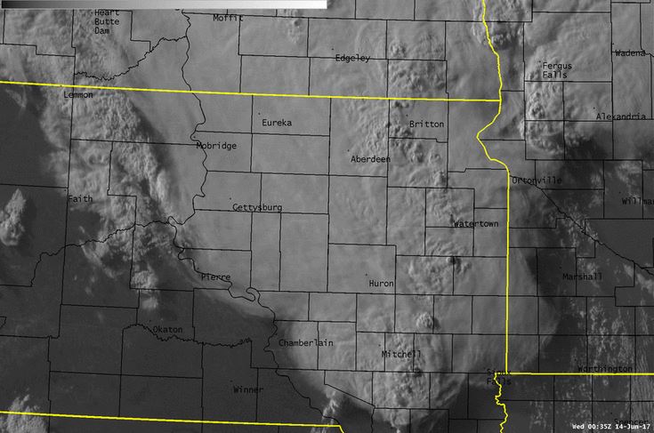
Radar & Satellite:
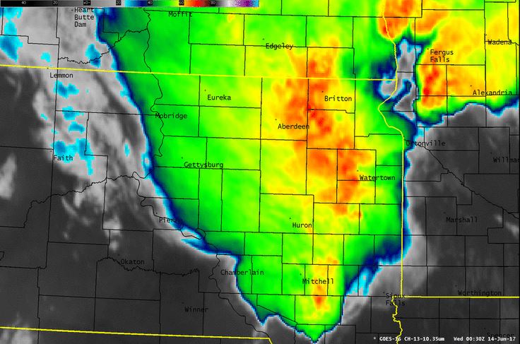
Radar Loop and GOES-16 Visible and Infrared Satellite Imagery at 7:30 pm from June 13, 2017
 |
 |
 |
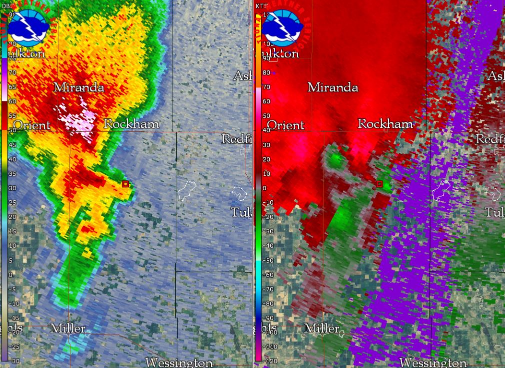
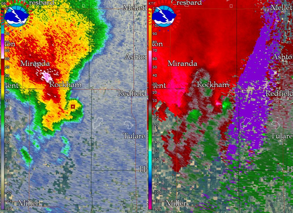
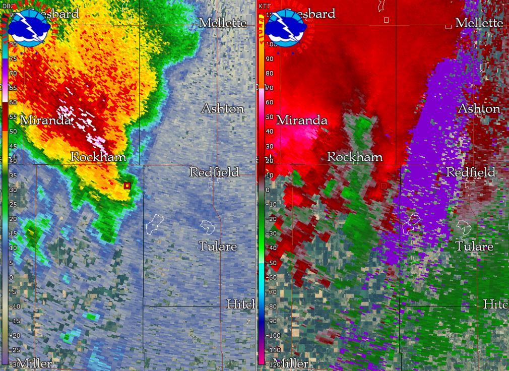
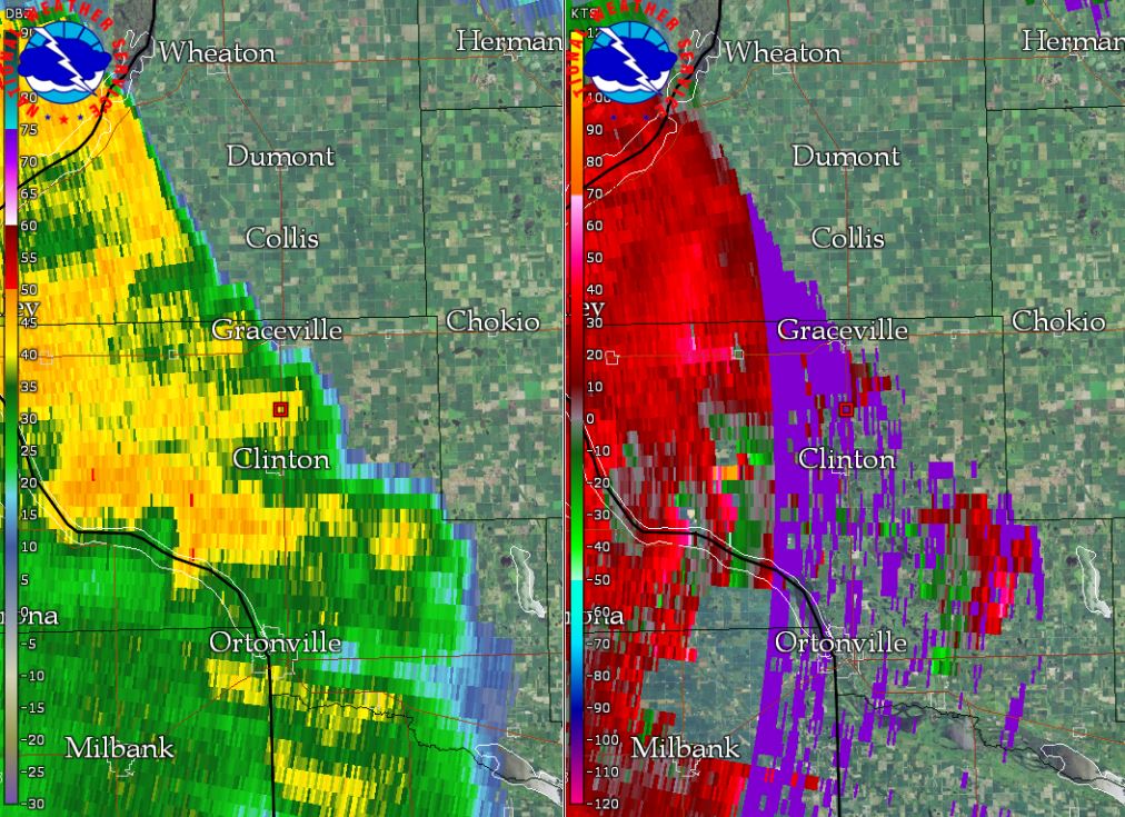
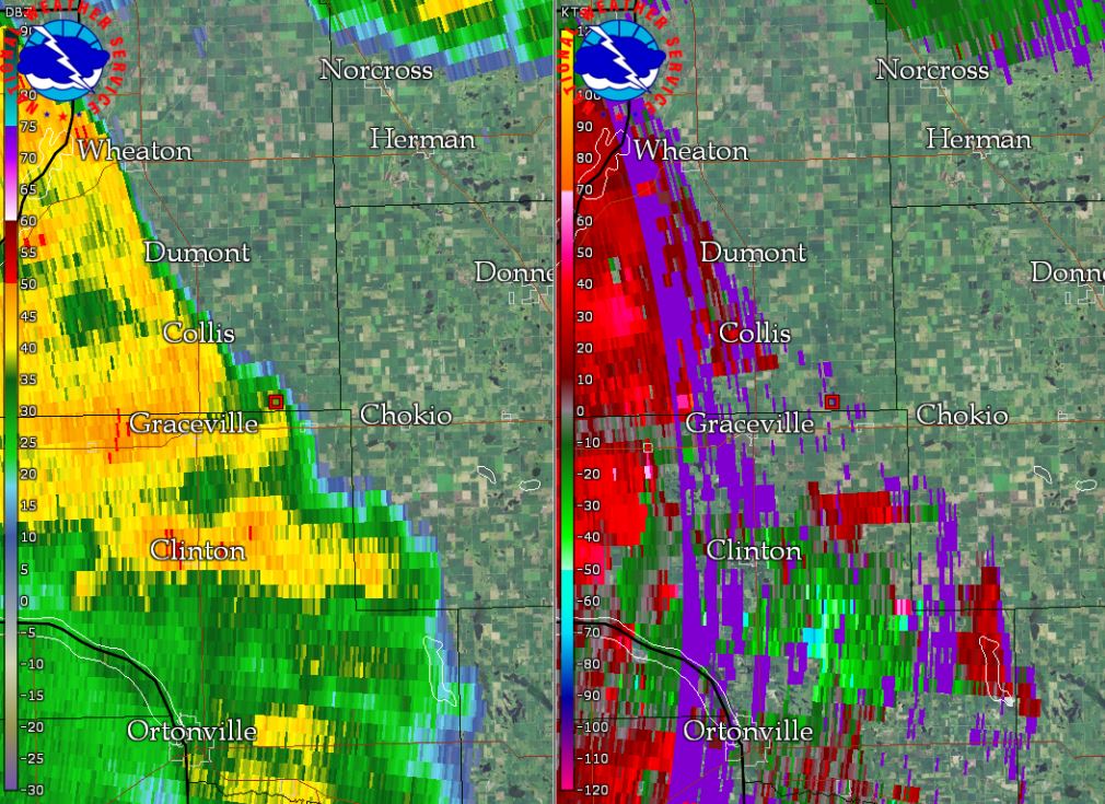
Radar reflectivity and storm-relative velocity at the time of each tornado. Note the transition from a supercell thunderstorm to a quasi-linear convective system.
 |
 |
 |
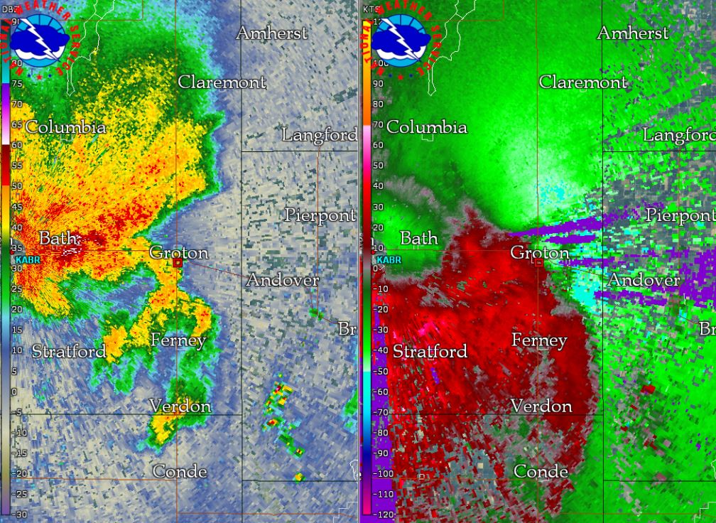 |
| Tornado #1 at 4:16 pm CDT | Tornado #2 at 4:25 pm CDT | Tornado #3 at 4:32 pm CDT | Tornado #4 at 6:05 pm CDT |
 |
 |
 |
 |
| Tornado #5 at 7:55 pm CDT | Tornado #6 at 8:20 pm CDT | Tornado #7 at 8:25 pm CDT | Tornado #8 at 8:27 pm CDT |
 |
|||
| Tornado #9 at 8:30 pm CDT |
|
Storm Reports
Preliminary SPC Storm Reports depict a widespread severe weather event: http://www.spc.noaa.gov/climo/reports/170613_rpts.html
PRELIMINARY LOCAL STORM REPORT...SUMMARY NATIONAL WEATHER SERVICE ABERDEEN SD 447 PM CDT THU JUN 15 2017 ..TIME... ...EVENT... ...CITY LOCATION... ...LAT.LON... ..DATE... ....MAG.... ..COUNTY LOCATION..ST.. ...SOURCE.... ..REMARKS.. 0350 PM HAIL 4 SE POLO 44.74N 99.05W 06/13/2017 M1.00 INCH HAND SD LAW ENFORCEMENT 0416 PM TORNADO 7 NNW BURDETTE 44.80N 98.84W 06/13/2017 HAND SD TRAINED SPOTTER BRIEF TOUCHDOWN, LOCATION APPROXIMATE. 0426 PM TORNADO 5 SSW ZELL 44.83N 98.77W 06/13/2017 HAND SD LAW ENFORCEMENT SEVERAL BUILDINGS AND TREES DAMAGED. RADAR ESTIMATED TIME. 0430 PM HAIL 1 WSW ROCKHAM 44.90N 98.84W 06/13/2017 E1.50 INCH FAULK SD EMERGENCY MNGR 0432 PM TORNADO 3 SSW ZELL 44.86N 98.75W 06/13/2017 HAND SD TRAINED SPOTTER APPROXIMATE LOCATION. 0440 PM HAIL 5 NE PIERRE 44.42N 100.25W 06/13/2017 M0.88 INCH HUGHES SD PUBLIC RADAR ESTIMATED TIME. 0445 PM HAIL 2 W ZELL 44.89N 98.77W 06/13/2017 E2.00 INCH HAND SD EMERGENCY MNGR 0445 PM HAIL 5 WSW BLUNT 44.49N 100.08W 06/13/2017 E1.00 INCH HUGHES SD PUBLIC ESTIMATED WINDS WERE 50 MPH. NO DAMAGE NOTICEABLE. 0508 PM HAIL 3 SW HARROLD 44.50N 99.78W 06/13/2017 E0.88 INCH HUGHES SD CO-OP OBSERVER 0508 PM HAIL 7 NW LEBANON 45.14N 99.87W 06/13/2017 E1.75 INCH POTTER SD PUBLIC TIME BASED ON RADAR. 0512 PM TSTM WND DMG 12 N HARROLD 44.70N 99.76W 06/13/2017 SULLY SD CO-OP OBSERVER 2 UPROOTED TREES. TIME BASED ON RADAR. 0514 PM HAIL 2 NNW TAILWATERS REC AR 44.06N 99.45W 06/13/2017 E1.00 INCH BUFFALO SD PUBLIC 0520 PM TSTM WND DMG 2 W BRENTFORD 45.16N 98.36W 06/13/2017 SPINK SD NWS EMPLOYEE TREE LIMBS DOWN. 0523 PM HAIL 18 N HOLABIRD 44.78N 99.57W 06/13/2017 E1.00 INCH HYDE SD COCORAHS HAIL BROKE PICKUP WINDSHIELD. ESTIMATED WINDS AT LEAST 40-50 MPH. NO OTHER DAMAGE NOTICEABLE. 0525 PM TSTM WND DMG 1 N BRENTFORD 45.17N 98.32W 06/13/2017 SPINK SD TRAINED SPOTTER POWER POLE SNAPPED. RADAR ESTIMATED TIME. 0530 PM TSTM WND GST 1 NW MELLETTE 45.16N 98.51W 06/13/2017 M62 MPH SPINK SD MESONET 0531 PM HAIL 6 NE HOVEN 45.30N 99.68W 06/13/2017 E1.00 INCH EDMUNDS SD PUBLIC HAIL TOOK SOME LEAVES OFF BEAN PLANTS. 0553 PM HAIL BATH 45.47N 98.32W 06/13/2017 E0.50 INCH BROWN SD EMERGENCY MNGR 0600 PM HAIL 5 S BATH 45.40N 98.31W 06/13/2017 E1.00 INCH BROWN SD PUBLIC MOSTLY DIME SIZE HAIL, BUT A FEW QUARTER SIZE. ESTIMATED WINDS BETWEEN 50-60 MPH. NO DAMAGE NOTICEABLE. 0605 PM TORNADO 1 S GROTON 45.44N 98.10W 06/13/2017 BROWN SD TRAINED SPOTTER 0606 PM HAIL 4 SE FAULKTON 44.99N 99.08W 06/13/2017 E1.00 INCH FAULK SD PUBLIC MOSTLY PEA TO NICKEL SIZE HAIL BUT A FEW QUARTER SIZE. WINDS ESTIMATED BETWEEN 40-50 MPH. 0639 PM FUNNEL CLOUD 3 W PIERPONT 45.50N 97.89W 06/13/2017 DAY SD TRAINED SPOTTER 0658 PM TSTM WND GST 1 SSE CLARK 44.87N 97.73W 06/13/2017 M92 MPH CLARK SD TRAINED SPOTTER RECORDED BY A FULL MOBILE MESONET. VERIFIED LOCATION WAS ACTUALLY 4.5 MILES SOUTH OF CLARK. 0658 PM TSTM WND DMG CLARK 44.88N 97.73W 06/13/2017 CLARK SD LAW ENFORCEMENT SHED ROOF REMOVED, SEVERAL TREES DOWN. RADAR ESTIMATED TIME. 0703 PM TSTM WND DMG 1 WSW ABERDEEN 45.46N 98.51W 06/13/2017 BROWN SD NWS EMPLOYEE TREES DOWN. RADAR ESTIMATED TIME. 0705 PM TSTM WND GST 4 S GARDEN CITY 44.90N 97.58W 06/13/2017 E65 MPH CLARK SD TRAINED SPOTTER 0705 PM TSTM WND DMG 1 SE ABERDEEN 45.46N 98.47W 06/13/2017 BROWN SD NWS EMPLOYEE 6 INCH TREE BRANCH DOWN. RADAR ESTIMATED TIME. 0715 PM TSTM WND DMG 5 NW BATH 45.53N 98.39W 06/13/2017 BROWN SD EMERGENCY MNGR TREE FELL ON POWER LINE. SEVERAL HOMES WITHOUT POWER IN ABERDEEN AND COLUMBIA AREA. TIME ESTIMATED FROM RADAR. 0718 PM TSTM WND DMG WALLACE 45.09N 97.48W 06/13/2017 CODINGTON SD LAW ENFORCEMENT LARGE TREES UPROOTED. RADAR ESTIMATED TIME. 0720 PM TSTM WND DMG 2 NW ORTONVILLE 45.32N 96.46W 06/13/2017 BIG STONE MN EMERGENCY MNGR DAMAGE TO SHED, LARGE BRANCH BROKE OFF TREE. RADAR ESTIMATED TIME. 0725 PM TSTM WND GST FLORENCE 45.06N 97.33W 06/13/2017 E60 MPH CODINGTON SD LAW ENFORCEMENT 60 MPH. 0725 PM FUNNEL CLOUD FLORENCE 45.06N 97.33W 06/13/2017 CODINGTON SD LAW ENFORCEMENT MOVING UP AND DOWN. 0727 PM TSTM WND DMG CLAREMONT 45.67N 98.01W 06/13/2017 BROWN SD NWS EMPLOYEE LARGE TREE LIMB DOWN. TIME BASED ON RADAR. 0729 PM TSTM WND DMG 5 NE BUTLER 45.31N 97.63W 06/13/2017 DAY SD NWS STORM SURVEY NUMEROUS TREES BLOWN DOWN AND STORAGE SHED COMPLETELY DESTROYED. ESTIMATED WIND GUSTS IN EXCESS OF 90 MPH. 0731 PM TSTM WND DMG 5 E BRISTOL 45.34N 97.65W 06/13/2017 DAY SD EMERGENCY MNGR SEVERAL POWER POLES DOWN. TIME ESTIMATED VIA RADAR. 0731 PM TSTM WND GST 4 W WEBSTER 45.34N 97.61W 06/13/2017 M69 MPH DAY SD TRAINED SPOTTER RADAR ESTIMATED TIME. 0732 PM TSTM WND DMG WEBSTER 45.34N 97.52W 06/13/2017 DAY SD EMERGENCY MNGR POWERLINES DOWN IN WEBSTER. TIME ESTIMATED VIA RADAR. 0733 PM TSTM WND GST 8 SW WAUBAY 45.25N 97.41W 06/13/2017 E65 MPH DAY SD TRAINED SPOTTER AT LEAST 65 MPH ESTIMATED. 0734 PM TSTM WND DMG 5 NNW WEBSTER 45.40N 97.55W 06/13/2017 DAY SD EMERGENCY MNGR THREE POWER POLES DOWN. TIME ESTIMATED VIA RADAR. 0735 PM TSTM WND DMG 4 SW WAUBAY 45.30N 97.37W 06/13/2017 DAY SD EMERGENCY MNGR DAIRY BARN PARTIALLY DESTROYED. TIME ESTIMATED VIA RADAR. 0735 PM TSTM WND GST 3 S WEBSTER 45.29N 97.52W 06/13/2017 M60 MPH DAY SD MESONET 0737 PM TSTM WND DMG WAUBAY 45.34N 97.31W 06/13/2017 DAY SD EMERGENCY MNGR A LOT OF DAMAGE THROUGHOUT TOWN...INCLUDING TREES UPROOTED AND ON HOUSES. POWER OUTAGES ACROSS DAY COUNTY. TIME ESTIMATED VIA RADAR. 0750 PM TSTM WND GST 4 W WAUBAY 45.34N 97.39W 06/13/2017 M86 MPH DAY SD MESONET 0755 PM TORNADO 3 ESE EDEN 45.60N 97.37W 06/13/2017 MARSHALL SD NWS STORM SURVEY BARN ROOF COMPLETELY COLLAPSED. DEBRIS LOFTED ONE TENTH OF A MILE. 0756 PM TSTM WND GST 2 SE MARVIN 45.24N 96.88W 06/13/2017 M55 MPH GRANT SD MESONET 0805 PM TSTM WND DMG 3 SW MILBANK 45.19N 96.68W 06/13/2017 GRANT SD PUBLIC LARGE SECTION OF ROOF BLOWN OFF DAIRY BARN. 0805 PM TSTM WND GST 4 SW HILLHEAD 45.80N 97.45W 06/13/2017 M76 MPH MARSHALL SD MESONET TIME ESTIMATED. 0810 PM TSTM WND GST 2 ENE SISSETON 45.67N 97.00W 06/13/2017 M55 MPH ROBERTS SD ASOS ASOS STATION 8D3, SISSETON MUNI AP. 0810 PM TSTM WND GST 6 SSW PEEVER 45.46N 96.99W 06/13/2017 M57 MPH ROBERTS SD MESONET 0810 PM TSTM WND DMG MILBANK 45.22N 96.64W 06/13/2017 GRANT SD EMERGENCY MNGR MULTIPLE TREES DOWN, ELECTRICAL LINES DOWN. POSSIBLE FIRES STARTED DUE TO ELECTRICAL LINES DOWN. 0814 PM TSTM WND GST CLAIRE CITY 45.86N 97.10W 06/13/2017 E60 MPH ROBERTS SD EMERGENCY MNGR 0820 PM TORNADO 2 WSW NEW EFFINGTON 45.85N 96.95W 06/13/2017 ROBERTS SD NWS STORM SURVEY SIGNIFICANT TREE DAMAGE FROM A BRIEF TORNADO TOUCHDOWN. 0820 PM TSTM WND DMG 2 NW ORTONVILLE 45.32N 96.46W 06/13/2017 BIG STONE MN EMERGENCY MNGR PATIO RIPPED OFF HOUSE, SUBSEQUENT ROOF DAMAGE OCCURRED. 0820 PM TSTM WND DMG ORTONVILLE 45.30N 96.44W 06/13/2017 BIG STONE MN EMERGENCY MNGR MULTIPLE TREES SNAPPED, MULTIPLE LARGE BRANCHES DOWN, AND ELECTRICAL LINES DOWN. 0820 PM TSTM WND DMG 2 NNW ORTONVILLE 45.33N 96.46W 06/13/2017 BIG STONE MN EMERGENCY MNGR MULTIPLE UPROOTED TREES AT THE ORTONVILLE GOLF COURSE. RADAR ESTIMATED TIME. 0820 PM TSTM WND DMG 2 N NEW EFFINGTON 45.88N 96.91W 06/13/2017 ROBERTS SD NWS STORM SURVEY TREES UPROOTED, LARGE BRANCHES BROKEN. RADAR ESTIMATED TIME. 0820 PM TSTM WND DMG 9 S ROSHOLT 45.74N 96.73W 06/13/2017 ROBERTS SD EMERGENCY MNGR TWO CABINS DESTROYED, ONE BY WIND AND THE OTHER BY A LARGE FELLED TREE. RADAR ESTIMATED TIME. ESTIMATED LOCATION. 0820 PM TSTM WND DMG 5 WNW ARTICHOKE 45.44N 96.25W 06/13/2017 BIG STONE MN TRAINED SPOTTER 13 MILES NE OF ORTONVILLE. WIND CAVED IN THE SIDES OF TWO GRAIN BINS. WIND ESTIMATE 70+ MPH. 0820 PM TSTM WND GST 1 N NEW EFFINGTON 45.87N 96.92W 06/13/2017 E70 MPH ROBERTS SD FIRE DEPT/RESCUE 0820 PM TSTM WND DMG 2 N NEW EFFINGTON 45.88N 96.92W 06/13/2017 ROBERTS SD NWS STORM SURVEY UPROOTED TREE. RADAR ESTIMATED TIME. 0820 PM TSTM WND DMG 2 NW ORTONVILLE 45.32N 96.46W 06/13/2017 BIG STONE MN EMERGENCY MNGR LARGE TREE BRANCH FELL ON HOUSE. RADAR ESTIMATED TIME. 0820 PM TSTM WND GST 4 SE BONANZA GROVE 45.41N 96.64W 06/13/2017 M58 MPH BIG STONE MN MESONET TIME ESTIMATED BY RADAR. 0823 PM TSTM WND GST ODESSA 45.26N 96.34W 06/13/2017 M70 MPH BIG STONE MN MESONET TIME ESTIMATED. 0825 PM TSTM WND DMG 3 NNE NEW EFFINGTON 45.89N 96.90W 06/13/2017 ROBERTS SD NWS STORM SURVEY LARGE BRANCHES BROKEN. 0825 PM TORNADO 2 N NEW EFFINGTON 45.89N 96.92W 06/13/2017 ROBERTS SD NWS STORM SURVEY TREE DAMAGE FROM A BRIEF TORNADO TOUCHDOWN. RADAR ESTIMATED TIME. 0825 PM TSTM WND DMG 3 SSW BARRY 45.52N 96.58W 06/13/2017 BIG STONE MN EMERGENCY MNGR LOSS OF WALL MACHINE SHED WALL AND DAMAGE TO MACHINE SHED ROOF. RADAR ESTIMATED TIME. 0825 PM TSTM WND DMG 4 NNE NEW EFFINGTON 45.91N 96.89W 06/13/2017 ROBERTS SD NWS STORM SURVEY LOSS OF ROOF BARN. RADAR ESTIMATED TIME. 0827 PM TORNADO 2 W GRACEVILLE 45.57N 96.48W 06/13/2017 BIG STONE MN TRAINED SPOTTER SHORT LIVED. 0827 PM TSTM WND DMG 3 SSE GRACEVILLE 45.53N 96.43W 06/13/2017 BIG STONE MN NWS STORM SURVEY COLLAPSE OF MACHINE SHED WALLS. RADAR ESTIMATED TIME. 0827 PM TORNADO 4 N CLINTON 45.51N 96.43W 06/13/2017 BIG STONE MN NWS STORM SURVEY PARTIAL ROOF TORN OFF OF HOUSE, SIDING DAMAGE TO HOUSE, MACHINE SHED WITH COLLAPSED ROOF AND WALLS, MACHINE SHED WITH CONSIDERABLE DAMAGE TO SOUTHWEST SECTION, EMPTY GRAIN BIN REMOVED FROM CEMENT BASE AND TOSSED, WIDESPREAD TREE DAMAGE, DEBRIS FROM FARM LOFTED 2000 FT TO THE NORTHEAST. 0828 PM TSTM WND DMG 4 NNW VICTOR 45.92N 96.87W 06/13/2017 ROBERTS SD FIRE DEPT/RESCUE 12-16" TREES SNAPPED. POSSIBLE TORNADO DAMAGE. RADAR ESTIMATED TIME. 0829 PM TSTM WND DMG CLINTON 45.46N 96.44W 06/13/2017 BIG STONE MN PUBLIC MULTIPLE TREES SNAPPED AND UPROOTED IN CLINTON. 0830 PM TSTM WND DMG 7 NE ORTONVILLE 45.37N 96.33W 06/13/2017 BIG STONE MN EMERGENCY MNGR DAMAGE TO OUTBUILDING. RADAR ESTIMATED TIME. 0830 PM TORNADO 2 NW JOHNSON 45.60N 96.33W 06/13/2017 TRAVERSE MN PUBLIC RESIDENT SAW THE TORNADO TOUCHDOWN, SIGNIFICANT TREE DAMAGE ON THE PROPERTY, TIME RADAR ESTIMATED. 0830 PM TSTM WND DMG 3 NW VICTOR 45.91N 96.88W 06/13/2017 ROBERTS SD NWS STORM SURVEY UPROOTED TREES. RADAR ESTIMATED TIME. 0830 PM TSTM WND DMG 2 WNW JOHNSON 45.58N 96.34W 06/13/2017 BIG STONE MN NWS STORM SURVEY COMPLETE DESTRUCTION OF AN OPEN FACED SHED. RADAR ESTIMATED TIME. 0830 PM TSTM WND DMG 5 ENE ODESSA 45.28N 96.24W 06/13/2017 BIG STONE MN TRAINED SPOTTER DENTED GRAIN BINS, SECTION OF MACHINE SHED ROOF REMOVED, GRAIN AUGER TIPPED, WINDOW BROKEN. RADAR ESTIMATED TIME. 0830 PM TSTM WND DMG 4 NNW VICTOR 45.92N 96.86W 06/13/2017 ROBERTS SD NWS STORM SURVEY DENTED GRAIN BINS, UPROOTED TREES. RADAR ESTIMATED TIME. 0830 PM TSTM WND DMG 3 WSW JOHNSON 45.55N 96.34W 06/13/2017 BIG STONE MN EMERGENCY MNGR MINOR DAMAGE TO ROOF OF BARN. RADAR ESTIMATED TIME. 0830 PM TSTM WND DMG 2 WNW JOHNSON 45.59N 96.33W 06/13/2017 TRAVERSE MN NWS STORM SURVEY LARGE TREE BRANCHES DOWN. RADAR TIME ESTIMATED. 0835 PM TSTM WND GST 3 WSW GRACEVILLE 45.56N 96.49W 06/13/2017 M61 MPH BIG STONE MN MESONET 0835 PM TSTM WND DMG JOHNSON 45.57N 96.29W 06/13/2017 BIG STONE MN EMERGENCY MNGR PARTIAL LOSS OF ROOF. RADAR ESTIMATED TIME. 0845 PM TSTM WND DMG TINTAH 46.01N 96.32W 06/13/2017 TRAVERSE MN TRAINED SPOTTER MANY LARGE LIMBS DOWNED.
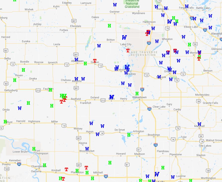
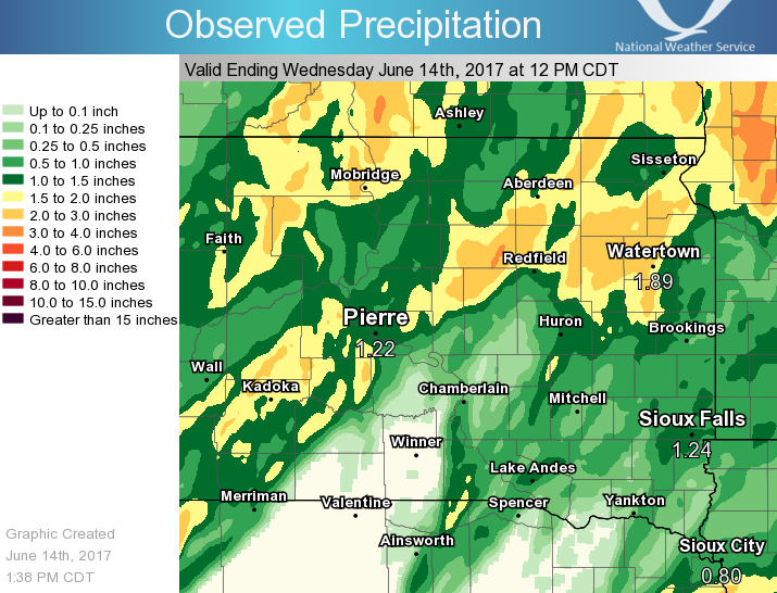
Rain Reports
12-hour rainfall total across the region ranged from nothing to around 2 inches across portions of eastern Faulk, northwestern Spink, eastern Brown, and far northeastern Traverse. Due to a storm that moved across the region prior to 8am, 24-hour rainfall totals include both events.
12-hour Precipitation
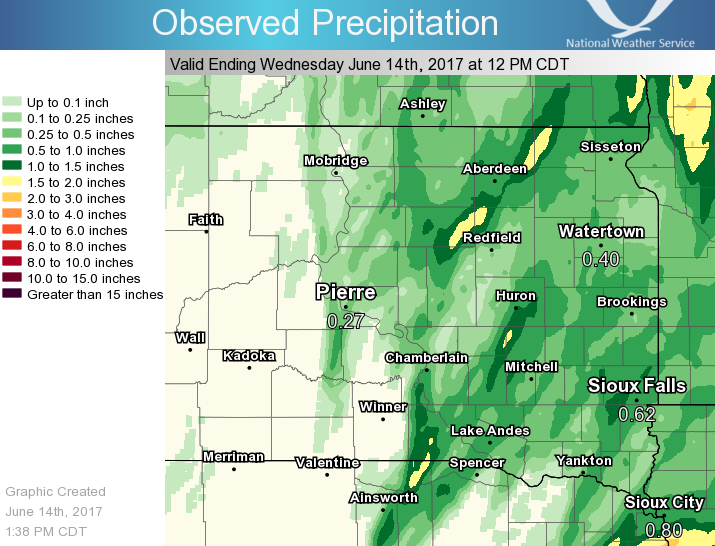
24-hour Precipitation
 |
Media use of NWS Web News Stories is encouraged! Please acknowledge the NWS as the source of any news information accessed from this site. |
|