Widespread life-threatening flash and urban flooding continues in south-central Texas, with considerable flooding impacts possible across central Texas. Wildfire smoke is impacting air quality across much of the Great Lakes region into southern New England and the Mid-Atlantic. Monsoonal thunderstorms may produce isolated to scattered flash flooding across the Southwest into the Great Basin. Read More >
Overview
|
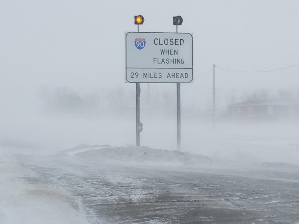
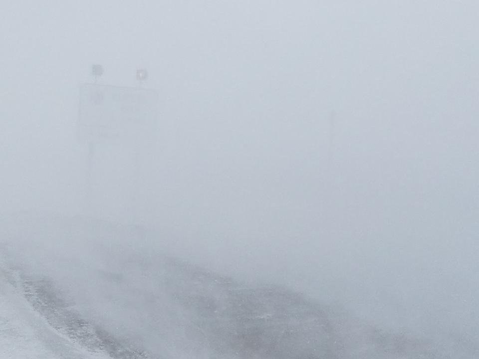
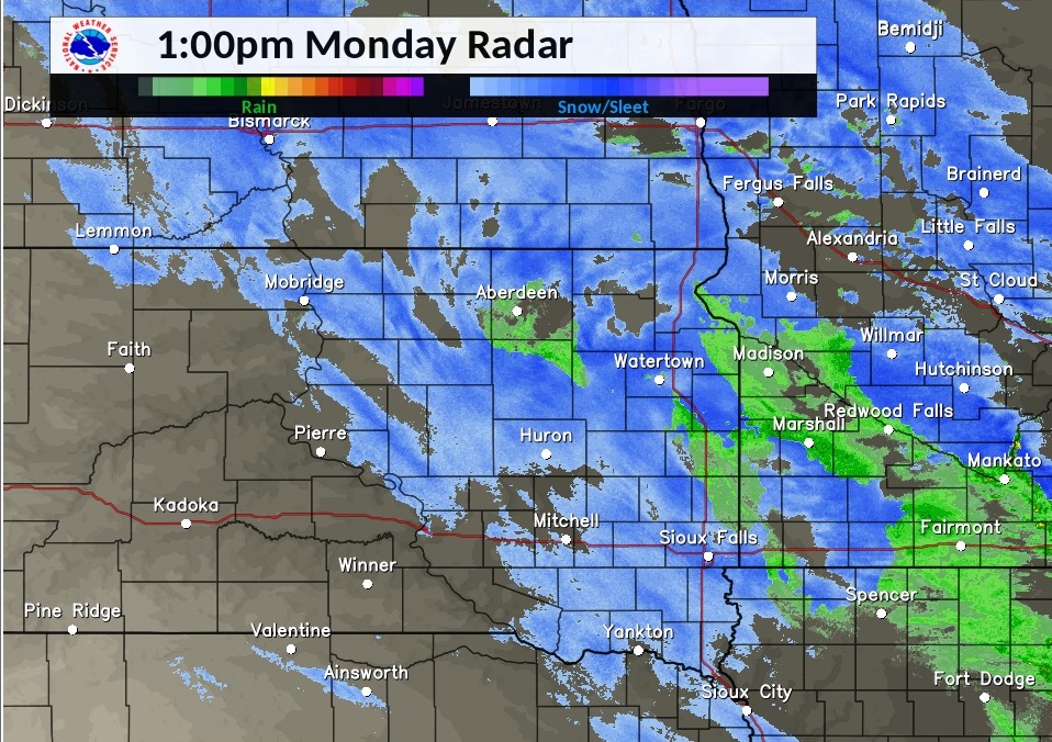
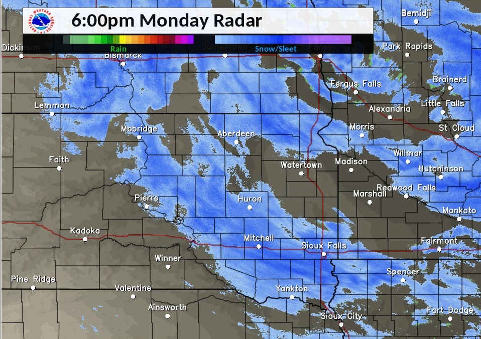
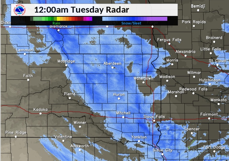
A powerful storm system impacted central and eastern South Dakota as well as western Minnesota from Sunday, March 4th through Tuesday, March 6th. This system brought a wide range of precipitation types, including rain, hail, sleet, ice pellets and snow! Thundersnow was reported late Sunday/early Monday morning across parts of northeast South Dakota. Many locations reported over 10 inches of snow when it was all said and done. For central South Dakota strong winds with gusts in excess of 50 mph combined with falling snow to create blizzard conditions. I-90 was closed from Murdo to Sioux Falls and I-29 was closed from the North Dakota border to the Iowa border on March 5th, and didn't re-open until the morning of the 6th. Travel was difficult or impossible on other state and county roads as well. Many schools cancelled class on both the 5th and 6th. |
Photos courtesy of Zach Nelson, River Front Broadcasting |
Snow
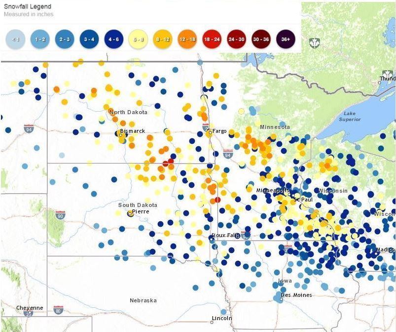
Total snowfall map based on storm reports
Total snowfall map based on a blend of reports and estimations
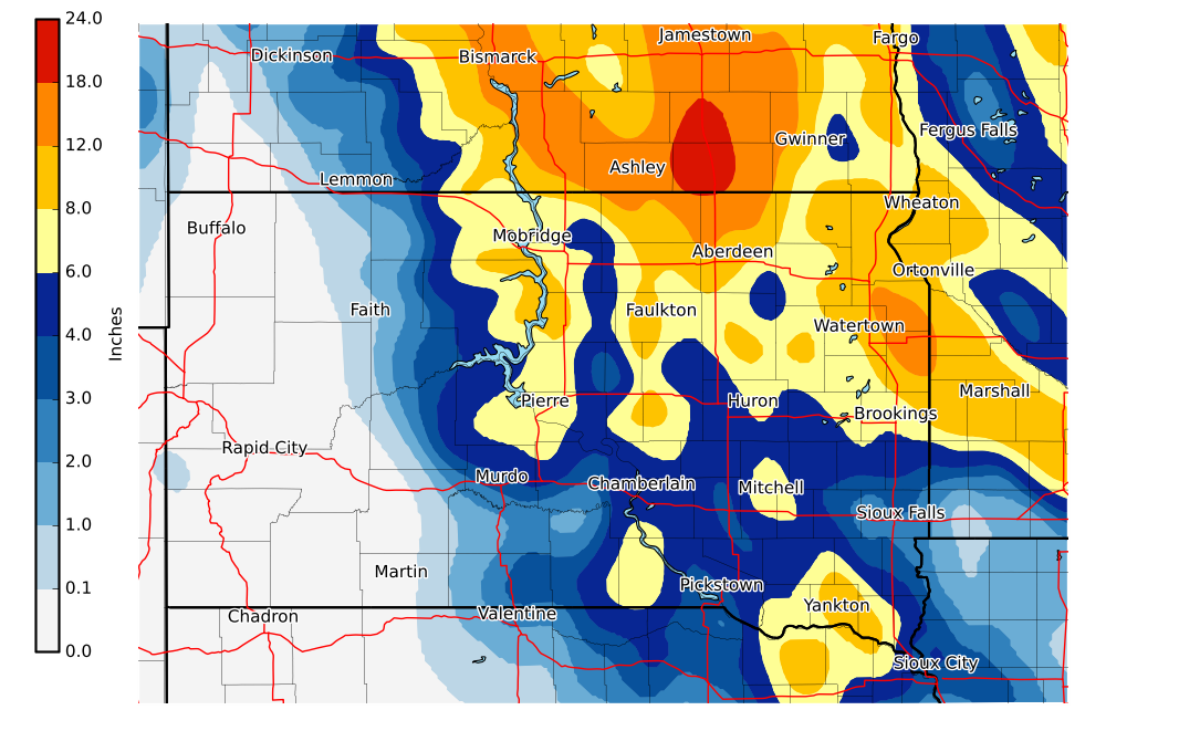
Some of these snowfall amounts rival historic 24 hour snow total records (on a county by county basis)
https://www.ncdc.noaa.gov/snow-and-ice/snowfall-extremes/SD
https://www.ncdc.noaa.gov/snow-and-ice/snowfall-extremes/MN
..TIME... ...EVENT... ...CITY LOCATION... ...LAT.LON...
..DATE... ....MAG.... ..COUNTY LOCATION..ST.. ...SOURCE....
..REMARKS..
0800 AM Heavy Snow 6 ENE Spring Creek Colo 45.93N 98.77W
03/06/2018 M18.0 inch McPherson SD CO-OP Observer
Storm Total snowfall.
0100 PM Heavy Snow Gary 44.80N 96.46W
03/06/2018 M18.0 inch Deuel SD Trained Spotter
Storm total.
0930 AM Heavy Snow FREDERICK 45.83N 98.51W
03/06/2018 E16.0 inch Brown SD Public
STORM TOTAL AS OF 930 AM.
0800 AM Heavy Snow 2 S TWIN BROOKS 45.18N 96.79W
03/06/2018 M15.0 inch Grant SD Public
RELAYED VIA SOCIAL MEDIA WITH PHOTO.
0200 PM Heavy Snow 5 NW Leola 45.77N 99.01W
03/06/2018 M13.8 inch McPherson SD Public
Relayed via social media, with photo.
1200 PM Heavy Snow Wilmot 45.41N 96.86W
03/06/2018 M13.6 inch Roberts SD CO-OP Observer
Corrects previous heavy snow report from
Wilmot. Storm total snowfall.
0915 AM Heavy Snow 4 N CRAVENS CORNER 45.51N 98.93W
03/06/2018 M13.0 inch Edmunds SD Public
STORM TOTAL AS OF 9 AM. RELAYED VIA SOCIAL
MEDIA WITH PHOTO.
0700 AM Snow LA BOLT 45.05N 96.68W
03/06/2018 M12.5 inch Grant SD Cocorahs
COCORAHS STATION SD-GT-9, LA BOLT.
1000 AM Heavy Snow CLEAR LAKE 44.75N 96.68W
03/06/2018 M12.2 inch Deuel SD CO-OP Observer
STORM TOTAL AS OF 10 AM. CO-OP OBSERVER
STATION CLKS2, CLEAR LAKE.
0730 AM Snow MILBANK 45.22N 96.63W
03/06/2018 M12.0 inch Grant SD CO-OP Observer
CO-OP OBSERVER STATION MLBS2, MILBANK.
0700 AM Heavy Snow Leola 45.72N 98.94W
03/06/2018 M11.3 inch McPherson SD CO-OP Observer
Storm Total snowfall.
0500 PM Heavy Snow 5 SSW Summit 45.23N 97.06W
03/06/2018 M11.0 inch Grant SD CO-OP Observer
Storm total snowfall.
0700 AM Snow SISSETON 3 W 45.66N 97.12W
03/06/2018 M10.6 inch Roberts SD CO-OP Observer
CO-OP OBSERVER STATION SIWS2, SISSETON 3 W.
0600 PM Heavy Snow 2 ESE Artichoke 45.39N 96.13W
03/06/2018 M10.5 inch Big Stone MN CO-OP Observer
Storm total.
1000 AM Heavy Snow ODESSA 45.26N 96.33W
03/06/2018 M10.3 inch Big Stone MN Trained Spotter
STORM TOTAL AS OF 10 AM. RELAYED VIA SOCIAL
MEDIA.
0130 AM Heavy Snow WHEATON 45.81N 96.50W
03/06/2018 E10.0 inch Traverse MN Public
STILL SNOWING.
0943 AM Heavy Snow 4 S GARDEN CITY 44.90N 97.58W
03/06/2018 M10.0 inch Clark SD CO-OP Observer
STORM TOTAL AS OF 930 AM.
0700 AM Snow HERREID 3 ESE 45.82N 100.01W
03/06/2018 M10.0 inch Campbell SD Cocorahs
COCORAHS STATION SD-CP-6, HERREID 3 ESE.
0600 PM Heavy Snow 2 ENE Roscoe 45.46N 99.30W
03/06/2018 M9.5 inch Edmunds SD CO-OP Observer
Storm total snowfall.
1200 PM Heavy Snow 3 ESE Aberdeen 45.46N 98.41W
03/06/2018 M9.3 inch Brown SD Official NWS Obs
Storm total snowfall for Aberdeen.
0600 AM Heavy Snow ABERDEEN 3 E 45.46N 98.41W
03/06/2018 M9.2 inch Brown SD CO-OP Observer
STORM TOTAL AS OF 6 AM. CO-OP OBSERVER
STATION ABES2, ABERDEEN 3 E.
0700 AM Heavy Snow BROWNS VALLEY 6 N 45.69N 96.83W
03/06/2018 M9.1 inch Roberts SD Cocorahs
COCORAHS STATION SD-RB-4, BROWNS VALLEY 6 N.
0700 PM Heavy Snow 5 ENE GREENWAY 45.94N 99.62W
03/05/2018 E9.0 inch McPherson SD Public
STILL SNOWING.
0700 PM Heavy Snow JAVA 45.50N 99.88W
03/05/2018 E9.0 inch Walworth SD Public
STILL SNOWING.
0100 PM Heavy Snow 4 N CRAVENS CORNER 45.51N 98.93W
03/05/2018 E9.0 inch Edmunds SD Public
CORRECTS PREVIOUS SNOW REPORT FROM THIS
MORNING AT THIS LOCATION. VISIBILITY NEAR
ZERO. RELAYED VIA SOCIAL MEDIA.
0600 PM Heavy Snow ROY LAKE STATE PARK 45.71N 97.43W
03/06/2018 M8.5 inch Marshall SD CO-OP Observer
Corrects previous heavy snow report from 6
PM Monday at this location. Storm total
snowfall.
0700 AM Heavy Snow 2 NW Westport 45.67N 98.53W
03/07/2018 M8.5 inch Brown SD CO-OP Observer
Storm total.
0800 AM Heavy Snow Eureka 45.77N 99.63W
03/06/2018 M8.4 inch McPherson SD CO-OP Observer
Storm total as of 8 AM.
0250 PM Heavy Snow 4 S GARDEN CITY 44.90N 97.58W
03/05/2018 E8.0 inch Clark SD CO-OP Observer
0300 PM Heavy Snow 1 WSW FREDERICK 45.82N 98.53W
03/05/2018 E8.0 inch Brown SD Public
STILL SNOWING.
0800 AM Heavy Snow PIERRE 44.37N 100.32W
03/06/2018 E8.0 inch Hughes SD CO-OP Observer
3 FOOT DRIFTS.
0600 PM Snow BOWDLE 45.44N 99.66W
03/06/2018 M8.0 inch Edmunds SD CO-OP Observer
Corrects previous snow report from 6 PM
Monday at this location. Storm Total
snowfall.
0500 AM Heavy Snow BROWNS VALLEY 45.62N 96.83W
03/06/2018 M7.8 inch Traverse MN CO-OP Observer
CO-OP OBSERVER STATION BRVM5, BROWNS VALLEY.
0800 AM Snow MOBRIDGE 45.54N 100.44W
03/06/2018 M7.6 inch Walworth SD CO-OP Observer
STORM TOTAL AS OF 8 AM.
0700 AM Heavy Snow FAULKTON 1 NW 45.03N 99.13W
03/06/2018 M7.5 inch Faulk SD CO-OP Observer
STORM TOTAL AS OF 7 AM. CO-OP OBSERVER
STATION FAUS2, FAULKTON 1 NW.
0800 AM Heavy Snow WATERTOWN 2 S 44.87N 97.12W
03/06/2018 M7.3 inch Codington SD CO-OP Observer
STORM TOTAL AS OF 8 AM. CO-OP OBSERVER
STATION WATS2, WATERTOWN 2 S.
0700 AM Snow BRITTON 45.78N 97.75W
03/06/2018 M7.0 inch Marshall SD CO-OP Observer
CO-OP OBSERVER STATION BRIS2, BRITTON.
0830 AM Heavy Snow 7 ESE PIERPONT 45.46N 97.70W
03/06/2018 M7.0 inch Day SD Emergency Mngr
STORM TOTAL AS OF 830 AM.
0700 PM Heavy Snow TIMBER LAKE
03/06/2018 M7.0 inch Dewey SD CO-OP Observer
0800 PM Heavy Snow IPSWICH 45.45N 99.03W
03/05/2018 M7.0 inch Edmunds SD CO-OP Observer
CO-OP OBSERVER STATION IPSS2, IPSWICH.
0800 AM Heavy Snow WATERTOWN 2 E 44.91N 97.11W
03/06/2018 M7.0 inch Codington SD Cocorahs
COCORAHS STATION SD-CD-8, WATERTOWN 2 E.
0330 PM Heavy Snow 3 ESE WATERTOWN 44.89N 97.10W
03/05/2018 E7.0 inch Codington SD Broadcast Media
STILL SNOWING.
0700 PM Heavy Snow POLLOCK 45.90N 100.28W
03/06/2018 M7.0 inch Campbell SD CO-OP Observer
Corrects previous snow report from 7 PM
Monday at this location. Storm total
snowfall.
0700 AM Heavy Snow Roscoe 45.45N 99.33W
03/06/2018 M6.8 inch Edmunds SD CO-OP Observer
0800 AM Heavy Snow HAYTI 1 W 44.66N 97.23W
03/06/2018 M6.8 inch Hamlin SD CO-OP Observer
STORM TOTAL AS OF 8 AM. CO-OP OBSERVER
STATION HYTS2, HAYTI 1 W.
0600 PM Snow ABERDEEN 45.47N 98.48W
03/05/2018 M6.7 inch Brown SD Official NWS Obs
CORRECTS PREVIOUS SNOW REPORT FROM NOON AT
THIS LOCATION. STORM TOTAL SNOW SO FAR,
STILL SNOWING.
0600 AM Snow WESTPORT 2 NW 45.68N 98.53W
03/06/2018 M6.5 inch Brown SD CO-OP Observer
CO-OP OBSERVER STATION WPTS2, WESTPORT 2 NW.
0600 PM Heavy Snow 1 N KIDDER 45.90N 97.71W
03/06/2018 M6.5 inch Marshall SD CO-OP Observer
Corrects previous heavy snow report from 6
PM Monday for this location. Storm total
snowfall.
0700 AM Heavy Snow SELBY 45.50N 100.03W
03/06/2018 M6.3 inch Walworth SD CO-OP Observer
STORM TOTAL AS OF 7 AM. CO-OP OBSERVER
STATION SBYS2, SELBY.
1000 PM Snow SISSETON 45.67N 97.00W
03/05/2018 M6.2 inch Roberts SD CO-OP Observer
CO-OP OBSERVER STATION SSSS2, SISSETON.
0600 AM Snow CASTLEWOOD 44.73N 97.03W
03/06/2018 M6.2 inch Hamlin SD CO-OP Observer
CO-OP OBSERVER STATION CLWS2, CASTLEWOOD.
0600 PM Heavy Snow 1 S CHELSEA 45.15N 98.74W
03/05/2018 M6.0 inch Faulk SD CO-OP Observer
STILL SNOWING.
1200 PM Heavy Snow 1 N Ortonville 45.32N 96.44W
03/06/2018 E6.0 inch Big Stone MN CO-OP Observer
0853 AM Heavy Snow 6 E HAYES 44.37N 100.90W
03/06/2018 E6.0 inch Stanley SD CO-OP Observer
BLIZZARD CONDITIONS AS WELL, ZERO VISIBILITY
AT TIMES.
0700 AM Snow HIGHMORE 19 NNW 44.78N 99.57W
03/06/2018 M6.0 inch Hyde SD Cocorahs
COCORAHS STATION SD-HY-2, HIGHMORE 19 NNW.
0700 AM Heavy Snow TURTON 45.05N 98.10W
03/06/2018 M6.0 inch Spink SD CO-OP Observer
CO-OP OBSERVER STATION TURS2, TURTON.
0230 PM Heavy Snow 6 N TOLSTOY 45.30N 99.61W
03/05/2018 E6.0 inch Edmunds SD NWS Employee
STILL SNOWING.
0800 AM Heavy Snow 2 W Rauville 44.98N 97.12W
03/06/2018 M6.0 inch Codington SD CO-OP Observer
0800 AM Snow GANN VALLEY 44.03N 98.99W
03/06/2018 M5.5 inch Buffalo SD CO-OP Observer
STORM TOTAL AS OF 8 AM. CO-OP OBSERVER
STATION GNVS2, GANN VALLEY.
0700 AM Snow PIERRE 1 S 44.35N 100.32W
03/06/2018 M5.3 inch Hughes SD Cocorahs
COCORAHS STATION SD-HG-10, PIERRE 1 S.
0733 PM Snow 4 E BUTLER 45.26N 97.62W
03/05/2018 E5.0 inch Day SD Public
STILL SNOWING.
0700 AM Snow CLAREMONT 2 SSE 45.64N 98.00W
03/06/2018 M5.0 inch Brown SD Cocorahs
COCORAHS STATION SD-BR-3, CLAREMONT 2 SSE.
1012 AM Snow EUREKA 45.77N 99.62W
03/05/2018 E5.0 inch McPherson SD Trained Spotter
1100 AM Snow MARVIN 45.26N 96.91W
03/05/2018 E5.0 inch Grant SD Public
RELAYED VIA SOCIAL MEDIA WITH PHOTO.
0700 AM Snow VICTOR 4 NNE 45.87N 96.80W
03/06/2018 M5.0 inch Roberts SD CO-OP Observer
CO-OP OBSERVER STATION VTRS2, VICTOR 4 NNE.
1011 AM Snow ROSCOE 45.45N 99.33W
03/05/2018 E5.0 inch Edmunds SD Emergency Mngr
1200 PM Snow Andover 45.41N 97.90W
03/06/2018 M4.9 inch Day SD CO-OP Observer
Storm total snowfall.
0700 AM Snow FORT PIERRE 44.36N 100.37W
03/06/2018 M4.5 inch Stanley SD Cocorahs
COCORAHS STATION SD-ST-6, FORT PIERRE.
0900 AM Snow MURDO 43.88N 100.72W
03/06/2018 M3.3 inch Jones SD CO-OP Observer
Corrects previous snow report from MURDO.
0600 PM Snow Kennebec 43.90N 99.86W
03/06/2018 M2.5 inch Lyman SD CO-OP Observer
Storm total snowfall.
Estimated storm total precipitation amounts
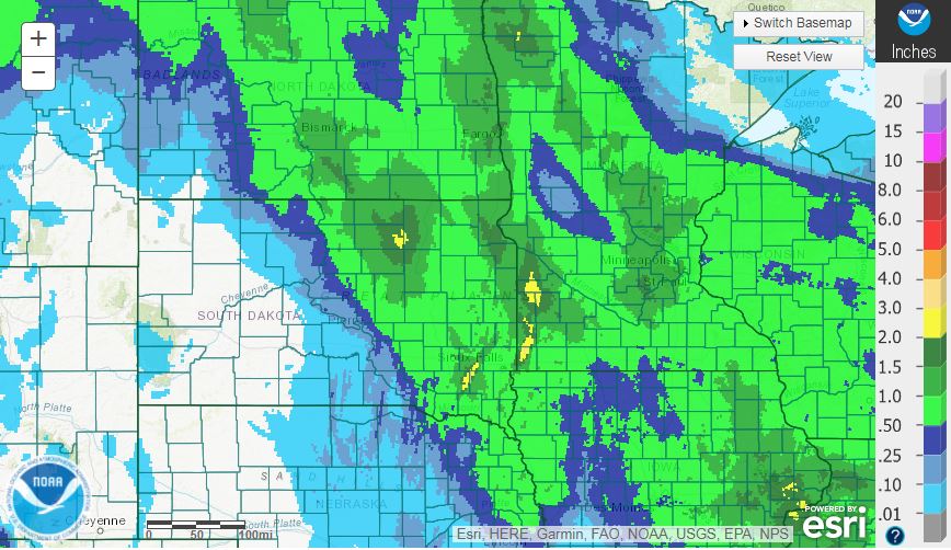
Storm total precipitation amounts recorded by COOP Observers
| Clear Lake | 2.05 | ||
| Victor 4 N | 1.4 | ||
| Sisseton 3 W | 1.32 | ||
| Elm Lake 4 NW | 1.3 | ||
| Big Stone City 2 NW | 1.3 | ||
| Artichoke Lake 1 E | 1.28 | ||
| Sisseton 10.4 ENE | 1.28 | ||
| Leola | 1.22 | ||
| Lake Norden 4.3 ENE | 1.13 | ||
| Summit 1 W | 1.11 | ||
| Rauville 2 W | 1.07 | ||
| Hayti | 1.04 | ||
| Aberdeen | 1.02 | ||
| Watertown 7.6 ENE | 0.98 | ||
| Wilmot | 0.97 | ||
| Watertown 2.7 E | 0.96 | ||
| Castlewood | 0.94 | ||
| Roscoe | 0.91 | ||
| Eureka | 0.88 | ||
| Tulare 4.5 SSW | 0.88 | ||
| Roy Lake | 0.87 | ||
| Westport | 0.87 | ||
| La Bolt | 0.87 | ||
| Gary 6.1 SW | 0.73 | ||
| Java 11.5 NNE | 0.71 | ||
| Ipswich | 0.7 | ||
| Watertown 2 S | 0.7 | ||
| Sisseton | 0.69 | ||
| Waubay Nat'l WL | 0.69 | ||
| Britton | 0.68 | ||
| Brown's Valley | 0.67 | ||
| Webster | 0.65 | ||
| Miller | 0.6 | ||
| Britton 13 NW | 0.58 | ||
| Gann Valley 7.8 WNW | 0.55 | ||
| Pierre | 0.54 | ||
| Selby | 0.53 | ||
| Timber Lake | 0.53 | ||
| Hayes 6 E | 0.49 | ||
| Faulkton 1 NW | 0.49 | ||
| Pollock | 0.49 | ||
| Turton | 0.48 | ||
| Bowdle | 0.45 | ||
| Claremont 2.4 SSE | 0.45 | ||
| Fort Pierre | 0.44 | ||
| Doland | 0.39 | ||
| Mobridge | 0.33 | ||
| Gann Valley | 0.31 | ||
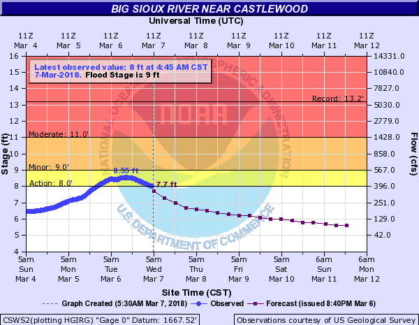
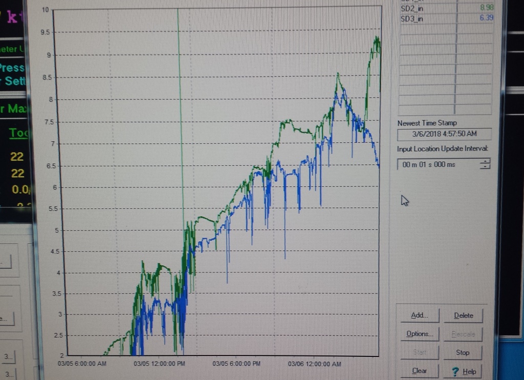
Reports of standing water were common after the event, and there were even issues with some water in basements. Below is a hydrograph of the Big Sioux River near Castlewood, showing the response from the heavy precipitation.
Photos:
 |
 |
 |
 |
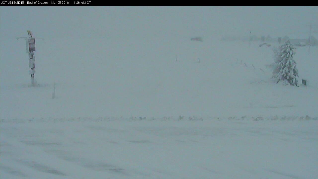
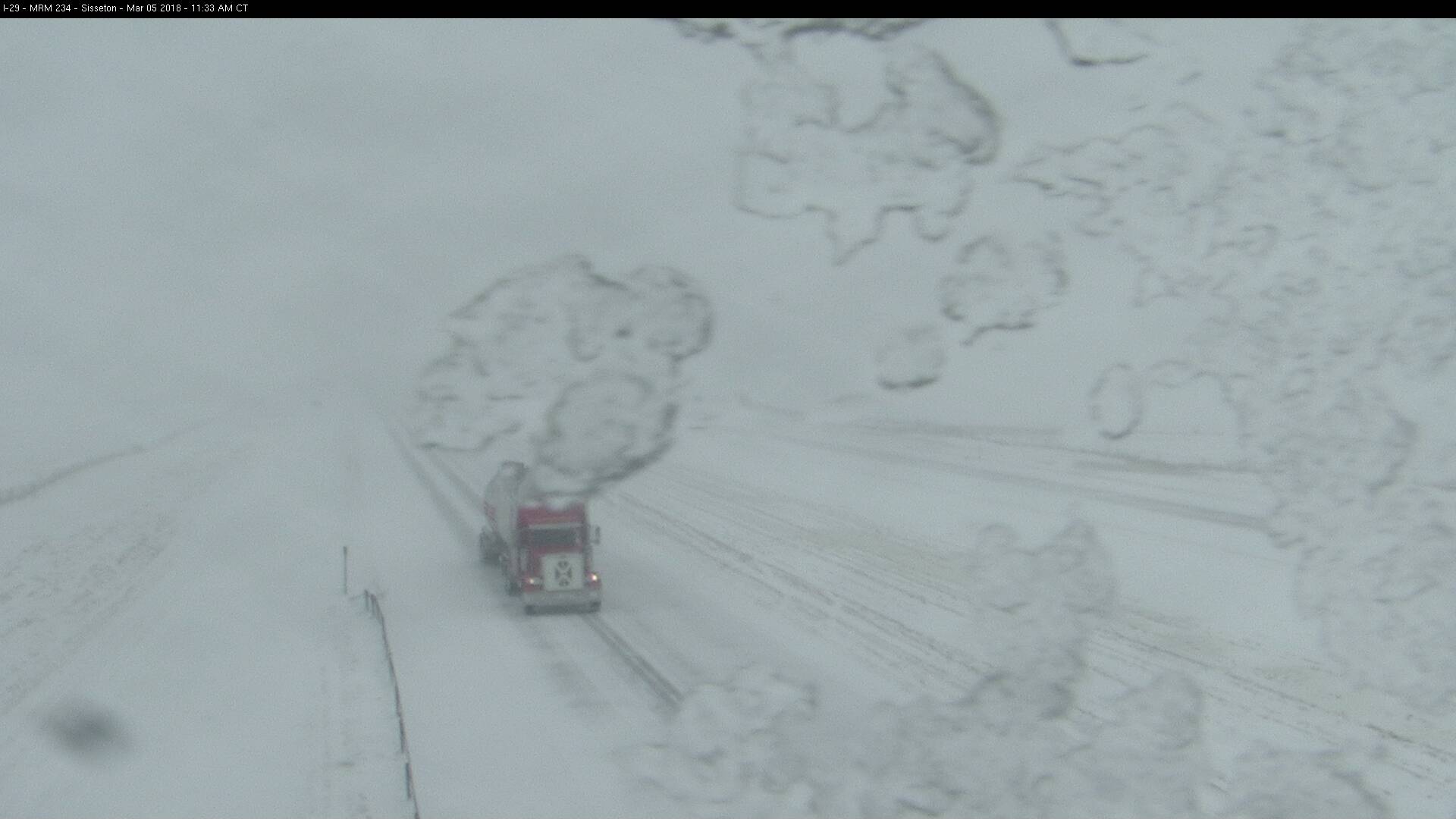
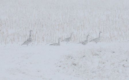
| SDDOT webcam at Craven Corner at 11:00 am March 5th | SDDOT webcam near Sisseton at 11:00 am March 5th | Heavy wet snow near Aberdeen. Photo courtesy of Mike Scott. | Hail at Watertown on Sunday 11:50 PM Sunday, March 4th. Photo courtesy of Josh Peterson. |
 |
 |
 |
 |
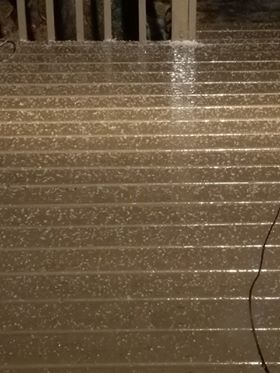
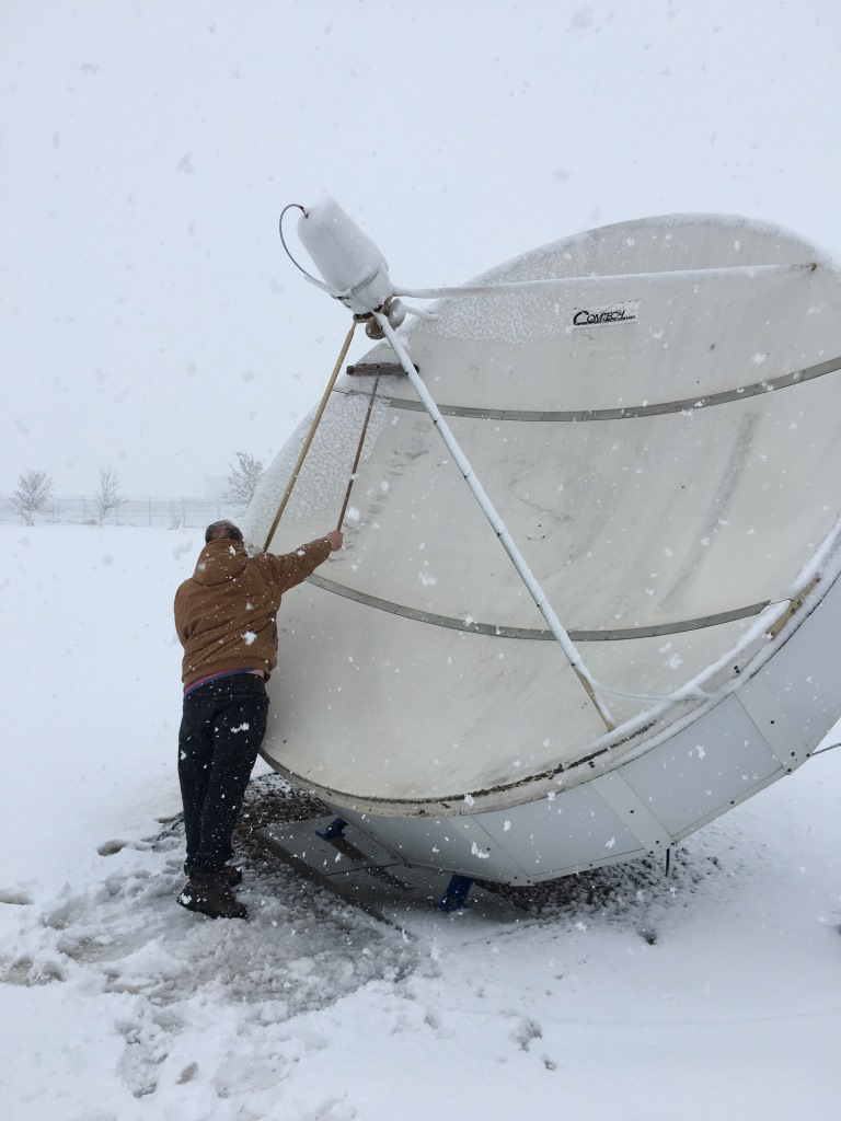
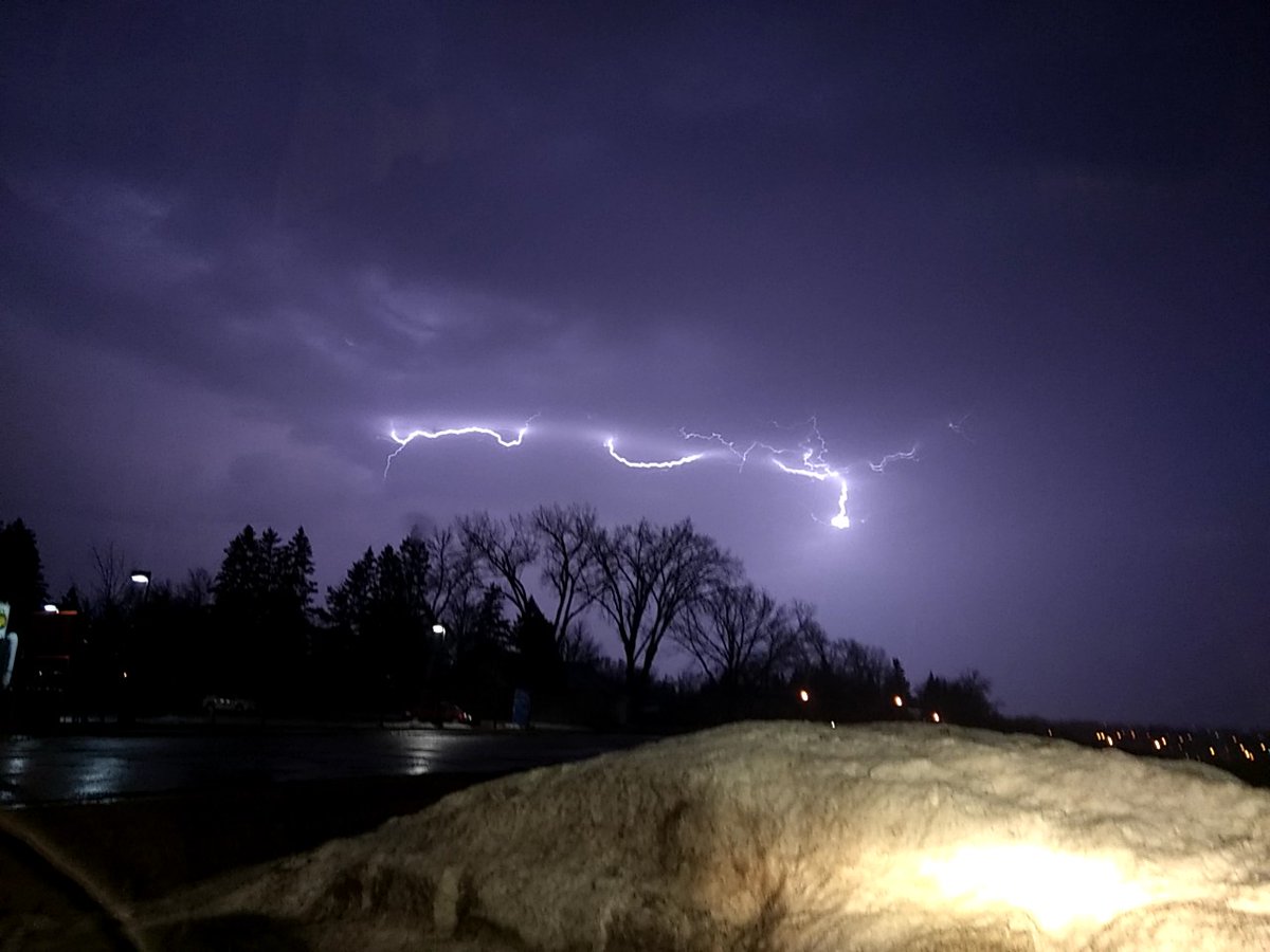
| Snow sensor readings at the Weather Service in Aberdeen over the course of the event | The signal for data ingestion at the Weather Service in Aberdeen was interrupted for a brief time due to snow | Lightning in Watertown on the evening of March 4th, captured by Alex Resel | Hail in Watertown on the evening of March 4th, courtesy of Alex Resel |
 |
 |
 |
 |
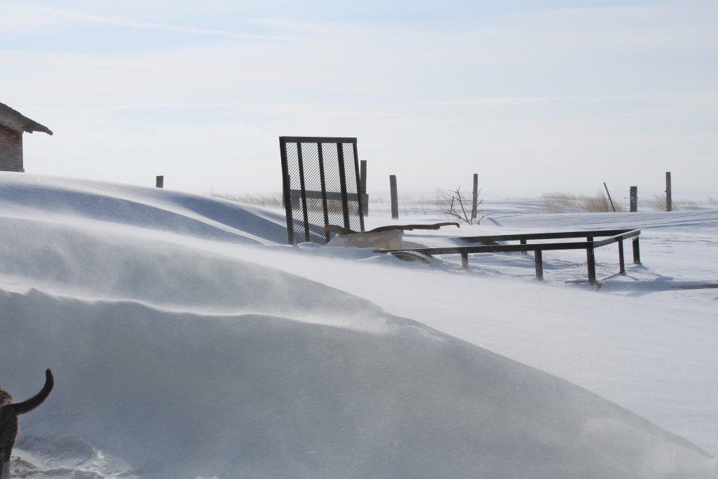
| Snow drifts on March 6th 5 miles N of Tolstoy. Photo: NWS employee | Snow drifts on March 6th 5 miles N of Tolstoy. Photo: NWS employee | Deep snow 2 miles S of Twin Brooks on March 6th, courtesy of Jen Bates | Deep snow 2 miles S of Twin Brooks on March 6th, courtesy of Jen Bates |
 |
 |
 |
 |
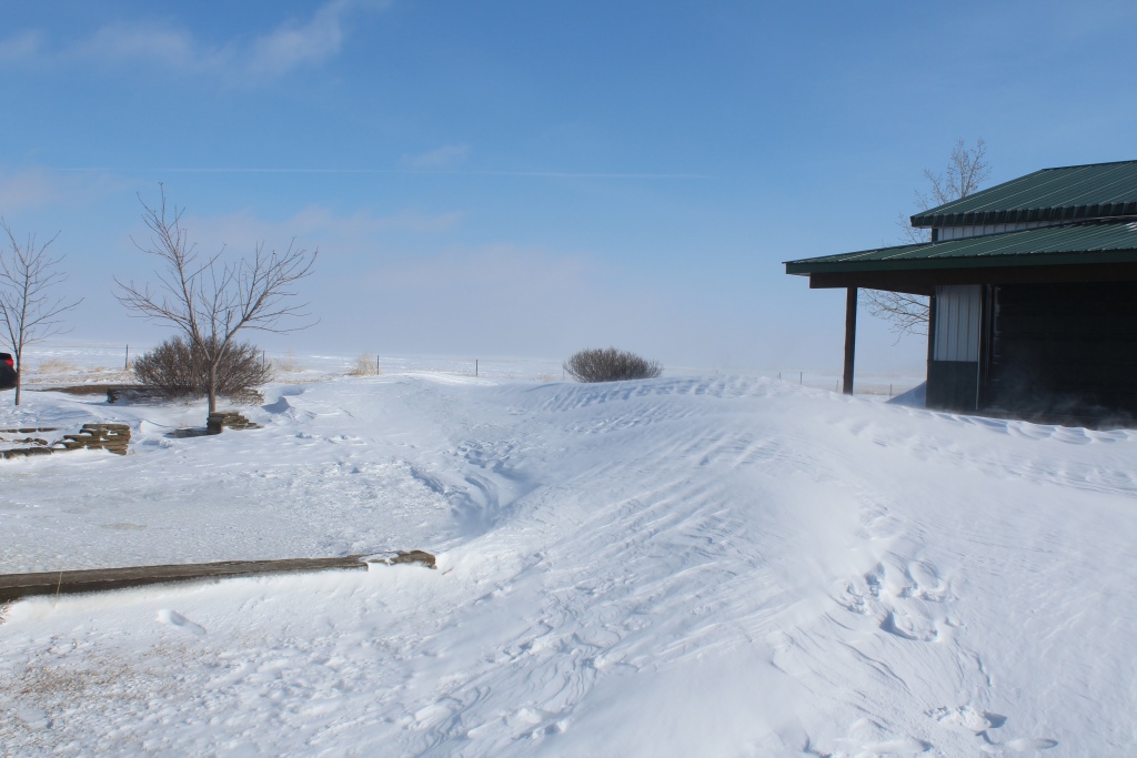
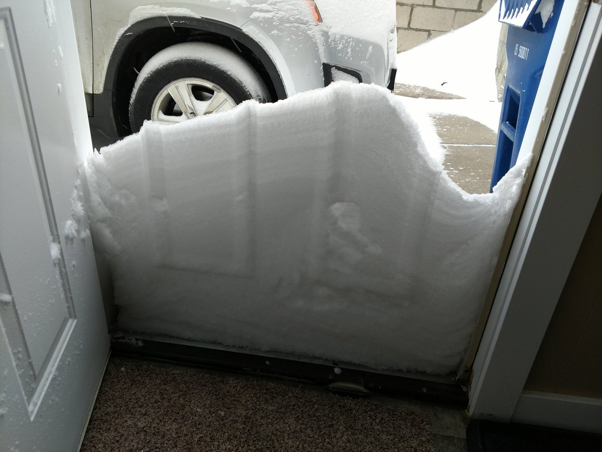
| Heavy snow in Watertown on March 5th, courtesy of Alex Resel | Heavy snow in Watertown on March 5th, courtesy of Alex Resel | Snow drift over an entry way in Pierre on March 6th, courtesy of Brent Nathaniel | Storm aftermath at the State Capital in Pierre, courtesy of Hunter Anderson |
 |
 |
 |
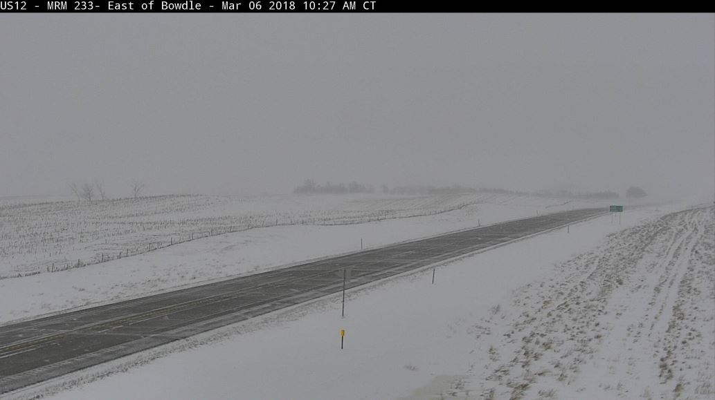 |
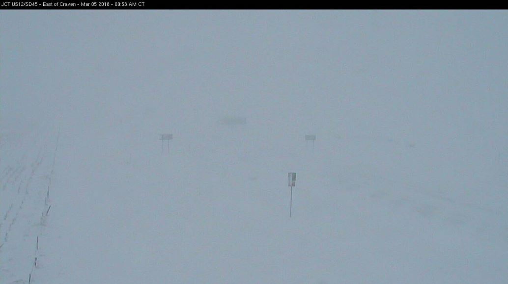
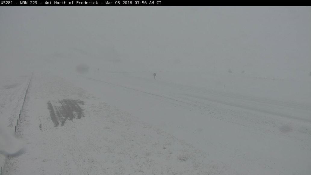
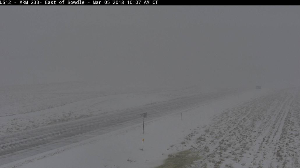
| SDDOT webcam at Craven Corner from 9:53 am on March 5th | SDDOT webcam 7 miles NNW of Frederick from 7:56 am on March 5th | SDDOT webcam at Bowdle from 10:07 am on March 5th | SDDOT webcam at Bowdle from 24 hours later at 10:27 am on March 6th |
 |
 |
 |
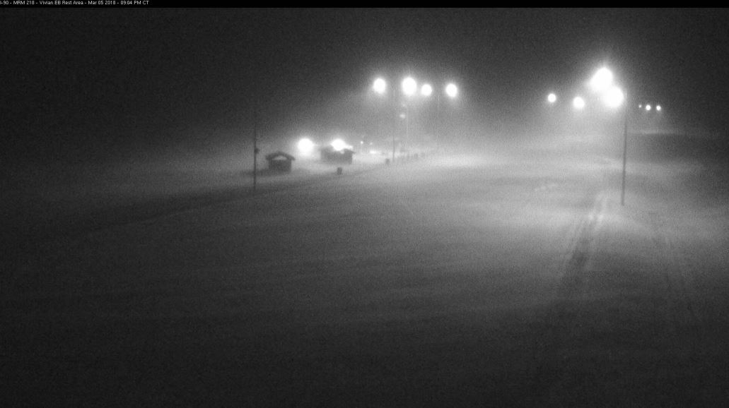 |
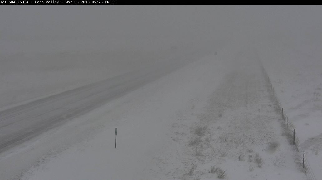
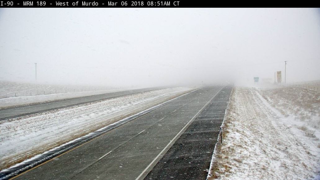
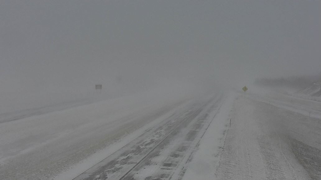
| SDDOT webcam 3 miles N of Gann Valley from 5:30 pm on March 5th | SDDOT webcam 3 miles W of Murdo from 8:51 am on March 6th | SDDOT webcam 3 miles SE of Reliance from 9:30 am on March 5th | SDDOT webcam 5 miles ESE of Vivian from 9:04 pm on March 5th |
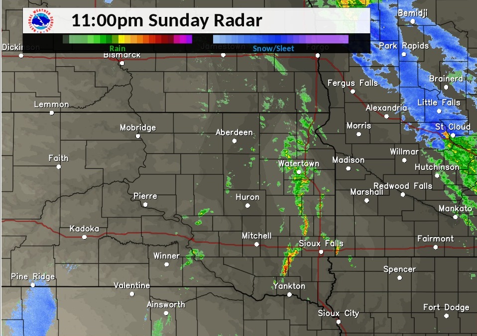
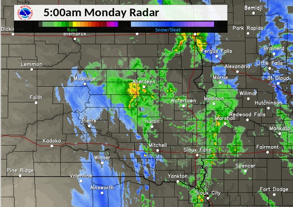
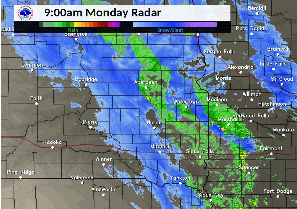
Radar/Satellite:
 |
 |
 |
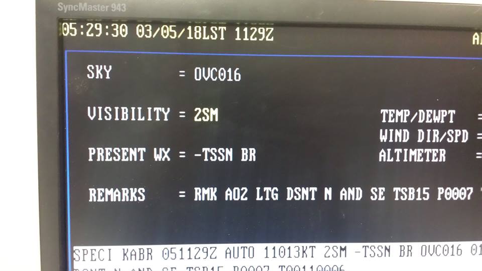 |
| Radar image of thunderstorms in and around Watertown on March 4th | Radar image around the time of thundersnow across parts of northeastern South Dakota on March 5th (image shows too much rain) | Radar image as rain had turned over to snow across most areas (image shows too much rain) | "TSSN" is the code for thundersnow, as reported by the Aberdeen automated observing at 5:30 am March 5th |
 |
 |
 |
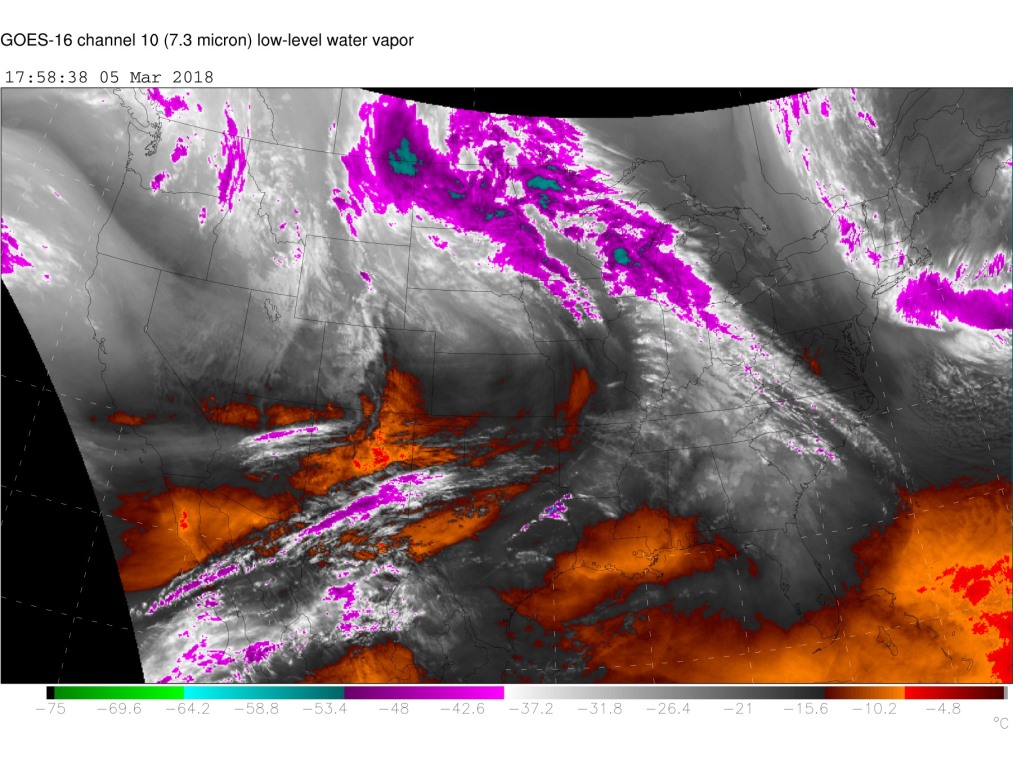 |
| Radar image of heavy snow as it continues wrapping around a strong and stalled area of low pressure | Radar image of snow regrouping heading into nightfall on March 5th | Radar image of snow building back across central South Dakota on early morning of March 6th. | Water Vapor satellite imagery at noon on March 5th |
 |
 |
 |
|
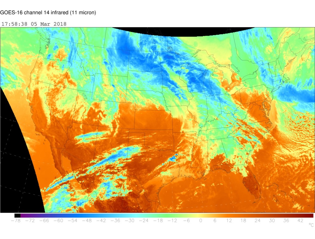
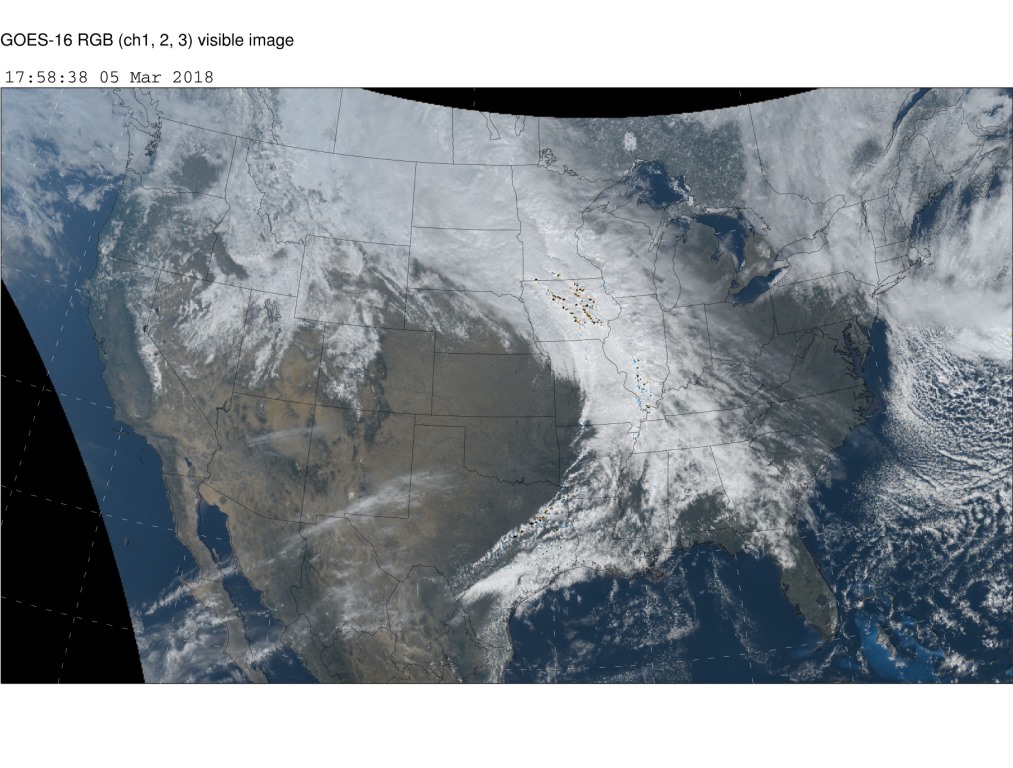
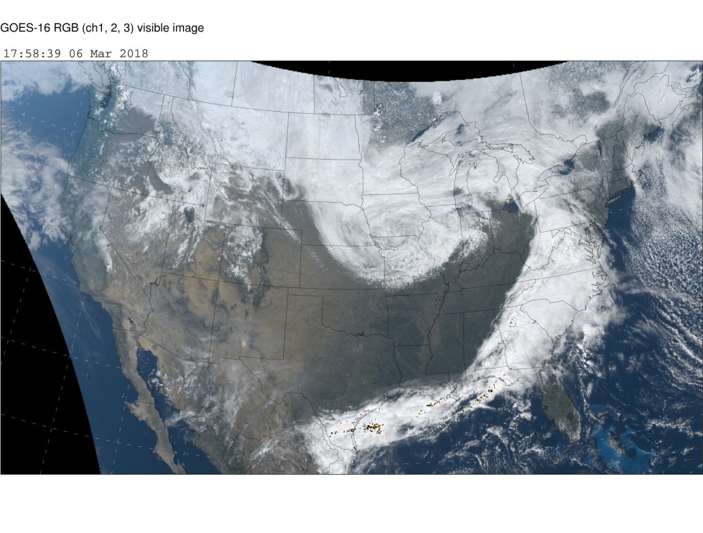
| Infrared satellite imagery at noon on March 5th | Visible satellite imagery at noon on March 5th | Visible satellite imagery 24 hours later at noon on March 6th |
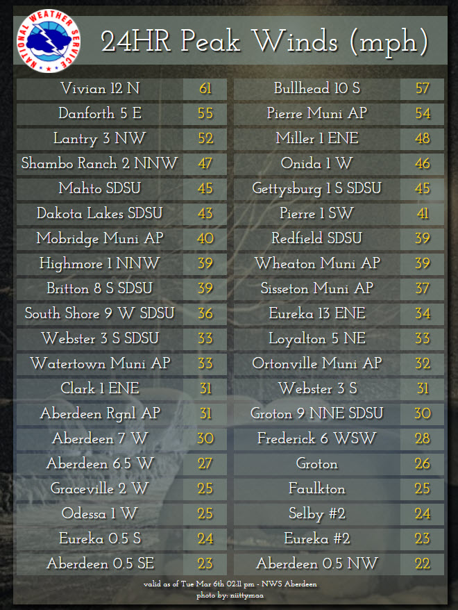
Peak Wind Reports
Peak wind gusts from March 5th. Blizzard conditions were widespread on the 5th across central South Dakota as a result. Amazingly, the automated observing station at the Pierre Airport recorded quarter mile visibility or less from 8 am to 11 pm with only a minor break.
 |
Media use of NWS Web News Stories is encouraged! Please acknowledge the NWS as the source of any news information accessed from this site. |
|