
Wildfire smoke continues to impact air quality from the Great Lakes region into New England and the Mid-Atlantic today with widespread Air Quality Alerts in effect. Severe thunderstorms are expected across portions of the Ohio Valley and Lower Great Lakes into the Mid-Atlantic and Northeast, this afternoon into the evening. Monsoonal thunderstorms may bring areas of flooding to the Southwest. Read More >
Overview
|
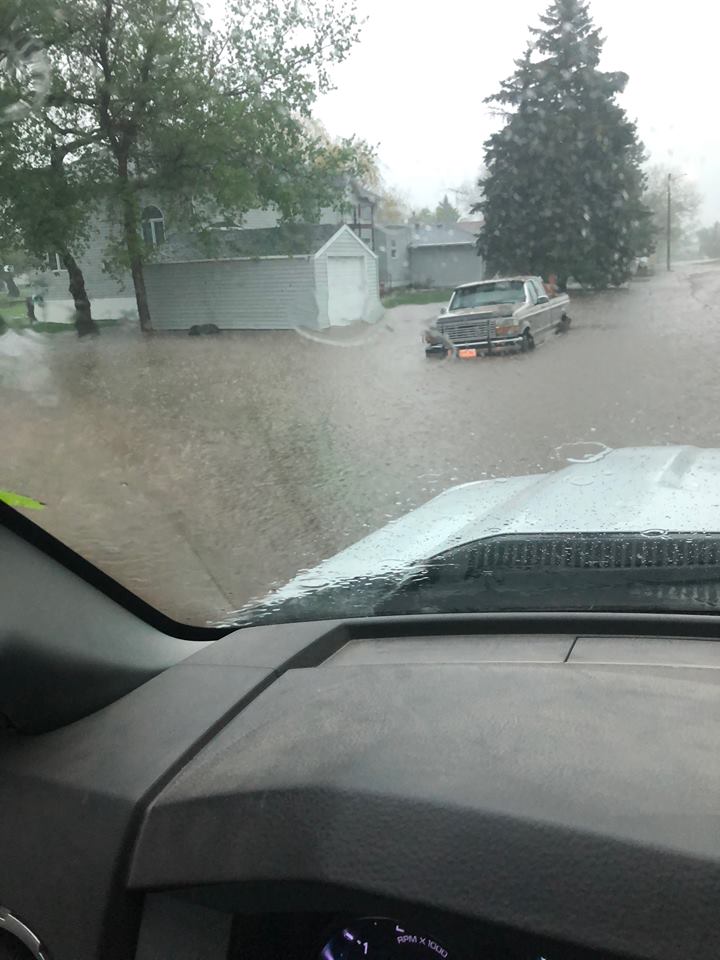
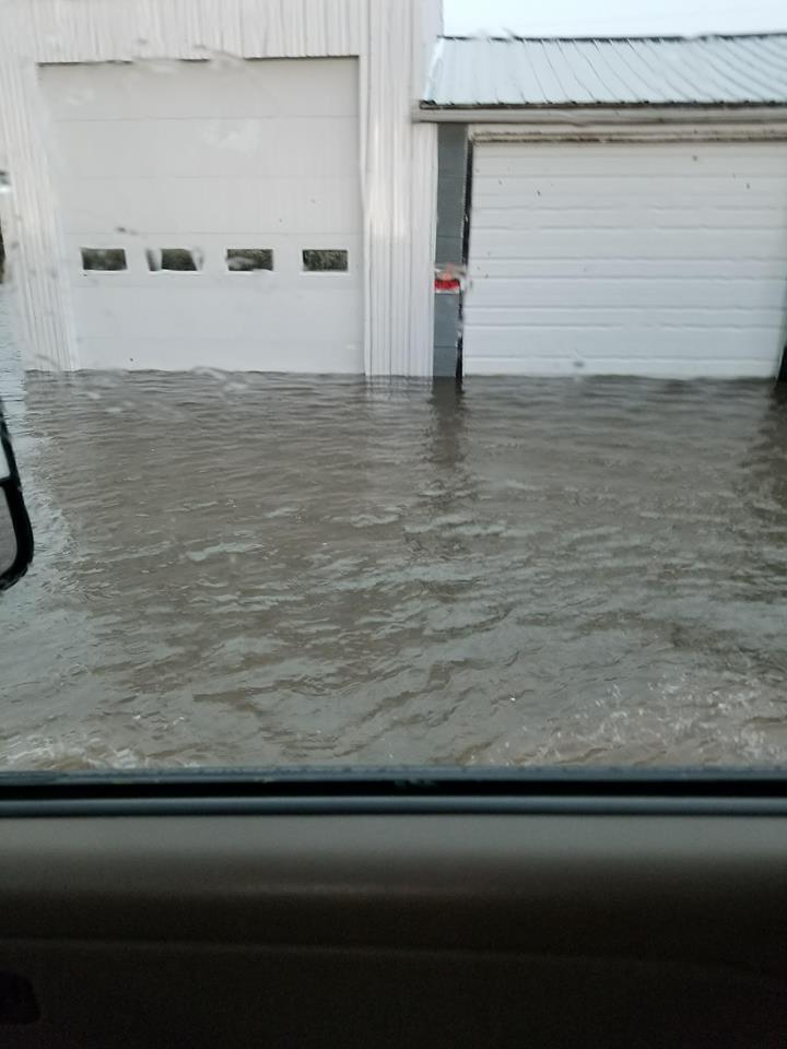
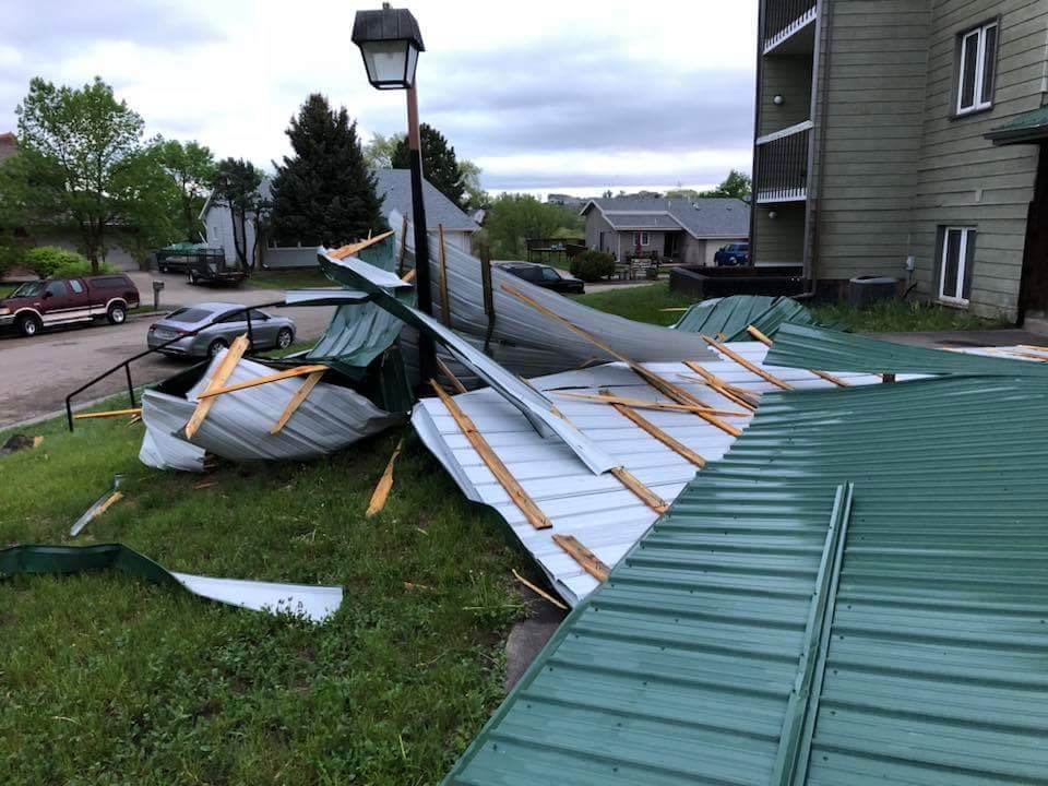
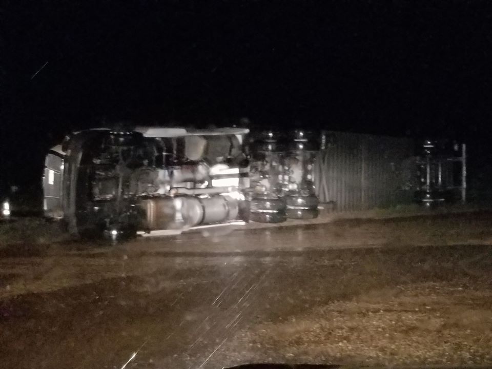
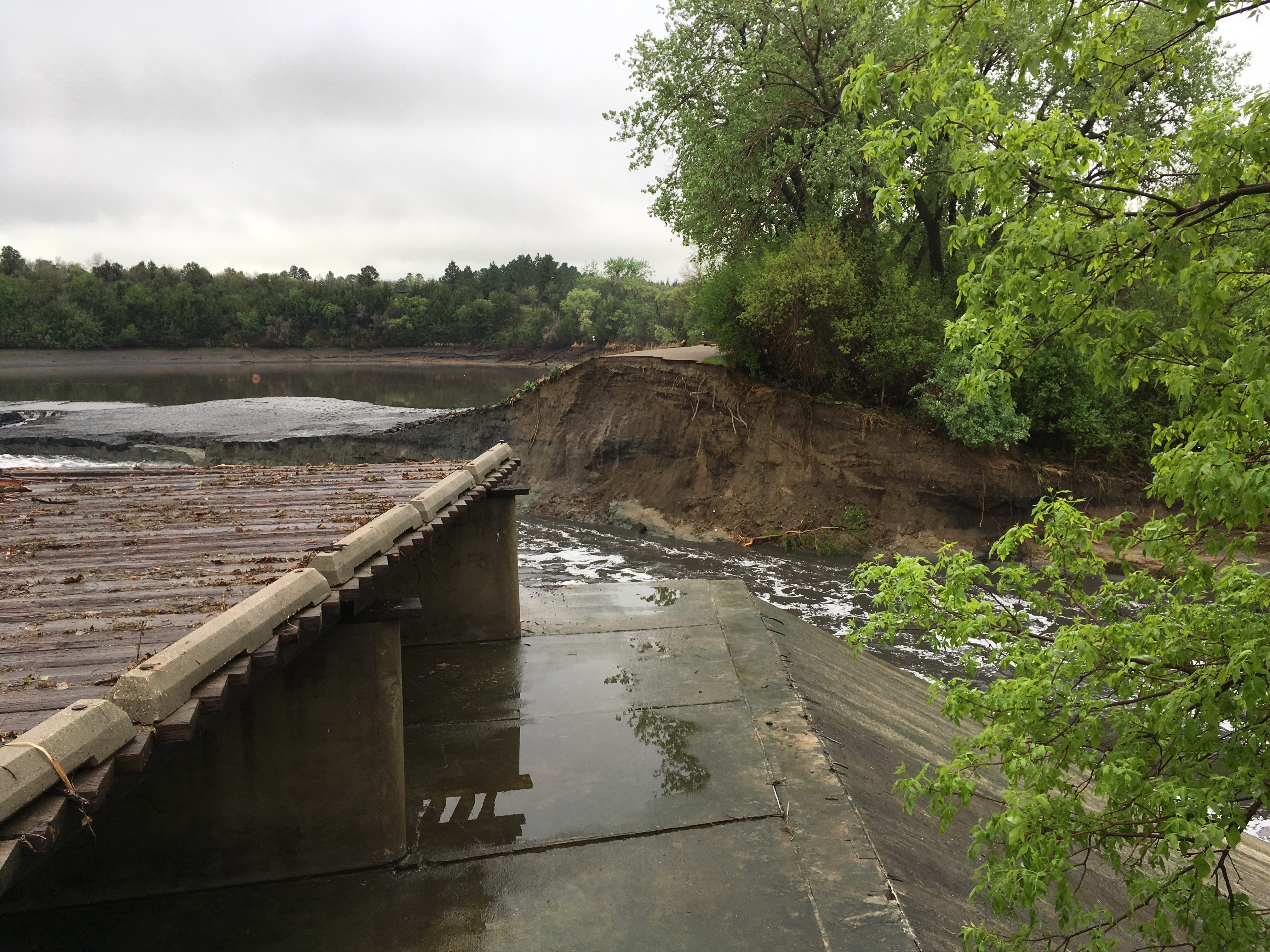
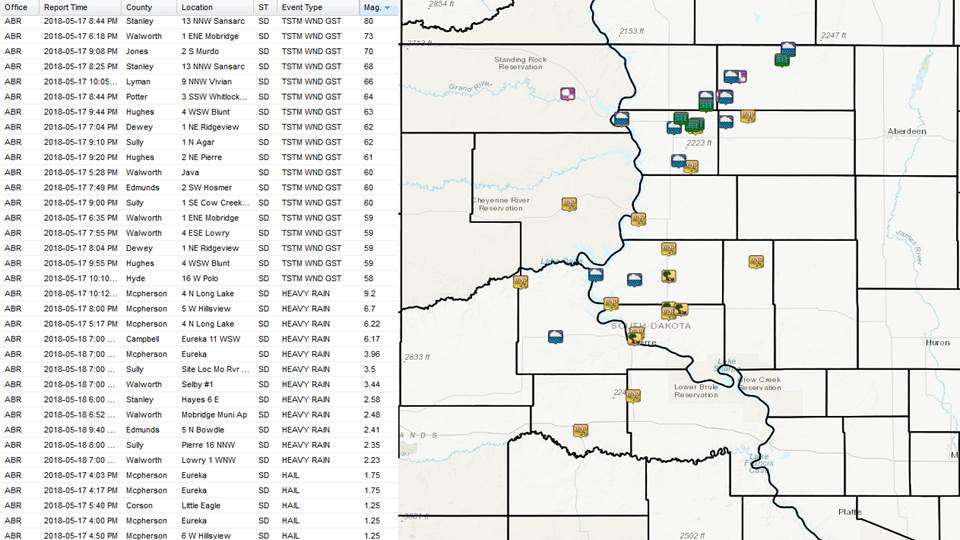
On May 17th, 2018 storms initially formed along a boundary across parts of north central South Dakota. The slow moving storms trained along this boundary and produced significant flooding, large hail and gusty winds. Anywhere from 4 to 9 inches of rain has been estimated along a line extending from Selby, SD to Long Lake, SD. Many roads were over topped with water and barricades were setup. Several reports of basement flooding were noted. Additional wind producing storms developed over western South Dakota and moved along the I-90/Pierre area. Wind gusts ranging from 60 to 80 mph were reported. Damage included a semi truck tipped over, sheet metal blown off roofs and significant tree damage. The heavy rain also aided in the failure of the Hiddenwood Dam at Hiddenwood State Park about 4 miles northeast of Selby, SD during the early morning hours of May 18th, 2018. Water from that break resulted in significant overland flooding and many county and secondary roads went under water. |
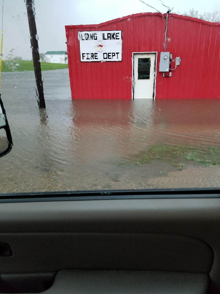 Flooding in Long Lake, SD. Photo courtesy of Sandy Chapman. |
Photos & Video:
Header
 |
 |
 |
 |
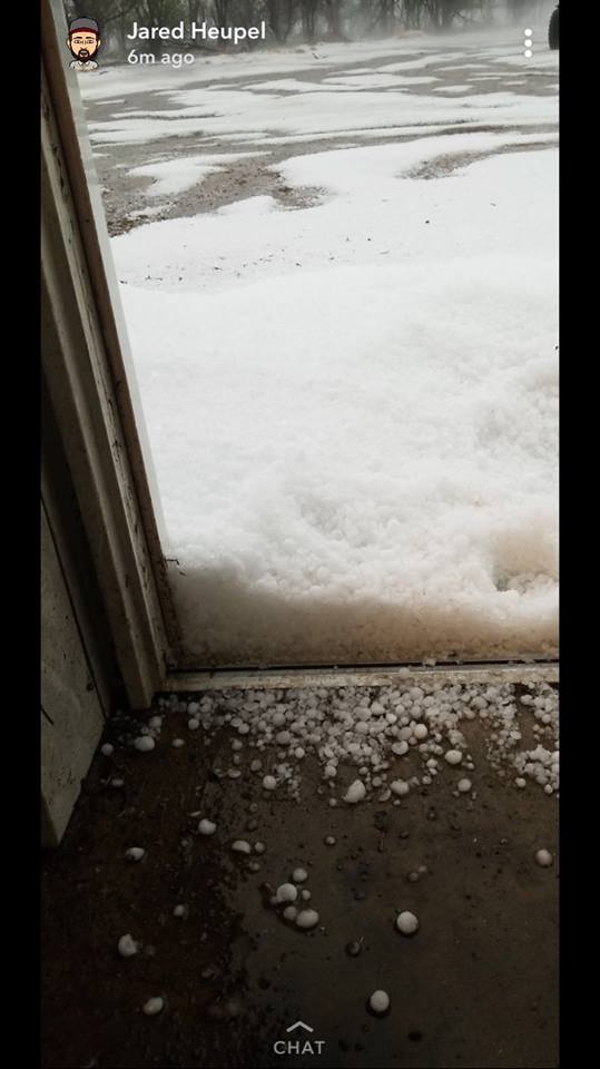
| Golfball Size Hail in Eureka, SD Courtesy of Keith Kramlich |
Floding in Eureka, SD Courtesy of Keith Kramlich |
Flooding in Long Lake, SD Courtesy of Sandy Chapman |
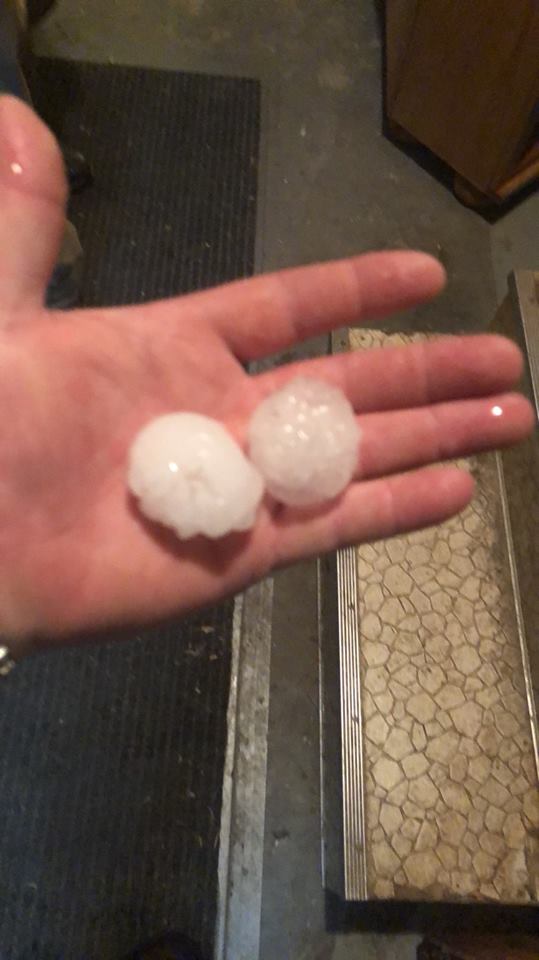
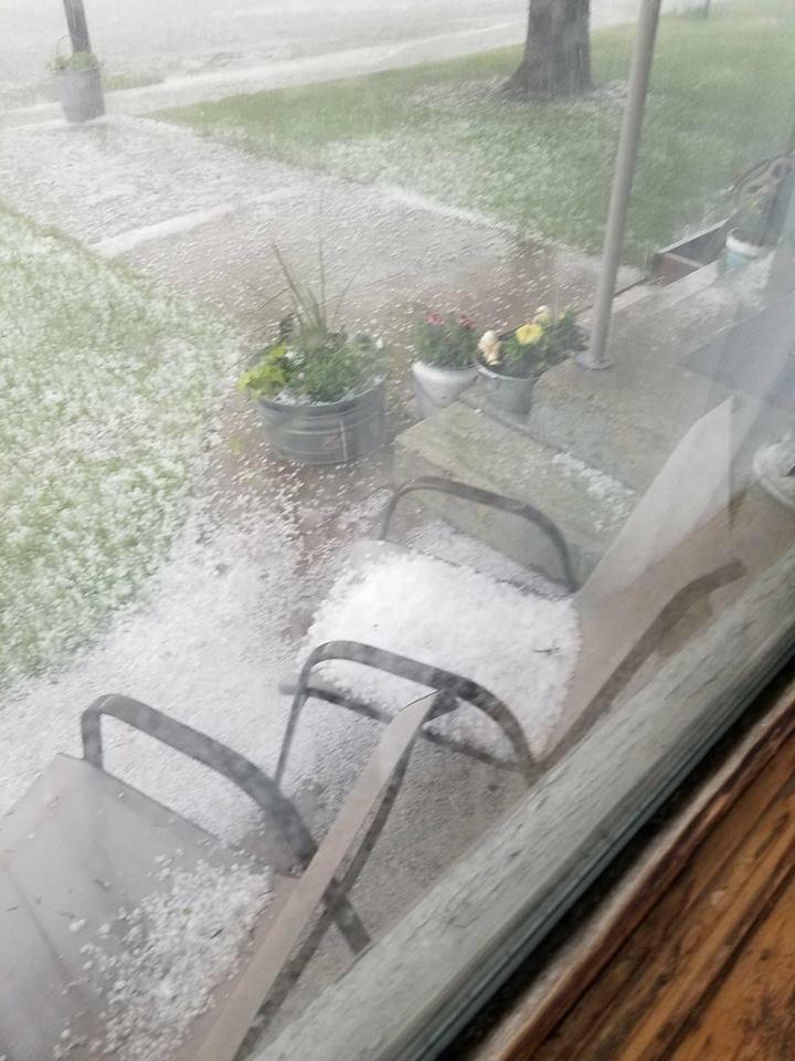
Hail in Long Lake, SD Courtesy of Sandy Chapman |
 |
 |
 |
 |
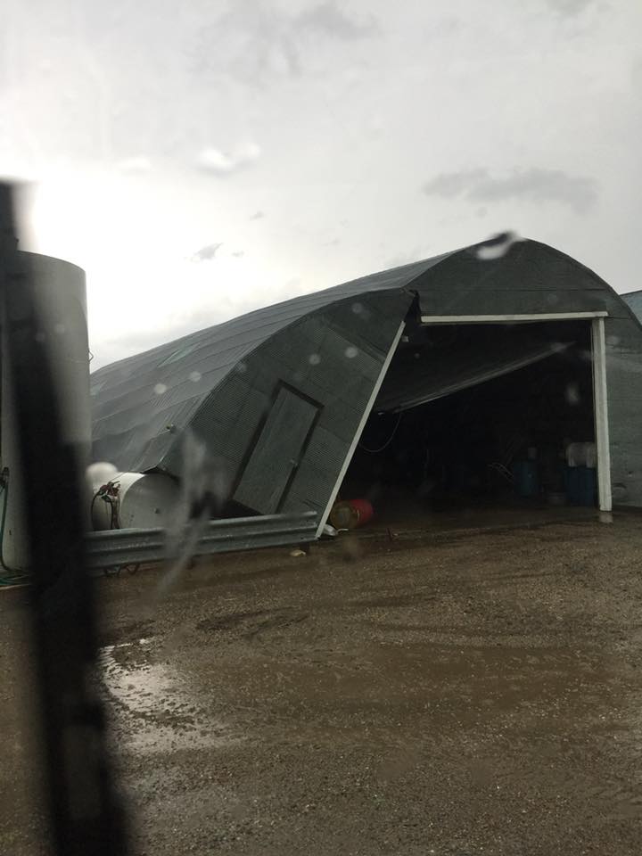
| Wind Damage North of Eureka, SD Courtesy of Eric Odenbach |
Wind Damage North of Eureka, SD Courtesy of Eric Odenbach |
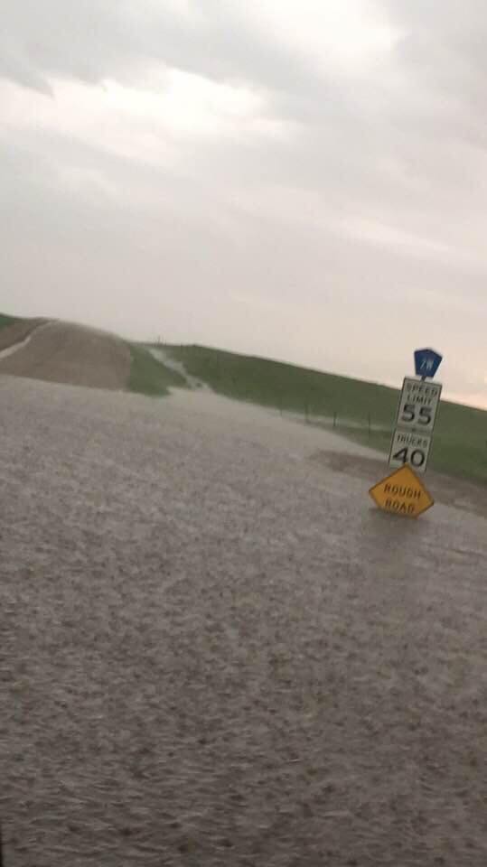
Flooding 15 Miles NE of Java, SD Courtesy of Ashley Schaefer |
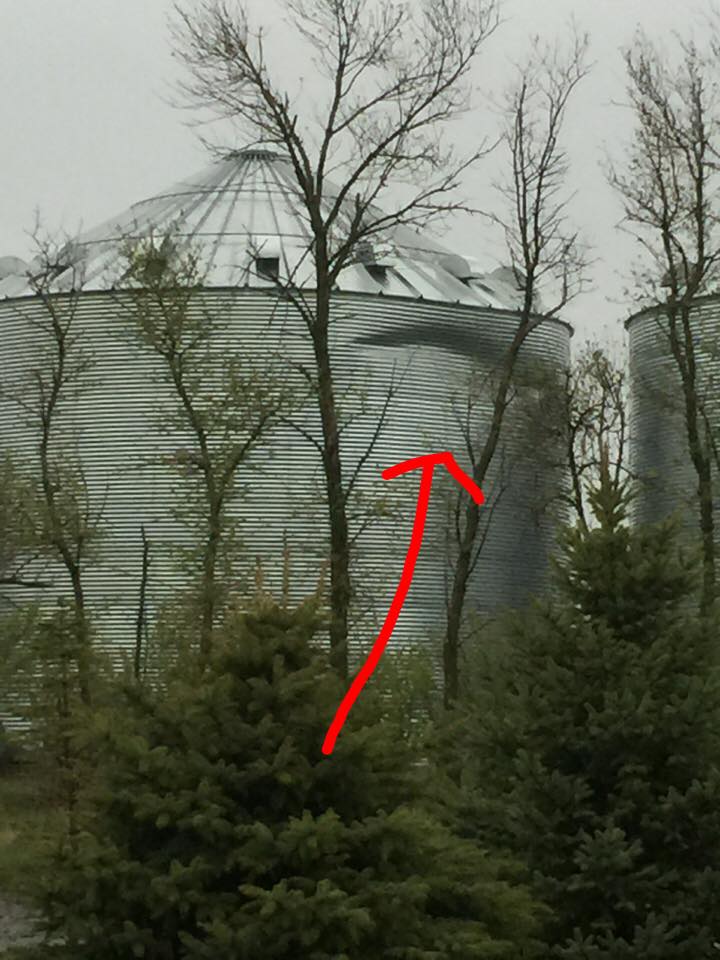
Wind Damage near Onida, SD Courtesy of KCCR Pierre |
 |
 |
 |
.JPG) |
| Wind Damage in Pierre, SD Courtesy of Leahandra Maria Ashley |
Wind Damage near Onida, SD Courtesy of KCCR Pierre |
Hiddenwood Dam Break Courtesy of Walworth County Sheriff |
Hiddenwood Dam Break Courtesy of Walworth County Sheriff |
Storm Reports
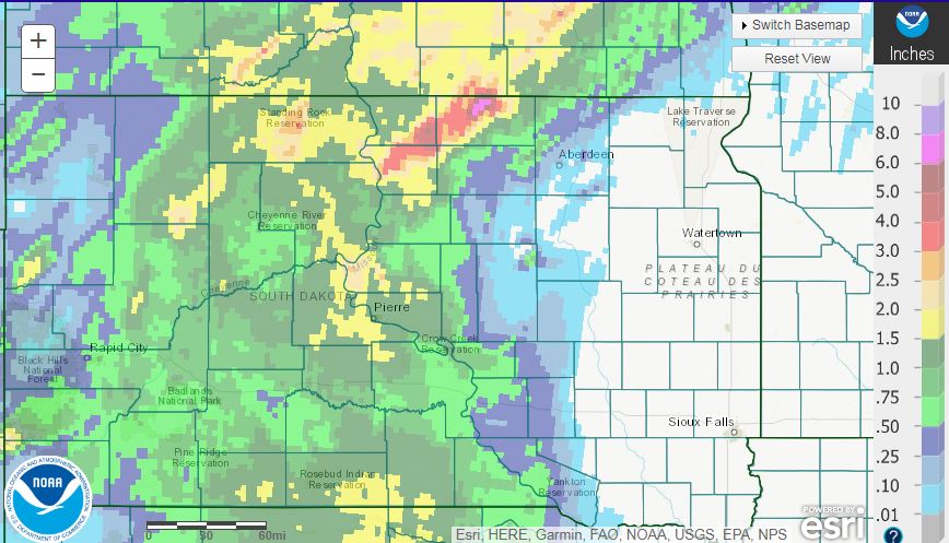
Radar estimated rainfall totals from https://water.weather.gov/precip/. Some of the more extreme measured totals range from 9 to 13+ inches of rain within 24 hours near the Long Lake, SD area.
 |
Media use of NWS Web News Stories is encouraged! Please acknowledge the NWS as the source of any news information accessed from this site. |
|

