Severe thunderstorms capable of large hail and damaging wind gusts appear possible over the central and southern High Plains and eastern Kansas into Missouri Friday afternoon and evening. Rounds of storms Friday ahead of a slow moving frontal boundary will bring locally heavy rainfall and scattered flash flooding potential to the Mid-Mississippi, Ohio, and Tennessee Valleys, and the Appalachians. Read More >
Overview
|
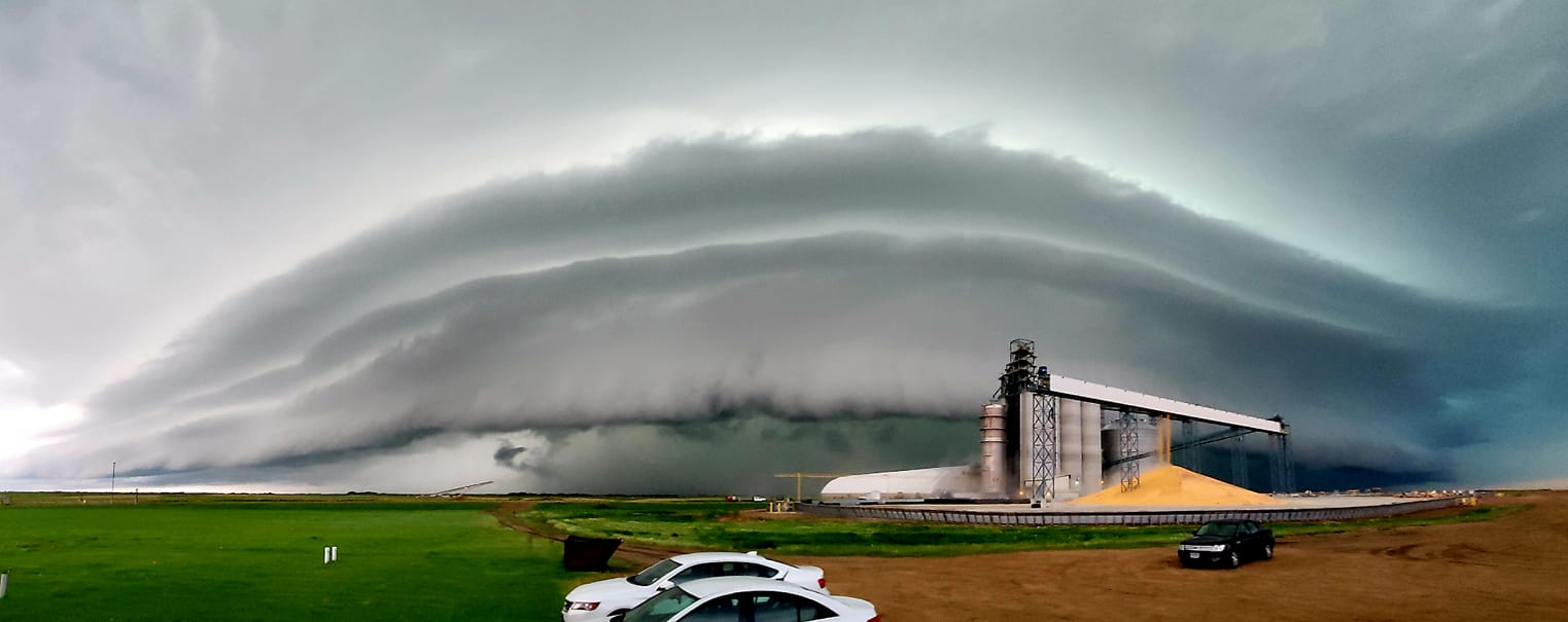
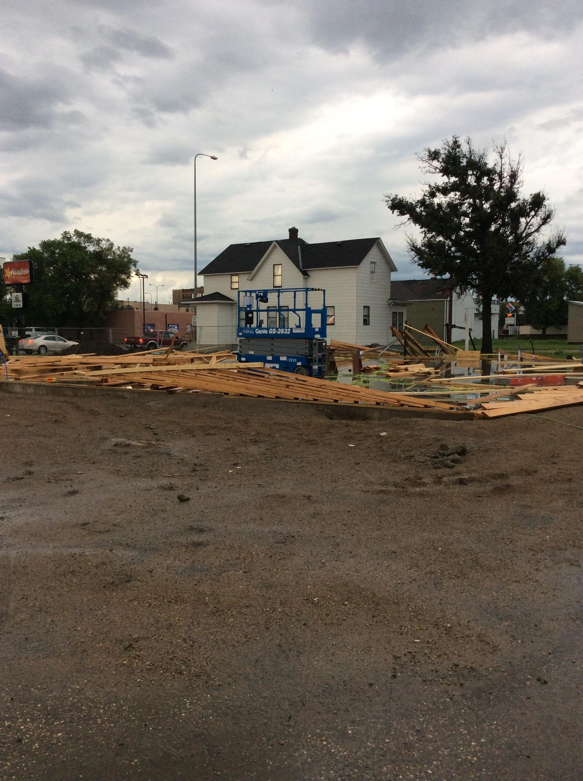
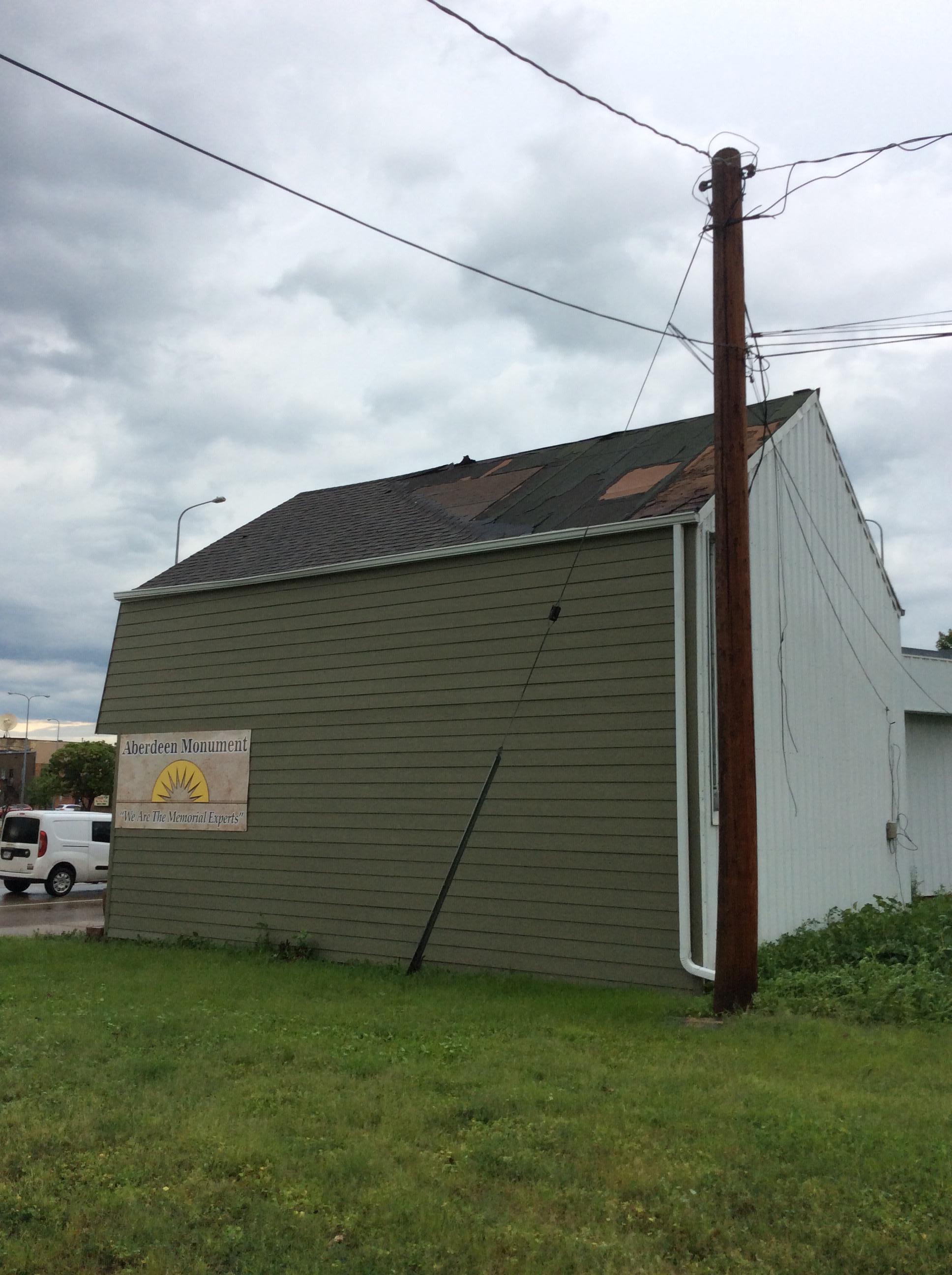
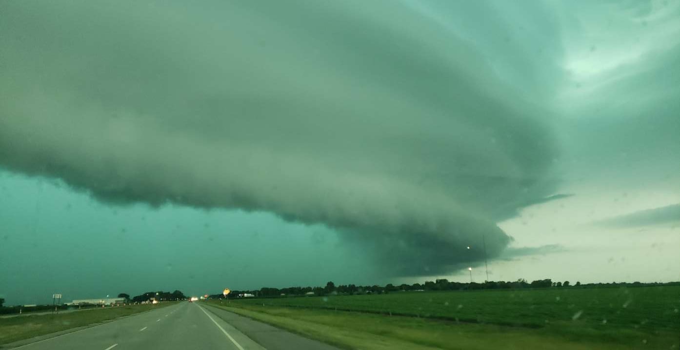
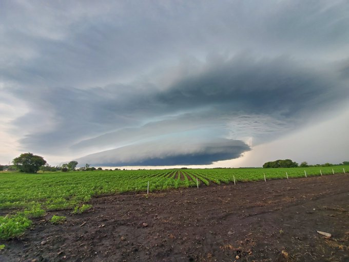
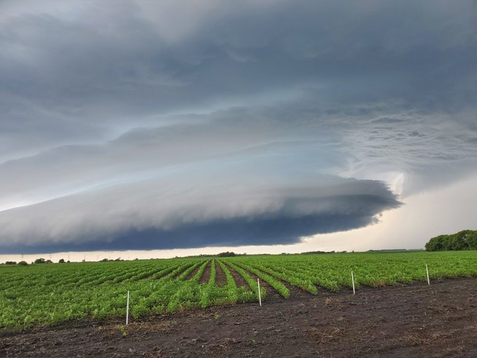
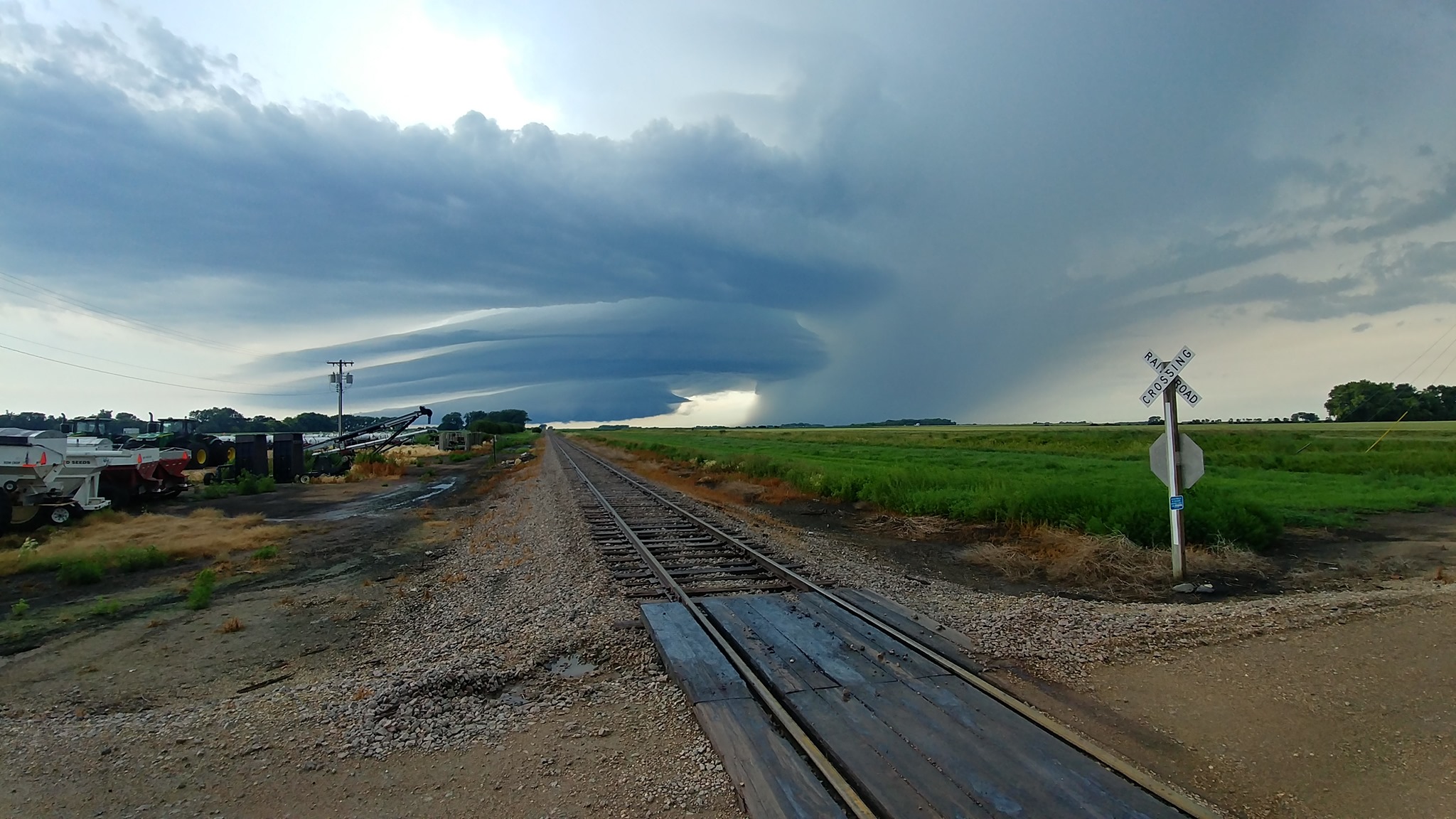
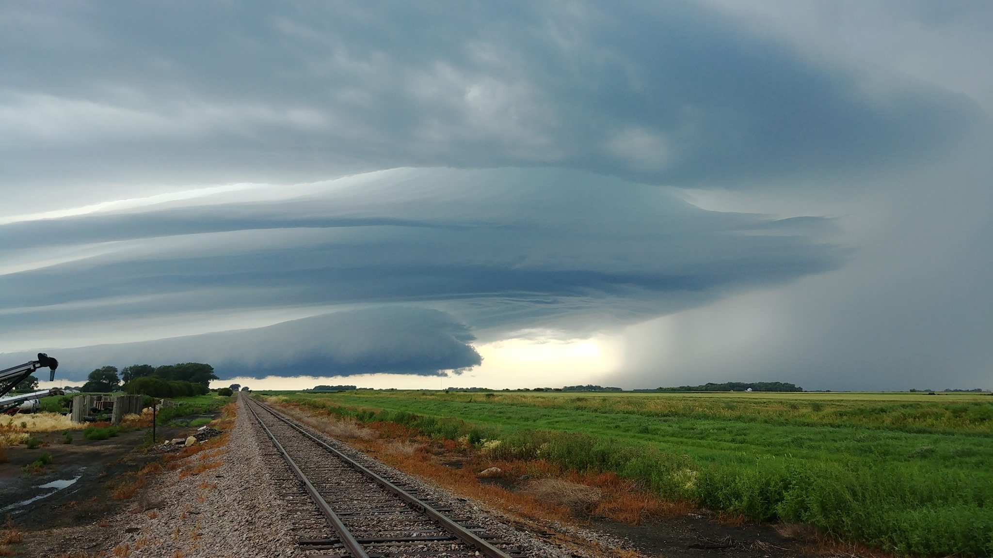
Storms developed over northwest South Dakota during the early morning hours of July 19, 2019 and tracked eastward, persisting all the way across northern South Dakota and into west central Minnesota. The storms were prolific wind producers with wind speeds anywhere from 59 to 79 mph recorded by weather instruments. Many reports of tree damage, roof damage and structural damage occurred in the storms path. In Aberdeen, SD a localized area of intense winds occurred on the southwest side of town, near the intersection of 6th Ave and S 2nd St. A store marquee sign was torn down and pieces tossed a block away, framing for new construction was flattened, and significant shingle damage occurred. Eye witnesses noted some rotation as debris was lofted into the air. This may have been cause by a 'gustnado'. A gustnado is a small, whirlwind which typically forms on the leading edge of a straight-line wind producing thunderstorm. Gustnadoes do not connect with the cloud-base and therefore are not considered tornadoes, but instead are classified as thunderstorm wind events. Based off damage, winds in this small area of Aberdeen were likely in the 80-90 mph range. The automated weather station at the Aberdeen Airport recorded 79 mph winds. Storms transitioned from linear, wind producing storms to single cell rotating storms, or supercell storms, as they moved over west central MN. Hail and funnel clouds were reported in Traverse county. |
Photo Courtesy of Michelle Johnson |
Wind:
Photos
 |
 |
 |
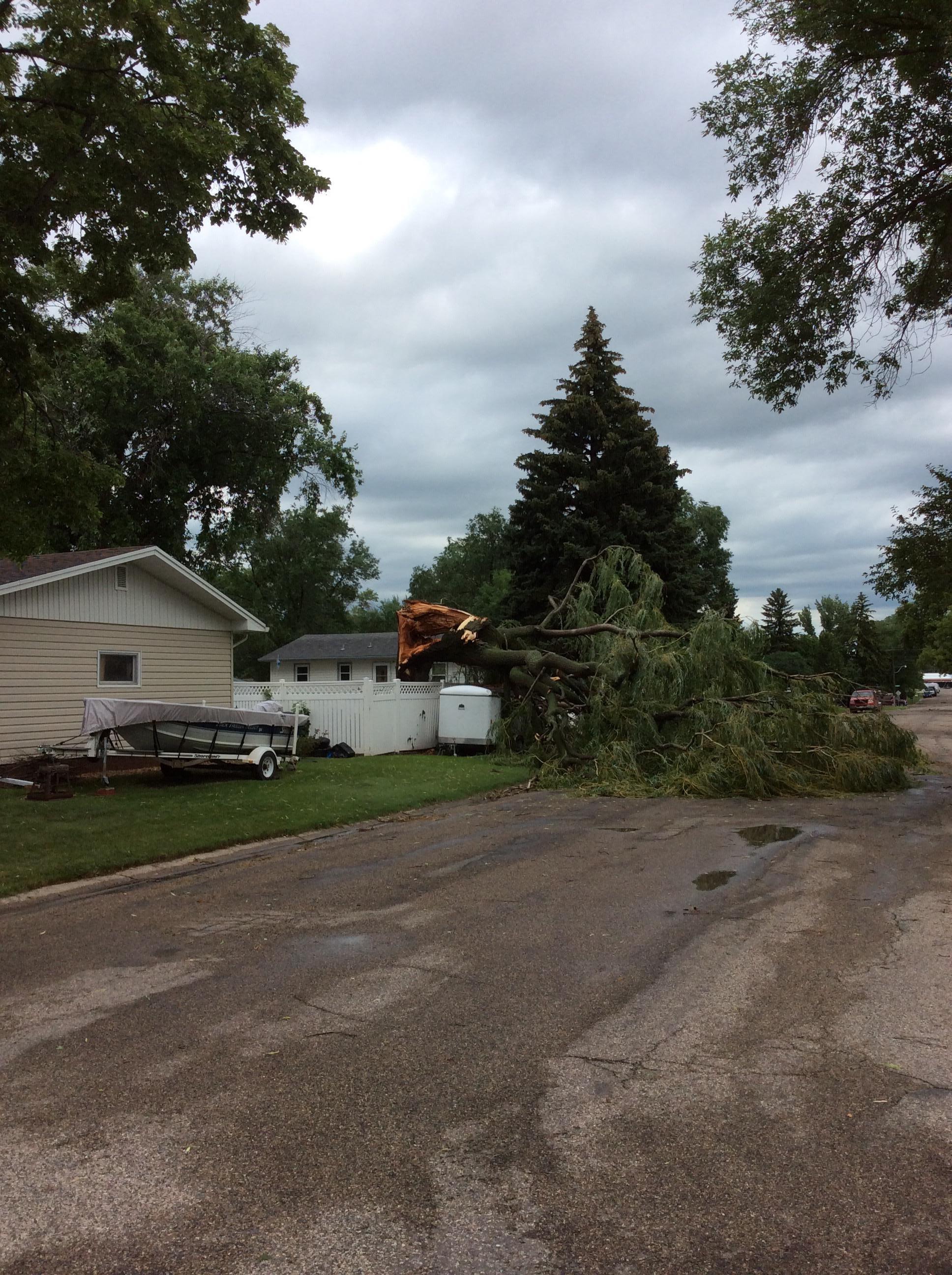 |
| Business Marquee Sign Damage in Aberdeen, SD. Photo Credit: NWS Aberdeen. | New Construction Flattened in Aberdeen, SD. Photo Credit: NWS Aberdeen. | Shingle Damage in Aberdeen, SD. Photo Credit: NWS Aberdeen. | Tree Damage in Aberdeen, SD. Photo Credit: NWS Aberdeen. |
 |
 |
 |
 |
| Outbuilding Damage Near Tolstoy, SD. Photo Credit: NWS Aberdeen Employee. | Shelf Cloud at Mina Lake, SD. Photo Credit: NWS Aberdeen Employee. | Shelf Cloud at NWS Aberdeen at 835am. Photo Credit: NWS Aberdeen. | Shelf Cloud at NWS Aberdeen at 838am. Photo Credit: NWS Aberdeen. |
 |
 |
 |
 |
| Window destroyed by blowing gravel. Photo Credit: NWS Aberdeen Employee | Shelf cloud as it approached Groton. Photo Credit: Tanya Johnson | Shelf cloud captured by Dee Archambeau | Damage in Aberdeen, captured by Candace Rohrbach |
 |
 |
 |
 |
| Supercell storm structure near Graceville, MN. Photo Credit: Jason Bednar. | Supercell storm structure near Graceville, MN. Photo Credit: Jason Bednar. | Supercell storm structure at Chokio, MN at 1122am. Photo Credit: Roland Jurgens | Supercell storm structure at Chokio, MN at 1122am. Photo Credit: Roland Jurgens |
Radar
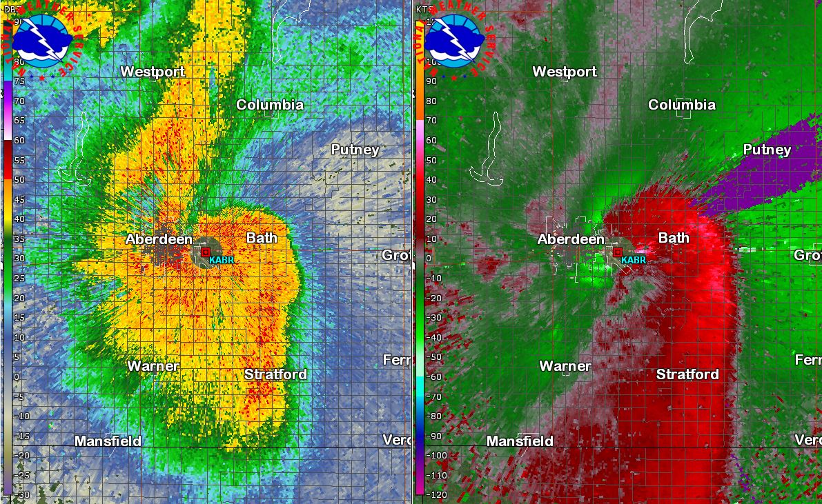
Radar loop of thunderstorms as they track across northern South Dakota and west central Minnesota on July 19, 2019, along with a snapshot of the radar reflectivity and velocity at 847am, the time of the measured 78 mph winds at the Aberdeen Airport.
Storm Reports
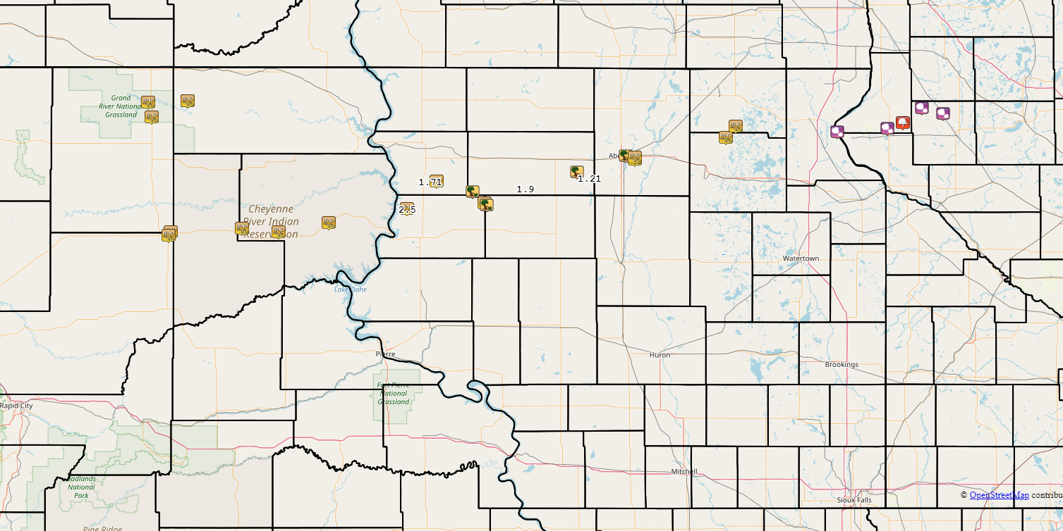
For a complete list of storm reports visit: https://mesonet.agron.iastate.edu/lsr/#ABR/201907190500/201907191700/0101
 |
Media use of NWS Web News Stories is encouraged! Please acknowledge the NWS as the source of any news information accessed from this site. |
|