Tropical system in the Gulf expected to gradually strengthen the next couple of days off the Florida Panhandle and Alabama coasts. Instances of flash flooding will be possible through Thursday along the eastern and central Gulf Coast. Severe thunderstorms will develop and move along a cold front crossing the Upper Midwest, and through the Ohio Valley/Mid-Atlantic on Tuesday. Read More >
Overview
|
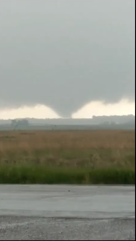
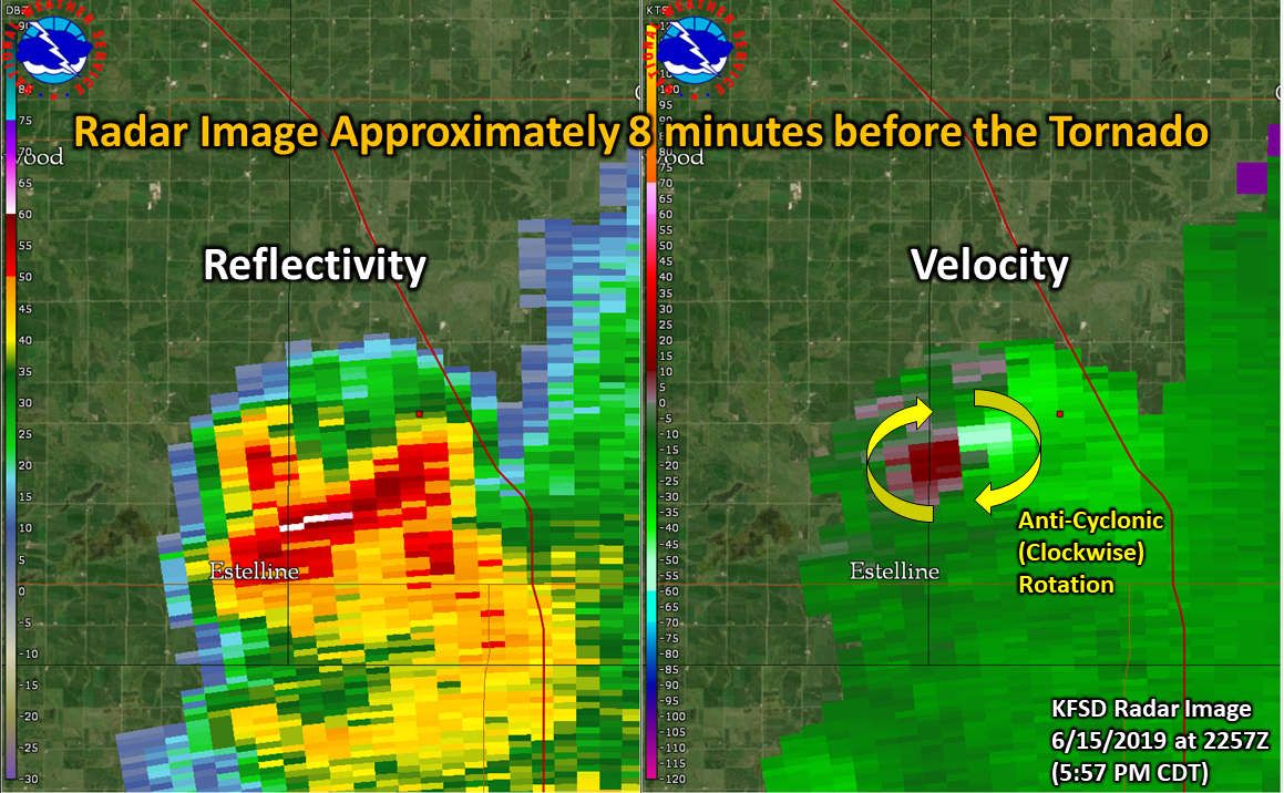
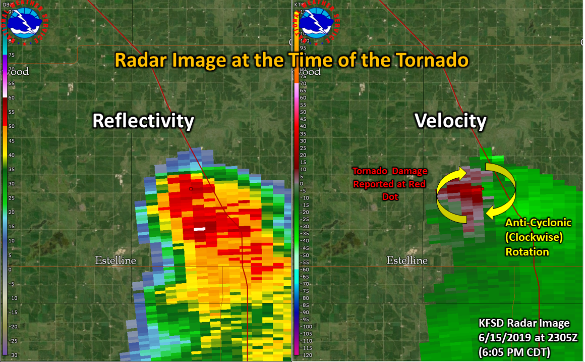
During the evening of June 15, 2019, a brief tornado occurred 5.5 miles to the northeast of Estelline, SD. The tornado lasted less than a minute (at around 6:05 PM CDT) and knocked down 7 trees at a farmstead. The tornado was moving in an easterly direction and the tornado tossed tree branches to the south and west from the group of trees that were knocked down. One of the trees hit the corner of a shed and bent part of the metal overhang on the shed. Based off radar data, damage report, and a Facebook video, the tornado that occurred northeast of Estelline appears to be a very rare "anticyclonic" tornado, which means that it was rotating in a clockwise direction. In the Northern Hemisphere, nearly all of the tornadoes that occur rotate in a counter-clockwise ("cyclonic") direction and estimates indicate that maybe only 1% of tornadoes are anticyclonic like the one that occurred on June 15th. This storm split off from the parent thunderstorm and moved easterly, while the parent storm continued to the southeast. Meteorologists define these types of storms as "left moving" since they move to the left of the storm that they split from. |
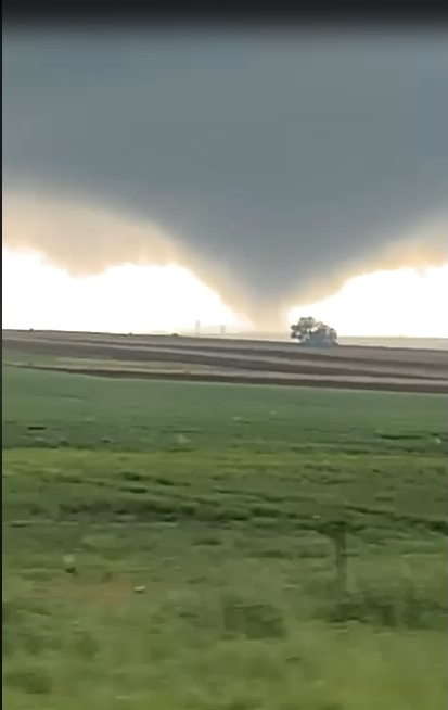 Screenshot from Facebook video by Sean and Kathy Lesnar |
Tornadoes
|
Tornado - 5.5 miles northeast of Estelline, SD
Track Map 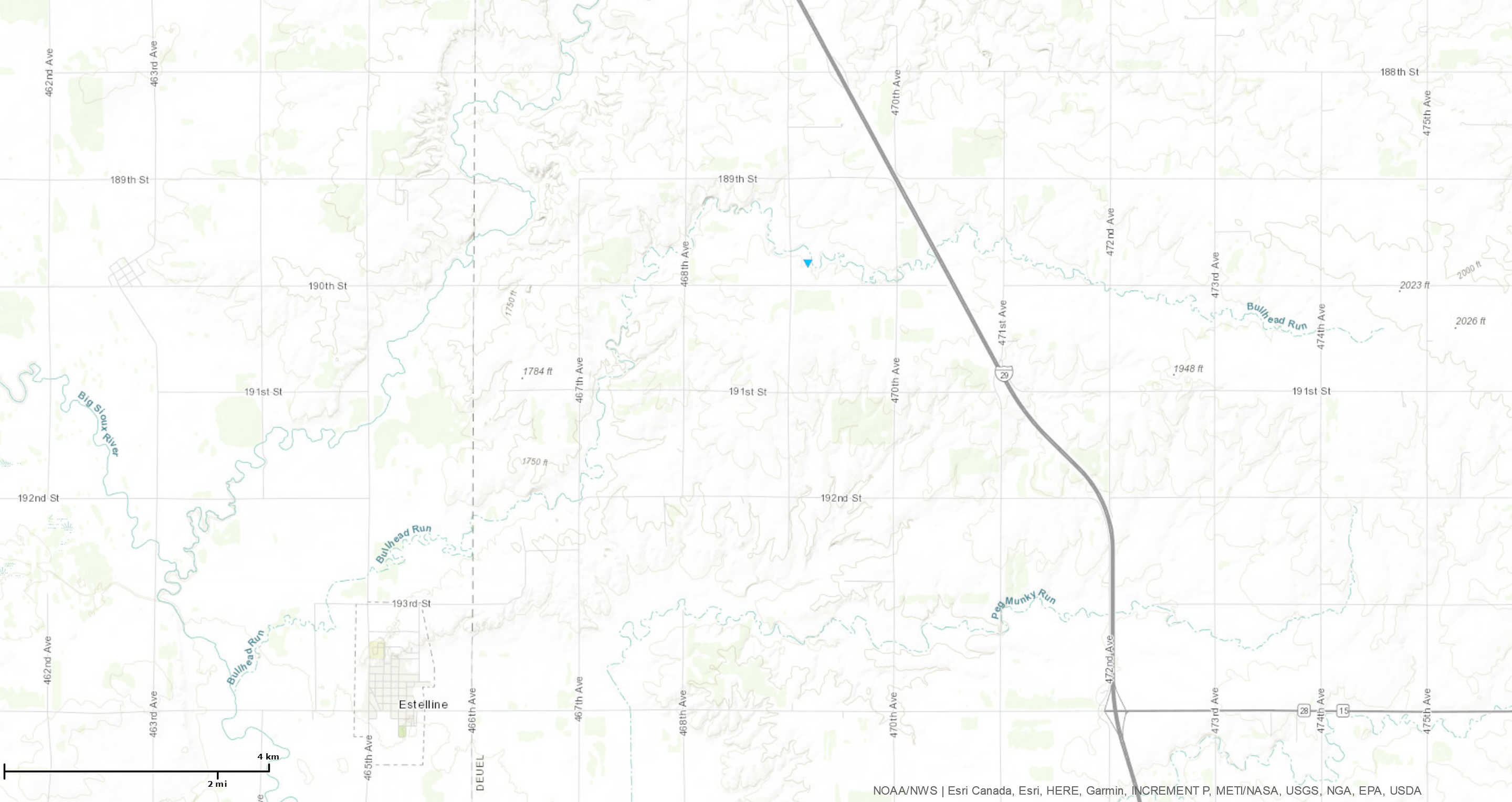 
Downloadable KMZ File |
||||||||||||||||
|
||||||||||||||||
The Enhanced Fujita (EF) Scale classifies tornadoes into the following categories:
| EF0 Weak 65-85 mph |
EF1 Moderate 86-110 mph |
EF2 Significant 111-135 mph |
EF3 Severe 136-165 mph |
EF4 Extreme 166-200 mph |
EF5 Catastrophic 200+ mph |
 |
|||||
Radar
 |
 |
|
| KFSD (Sioux Falls, SD) Radar Loop of Estelline, SD Tornado on June 15, 2019. The red dot indicates where tornado damage occurred and the position indicated on the Facebook videos. | KFSD (Sioux Falls, SD) Radar image from 2257Z (5:57 PM CDT) on 6/15/19 - The radar is viewing the storm at approximately 5,800 feet above the ground - Not shown, but the "anti-cyclonic" rotation extended through the height of the storm. | KFSD (Sioux Falls, SD) Radar image from 2305Z (6:05 PM CDT) on 6/15/19 at the time/location of the tornado damage. This location matches the location of the Facebook video that was looking northwest from I-29. |
 |
Media use of NWS Web News Stories is encouraged! Please acknowledge the NWS as the source of any news information accessed from this site. |
|