
Widespread life-threatening flash and urban flooding will continue to pose a significant threat to life and property in south-central Texas. Catastrophic fiver flooding, with rapid rises on small streams, arroyos, and typically dry washes, is expected. Monsoonal showers persist across the Great Basin and Southwest with greatest flash flooding in southern Arizona. Read More >
Overview
|
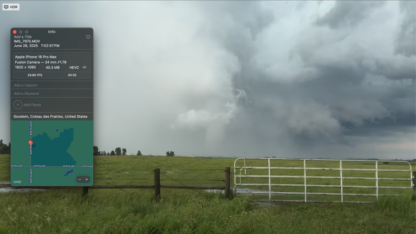
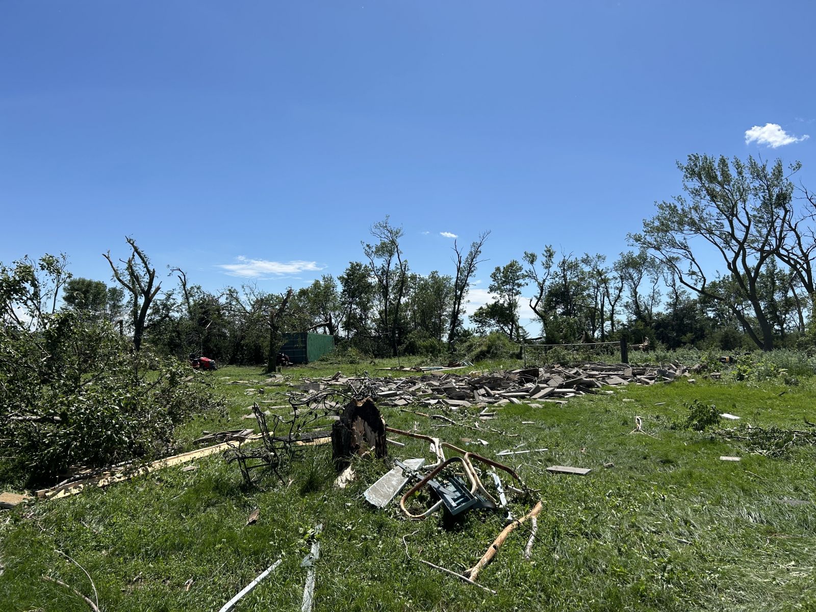
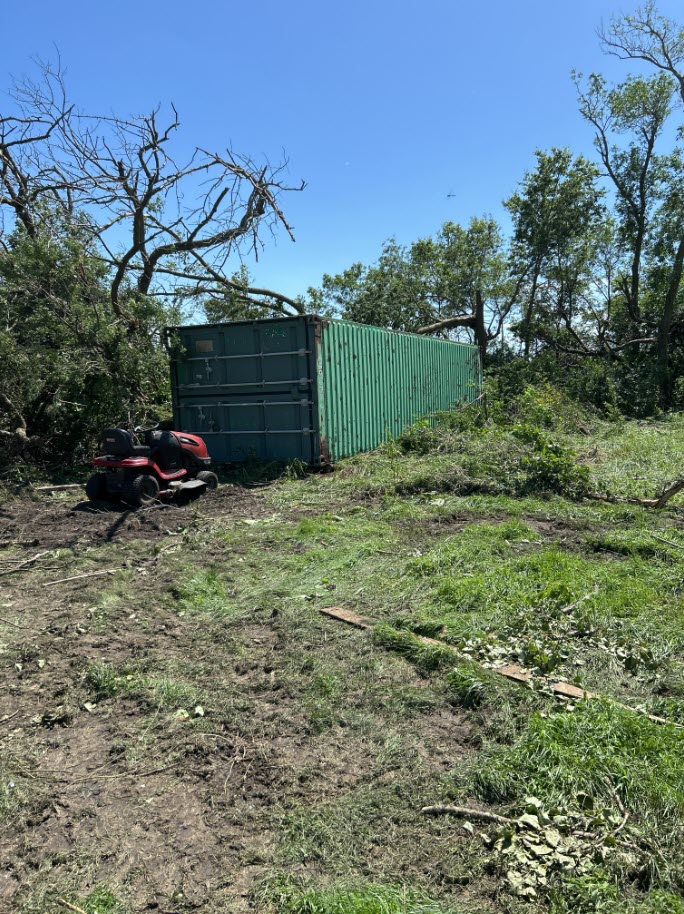
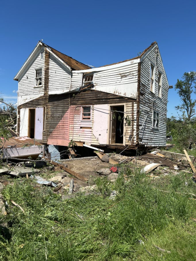
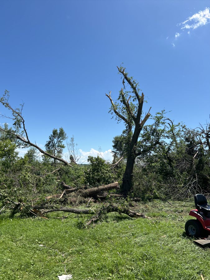
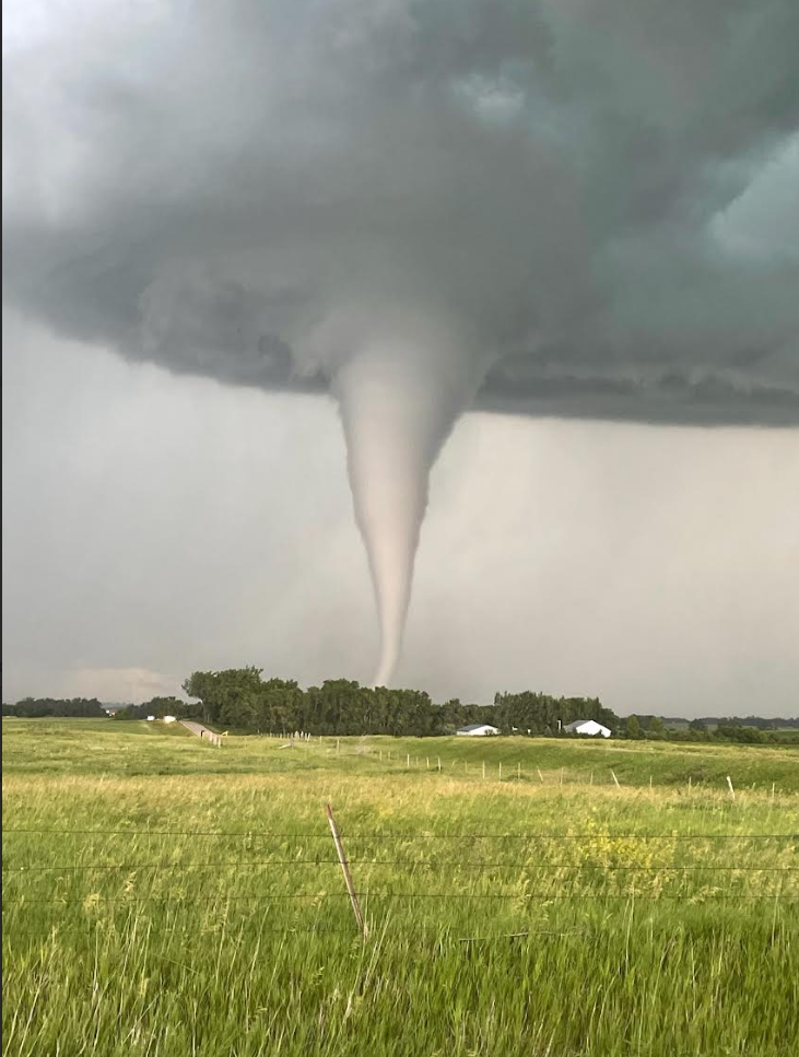
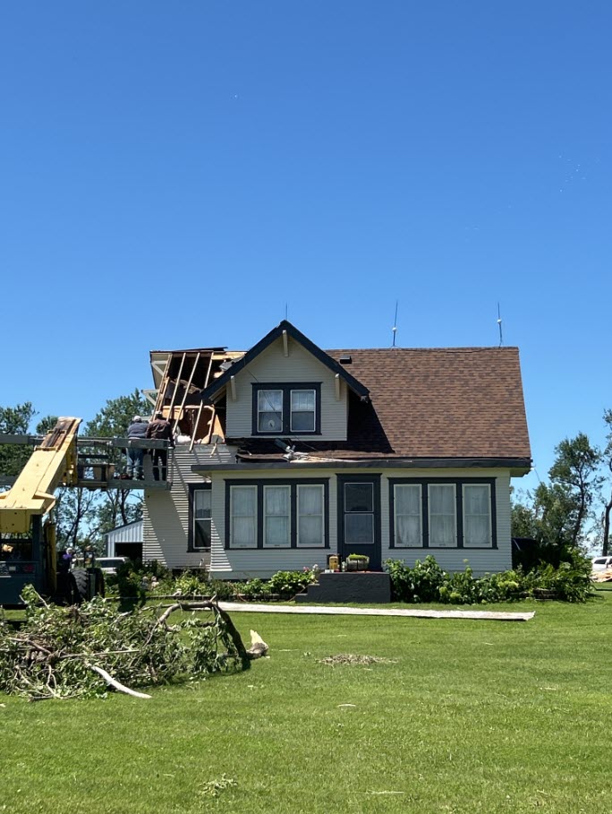
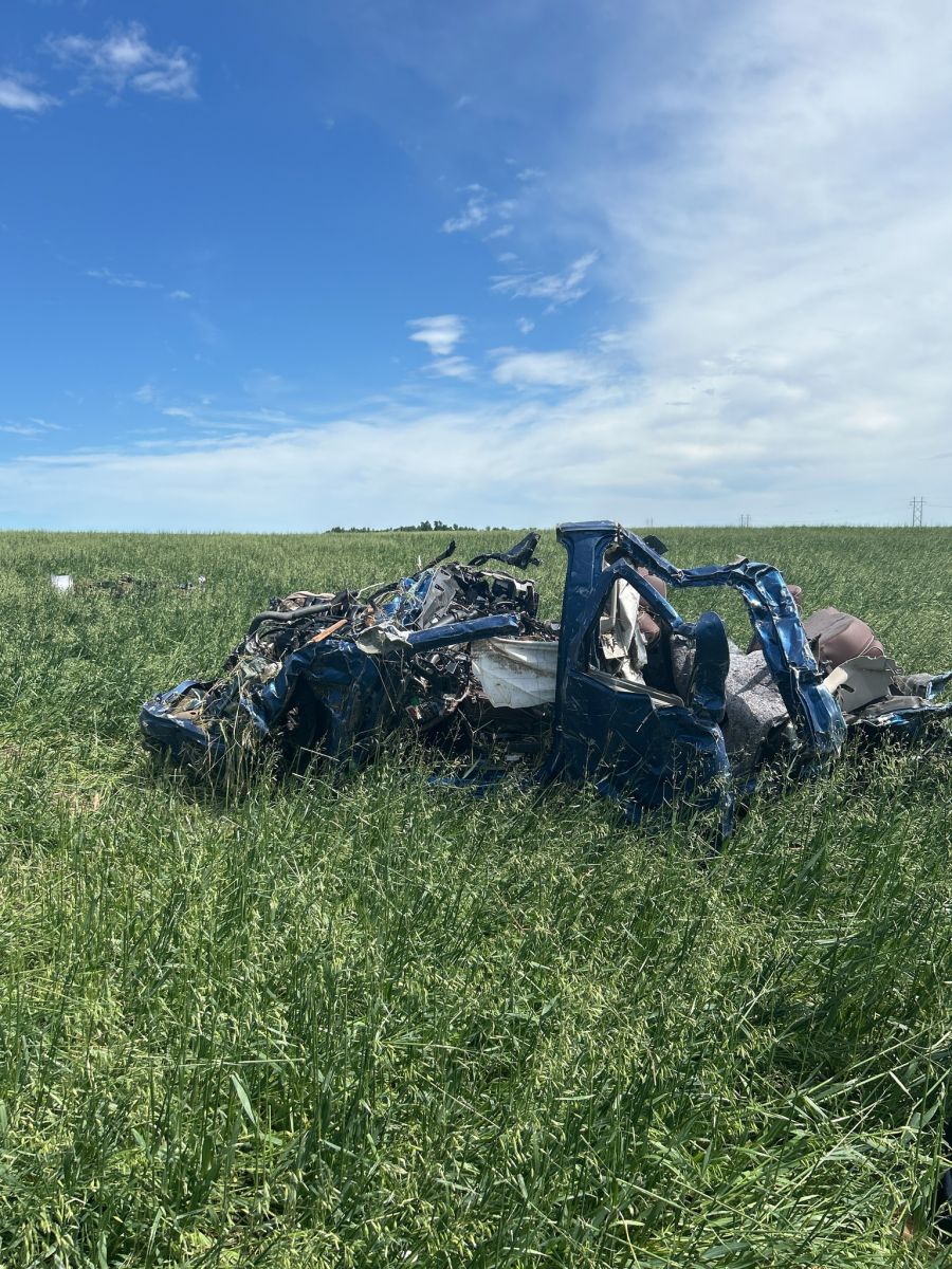
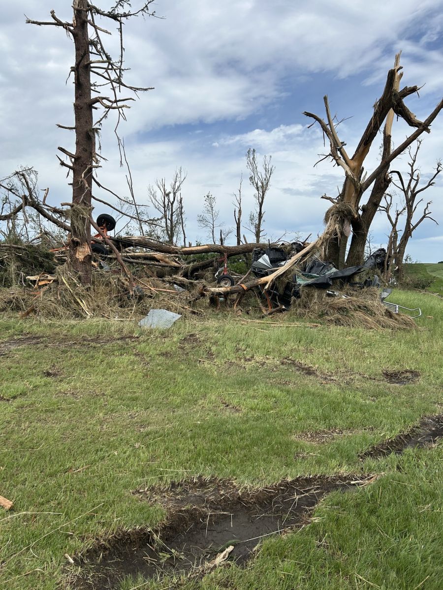
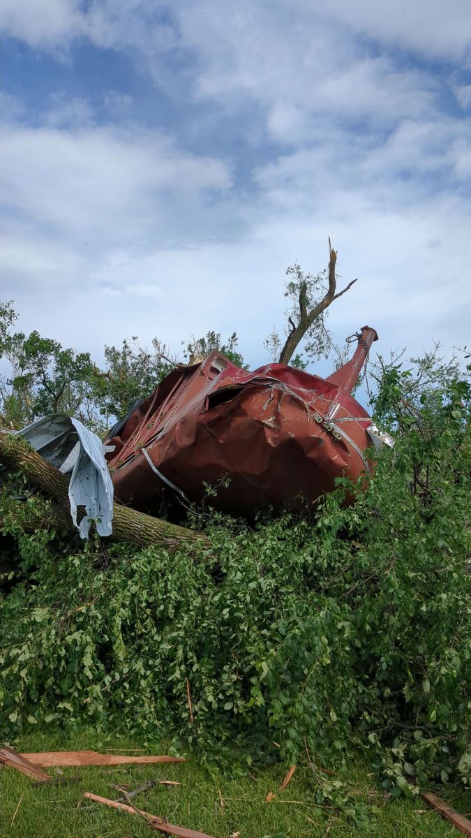
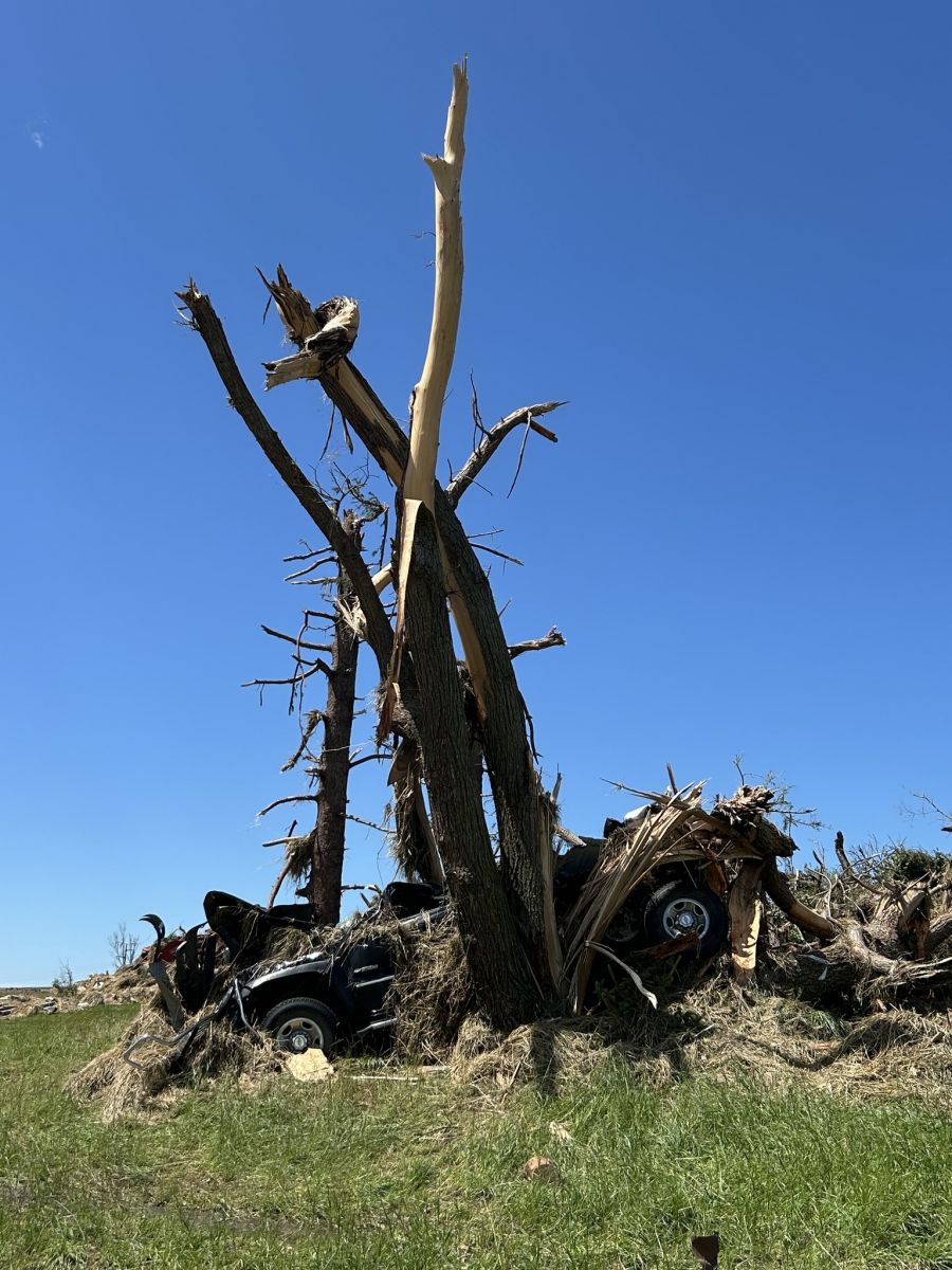
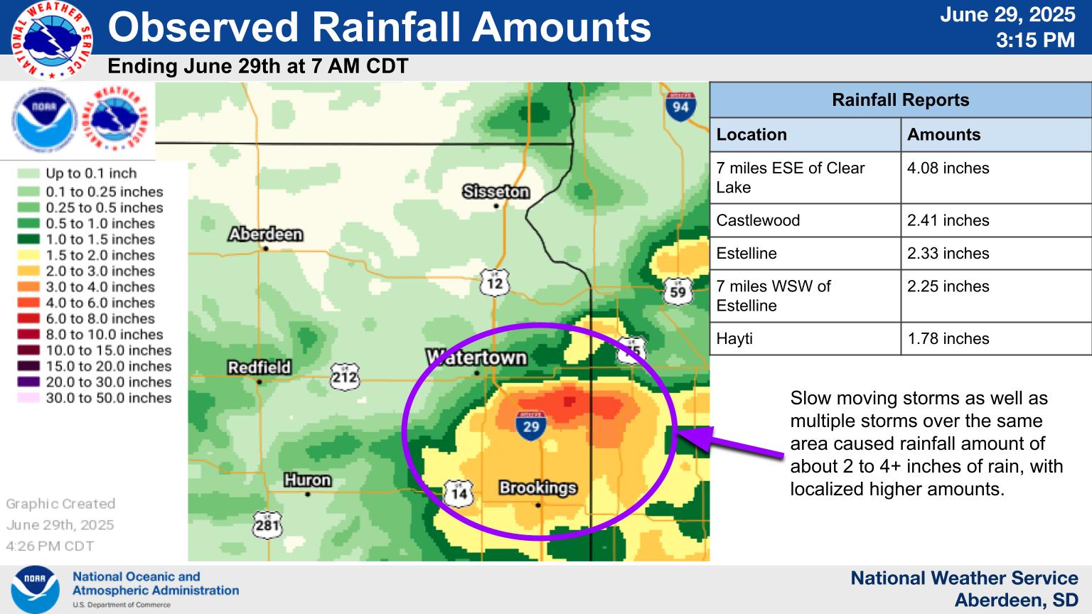
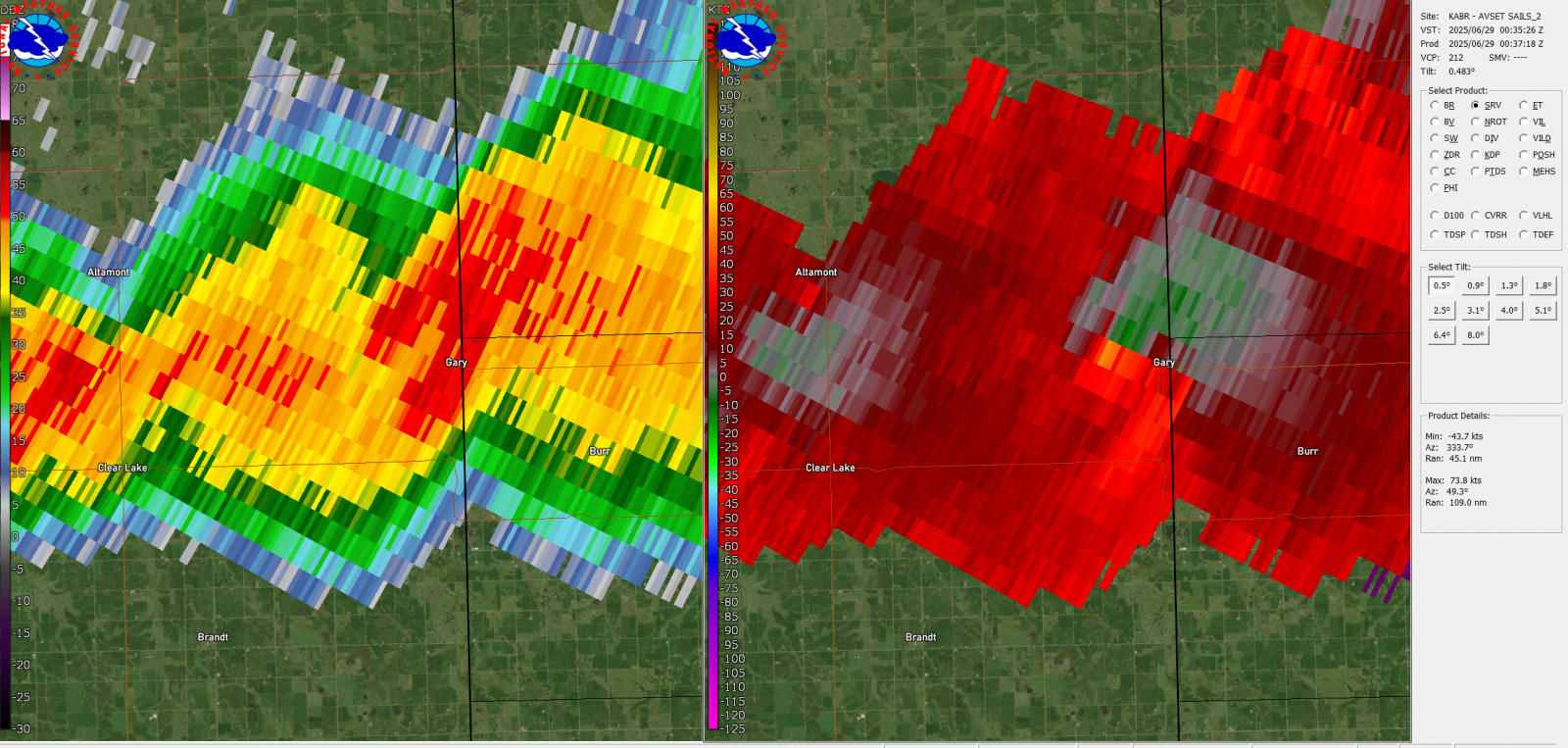
Supercell thunderstorms began to develop Saturday afternoon south of Watertown and moved off to the east into Minnesota. The environment was supportive of tornado development across east central South Dakota Saturday afternoon. Four tornadoes were documented. Thunderstorms kept redeveloping generally in the same region for roughly five and a half hours. The first tornado touched down at approximately 6:53 p.m. on June 28, 2025, about five miles northwest of Clear Lake. This tornado would shift an unoccupied farm house off its foundation, destroy outbuildings, flip a large shipping container used for storage, and do significant tree damage. This tornado was rated EF2. The second tornado was a brief touchdown as documented by photo and video. It did minor tree damage and was rated an EF0. The 3rd tornado was the longest and most destructive and touched down between Clear Lake and Gary, SD. It was rated a high end EF3 with wind speeds estimated at 155-165 mph. The tornado had a nearly 40-minute track that stretched roughly 9.71 miles. Damage occurred at multiple properties, but the property with the most extensive damage included a completely destroyed farm house, a garage, two machine sheds, several silos/grain bins and a barn. Vehicles in one garage were picked up and tossed, including a half ton pickup hurled 300 yards northeast. The EF3 rating is of unusual severity. 1,931 tornadoes have been documented in South Dakota between 1950-2024. Of those, only 75 tornadoes have been documented as an EF3 or greater, meaning less than 4% of South Dakota tornadoes reach this level of severity. The final tornado touched down east of Gary, SD on the Minnesota side. There was no damage noted and was rated an EF Unknown by the Twin Cities National Weather Service. As storms trained over the same area for several hours, excessive heavy rainfall developed resulting in portions of Hamlin and Deuel Counties receiving 2 to 4+ inches of rainfall. |
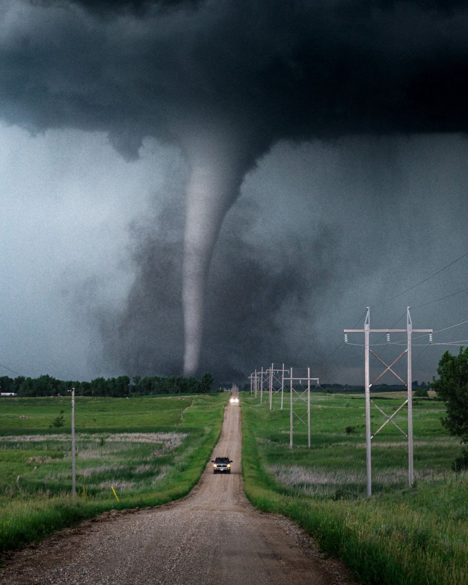 Photo credit: @adamorgler |
Tornadoes
Select a tornado from the table to zoom into the track and view more information. The default table view is limited to 8 tracks, but can be scrolled by a mouse wheel or dynamically expanded. Additionally, the table can fill the entire window by clicking the small circular expanding arrow icon at the very top right of the table and returned to its original size by clicking the button again. The side information panel that opens over the map can be closed using the "X" on the upper right corner of the pop-up. Zoom into the map and click damage points to see detailed information and pictures from the surveys.
|
NOTE: times shown below are local to your device's time zone. |

The Enhanced Fujita (EF) Scale classifies tornadoes into the following categories:
| EF0 Weak 65-85 mph |
EF1 Moderate 86-110 mph |
EF2 Significant 111-135 mph |
EF3 Severe 136-165 mph |
EF4 Extreme 166-200 mph |
EF5 Catastrophic 200+ mph |
 |
|||||
| Tornadoes that fail to impact any ratable damage indicators on the EF-Scale are rated EF-Unknown (EF-U) | |||||
Photos & Video
Northwest of Clear Lake Tornado & Damage Pictures
 |
 |
 |
 |
| Photo Shared By Mike LaBeau | Photo Shared By Jessica Miller From the Crystal Springs Rodeo Campground | Photo Shared By Paige Berdomas & Bryce Shelton | Photo Shared By Josh Boustead |
 |
 |
 |
 |
| NWS Damage Survey | NWS Damage Survey | NWS Damage Survey | NWS Damage Survey |
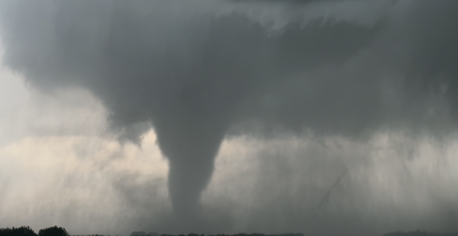
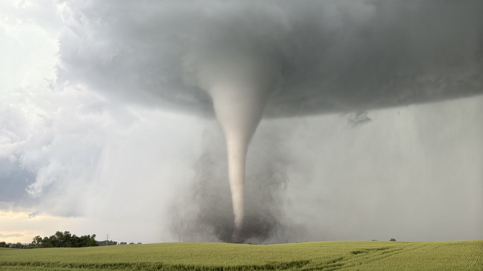
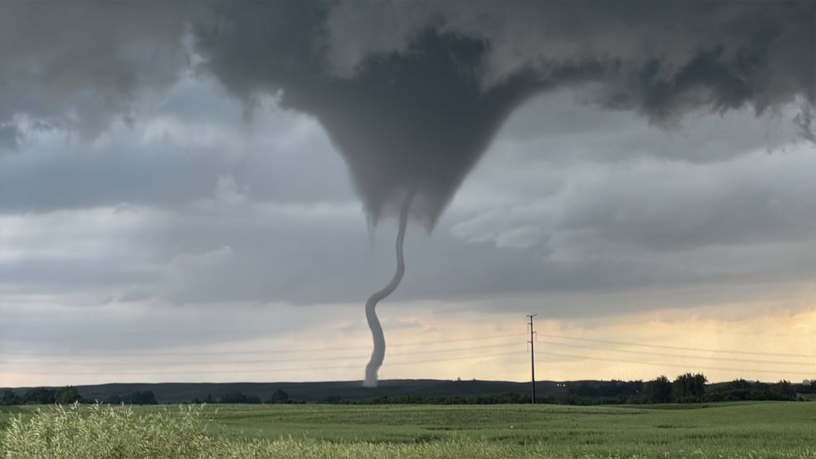
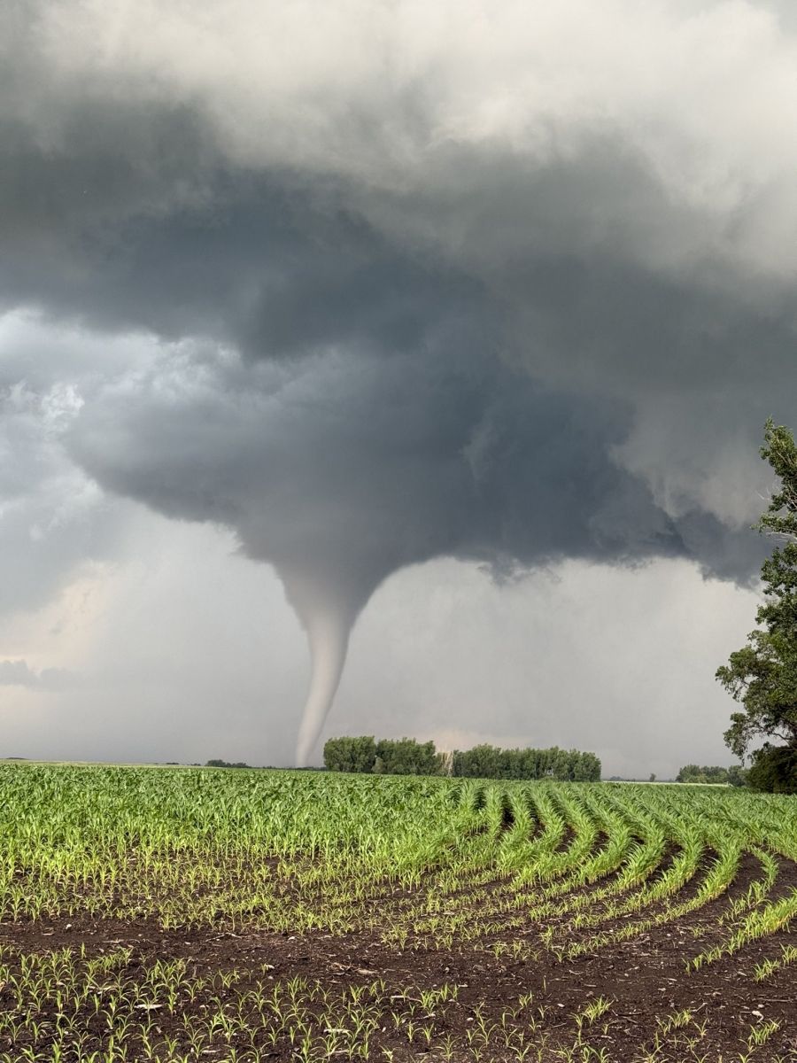
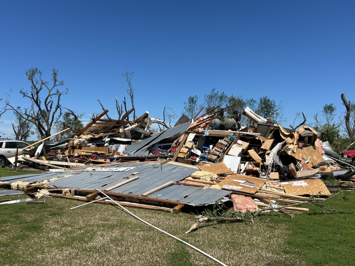
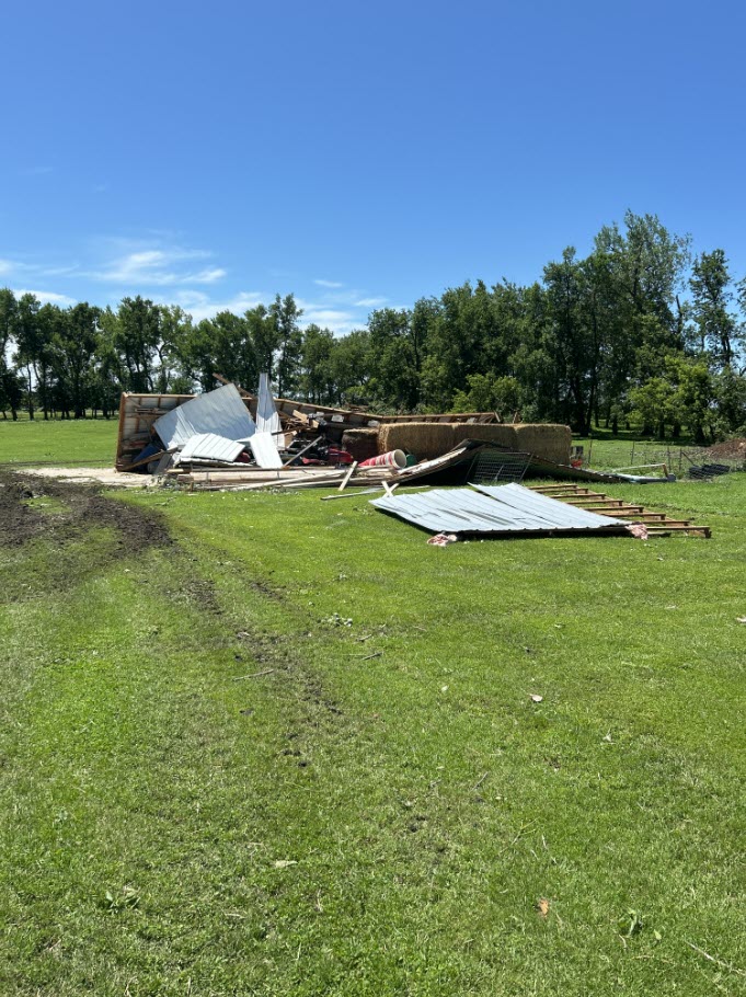
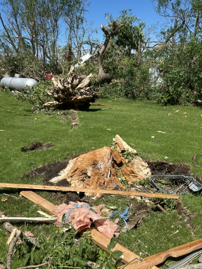
Between Clear Lake and Gary Tornado Pictures
 |
 |
 |
 |
| Photo Shared By Alex Resel | Photo Shared By Alex Resel | Photo Shared By Adam Orgler | Photo Shared By Jim Marko |
 |
 |
 |
 |
| NWS Damage Survey | NWS Damage Survey | NWS Damage Survey | NWS Damage Survey |
 |
 |
 |
 |
| NWS Damage Survey | NWS Damage Survey | NWS Damage Survey | NWS Damage Survey |
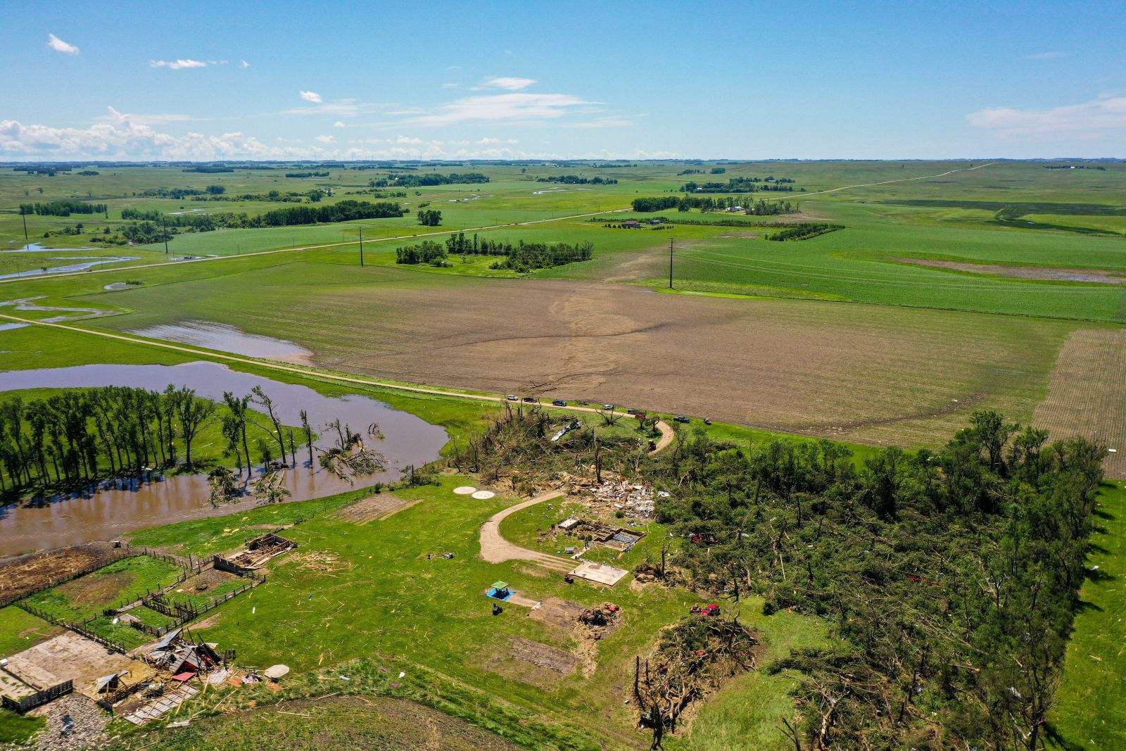
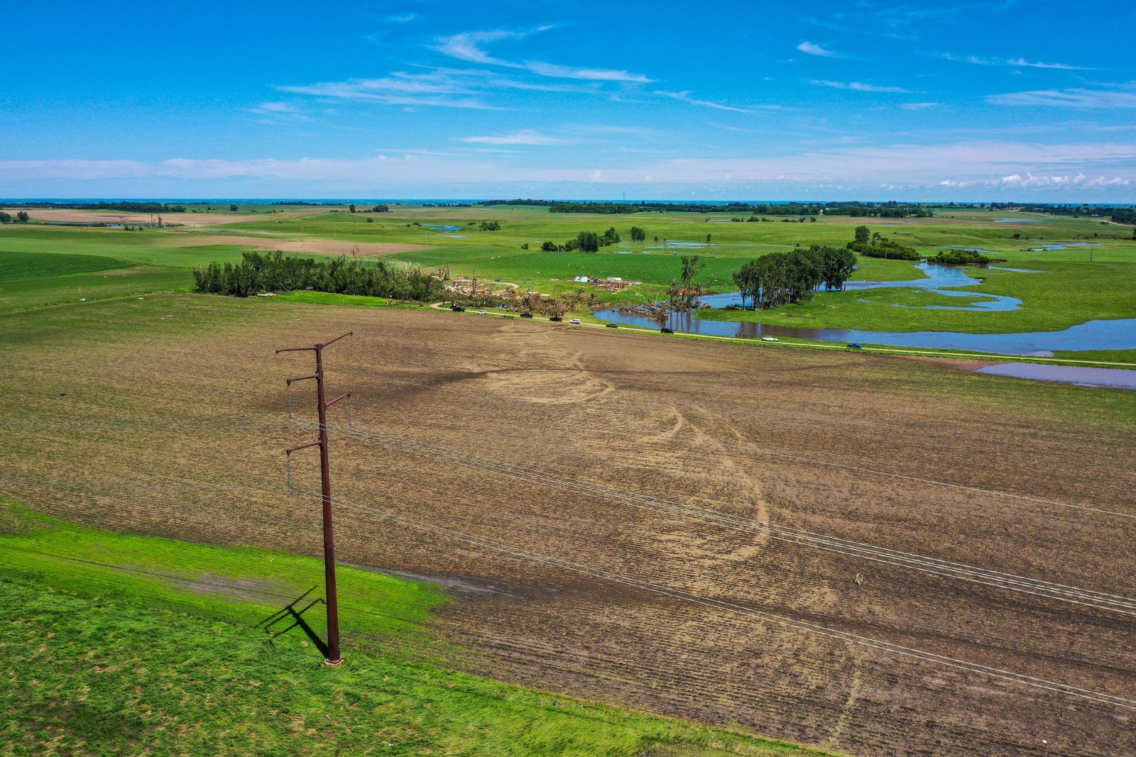
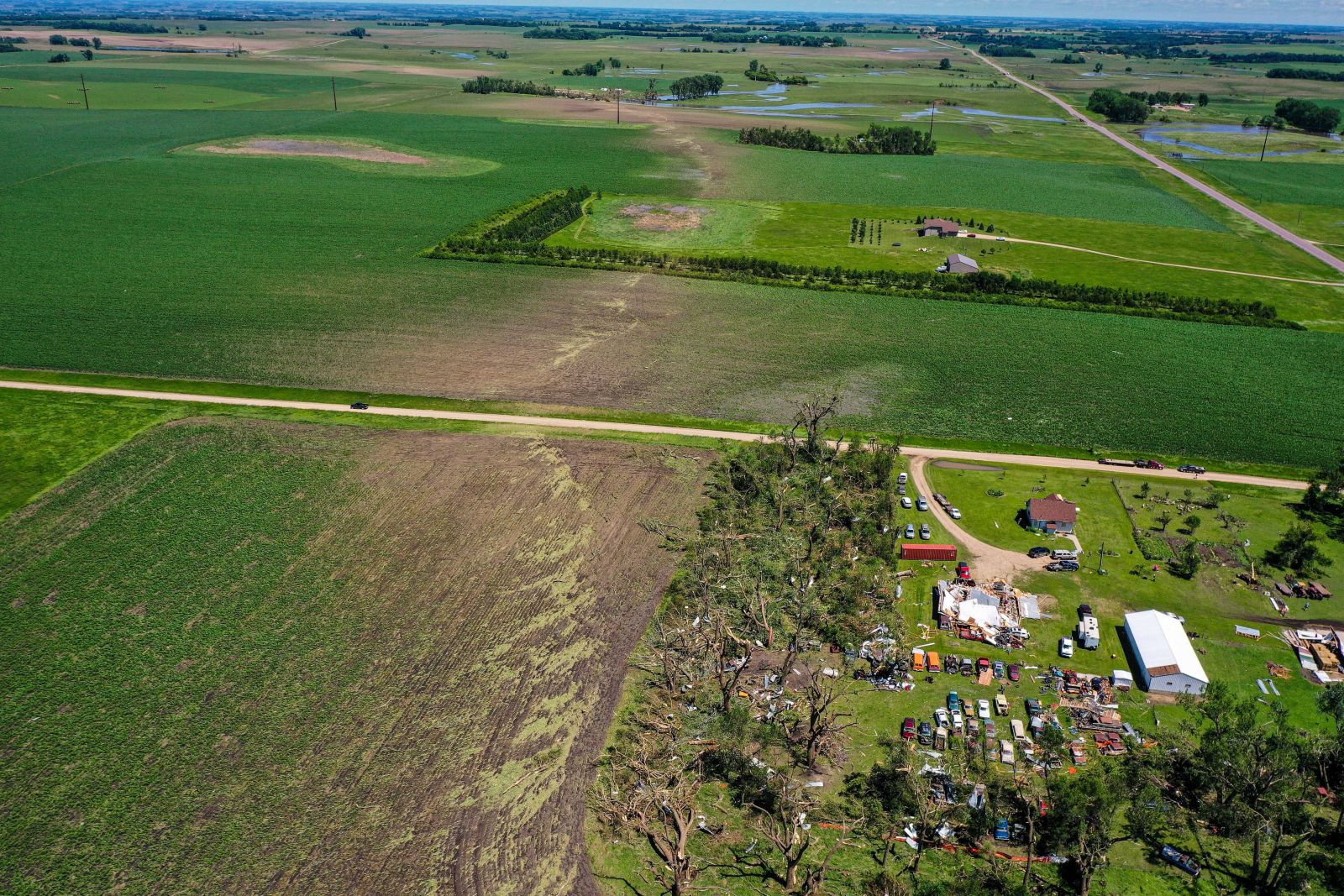
Areal Damage Photos
 |
 |
 |
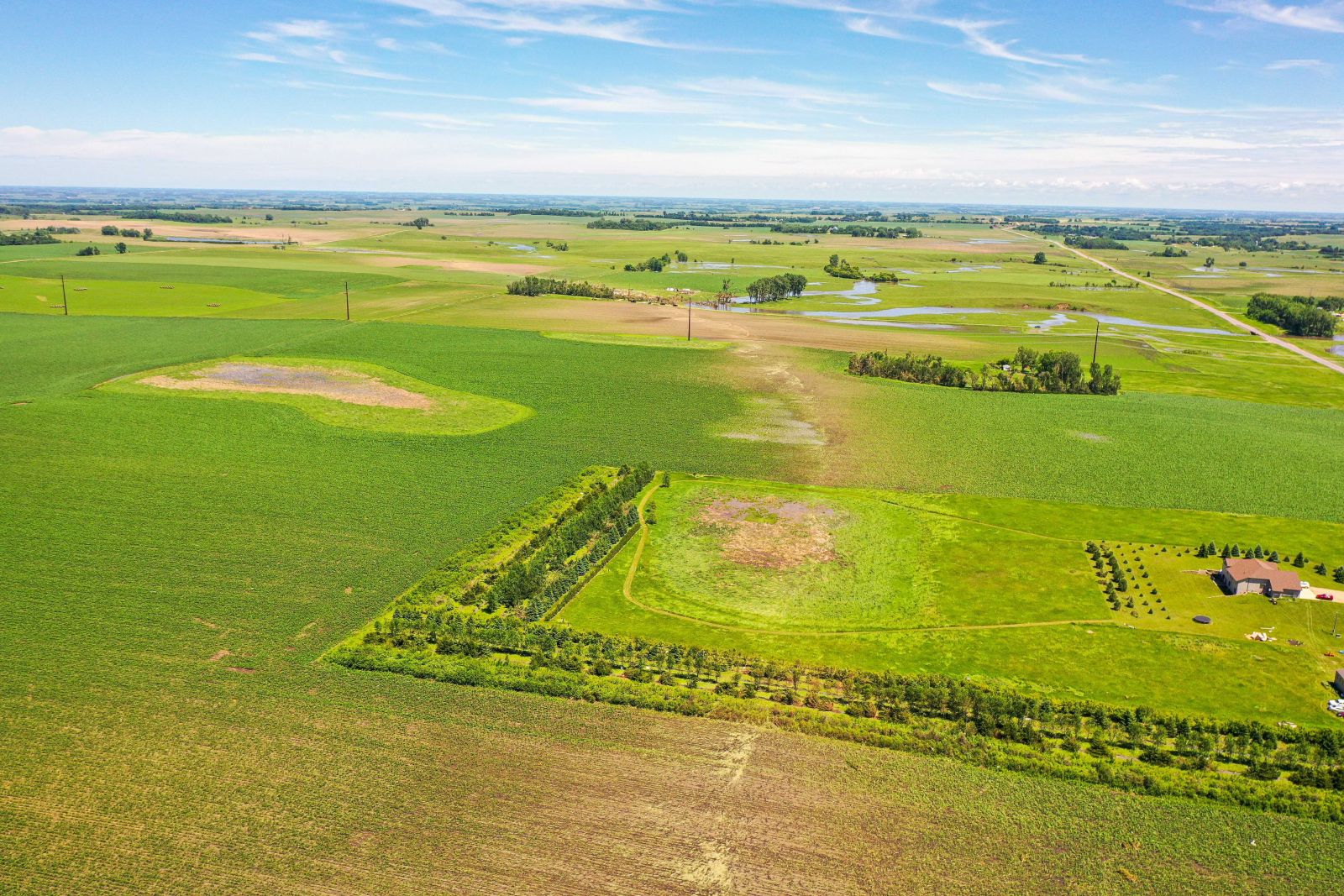 |
| Photo Shared By Shawn Cable KEYC-TV | Photo Shared By Shawn Cable KEYC-TV | Photo Shared By Shawn Cable KEYC-TV | Photo Shared By Shawn Cable KEYC-TV |
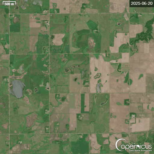 |
| Before (June 20, 2025) and after (July 2, 2025) Sentinel satellite imagery comparison showing the June 28 tornado scar through cropland. Copernicus Sentinel data 2025 |
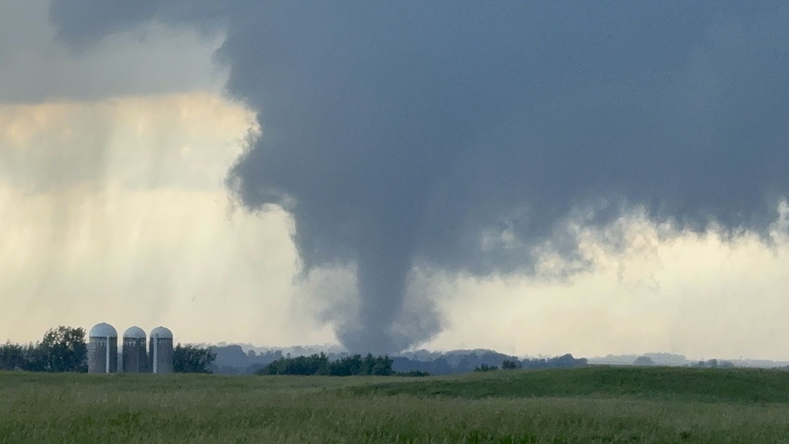
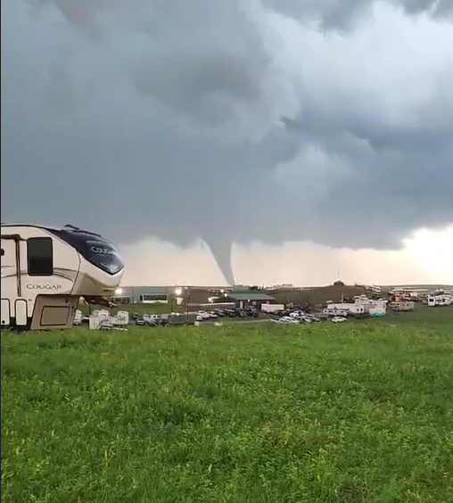
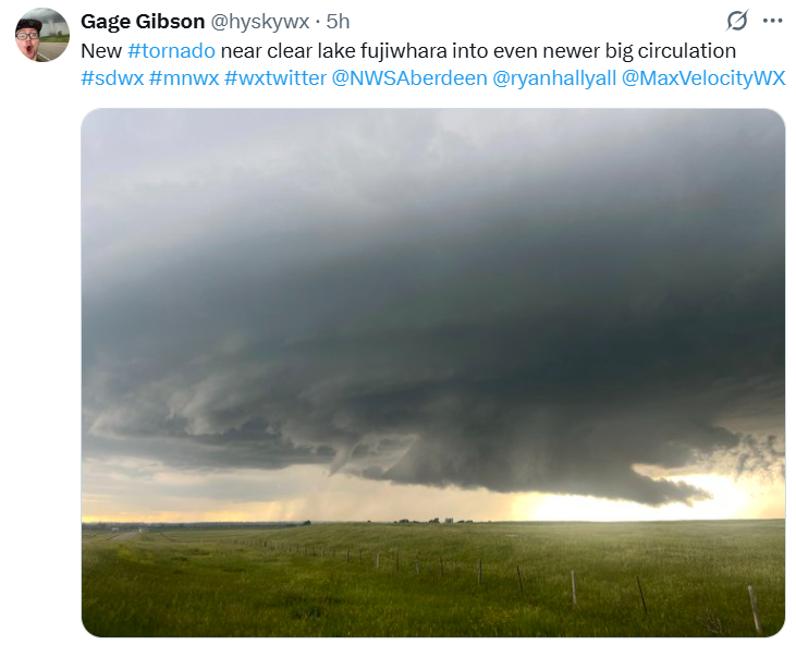
Wall Clouds/Funnels
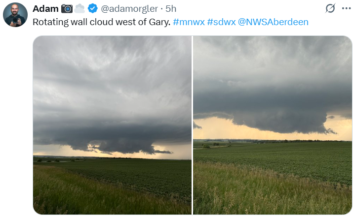 |
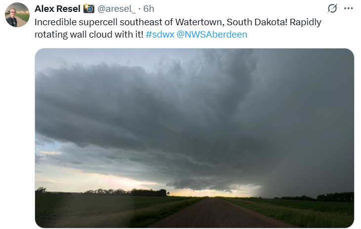 |
 |
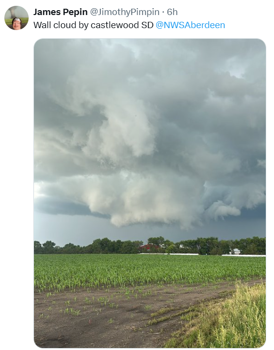 |
| Photo Shared By Adam Orgler | Photo Shared By Alex Resel | Photo Shared By Gage Gibson | Photo Shared By James Pepin |
A Collection YouTube Video Documentation
Rain Reports
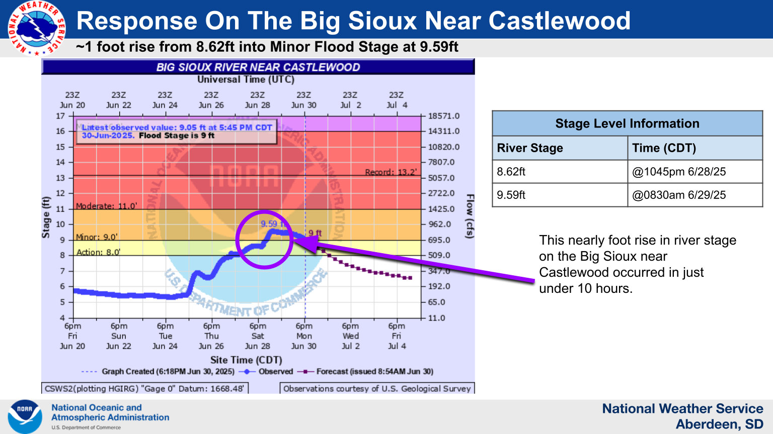
Hydrographs
Excessive heavy rainfall from slow-moving, training thunderstorms Saturday night, June 28th, resulted in a local and rapid rise response on the Big Sioux River in east central South Dakota (Hamlin County).
 |
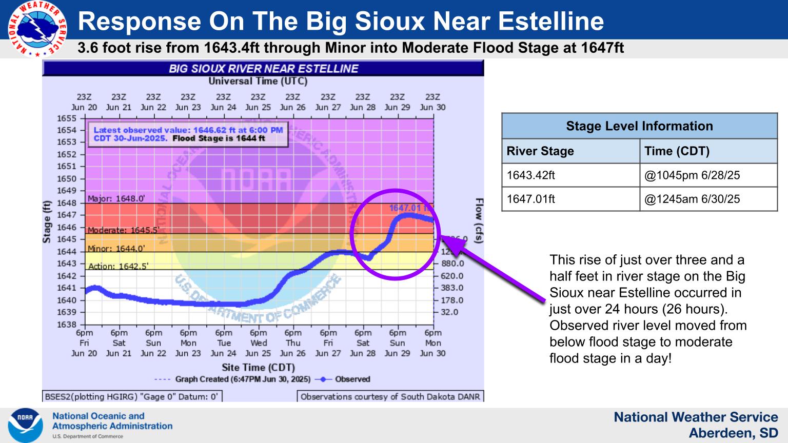 |
| Hydrograph from the Big Sioux River near Castlewood. | Hydrograph from the Big Sioux River near Estelline |
Flood Report
 |
| LSR for flooding and damage |
Storm Reports
Preliminary Local Storm Report...Summary
National Weather Service Aberdeen SD
812 PM CDT Sun Jun 29 2025

..TIME...   ...EVENT...      ...CITY LOCATION...     ...LAT.LON...
..DATE...   ....MAG....      ..COUNTY LOCATION..ST.. ...SOURCE....
            ..REMARKS..

0552 PM     Funnel Cloud     4 NE Veblen             45.90N 97.22W
06/28/2025                   Roberts            SD   Emergency Mngr

            Message on Slack about a persistent funnel
            cloud (around for about 6 min since 5:29)
            near Veblen. Roberts county EM said that
            dispatch has had a few calls about a funnel
            west of the Dakota Magic Casino.

0633 PM     Funnel Cloud     3 NE Claremont Colony   44.75N 96.90W
06/28/2025                   Hamlin             SD   Public

            Funnel cloud by trained weather spotter and
            passed along on state radio.

0918 PM     Funnel Cloud     Castlewood              44.72N 97.03W
06/28/2025                   Hamlin             SD   Public

            Video sent on Facebook of a funnel cloud in
            Castlewood around 9:18pm.

0940 PM     Hail             4 W Castlewood          44.73N 97.11W
06/28/2025  M1.00 Inch       Hamlin             SD   Trained Spotter


0950 PM     Hail             2 S Thomas              44.73N 97.20W
06/28/2025  M1.00 Inch       Hamlin             SD   Emergency Mngr


1054 PM     Hail             2 SSE Stone Bridge      44.57N 97.03W
06/28/2025  M1.00 Inch       Hamlin             SD   Trained Spotter

            Trained Spotter had Quarter plus sized hail
            1 mile east of Lake Poinsett.

0659 PM     Tornado          5 W Clear Lake          44.78N 96.78W
06/28/2025                   Deuel              SD   Trained Spotter

            relayed from multiple spotters.

0707 PM     Tornado          Tunerville              44.89N 96.68W
06/28/2025                   Deuel              SD   Trained Spotter

            Trees blown down and abandoned structure was
            damaged/hit.

0716 PM     Funnel Cloud     2 ENE Clear Lake        44.78N 96.64W
06/28/2025                   Deuel              SD   Trained Spotter

            Photo on X of a new funnel cloud coming from
            storm.

0813 PM     Tornado          5 WNW Lake Cochrane Rec 44.75N 96.54W
06/28/2025                   Deuel              SD   Trained Spotter

            Spotter called with a Tornado on the ground.

0816 PM     Funnel Cloud     3 E Clear Lake          44.77N 96.62W
06/28/2025                   Deuel              SD   Storm Chaser

            Called about Funnel almost to the ground
            with some ground debris being spun and
            tossed around.

0830 PM     Tornado          1 WNW Lake Cochrane Rec 44.71N 96.48W
06/28/2025                   Deuel              SD   Law Enforcement

            Tornado reported around the Lake Cochrane
            Rec Area.

0858 PM     Hail             3 S Gary                44.75N 96.46W
06/28/2025  M2.00 Inch       Deuel              SD   Public

            Report from mPING: Hen Egg (2.00 in.).

1013 PM     Funnel Cloud     3 NE Astoria            44.59N 96.50W
06/28/2025                   Deuel              SD   Trained Spotter

            Spotter reported a possible rain-wrapped
            tornado while heading towards Brandt.

1016 PM     Tornado          1 E Toronto             44.57N 96.62W
06/28/2025                   Deuel              SD   Law Enforcement

            state radio report of tornado 1 mile east of
            Toronto.

1018 PM     Tornado          1 N Toronto             44.59N 96.64W
06/28/2025                   Deuel              SD   Law Enforcement

            state radio report of a different tornado 1
            mile north of Toronto.

0920 PM     Funnel Cloud     6 SW Kranzburg          44.82N 96.99W
06/28/2025                   Codington          SD   Law Enforcement

            Funnel cloud spotted just west of I-29 at
            mile marker 174.
Environment
A set-up that favored the potential for tornadic development accompanied a cold frontal boundary Saturday afternoon through late evening. Thunderstorms slowed the front's progress to a stand-still during the overnight hours.
 |
 |
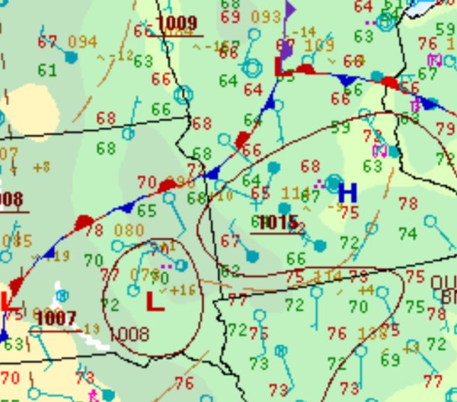 |
| WPC Surface Analysis at 7pm CDT June 28th | WPC Surface Analysis at 10pm CDT June 28th | WPC Surface Analysis at 1am CDT June 29th |
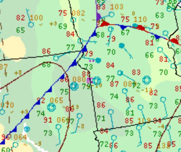
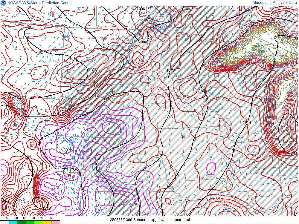
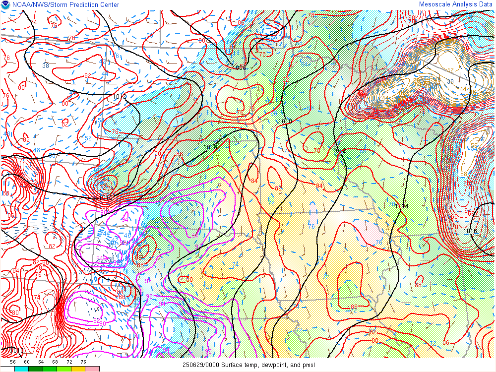
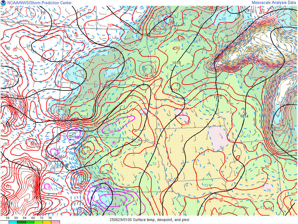
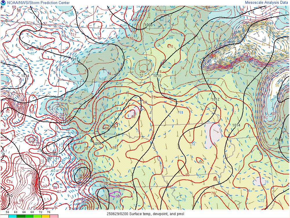
Surface Temperature, Dewpoint & Pressure
 |
 |
 |
 |
| Surface - 6 pm CDT - June 28th SPC's Mesoanalysis Graphic |
Surface - 7 pm CDT - June 28th SPC's Mesoanalysis Graphic |
Surface - 8 pm CDT - June 28th SPC's Mesoanalysis Graphic |
Surface - 9 pm CDT - June 28th SPC's Mesoanalysis Graphic |
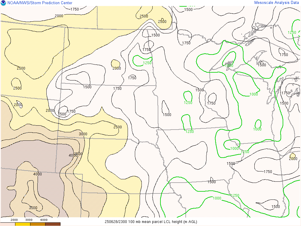
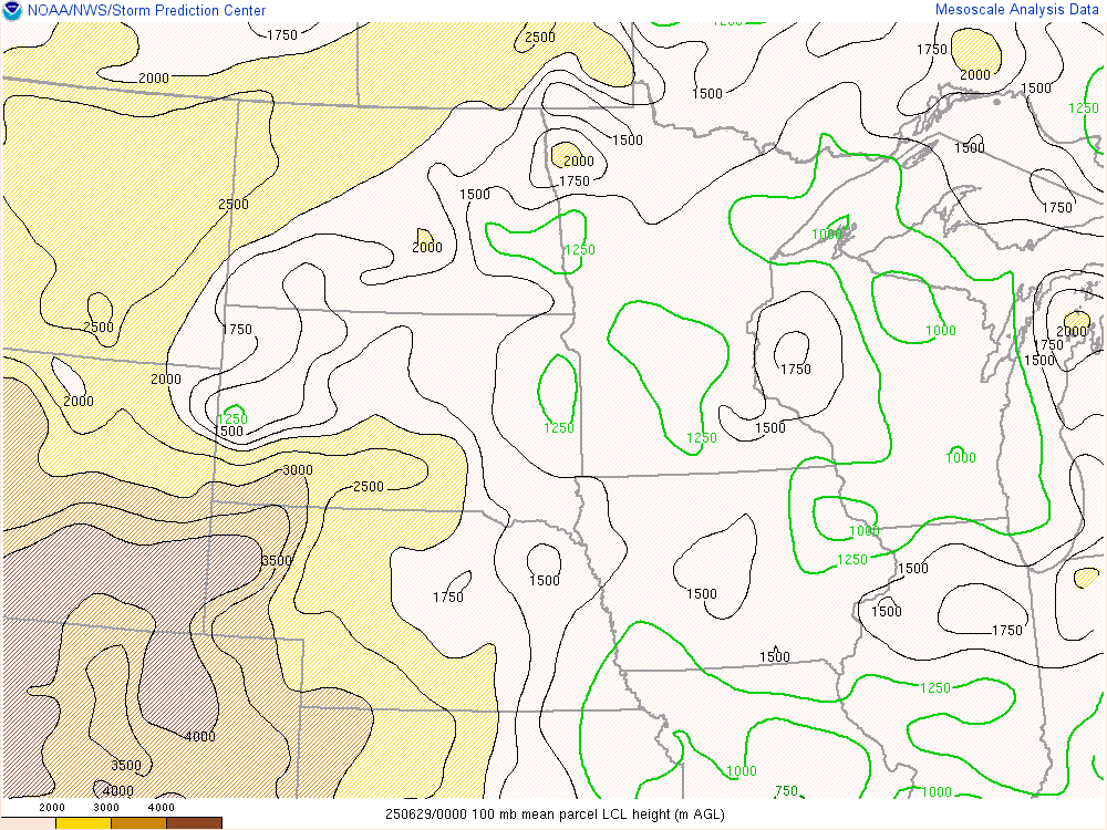
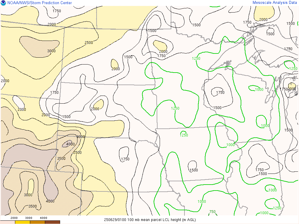
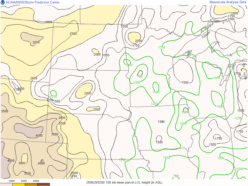
Lifted Condensation Level Heights (LCL)
 |
 |
 |
 |
| LCL - 6 pm CDT - June 28th SPC's Mesoanalysis Graphic |
LCL - 7 pm CDT - June 28th SPC's Mesoanalysis Graphic |
LCL - 8 pm CDT - June 28th SPC's Mesoanalysis Graphic |
LCL - 9 pm CDT - June 28th SPC's Mesoanalysis Graphic |
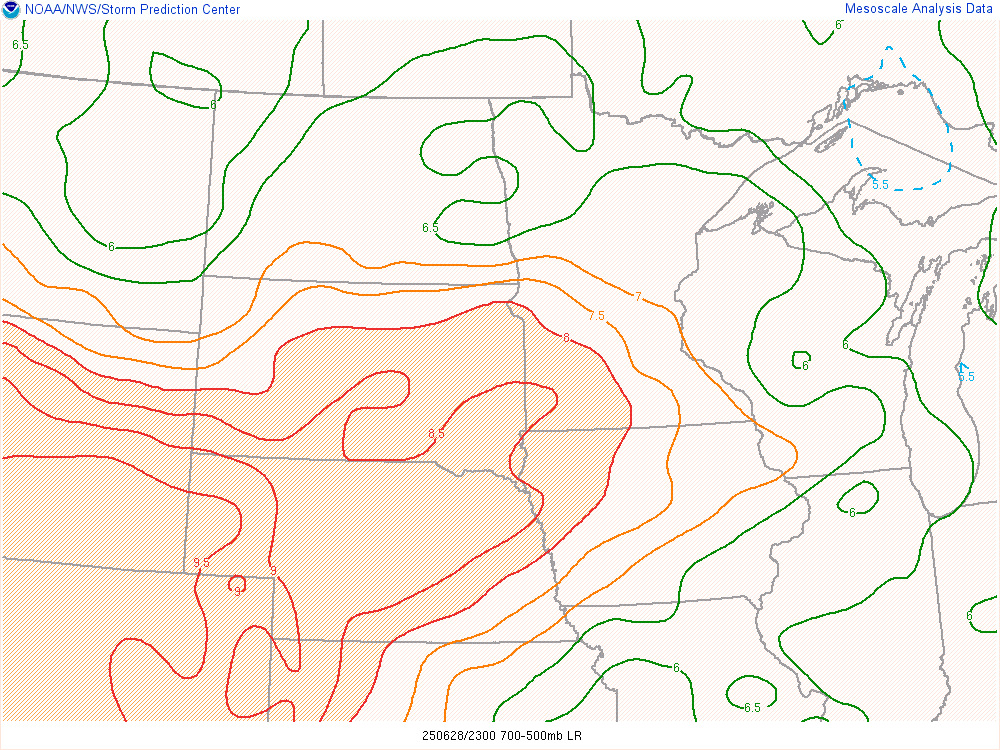
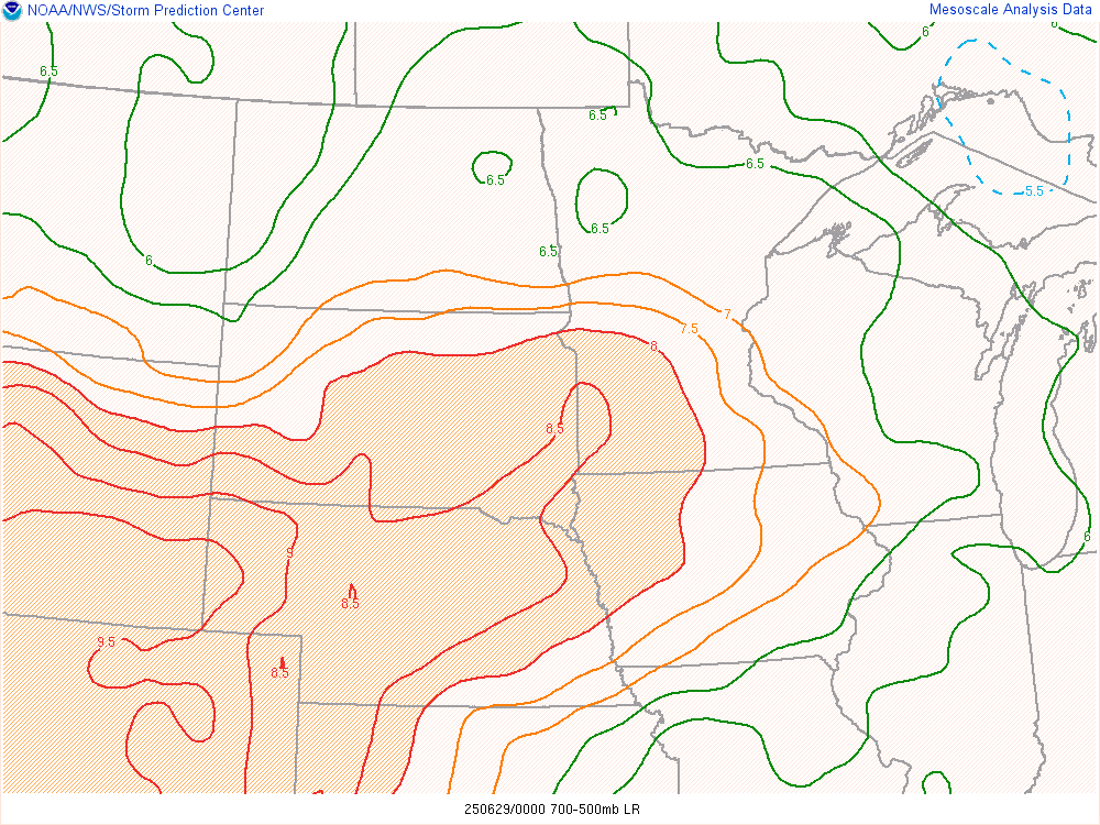
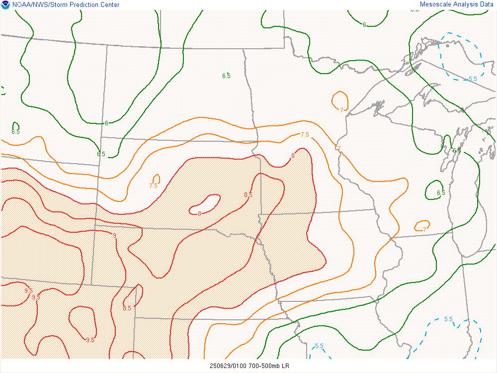
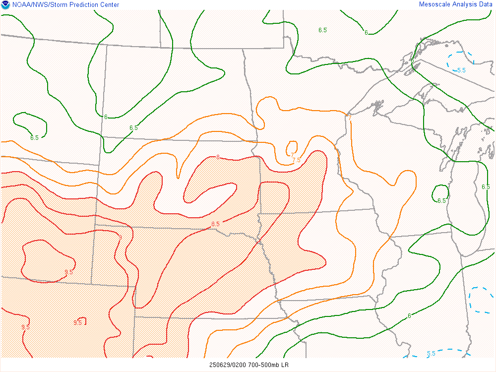
700-500 MB Mid-Level Lapse Rates
 |
 |
 |
 |
| Lapse Rate - 6 pm CDT - June 28th SPC's Mesoanalysis Graphic |
Lapse Rate - 7 pm CDT - June 28th SPC's Mesoanalysis Graphic |
Lapse Rate - 8 pm CDT - June 28th SPC's Mesoanalysis Graphic |
Lapse Rate - 9 pm CDT - June 28th SPC's Mesoanalysis Graphic |
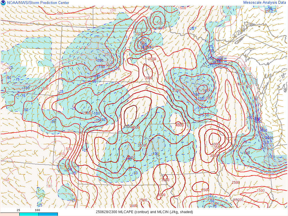
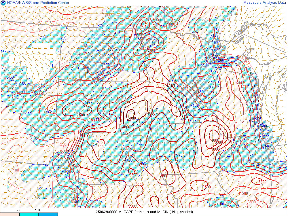
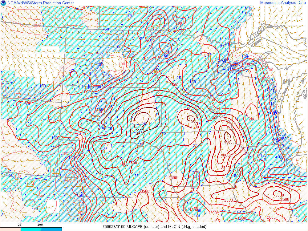
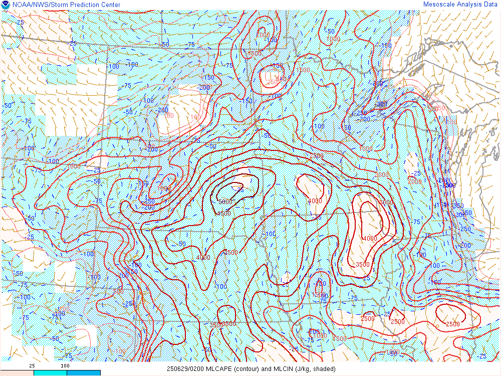
Mixed Layer CAPE (ML CAPE)
 |
 |
 |
 |
| MLCAPE - 6 pm CDT - June 28th SPC's Mesoanalysis Graphic |
MLCAPE - 7 pm CDT - June 28th SPC's Mesoanalysis Graphic |
MLCAPE - 8 pm CDT - June 28th SPC's Mesoanalysis Graphic |
MLCAPE - 9 pm CDT - June 28th SPC's Mesoanalysis Graphic |
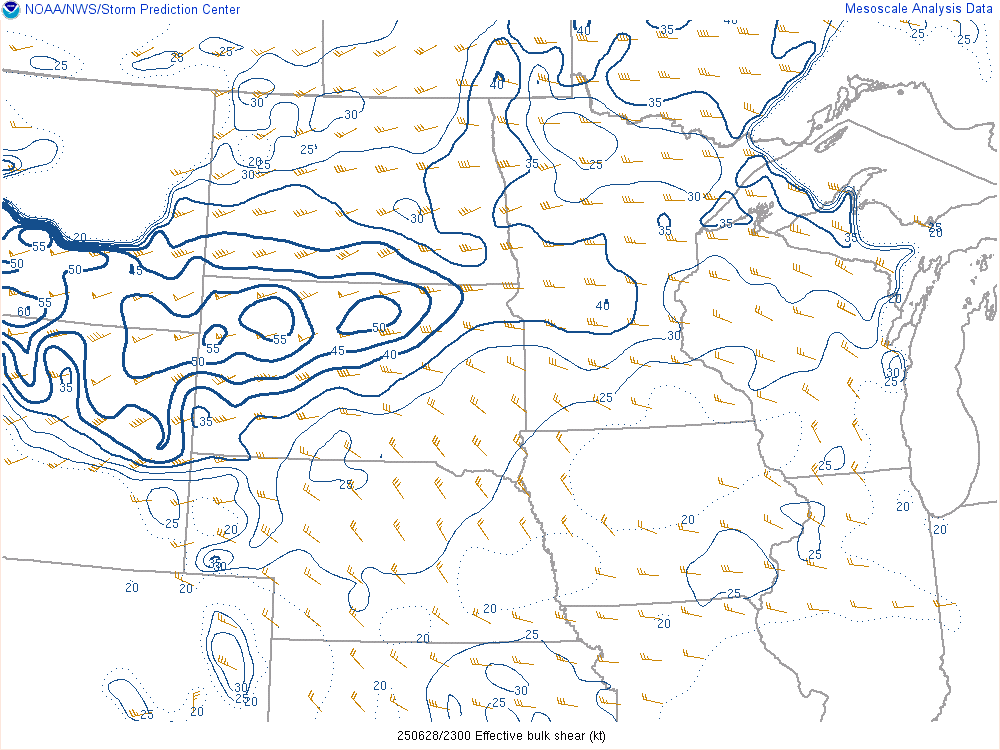
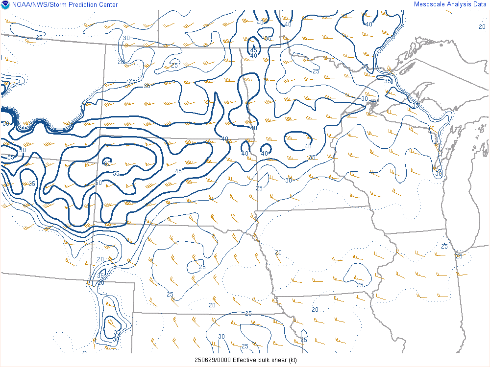
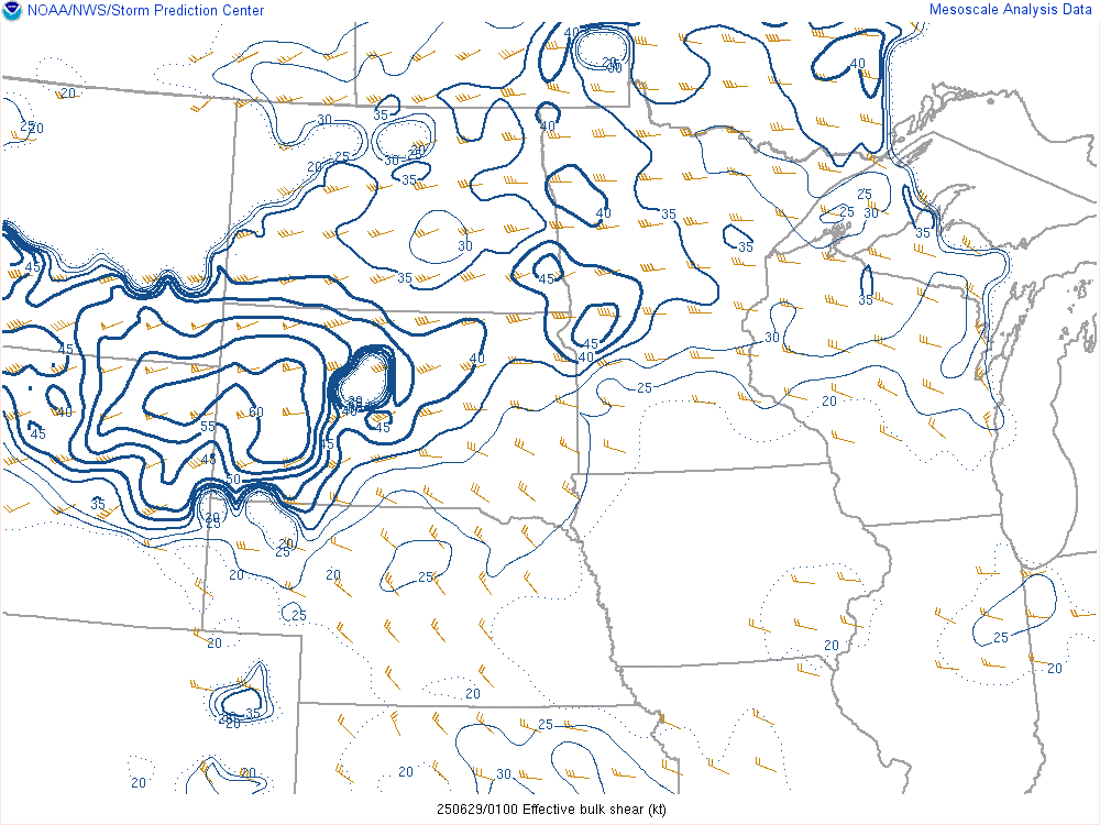
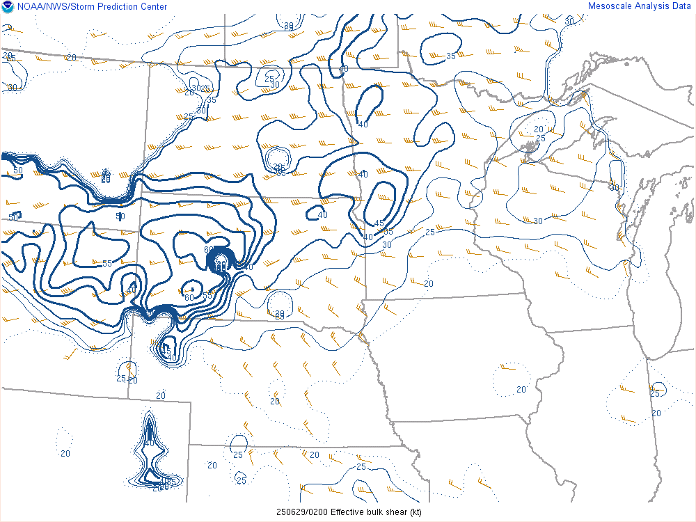
Effective Bulk Shear (EBS)
 |
 |
 |
 |
| EBS - 6 pm CDT - June 28th SPC's Mesoanalysis Graphic |
EBS - 7 pm CDT - June 28th SPC's Mesoanalysis Graphic |
EBS - 8 pm CDT - June 28th SPC's Mesoanalysis Graphic |
EBS - 9 pm CDT - June 28th SPC's Mesoanalysis Graphic |
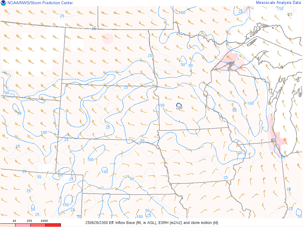
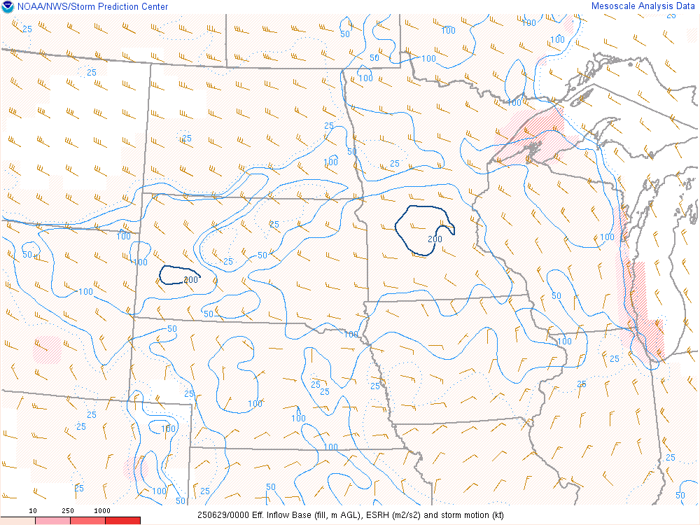
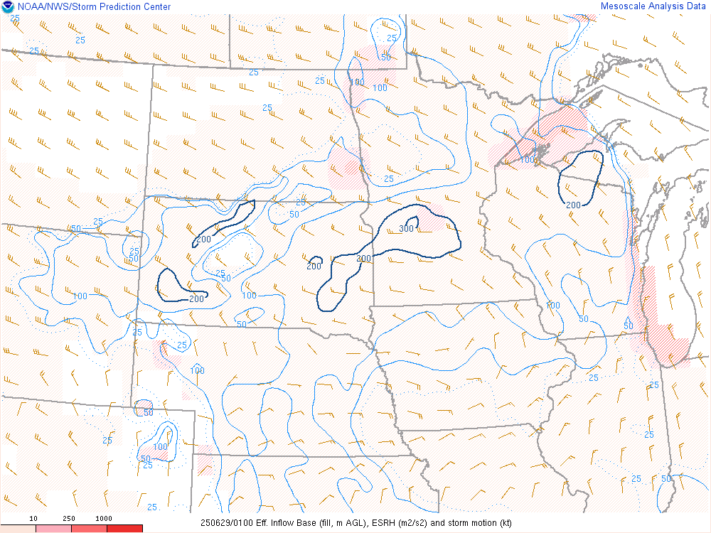
Effective Storm Relative Helicity (ESRH)
 |
 |
 |
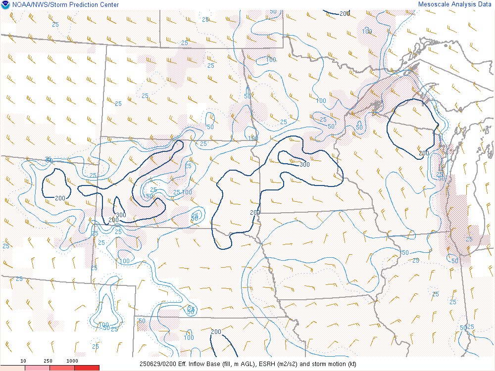 |
| ESRH - 6 pm CDT - June 28th SPC's Mesoanalysis Graphic |
ESRH - 7 pm CDT - June 28th SPC's Mesoanalysis Graphic |
ESRH - 8 pm CDT - June 28th SPC's Mesoanalysis Graphic |
ESRH - 9 pm CDT - June 28th SPC's Mesoanalysis Graphic |
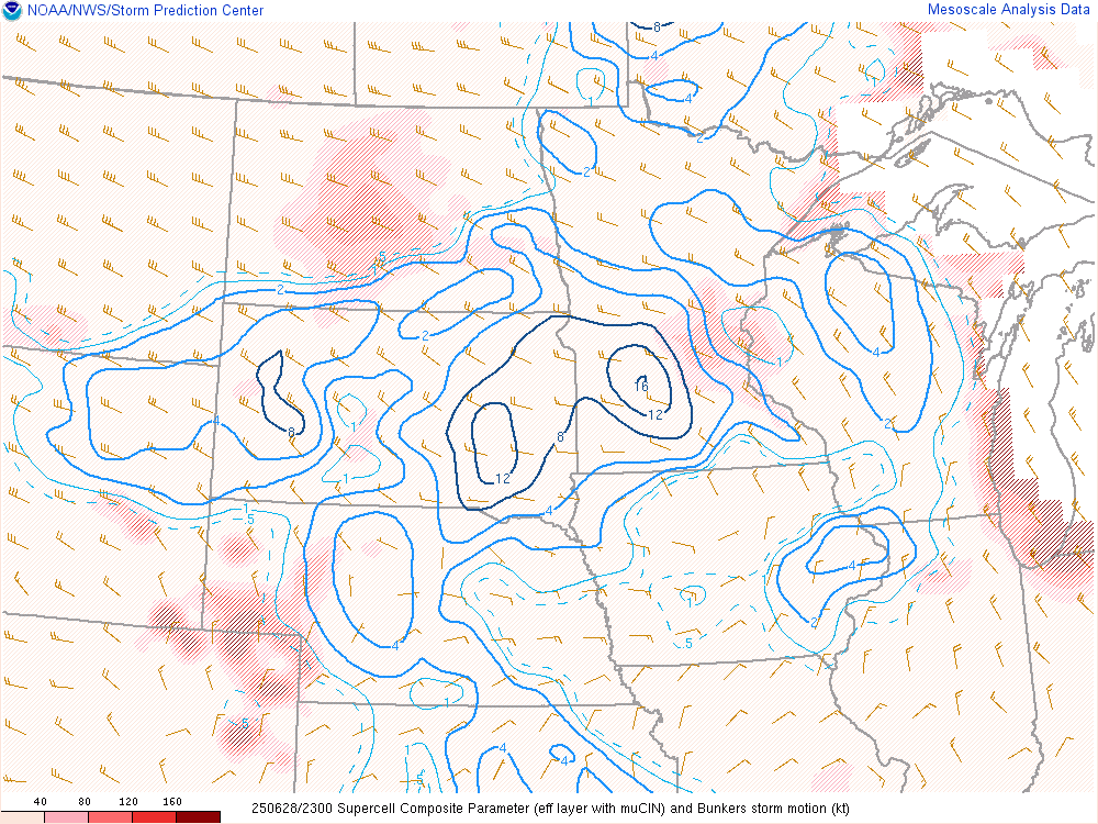
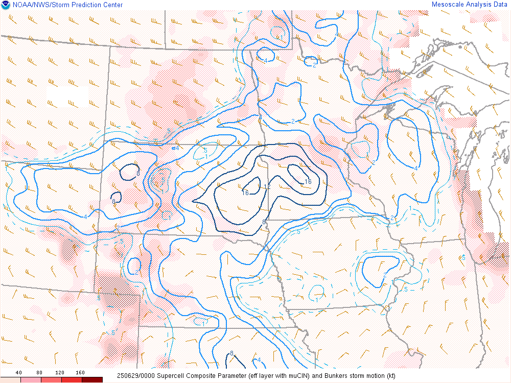
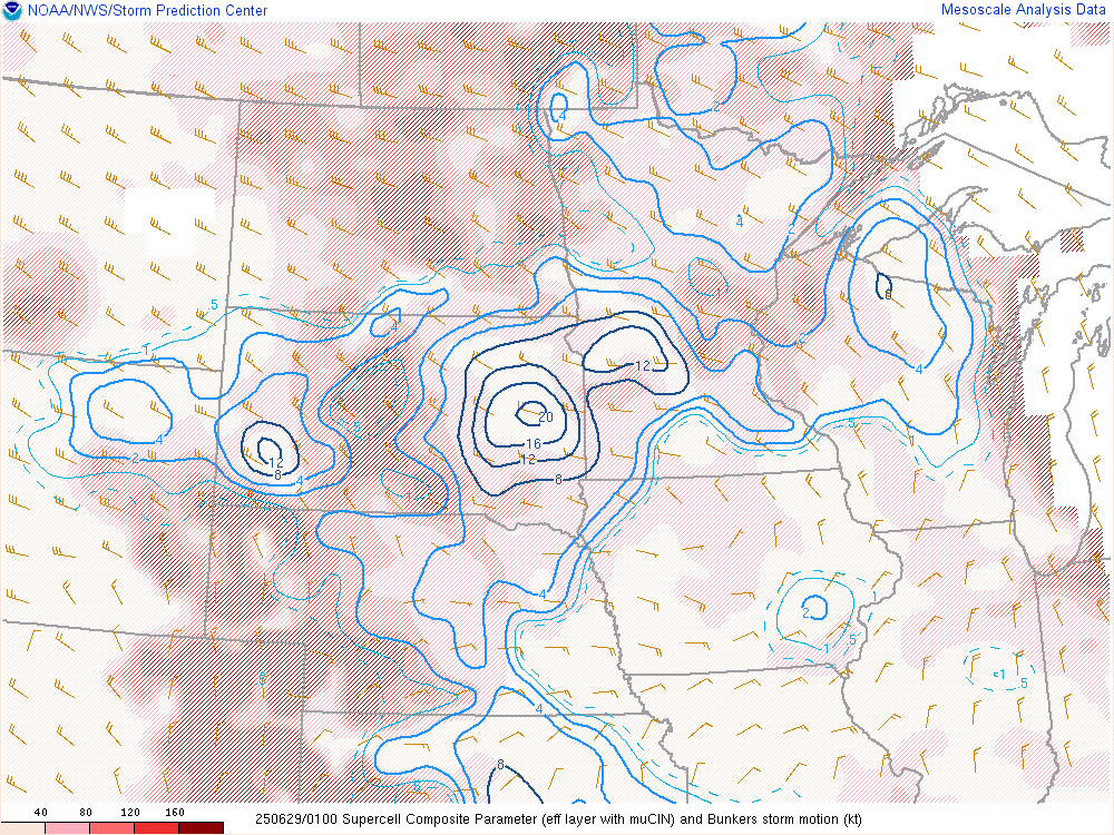
Supercell Composite Parameter (SCP)
 |
 |
 |
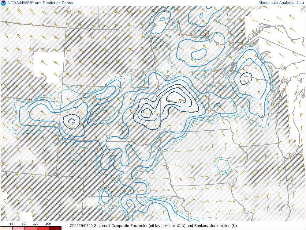 |
| SCP - 6 pm CDT - June 28th SPC's Mesoanalysis Graphic |
SCP - 7 pm CDT - June 28th SPC's Mesoanalysis Graphic |
SCP - 8 pm CDT - June 28th SPC's Mesoanalysis Graphic |
SCP - 9 pm CDT - June 28th SPC's Mesoanalysis Graphic |
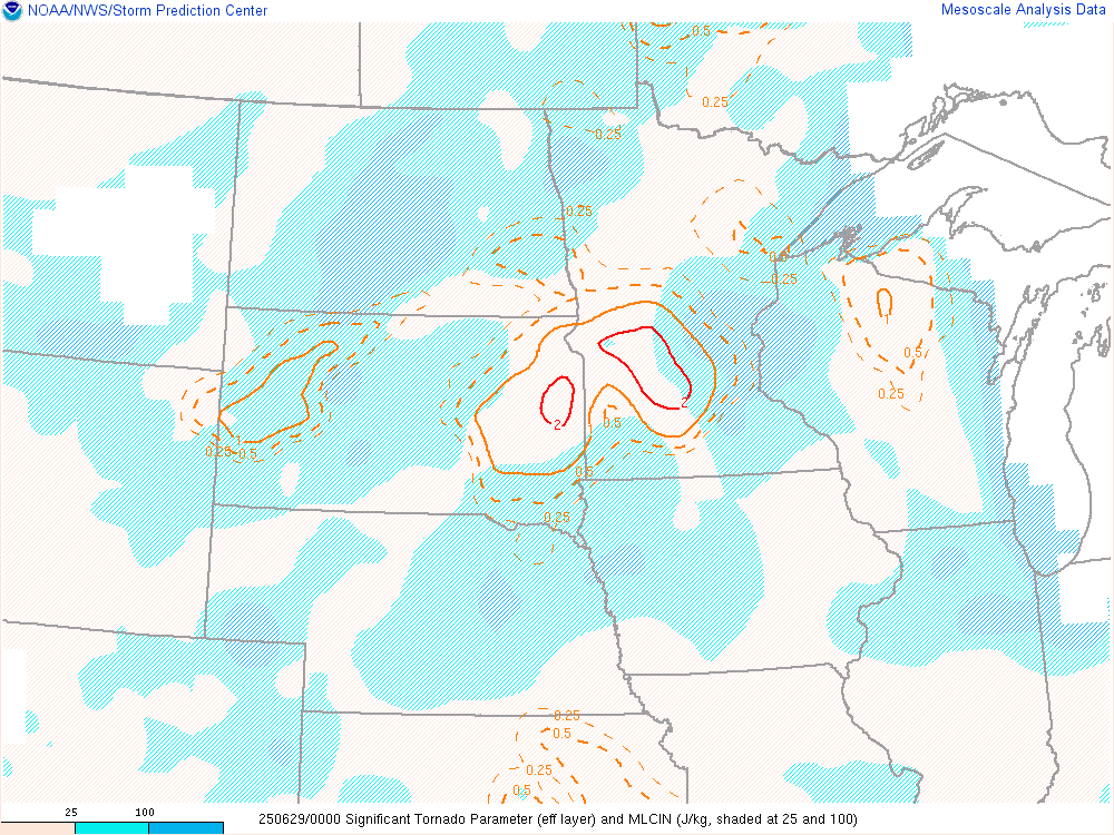
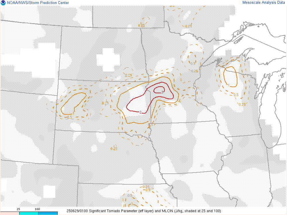
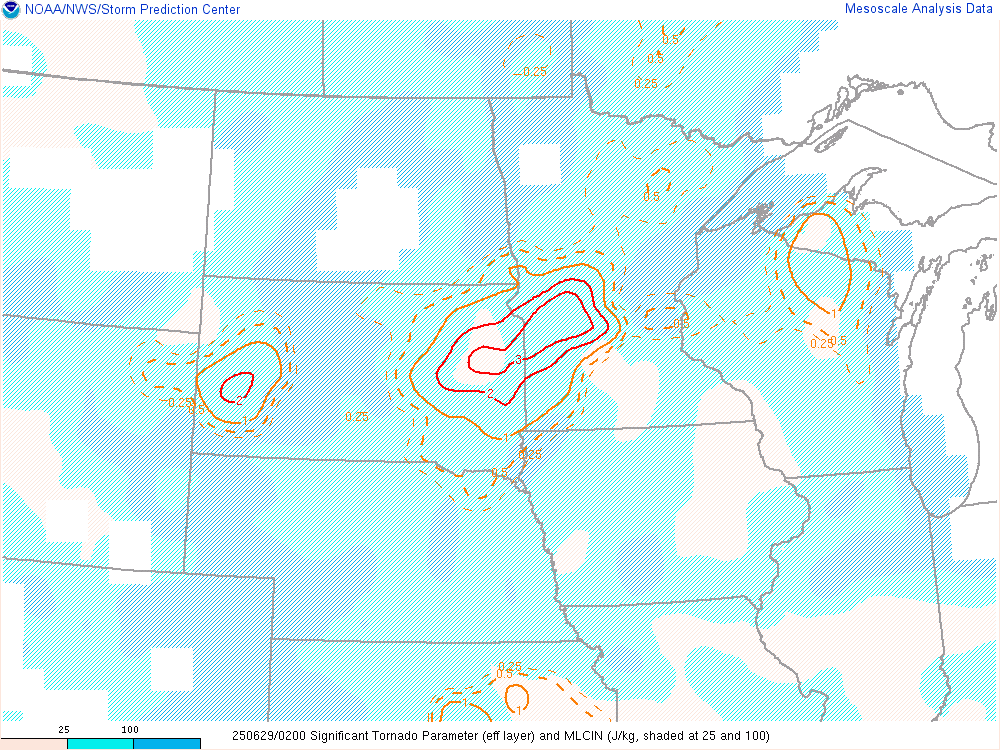
Significant Tornado Parameter (STP)
 |
 |
 |
 |
| STP - 6 pm CDT - June 28th SPC's Mesoanalysis Graphic |
STP - 7 pm CDT - June 28th SPC's Mesoanalysis Graphic |
STP - 8 pm CDT - June 28th SPC's Mesoanalysis Graphic |
STP - 9 pm CDT - June 28th SPC's Mesoanalysis Graphic |
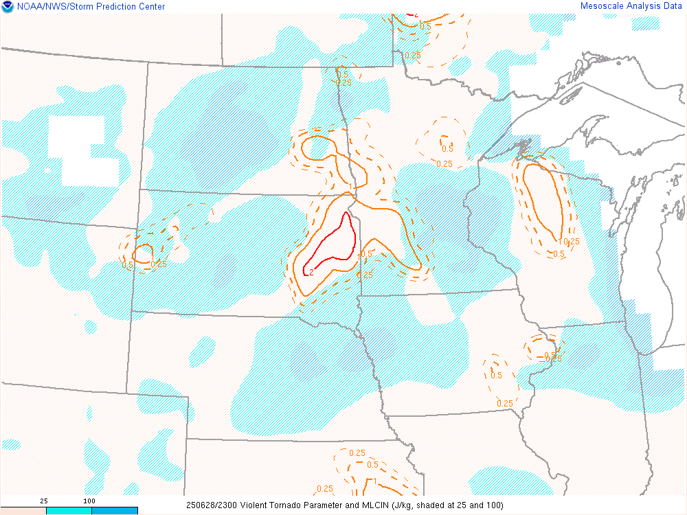
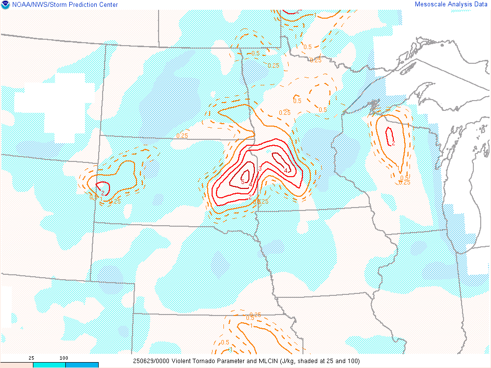
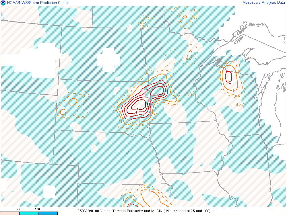
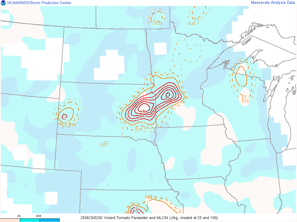
Violent Tornado Parameter (VTP)
 |
 |
 |
 |
| VTP - 6 pm CDT - June 28th SPC's Mesoanalysis Graphic |
VTP - 7 pm CDT - June 28th SPC's Mesoanalysis Graphic |
VTP - 8 pm CDT - June 28th SPC's Mesoanalysis Graphic |
VTP - 9 pm CDT - June 28th SPC's Mesoanalysis Graphic |
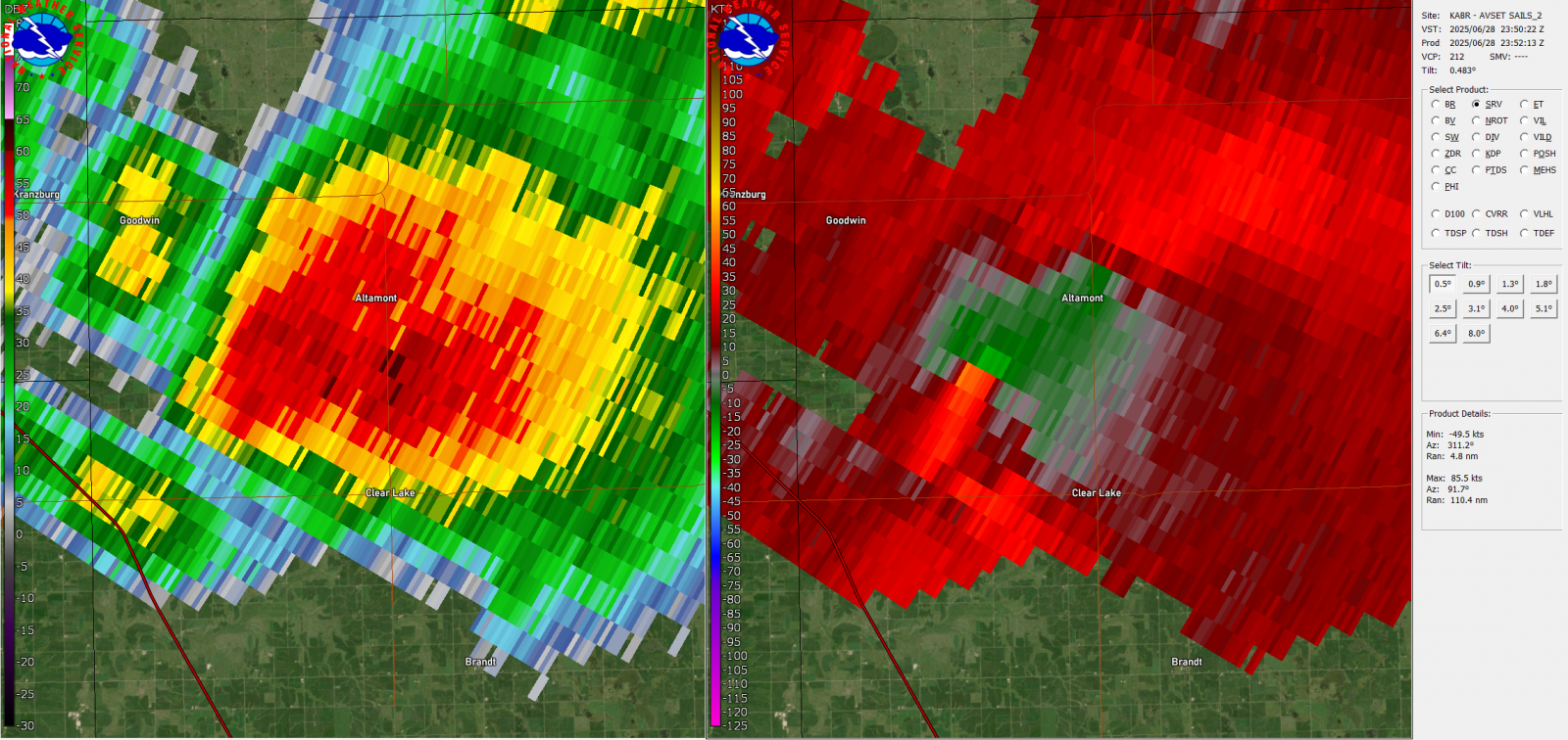
Radar & Satellite
 |
 |
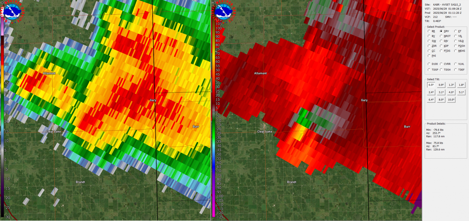 |
| Initial tornado touchdown observed by spotters and chasers northwest of Clear Lake SD. Radar time is approximately 6:50 pm | Brief tornado touchdown southwest of Gary SD. Radar time is approximately 7:35 pm | This is the initial radar couplet of what would go on to be the EF-3 tornado near Gary, Radar time is approximately 8:09 pm |
| MRMS Reflectivity of the June 28, 2025 Tornadic Event. The loop goes from 6 PM CDT to midnight. |
| Cooperative Institute for Research in the Atmosphere (CIRA) GOES-19 Satellite Loop |
 |
Media use of NWS Web News Stories is encouraged! Please acknowledge the NWS as the source of any news information accessed from this site. |
|

