
Record setting heat is expected over the next several days from the Intermountain West through the northern Plains. Furthermore, fire weather concerns increase with dry and breezy conditions. Meanwhile, heavy rainfall and severe thunderstorm threats for the Ohio/Tennessee Valleys, central Appalachians and Southeast today. The threat shifts to central Gulf Coast and across central Texas this week. Read More >
Overview
|
A Mesoscale Convective Vortex (MCV) lifted north along/near the Missouri River in central South Dakota during the afternoon hours of September 14th, just to the northeast of a surface low. As it moved north, the rotation in the vortex tightened and to the development of a tornado just to the east of Mobridge, South Dakota. The tornado tracked 3.99 miles and was rated an EF-1. As the tornado moved to the northwest, it tipped over a couple trailers, knocked down walls on a garage, damaged a silo, and snapped several power poles. A second tornado was observed by a storm chaser 8 miles to the northeast of Wakpala. What is a Mesoscale Convective Vortex (MCV)? It's an area of low pressure within a thunderstorm complex that leads to the winds and precipitation to pull into a circling pattern. These MCV's are usually pretty small, and can lead to localized areas of severe weather. |
Aberdeen, SD radar loop on September 14, 2025 from 11:41am CDT to 1:49pm CDT and showing the track of the storm that produced tornadoes near Mobridge, SD and Wakpala, SD. |
Tornadoes
Select a tornado from the table to zoom into the track and view more information. The default table view is limited to 8 tracks, but can be scrolled by a mouse wheel or dynamically expanded. Additionally, the table can fill the entire window by clicking the small circular expanding arrow icon at the very top right of the table and returned to its original size by clicking the button again. The side information panel that opens over the map can be closed using the "X" on the upper right corner of the pop-up. Zoom into the map and click damage points to see detailed information and pictures from the surveys.
|
NOTE: times shown below are local to your device's time zone. |

The Enhanced Fujita (EF) Scale classifies tornadoes into the following categories:
| EF0 Weak 65-85 mph |
EF1 Moderate 86-110 mph |
EF2 Significant 111-135 mph |
EF3 Severe 136-165 mph |
EF4 Extreme 166-200 mph |
EF5 Catastrophic 200+ mph |
 |
|||||
| Tornadoes that fail to impact any ratable damage indicators on the EF-Scale are rated EF-Unknown (EF-U) | |||||
Photos & Video
Thank you to the Walworth County EM and the storm chasers/spotters that relayed pictures to us during and after the event.
 |
 |
 |
 |
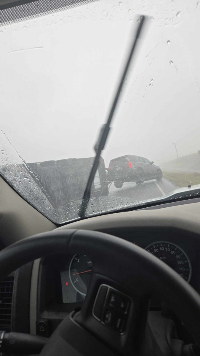
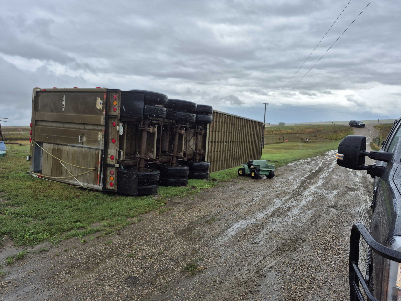
| A towed trailer flipped on US-12 around 2 miles east of Mobridge. (Photo from Bryson Vetch) |
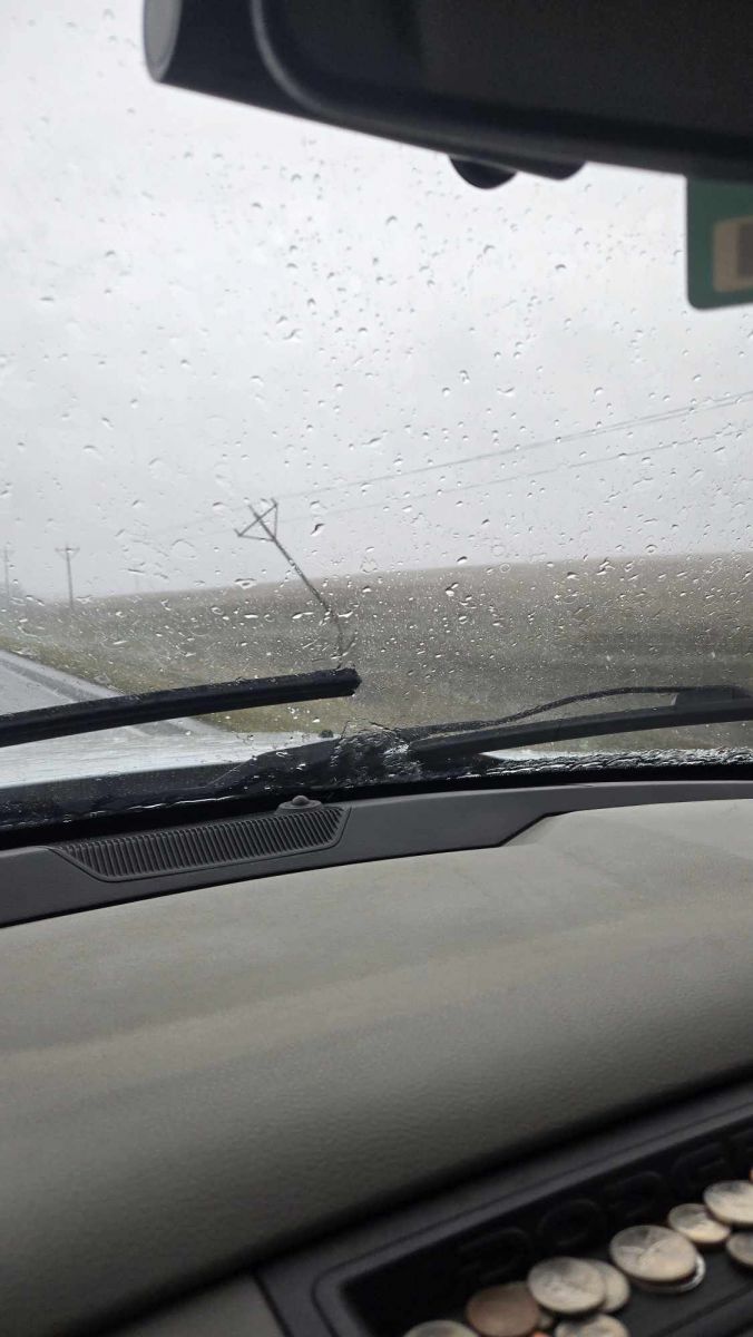
Broken power pole along US-12 to the east of Mobridge, SD (Photo from Bryson Vetch) |
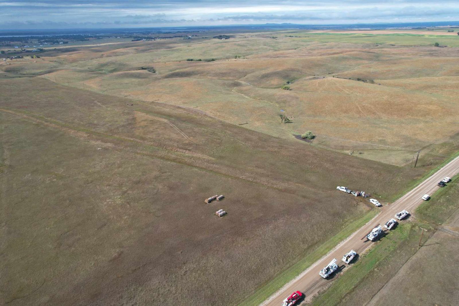
Drone imagery of power poles broken to the east-northeast of Mobridge, SD (Photo from Bryson Vetch) |
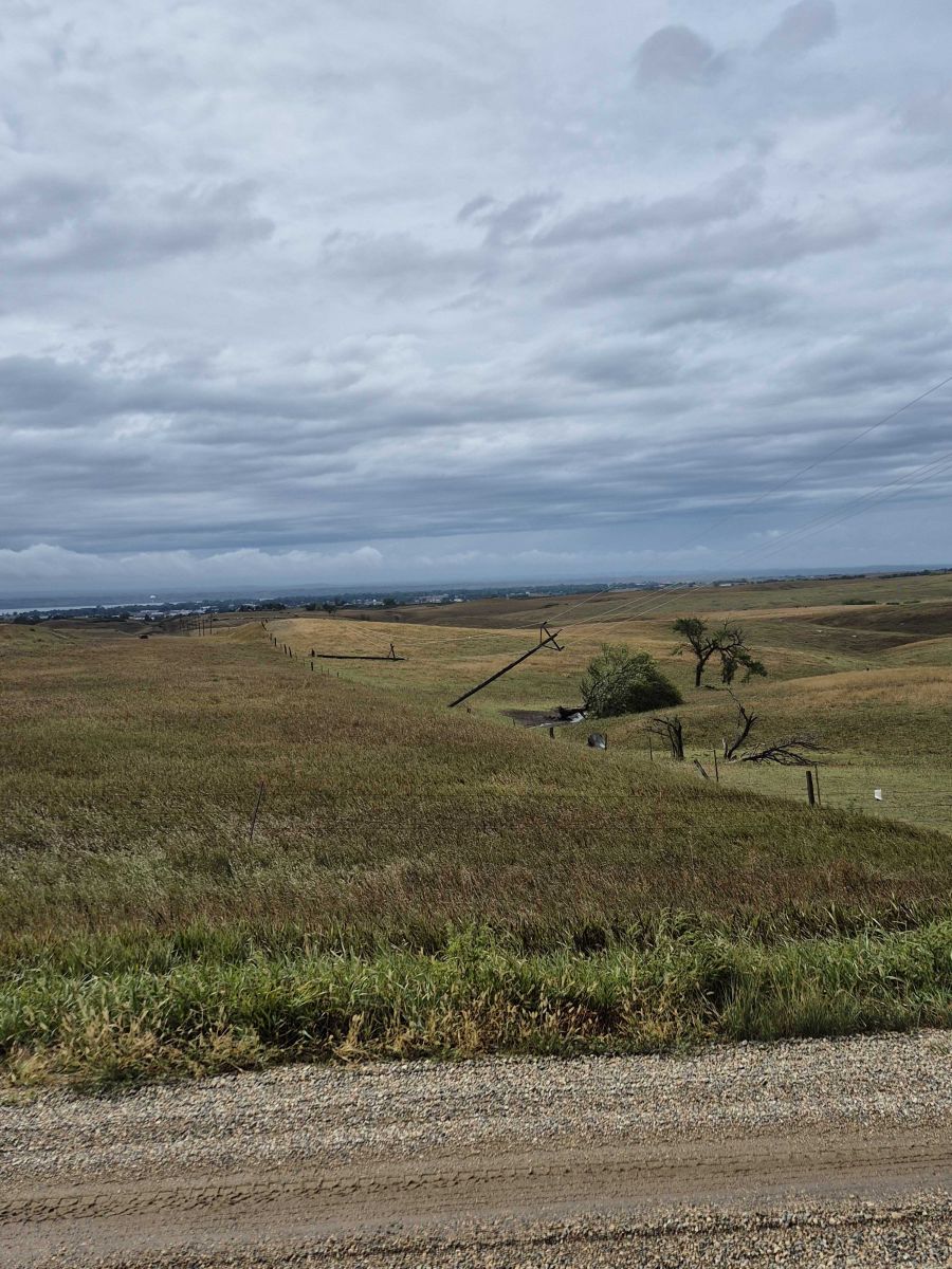
Photo of the broken power poles to the east-northeast of Mobridge, SD, looking to the west. (Photo from Walworth County EM) |
 |
 |
 |
 |
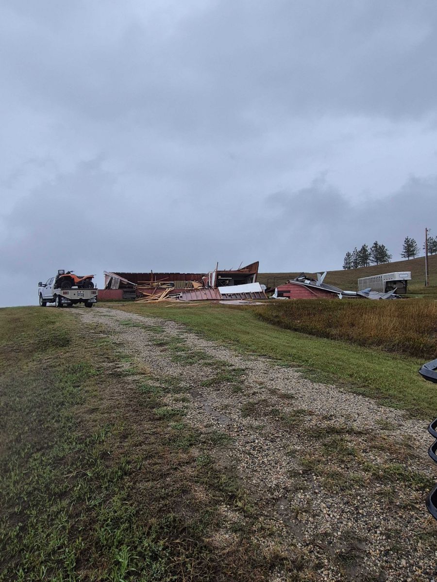
| Garage that was damage from the tornado to the southeast of Mobridge, SD (Photo from Walworth County EM) |
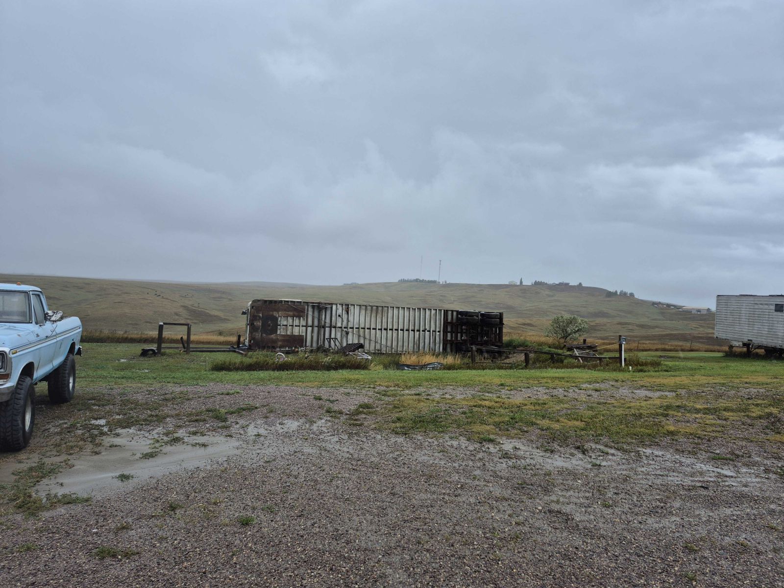
Flipped trailer from the tornado (Photo from Walworth County EM) |
Another flipped trailer (Photo from Walworth County EM) |
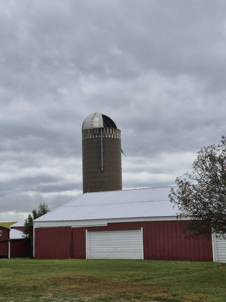
Damage to the top of a silo (Photo from Walworth County EM) |
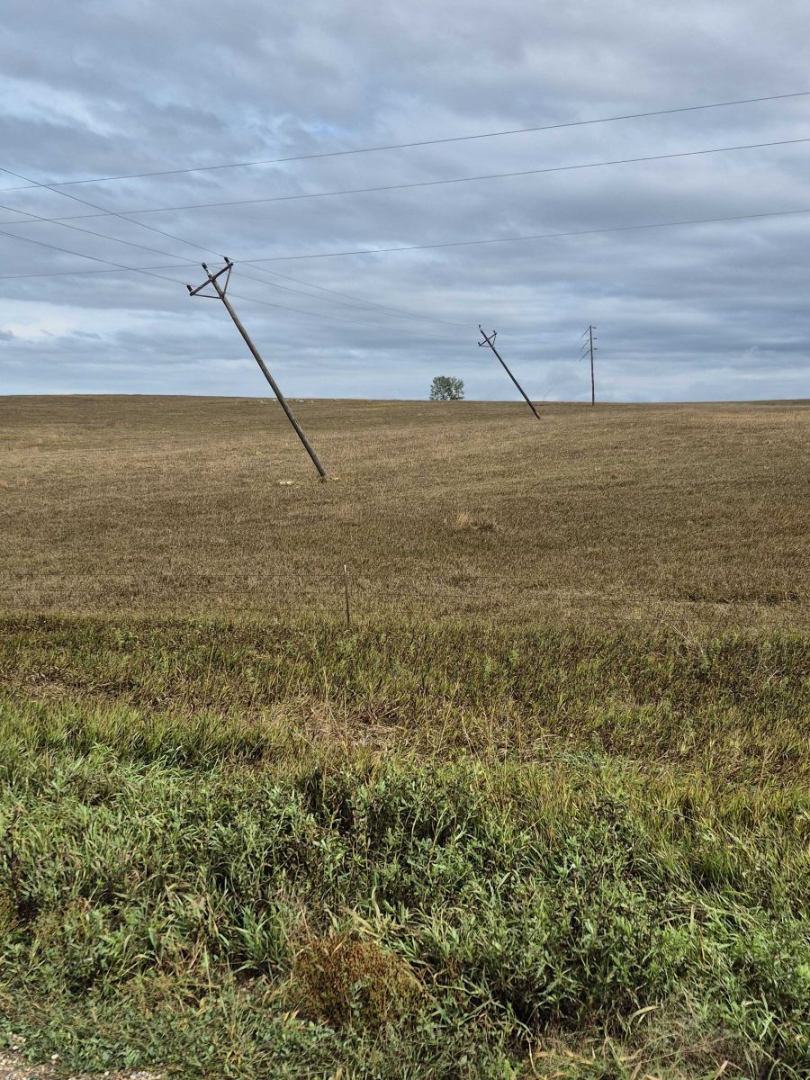 |
| Additional leaning power poles (Photo from Walworth County EM) |
Radar
 |
 |
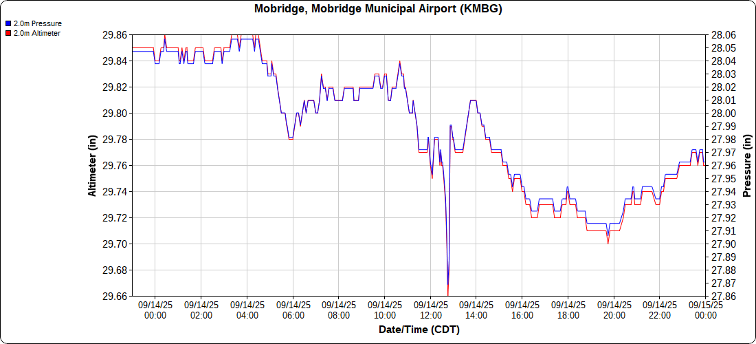 |
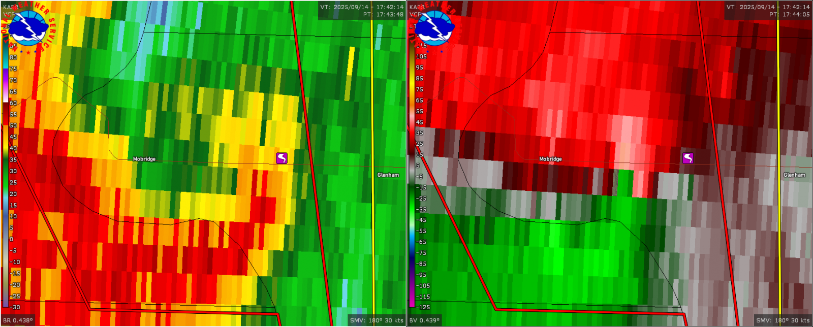
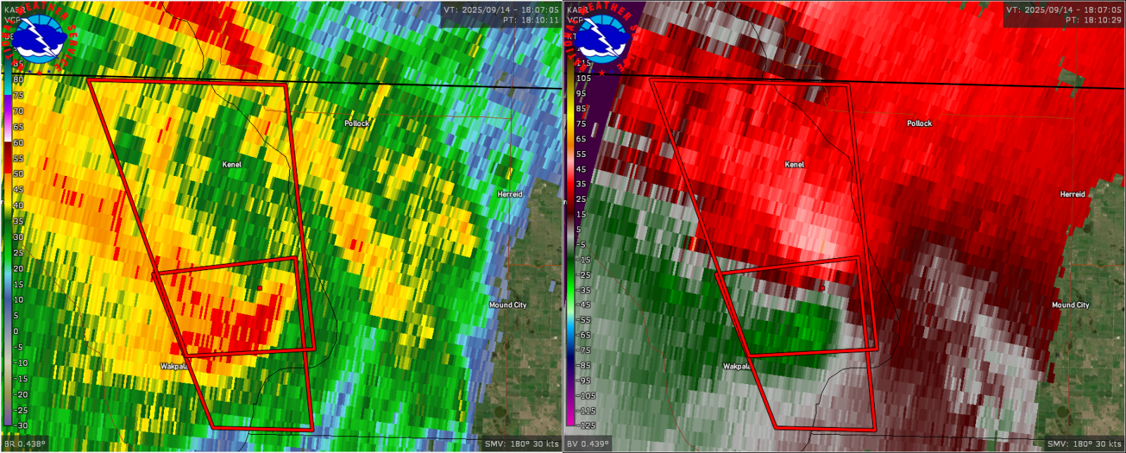
| Radar image at 12:44pm CDT on September 14, 2025 as the tornado was crossing US-12 just to the east of Mobridge, SD | Radar image at 1:10pm CDT on September 14, 2025 at the time of a storm chaser report of a tornado to the northeast of Wakpala, SD | Mobridge, SD Airport (KMBG) Pressure Observations for September 14, 2025. The sharp drop and rise of pressure around 12:45pm CDT was when the tornado moved just to the east of the airport. (Image courtesy of MesoWest) |
 |
Media use of NWS Web News Stories is encouraged! Please acknowledge the NWS as the source of any news information accessed from this site. |
|

