Overview
|
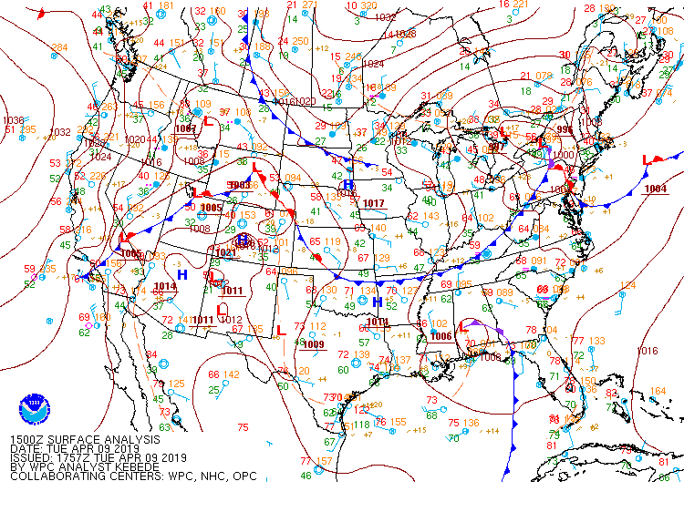
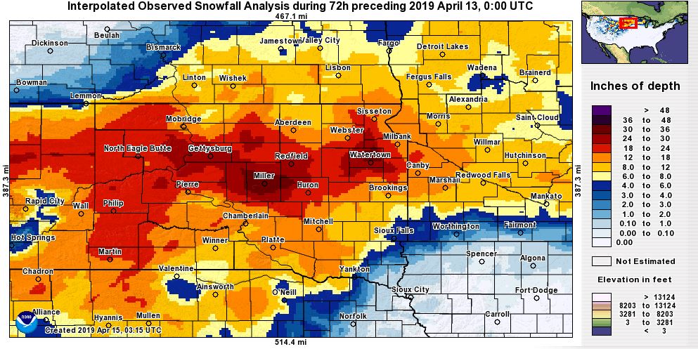
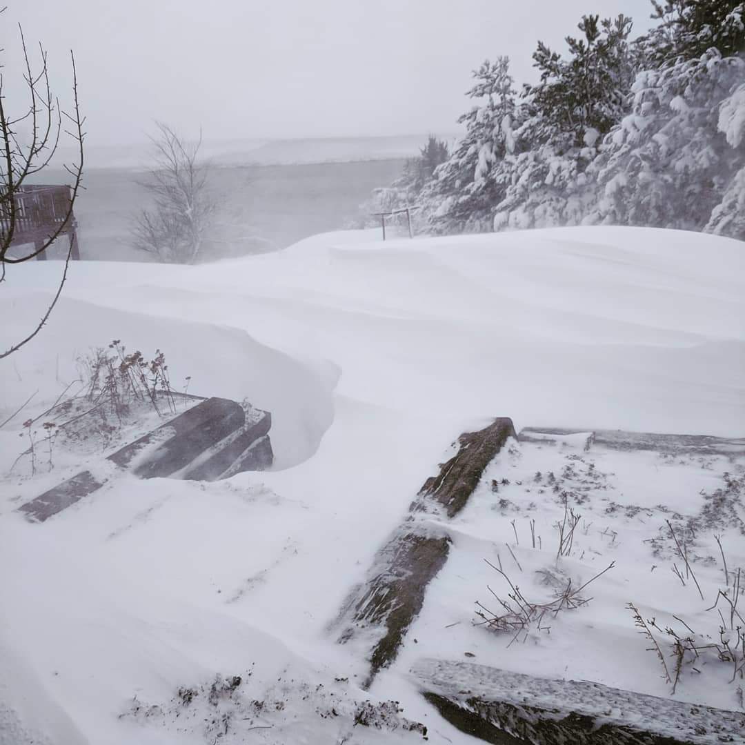
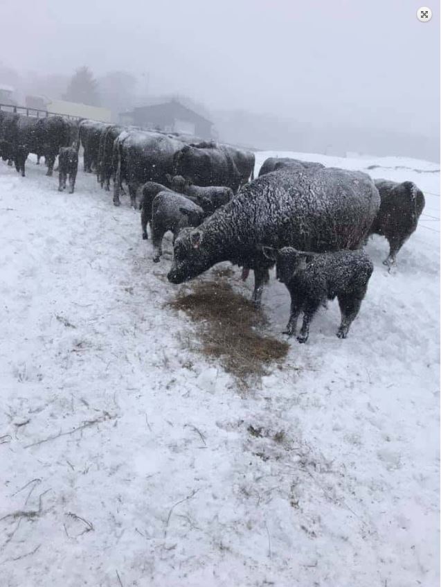
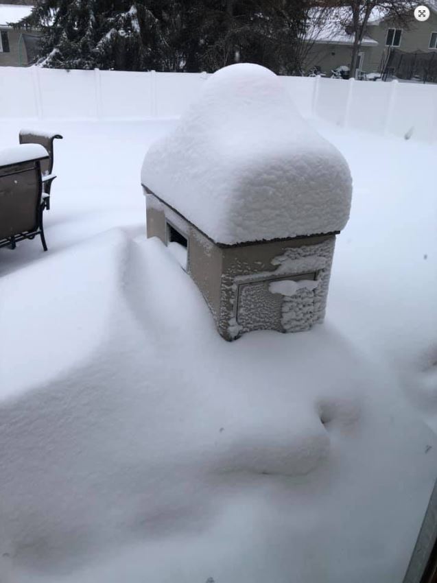
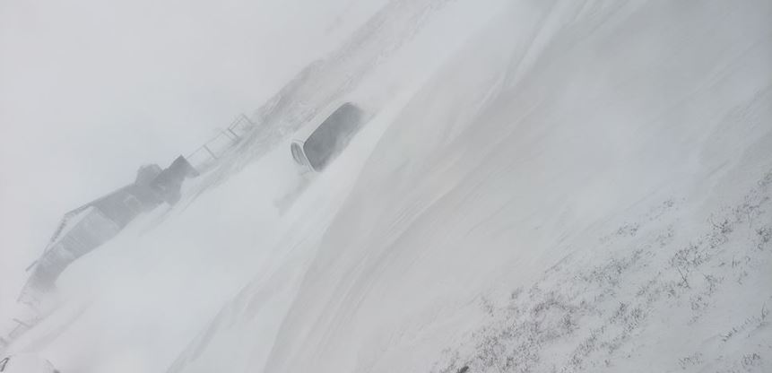
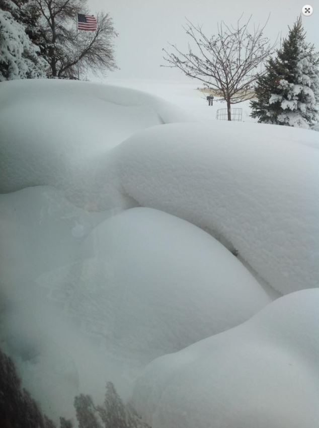
A low pressure system that developed in eastern Colorado during the afternoon of April 9th, 2019, produced heavy snowfall across the region on April 10-11th as it moved through the Central and Northern Plains. The initial wave of snow moved into portions of central and eastern South Dakota during the early morning hours of April 10th. This snow fell at rates exceeding 1 inch an hour and produced anywhere from 3 to 12 inches of snow by the evening of April 10th. The heaviest snow occurred between US Highway 12 and 14, stretching from Eagle Butte, eastward through northern Faulk County and to the Watertown area. The second wave of snow occurred as during the evening of April 10th through the early morning hours of April 12th, as the low moved from central Kansas to southwestern Minnesota. Once again, snowfall rates exceeded 1 inch an hour in many locations on April 11th. The heavy snow, combined with winds gusting between 40 and 50 mph, produced blizzard conditions across much of central and eastern South Dakota into the evening hours of April 11th. The poor weather conditions led to "No Travel Advised" across much of the eastern 2/3rds of South Dakota and closed Interstate 90 from Rapid City to Sioux Falls and Interstate 29 from Sioux Falls to Fargo, ND. Storm total snowfall amounts exceeded a foot for numerous locations and some locations even eclipsed the two foot mark. Finally, thundersnow was reported across portions of central and eastern South Dakota, and west central Minnesota especially in the Watertown area. Thunderstorms also produced pea-sized hail across portions of east central South Dakota on the 11th. |
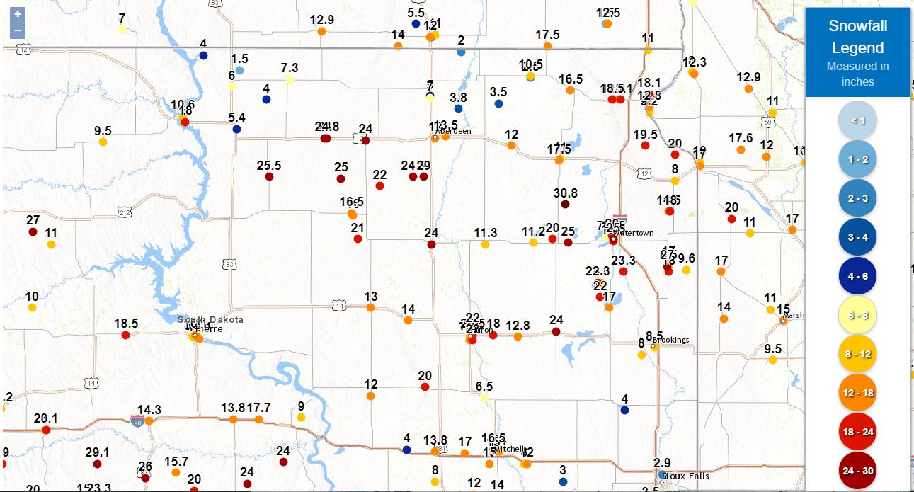
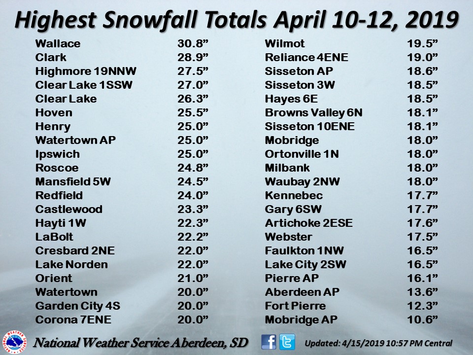 Some of the highest reported snowfall amounts across west central Minnesota and central and northeastern South Dakota. |
 |
 |
 |
|
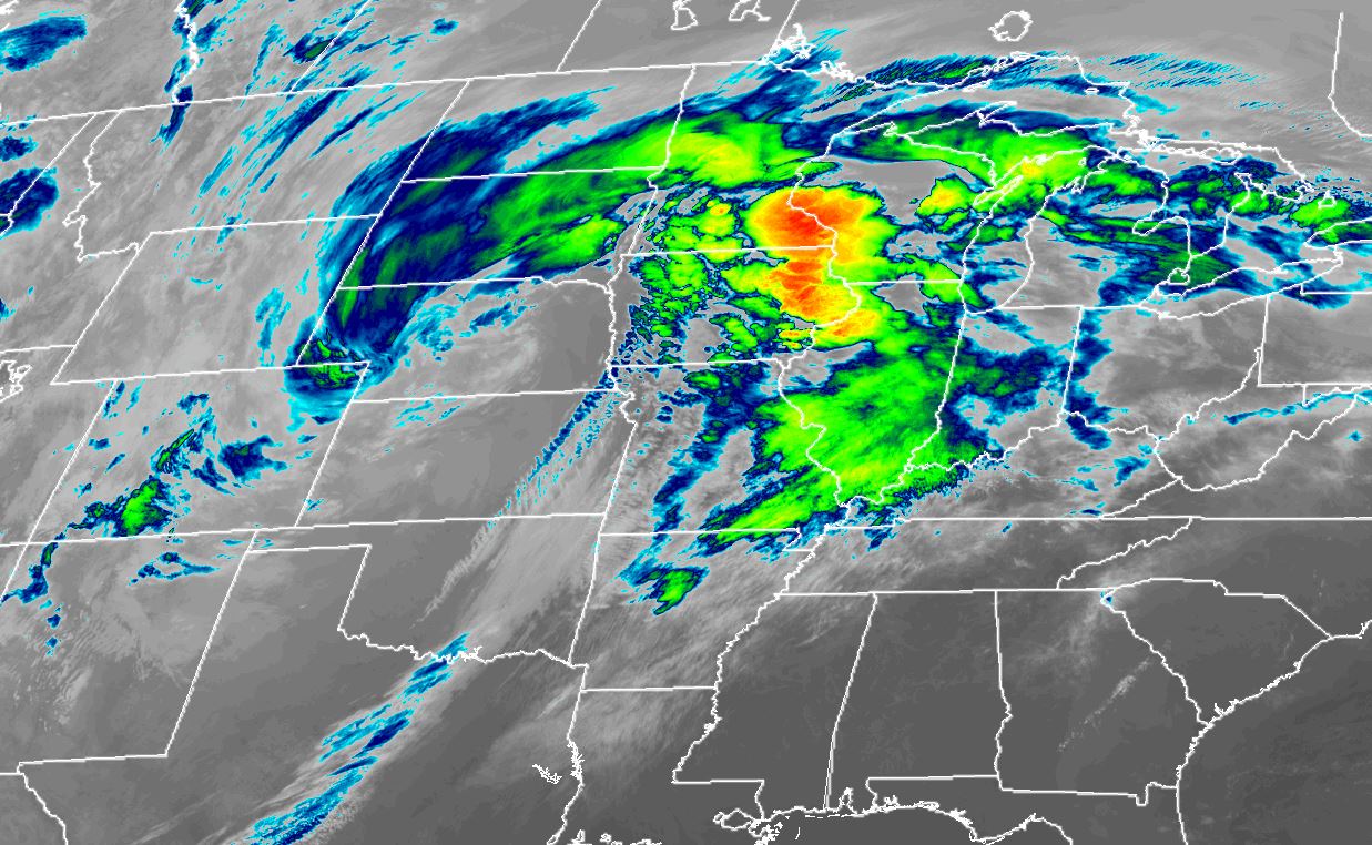
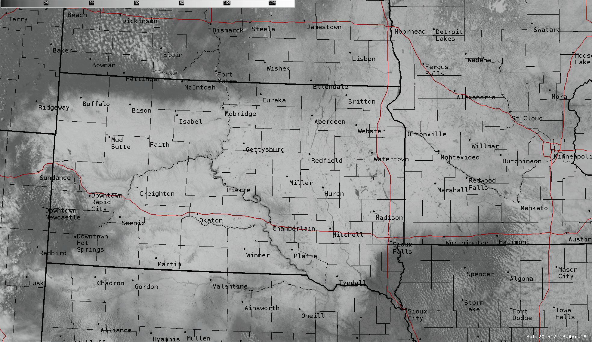
| Radar loop from 1 PM CDT April 9, 2019 to 10 AM CDT April 12, 2019 | Loop of the surface low track from 10 AM CDT April 9, 2019 to 7 AM CDT April 12, 2019 | GOES-16 Infrared Satellite Imagery at 9am on April 11th, courtesy of the CIRA RAMMB-SLIDER | Visible satellite imagery taken at 4pm on April 13th, showing the extent of the snowfall across the region. |
Wind
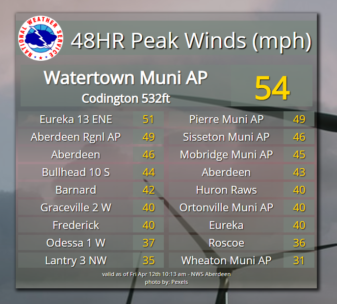
Peak Wind Values
...HIGHEST WIND REPORTS IN THE PAST 48 HOURS...

Location                     Speed     Time/Date       Lat/Lon
Watertown Muni AP            54 MPH    0329 AM 04/11   44.90N/97.15W
Eureka 13 ENE                51 MPH    0315 PM 04/11   45.88N/99.41W
Aberdeen Rgnl AP             49 MPH    0123 PM 04/11   45.45N/98.42W
Pierre Muni AP               49 MPH    0152 PM 04/11   44.38N/100.28W
Aberdeen                     46 MPH    0400 PM 04/11   45.47N/98.64W
Sisseton Muni AP             46 MPH    0101 PM 04/11   45.67N/96.98W
Mobridge Muni AP             45 MPH    0322 PM 04/11   45.55N/100.42W
Bullhead 10 S                44 MPH    0506 PM 04/11   45.61N/101.06W
Aberdeen                     43 MPH    1000 AM 04/11   45.54N/98.64W
Barnard                      42 MPH    0200 PM 04/11   45.72N/98.61W
Eureka                       40 MPH    0431 PM 04/11   45.77N/99.62W
Frederick                    40 MPH    0431 PM 04/11   45.78N/98.62W
Ortonville Muni AP           40 MPH    0855 AM 04/11   45.30N/96.42W
Graceville 2 W               40 MPH    1000 AM 04/11   45.56N/96.49W
Huron Raws                   40 MPH    0741 PM 04/11   44.24N/98.77W
Odessa 1 W                   37 MPH    0951 AM 04/11   45.26N/96.34W
Eureka                       36 MPH    0300 PM 04/11   45.77N/99.62W
Roscoe                       36 MPH    0700 AM 04/11   45.45N/99.35W
Groton                       35 MPH    1101 AM 04/11   45.44N/98.09W
Lantry 3 NW                  35 MPH    0352 PM 04/11   45.06N/101.47W
Wheaton Muni AP              31 MPH    1246 PM 04/11   45.78N/96.55W
Glad Valley                  30 MPH    0216 PM 04/11   45.55N/101.87W

Observations are collected from a variety of sources with varying
equipment and exposures. We thank all volunteer weather observers
for their dedication. Not all data listed are considered official.

$$
Snow and Liquid Eqivalent
Snow and Liquid Eqivalent
|
 |
 |
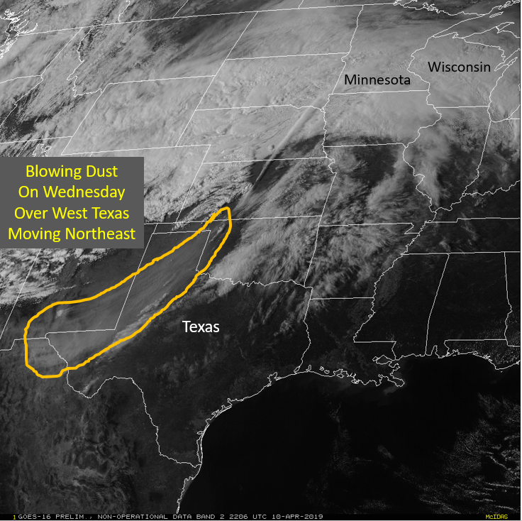 |
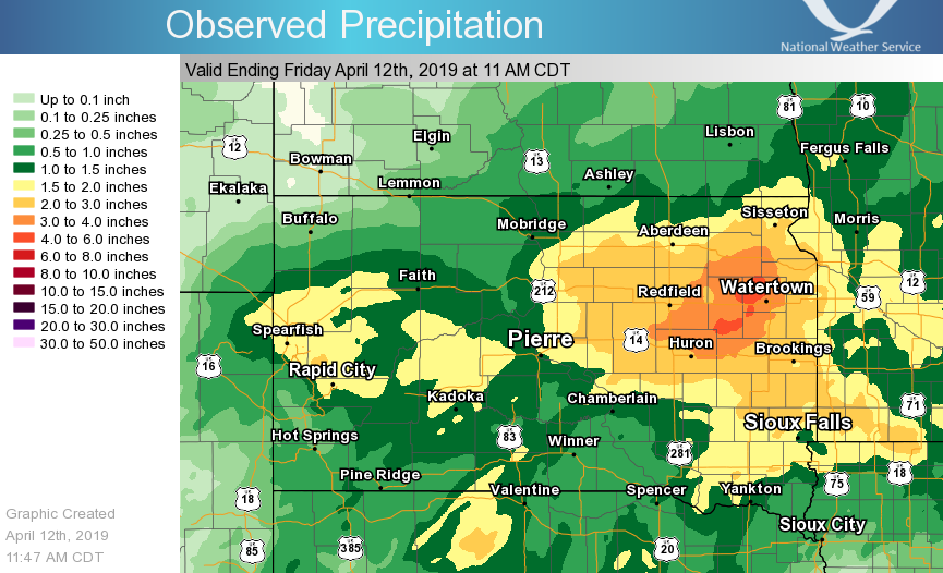
| Some of the highest reported snowfall amounts across west central Minnesota and central and northeastern South Dakota. | Snowfall reports in map format. This map is a mix of 24 hour, 48 hour, and 72 hour snowfall amounts. Thus, you will see variability from location to location. | Liquid Equivalent precipitation observed for the 72 hours prior to 11 AM CDT on April 12, 2019. River flooding remained a concern/threat in response. | Snowfall across portions of Minnesota turned an orange color, thanks to the mixing in of Texas/New Mexico dust. Visible Satellite image shown |
 |
 |
||
| Approximated snowfall totals across the area from April 10-12th, courtesy of NOHRSC | Approximated snowfall totals across the country from April 10-12th, courtesy of NOHRSC |
Snowfall reports below are as of 2 PM CDT April 12, 2019
...72 HOUR SNOWFALL REPORTS...

Location                     Amount    Time/Date       Provider
Clear Lake                   26.3 in   1000 AM 04/12   COOP
Watertown 1 W                25.0 in   0900 AM 04/12   COOP
Roscoe                       24.0 in   0700 AM 04/12   COOP
Redfield                     24.0 in   1250 PM 04/12   Emergency Mngr
Hayti 1 W                    22.3 in   0800 AM 04/12   COOP
Castlewood                   22.2 in   0200 PM 04/12   Public
Lake Norden                  22.0 in   0100 PM 04/12   Public
Orient                       21.0 in   1157 AM 04/12   Public
Sisseton 3 W                 18.5 in   0700 AM 04/12   UCOOP
Hayes 6 E                    18.5 in   0600 AM 04/12   UCOOP
Browns Valley 6 N            18.1 in   0700 AM 04/12   COCORAHS
Milbank                      18.0 in   0730 AM 04/12   COOP
Watertown 2 E                16.5 in   0915 AM 04/12   COCORAHS
Faulkton 1 NW                16.0 in   0800 AM 04/12   COOP
Pierre 1 S                   14.1 in   0700 AM 04/12   COCORAHS
Selby                        14.0 in   0700 AM 04/12   COOP
Presho 0.3 SSW               13.8 in   0700 AM 04/12   COCORAHS
3 ESE Aberdeen               13.5 in   0700 AM 04/12   Official NWS Obs
Browns Valley                12.8 in   0600 AM 04/12   COOP
Wheaton                      12.3 in   0800 AM 04/12   COOP
Aberdeen 1 SSW               12.0 in   0700 AM 04/12   COCORAHS
Doland                       11.3 in   0800 AM 04/12   UCOOP

...24 HOUR SNOWFALL REPORTS ENDING MORNING OF APRIL 12...

Location                     Amount    Time/Date       Provider
Garden City 4 S              20.0 in   0800 AM 04/12   UCOOP
Murdo                        14.3 in   0900 AM 04/12   COOP
Sisseton 3 W                 12.4 in   0700 AM 04/12   UCOOP
Browns Valley 6 N            12.1 in   0700 AM 04/12   COCORAHS
Webster                      11.0 in   0800 AM 04/12   COOP
Britton                      10.5 in   0700 AM 04/12   COOP
Ortonville 1 N               10.0 in   0800 AM 04/12   UCOOP
Reliance 4 ENE               10.0 in   0800 AM 04/12   COCORAHS
Roscoe                       10.0 in   0700 AM 04/12   COOP
Browns Valley                9.2 in    0600 AM 04/12   COOP
Clear Lake                   8.5 in    1000 AM 04/12   COOP
Wheaton                      8.0 in    0800 AM 04/12   COOP
Milbank                      8.0 in    0730 AM 04/12   COOP
LaBolt 0.1 WSW               7.7 in    0730 AM 04/12   COCORAHS
Watertown 1 W                7.5 in    0900 AM 04/12   COOP
Hecla 7 WNW                  7.5 in    0800 AM 04/12   COCORAHS
Clear Lake 7 ESE             7.5 in    0800 AM 04/12   COCORAHS
Aberdeen 1 SSW               7.0 in    0700 AM 04/12   COCORAHS
Westport 2 Nw                7.0 in    0600 AM 04/12   COOP
Aberdeen 3 E                 6.3 in    0600 AM 04/12   COOP
Presho 0.3 SSW               6.2 in    0700 AM 04/12   COCORAHS
Claremont 2 SSE              6.0 in    0700 AM 04/12   COCORAHS
Selby                        5.4 in    0700 AM 04/12   COOP
Faulkton 1 NW                5.0 in    0800 AM 04/12   COOP
Hayes 6 E                    5.0 in    0600 AM 04/12   UCOOP
Pierre 1 S                   4.5 in    0700 AM 04/12   COCORAHS
Watertown 2 E                4.0 in    0915 AM 04/12   COCORAHS
Herreid 3 ESE                3.0 in    0700 AM 04/12   COCORAHS
Doland                       1.5 in    0800 AM 04/12   UCOOP

...24 HOUR SNOWFALL REPORTS ENDING MORNING OF APRIL 11...

Location                     Amount    Time/Date       Provider
Watertown 1 W                15.7 in   0900 AM 04/11   COOP
LaBolt 0.1 WSW               14.5 in   0800 AM 04/11   COCORAHS
Clear Lake                   13.5 in   1000 AM 04/11   COOP
Vivian 7 NNE                 13.0 in   1159 AM 04/11   COCORAHS
Watertown 2 E                10.0 in   0845 AM 04/11   COCORAHS
Hayti 1 W                    10.0 in   0800 AM 04/11   COOP
Clear Lake 7 ESE             9.6 in    0800 AM 04/11   COCORAHS
Reliance 4 ENE               9.0 in    0800 AM 04/11   COCORAHS
Miller 0.3 SSW               9.0 in    0750 AM 04/11   COCORAHS
Roscoe                       9.0 in    0700 AM 04/11   COOP
Pierre 1 S                   8.5 in    0700 AM 04/11   COCORAHS
Hayes 6 E                    8.0 in    0600 AM 04/11   UCOOP
Doland                       7.3 in    0800 AM 04/11   UCOOP
Fort Pierre 0.5 SE           7.3 in    0700 AM 04/11   COCORAHS
Aberdeen 3 E                 7.2 in    0600 AM 04/11   COOP
Webster                      6.5 in    0800 AM 04/11   COOP
Selby                        5.1 in    0700 AM 04/11   COOP
Faulkton 1 NW                5.0 in    0800 AM 04/11   COOP
Aberdeen 1 SSW               5.0 in    0700 AM 04/11   COCORAHS
Westport 2 Nw                5.0 in    0530 AM 04/11   COOP
Wheaton                      4.3 in    0800 AM 04/11   COOP
Eureka 11 WSW                3.7 in    0700 AM 04/11   COCORAHS
Browns Valley                3.6 in    0615 AM 04/11   COOP
Claremont 2 SSE              3.5 in    0700 AM 04/11   COCORAHS
Britton                      2.5 in    0700 AM 04/11   COOP
Hecla 7 WNW                  2.0 in    0800 AM 04/11   COCORAHS
Herreid 3 ESE                1.5 in    0700 AM 04/11   COCORAHS
Eureka                       1.2 in    0800 AM 04/11   COCORAHS

...MISC SNOWFALL REPORTS...

Location                     Amount    Time/Date       Provider
3 NNW Norbeck                25.0 in   1200 PM 04/11   Public
5 W Mansfield                24.5 in   0903 AM 04/11   Public
4 S Garden City              20.0 in   0838 AM 04/12   CO-OP Observer
Wallace                      20.0 in   0130 PM 04/11   Public
3 S Clear Lake               18.0 in   0708 PM 04/11   Public
Clark                        18.0 in   1230 PM 04/11   Public
Ortonville                   17.0 in   0558 AM 04/12   Public
Clear Lake                   17.0 in   0708 PM 04/11   Public
Hayti                        16.5 in   0530 PM 04/11   Public
Murdo                        14.3 in   1001 AM 04/12   CO-OP Observer
Ortonville                   14.0 in   0141 PM 04/11   Public
3 W Sisseton                 12.4 in   1006 AM 04/12   CO-OP Observer
Clark                        11.2 in   0958 AM 04/12   CO-OP Observer
Webster                      11.0 in   1008 AM 04/12   CO-OP Observer
4 N Victor                   11.0 in   1007 AM 04/12   CO-OP Observer
Britton                      10.5 in   0955 AM 04/12   CO-OP Observer
1 N Ortonville               10.0 in   1003 AM 04/12   CO-OP Observer
Castlewood                   10.0 in   0959 AM 04/12   CO-OP Observer
Roscoe                       10.0 in   0901 AM 04/12   Emergency Mngr
Mound City                   10.0 in   0857 AM 04/12   Emergency Mngr
Browns Valley                9.2 in    0957 AM 04/12   CO-OP Observer
1 N Ortonville               9.0 in    0617 PM 04/11   Cocorahs
Clear Lake                   8.5 in    1107 AM 04/12   CO-OP Observer
Wheaton                      8.0 in    1024 AM 04/12   CO-OP Observer
Milbank                      8.0 in    1001 AM 04/12   CO-OP Observer
Watertown                    7.5 in    1021 AM 04/12   CO-OP Observer
2 NW Westport                7.0 in    1009 AM 04/12   CO-OP Observer
Pierre                       7.0 in    1004 AM 04/12   CO-OP Observer
Mound City                   6.0 in    0846 AM 04/12   Trained Spotter
Selby                        5.4 in    1005 AM 04/12   CO-OP Observer
Mobridge                     4.0 in    1043 AM 04/12   CO-OP Observer
Mound City                   4.0 in    0251 PM 04/11   Public

Observations are collected from a variety of sources with varying
equipment and exposures. We thank all volunteer weather observers
for their dedication. Not all data listed are considered official.

$$
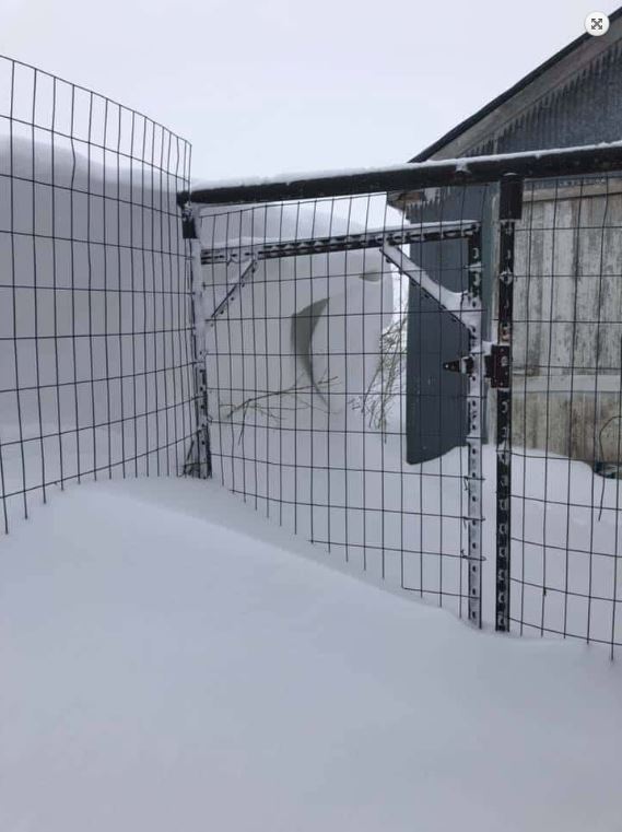
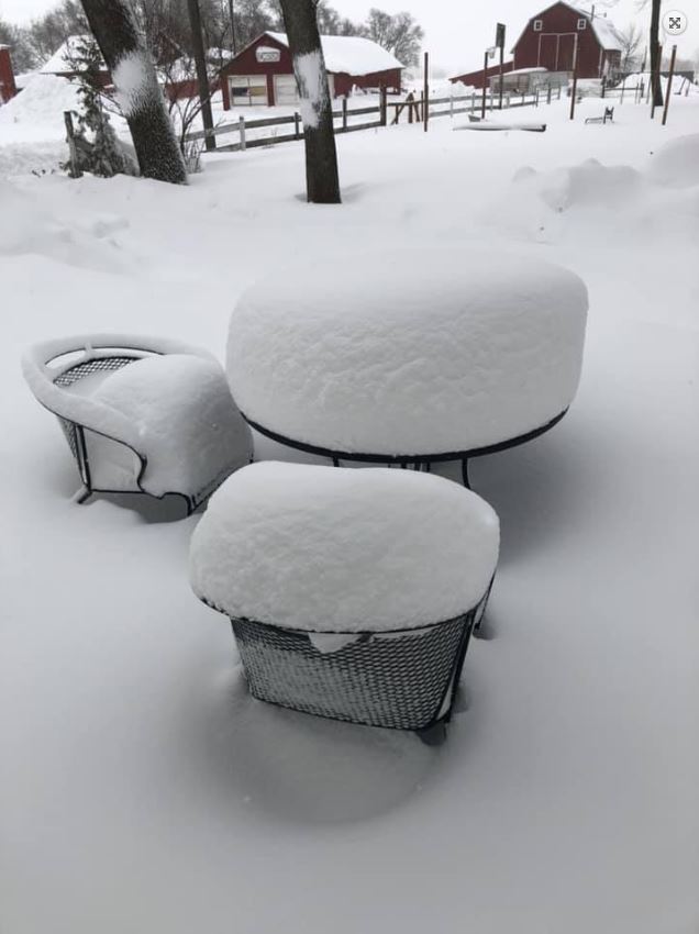
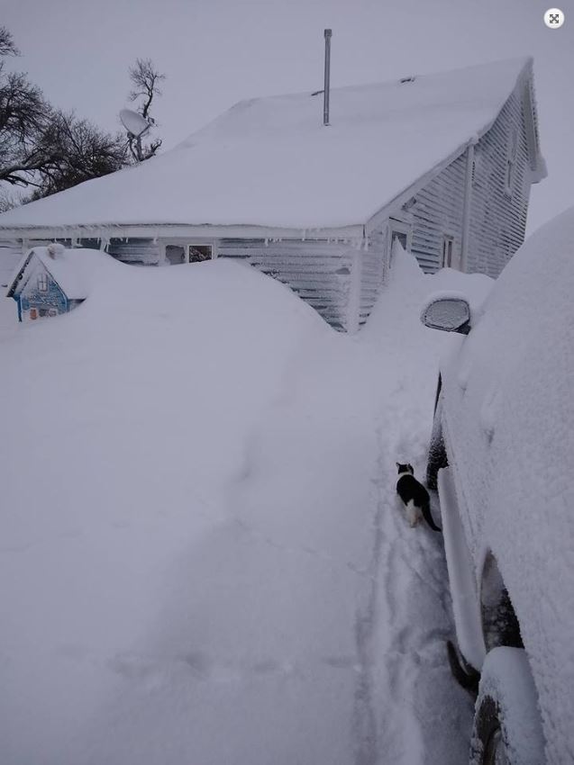
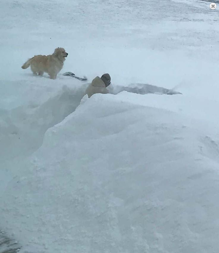
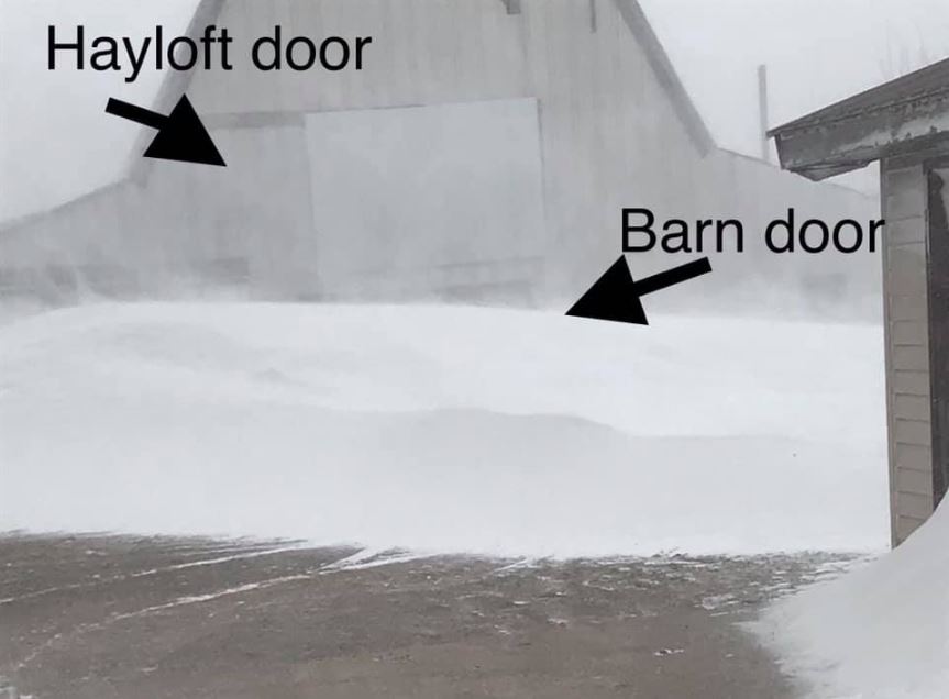
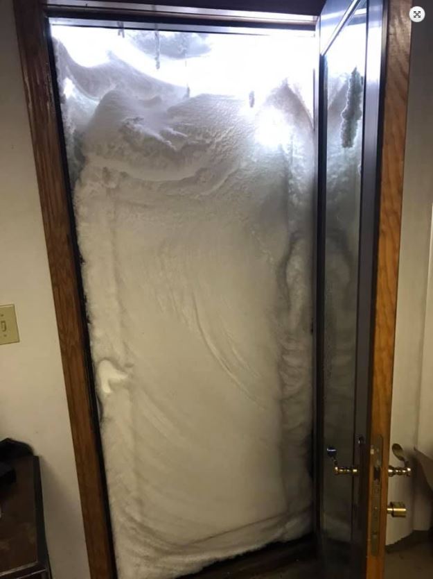
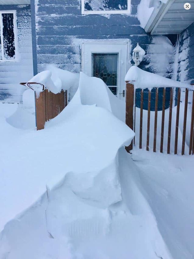
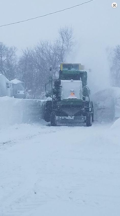
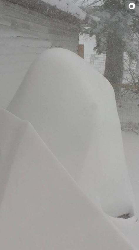
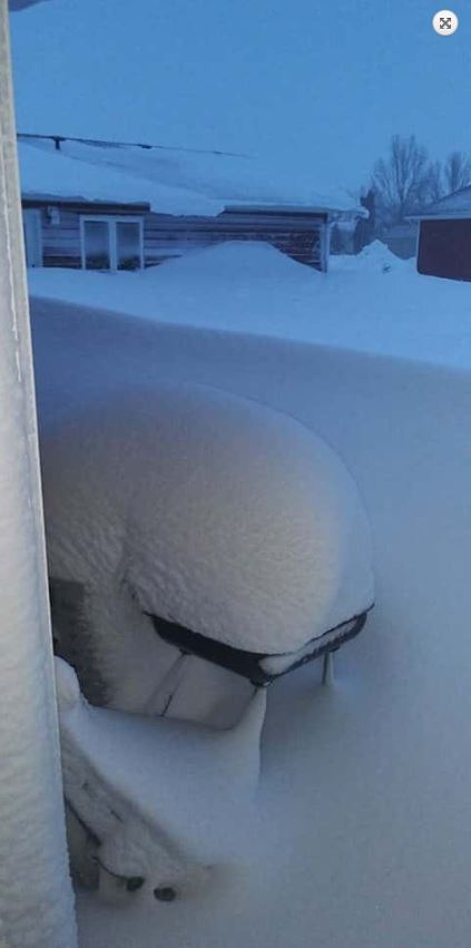
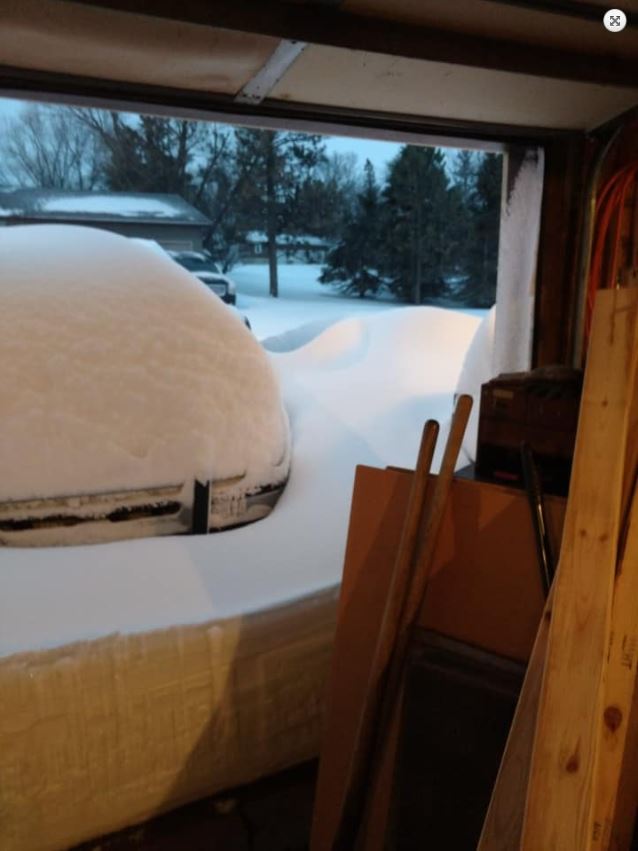
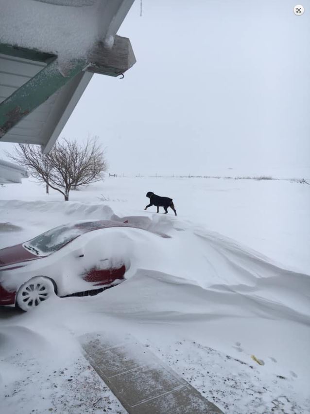
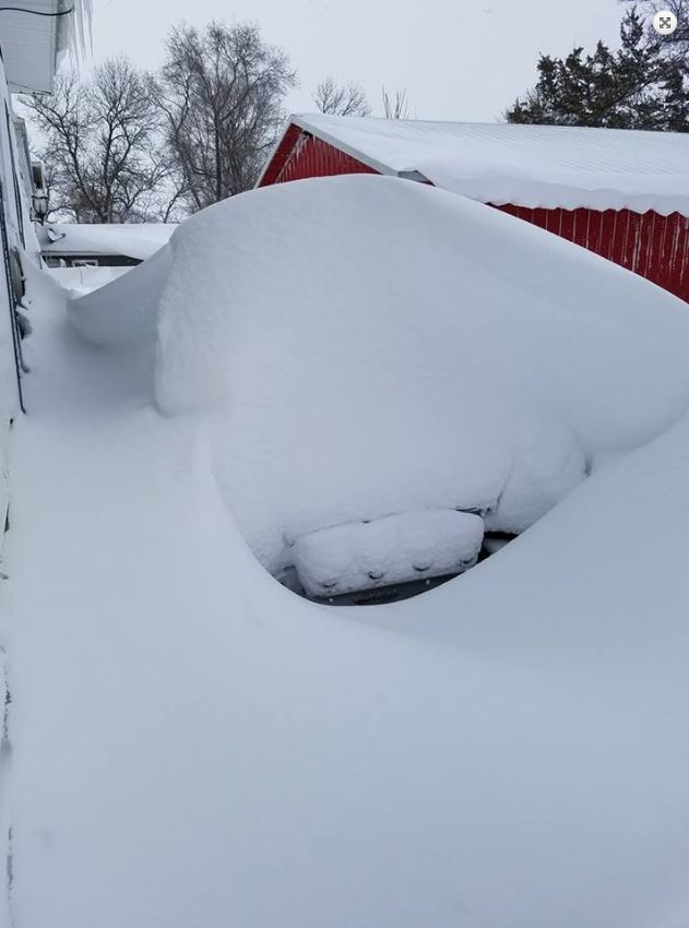
Storm Reports / Photos
 |
 |
 |
 |
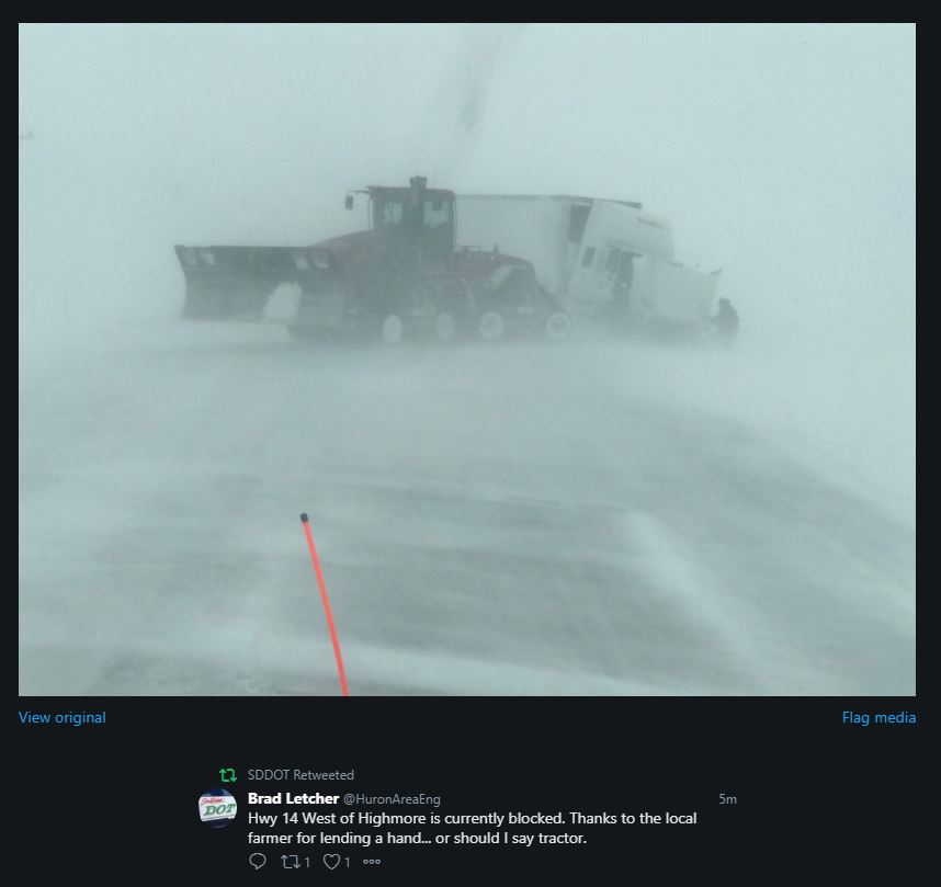
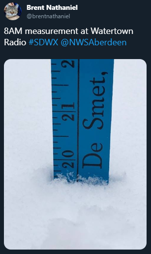
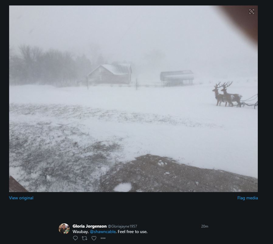
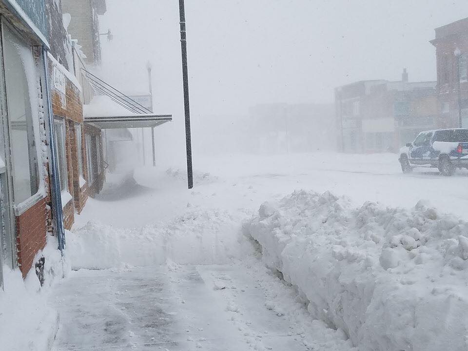
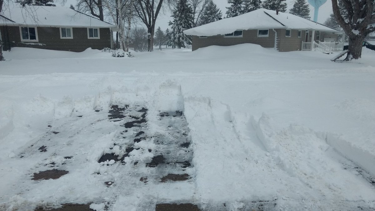
| Highway 14 west of Highmore (Source: SDDOT Twitter) | Snowfall measurement in Watertown at 8 AM April 12, 2019 (Source: Brent Nathaniel - Twitter) | Reduced visibility in Waubay at 830 AM CDT April 11, 2019 (Source: Gloria Jorgenson - Twitter) | Highway 14 west of Highmore (Source: SDDOT Twitter) |
 |
 |
 |
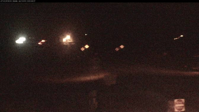 |
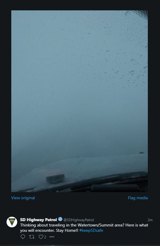
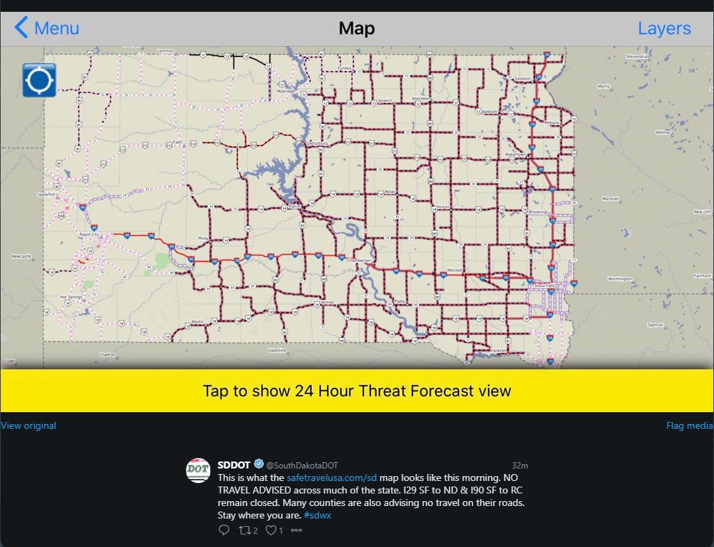
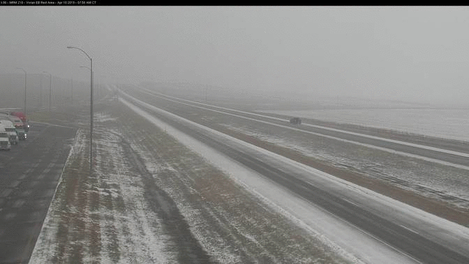
| Zero visibility in the Watertown/Summit area at 830 AM CDT April 11, 2019 (Source: SD Highway Patrol - Twitter) | No Travel Advised covered most of the eastern 2/3rds of South Dakota at 7 AM CDT on April 11, 2019 (Source: SDDOT Twitter) | Webcam Loop at Vivian, SD - From 8 AM April 10 to 8 AM April 12 (Source: SDDOT) | Webcam Loop at Mellette, SD - From 4 AM April 10 to 8 AM April 12 (Source: SDDOT) |
 |
 |
 |
 |
| Thundersnow reported at Pierre on the morning of April 10th | Webster at 1130am on the 11th, courtesy of Daniel Basler Jr. Keep in mind, many areas began the event with little to no snow depth. | Heavy snow accumulations at Watertown, courtesy of Alex Resel | Blizzard with an estimated 10 foot visibility 2 miles north of Mellette at 7:50 am on the 11th, courtesy of the SD Highway Patrol |
 |
 |
 |
 |
| Blizzard conditions and heavy snow at Richmond Lake, from an NWS employee | The following photos, including this one by Ty Fuller from Henry, are relayed by Brent Nathaniel via www.gowatertown.net/wpb_gallery/photos-april-2019-blizzard/#prettyPhoto | Clark, courtesy of Rae Jean Flora | Goodwin, courtesy of Daisy Muston Van Wormer |
 |
 |
 |
 |
| Clear Lake, courtesy of Angela Carr Imm | Lake City, courtesy of Tari Heitmann | Lake City, courtesy of Tari Heitmann | Watertown, courtesy of Melissa Passow |
 |
 |
 |
 |
| Clear Lake, courtesy of Lisa Brown | Henry, courtesy of Lacy Jordan Shepherd | Ipswich, courtesy of Karen Casare | Willow Lake, courtesy of Carolyn Edleman |
 |
 |
 |
 |
| Summit, courtesy of Jon Boomgaarden | Mellette, courtesy of Garret Barnhardt | Lake Kampeska, courtesy of Debie Hamers Grupe | South Shore, courtesy of Daniel Kaaz |
 |
 |
 |
 |
| Bradley, courtesy of Cindy Bruns | Aberdeen, courtesy of Chris Mueller | Waubay, courtesy of Ruth Holzerland | Northville, courtesy of Rose Hoellein |
Records
Here are some preliminary records for this event.
Daily Snowfall/Precipitation:
Aberdeen AP: 6.1" of snow on the 10th (4.5" in 2007)
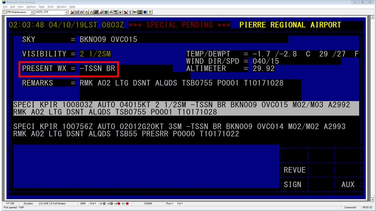
Pierre AP: 5.1" of snow on the 10th (4.7" in 2013) and 10.2" of snow on the 11th (4.7" in 1995)
Mobridge AP: 0.79" of liquid on the 10th (0.79" in 1959) and 3.0" of snow on the 10th (2.2" in 1959)
Watertown AP: 10.2" of snow on the 10th (10.0" in 2008) and 13.0" of snow on the 11th (7.3" in 2013)
Sisseton AP: 11.3" of snow on the 11th (6.1" in 2003)
Other:
Watertown AP 25” = Highest 3-day total (records through 1893)
Sisseton AP 18.6” = Highest April 3-day total (records through 1900)
Clear Lake 26.3” = Highest 3-day total (records through 1903)
Castlewood 23.3" = Highest 3-day total at least from 1893-2011
Clark 28.9" = Highest 3-day total (records through 1894)
Ipswich 25" = Highest 3-day total (records through 1894)
Roscoe 24.8” = Highest 3-day total (records through 1934)
Milbank 18" = Highest 3-day April total at least from 1893-2009
Waubay 2NW 18" = Tied highest 3-day total (records through 1952)
Webster 17.5" = Highest 3-day April total (records through 1893)
Pierre AP 16.1” = 2nd highest April 3-day total
Aberdeen AP 13.6” = 4th highest April 3-day total (records through 1893)
Selby 14" = Highest 3-day April total (records through 1907)
Wheaton 12.5” = Highest April 3-day total (records through 1914)
This storm will go down as one of the worst to affect the area in recent history, and in some cases all-time, in terms of snowfall totals. For comparison, official 3-day snowfall records by county across South Dakota and Minnesota can be found here (these records are composed of official COOP measurements): https://www.ncdc.noaa.gov/snow-and-ice/snowfall-extremes/SD/3
 |
Media use of NWS Web News Stories is encouraged! Please acknowledge the NWS as the source of any news information accessed from this site. |
|

