
A heat wave over the Southwest will intensify this week, peaking and expanding into the Intermountain West and northern High Plains this weekend. Critical to extremely critical fire weather conditions are forecast from the Northwest and the northern Great Basin this weekend. Particularly Dangerous Situation Red Flag Warnings have been issued. Read More >
Overview
|
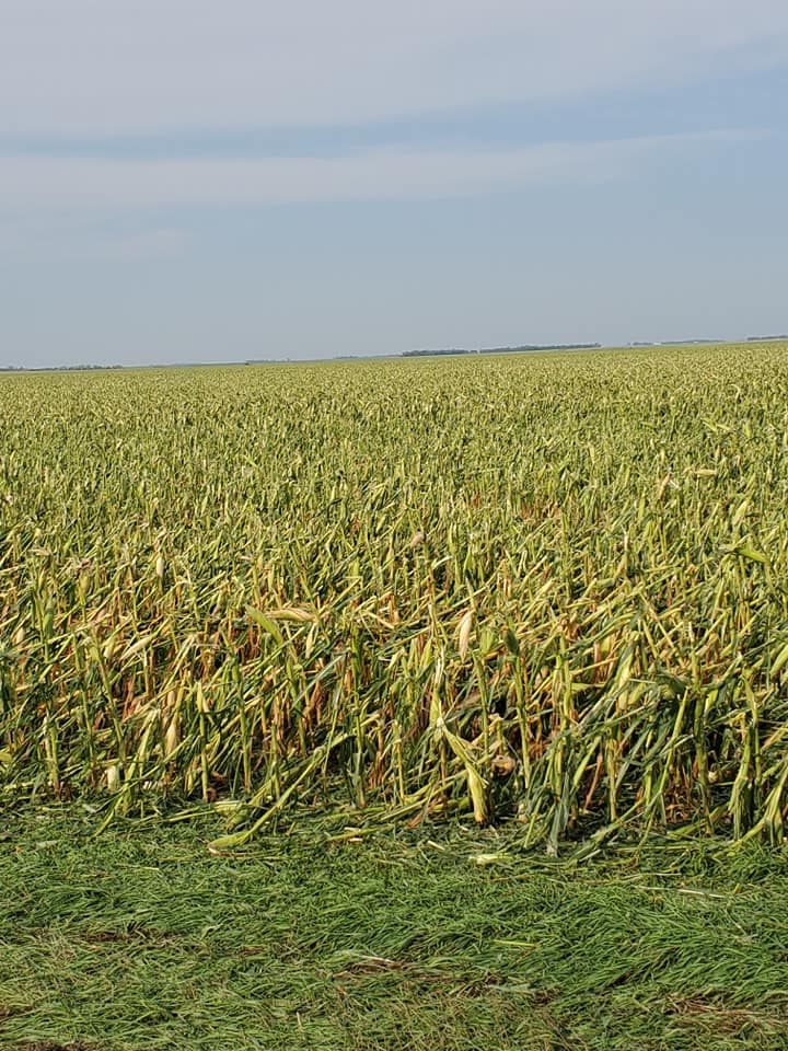
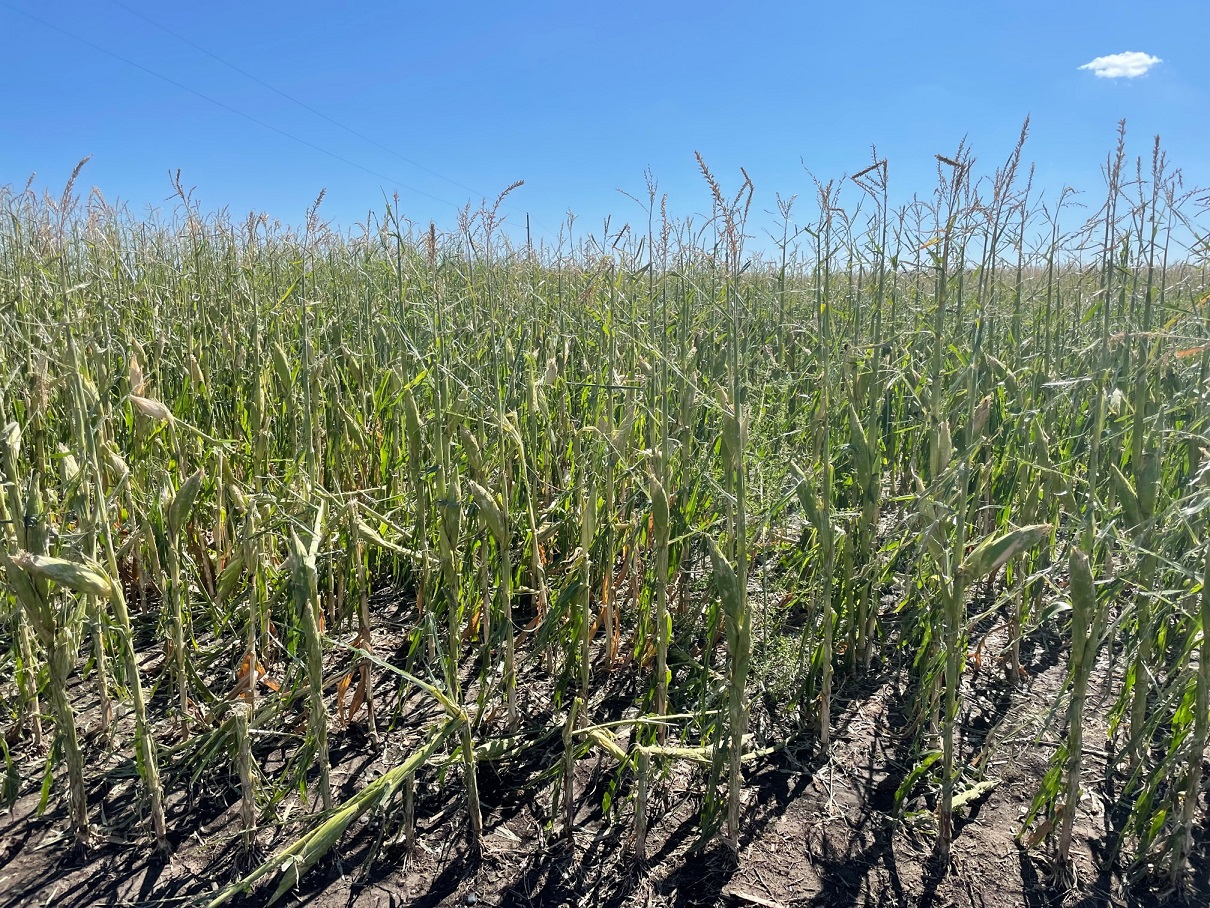
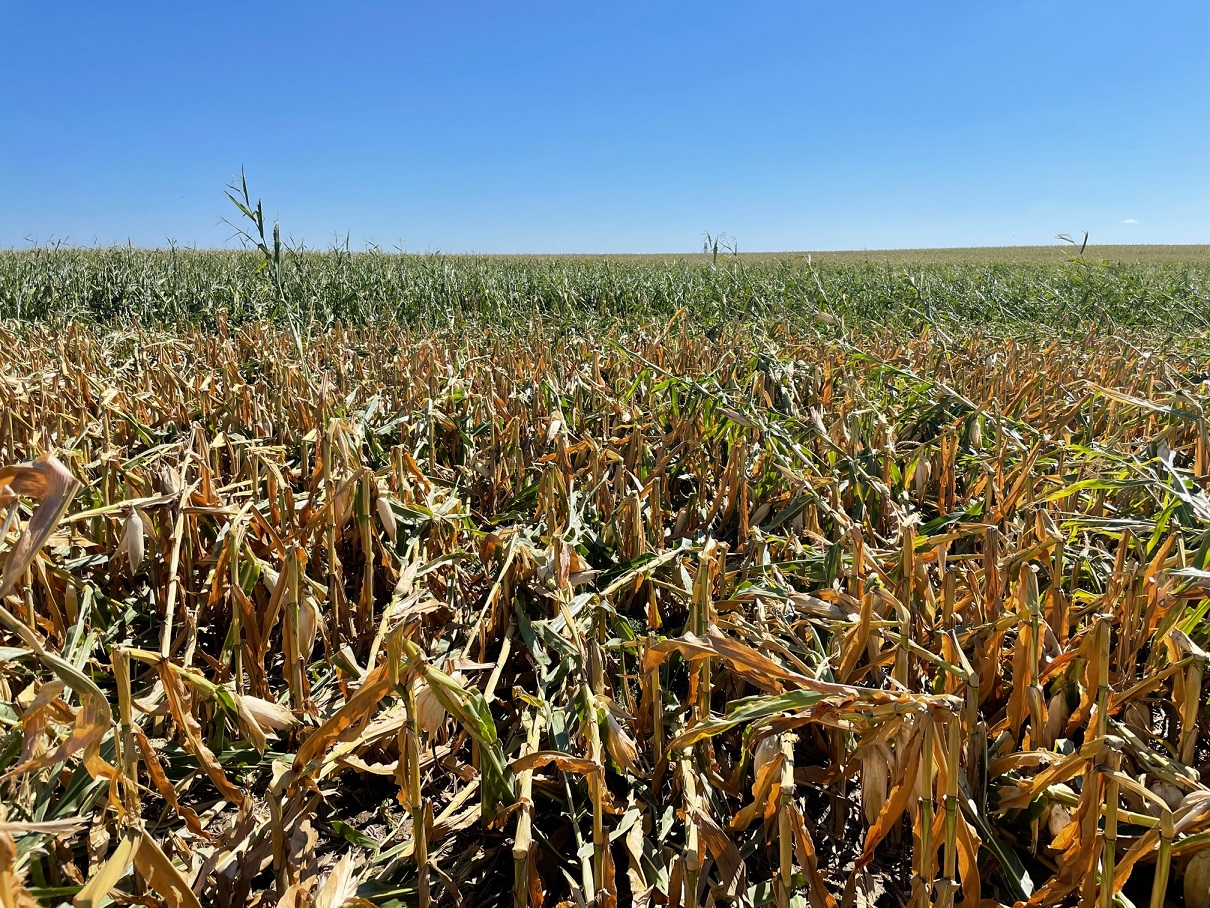
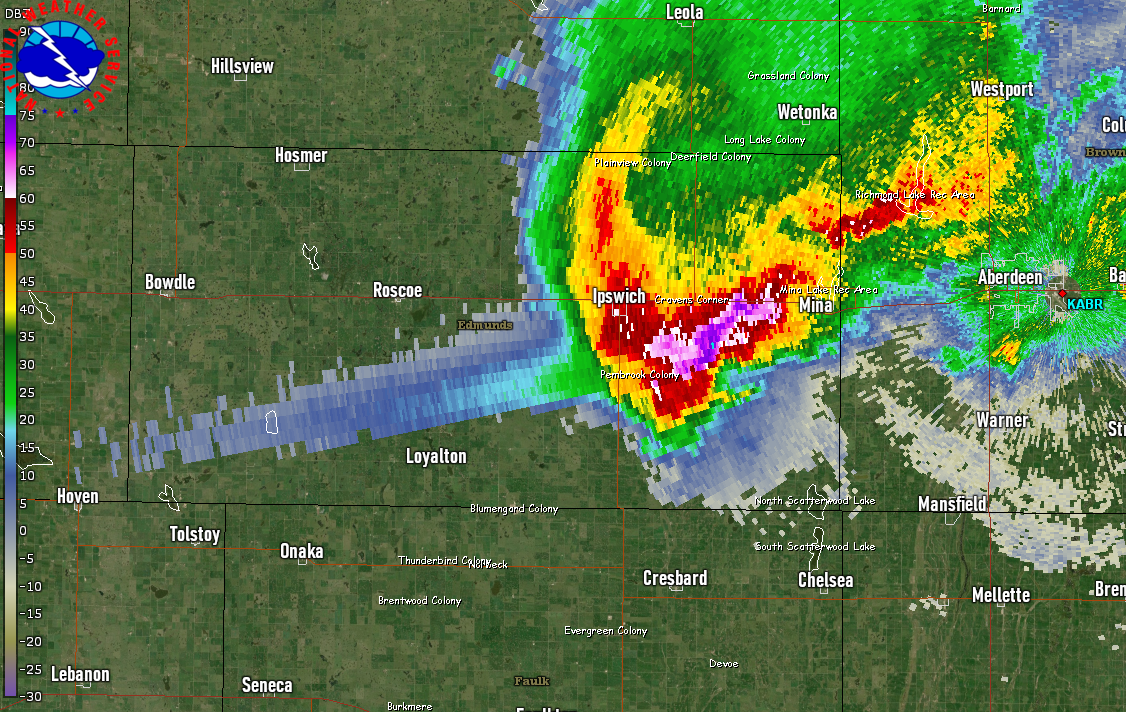
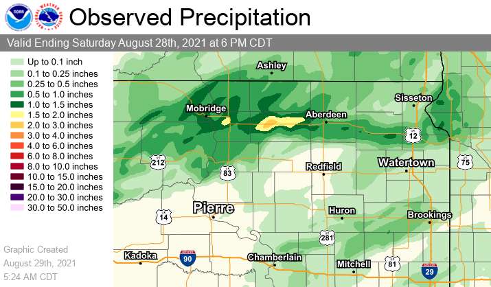
A supercell thunderstorm produced a long swath of significant hail across portions of north central and northeastern South Dakota into west central Minnesota during the morning of August 28th. The storm produced hail to the size of tennis and baseballs, and led to extensive damage to houses, vehicles, and crops within its path. Initial estimates of the severe hail path (areas with hail of 1" or greater) show a path length of around 225 miles, stretching from Lake Oahe to west central Minnesota. This storm persisted uninterrupted for about 6 hours, from ~2:30 am to 8:30 am. During that time, the average width of the severe hail was around 6-7 miles, with the peak width around 11 miles. Additional severe thunderstorms developed as well, leading to further reports of damaging winds and large hail before exiting the area shortly after 10am. We want to thank you for all of the hail reports and pictures that you have sent to us! |
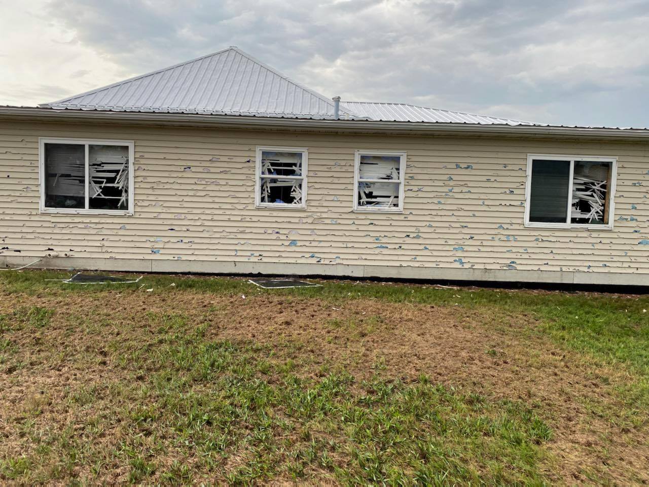 Hail damage to a house in Edmunds County - Photo shared by Edmunds County EM |
 |
 |
|
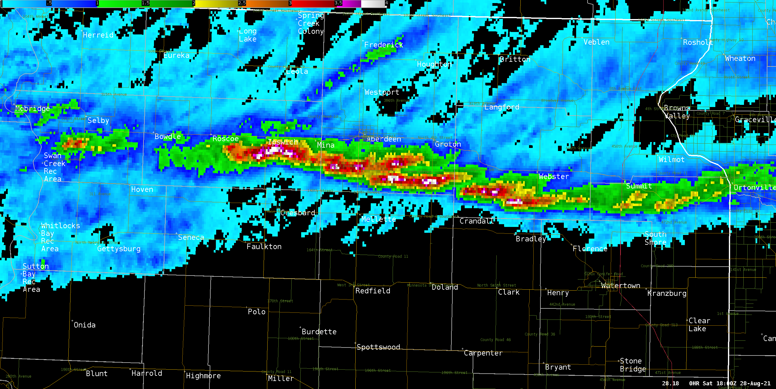
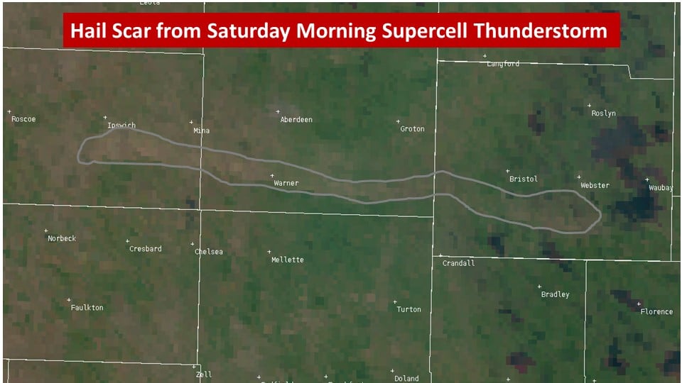
| Video of the radar and maximum estimated hail size. From 11PM CDT on August 27, 2021 to 11am CDT August 28, 2021 | MRMS Maximum Estimated Size of Hail (MESH) for the 24 hours prior to 1pm CDT on August 28, 2021. Hail Estimate Scale: Green = 1-2" hail, Yellow = 2-2.5" hail, and Orange/Red/Purple = 2.5"+ | Hail scar as seen on the 29th via satellite |
Photos:
 |
 |
 |
 |
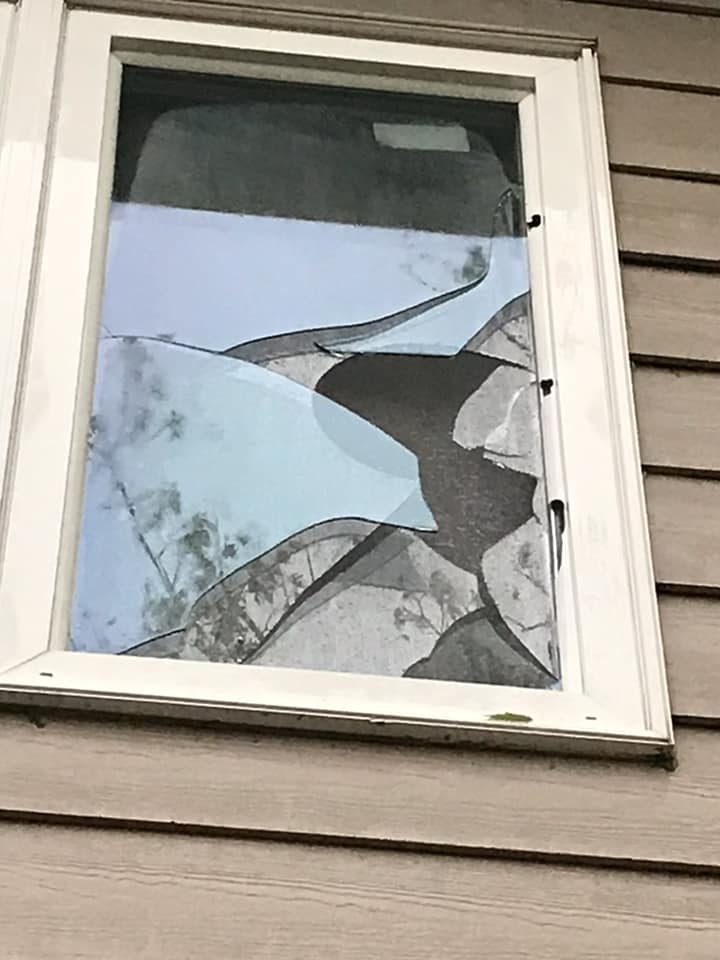
| Broken window 4.5 miles west of Warner, SD - Image from Kimberly Huber | Corn damage - Brown County EM | Hail in Butler, SD - Image from Day County Sheriff | Damage to beans 5 miles southeast of Aberdeen, SD - Photo from Kaitlyn Fleegel |
 |
 |
 |
 |
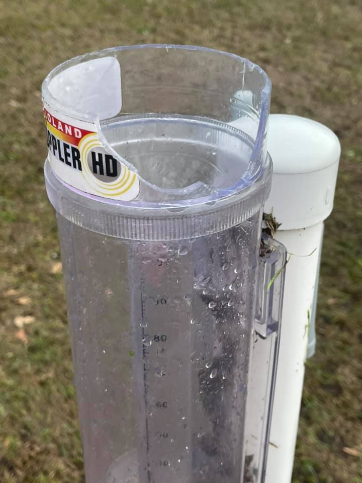
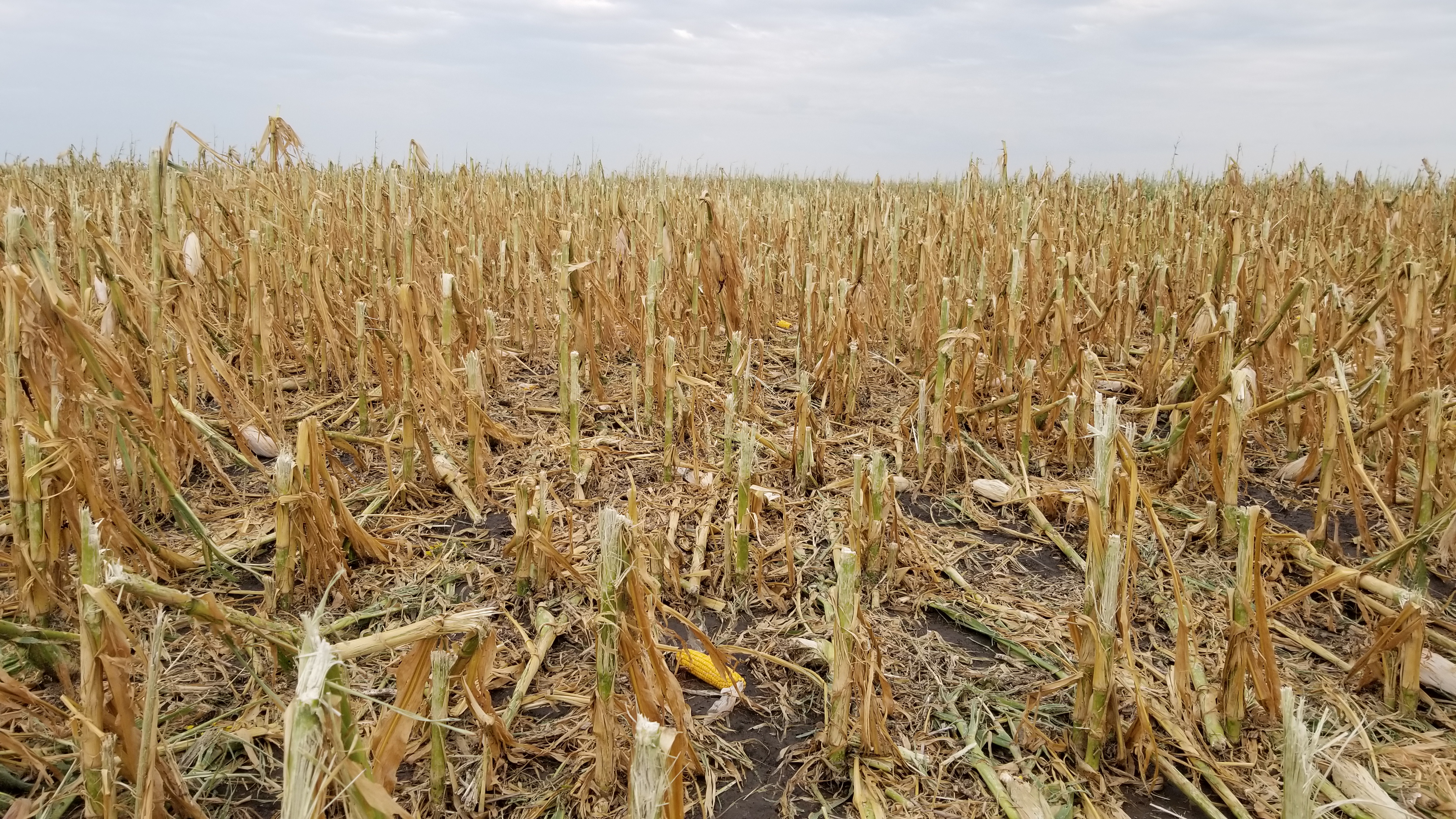
| Closeup of damage to corn about 11 miles south-southeast of Aberdeen, SD - Photo by NWS Employee | Corn blown down from severe winds on the south side of the storm (14 miles south-southeast of Aberdeen). There were numerous localized areas of corn stocks leaning or bent over in this area. - Photo by NWS Employee | Damaged Rain Gauge - 4.5 miles west of Warner, SD - Image from Kimberly Huber | 1.5" hail 6 miles south and 2 miles west of Ipswich, SD - Photo relayed by Edmunds County EM |
 |
 |
 |
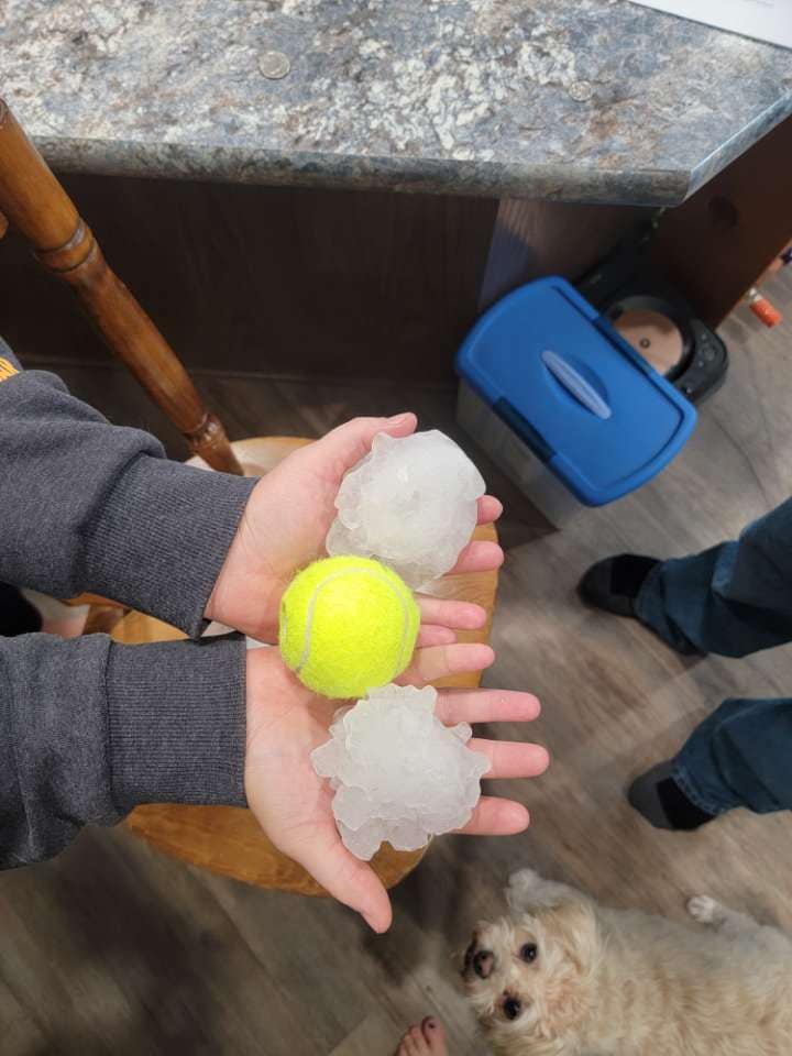 |
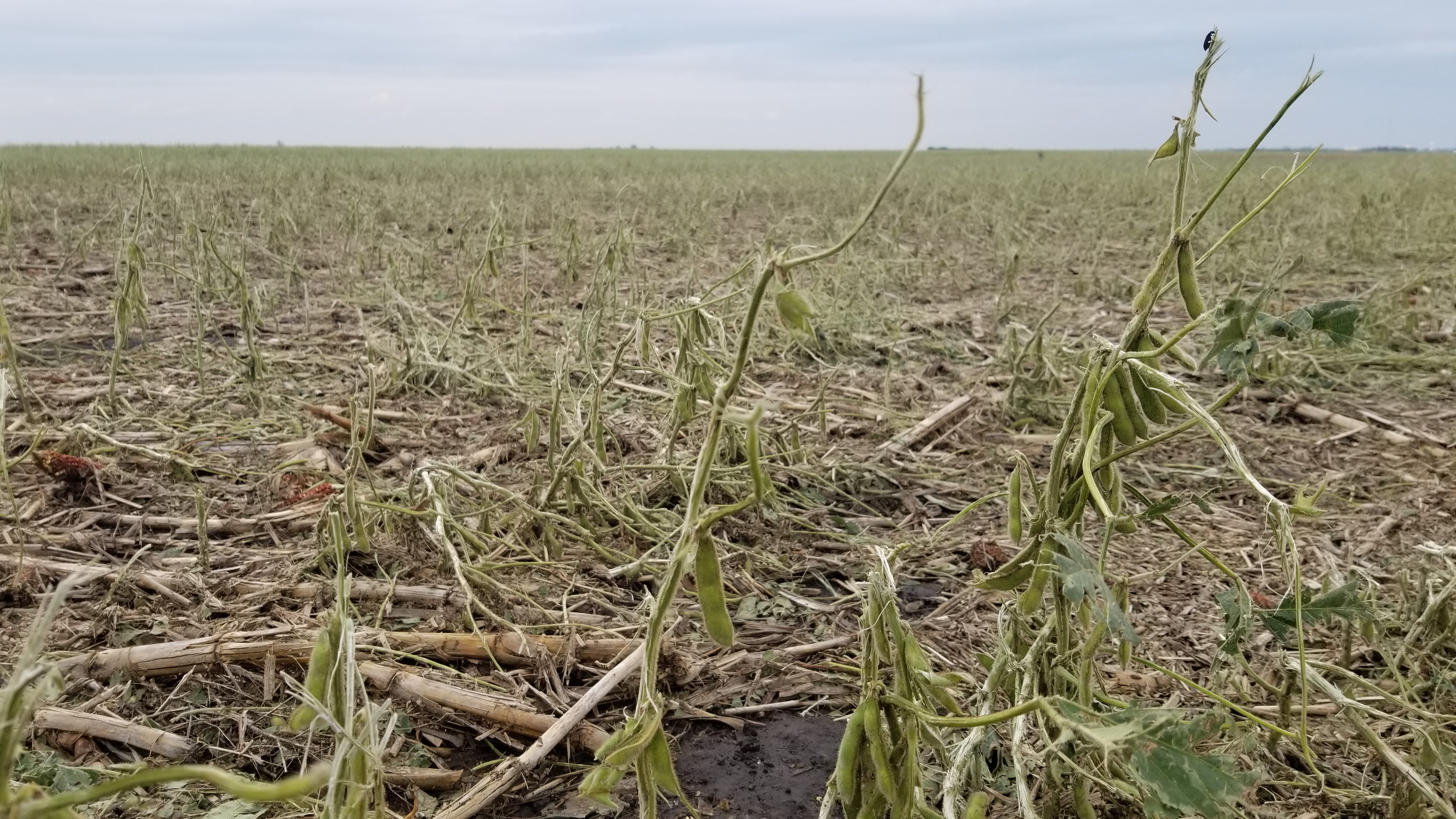
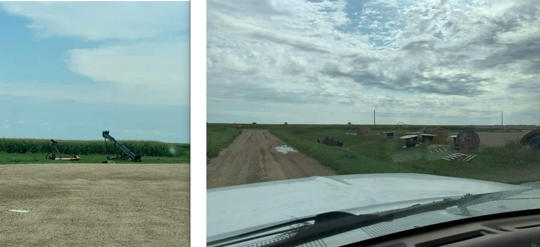
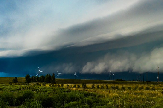
| Damage to corn to the west of Warner, SD - Photo from Marc (Twitter @LanceCasual) | Damage to beans to the west of Warner, SD - Photo from Marc (Twitter @LanceCasual) | Damage to corn to the west of Warner, SD - Photo from Marc (Twitter @LanceCasual) | Tennis ball sized hail in Grant County, South Dakota - Photo relayed by Grant County EM |
 |
 |
 |
 |
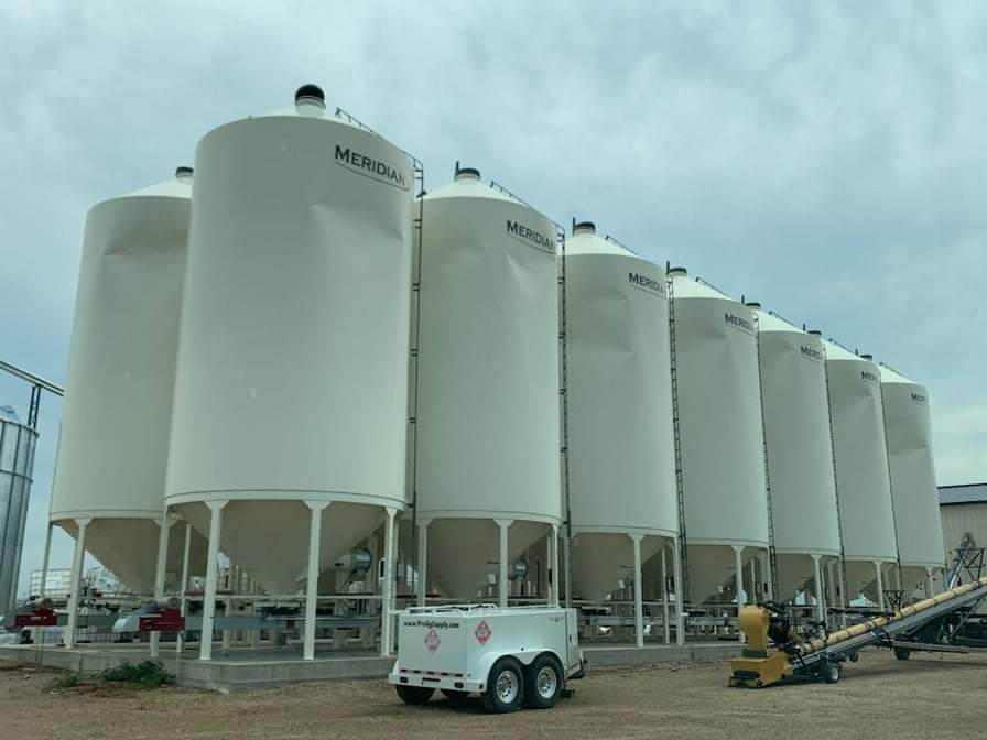
| Damage to beans south of Ipswich - Photo by NWS Employee | Damage to corn south of Ipswich - Photo by NWS Employee | Damage to silos at Verdon - Photo by Dustin McElhone | Wind damage at Verdon - Photo by Dustin McElhone |
 |
 |
 |
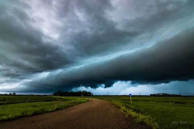 |
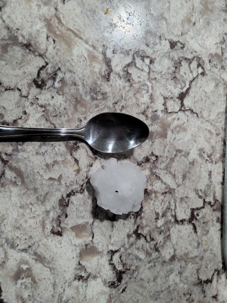
| Hail near Butler around 6am - Photo courtesy of the Day County EM | Hail at Ortonville - Photo by Big Stone County EM. Hail in excess of tennis ball size was reported in and around this area. | Near Milbank around 9am - Photo by Alex Resel | Near Milbank around 9am - Photo by Alex Resel |
 |
 |
||
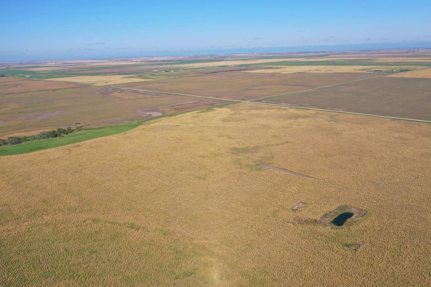
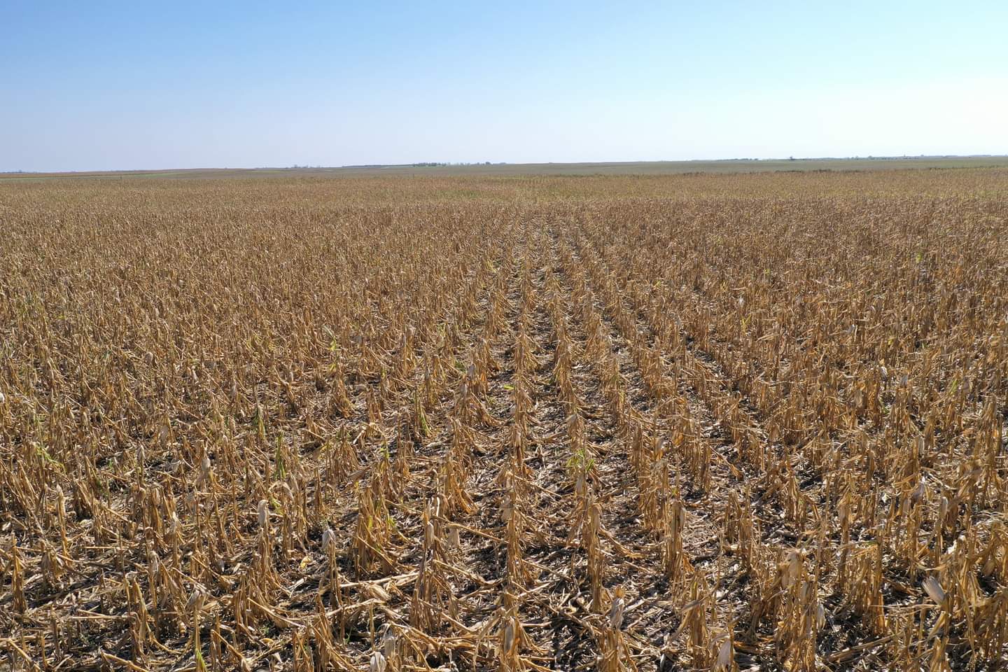
| Drone photo from Sept 16th about 7 miles SSW of Mina | Drone photo from Sept 16th about 7 miles SSW of Mina |
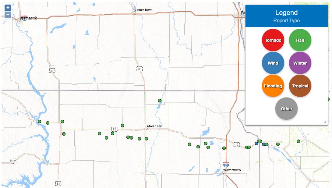
Storm Reports (Preliminary)
Interactive map version of reports here and here.
..TIME...   ...EVENT...      ...CITY LOCATION...     ...LAT.LON...
..DATE...   ....MAG....      ..COUNTY LOCATION..ST.. ...SOURCE....
            ..REMARKS..

0232 AM     HAIL             5 N LOWRY               45.39N 99.98W
08/28/2021  E2.50 INCH       WALWORTH           SD   TRAINED SPOTTER

            NUMEROUS HAILSTONES UP TO TENNIS BALL SIZED
            AND DECREASED TO GOLF BALL SIZED BEFORE
            ENDING. GROUND WAS WHITE WITH HAIL.

0650 AM     HAIL             7 SSW SUMMIT            45.21N 97.09W
08/28/2021  E2.50 INCH       GRANT              SD   PUBLIC

            TIME ESTIMATED BASED ON RADAR.

0733 AM     HAIL             2 W MILBANK             45.22N 96.68W
08/28/2021  E1.25 INCH       GRANT              SD   TRAINED SPOTTER

            HAILED FOR 5 TO 10 MINUTES.

0915 AM     HAIL             3 NW MILBANK            45.26N 96.68W
08/28/2021  M2.50 INCH       GRANT              SD   PUBLIC

            RELAYED THROUGH GRANT CO EM.

0919 AM     HAIL             MILBANK                 45.22N 96.64W
08/28/2021  E1.75 INCH       GRANT              SD   TRAINED SPOTTER


0935 AM     HAIL             BIG STONE CITY          45.30N 96.47W
08/28/2021  E1.25 INCH       GRANT              SD   PUBLIC


0320 AM     HAIL             3 S ROSCOE              45.40N 99.34W
08/28/2021  E1.00 INCH       EDMUNDS            SD   TRAINED SPOTTER


0325 AM     HAIL             4 N CRAVENS CORNER      45.50N 98.92W
08/28/2021  E1.00 INCH       EDMUNDS            SD   TRAINED SPOTTER


0348 AM     HAIL             5 SW IPSWICH            45.40N 99.10W
08/28/2021  E1.75 INCH       EDMUNDS            SD   PUBLIC

            10 WINDOWS DESTROYED.

0400 AM     HAIL             7 S MINA                45.34N 98.76W
08/28/2021  E1.00 INCH       EDMUNDS            SD   TRAINED SPOTTER

            50 MPH OR STRONGER WINDS.

0408 AM     HAIL             7 SSW MINA              45.35N 98.82W
08/28/2021  M2.50 INCH       EDMUNDS            SD   TRAINED SPOTTER

            MEASURED TENNIS BALL SIZED HAIL. SEVERAL
            WINDOWS BROKEN ON HOUSE. HAIL IS COVERING
            THE GROUND.

0710 AM     HAIL             5 NE LOYALTON           45.34N 99.21W
08/28/2021  E1.00 INCH       EDMUNDS            SD   TRAINED SPOTTER


0544 AM     HAIL             BUTLER                  45.26N 97.71W
08/28/2021  M2.00 INCH       DAY                SD   LAW ENFORCEMENT

            PICTURE OF HAIL OF 2 INCHES IN DIAMETER.
            MENTIONED THAT SOME WERE A LITTLE LARGER.
            THERE WAS ALSO A LARGE TREE LIMB DOWN AND
            WINDSHIELDS BROKEN JUST WEST OF TOWN.

0603 AM     HAIL             7 ENE LILY              45.23N 97.56W
08/28/2021  E1.75 INCH       DAY                SD   TRAINED SPOTTER

            GOLF BALL SIZED HAIL IS ONGOING.

0825 AM     HAIL             7 SE WEBSTER            45.27N 97.42W
08/28/2021  E1.00 INCH       DAY                SD   TRAINED SPOTTER


0830 AM     HAIL             9 SSW WAUBAY            45.22N 97.38W
08/28/2021  E2.50 INCH       DAY                SD   PUBLIC

            RADAR ESTIMATED, RELAYED THROUGH FACEBOOK.

0430 AM     HAIL             6 W WARNER              45.33N 98.62W
08/28/2021  E1.50 INCH       BROWN              SD   TRAINED SPOTTER


0434 AM     HAIL             WARNER                  45.33N 98.49W
08/28/2021  E1.75 INCH       BROWN              SD   LAW ENFORCEMENT

            HAILING FOR THE LAST 10 MINUTES.

0715 AM     HAIL             4 NNW HOUGHTON          45.81N 98.25W
08/28/2021  E1.00 INCH       BROWN              SD   PUBLIC


0753 AM     HAIL             ORTONVILLE              45.30N 96.44W
08/28/2021  M1.00 INCH       BIG STONE          MN   PUBLIC

            REPORT RELAYED THROUGH SOCIAL MEDIA.

0942 AM     HAIL             ODESSA                  45.26N 96.33W
08/28/2021  E0.75 INCH       BIG STONE          MN   PUBLIC

            REPORT FROM MPING: DIME (0.75 IN.).

0957 AM     HAIL             3 NE CORRELL            45.26N 96.12W
08/28/2021  M2.75 INCH       BIG STONE          MN   PUBLIC

            RELAYED THROUGH FB.

0135 AM     HAIL             GLENHAM                 45.53N 100.27W
08/28/2021  E1.25 INCH       WALWORTH           SD   TRAINED SPOTTER


0156 AM     HAIL             1 ENE MOBRIDGE          45.55N 100.42W
08/28/2021  M0.50 INCH       WALWORTH           SD   TRAINED SPOTTER


0156 AM     HAIL             3 NNE SELBY             45.55N 100.01W
08/28/2021  M1.00 INCH       WALWORTH           SD   TRAINED SPOTTER


0949 AM     TSTM WND DMG     ODESSA                  45.26N 96.33W
08/28/2021                   BIG STONE          MN   PUBLIC

            REPORT FROM MPING: 1-INCH TREE LIMBS BROKEN;
            SHINGLES BLOWN OFF.

1231 AM     TSTM WND GST     1 E HAYES               44.37N 101.00W
08/27/2021  M59 MPH          STANLEY            SD   PUBLIC

            PERSONAL WEATHER STATION.

1249 AM     TSTM WND GST     10 SW CHANTLER CREEK RE 44.39N 100.77W
08/27/2021  M64 MPH          STANLEY            SD   MESONET

            MESONET STATION 202 HAYES (SDDOT).

0808 AM     TSTM WND GST     1 WNW MELLETTE          45.16N 98.51W
08/28/2021  M64 MPH          SPINK              SD   MESONET

            MESONET STATION 175 MELLETTE (SDDOT).

0358 AM     TSTM WND GST     9 NNW VIVIAN            44.05N 100.33W
08/27/2021  M61 MPH          LYMAN              SD   MESONET

            MESONET STATION 13 VIVIAN (SDDOT).

0844 AM     TSTM WND GST     7 SSW SUMMIT            45.21N 97.09W
08/28/2021  E65 MPH          GRANT              SD   PUBLIC


0944 AM     TSTM WND GST     3 SW BIG STONE CITY     45.27N 96.51W
08/28/2021  M70 MPH          GRANT              SD   MESONET

            MESONET STATION 292 7NE MILBANK (SDDOT).

0943 AM     TSTM WND GST     3 W ODESSA              45.26N 96.38W
08/28/2021  M62 MPH          BIG STONE          MN   MESONET

            MNDOT RWIS.
Radar and Rain Reports
 |
 |
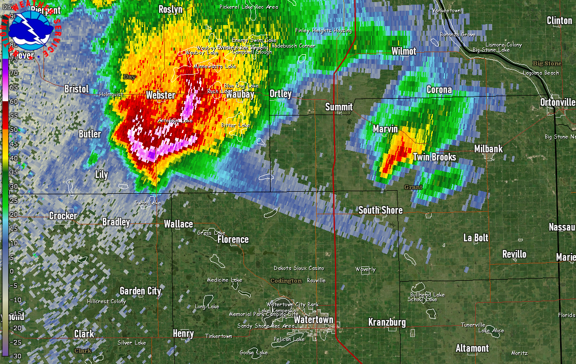 |
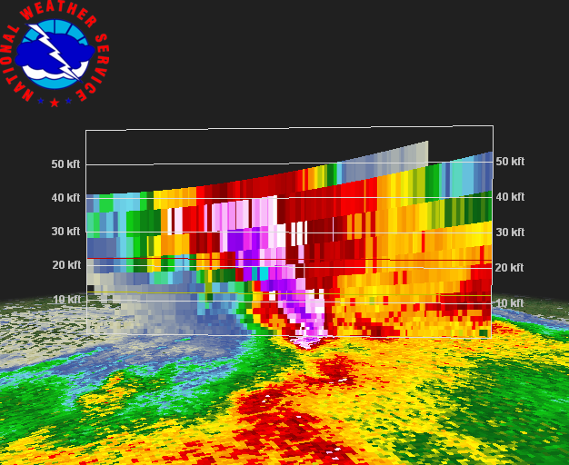
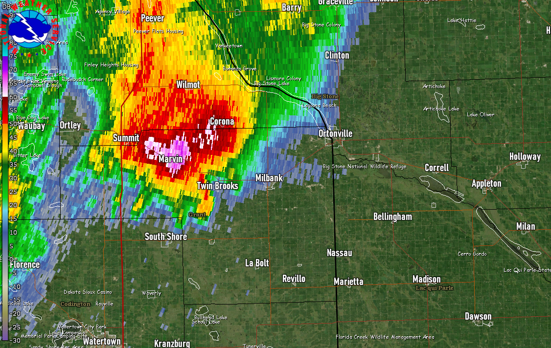
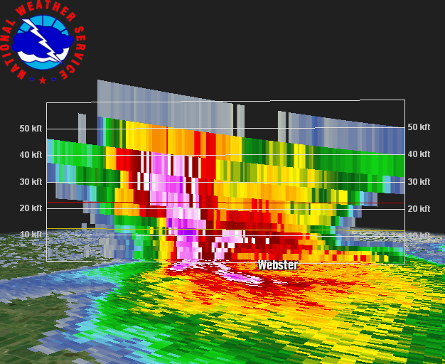 |
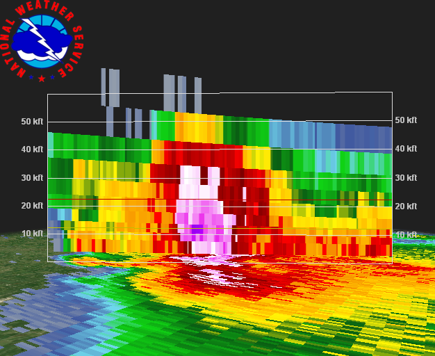
| Radar reflectivity of a long-track supercell south of Ipswich at 3:58 am. The large green spike pointing to the left of the storm is called a Three-Body Scatter Spike, and is an indication of very large hail. | Radar cross-section of the storm south of Ipswich at 3:58 am. | Radar reflectivity of a long-track supercell south of Webster at 6:03 am. The large green spike pointing to the right of the storm is called a Three-Body Scatter Spike, and is an indication of very large hail. | Radar cross-section of the storm south of Webster at 6:03 am. |
 |
 |
||
| Radar reflectivity of another supercell west of Milbank at 9:02 am. A Three-Body Scatter Spike can be seen with this storm as well. | Radar cross-section of the storm west of Milbank at 9:02 am. |
 |
Media use of NWS Web News Stories is encouraged! Please acknowledge the NWS as the source of any news information accessed from this site. |
|

