Overview
|
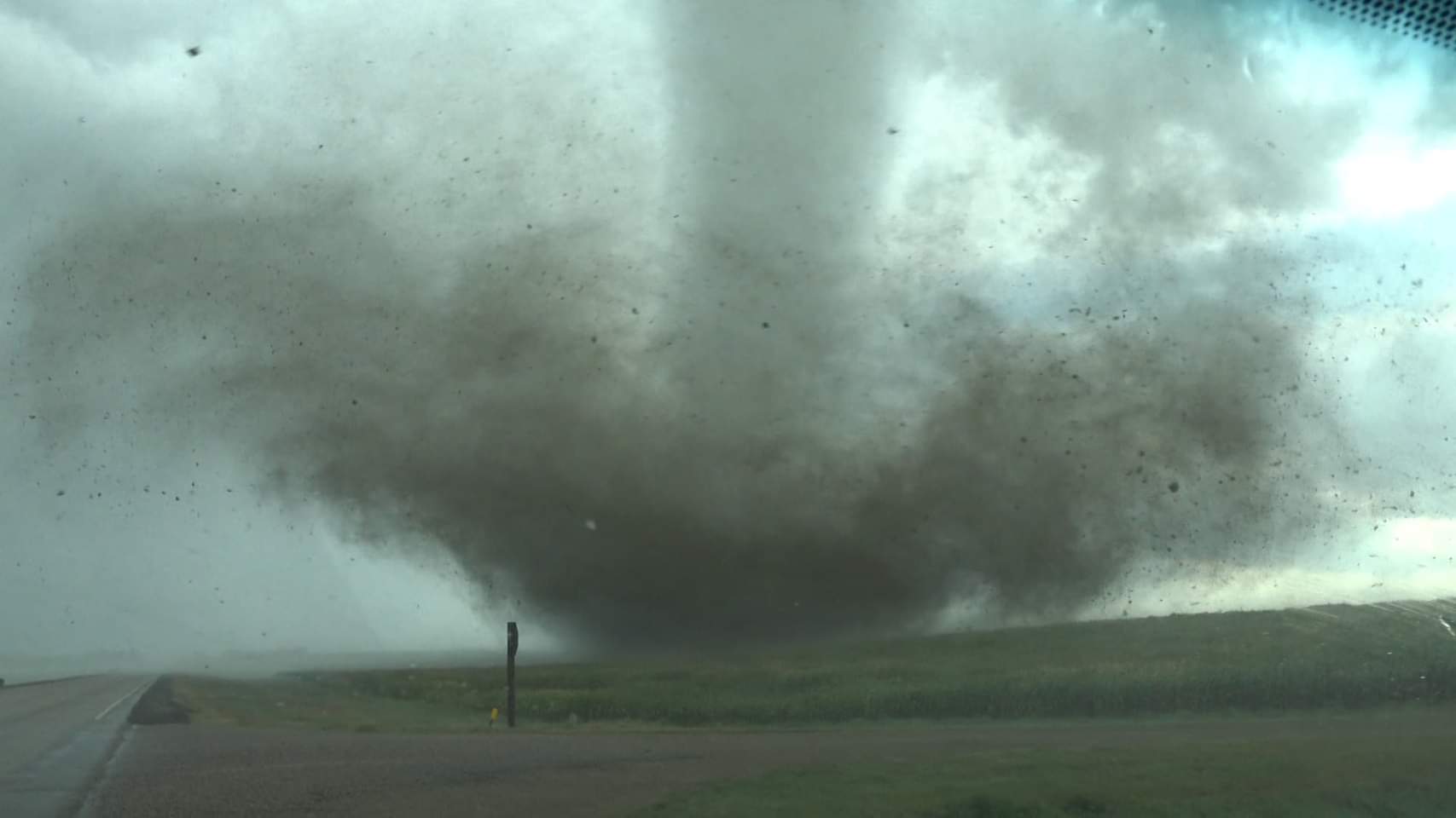
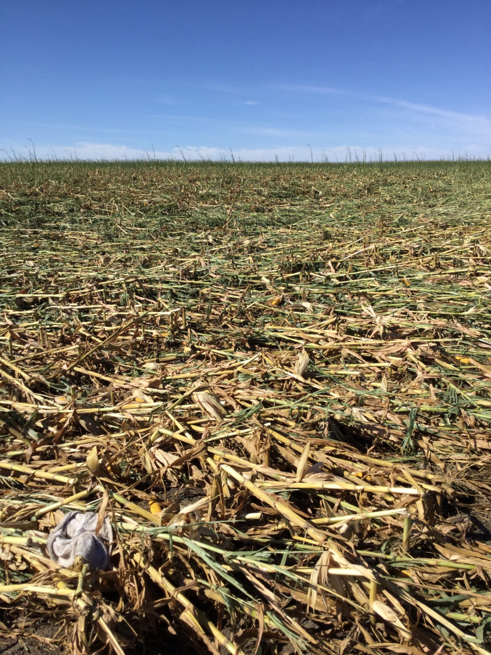
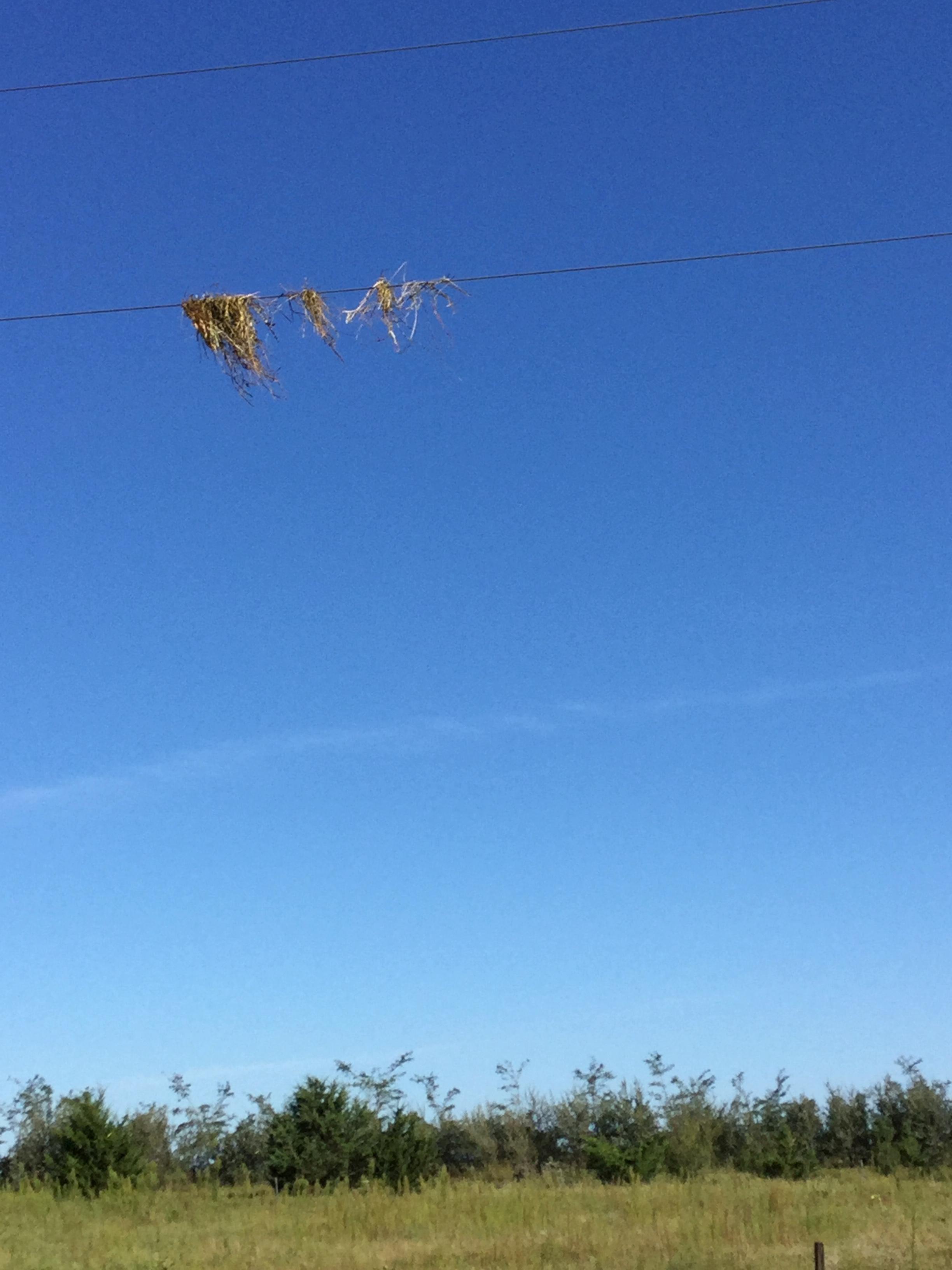
Severe thunderstorms developed along and ahead of a cold front moving southeast across central South Dakota during the late afternoon and evening hours on August 30th, 2020. These thunderstorms produced hail up to 2" in diameter and an EF-2 tornado north of Miller, SD which resulted in a fatality when an RV was struck on SD HWY 45. This was the first tornado-related fatality in South Dakota since June 4th, 1999. We wish to thank emergency management, first responders, storm chasers, trained spotters, and the public for the information they provided to us during and after the event. |
|
 |
||
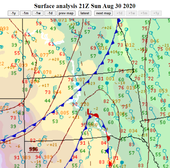
| Surface weather chart at 4pm on August 30, 2020. The cold front in western and northern South Dakota was moving southeast across the state. | "Sandwich" satellite loop of the storms from 4pm to 9pm on August 30, 2020. | Radar loop of the severe thunderstorms that occurred during the evening of August 30, 2020. |
Tornadoes
|
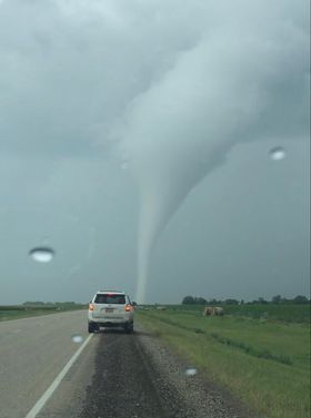
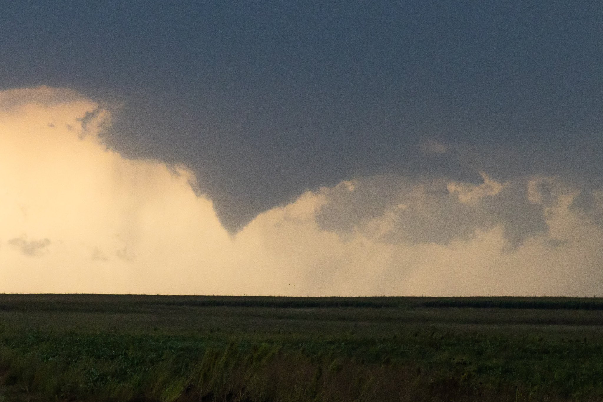
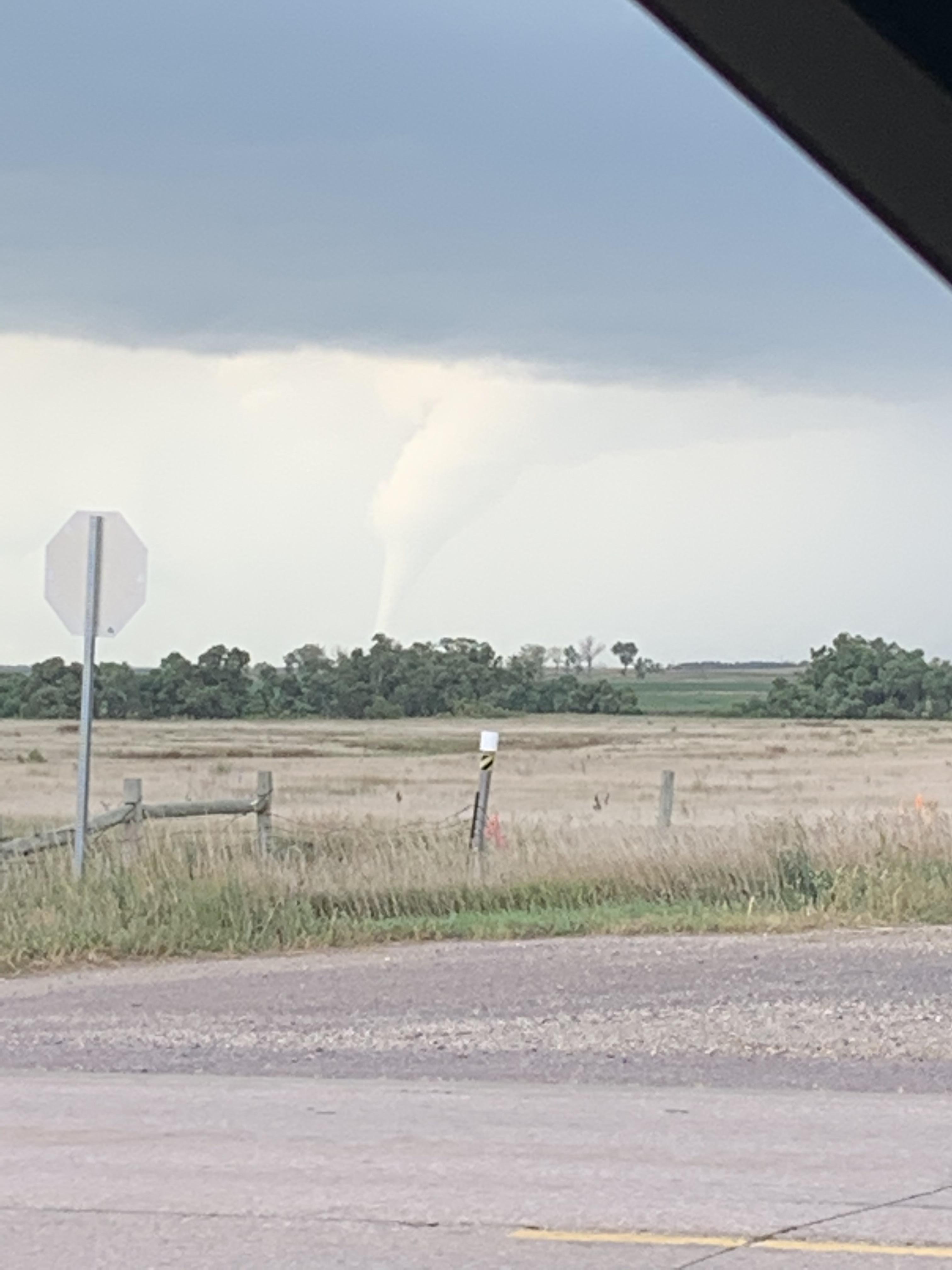
Tornado - 13 North of Miller, SD
Track Map 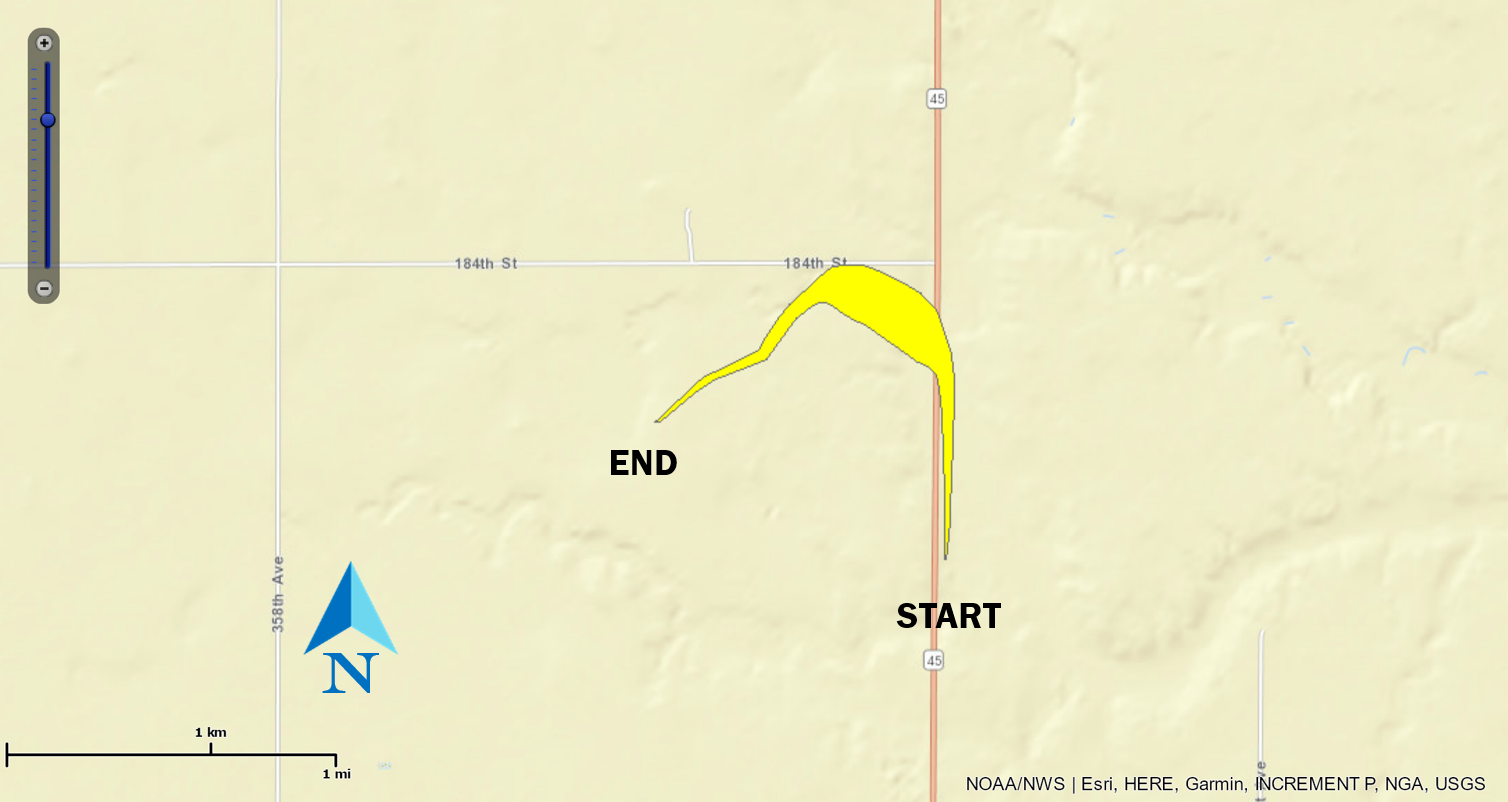 
|
||||||||||||||||
|
||||||||||||||||
The Enhanced Fujita (EF) Scale classifies tornadoes into the following categories:
| EF0 Weak 65-85 mph |
EF1 Moderate 86-110 mph |
EF2 Significant 111-135 mph |
EF3 Severe 136-165 mph |
EF4 Extreme 166-200 mph |
EF5 Catastrophic 200+ mph |
 |
|||||
Storm Reports
..TIME...   ...EVENT...      ...CITY LOCATION...     ...LAT.LON...
..DATE...   ....MAG....      ..COUNTY LOCATION..ST.. ...SOURCE....
            ..REMARKS..

0618 PM     Tstm Wnd Gst     2 S Gorman              44.90N 100.08W
08/30/2020  M55 MPH          Potter             SD   Mesonet

            Mesonet station 212 Agar (SDDOT).

1019 PM     Tstm Wnd Gst     3 SE Reliance           43.85N 99.56W
08/30/2020  M53 MPH          Lyman              SD   Mesonet

            Mesonet station 54 Reliance (SDDOT).

0759 PM     Tstm Wnd Gst     13 N Vivian             44.12N 100.30W
08/30/2020  M56 MPH          Lyman              SD   Mesonet

            Mesonet station RFPS2 Vivian 13 N.

0659 PM     Tstm Wnd Gst     1 NE Stephan            44.26N 99.44W
08/30/2020  M56 MPH          Hyde               SD   Mesonet

            Mesonet station 183 Mac''s Corner (SDDOT).

0603 PM     Tstm Wnd Gst     17 W Polo               44.78N 99.45W
08/30/2020  M57 MPH          Hyde               SD   Mesonet

            Mesonet station 215 JCT SD47/SD26 (SDDOT).

0629 PM     Hail             5 SW Vayland            44.43N 98.86W
08/30/2020  E1.00 inch       Hand               SD   Public

            Radar estimated time.

0614 PM     Hail             Miller                  44.52N 98.99W
08/30/2020  E2.00 inch       Hand               SD   Public

            Photo on social media. Radar estimated time.

0610 PM     Tornado          7 SE Polo               44.71N 99.02W
08/30/2020                   Hand               SD   Storm Chaser

            Approximate time and location, based on
            several phone and social media reports.
            Damage reported as well.

0550 PM     Hail             7 ENE Polo              44.82N 98.98W
08/30/2020  M1.75 inch       Hand               SD   Public

            Pea to golf ball sized hail. Radar estimated
            time.

0515 PM     Hail             9 S Burkmere            44.92N 99.30W
08/30/2020  E1.75 inch       Faulk              SD   Public

            Stripped leaves off of some beans.

0526 PM     Hail             3 SSE Pembrook Colony   45.33N 98.98W
08/30/2020  E1.00 inch       Edmunds            SD   Public

            Radar estimated time.

0649 PM     Tstm Wnd Gst     3 N Gann Valley         44.08N 98.99W
08/30/2020  M53 MPH          Buffalo            SD   Mesonet

            Mesonet station 201 Gann Valley (SDDOT).

0634 PM     Hail             11 N Gann Valley        44.07N 98.98W
08/30/2020  E1.00 inch       Buffalo            SD   Trained Spotter

            Corrects previous hail report from 3 N Gann
            Valley. Radar estimated time.
 |
Media use of NWS Web News Stories is encouraged! Please acknowledge the NWS as the source of any news information accessed from this site. |
|