Scattered strong to severe thunderstorms may pose a risk for damaging wind gusts over the Carolinas, southeast Virginia, and the Tennessee Valley Sunday afternoon then the northern Plains from late afternoon into Sunday night. Monsoonal thunderstorms may cause locally considerable flash, urban, and small stream flooding in the Southwest U.S. the next few days. Read More >
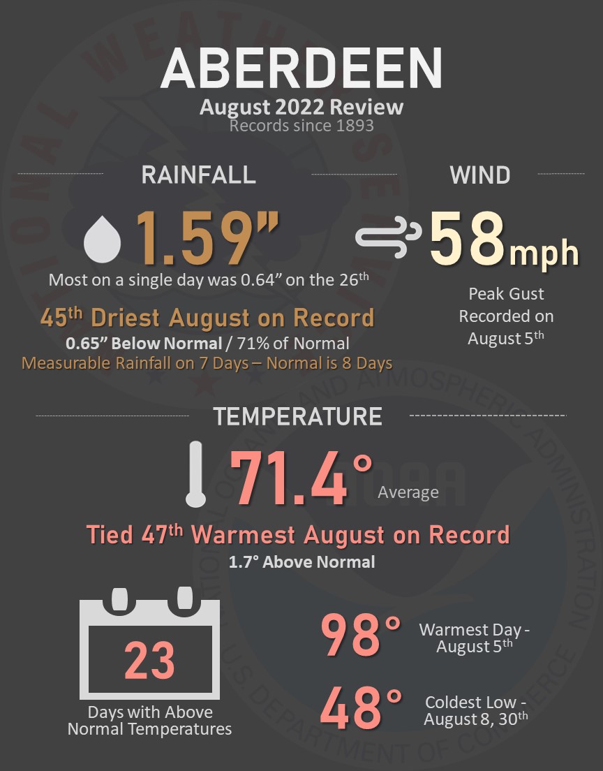
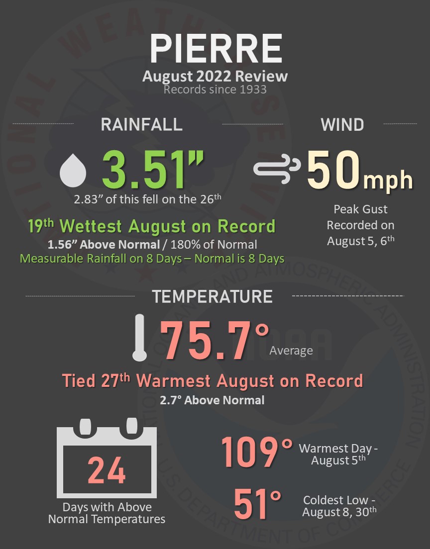
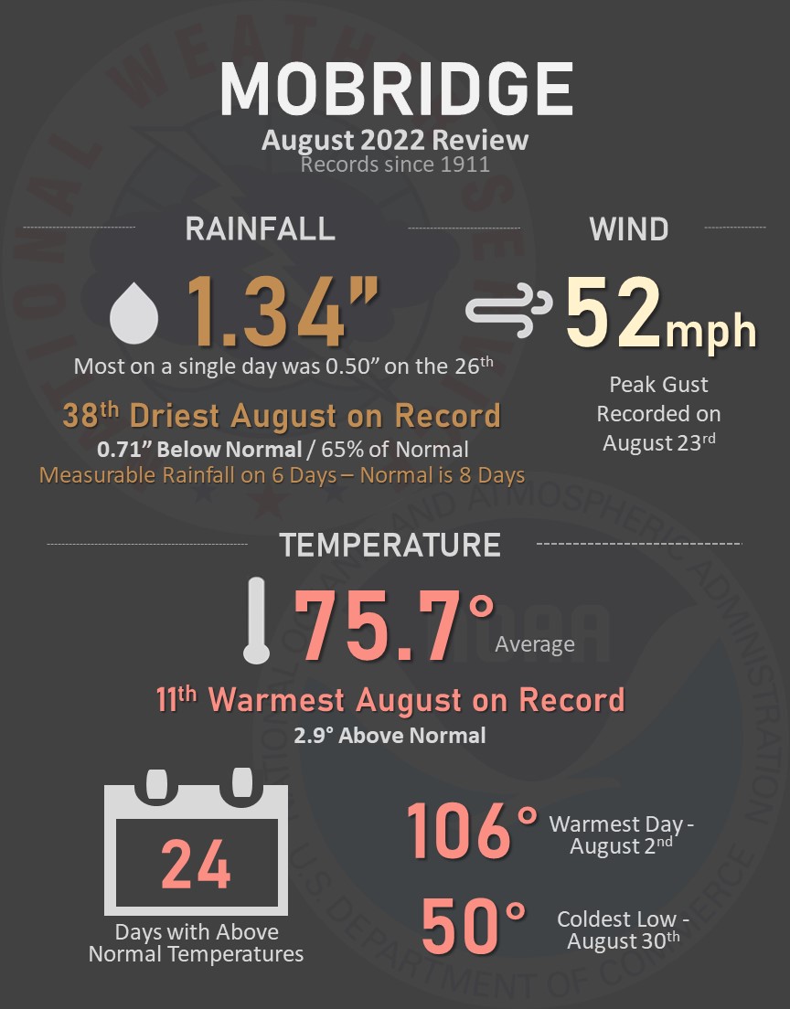
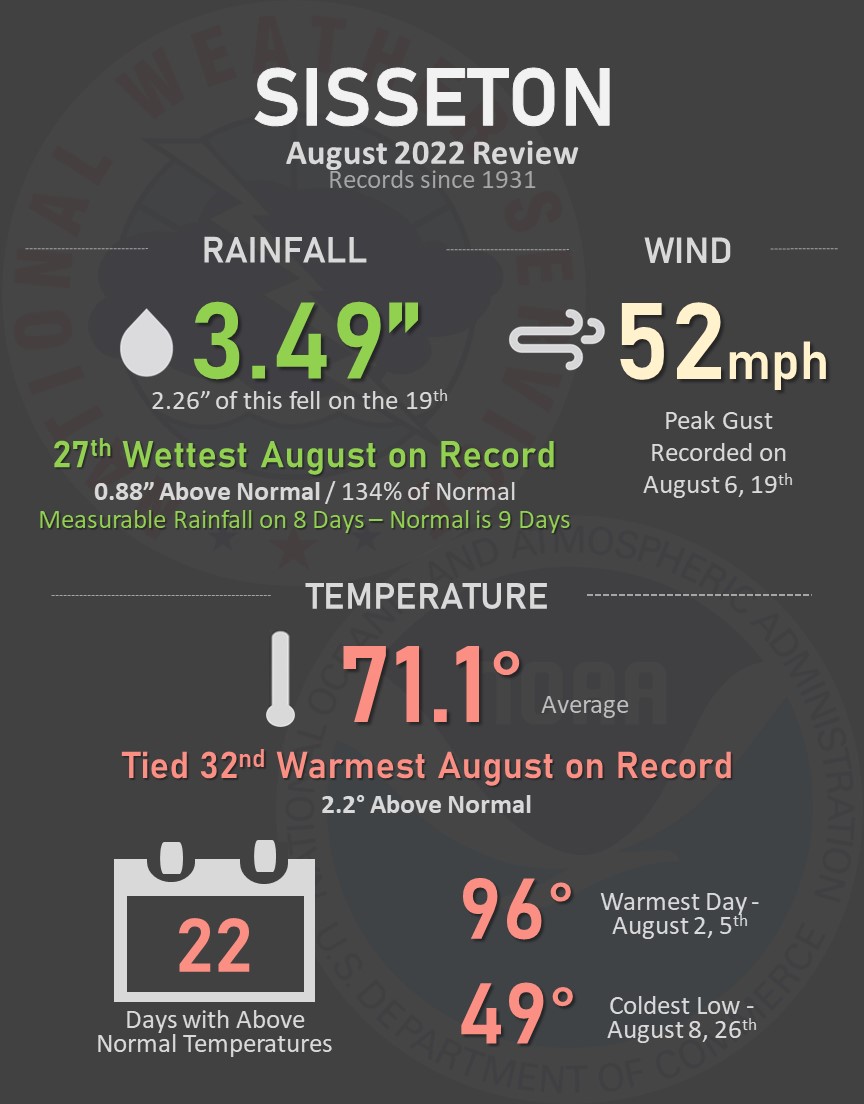
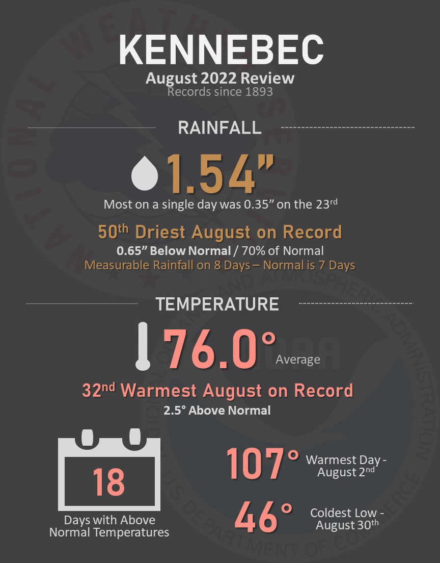
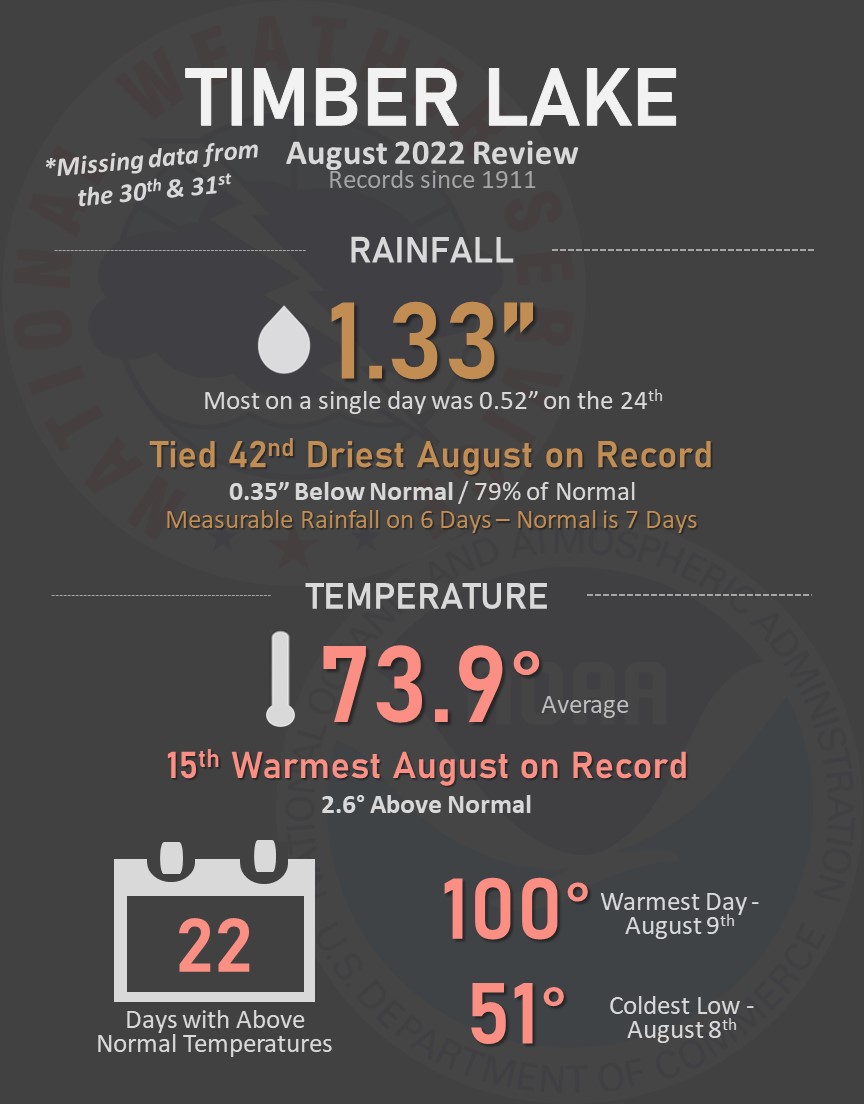
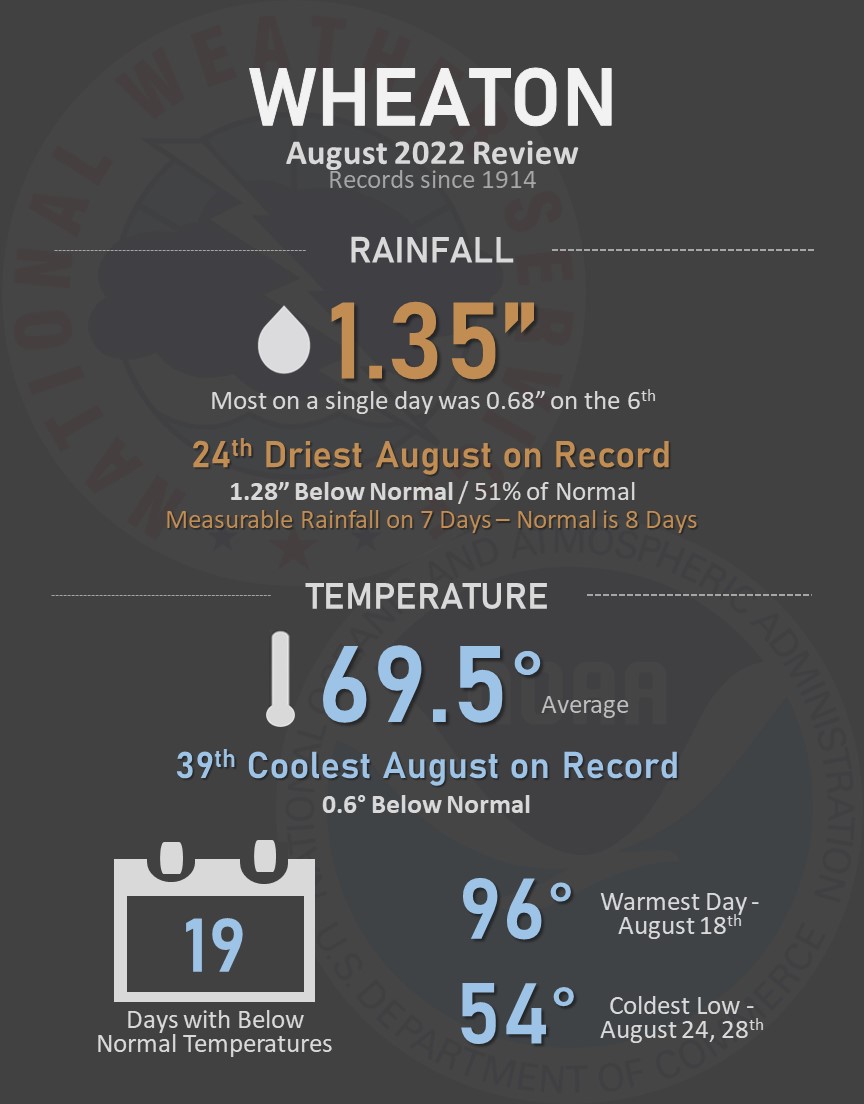
Here's a summary of August's weather at several towns across the area. Temperatures were near to above average, and precipitation varied quite a bit from place to place. Find information for additional locations here.

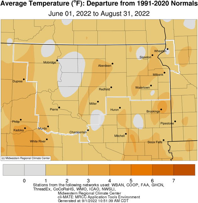
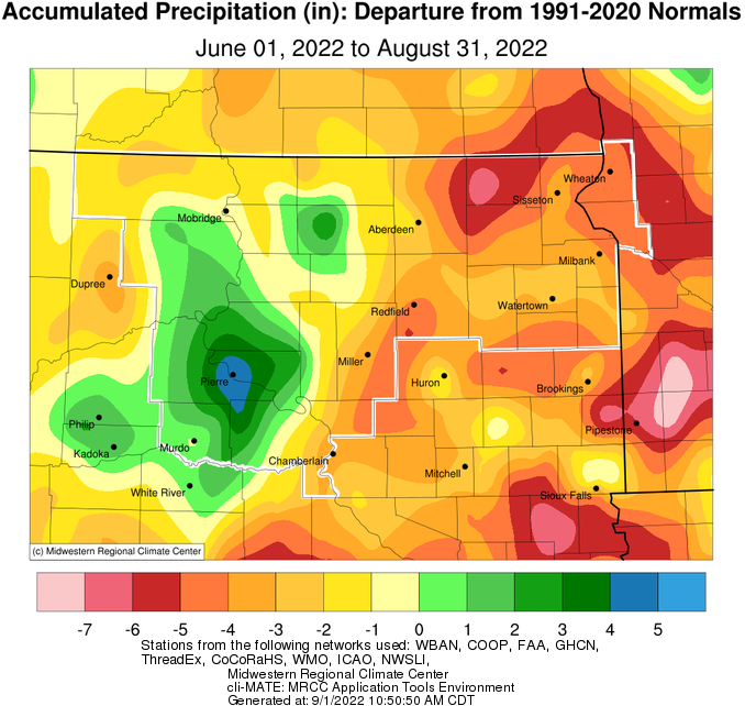
Meteorological summer (June - August) finished above average on the whole temperature-wise. Precipitation varied quite a bit, with a deficit of 4 to 6 inches across portions of northeastern South Dakota and west central Minnesota, but a surplus of 2 to 5 inches across portions of central South Dakota. The graphics below from the Midwestern Regional Climate Center illustrate this well, showing approximate temperature departures as well as precipitation totals and departures across our forecast area.
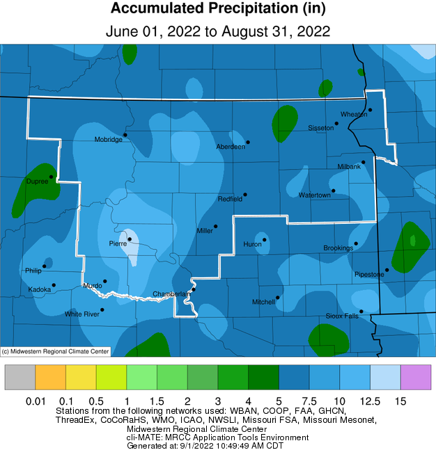
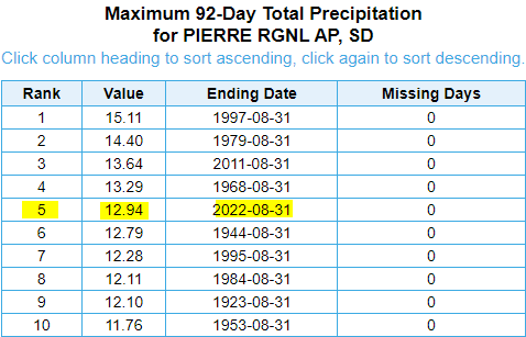
Noteworthy, with over a foot of rain, Pierre recorded their 5th wettest summer on record.
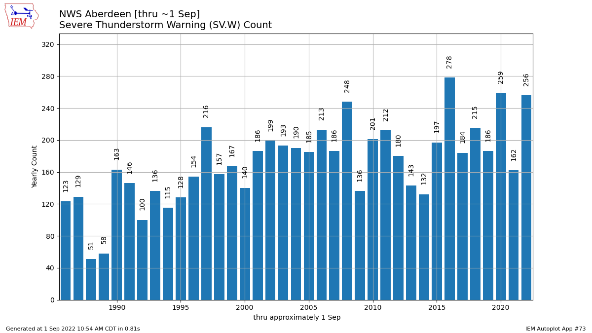
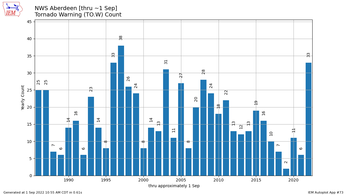
The severe weather season has been very active. NWS Aberdeen has issued 256 severe thunderstorm warnings so far this year, and 33 tornado warnings. Both of these rank among the highest year-to-date on record for our office since records began in 1986 (as seen in the graphs from the IEM below). We average an additional 10 severe thunderstorm warnings in September and 1 in October, and an additional tornado warning in September.