
Widespread life-threatening flash and urban flooding continues in south-central Texas, with considerable flooding impacts possible across central Texas. Wildfire smoke is impacting air quality across much of the Great Lakes region into southern New England and the Mid-Atlantic. Monsoonal thunderstorms may produce isolated to scattered flash flooding across the Southwest into the Great Basin. Read More >
Aberdeen, SD
Weather Forecast Office
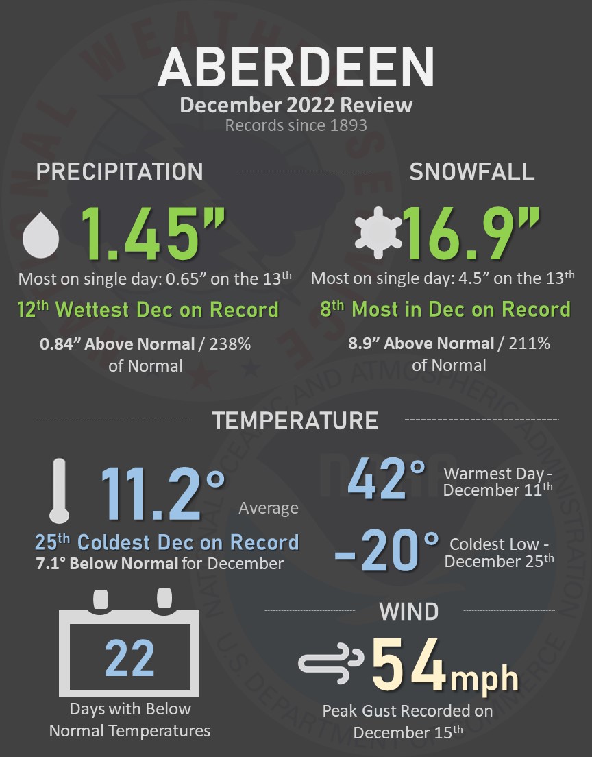
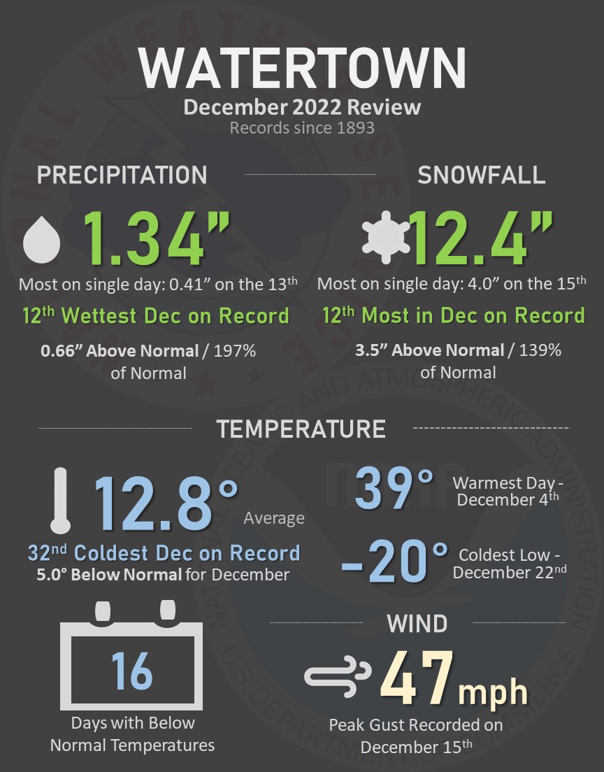
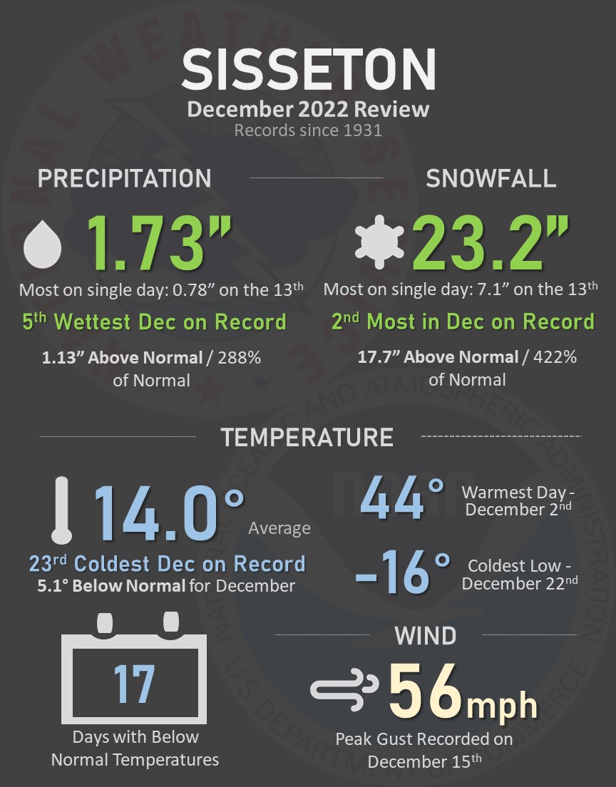
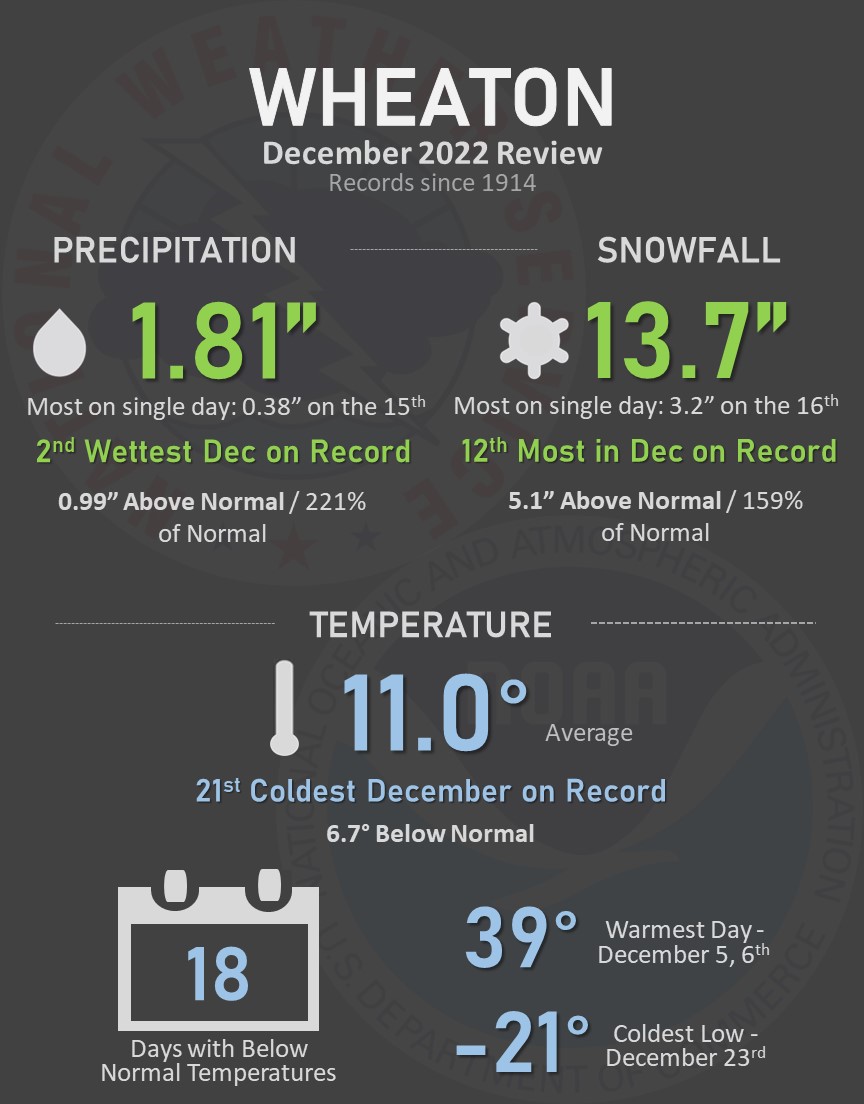
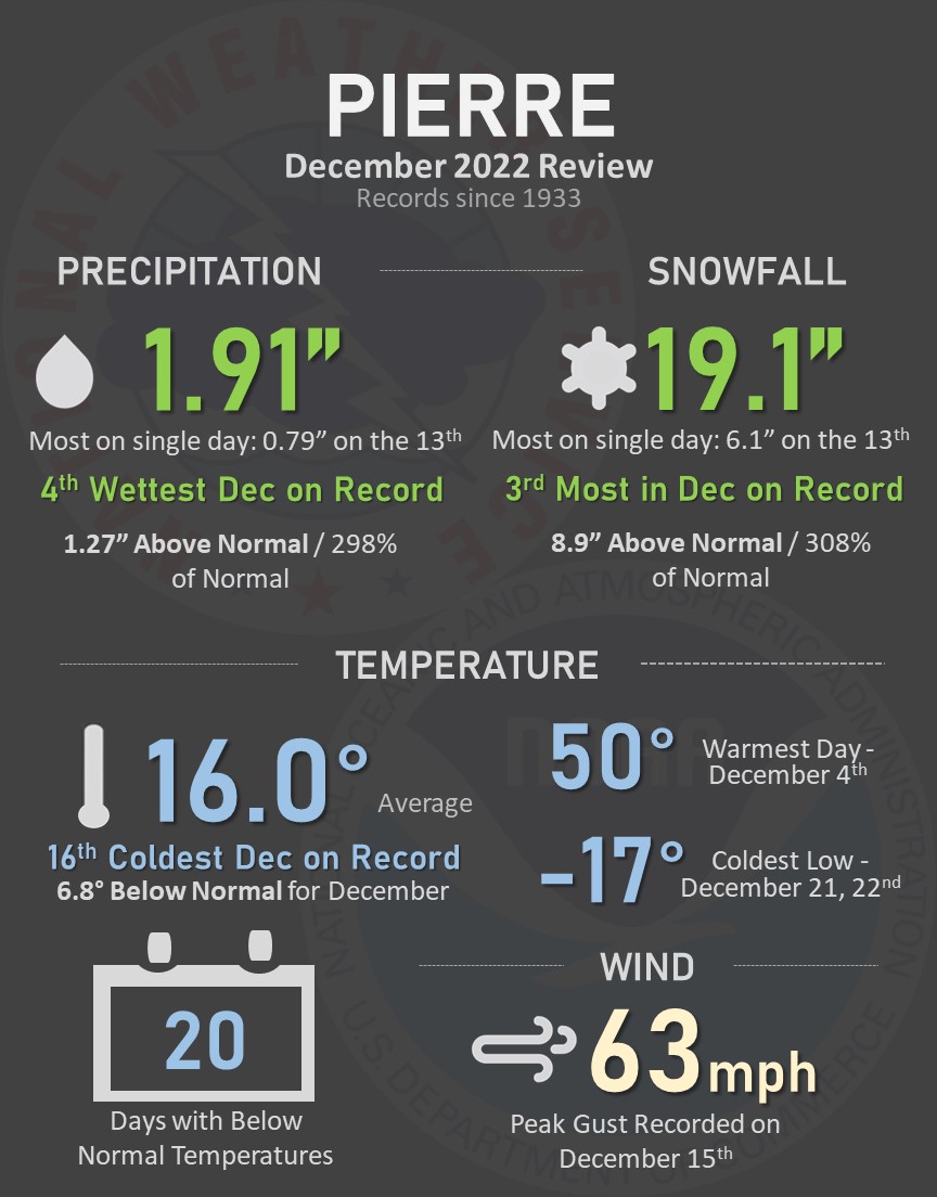
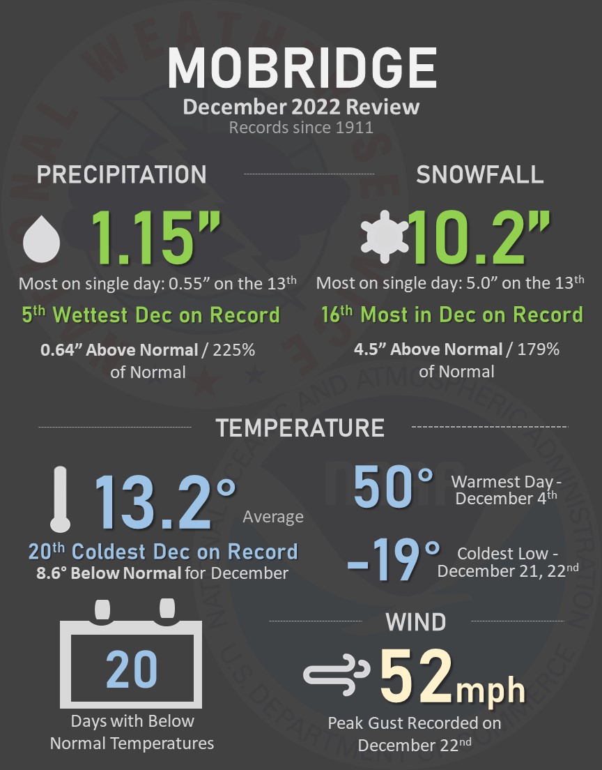
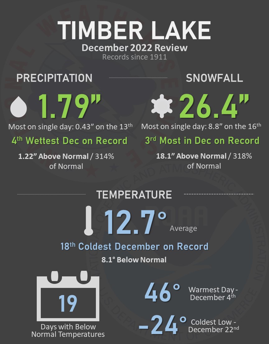
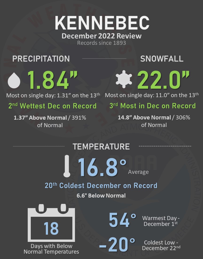
December 2022 will go down in the books as having been cold and snowy, thanks in large part to a couple of potent winter storm systems in the middle and later parts of the month. Find all the details for select locations in the graphics below. Some of the highlights include: Pierre recorded their 4th wettest and 3rd snowiest December on record, Mobridge recorded their 5th wettest December on record, Sisseton recorded their 5th wettest and 2nd snowiest December on record, Kennebec recorded their 2nd wettest and 3rd snowiest December on record, Timber Lake recorded their 4th wettest and 3rd snowiest December on record, and Wheaton recorded their 2nd wettest December on record.
US Dept of Commerce
National Oceanic and Atmospheric Administration
National Weather Service
Aberdeen, SD
824 391st Ave S.
Aberdeen, SD 57401-9311
605-225-0519
Comments? Questions? Please Contact Us.

