Overview
|
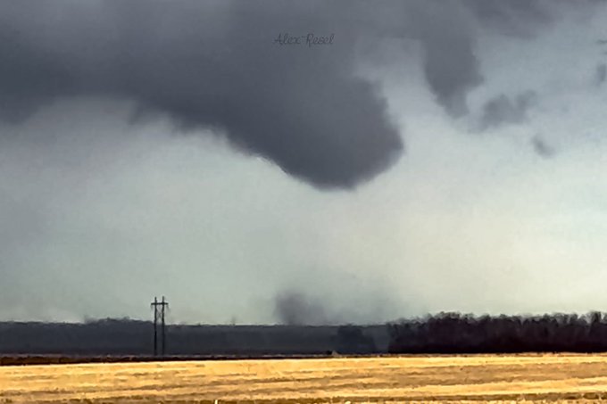
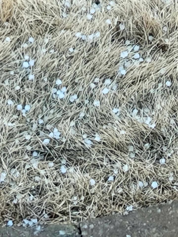
Unusual February thunderstorms developed along a front on Monday the 24th. Conditions came together just enough to form weak, low-topped supercells. While the environment wasn't suitable for strong thunderstorms, there was just enough low-level rotation that was tilted and stretched to form a brief, weak tornado near the borders of Codington, Hamlin, and Deuel counties. Tornado touched down around 4:11pm CST and lasted around a minute in an open field. No damage was observed, and without damage, the tornado will be documented as an Enhanced Fujita Scale Unknown or EF-U. Some storms also produced pea sized hail.
This event was unique because it was the first February tornado to be documented in South Dakota history! The only remaining months with no tornadoes documented in South Dakota are November, December, and January.
There was a stark difference between temperatures the previous week (in the -20s to -30s) and this week's temperatures (highs in the 50s). |
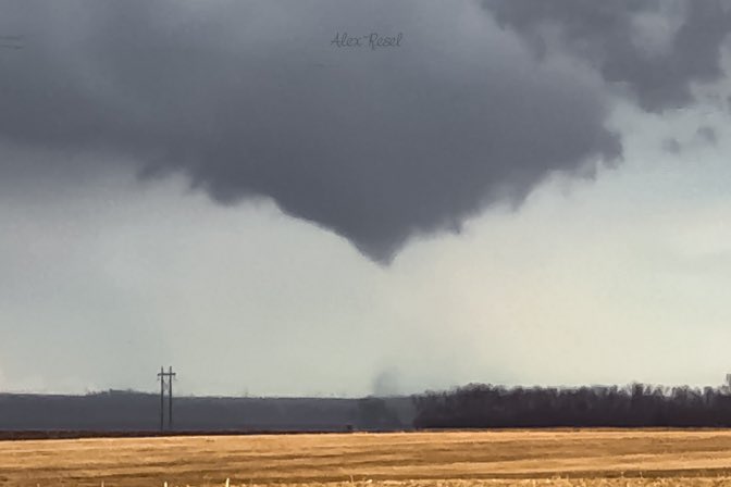 Tornado captured by Alex Resel. |
Photos & Video
Header
 |
 |
 |
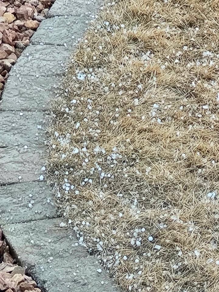 |
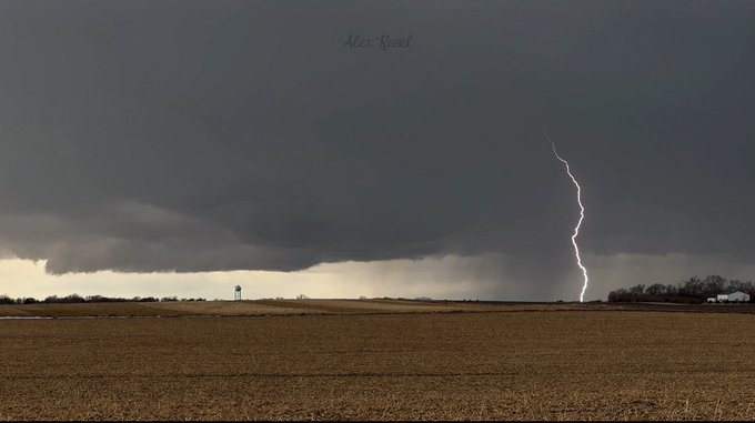
| Tornado Photo credit: Alex Resel | Wall Cloud/Lightning Photo credit: Alex Resel | Pea Sized Hail in Watertown. Photo credit: Mike Tanner | Pea Sized Hail in Watertown. Photo credit: Mike Tanner |
 |
|||
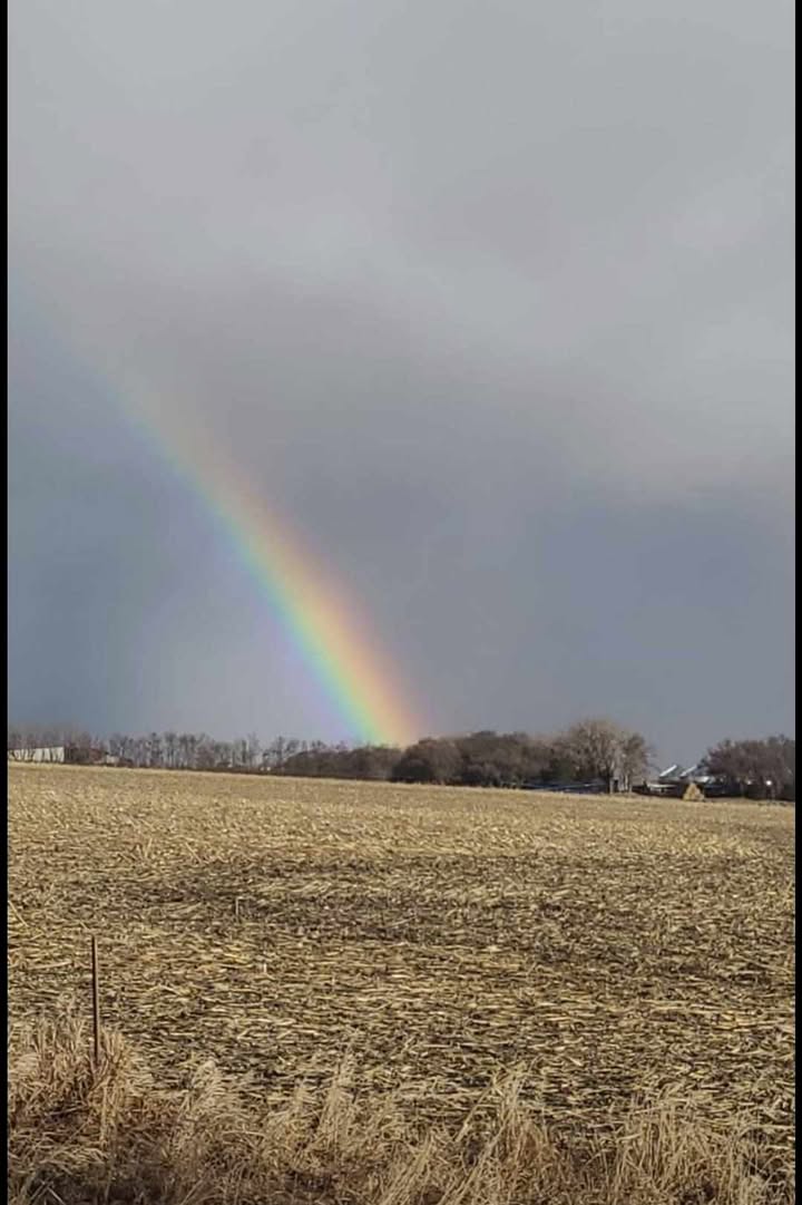
| Rainbow near Garden City. Photo credit: Linda Anderson |
Environment
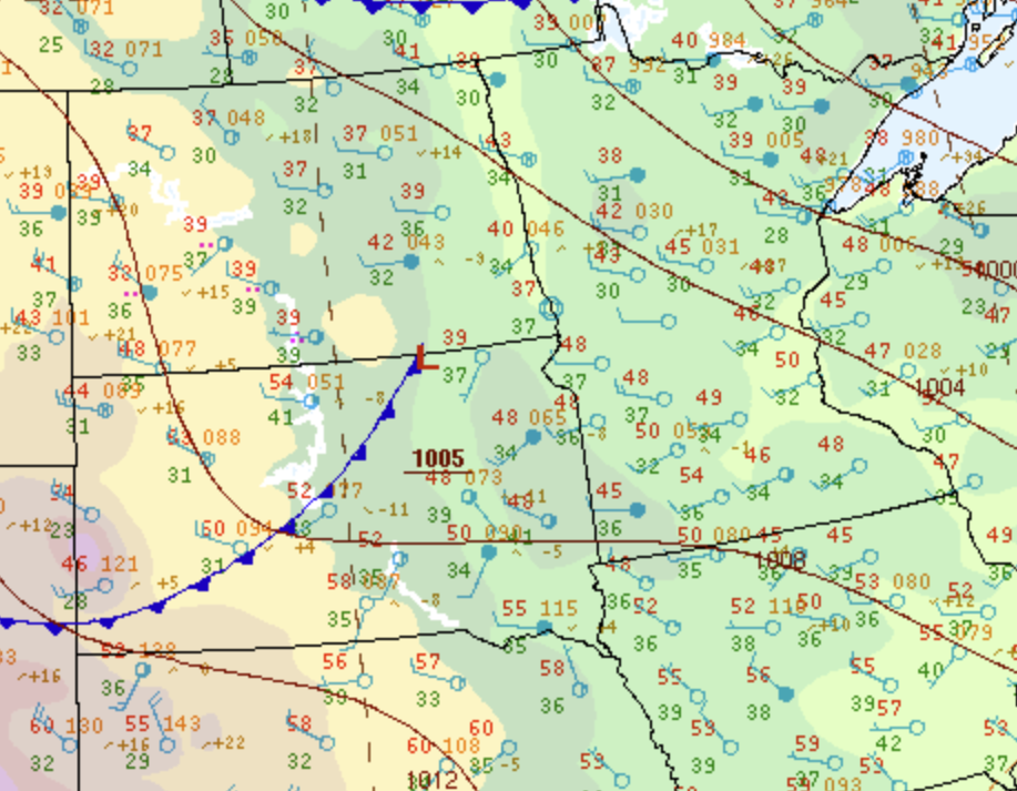
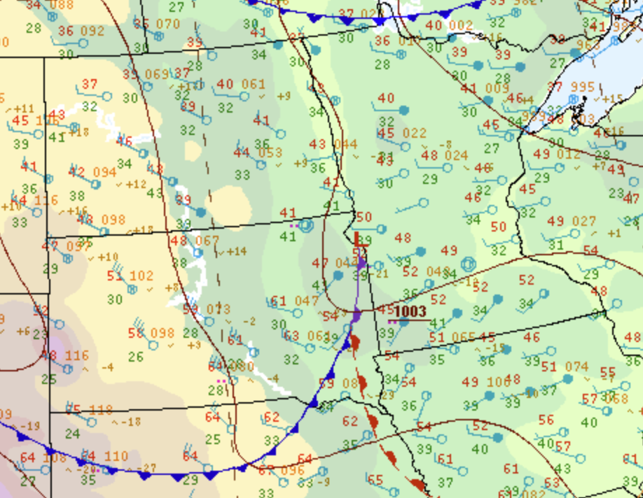
Surface Pressure Pattern.
 |
 |
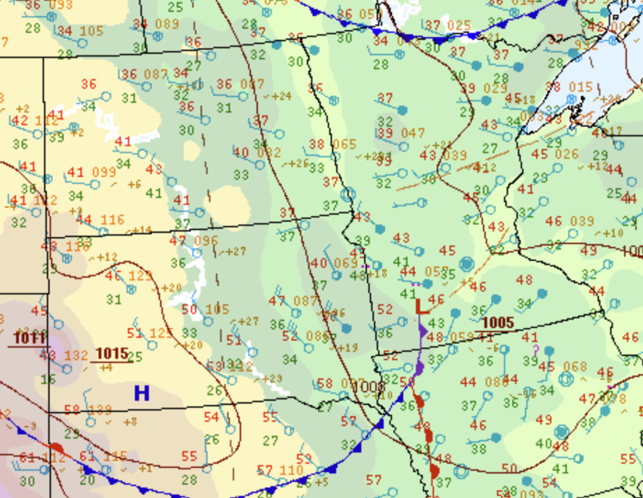 |
| Surface pressure at 18Z on February 24th, 2025 | Surface pressure at 21Z on February 24th, 2025 | Surface pressure at 00Z on February 25th, 2025 |
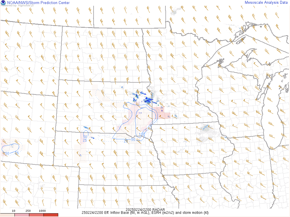
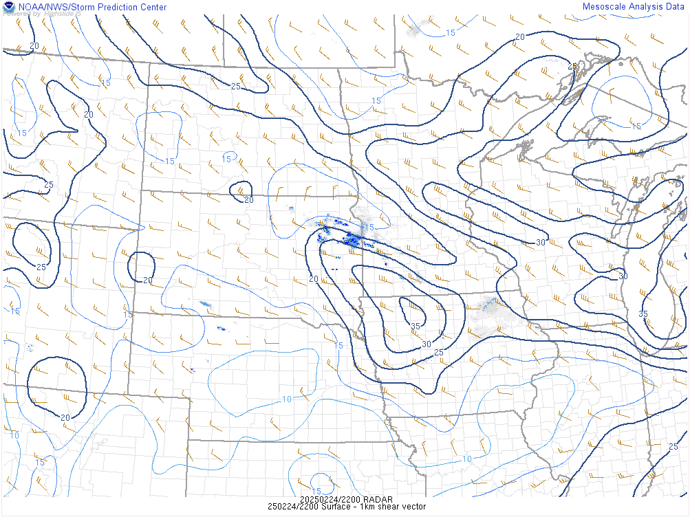
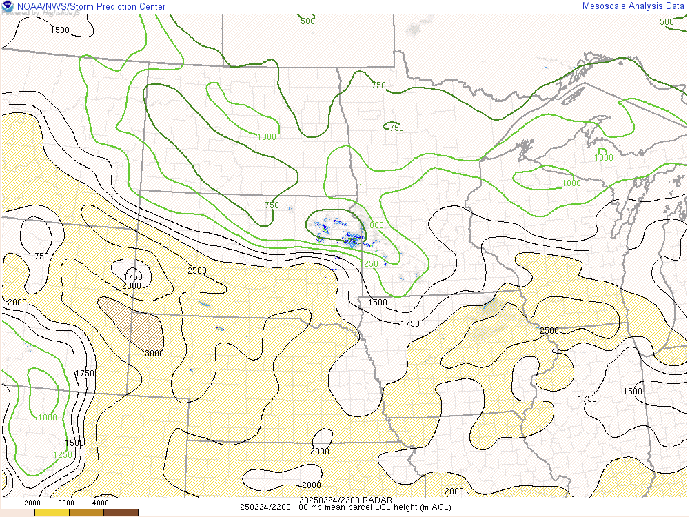
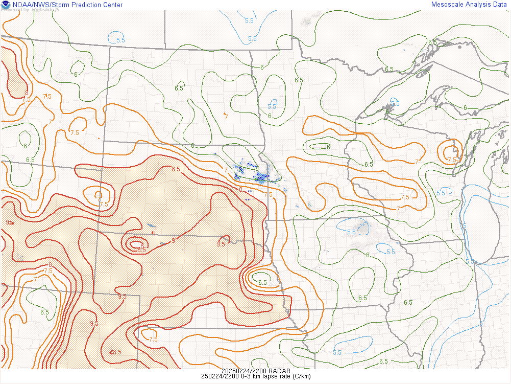
Environmental Parameters around the time of tornado occurrence.
 |
 |
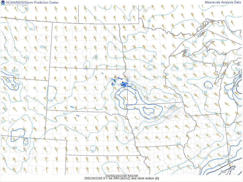 |
| 0-1km Effective Storm Relative Helicity at 22Z on February 24th, 2025 | 0-1km Shear at 22Z on February 24th, 2025 | 0-1km Storm Relative Helicity at 22Z on February 24th, 2025 |
 |
 |
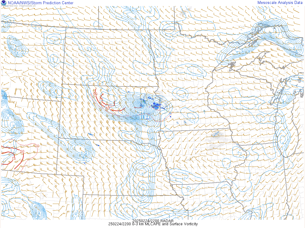 |
| LCL Heights at 22Z on February 24th, 2025 | Low-Level Lapse Rates at 22Z on February 24th, 2025 | Mixed Layer CAPE and Surface Vorticity at 22Z on February 24th, 2025 |
 |
Media use of NWS Web News Stories is encouraged! Please acknowledge the NWS as the source of any news information accessed from this site. |
|

