Overview
|
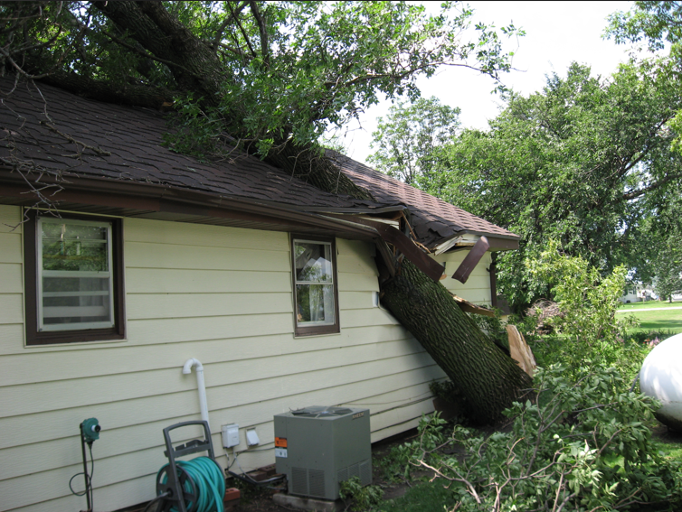
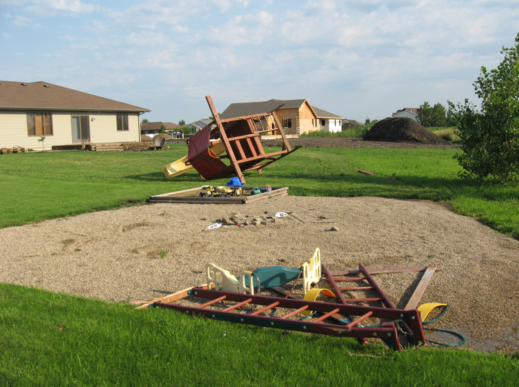
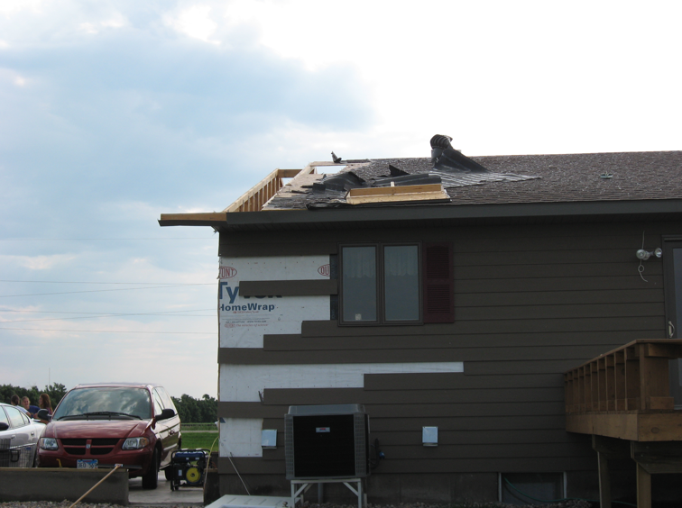
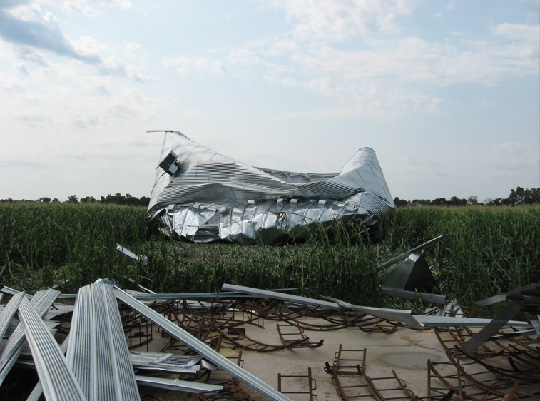
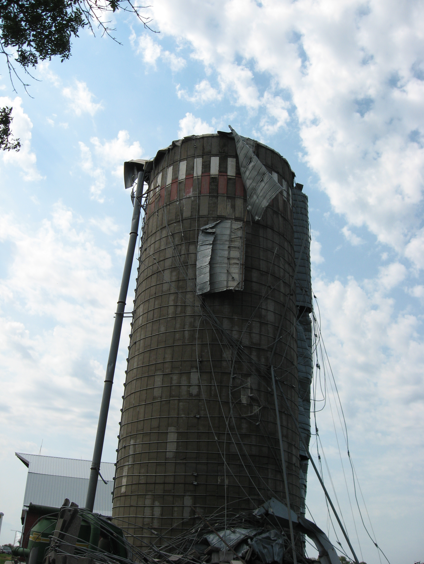
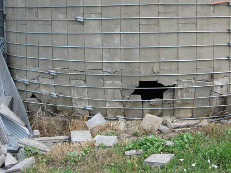
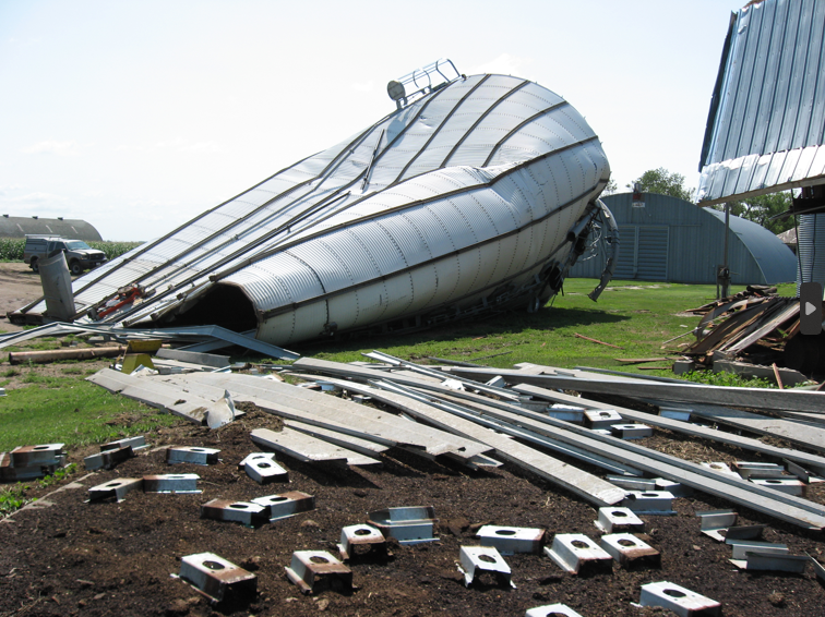
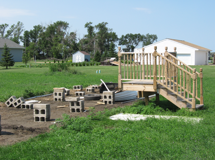
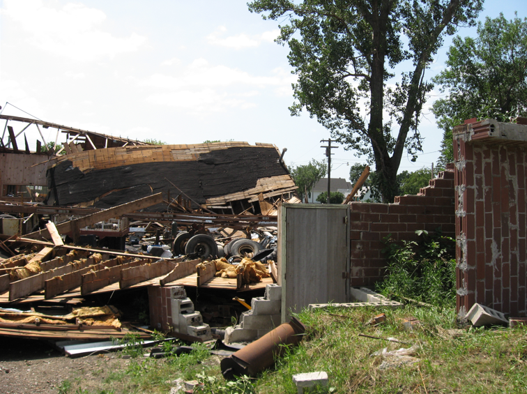
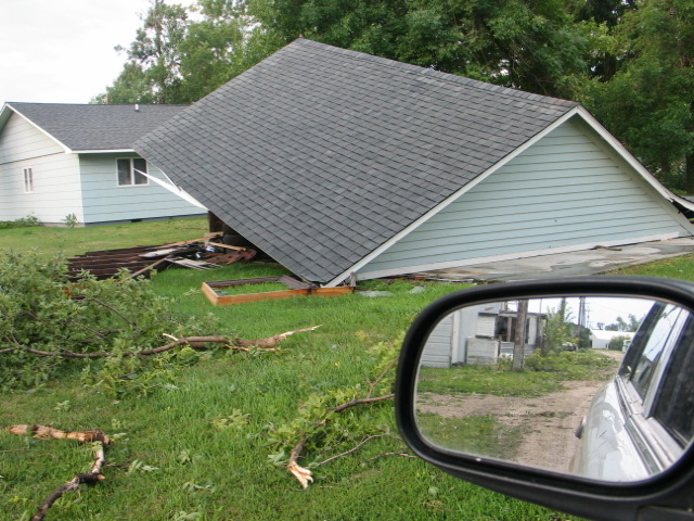
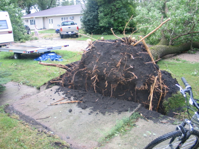
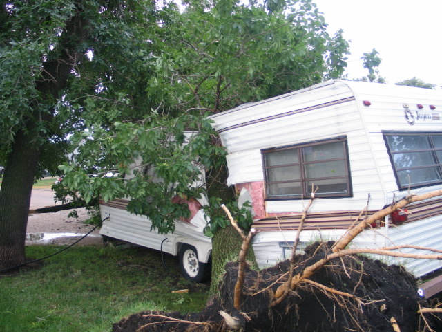
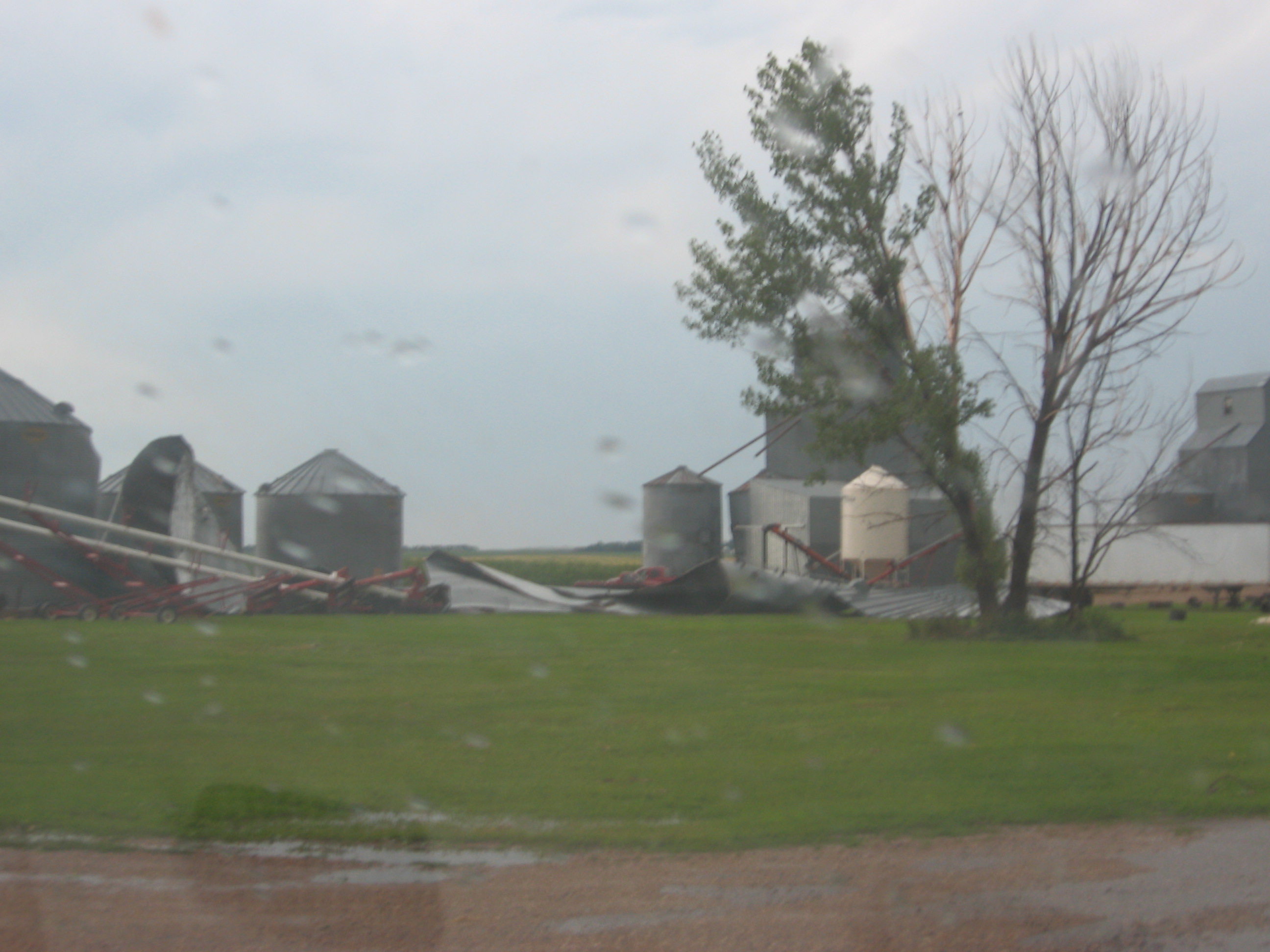
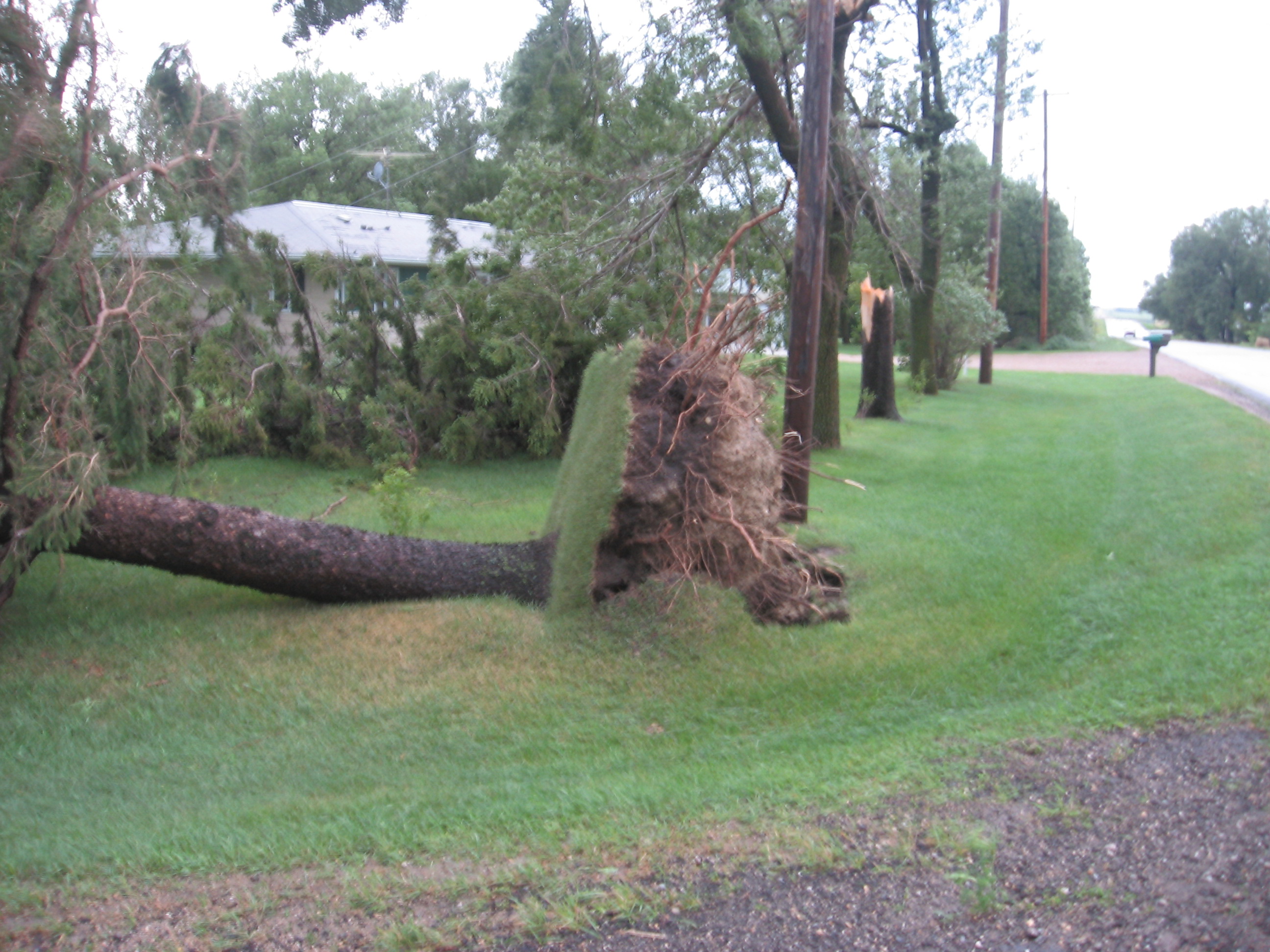
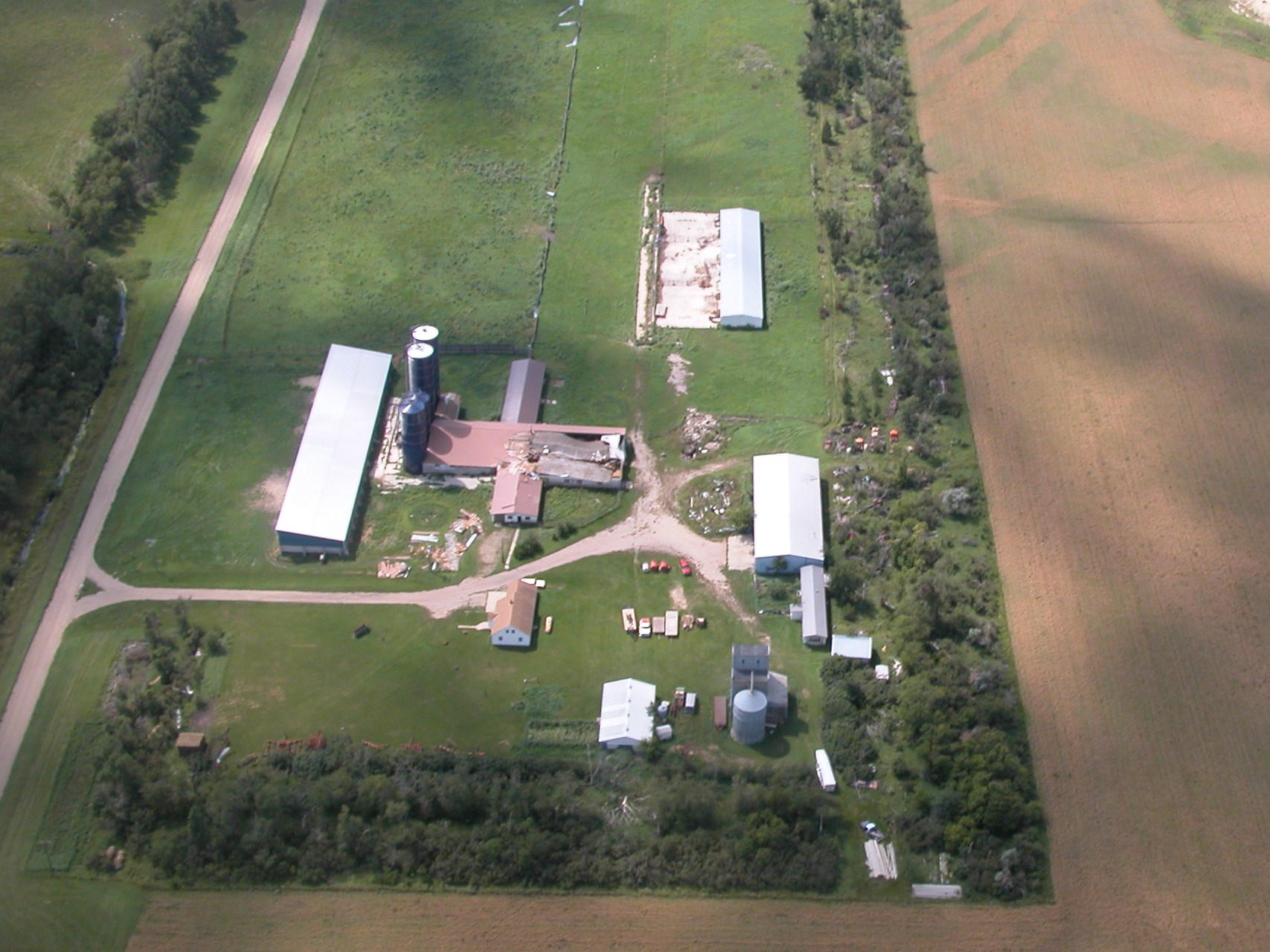
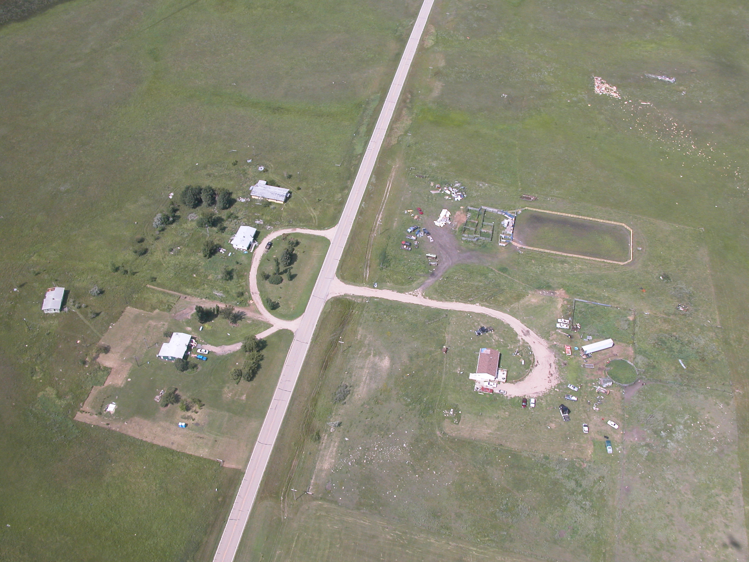
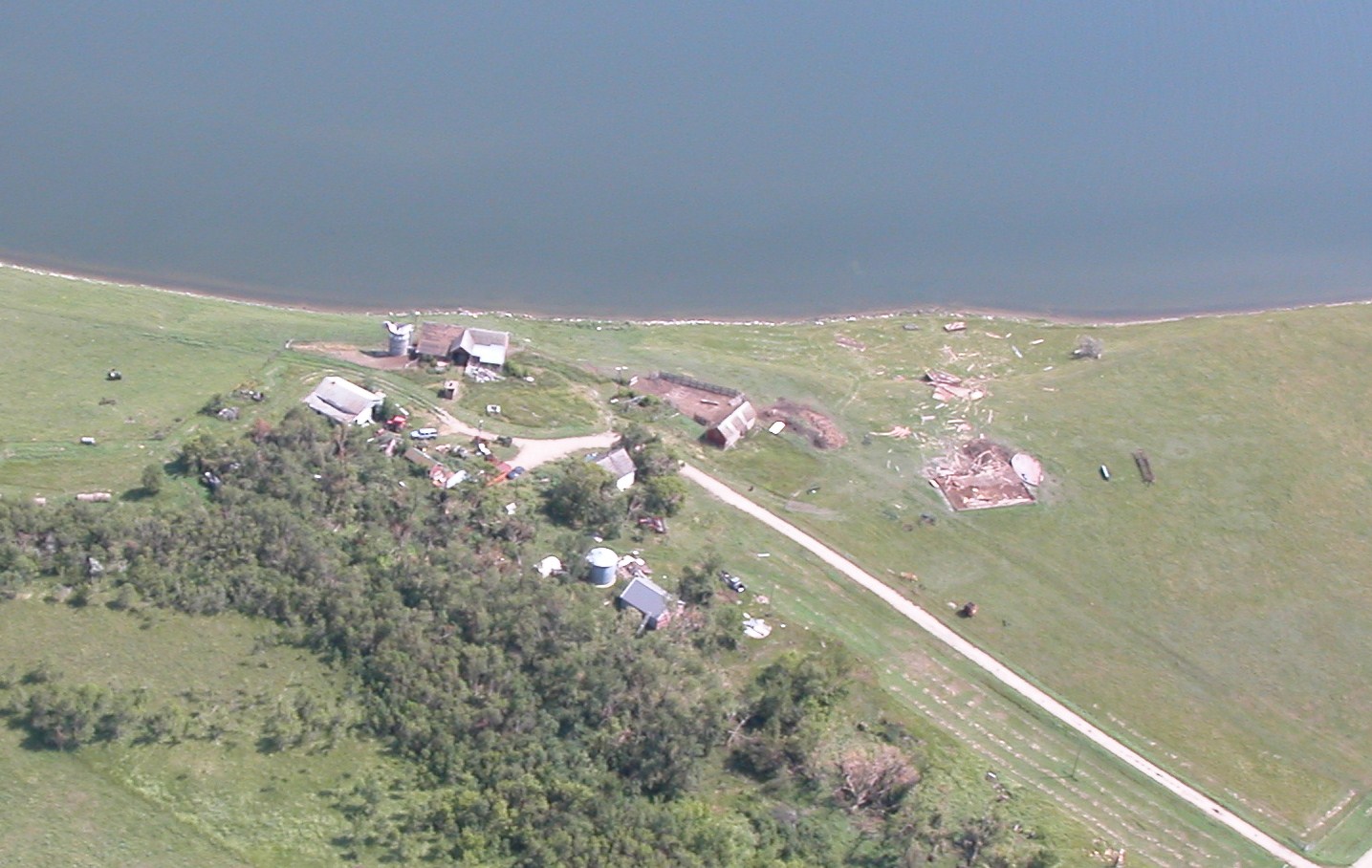
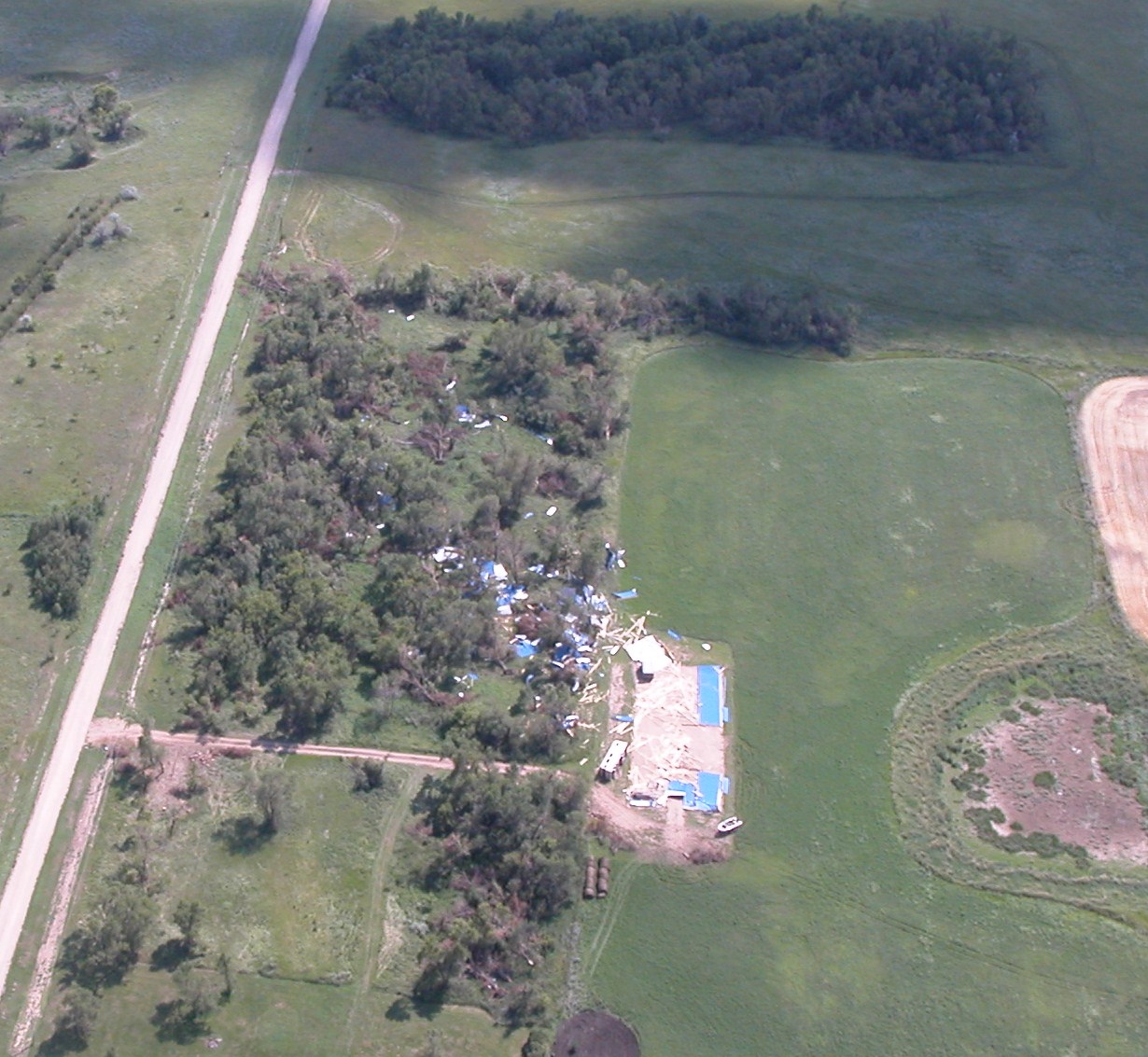
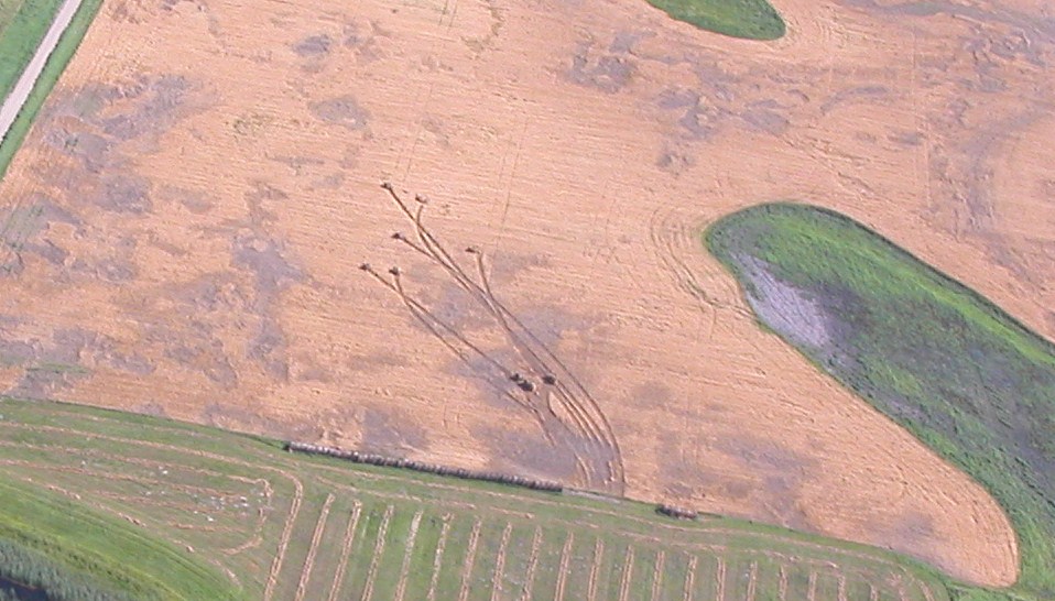
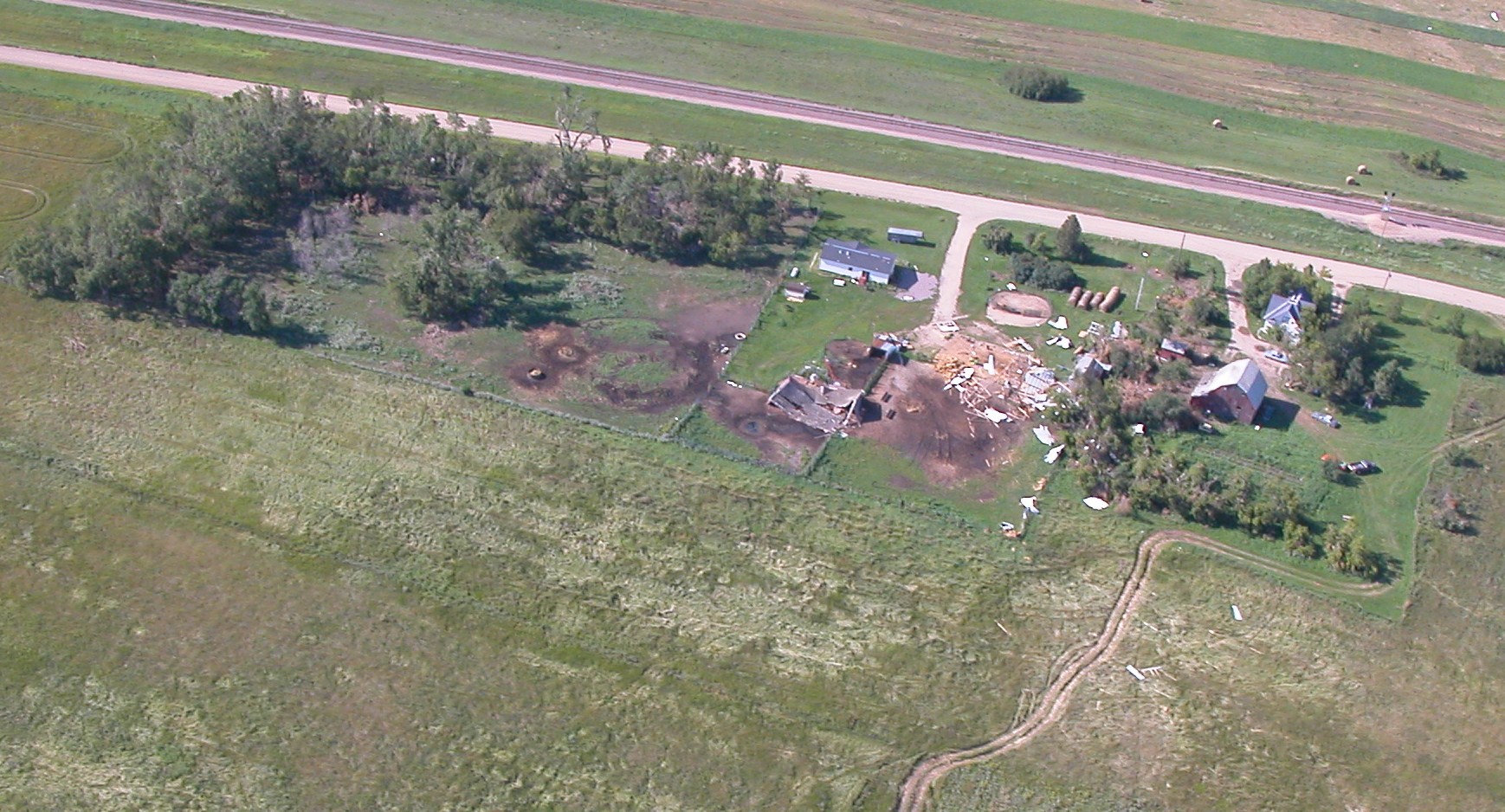
As the people of South Dakota and Minnesota know all too well, the weather can turn dangerous during the warm and humid summer months, and on July 31st, 2008, that is exactly what happened. In the early morning hours of July 31st, a fast moving line of thunderstorms brought widespread wind damage to a large part of northeast South Dakota and west central Minnesota. The storms originated in North Dakota and began to expand and surge southeast into northeast South Dakota. As the storms moved southeast, they began to tap into warmer, more humid air and rapidly evolve into a line of severe thunderstorms. Widespread wind damage occurred in a swath extending from Long Lake in McPherson County all the way into eastern Grant County and southern Big Stone County in Minnesota. In fact, this line of storms continued to produce damage throughout the morning as they raced across southern Minnesota and into northern Illinois. The most extensive damage in northeast South Dakota was generally found along and near US Highway 12 from Aberdeen to Milbank. Several observing stations in the path of these storm measured wind speeds ranging from 70 to over 115 mph. National Weather Service damage surveys estimated wind speeds even stronger with peak winds speeds over 120 mph. Over fifty communities in northeast South Dakota and west central Minnesota along with the surrounding rural areas received minor to major tree and structural damage as straight line winds from 70 to 120 mph raced across the area. The Webster and Waubay areas received the most extensive damage from the storms. Across the entire area, thousands of trees were snapped or uprooted, hundreds of grain bins were damaged or destroyed, hundreds of homes, businesses, and outbuildings were damaged or destroyed along with many power poles and miles of power lines downed. Many mobile homes, campers, and boats were also damaged or destroyed along with many road and business signs. Fallen trees also caused damage to many homes, vehicles, and campers . A State Forestry Specialist said the extensive tree damage in the Webster area was one of the worst he has ever seen. The strong winds and hail also played havoc with the crops in northeast South Dakota and west central Minnesota. Thousands of acres of crops were also damaged or completely destroyed by the winds and hail. The greatest crop damage occurred in the Roslyn, Grenville, Eden, and Pickerel Lake areas in Marshall and Day counties. Many acres of corn were blown down and not able to come back. The large hail combined with the strong winds also broke out countless windows in homes and vehicles along with damaging the siding on homes. The downed power lines and poles also left thousands of people without power for up to several days. The intense winds were able to move large hay bales up to 700 yards. On Highway 12 near Webster and near Milbank, three semis were overturned by the high winds causing injuries to all of the drivers. Along with these injuries, several other storm related injuries occurred with no storm related deaths. Sadly after the storm, a fifty-eight year old man died two miles north of Waubay during the cleanup when he was pinned between a backhoe and a tree. The Highway 12 windstorm will be remembered for years to come for many of the people of northeast South Dakota and west central Minnesota as one, if not, the most intense severe weather events they have experienced. |
 Damage from intense straight-line winds |
Photos
 |
 |
 |
 |
| Damage in Aberdeen (NWS Aberdeen) |
Damage in Aberdeen (NWS Aberdeen) |
Damage in Aberdeen (NWS Aberdeen) |
Damage in Warner (NWS Aberdeen) |
 |
 |
 |
 |
| Photo from NWS Aberdeen |
Photo from NWS Aberdeen |
Photo from NWS Aberdeen |
Photo from NWS Aberdeen |
 |
 |
 |
 |
| Photo from NWS Aberdeen |
Photo from NWS Aberdeen |
Photo from NWS Aberdeen | Damage at Langford (NWS Aberdeen) |
 |
 |
 |
 |
| Damage at Langford (NWS Aberdeen) |
Damage at Langford (NWS Aberdeen) |
Damage at Roslyn (NWS Aberdeen) |
Damage at Roslyn (NWS Aberdeen) |
 |
 |
 |
 |
| Photo courtesy of the Civil Air Patrol, US Air Force Auxiliary | Photo courtesy of the Civil Air Patrol, US Air Force Auxiliary | Photo courtesy of the Civil Air Patrol, US Air Force Auxiliary | Photo courtesy of the Civil Air Patrol, US Air Force Auxiliary |
 |
 |
||
| Photo courtesy of the Civil Air Patrol, US Air Force Auxiliary | Photo courtesy of the Civil Air Patrol, US Air Force Auxiliary |
Radar
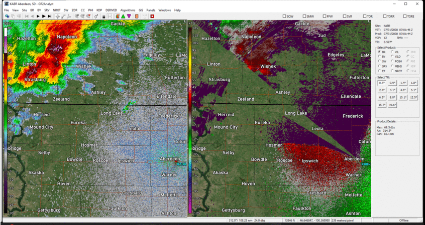 |
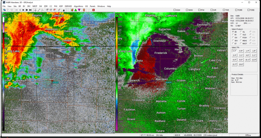 |
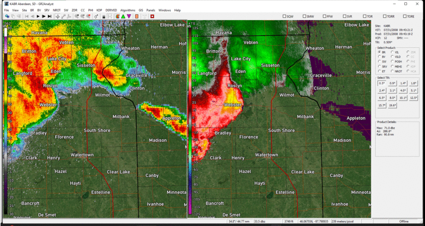 |
| Radar reflectivity (left) and velocity (right) from 2:01am - 3:20am CDT 7/31/2008 | Radar reflectivity (left) and velocity (right) from 3:20am - 4:43am CDT 7/31/2008 | Radar reflectivity (left) and velocity (right) from 4:43am - 5:57am CDT 7/31/2008 |
Storm Reports
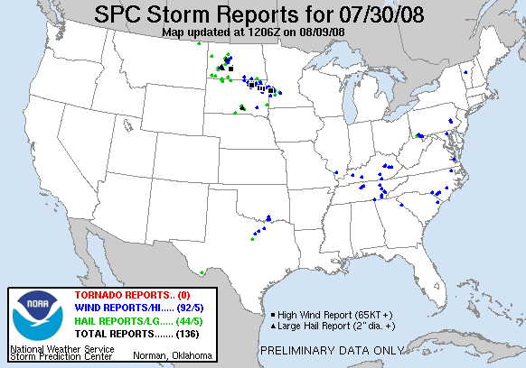 |
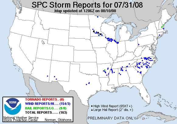 |
| Severe weather reports across the United States from 7am July 30th to 7am July 31st, 2008 | Severe weather reports across the United States from 7am July 31st to 7am August 1st, 2008 |
| WFO | Report Time | County | Location | State | Event Type | Magnitude | |
| ABR | 7/31 2:40 AM | CORSON | 10 W MCLAUGHLIN | SD | HAIL | ||
| ABR | 7/31 3:04 AM | MCPHERSON | 10 W LONG LAKE | SD | TSTM WND GST | 72 | |
| ABR | 7/31 3:16 AM | MCPHERSON | LONG LAKE | SD | TSTM WND GST | 60 | |
| ABR | 7/31 3:30 AM | MCPHERSON | LEOLA | SD | TSTM WND GST | 68 | |
| ABR | 7/31 3:40 AM | MCPHERSON | LEOLA | SD | HAIL | 1 | |
| ABR | 7/31 3:40 AM | EDMUNDS | 8 SE IPSWICH | SD | TSTM WND GST | 59 | |
| ABR | 7/31 3:47 AM | EDMUNDS | 5 NW MINA | SD | TSTM WND GST | 62 | |
| ABR | 7/31 3:53 AM | BROWN | 1 NE WESTPORT | SD | TSTM WND DMG | 0 | |
| ABR | 7/31 3:53 AM | BROWN | 5 W ABERDEEN | SD | TSTM WND DMG | 0 | |
| ABR | 7/31 4:00 AM | BROWN | COLUMBIA | SD | TSTM WND DMG | 0 | |
| ABR | 7/31 4:00 AM | BROWN | 2 N WARNER | SD | TSTM WND DMG | 0 | |
| ABR | 7/31 4:00 AM | BROWN | 3 N WARNER | SD | TSTM WND DMG | 0 | |
| ABR | 7/31 4:02 AM | BROWN | ABERDEEN | SD | TSTM WND GST | 79 | |
| ABR | 7/31 4:02 AM | SPINK | MANSFIELD | SD | TSTM WND GST | 70 | |
| ABR | 7/31 4:05 AM | BROWN | SSE COLUMBIA | SD | TSTM WND DMG | 0 | |
| ABR | 7/31 4:05 AM | BROWN | ABERDEEN | SD | TSTM WND DMG | 0 | |
| ABR | 7/31 4:08 AM | BROWN | 1 SSE PUTNEY | SD | TSTM WND DMG | 0 | |
| ABR | 7/31 4:10 AM | BROWN | 2 SE PUTNEY | SD | TSTM WND DMG | 0 | |
| ABR | 7/31 4:10 AM | BROWN | COLUMBIA | SD | TSTM WND DMG | 0 | |
| ABR | 7/31 4:13 AM | BROWN | 5 N STRATFORD | SD | TSTM WND DMG | 0 | |
| ABR | 7/31 4:15 AM | MARSHALL | 4 WSW HILLHEAD | SD | HAIL | 1 | |
| ABR | 7/31 4:15 AM | SPINK | MELLETTE | SD | TSTM WND GST | 70 | |
| ABR | 7/31 4:16 AM | BROWN | 1 WSW GROTON | SD | TSTM WND DMG | 0 | |
| ABR | 7/31 4:25 AM | DAY | 4 SE PIERPONT | SD | TSTM WND GST | 60 | |
| ABR | 7/31 4:30 AM | MARSHALL | 3 SE CLAREMONT | SD | TSTM WND DMG | 0 | |
| ABR | 7/31 4:40 AM | DAY | WEBSTER | SD | TSTM WND DMG | 0 | |
| ABR | 7/31 4:45 AM | DAY | 3 SW ROSLYN | SD | TSTM WND GST | 70 | |
| ABR | 7/31 4:47 AM | DAY | WEBSTER | SD | TSTM WND DMG | 0 | |
| ABR | 7/31 4:47 AM | DAY | WEBSTER | SD | TSTM WND GST | 70 | |
| ABR | 7/31 4:50 AM | DAY | WAUBAY | SD | TSTM WND DMG | 0 | |
| ABR | 7/31 4:50 AM | MARSHALL | ROY LAKE STATE PARK | SD | TSTM WND DMG | 0 | |
| ABR | 7/31 4:55 AM | DAY | 7 S WEBSTER | SD | TSTM WND GST | 75 | |
| ABR | 7/31 5:00 AM | DAY | PICKEREL LAKE STATE PAR | SD | TSTM WND DMG | 0 | |
| ABR | 7/31 5:05 AM | GRANT | 11 SSW SUMMIT | SD | TSTM WND GST | 115 | |
| ABR | 7/31 5:05 AM | DAY | 4 SE WEBSTER | SD | TSTM WND GST | 70 | |
| ABR | 7/31 5:15 AM | DAY | 7 N WAUBAY | SD | HAIL | 1.5 | |
| ABR | 7/31 5:15 AM | DAY | PICKEREL LAKE STATE PAR | SD | TSTM WND DMG | 0 | |
| ABR | 7/31 5:16 AM | CODINGTON | WATERTOWN | SD | TSTM WND GST | 62 | |
| ABR | 7/31 5:20 AM | CODINGTON | SOUTH SHORE | SD | TSTM WND GST | 61 | |
| ABR | 7/31 5:20 AM | BIG STONE | ORTONVILLE | MN | TSTM WND DMG | 0 | |
| ABR | 7/31 5:25 AM | BIG STONE | ORTONVILLE | MN | TSTM WND DMG | 0 | |
| ABR | 7/31 5:40 AM | GRANT | MILBANK | SD | TSTM WND DMG | 0 | |
| ABR | 7/31 5:50 AM | DAY | WAUBAY | SD | TSTM WND DMG | 0 | |
| ABR | 7/31 6:00 AM | BIG STONE | 6 ESE ORTONVILLE | MN | TSTM WND GST | 59 |
Environment
Thunderstorms developed near Lake Sakakawea in northwestern North Dakota around 8:30pm CDT on Wednesday, July 30th, north of a low pressure system and stationary front. These storms would track east-southeast through the evening, overnight, and through the next morning, before finally collapsing just south of Lake Michigan during the early afternoon on Thursday, July 31st, 2008. The environment was primed through the course of the storm's existence for intense thunderstorm winds, even during the nighttime, due to a number of factors including the presence of rich moisture to the south of the boundary with dewpoints in the upper 60s to low 70s, high instability (2500-4000 J/kg of Most Unstable CAPE), high potential for strong downdrafts (1000-1300 J/kg of Downdraft CAPE), and very strong wind shear (50-60 kts of effective bulk shear).
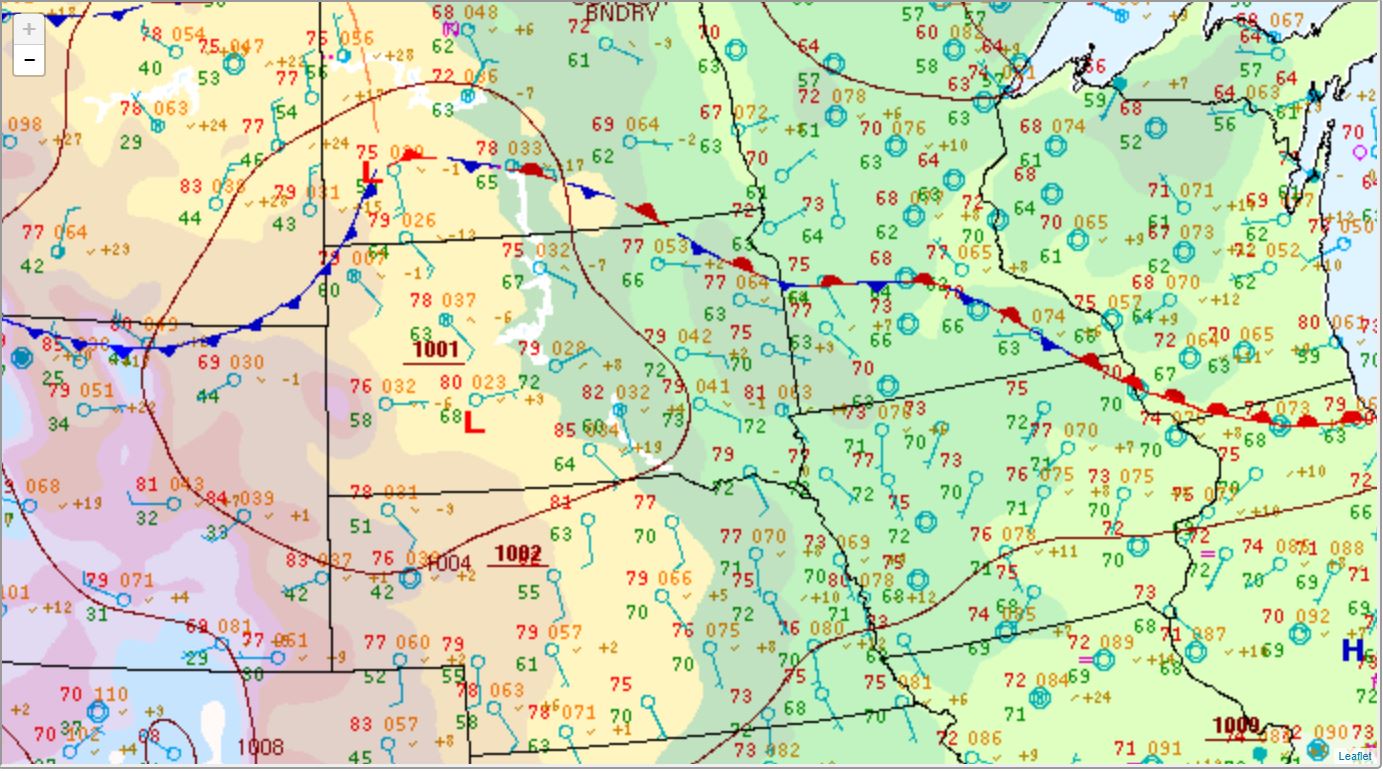 |
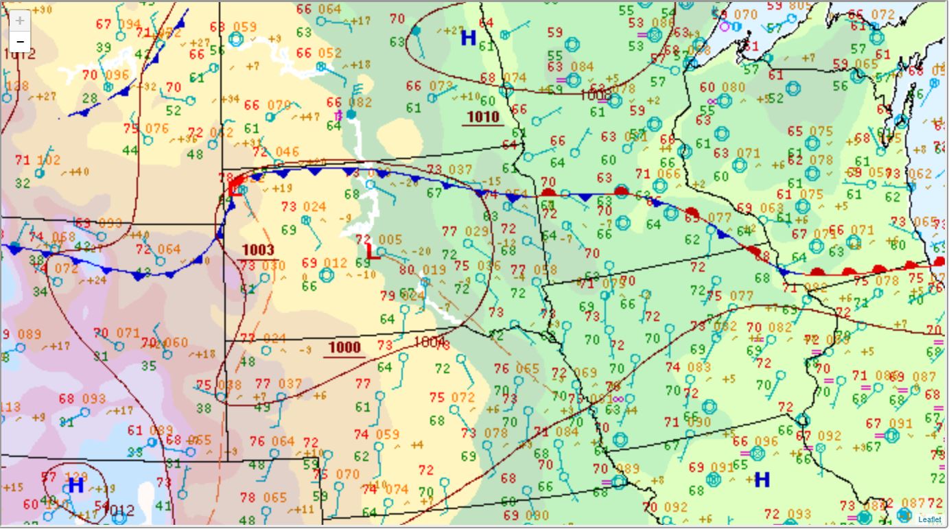 |
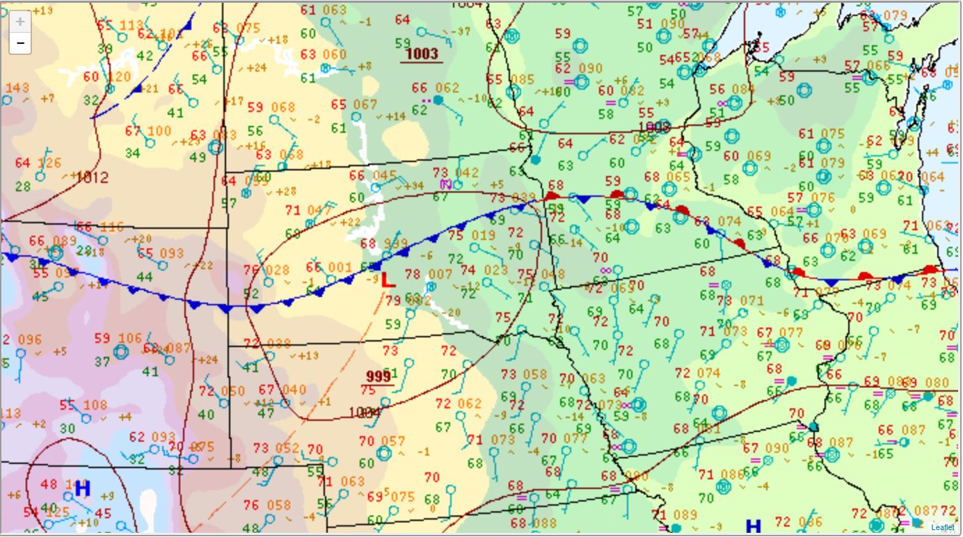 |
| Surface weather map at 10pm CDT 7/30/2008 | Surface weather map at 1am CDT 7/31/2008 | Surface weather map at 4am CDT 7/31/2008 |
 |
Media use of NWS Web News Stories is encouraged! Please acknowledge the NWS as the source of any news information accessed from this site. |
|

