Overview
|
Thunderstorms rapidly developed around midnight on June 11th in central South Dakota, producing large hail up to 2.5 inches in size. As the storms moved to the east-northeast, they evolved into a line and produced a large area of wind damage across east central South Dakota. The hardest hit areas were across Clark, Codington, Hamlin, and Deuel counties, where winds were estimated to reach 80 to 90 mph. The storms continued east into Minnesota and eventually Wisconsin and Upper Michigan, producing damaging winds into the afternoon hours. |
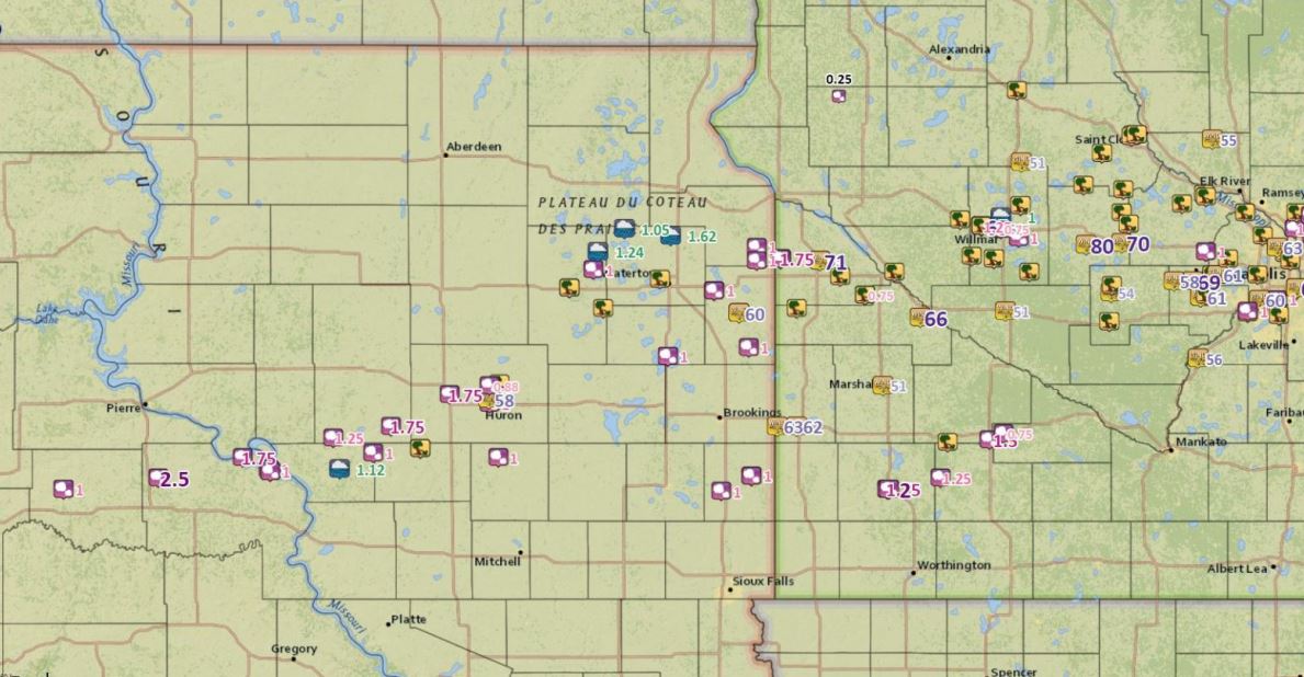 Storm reports across eastern South Dakota and central Minnesota during the morning of June 11, 2017. |
 |
 |
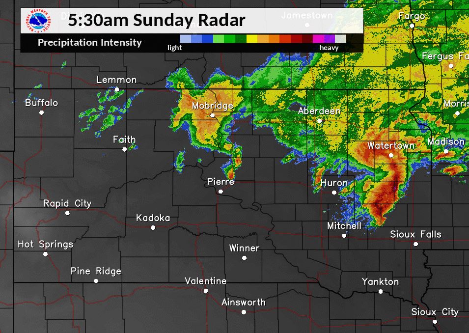
| Radar image of storms as they strike the Watertown area at 5:30 am on June 11th, 2017 | GOES-16 Infrared Satellite Imagery at 4:50 am. (Preliminary, Non-Operational Data) |
Photos & Video:
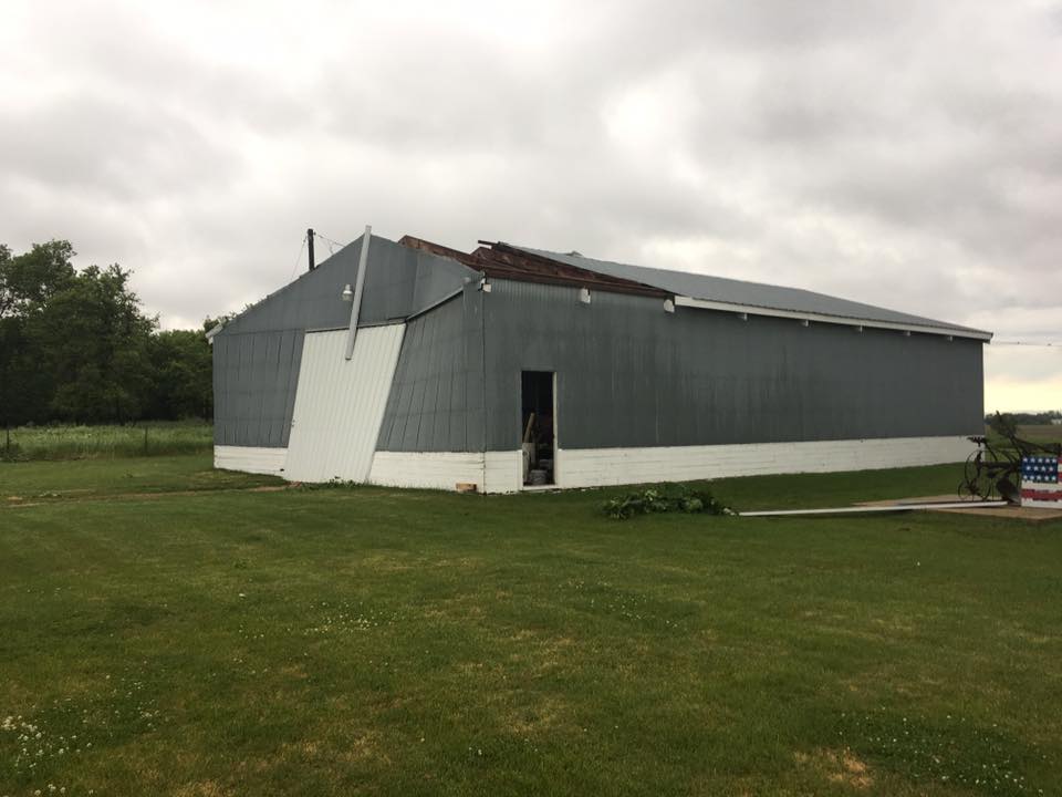
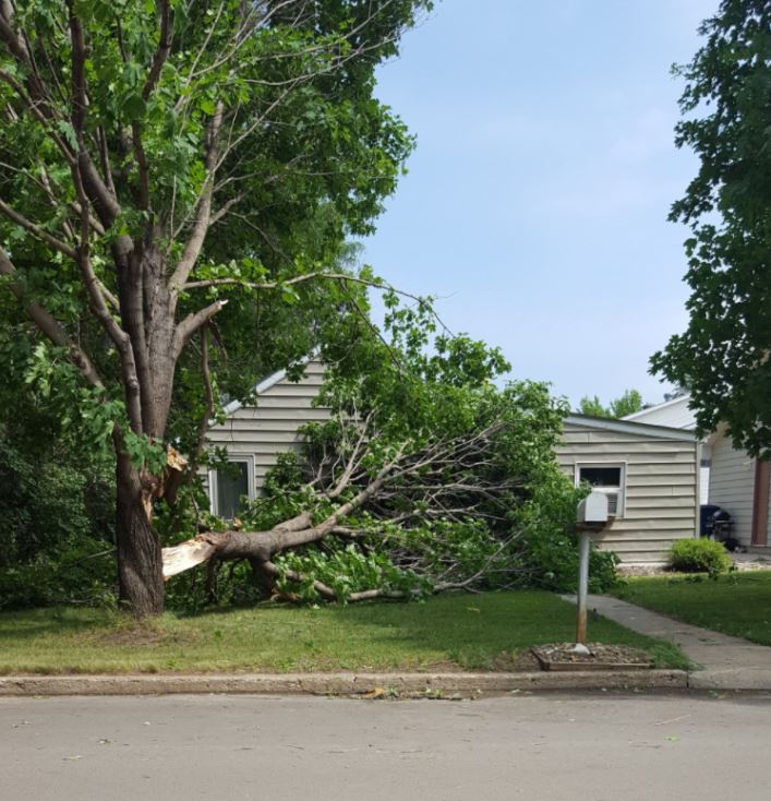
Wind damage photos from across the area
Goodwin, SD
 |
 |
 |
 |
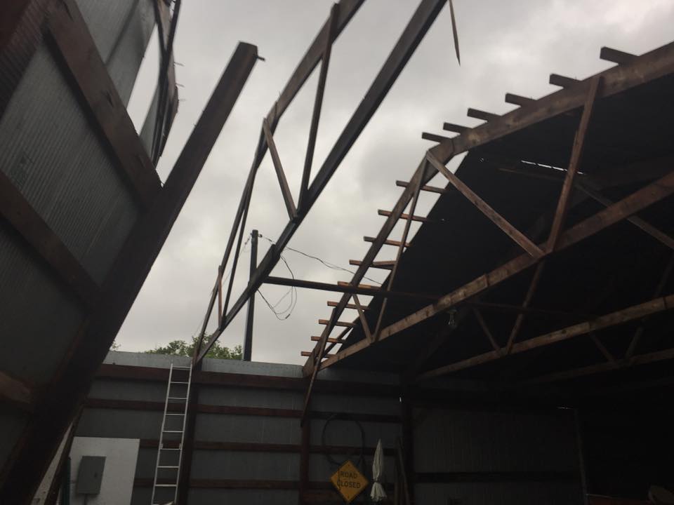
| Beams from the shed went through the roof of the house. (Juanita Propst - Facebook) |
Roof of a shed blown off in Goodwin, SD (Juanita Propst - Facebook) |
Shed without a portion of the roof (Juanita Propst - Facebook) |
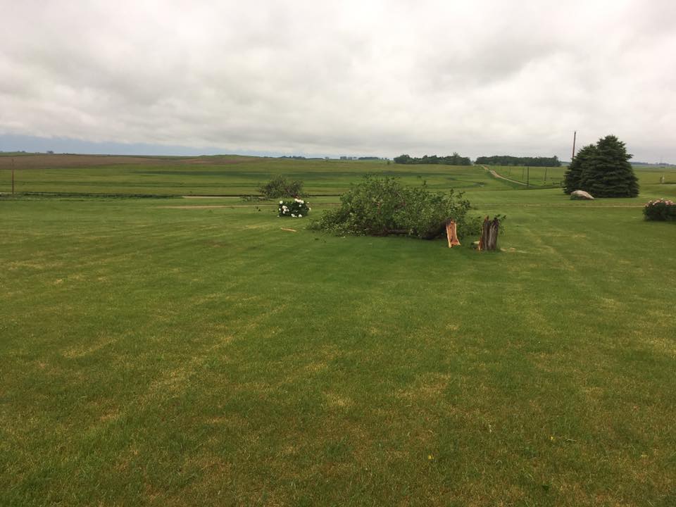
Trees snapped from the strong winds (Juanita Propst - Facebook) |
Lake Norden, SD
 |
 |
 |
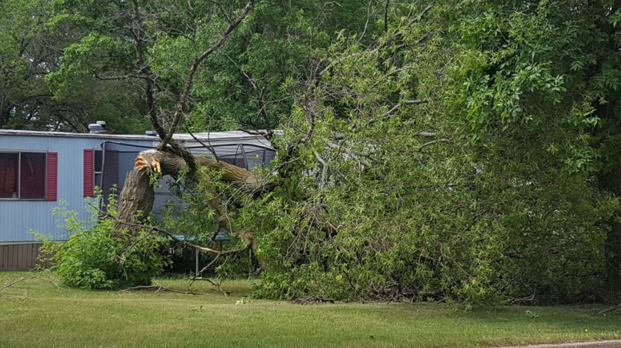
| (John Andrews - Twitter) | Tree uprooted in Lake Norden, SD (John Andrews - Twitter) |
(John Andrews - Twitter) |
Watertown, SD
 |
 |
 |
 |
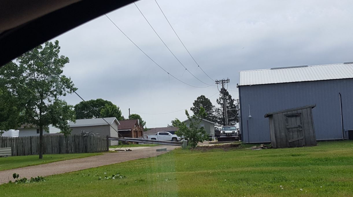
| Power pole snapped in Watertown, SD (Tanner Butler - Twitter) |
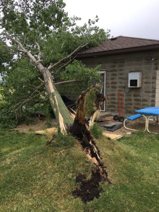
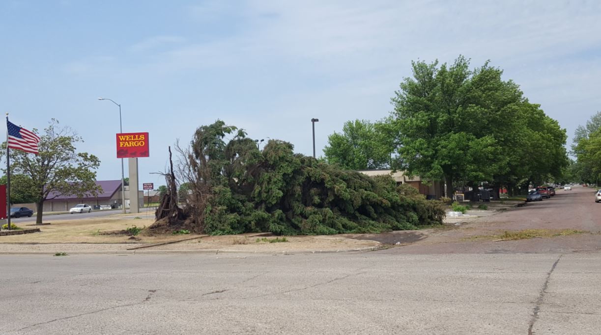
Tree uprooted near Wells Fargo in Watertown (Tanner Butler - Twitter) |
Tree snapped in Watertown, SD (Tanner Butler - Twitter) |
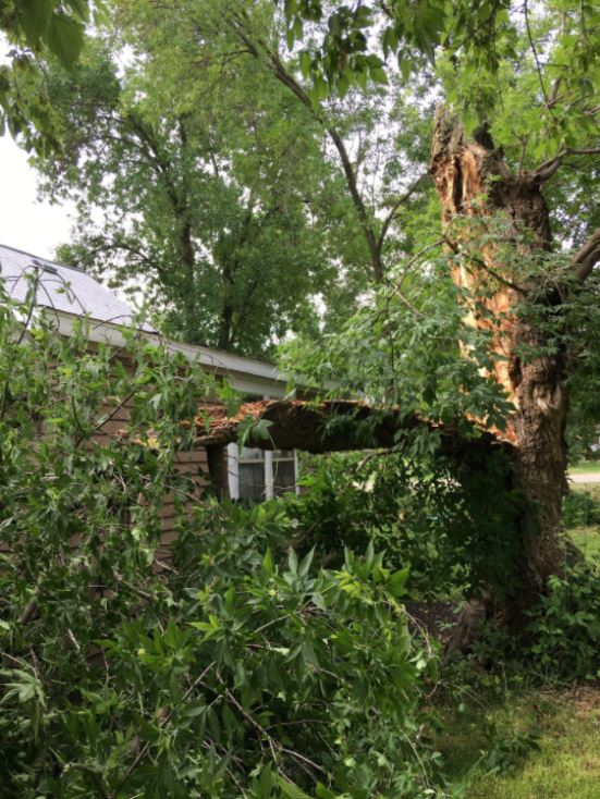
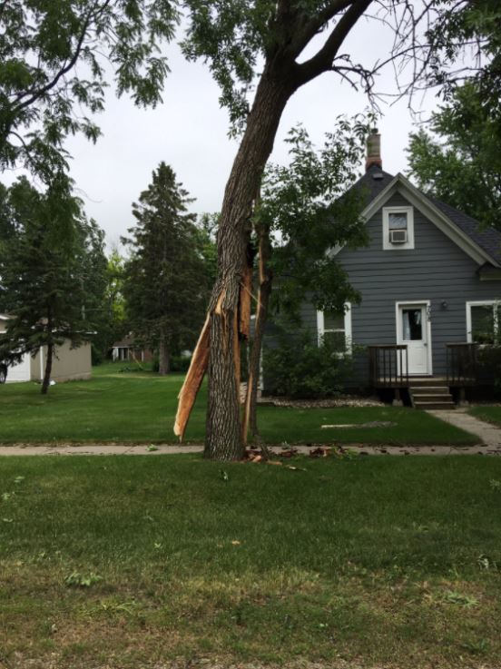
Tree on house in Watertown, SD (Tanner Butler - Twitter) |
Storm Reports
Interactive map version of storm reports here
PRELIMINARY LOCAL STORM REPORT...SUMMARY
NATIONAL WEATHER SERVICE ABERDEEN SD
959 PM CDT SUN JUN 11 2017

..TIME...   ...EVENT...      ...CITY LOCATION...     ...LAT.LON...
..DATE...   ....MAG....      ..COUNTY LOCATION..ST.. ...SOURCE....
            ..REMARKS..

0130 AM     HAIL             8 N VIVIAN              44.04N 100.27W
06/11/2017  E2.50 INCH       LYMAN              SD   MESONET


0130 AM     HAIL             8 NNE OKATON            43.99N 100.86W
06/11/2017  E1.00 INCH       JONES              SD   PUBLIC


0142 AM     HAIL             2 ESE JOE CREEK REC ARE 44.13N 99.75W
06/11/2017  E1.75 INCH       LYMAN              SD   PUBLIC


0145 AM     HAIL             1 NNW LOWER BRULE       44.08N 99.59W
06/11/2017  E1.00 INCH       LYMAN              SD   PUBLIC


0240 AM     HAIL             6 WSW AMES              44.22N 99.19W
06/11/2017  E1.25 INCH       HAND               SD   PUBLIC


0300 AM     HAIL             LOWER BRULE             44.07N 99.58W
06/11/2017  E1.00 INCH       LYMAN              SD   PUBLIC


0315 AM     HAIL             3 ENE DANFORTH          44.27N 98.83W
06/11/2017  E1.75 INCH       HAND               SD   PUBLIC


0335 AM     HAIL             8 SSW DANFORTH          44.15N 98.94W
06/11/2017  E1.00 INCH       BUFFALO            SD   PUBLIC


0400 AM     HAIL             3 S BRANDT              44.62N 96.62W
06/11/2017  E1.00 INCH       DEUEL              SD   TRAINED SPOTTER


0438 AM     HAIL             GARDEN CITY             44.96N 97.58W
06/11/2017  E1.00 INCH       CLARK              SD   TRAINED SPOTTER

            7 TO 8 MINUTES OF HAIL RANGING FROM DIMES TO
            QUARTERS.

0500 AM     TSTM WND DMG     CLARK                   44.88N 97.73W
06/11/2017                   CLARK              SD   TRAINED SPOTTER

            MAJOR TREE DAMAGE IN CLARK.

0525 AM     HAIL             4 WSW STONE BRIDGE      44.58N 97.12W
06/11/2017  M1.00 INCH       HAMLIN             SD   EMERGENCY MNGR


0530 AM     HAIL             1 ESE GOODWIN           44.87N 96.83W
06/11/2017  E1.00 INCH       DEUEL              SD   PUBLIC

            LOTS OF TREE DAMAGE. A NEARBY STEEL STORAGE
            STRUCTURE AND FARM HOUSE HAD WIND BLOWN
            DAMAGE.

0530 AM     HAIL             1 NW ALBEE              45.06N 96.57W
06/11/2017  E1.00 INCH       GRANT              SD   PUBLIC

            HAIL QUARTER SIZE. STRONG WINDS SCOTT
            REPORTED 3 MATURE TREES DOWN. LOCATION WAS
            JUST N OF REVILLO.

0534 AM     TSTM WND GST     CLEAR LAKE              44.77N 96.68W
06/11/2017  M51 MPH          DEUEL              SD   TRAINED SPOTTER


0540 AM     TSTM WND DMG     WATERTOWN               44.92N 97.17W
06/11/2017                   CODINGTON          SD   LAW ENFORCEMENT

            SOME TREES DOWN. POWER OUTAGE.

0545 AM     TSTM WND GST     CLEAR LAKE              44.77N 96.68W
06/11/2017  E60 MPH          DEUEL              SD   PUBLIC

            SIXTY MPH WINDS WITH DIME SIZE HAIL.

0550 AM     TSTM WND DMG     1 ENE ALTAMONT          44.85N 96.67W
06/11/2017                   DEUEL              SD   TRAINED SPOTTER

            SEVERAL TREES BLOWN DOWN OR UPROOTED. LARGE
            EVERGREEN TREES SNAPPED OFF FROM AT ABOUT 15
            FEET ABOVE THE GROUND. TIME ESTIMATED BASED
            ON RADAR.

0605 AM     HAIL             1 S REVILLO             45.00N 96.57W
06/11/2017  E1.00 INCH       GRANT              SD   PUBLIC

            QUARTER HAIL.

1115 AM     HEAVY RAIN       8 W SOUTH SHORE         45.11N 97.10W
06/11/2017  M1.62 INCH       CODINGTON          SD   MESONET

            MESONET STATION SOSS2, SOUTH SHORE 8 W.

1131 AM     HEAVY RAIN       9 E LEES CORNER         44.08N 99.15W
06/11/2017  M1.12 INCH       BUFFALO            SD   MESONET

            MESONET STATION E0083, LEES CORNER 8 E.

1135 AM     HEAVY RAIN       5 SW WALLACE            45.04N 97.55W
06/11/2017  M1.24 INCH       CLARK              SD   MESONET

            MESONET STATION AU451, WALLACE 4 SW.

1138 AM     HEAVY RAIN       6 NE WALLACE            45.14N 97.39W
06/11/2017  M1.05 INCH       CODINGTON          SD   MESONET

            MESONET STATION E1293, WALLACE 5 ENE.
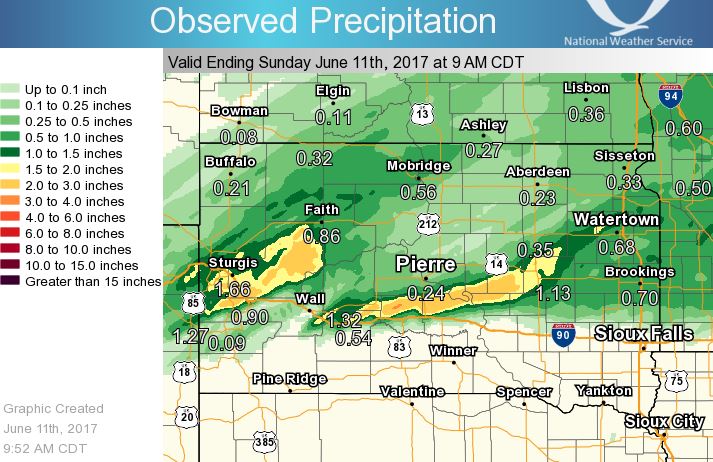
Rain Reports
While a few locations received beneficial rainfall, most locations only experienced light rain and less than a quarter of an inch.
 |
Media use of NWS Web News Stories is encouraged! Please acknowledge the NWS as the source of any news information accessed from this site. |
|

