Overview
|
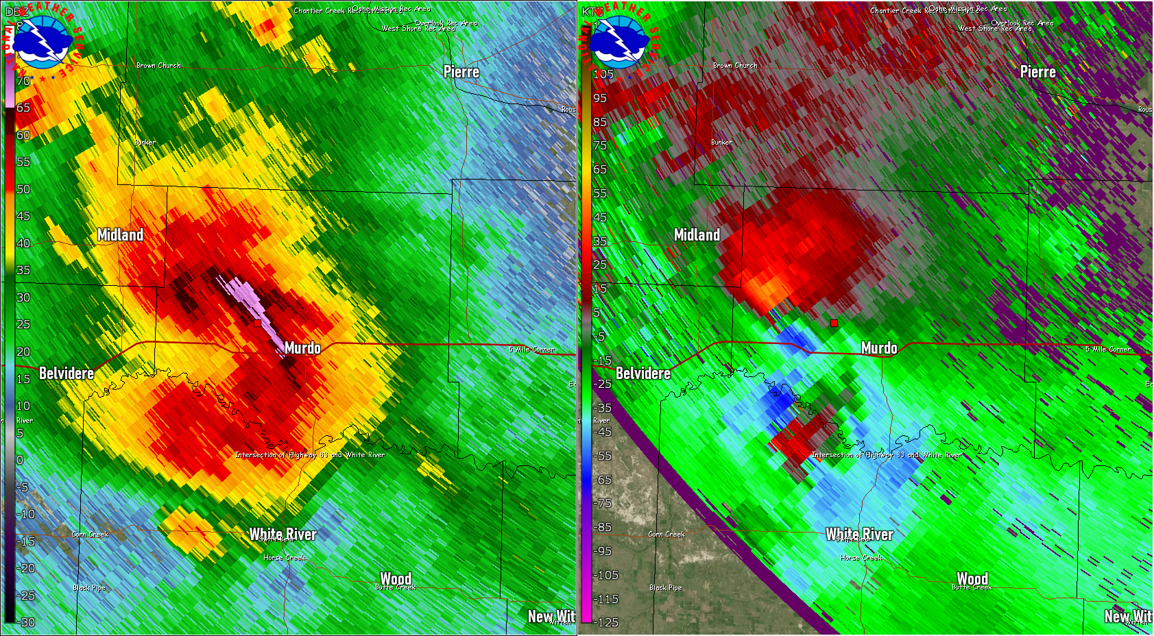
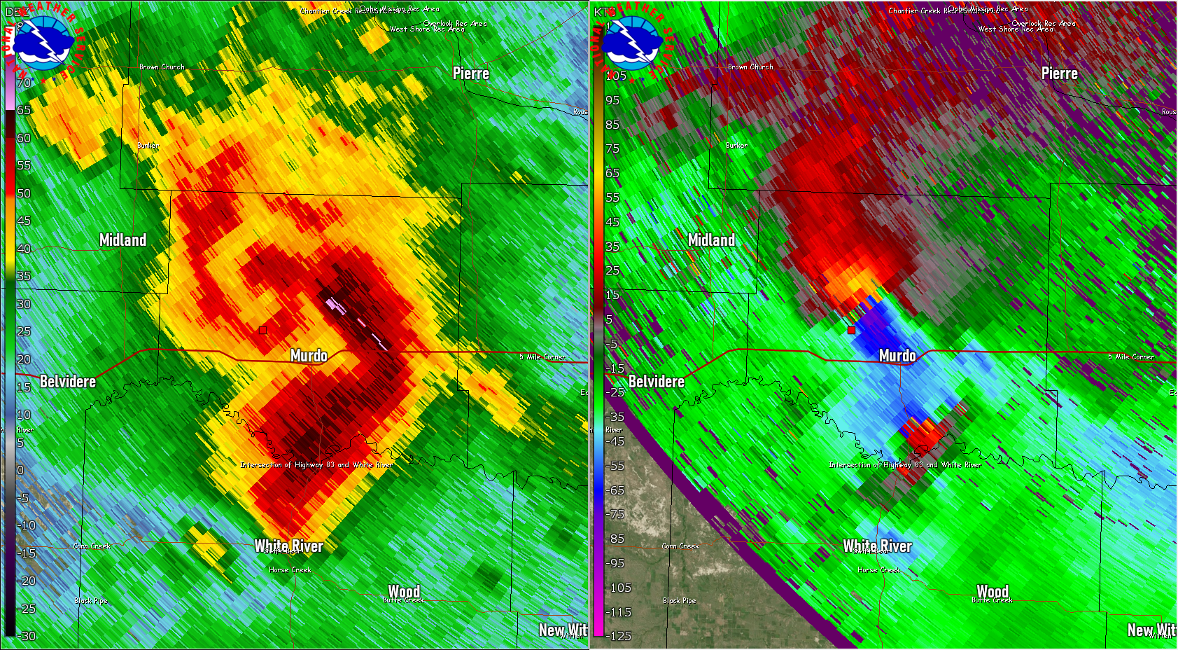
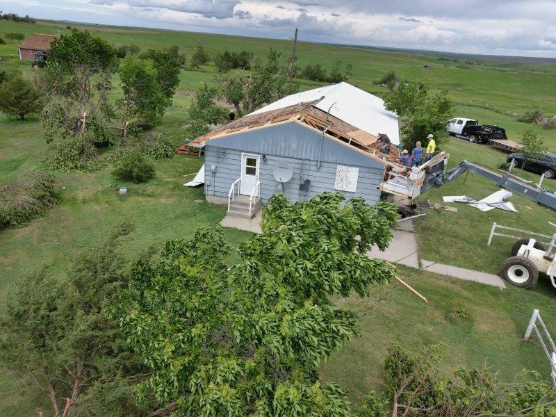
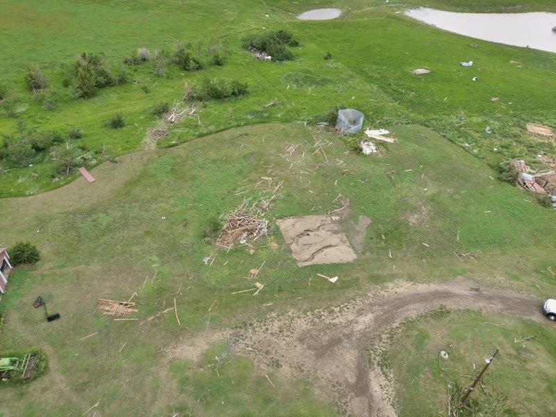
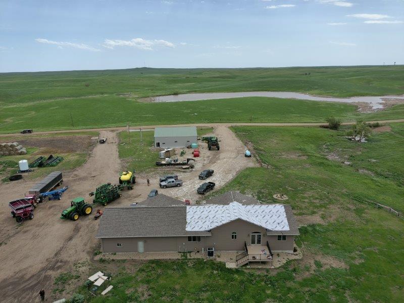
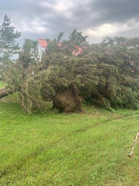
June 12-13: Severe thunderstorms transitioned from a supercell to a line of storms over western and then south central South Dakota during the evening of June 12th. In addition to destructive straight-line winds, these storms produced two confirmed EF2 tornadoes across Jones County in the "bookend vortex" section of the line. A third tornado was observed west of Lower Brule, as the complex continued to track east into the early morning of June 13th. Later in the night, a second line of training thunderstorms would set up over parts of Jones and Stanley counties, resulting in areas of flooding. Additionally, a small area of low pressure developed behind the system. This is referred to as a "wake low" and resulted in additional non-thunderstorm winds and wind damage over parts of eastern South Dakota. June 14: Right after midnight on June 14th, storms developed over south central South Dakota and quickly became wind producers. As the storms intensified and tracked northeast, the winds became increasingly extreme. Peak winds would occur between 4 and 5 am as the storms tracked across parts of north central and northeast South Dakota and into southeast North Dakota. A personal weather station near Roscoe, SD recorded winds at 120 mph. Numerous trees and powerlines were downed, widespread reports of roof, outbuilding and grain bin damage were noted, and 16 steel towers were downed approximately 7 miles WSW of Frederick. Damage was widespread. Due to the damage from several rounds of significant severe weather across South Dakota from June 11-14th, a Presidential Disaster Declaration was approved on August 2nd for a number of counties. |
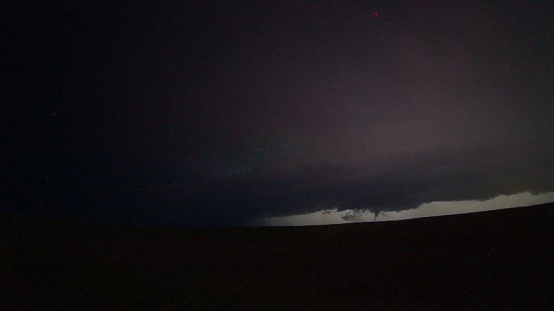 An EF2 tornado west of Okaton in Jones County. Image courtesy of Roger Hill. |
Surveyed Tornadoes, Extreme Wind:
|
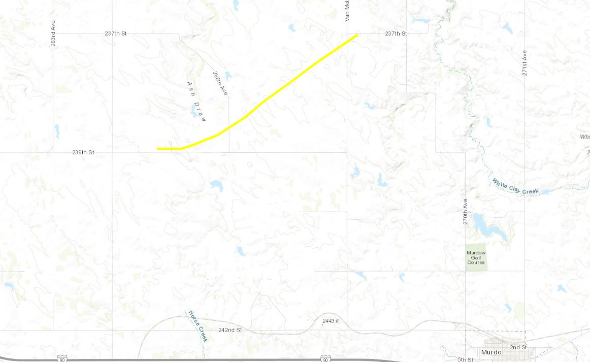
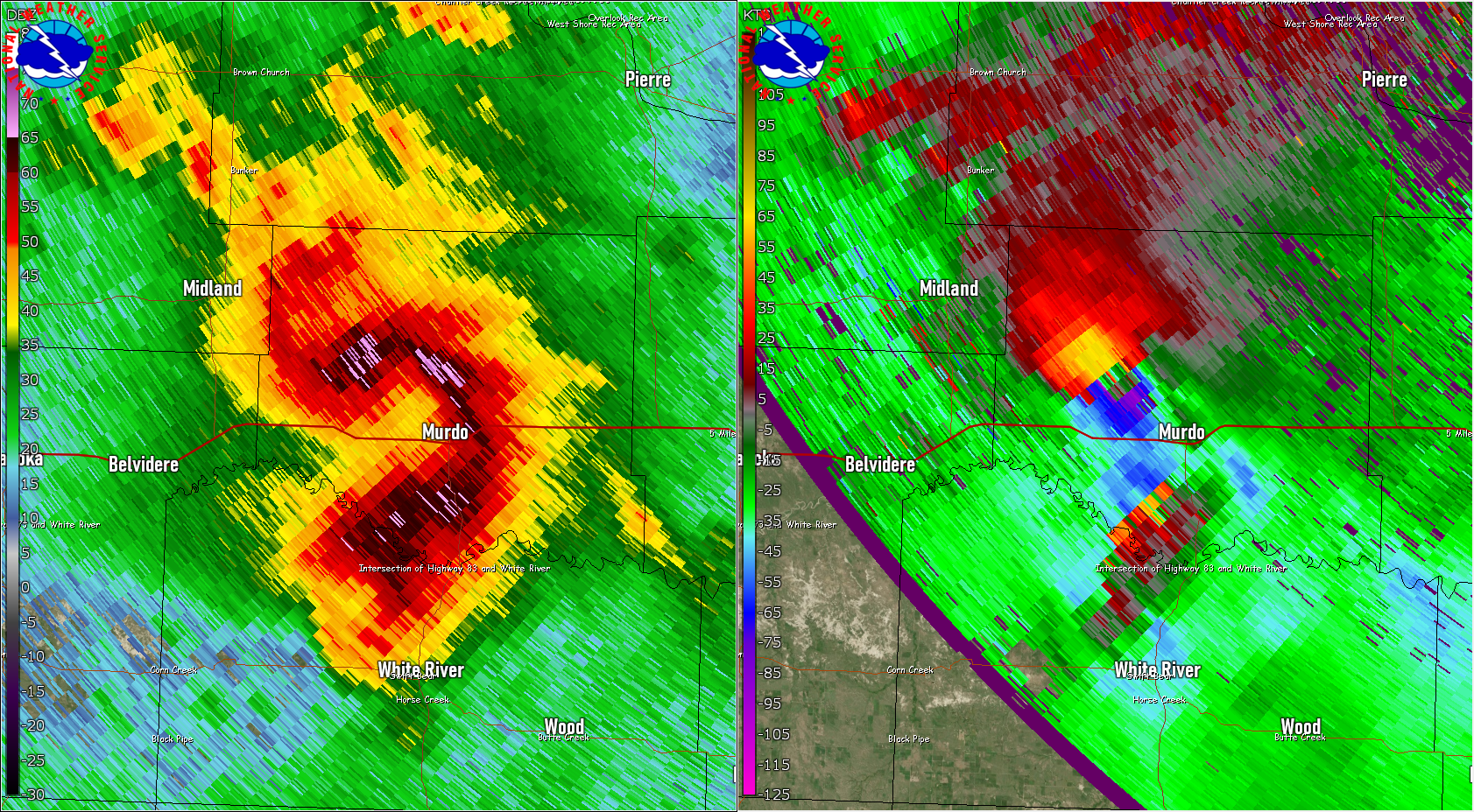
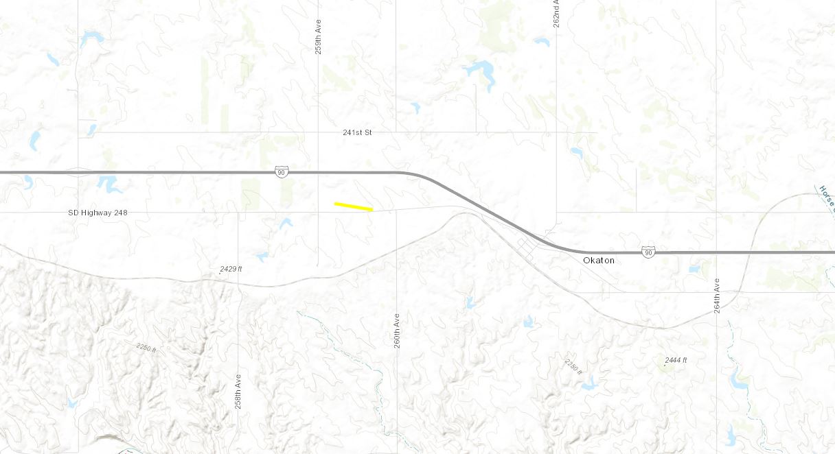
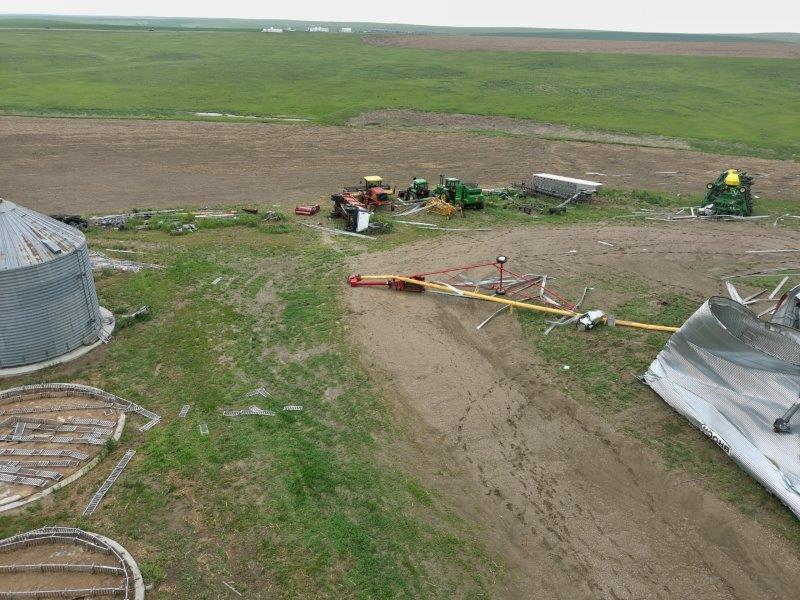
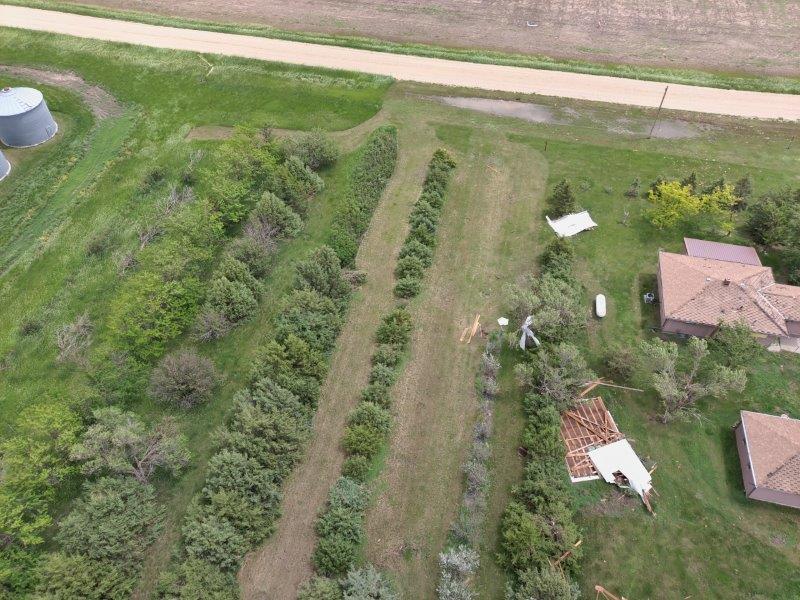
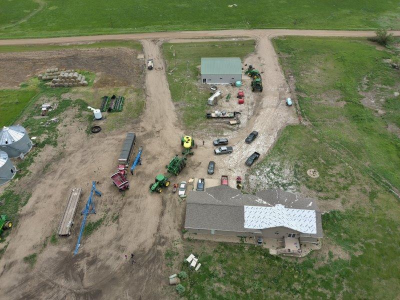
Tornado #1 - NW of Murdo
Track Map
The Enhanced Fujita (EF) Scale classifies tornadoes into the following categories:
|
||||||||||||||||||||||||||||||||||||||||||||||||||||||||||||||||||||||||||||||||
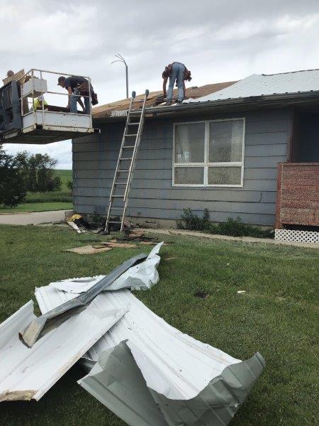
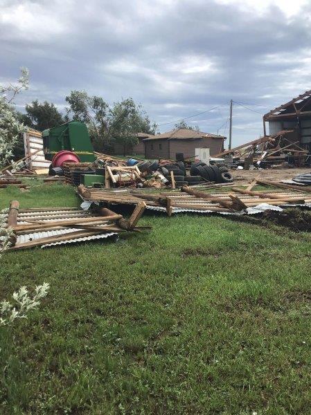
Photos: June 12-13
 |
 |
 |
 |
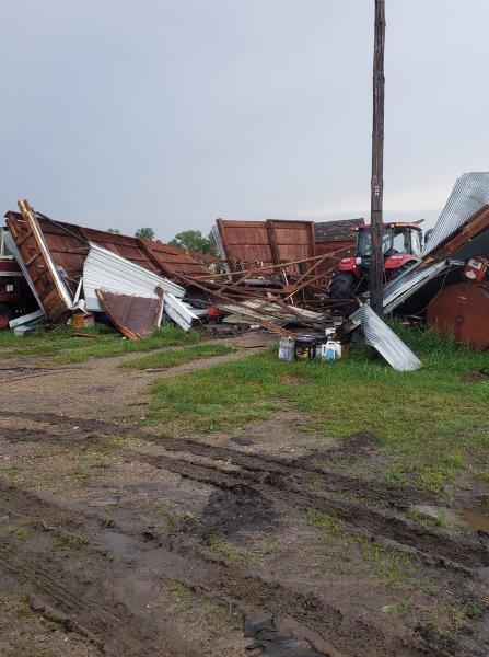
| Jun 12th Jones County tornado damage. Photo courtesy of the South Dakota Highway Patrol. | Jun 12th Jones County tornado damage. Photo courtesy of the South Dakota Highway Patrol. | Jun 12th Jones County storm damage. Photo courtesy of the South Dakota Highway Patrol. | Jun 12th Jones County tornado damage. Photo courtesy of the South Dakota Highway Patrol. |
 |
 |
 |
 |
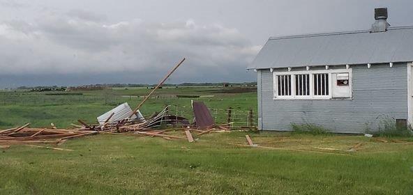
| Jun 12th Jones County tornado damage. Photo courtesy of the South Dakota Highway Patrol. | June 13, early morning "wake low" wind damage near Andover. Photo courtesy of Angela Herrick. | June 13, early morning "wake low" wind damage near Andover. Photo courtesy of Angela Herrick. | June 13, early morning "wake low" wind damage in Conde. Photo courtesy of Bonnie Mortenson. |
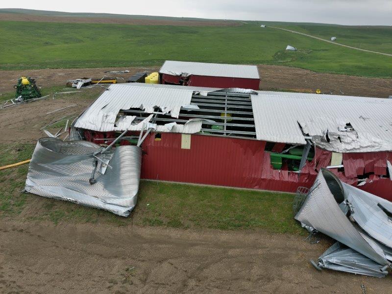
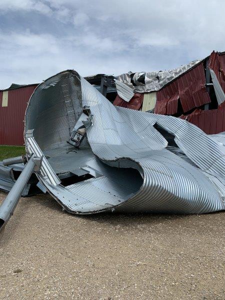
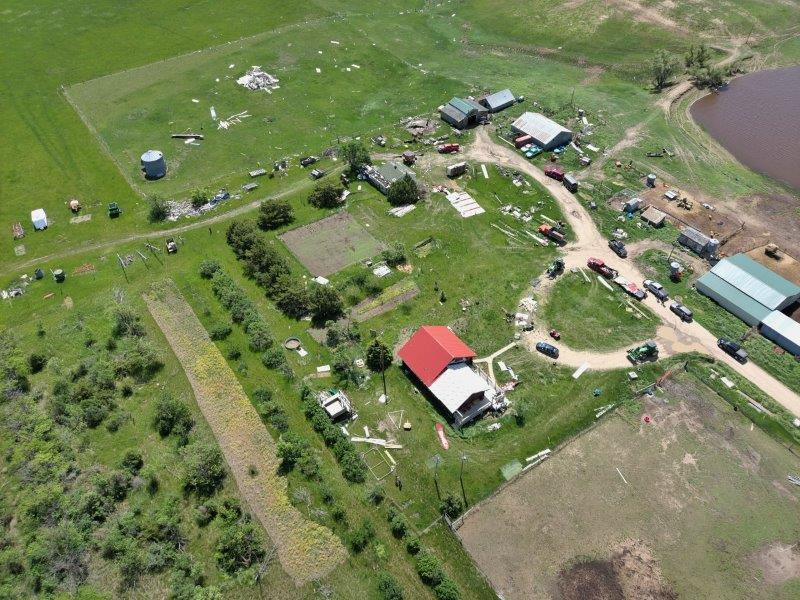
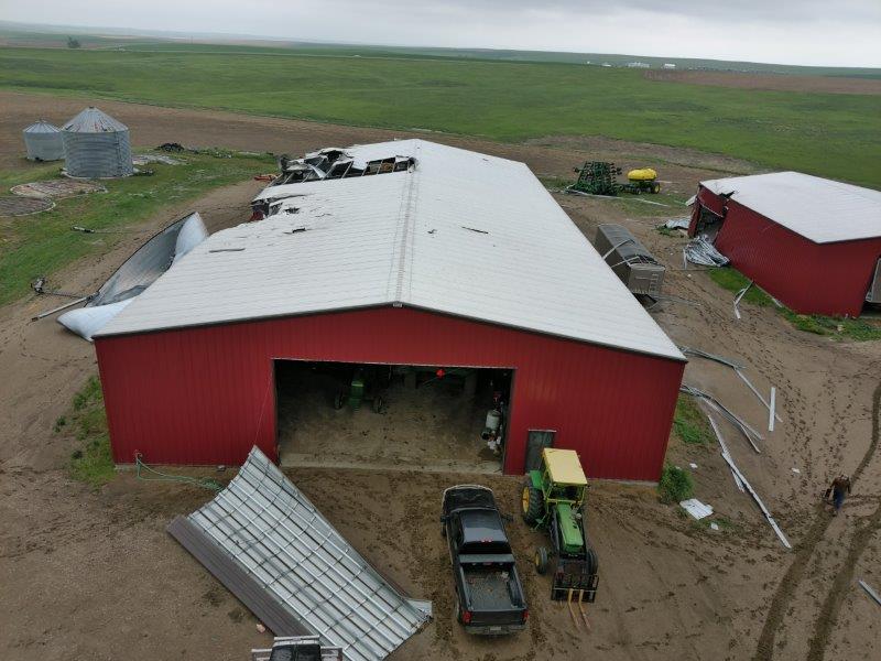
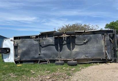
Photos: June 14
 |
 |
 |
 |
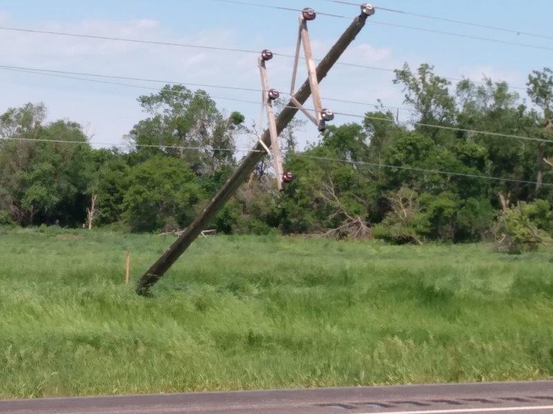
| June 14th storm damage 6 miles east and 1 mils south of Leola. Photo courtesy of Jackie Kessler. | June 14th storm damage near Frederick. Photo courtesy of Deb Witte. | June 14th storm damage near Frederick. Photo courtesy of Jamie Voeller. | June 14th storm damage in Frederick. Photo courtesy of Jamie Voeller. |
 |
 |
.jpg) |
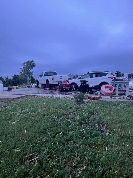 |
| June 14th storm damage in Frederick. Photo courtesy of Tia Louise. | June 14th storm damage four miles south of Leola. Photo courtesy of Tami Rath. | June 14th storm damage in Roscoe. Photo courtesy of Leland Triechel. | June 14th storm damage two miles south of Roscoe. Photo courtesy of Savanah Wolff. |
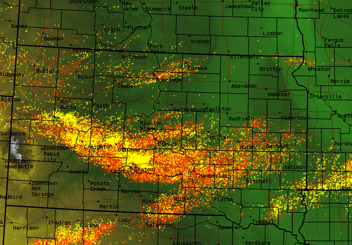
Radar, Satellite
| Radar reflectivity from 10 PM CDT on Sunday, June 12 to 4 AM CDT on Monday, June 13 | |
|
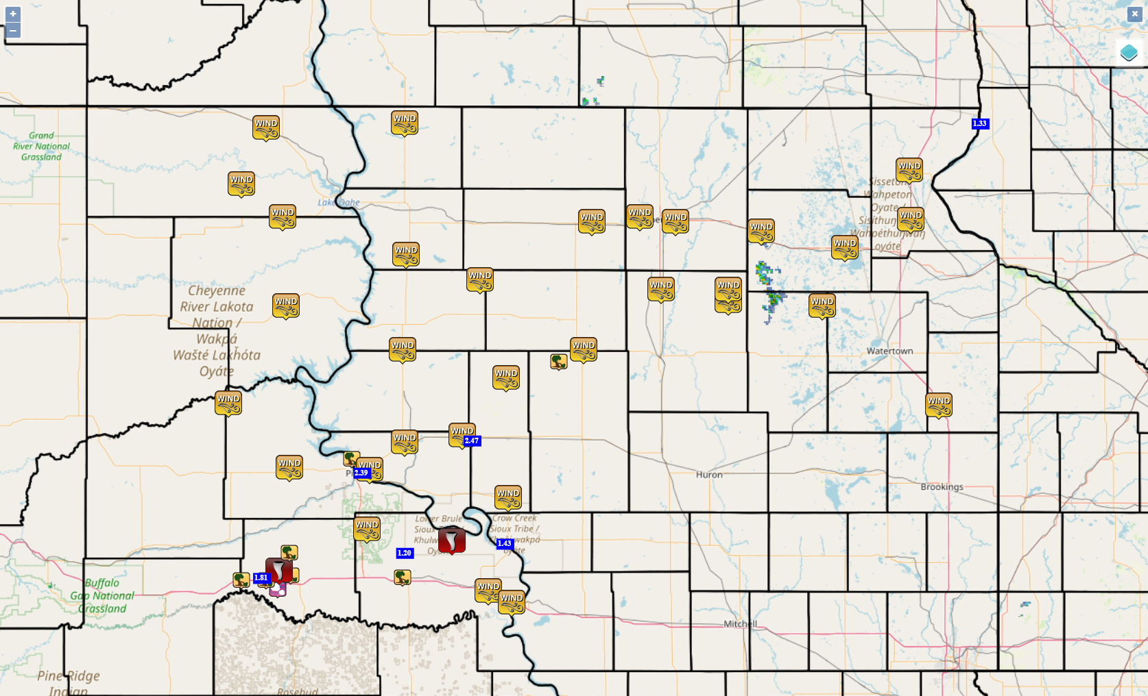
Storm Reports
Locations of preliminary reports of severe weather across the area, including damaging straight-line winds, large hail, heavy rain and tornadoes.
June 12-13
Click for an interactive map: June 12 and 13.
June 14
Click for an interactive map for June 14.

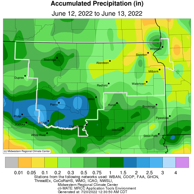
Rainfall, Lightning
June 12-13
Approximate rainfall totals during the calendar days of June 12th and 13th, from the Midwestern Regional Climate Center
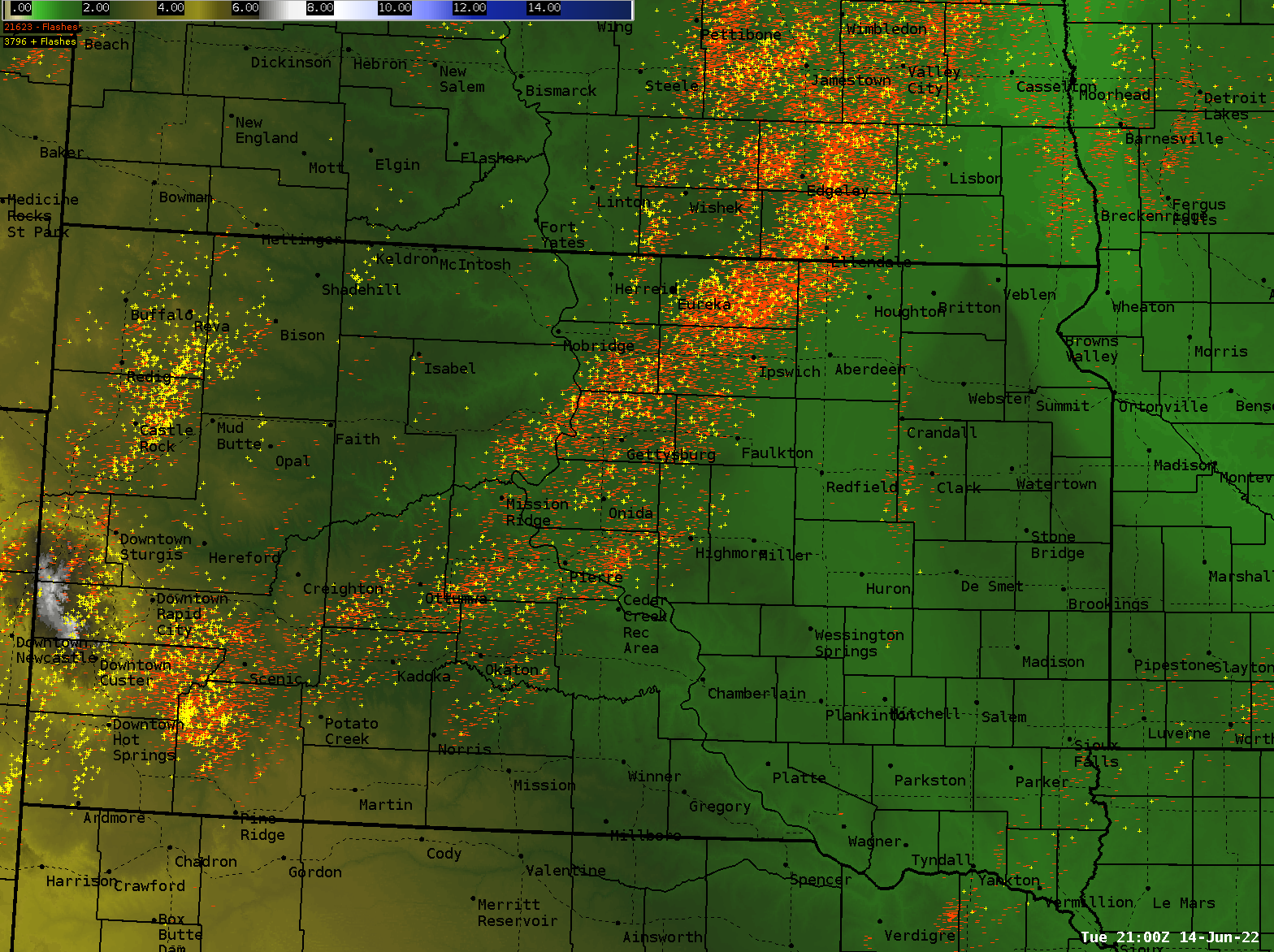
24-hour cloud-to-ground lightning strikes from 5pm 6-12 through 5pm 6-13, from the National Lightning Detection Network. Yellow icons indicate positively charged lightning strikes, and red negatively charged.
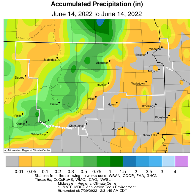
June 14
Approximate rainfall totals during the calendar day of June 14th, from the Midwestern Regional Climate Center
24-hour cloud-to-ground lightning strikes from 4pm 6-13 through 4pm 6-14, from the National Lightning Detection Network. Yellow icons indicate positively charged lightning strikes, and red negatively charged.
Environment, Other
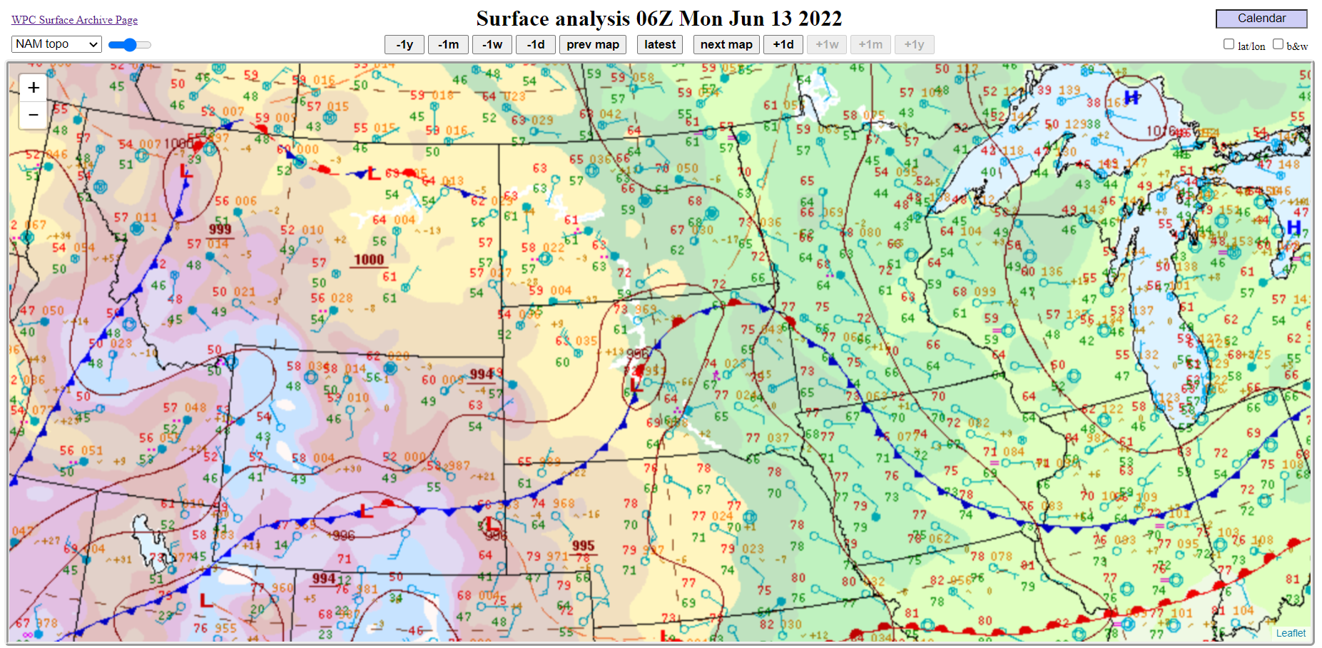
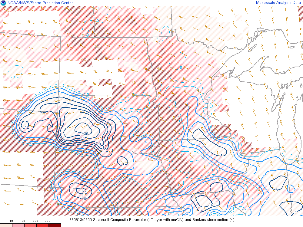
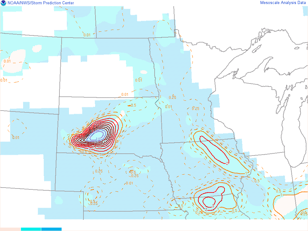
June 12-13 Environmental Data
 |
 |
 |
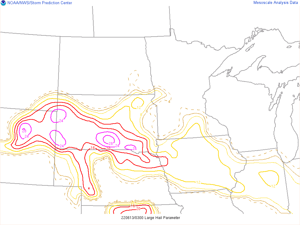 |
| 1am, June 13th, a weak, yet distinguishable low over south central South Dakota | 10pm, June 13th, supercell composite parameter. | 10pm, June 13th, significant tornado parameter. | 10pm, June 13th, large hail parameter. |
June 14 Environmental Data
 |
 |
 |
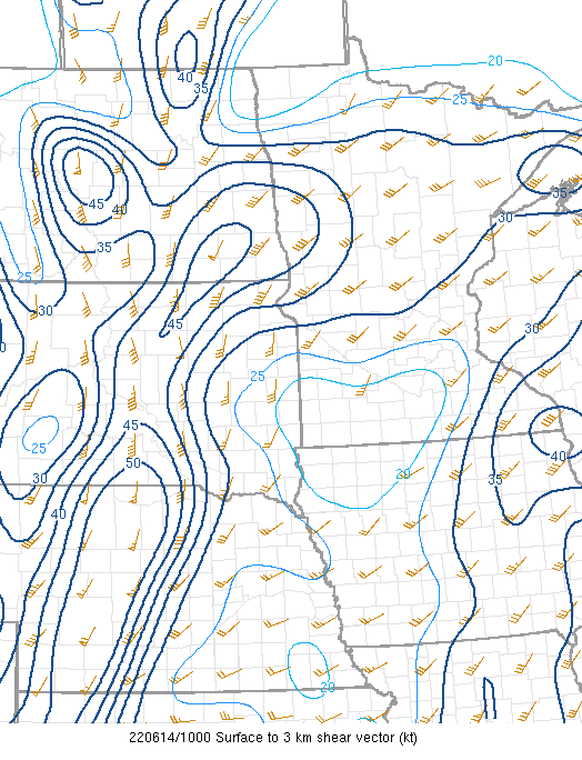 |
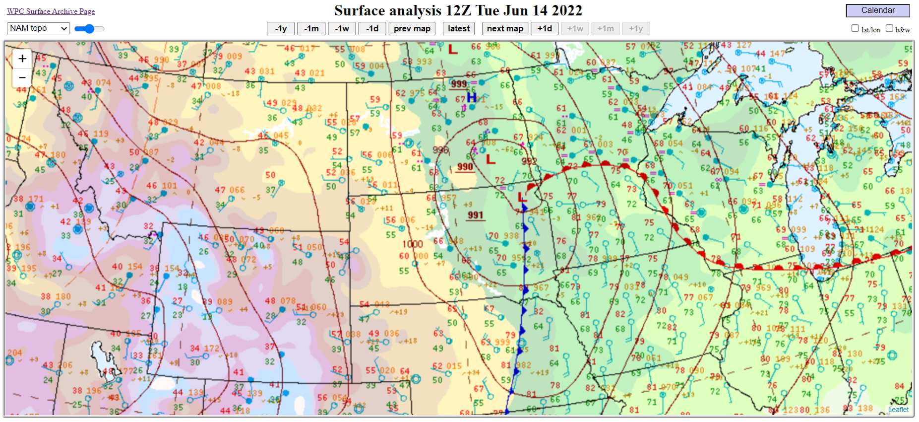
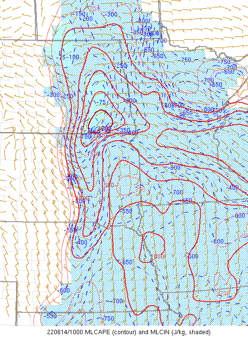
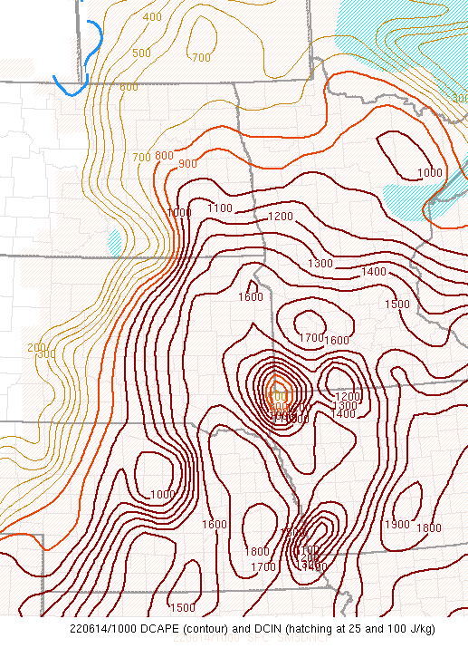
| 7am, June 14th, a low pressure system was situated over northeast South Dakota. | 5 am, June 14th, ML CAPE | 5 am, June 14th, Downdraft CAPE | 5 am, June 14th, 0-3 KM Shear |
 |
Media use of NWS Web News Stories is encouraged! Please acknowledge the NWS as the source of any news information accessed from this site. |
|