Overview
|
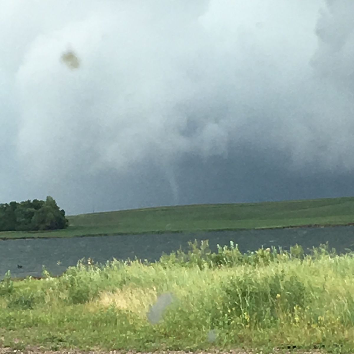
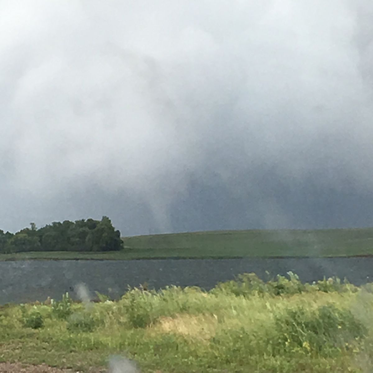
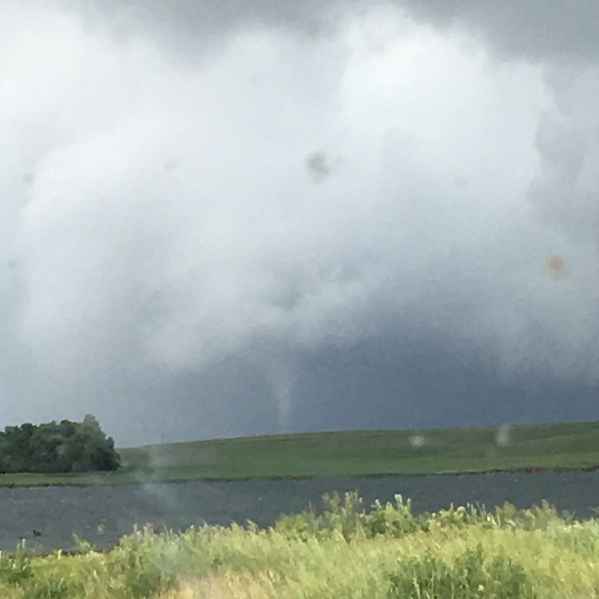
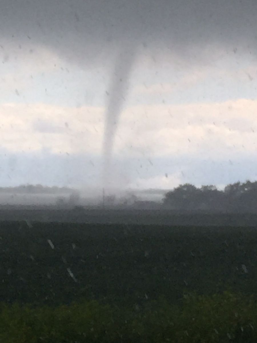
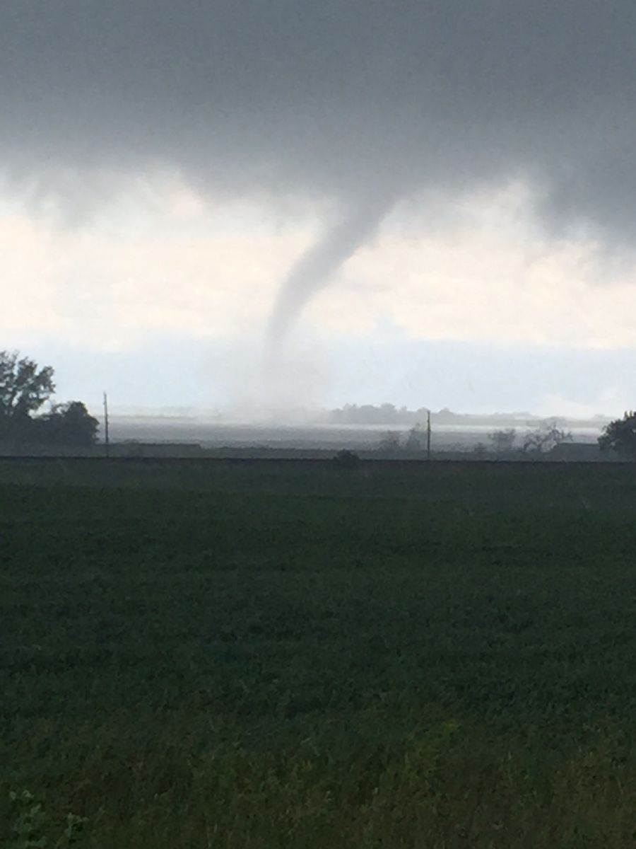
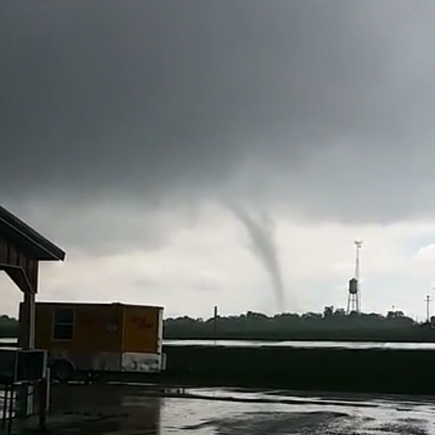
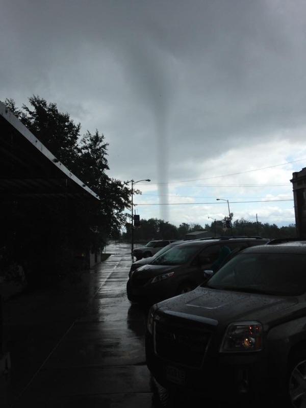
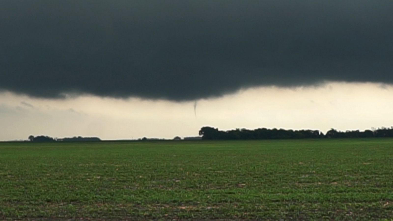
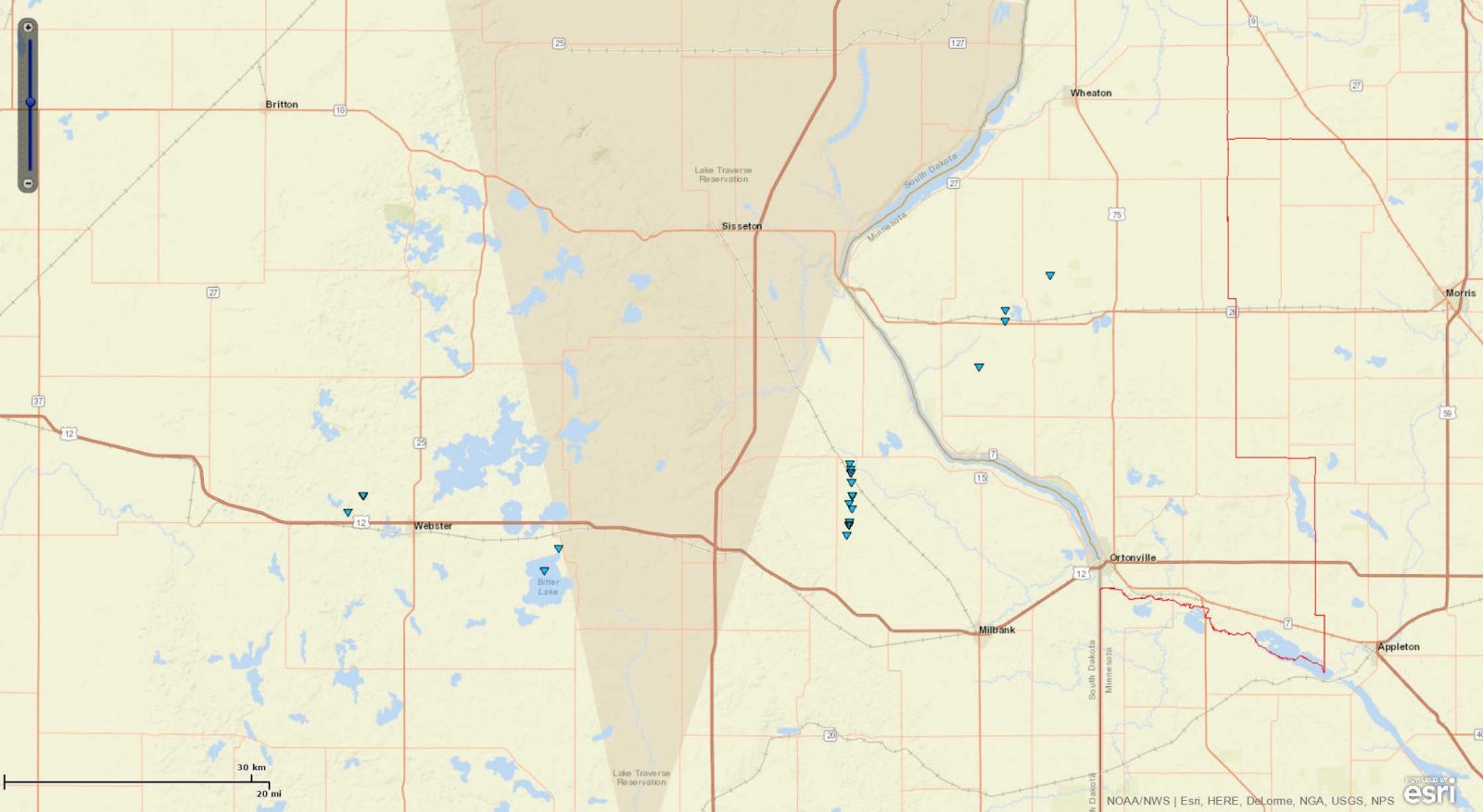
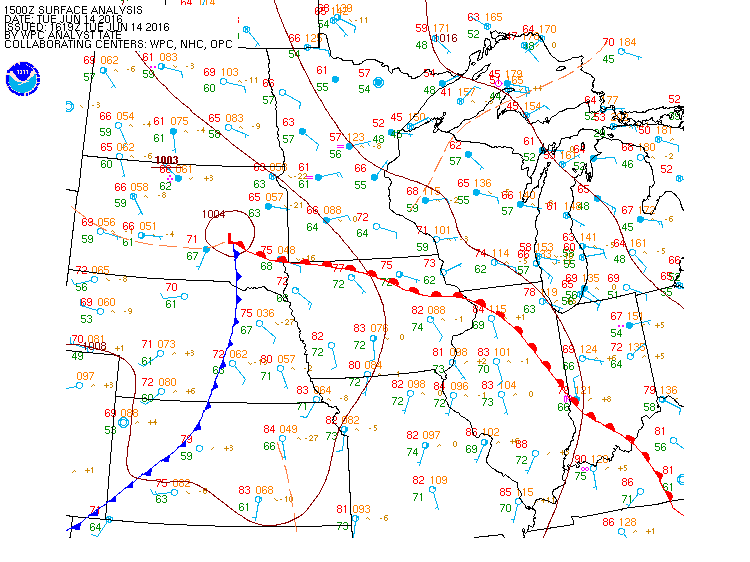
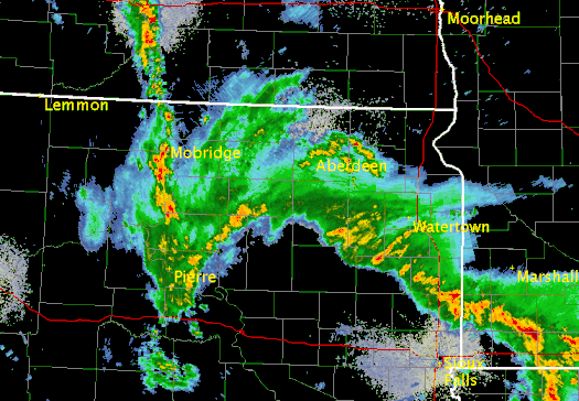
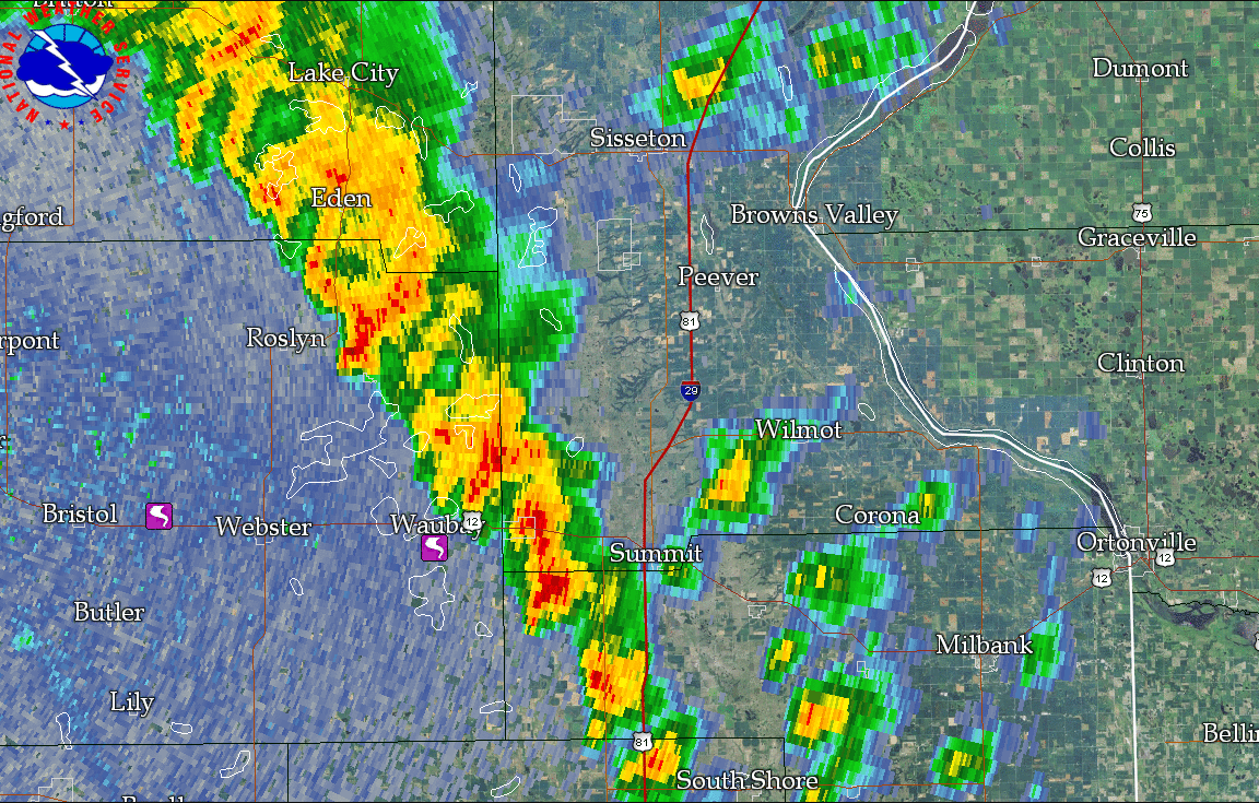
An area of low pressure lifting north-northeast across Northeastern South Dakota led to showers and thunderstorms across the region. As thunderstorms formed along a warm front stretching east into Minnesota, several tornadoes occurred across Day, Grant, and Roberts counties in South Dakota and Big Stone and Traverse counties in Minnesota. Find a map of where they occurred on the map at the right, or at this link. |
 |
 |
 |
 |
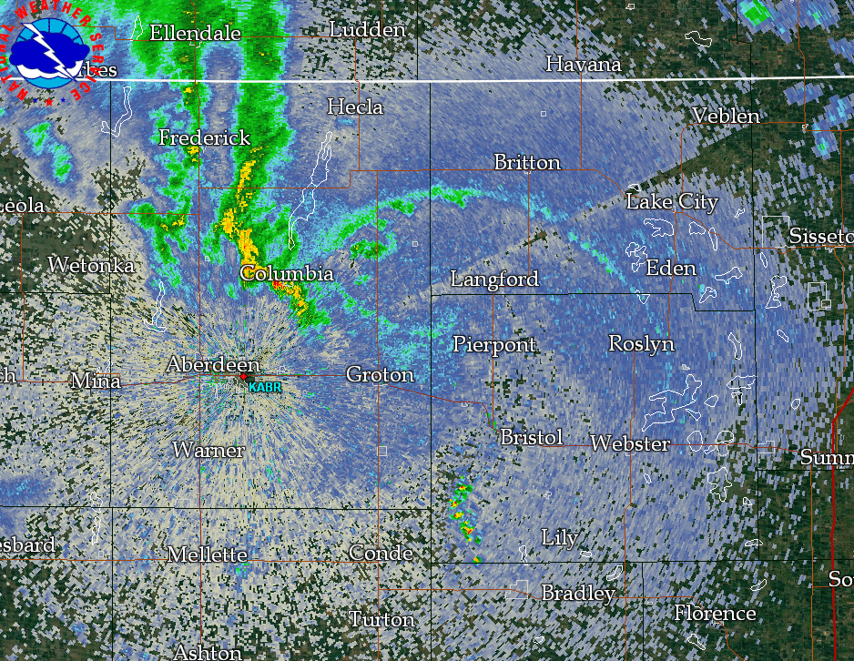 |
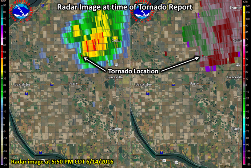
| Animated loop of the low moving across Northeast South Dakota | Radar Loop from 8 AM CDT to 7 PM CDT on June 14, 2016 | Radar reflectivity at ~4pm CDT - tornadic storms | Radar reflectivity at ~5pm CDT - warm and cold fronts |
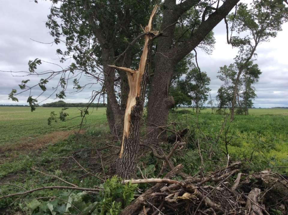
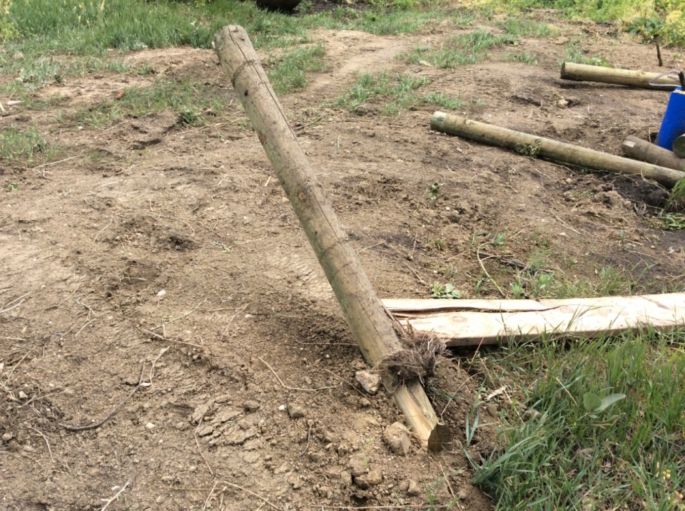
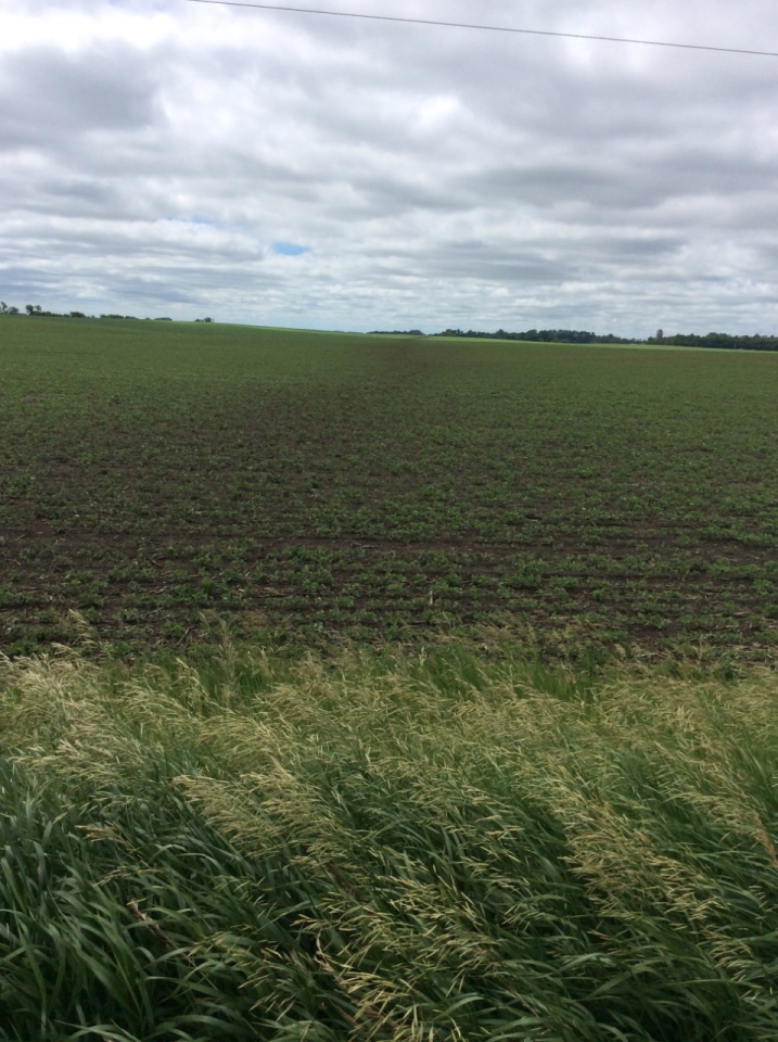
Tornadoes:
|
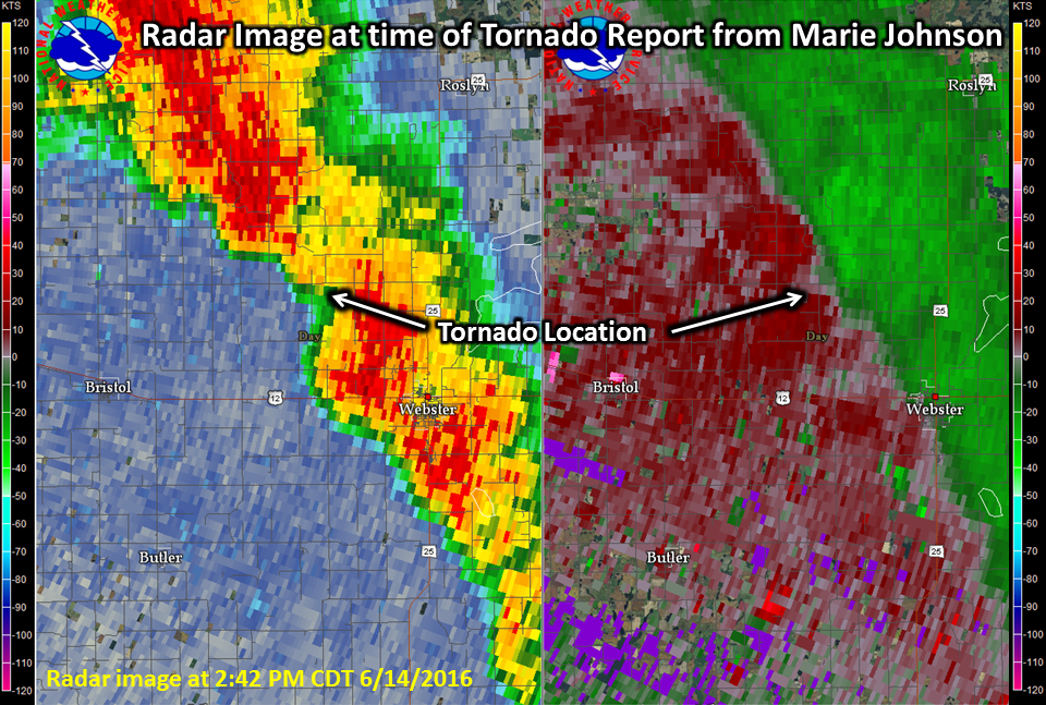
Tornado - 5 Miles West of Webster
Track Map .jpg) 
Downloadable KMZ File |
||||||||||||||||
|
||||||||||||||||
|
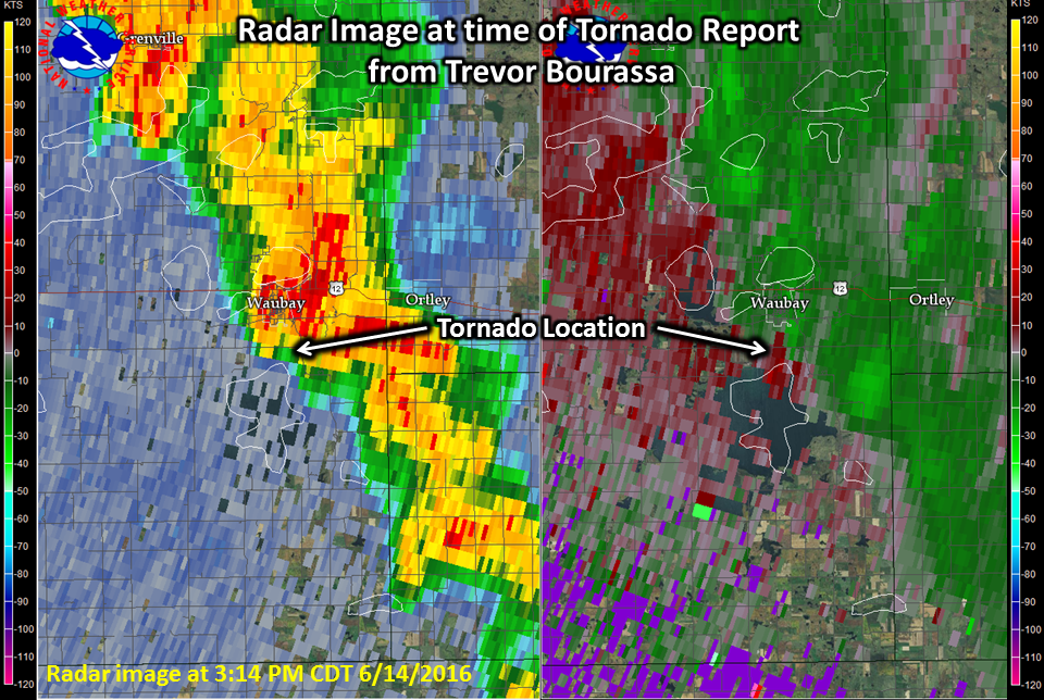
Tornado - 1 Mile South of Waubay
Track Map 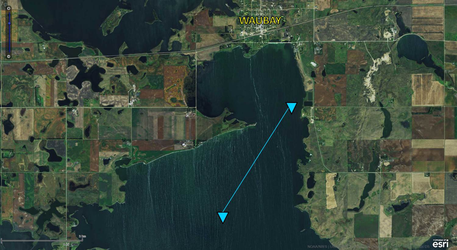
Downloadable KMZ File |
||||||||||||||||
|
||||||||||||||||
|
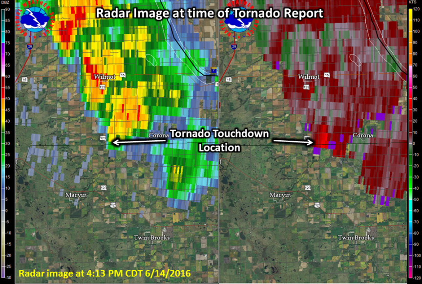
Tornado - 4 Miles West of Corona
Track Map 
Downloadable KMZ File |
||||||||||||||||
|
||||||||||||||||
|
Tornado - 5 Miles Southeast of Beardsley
Track Map 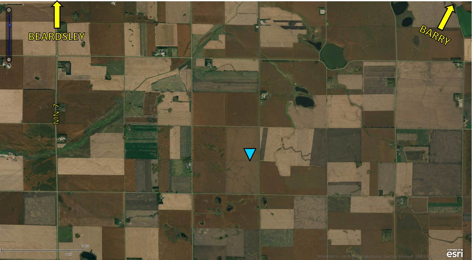
|
||||||||||||||||
|
||||||||||||||||
|
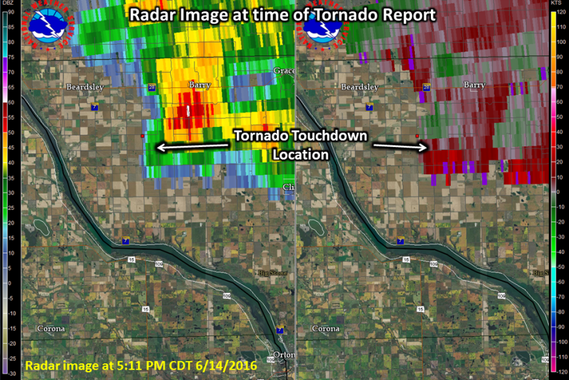
Tornado - 2 Miles West of Barry
Track Map 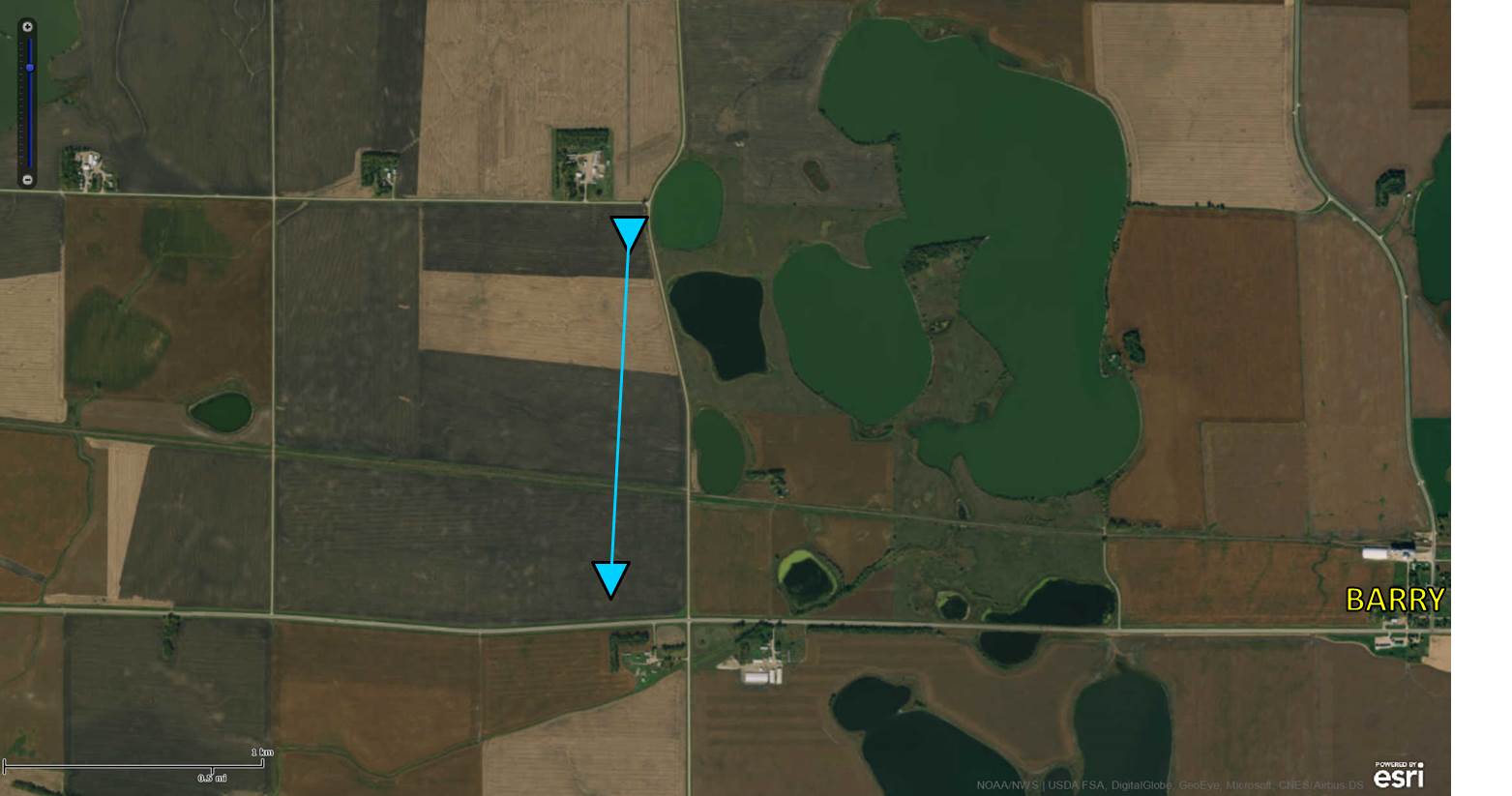
|
||||||||||||||||
|
||||||||||||||||
|
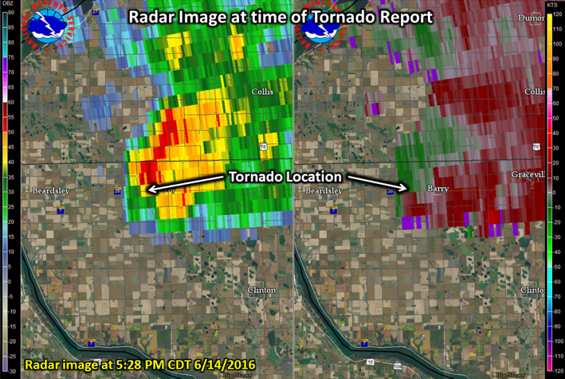
Tornado - 4 Miles North Northeast of Barry
Track Map 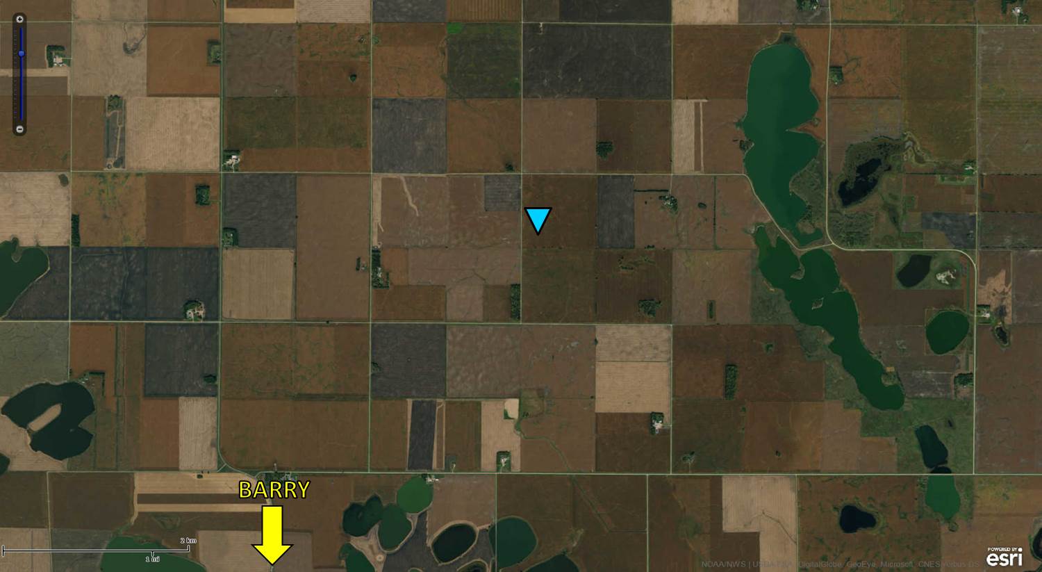
|
||||||||||||||||
|
||||||||||||||||
The Enhanced Fujita (EF) Scale classifies tornadoes into the following categories:
| EF0 Weak 65-85 mph |
EF1 Moderate 86-110 mph |
EF2 Significant 111-135 mph |
EF3 Severe 136-165 mph |
EF4 Extreme 166-200 mph |
EF5 Catastrophic 200+ mph |
 |
|||||
Rain Reports
24 Hour Rainfall Map and Reports - Ending at 9am CDT on June 15, 2016...Rainfall Reports... Location Amount Time/Date Highmore 21.3 N 3.50 in 0800 AM 06/15 Hecla 7 WNW 3.45 in 0800 AM 06/15 Highmore 17 N 3.23 in 0800 AM 06/15 Craven 4 N 2.83 in 0715 AM 06/15 Roscoe 9.7 SE 2.80 in 0800 AM 06/15 Leola 9 W 2.70 in 0805 AM 06/15 Loyalton 5 NE 2.59 in 0845 AM 06/15 12 N Highmore 2.55 in 0700 AM 06/15 Columbia 2 N 2.10 in 0400 AM 06/15 Holabird 8.5 N 2.07 in 0600 AM 06/15 1 NW Sutton Bay Rec Area 1.99 in 0530 AM 06/15 Veblen 8.3 W 1.98 in 0800 AM 06/15 Leola 9 ENE 1.90 in 0800 AM 06/15 Elm River Near Frederick 1.77 in 0830 AM 06/15 Frederick 8.4 SW 1.60 in 0700 AM 06/15 Aberdeen-20mi.nne 1.57 in 0800 AM 06/15 Roscoe 1.55 in 0700 AM 06/15 Roy Lake Recreation Area 1.52 in 0600 AM 06/15 Mina 7s 1.50 in 1000 PM 06/14 Westport 2 NW 1.48 in 0500 AM 06/15 Barnard 5 W 1.37 in 0834 AM 06/15 Hillhead 3 WSW 1.34 in 0759 AM 06/15 15 NW Britton 1.28 in 0700 AM 06/15 4 E Richmond Lake Rec Area 1.22 in 0700 AM 06/15 7 NE Presho 1.20 in 0300 PM 06/14 Murdo 1.07 in 0900 AM 06/14 Aberdeen 1.5 SW 1.05 in 0800 AM 06/15 Sisseton 3w 1.04 in 0700 AM 06/15 6 N Browns Valley 0.98 in 0700 AM 06/15 Sisseton Municipal Airport 0.97 in 0656 AM 06/15 Eureka 13 ENE 0.94 in 0815 AM 06/15 Sisseton 0.88 in 0700 AM 06/15 Moccasin Creek At Aberdeen 0.84 in 0745 AM 06/15 Used As Comp Site In Britton 0.83 in 0700 PM 06/14 Pierre Municipal Airport 0.82 in 0653 AM 06/15 Richmond Lake Rec Area 2 SE 0.80 in 0745 AM 06/15 Aberdeen 1 WNW 0.79 in 0841 AM 06/15 Bowdle 0.76 in 0600 PM 06/14 Elm River Near Ordway 0.76 in 0745 AM 06/15 Sisseton-32mi.sw 0.74 in 0805 AM 06/15 Grenville 5.6 ENE 0.70 in 0800 AM 06/15 7 NNE Vivian 0.68 in 0700 AM 06/15 Turton 0.67 in 0700 AM 06/15 Richmond Lake Rec Area 4 S 0.67 in 0835 AM 06/15 Turton 0.67 in 0700 AM 06/15 Wheaton 0.64 in 0800 AM 06/15 Aberdeen Regional Airport 0.62 in 0653 AM 06/15 Mobridge-43mi.ene 0.62 in 0800 AM 06/15 Eureka 0.62 in 0800 AM 06/15 Aberdeen 3 E 0.58 in 0600 AM 06/15 Eureka 0.57 in 0827 AM 06/15 Browns Valley 3 W 0.57 in 0645 PM 06/14 Artichoke Lake 0.55 in 0900 PM 06/14 6 SW Cedar Creek Rec Area 0.55 in 0700 AM 06/15 Pierre 2 N 0.53 in 0900 AM 06/14 Eureka 0.52 in 0833 AM 06/15 Pierre 0.52 in 0950 AM 06/14 National Wildlife Refuge 0.52 in 0400 PM 06/14 Wheaton 1 NNE 0.52 in 0830 AM 06/15 Richmond Lake Rec Area 5 SSW 0.51 in 0838 AM 06/15 5 SSW Bath 0.50 in 0700 AM 06/15 Mansfield 0.1 NW 0.50 in 0700 AM 06/15 Wheaton 7 WSW 0.49 in 0800 AM 06/15 Little Eagle 1 SW 0.48 in 0831 AM 06/15 Wheaton 1 NW 0.48 in 0800 AM 06/15 Groton 0.48 in 0839 AM 06/15 Browns Valley 0.46 in 0500 AM 06/15 3 W Onida 0.45 in 0800 AM 06/15 Fort Pierre 0.44 in 0700 AM 06/15 12 Mile Creek At C.s.a.h. #1 0.44 in 0800 AM 06/15 Mobridge Municipal Airport 0.43 in 0652 AM 06/15 Pierre Capitol 0.42 in 0605 AM 06/15 Harrold 3.8 ESE 0.42 in 0800 AM 06/15 Ashton 0.41 in 0845 AM 06/15 Odessa 1 W 0.41 in 0751 AM 06/15 Hoven 0.39 in 0845 AM 06/15 Chamberlain-27mi.wnw 0.37 in 0600 PM 06/14 Fort Pierre 2 S 0.37 in 0830 AM 06/15 Dumont 10 NE 0.36 in 0800 AM 06/15 4 NNE Grey Goose 0.36 in 0800 AM 06/15 Harrold 14 NNW 0.35 in 0800 AM 06/15 Peever 3 E 0.34 in 0841 AM 06/15 Kennebec 0.3 SE 0.31 in 0700 AM 06/15 Glenham 5 N 0.31 in 0800 AM 06/15 Clear Lake 0.30 in 0841 AM 06/15 Presho 0.29 in 0700 AM 06/15 Herreid 3.6 ESE 0.28 in 0700 AM 06/15 4 N Thomas 0.27 in 0700 AM 06/15 Vivian 7 NW 0.26 in 0805 AM 06/15 Watertown Municipal Airport 0.25 in 0653 AM 06/15 Milbank 0.25 in 0730 AM 06/15 White Horse 2 ESE 0.25 in 0830 AM 06/15 Observations are collected from a variety of sources with varying equipment and exposures. Not all data listed are considered official. $$
 |
Media use of NWS Web News Stories is encouraged! Please acknowledge the NWS as the source of any news information accessed from this site. |
|