Overview
June ended with two stand-out storms that produced similar damage in similar locations. Hardest hit were those across portions of Dewey, Stanley, Hughes and Sully counties, affected by high winds and large hail that pulverized crops. Read about the events that occurred during the early morning of June 27th and the evening of June 29th below.
|
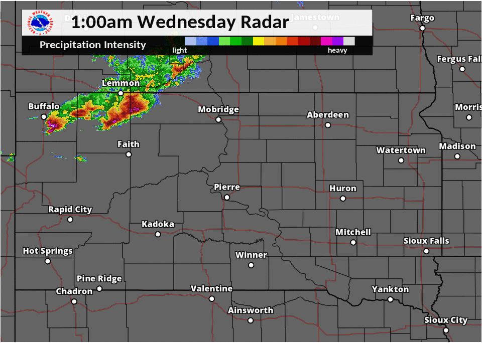
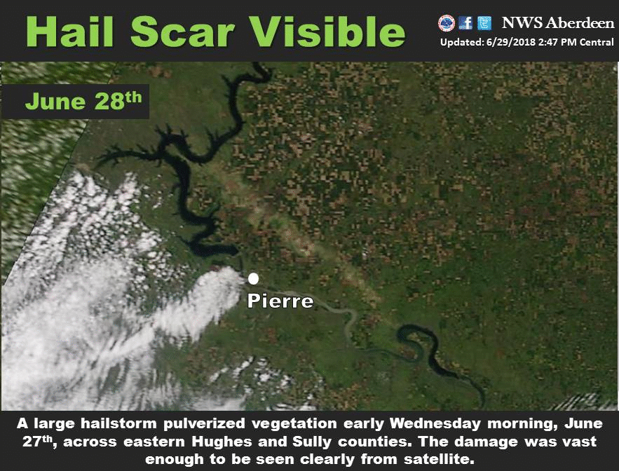
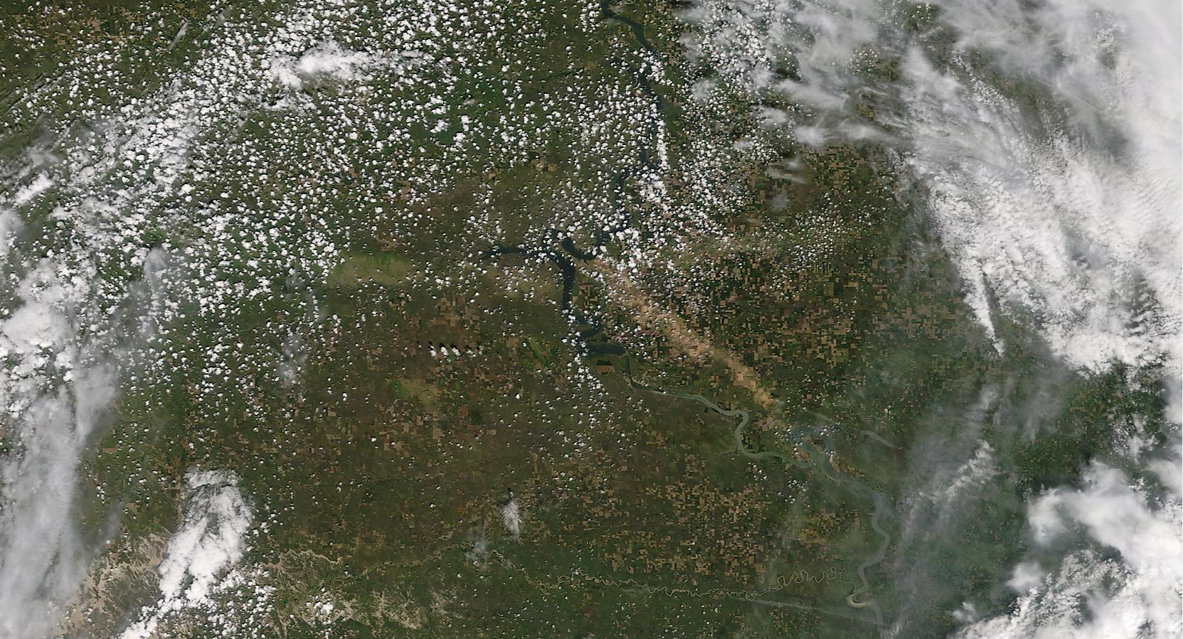
June 27th During the late evening on June 26th, severe thunderstorms developed across portions of southwestern North Dakota and then tracked southeastward into across north central and central South Dakota during the early morning of June 27th. Large hail cut a swath of destruction to vegetation across portions of Sully and Stanley county, just north and east of Pierre, as was evident on satellite imagery in the days following. Additionally, 2-4+ inches of rain in a short period of time led to flooding and flash flooding in some cases north of Pierre and near/in Oacoma. Several county roads were reported to be partially or completely submerged. |
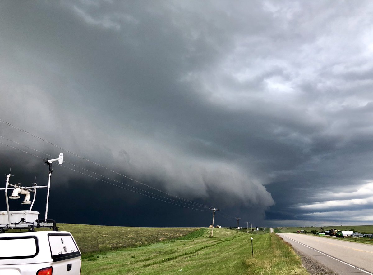
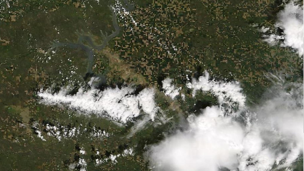
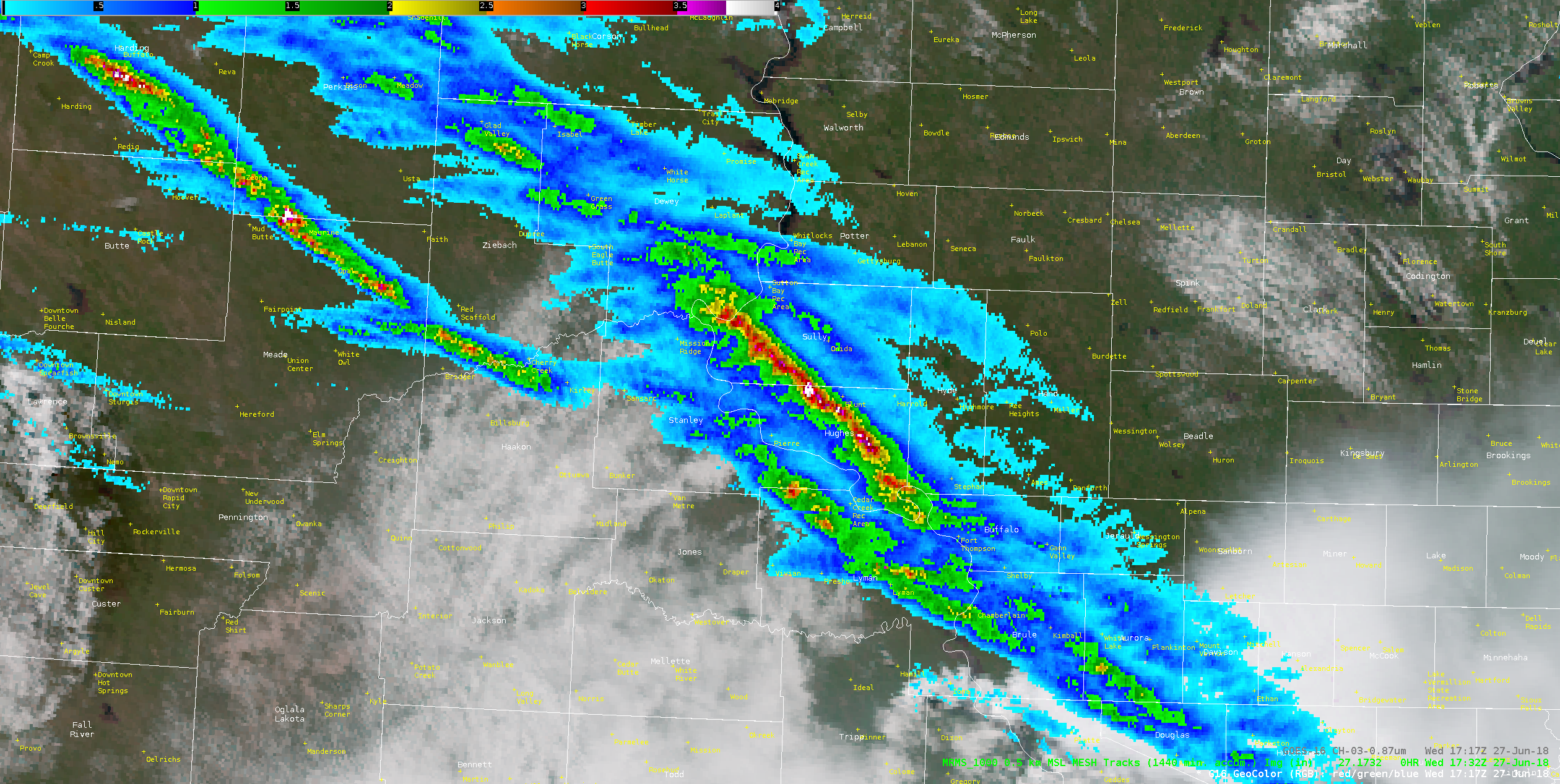
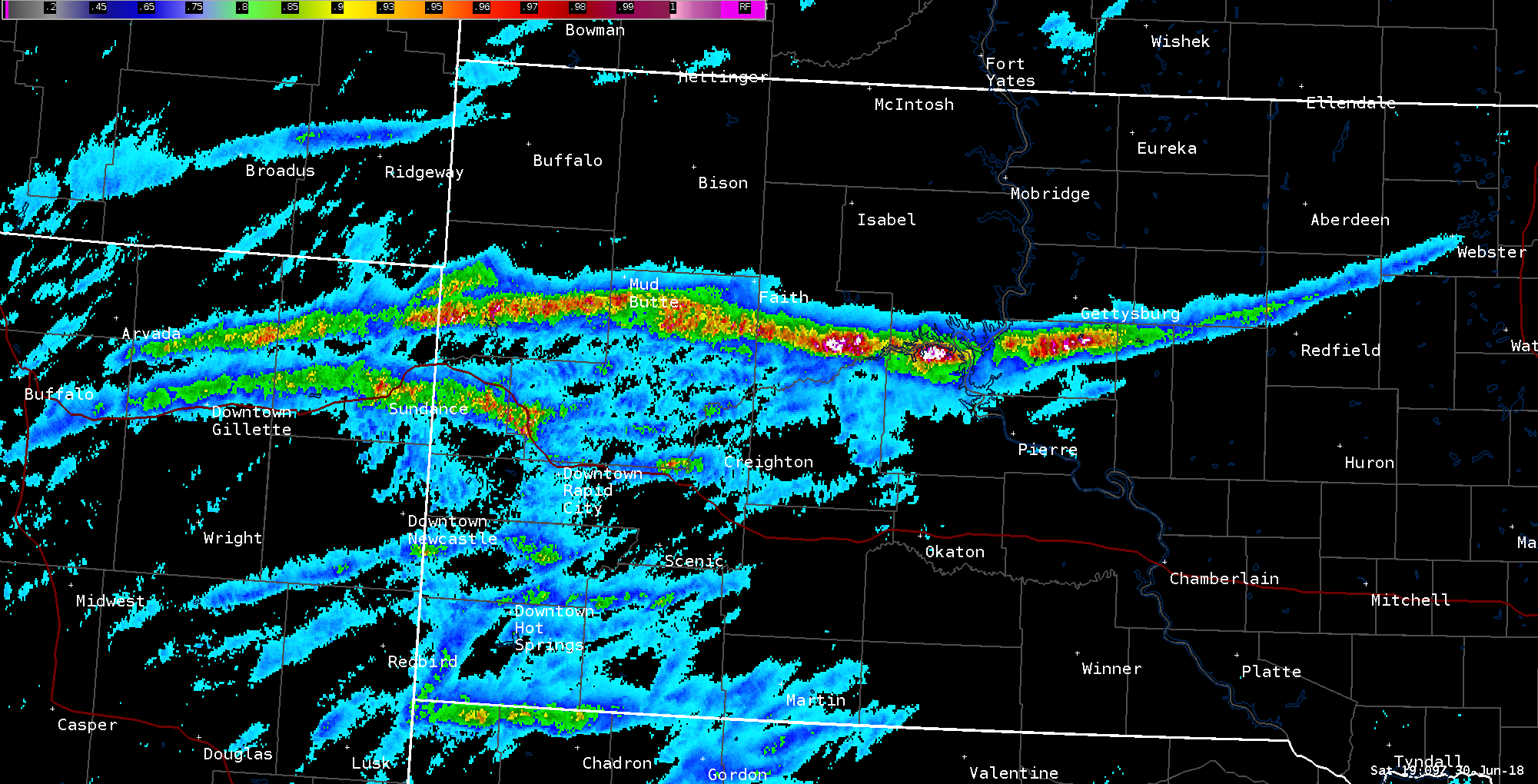
June 29th Severe thunderstorms developed across northeastern Wyoming during the afternoon hours, and a very favorable environment allowed activity to persist long distances eastward without losing much intensity. The most intense of these produced tornadoes across and near the northern Black Hills, 4.5" diameter hail near Newell, SD, and measured 90 mph straight-line winds near Sansarc, SD. This storm traveled a staggering 420 miles. During the days that followed, a large hail scar that meandered from western to central South Dakota was visible on satellite imagery; countless acres of crop and ranchland had been pulverized by the large hail. |
 |
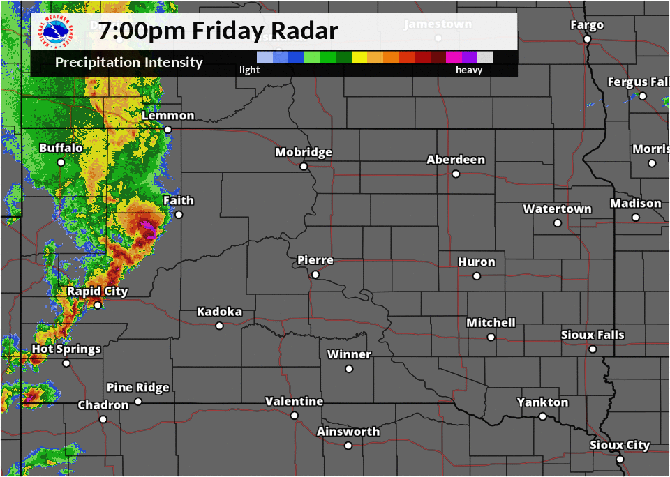 |
| June 27th Radar Loop | June 29th Radar Loop |
Photos & Satellite, Etc.:
Photos
 |
 |
 |
 |
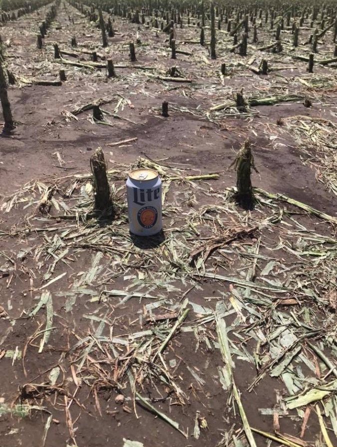
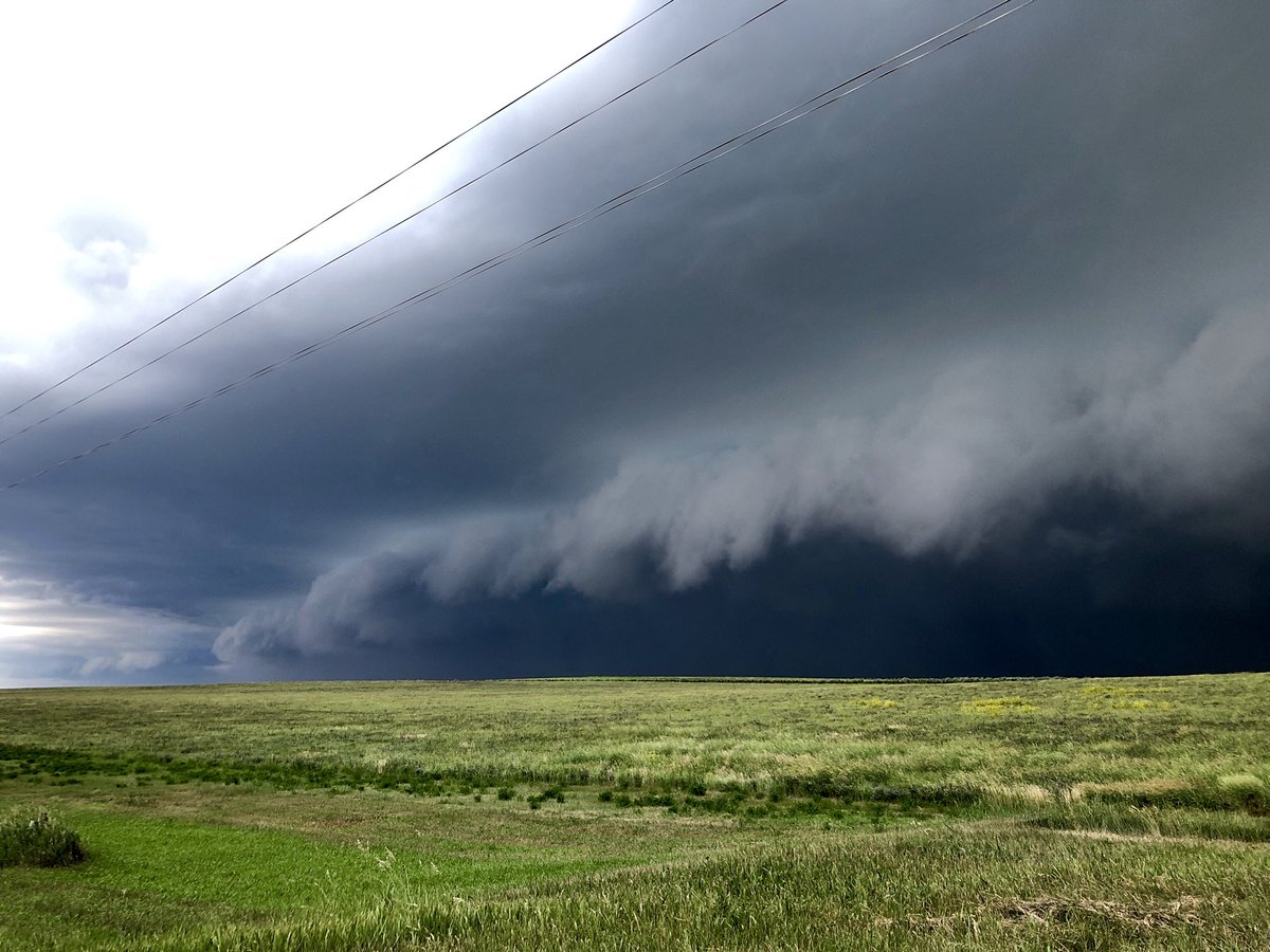
| Corn was chest high prior to the June 27th hailstorm east of Pierre. | Impacts of grapefruit sized hail and severe winds east of Newell, SD at 5:30 pm on June 29th. Courtesy of Kelsee Ellenbecker. | West of Pierre at 7:15 pm MDT on June 29th, courtesy of Derek Thompson | West of Pierre at 7:15 pm MDT on June 29th, courtesy of Derek Thompson |
 |
|||
| NWS instrumentation badly damaged from a COOP site in Onida, SD from the June 29th storm |
Satellite, Etc.
 |
 |
 |
|
| MODIS Satellite imagery GIF of the hail scar produced on June 27th | MODIS Satellite Imagery of the hail scar produced on June 27th | Maximum Estimated Size Hail from the June 27th hailstorm | |
 |
.JPG) |
 |
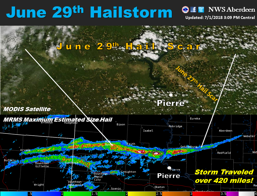 |
| MODIS Satellite imagery of the hail scar produced on June 29th (and from the 27th), taken a few days after the event. Note | MODIS Satellite imagery of the hail scar produced on June 29th (and from the 27th), taken a week after the event | Maximum Estimated Size Hail from the June 29th hailstorm | More on the June 29th hailstorm |
Rainfall
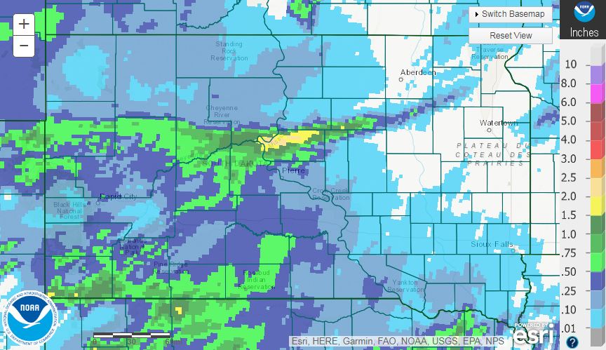
June 27th
 |
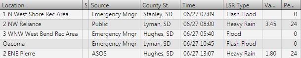 |
| Radar estimated rainfall from water.weather.gov | Local Storm Reports of heavy rain and flooding |
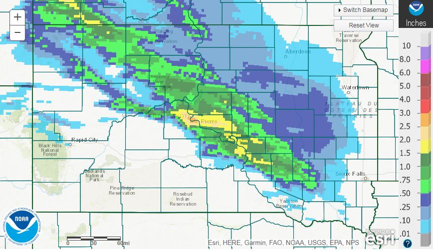
June 29th
 |
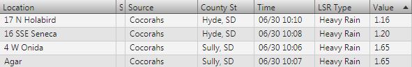 |
| Radar estimated rainfall from water.weather.gov | Local Storm Reports of heavy rainfall and flooding |
Storm Reports
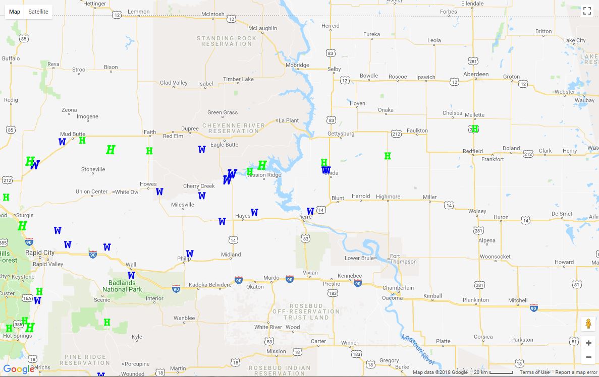
June 27th
 |
| Interactive storm reports map here: https://www.spc.noaa.gov/climo/gmf.php?rpt=180626_rpts_filtered |
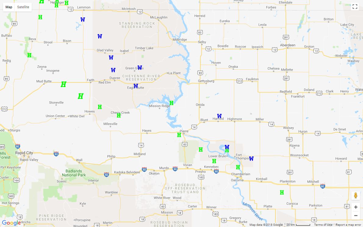
June 29th
 |
| Interactive storm reports map here: https://www.spc.noaa.gov/climo/gmf.php?rpt=180629_rpts_filtered |
 |
Media use of NWS Web News Stories is encouraged! Please acknowledge the NWS as the source of any news information accessed from this site. |
|

