
Record setting heat is expected over the next several days from the Intermountain West through the northern Plains. Furthermore, fire weather concerns increase with dry and breezy conditions. Meanwhile, heavy rainfall and severe thunderstorm threats for the Ohio/Tennessee Valleys, central Appalachians and Southeast today. The threat shifts to central Gulf Coast and across central Texas this week. Read More >
Overview
|
A low pressure system moving through the Central Plains brought an initial wintry mix of freezing rain and snow to the area on Friday night. The freezing rain led to slick roads, especially over east central South Dakota Saturday Morning. Meanwhile, heavy snow was falling farther to the west and continued throughout the day on Saturday. Areas north of Highway 212 received 6 to 12 inches of snow by the time the snow ended Saturday night. South of Highway 212, snowfall amounts were generally in the 3 to 6 inch range. In addition to the snow, wind increased through the day on Saturday, with gusts in the 30-45 mph range. The combination of the falling snow and blowing and drifting snow led to poor travel conditions across northern South Dakota and west central Minnesota. |
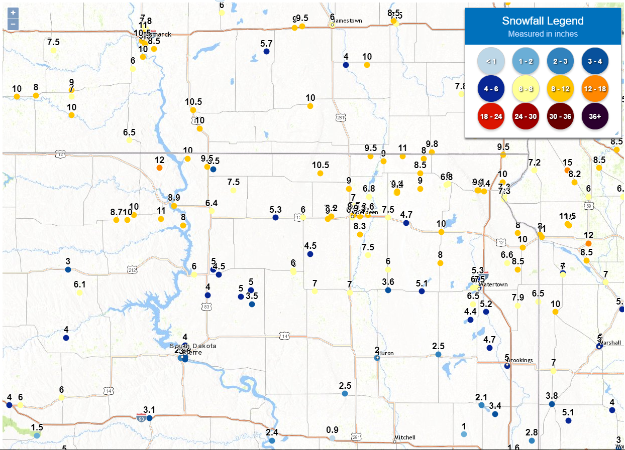 Observed snowfall amounts (Friday Night through Sunday Morning - 3/8-10/2019) across northeast South Dakota and west central Minnesota |
 |
 |
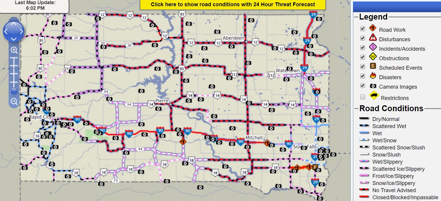 |
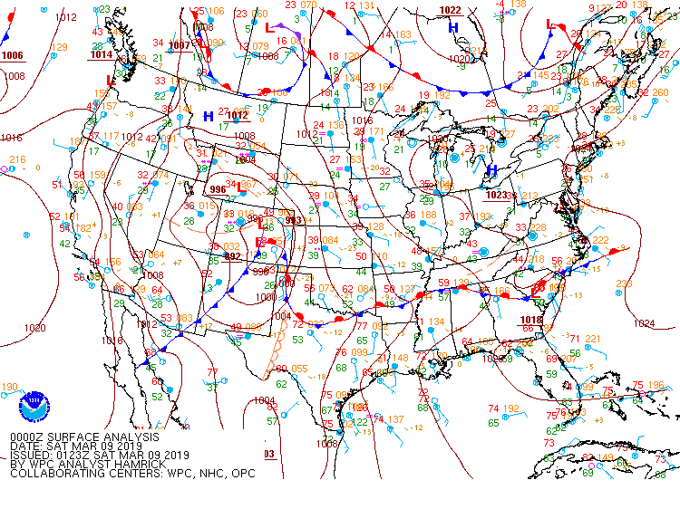
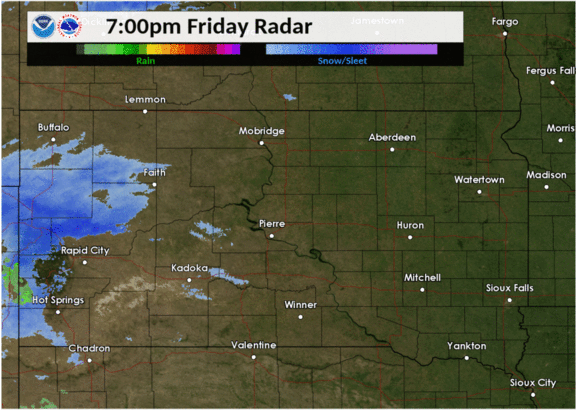
| WPC Surface Pressure Chart showing the low pressure system moving from the Central Plains to the Great Lakes region. | Hourly radar loop from Friday night into Saturday night | SD DOT Road Conditions at 6 PM CST on March 9th (Saturday), highlighting a large area of "No Travel Advised" |
Snow/Ice
Here is a text listing of the snow and freezing rain reports from this event. A map of the snowfall reports is included above.
...SNOWFALL REPORTS...

Location                     Amount    Time/Date       Lat/Lon
6 NE Mahto                   12.0 in   0715 PM 03/09   45.83N/100.60W
1 E Artichoke                11.5 in   0600 PM 03/10   45.40N/96.14W
8 N Promise                  11.0 in   0939 PM 03/09   45.44N/100.58W
11 ENE Hecla                 11.0 in   0700 AM 03/10   45.92N/97.94W
1 E Ortonville               11.0 in   1000 AM 03/10   45.30N/96.42W
7 NE Leola                   10.5 in   1200 PM 03/10   45.79N/98.84W
Webster                      10.0 in   0449 PM 03/09   45.34N/97.52W
2 ESE Artichoke              10.0 in   0600 PM 03/09   45.39N/96.12W
Mobridge                     10.0 in   0609 PM 03/09   45.54N/100.44W
Pollock                      10.0 in   0630 PM 03/09   45.90N/100.29W
7 W Trail City               10.0 in   0910 PM 03/09   45.47N/100.88W
6 E Timber Lake              10.0 in   1025 PM 03/09   45.43N/100.95W
10 SSE New Effington         10.0 in   0700 AM 03/10   45.72N/96.85W
Milbank                      10.0 in   0800 AM 03/10   45.22N/96.63W
Aberdeen                     9.8 in    0630 PM 03/09   45.47N/98.48W
Herreid                      9.5 in    0921 PM 03/09   45.84N/100.08W
4 N Victor                   9.5 in    0700 AM 03/10   45.93N/96.84W
7 WNW Hecla                  9.5 in    0800 AM 03/10   45.92N/98.29W
2 SSE Claremont              9.4 in    1025 PM 03/09   45.65N/98.00W
2 SSE Claremont              9.4 in    0700 AM 03/10   45.64N/98.00W
3 ESE Aberdeen               9.3 in    1200 AM 03/10   45.46N/98.41W
3 ESE Aberdeen               9.1 in    0609 PM 03/09   45.46N/98.41W
3 W Sisseton                 9.1 in    0700 AM 03/10   45.66N/97.11W
Hecla                        9.0 in    0617 PM 03/09   45.88N/98.15W
Brentford                    9.0 in    0659 PM 03/09   45.16N/98.32W
Mina                         9.0 in    0759 PM 03/09   45.44N/98.76W
6 NE Langford                9.0 in    0805 PM 03/09   45.67N/97.75W
Selby                        9.0 in    0953 PM 03/09   45.50N/100.03W
2 NW Westport                9.0 in    0700 AM 03/10   45.67N/98.53W
Mobridge                     8.9 in    0800 AM 03/10   45.54N/100.44W
Timber Lake                  8.7 in    0600 PM 03/10   45.43N/101.07W
Bath                         8.6 in    0605 PM 03/09   45.47N/98.32W
Bath                         8.5 in    0400 PM 03/09   45.47N/98.32W
Clear Lake                   8.5 in    0622 PM 03/09   44.77N/96.68W
Aberdeen                     8.5 in    0853 PM 03/09   45.47N/98.48W
Britton                      8.5 in    0700 AM 03/10   45.79N/97.75W
La Bolt                      8.5 in    0700 AM 03/10   45.05N/96.68W
1 S Sisseton                 8.4 in    0634 PM 03/09   45.65N/97.05W
4 E Warner                   8.3 in    0707 PM 03/09   45.32N/98.41W
2 NE Mina                    8.2 in    0600 AM 03/10   45.46N/98.72W
Sisseton 3 W                 8.2 in    0700 AM 03/10   45.66N/97.12W
4 E Corona                   8.0 in    0657 PM 03/09   45.33N/96.68W
6 NW Swan Creek Rec Area     8.0 in    0720 PM 03/09   45.39N/100.34W
1 N Kidder                   8.0 in    0728 PM 03/09   45.90N/97.71W
1 N Ortonville               8.0 in    0730 AM 03/10   45.32N/96.44W
3 WNW Wallace                8.0 in    0433 PM 03/10   45.10N/97.53W
Clear Lake                   7.9 in    0800 AM 03/10   44.77N/96.68W
2 S Claremont                7.5 in    0340 PM 03/09   45.64N/98.01W
2 NE Mina                    7.5 in    0634 PM 03/09   45.46N/98.73W
Groton                       7.5 in    0849 PM 03/09   45.45N/98.10W
11 SW Eureka                 7.5 in    0700 AM 03/10   45.66N/99.79W
Brentford                    7.5 in    0900 AM 03/10   45.16N/98.32W
Browns Valley                7.3 in    0500 AM 03/10   45.59N/96.83W
Browns Valley                7.3 in    0600 AM 03/10   45.62N/96.83W
Wheaton                      7.2 in    0700 AM 03/10   45.81N/96.50W
2 ESE Watertown              7.0 in    0615 PM 03/09   44.91N/97.13W
Clear Lake                   7.0 in    0641 PM 03/09   44.77N/96.68W
Redfield                     7.0 in    0642 PM 03/09   44.87N/98.52W
4 WSW Rockham                7.0 in    0700 PM 03/09   44.88N/98.90W
5 N Aberdeen                 7.0 in    0732 PM 03/09   45.54N/98.48W
Clear Lake                   7.0 in    0817 PM 03/09   44.77N/96.68W
Herreid 3 ESE                7.0 in    0700 AM 03/10   45.82N/100.01W
4 ESE Herreid                7.0 in    0700 AM 03/10   45.82N/100.01W
Lake City 3 SW               6.8 in    0600 PM 03/09   45.70N/97.46W
Columbia                     6.8 in    0700 AM 03/10   45.61N/98.31W
Stockholm                    6.6 in    0648 PM 03/09   45.10N/96.80W
1 SSW Aberdeen               6.5 in    0500 PM 03/09   45.45N/98.49W
Britton                      6.5 in    0530 PM 03/09   45.79N/97.75W
Gary                         6.5 in    1000 PM 03/09   44.80N/96.46W
2 ENE Thomas                 6.5 in    0441 PM 03/10   44.78N/97.17W
Selby                        6.4 in    0700 AM 03/10   45.50N/100.03W
Roy Lake State Park          6.0 in    0455 PM 03/09   45.71N/97.44W
3 SE Whitlocks Bay Rec Area  6.0 in    0500 PM 03/09   45.01N/100.22W
Browns Valley                6.0 in    0530 PM 03/09   45.59N/96.83W
Faulkton                     6.0 in    0745 PM 03/09   45.03N/99.13W
Watertown                    6.0 in    0824 PM 03/09   44.91N/97.17W
Ipswich                      6.0 in    0900 PM 03/09   45.45N/99.03W
Turton                       6.0 in    0700 AM 03/10   45.05N/98.10W
1 NW Faulkton                6.0 in    0800 AM 03/10   45.04N/99.14W
1 NNE Aberdeen               5.7 in    0220 PM 03/09   45.48N/98.47W
Roscoe                       5.3 in    0700 AM 03/10   45.45N/99.33W
2 W Rauville                 5.3 in    0800 AM 03/10   44.98N/97.12W
Castlewood                   5.2 in    0600 AM 03/10   44.72N/97.03W
Clark                        5.1 in    0700 AM 03/10   44.88N/97.73W
4 NW Gettysburg              5.0 in    0735 PM 03/09   45.05N/100.01W
16 S Lebanon                 5.0 in    0745 PM 03/09   44.84N/99.71W
Hayti                        5.0 in    0750 PM 03/09   44.66N/97.20W
13 SSW Seneca                5.0 in    0825 PM 03/09   44.89N/99.60W
Mobridge                     4.9 in    0800 AM 03/09   45.54N/100.44W
Andover                      4.7 in    1200 PM 03/10   45.41N/97.90W
Cresbard                     4.5 in    0611 PM 03/09   45.17N/98.95W
Gettysburg                   4.5 in    0733 PM 03/09   45.01N/99.95W
3 E Watertown                4.5 in    0930 AM 03/10   44.91N/97.11W
Hayti                        4.4 in    0800 AM 03/10   44.66N/97.20W
3 E Overlook Rec Area        4.0 in    0640 PM 03/09   44.46N/100.32W
1 N Agar                     4.0 in    0830 PM 03/09   44.85N/100.07W
1 S Pierre                   3.8 in    0700 AM 03/10   44.35N/100.32W
Doland                       3.6 in    0800 AM 03/10   44.89N/98.10W
17 N Holabird                3.5 in    0700 AM 03/10   44.78N/99.59W
Pierre                       3.0 in    0756 PM 03/09   44.37N/100.32W
1 SE Fort Pierre             2.8 in    0700 AM 03/10   44.36N/100.37W

...FREEZING RAIN REPORTS...

Location                     Amount    Time/Date       Lat/Lon
Clark                        0.11 in   0700 AM 03/09   44.88N/97.73W
Hayti                        0.09 in   0800 AM 03/09   44.66N/97.20W
1 ESE Castlewood             0.00 in   0645 AM 03/09   44.72N/97.01W

Observations are collected from a variety of sources with varying
equipment and exposures. We thank all volunteer weather observers
for their dedication. Not all data listed are considered official.

$$
Photos
Webcam images from across the region
As the heavy snow moved through
 |
 |
 |
 |
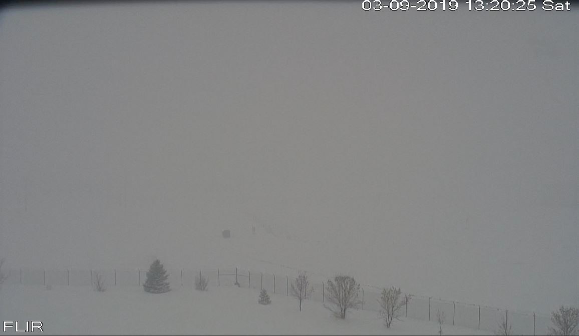
| Aberdeen, SD - 110 PM March 9th (NWS Aberdeen) |
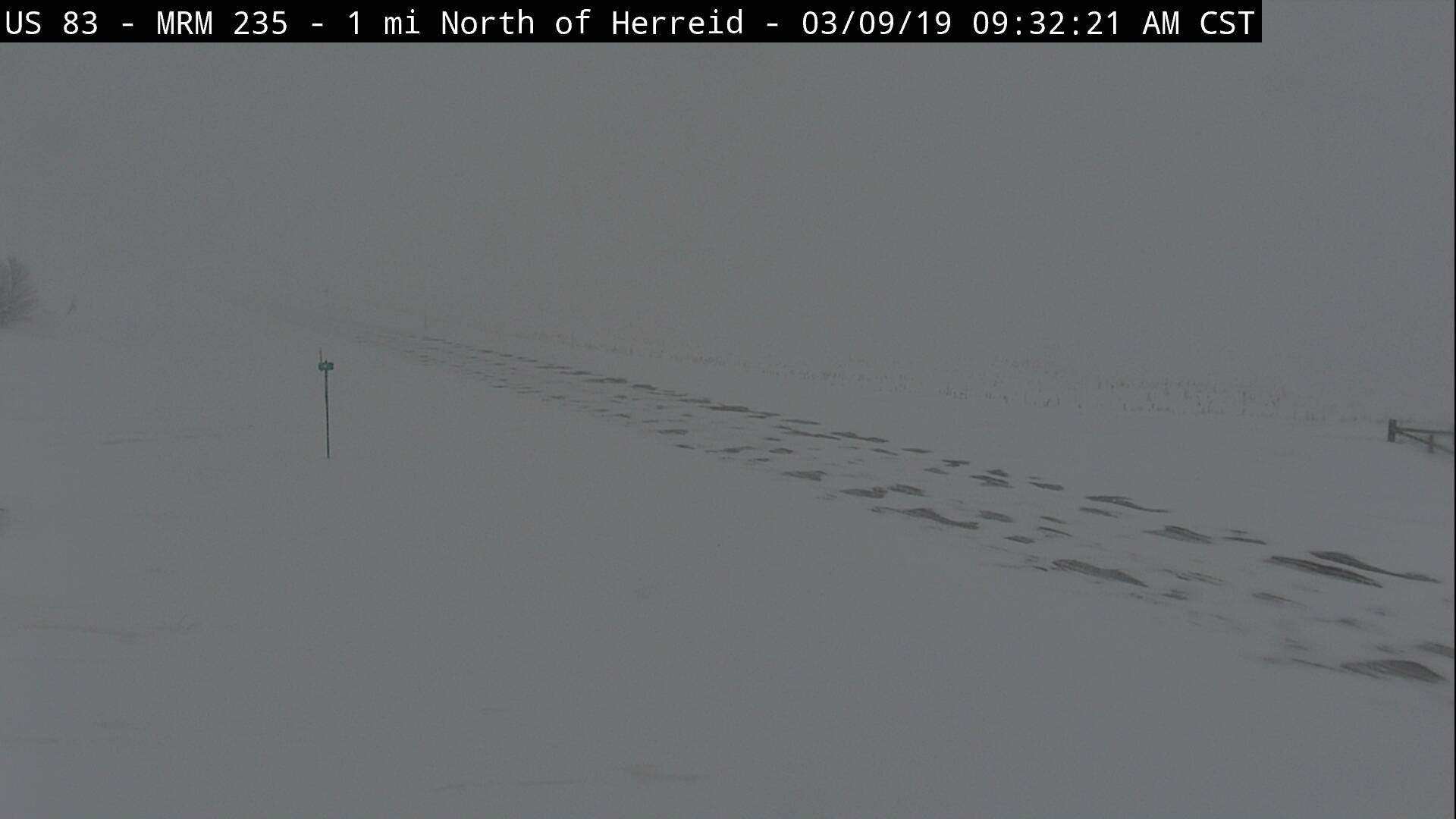
Herreid, SD - 932 AM March 9th (SD DOT) |
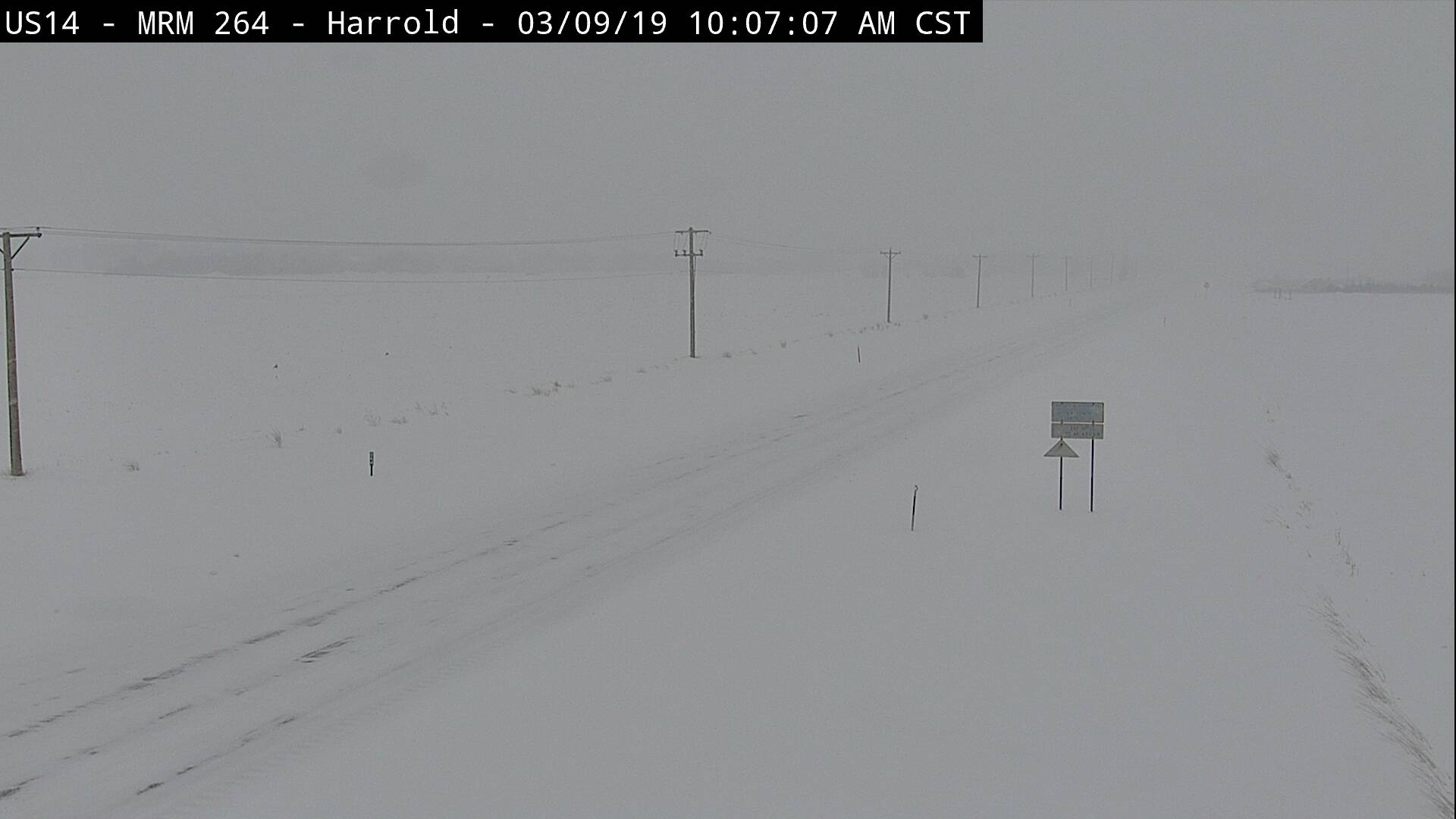
Harold, SD - 1007 AM March 9th (SD DOT) |
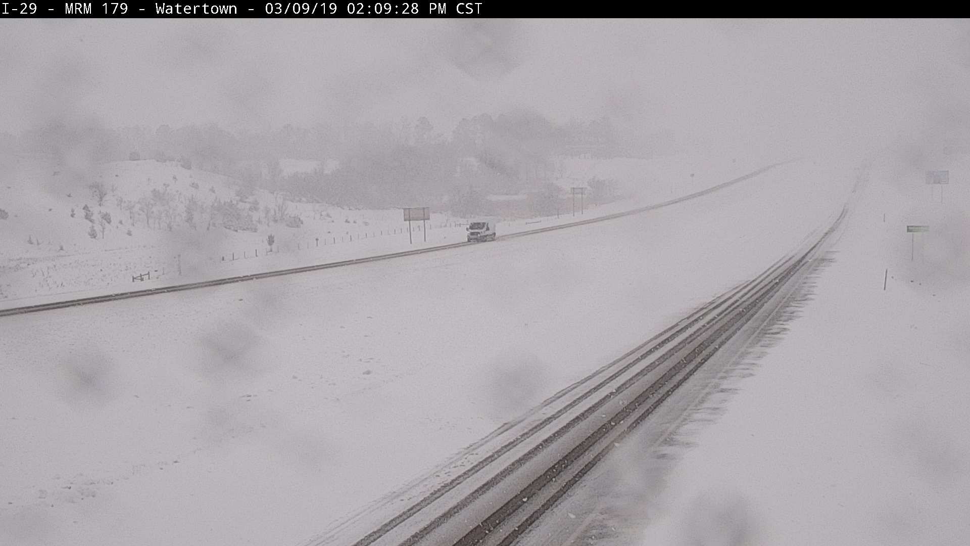
Watertown - I-29 - 209 PM Mar 9th (SD DOT) |
Peak Wind Gusts
Public Information Statement
National Weather Service Aberdeen SD
328 PM CDT Sun Mar 10 2019

...WIND REPORTS...

Location                     Speed     Time/Date       Lat/Lon
Pierre Muni AP               45 MPH    0402 PM 03/09   44.38N/100.29W
Watertown Muni AP            43 MPH    0919 PM 03/09   44.91N/97.15W
Sisseton Muni AP             41 MPH    0901 PM 03/09   45.67N/97.00W
Mobridge Muni AP             41 MPH    0300 PM 03/09   45.55N/100.41W
Graceville 2 W               40 MPH    1130 PM 03/09   45.56N/96.49W
Vivian 12 N                  40 MPH    0459 PM 03/09   44.12N/100.30W
Bullhead 10 S                39 MPH    0306 PM 03/09   45.61N/101.06W
Sisseton 2 E                 39 MPH    1056 PM 03/09   45.67N/97.00W
Aberdeen Rgnl AP             38 MPH    0523 PM 03/09   45.46N/98.41W
Lantry 3 NW                  37 MPH    0252 PM 03/09   45.06N/101.47W
Aberdeen 7 W                 36 MPH    0715 PM 03/09   45.47N/98.64W
Danforth 5 E                 36 MPH    0541 PM 03/09   44.24N/98.77W
Ortonville Muni AP           36 MPH    1136 PM 03/09   45.31N/96.42W
Odessa 1 W                   35 MPH    1051 PM 03/09   45.26N/96.34W
Holabird                     35 MPH    0609 PM 03/09   44.52N/99.60W
Shambo Ranch 2 NNW           33 MPH    0116 PM 03/09   45.55N/101.87W
Pierre 1 SW                  33 MPH    0623 PM 03/09   44.36N/100.34W
Eureka 0.5 S                 32 MPH    0346 PM 03/09   45.77N/99.62W
Frederick 6 WSW              32 MPH    0715 PM 03/09   45.78N/98.62W
Barnard 5 W                  31 MPH    1001 PM 03/09   45.72N/98.61W
Clark 1 ENE                  31 MPH    0935 PM 03/09   44.89N/97.71W
Onida 1 W                    31 MPH    0515 PM 03/09   44.70N/100.10W
Groton                       30 MPH    0900 PM 03/09   45.44N/98.09W
Aberdeen 9 NW                30 MPH    0716 PM 03/09   45.54N/98.64W
Webster 3 S                  30 MPH    0955 PM 03/09   45.29N/97.51W

Observations are collected from a variety of sources with varying
equipment and exposures. We thank all volunteer weather observers
for their dedication. Not all data listed are considered official.
 |
Media use of NWS Web News Stories is encouraged! Please acknowledge the NWS as the source of any news information accessed from this site. |
|

