
Widespread life-threatening flash and urban flooding continues in south-central Texas, with considerable flooding impacts possible across central Texas. Wildfire smoke is impacting air quality across much of the Great Lakes region into southern New England and the Mid-Atlantic. Monsoonal thunderstorms may produce isolated to scattered flash flooding across the Southwest into the Great Basin. Read More >
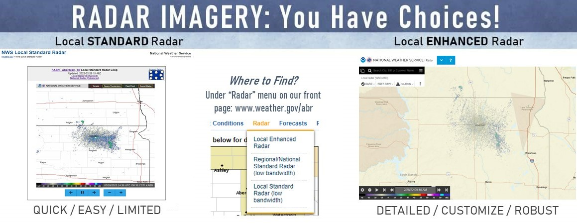
We've listened to your feedback and made some changes to how we serve you radar data. In addition to performance improvements to the enhanced page (local Aberdeen, SD area), we've added a simplified version that allows for faster loading (local Aberdeen, SD area). Read more about the new pages and data here. A quick run-down of pros and cons for each are listed below.
Standard/Lite Version
Pros: QUICKER load times (good for low bandwidth), can loop data (10 frames, about 45 minutes), automatically updated every 5 minutes, includes overlays for warnings (Tornado, Severe Thunderstorm, Flash Flood, Snow Squall), best for a "quick look" at what's going on.
Cons: Only reflectivity data, fixed view (cannot zoom in/out or scroll to other locations), no additive overlays (other hazards, map backgrounds, forecast information for a point, etc.).
Enhanced Version
Pros: Multiple radar products available (reflectivity, velocity, storm relative motion, etc.), more frequent updates, 4x higher resolution compared to the Standard/Lite versions, multiple overlays (all storm-based warnings, other hazards, forecasts for a point, etc.), move anywhere (scroll, zoom in/out), customization, loop data, auto updates, extensive help menu, best for storm interrogation.
Cons: Longer load times (higher bandwidth recommended), a lot of options - not necessarily "load and go."

