
Record setting heat is expected over the next several days from the Intermountain West through the northern Plains. Furthermore, fire weather concerns increase with dry and breezy conditions. Meanwhile, heavy rainfall and severe thunderstorm threats for the Ohio/Tennessee Valleys, central Appalachians and Southeast today. The threat shifts to central Gulf Coast and across central Texas this week. Read More >
Overview
|
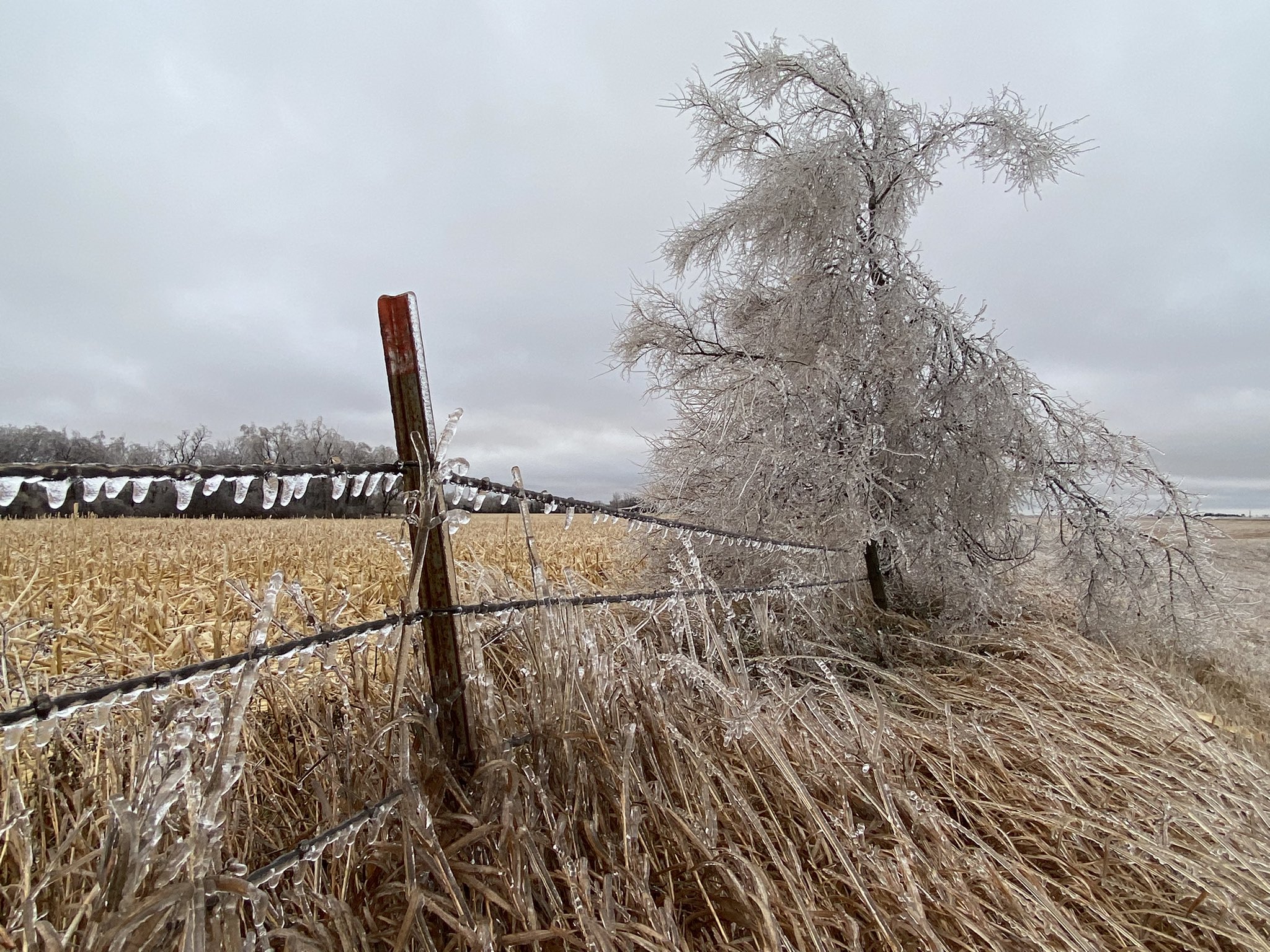
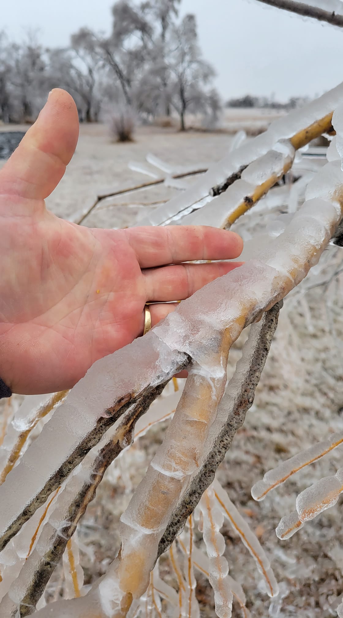
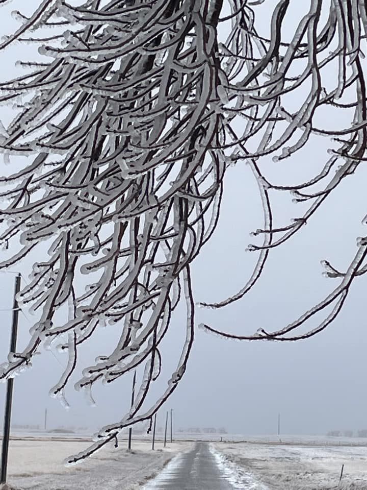
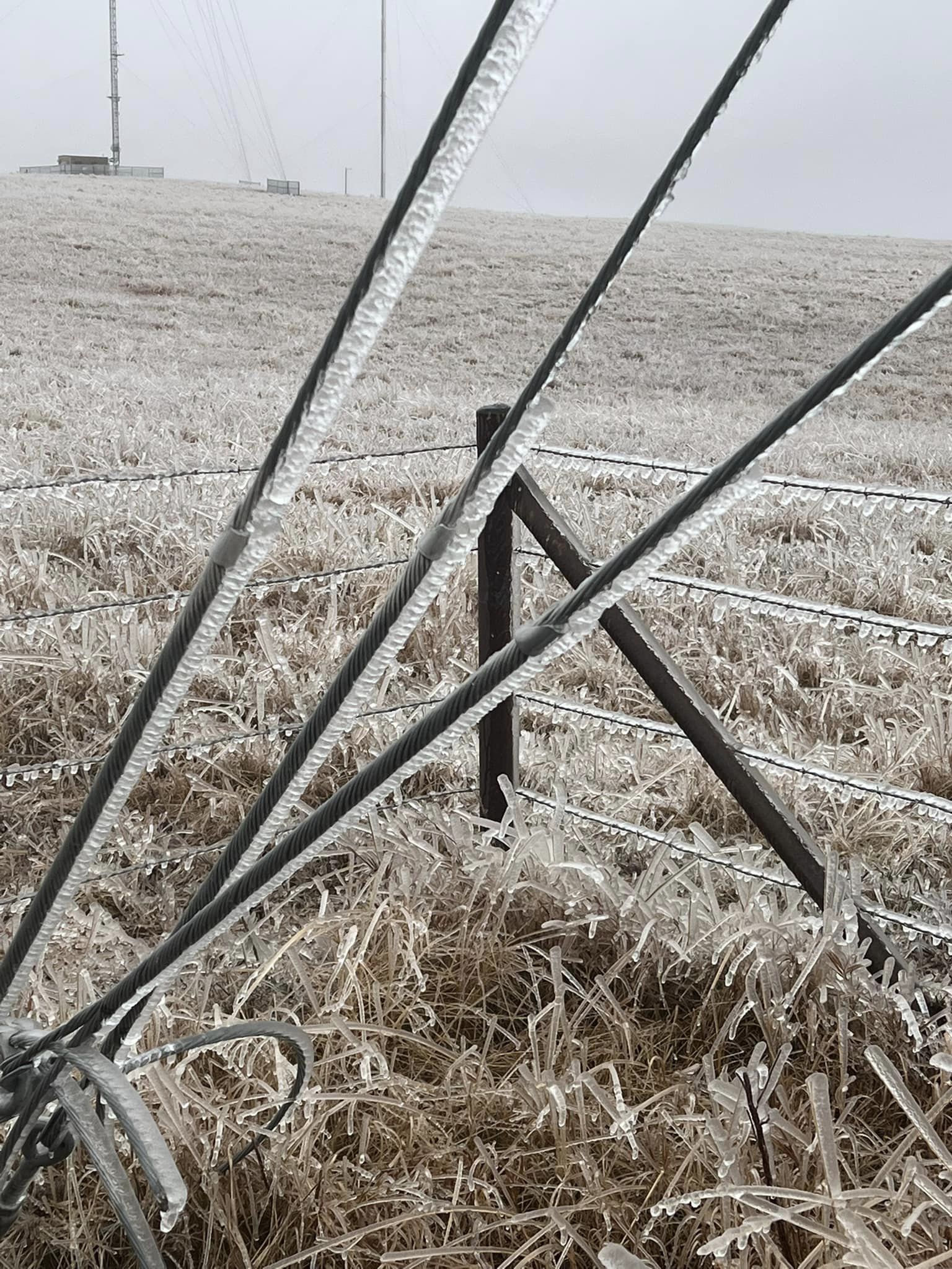
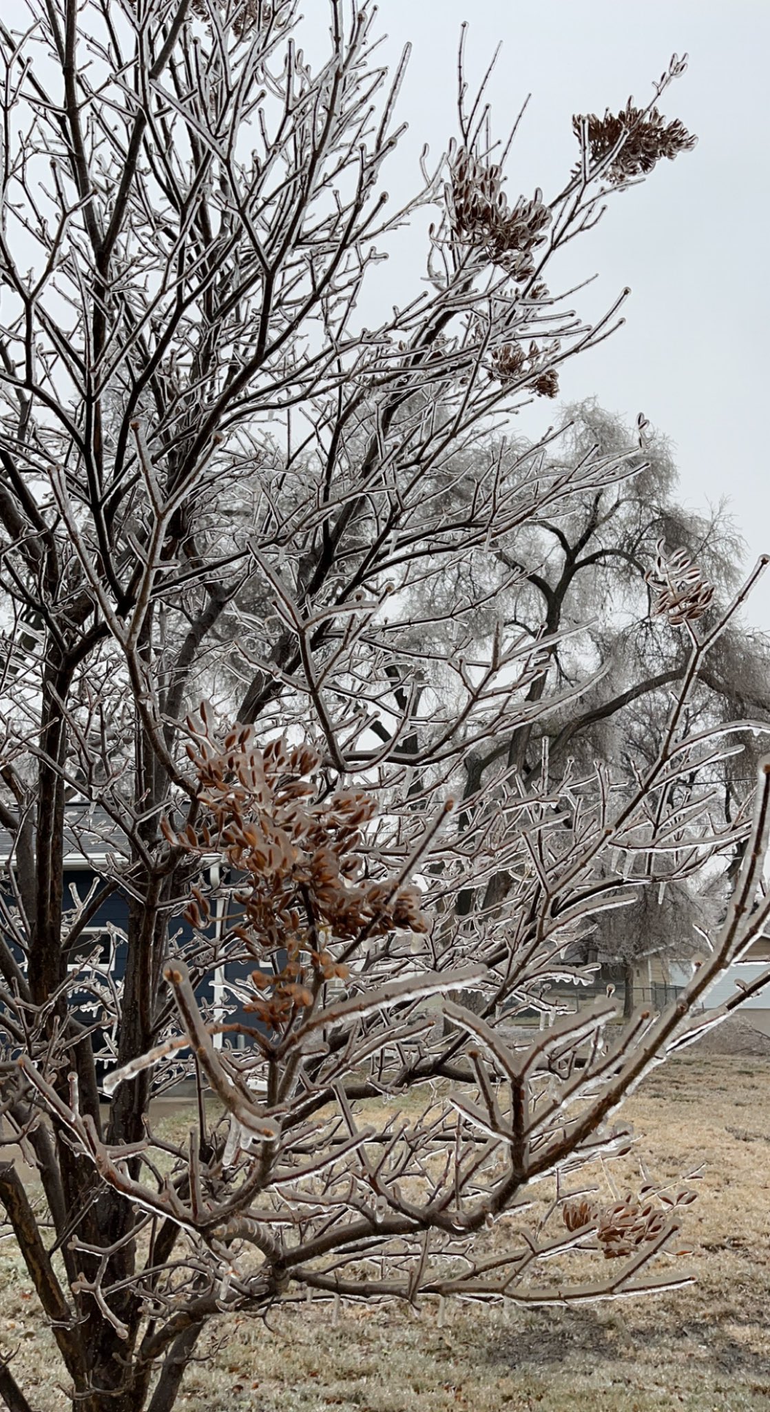
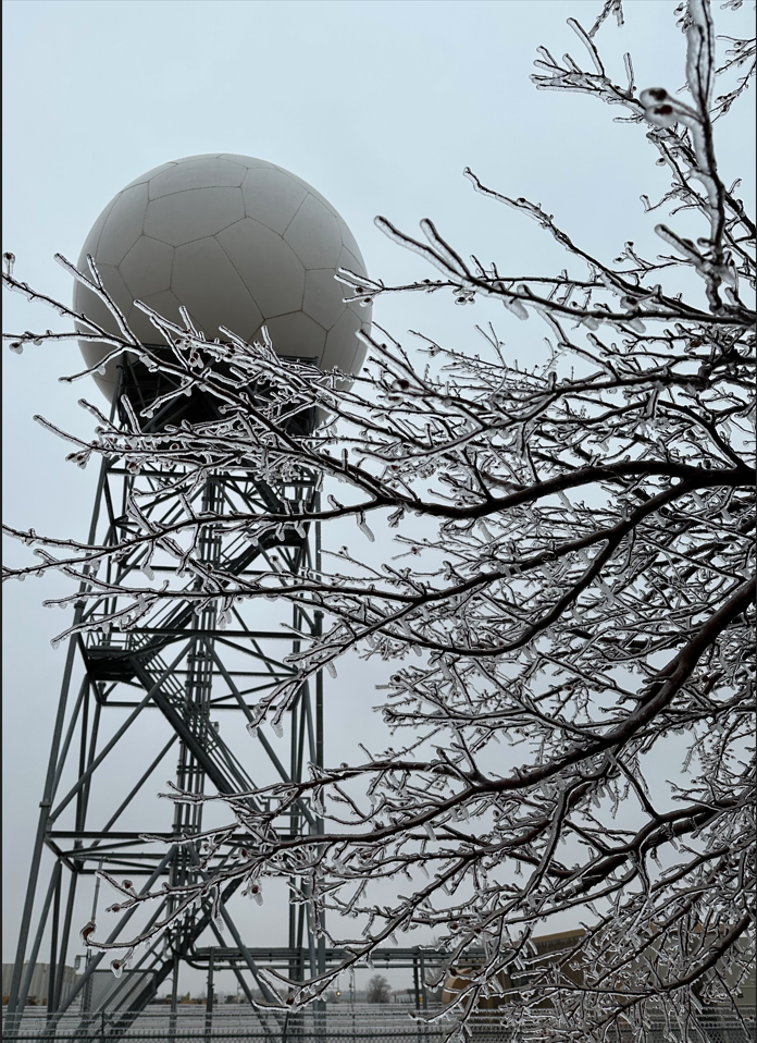
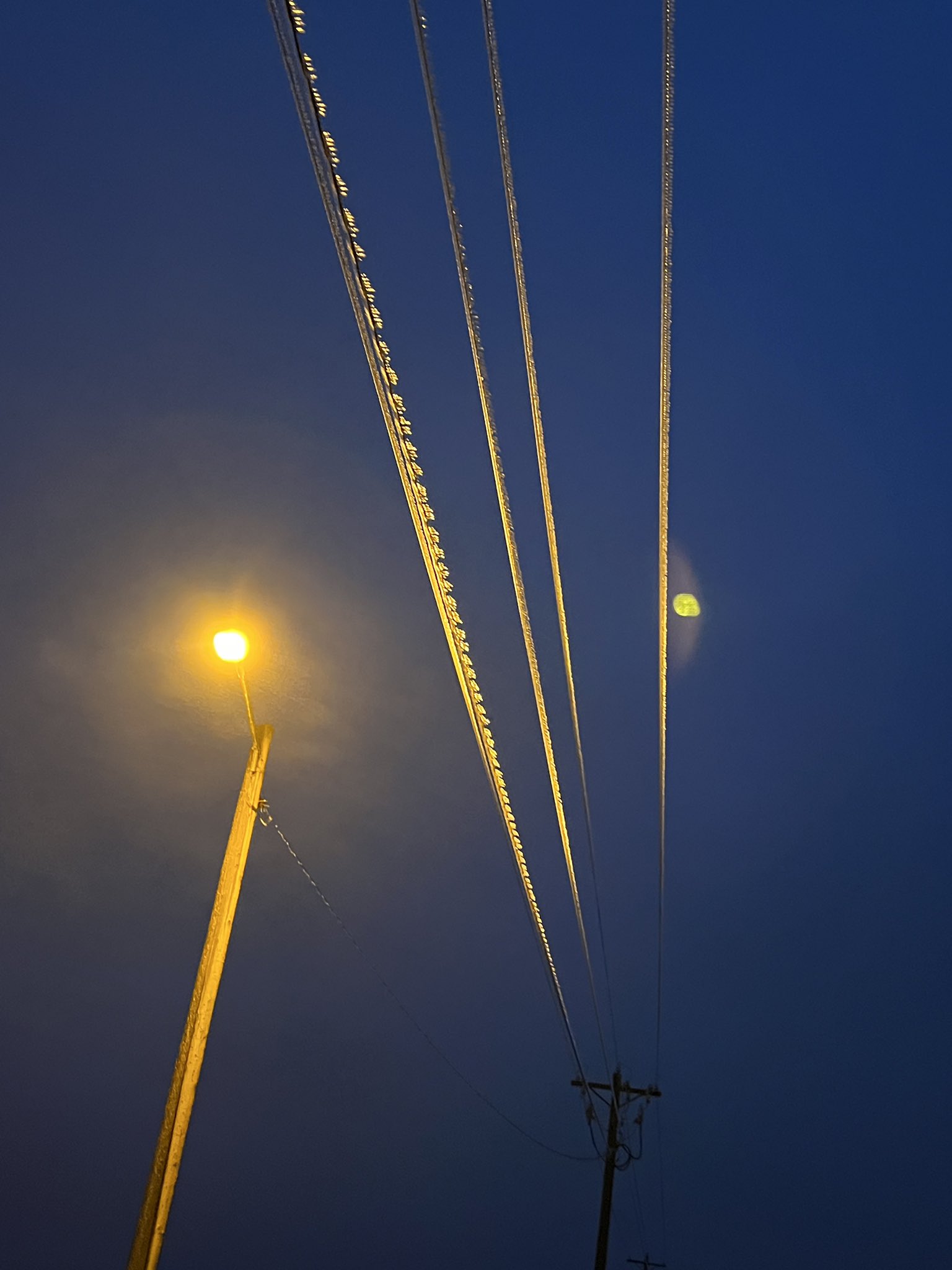
A powerful winter storm system, the first of the season, impacted central and northeastern South Dakota with a variety of precipitation types along with northwest wind from Wednesday, November 9th into Thursday afternoon, November 10th. Areas of freezing drizzle throughout the day on Wednesday resulted in icy surfaces. Relatively warm air atop 32° F or cooler air at the surface Wednesday evening and overnight then resulted in a swath of freezing rain from south central South Dakota northeastward into southeastern North Dakota, with generally between a quarter and half inch of ice accumulation. This was classified as an Ice Storm, which requires at least a quarter inch of ice accumulation. A beneficial half inch to locally near 2 inches of regular rain fell to the south and east of the freezing rain. Lightning and thunder was reported with both the rain and freezing rain. Heavy snow and significantly reduced visibilities were reported to the northwest of the freezing rain on the 10th, across north central South Dakota into much of North Dakota. Over 20 inches of snow was reported in and around Bismarck, ND. Strained trees and power lines from the extra weight of the ice led to power outages across the area, which lasted multiple days, as northwest wind gusted to between 25 and 50 mph on the 10th (winds weakened but were still breezy on the 11th). According to the Brown County Emergency Manager, approximately 1,000 customers were without power in just Brown County at one time, and around 80 remained without power on the morning of the 12th. Road conditions became extremely icy as well, leading to hazardous travel conditions and several vehicle accidents. Well below average temperatures moved in behind this system, which only prolonged impacts as temperatures remained below 32° F for many days, preventing a natural thaw of the ice and snow. |
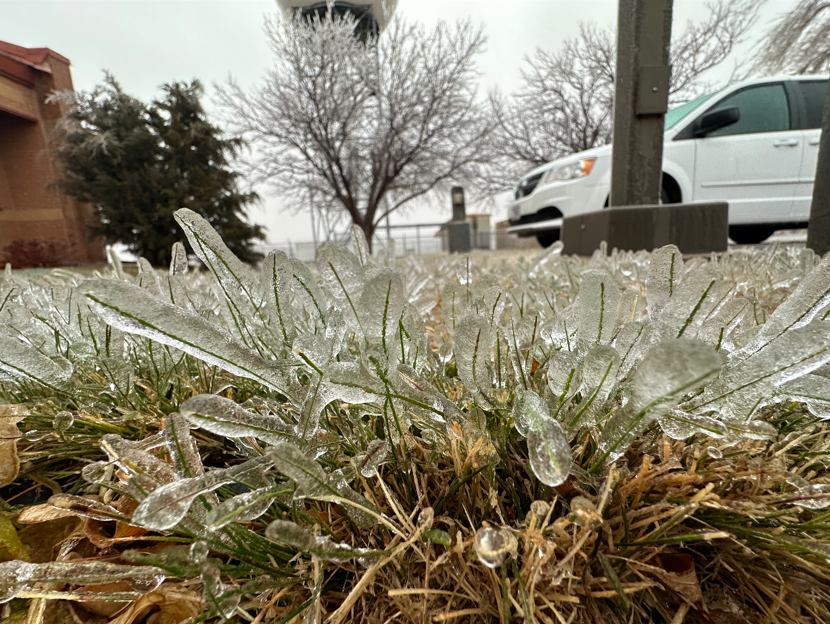 Ice accumulation on blades of grass from freezing rain at the National Weather Service office in Aberdeen, SD at 10am November 10th, 2022. |
Rain, Ice, Snow, Wind
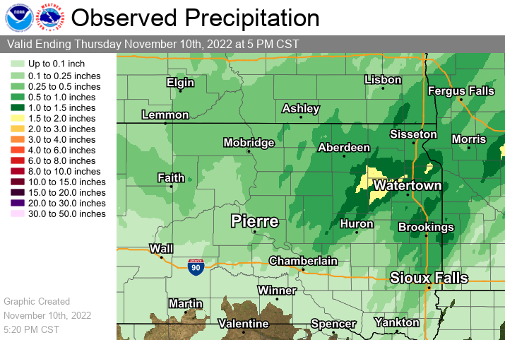
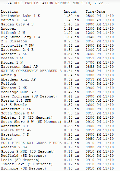
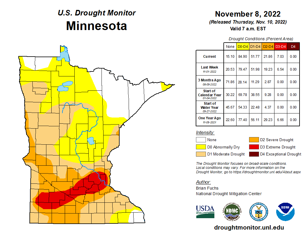
Considering the D1/Moderate to D2/Severe Drought in place leading up to the event, the moisture this system brought was much needed. Below is a map of approximate rainfall and/or liquid equivalent moisture over a 24 hour period ending at 5pm on the 10th, as well as listing of measured amounts over that same time.
 |
 |
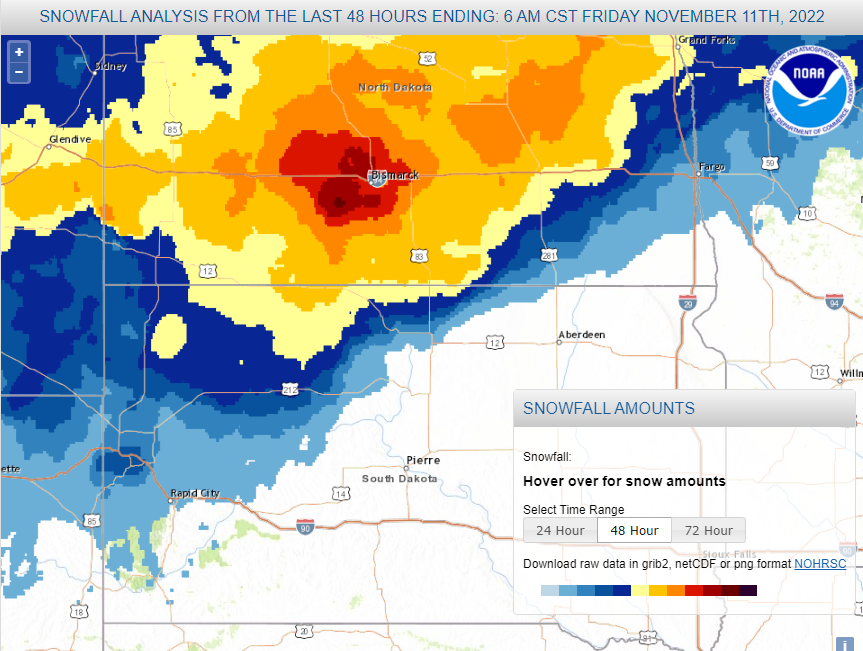
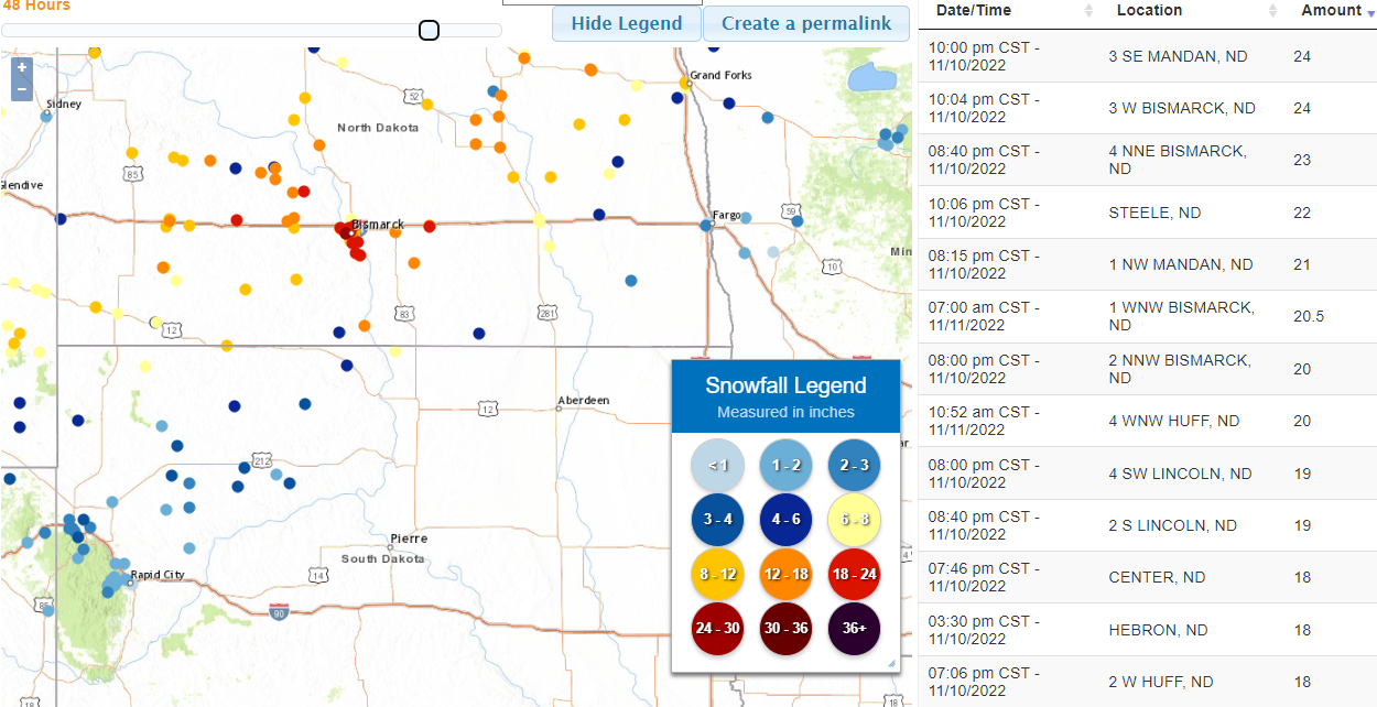
Snow associated with this system fell further northwest, in the colder air, mainly across north central South Dakota into North Dakota where the heaviest of it was observed. Below are two maps, the one on the left is of approximate snowfall totals (use the key associated with the image on the right), and the one on the right shows points of observed totals.
 |
 |
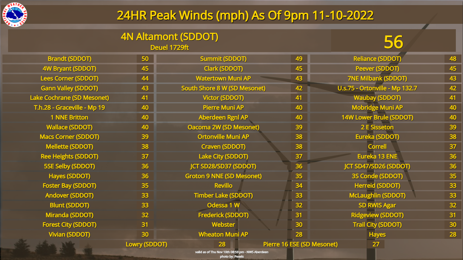
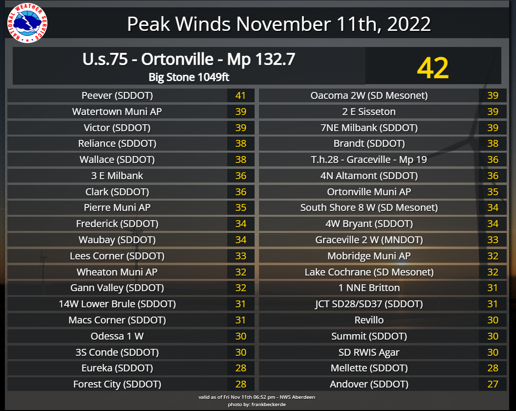
Breezy to windy northwesterly winds were another factor, mainly on the 10th (left image) but also continuing to a lesser degree on the 11th (right). This caused issues across north central South Dakota by creating blowing snow with significantly reduced visibilities, as well as across portions of central and northeastern South Dakota who received freezing rain and drizzle. Ice-coated trees and power lines strained and broke under the wieght of the ice, which led to power outages.
 |
 |
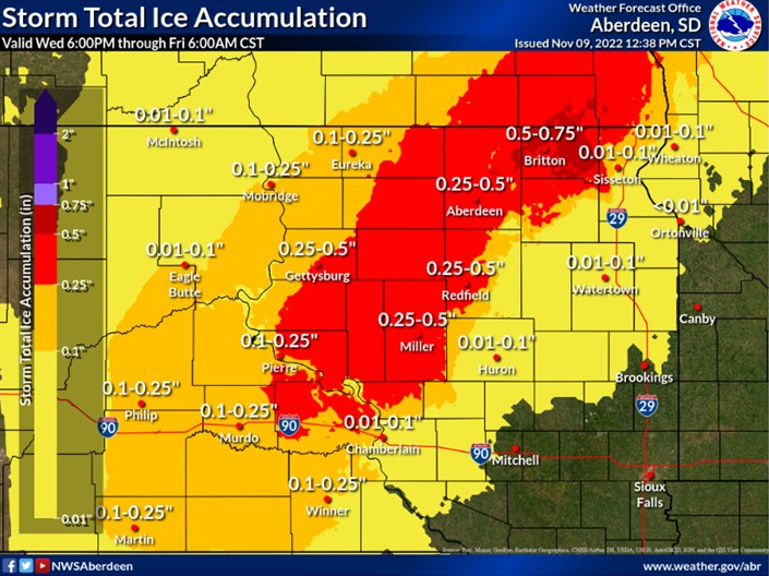
Finally, here is NWS Aberdeen's official storm total ice accumulation forecast issued at 3pm on the 9th, which provides a good map view approximation of where the freezing rain accumulated and how much. This is followed by a listing of observed freezing rain and/or ice storm reports, as well as other types of storm reports.
..TIME...   ...EVENT...      ...CITY LOCATION...     ...LAT.LON...
..DATE...   ....MAG....      ..COUNTY LOCATION..ST.. ...SOURCE....
            ..REMARKS..

0630 AM     ICE STORM        2 SSW ABERDEEN          45.45N 98.49W
11/10/2022                   BROWN              SD   NWS EMPLOYEE

            FREEZING RAIN ALL NIGHT. ICE COVERED TREES
            WITH MULTIPLE LARGE LIMBS DOWN OBSERVED ON
            THE DRIVE INTO WORK.

0700 AM     ICE STORM        SELBY                   45.51N 100.03W
11/10/2022                   WALWORTH           SD   CO-OP OBSERVER

            THE CO-OP OBSERVER IN SELBY ESTIMATED A
            QUARTER OF AN INCH OF ICE.

0740 AM     ICE STORM        4 W GROTON              45.45N 98.18W
11/10/2022                   BROWN              SD   PUBLIC

            JACKKNIFED SEMI ON HIGHWAY 12.

0745 AM     ICE STORM        IPSWICH                 45.45N 99.03W
11/10/2022                   EDMUNDS            SD   PUBLIC

            ESTIMATED QUARTER TO A HALF INCH OF ICE.

0800 AM     ICE STORM        FAULKTON                45.03N 99.13W
11/10/2022                   FAULK              SD   CO-OP OBSERVER

            TREE DAMAGE DUE TO ICE STORM.

0800 AM     SNOW             5 N FIRESTEEL           45.49N 101.29W
11/10/2022  M3.0 INCH        CORSON             SD   COCORAHS

            COCORAHS STATION SD-CR-18 ISABEL 9.5 NE.

0800 AM     ICE STORM        3 W OKATON              43.89N 100.95W
11/10/2022                   JONES              SD   COCORAHS

            TREES HEAVY WITH ICE, OVER 0.25 INCH ACCUMULATION.

0900 AM     ICE STORM        PIERRE                  44.37N 100.35W
11/10/2022                   HUGHES             SD   CO-OP OBSERVER

            ESTIMATED TENTH TO TWO TENTH OF AN INCH OF
            ICE ON TREES.

0930 AM     ICE STORM        BRITTON                 45.79N 97.75W
11/10/2022                   MARSHALL           SD   PUBLIC

            ESTIMATED QUARTER TO A HALF INCH OF ICE ON
            TREES. THE REPORT IS FROM SOCIAL MEDIA.

1000 AM     ICE STORM        ROY LAKE STATE PARK     45.71N 97.43W
11/10/2022                   MARSHALL           SD   CO-OP OBSERVER

            AT LEAST A HALF INCH OF ICE. LOTS OF TREE
            DAMAGE, INCLUDING SOME LARGER TREES.

1000 AM     ICE STORM        2 SSE REE HEIGHTS       44.48N 99.19W
11/10/2022                   HAND               SD   EMERGENCY MNGR

            ESTIMATED HALF INCH OF ICE.

1015 AM     ICE STORM        KENNEBEC                43.90N 99.86W
11/10/2022                   LYMAN              SD   CO-OP OBSERVER

            0.22 INCHES OF RAINFALL, AND AN ESTIMATED
            TENTH TO TWO TENTH OF AN INCH OF ICE ON
            TREES.

1100 AM     ICE STORM        LEOLA                   45.72N 98.94W
11/10/2022                   MCPHERSON          SD   PUBLIC

            ESTIMATED QUARTER TO HALF INCH OF ICE. THE
            REPORT IS FROM SOCIAL MEDIA.

1100 AM     ICE STORM        2 N MINA                45.46N 98.75W
11/10/2022                   EDMUNDS            SD   NWS EMPLOYEE

            ESTIMATED QUARTER TO A HALF INCH OF ICE.

1145 AM     ICE STORM        FRANKFORT               44.88N 98.31W
11/10/2022                   SPINK              SD   STORM CHASER

            ESTIMATED QUARTER OF AN INCH OF ICE.

1200 PM     ICE STORM        8 WNW WESTWOOD COLONY   45.92N 97.93W
11/10/2022                   MARSHALL           SD   CO-OP OBSERVER

            ESTIMATED HALF INCH TO ONE INCH OF ICE. LOTS
            OF TREE DAMAGE.

1200 PM     ICE STORM        ANDOVER                 45.41N 97.90W
11/10/2022                   DAY                SD   PUBLIC

            A LARGE CEDAR BRANCH DOWN DUE TO ICE. THE
            REPORT IS FROM SOCIAL MEDIA.

1215 PM     ICE STORM        4 W FAULKTON            45.03N 99.21W
11/10/2022                   FAULK              SD   PUBLIC

            ESTIMATED HALF INCH OF ICE. REPORT FROM
            SOCIAL MEDIA.

1230 PM     ICE STORM        6 E HAYES               44.37N 100.90W
11/10/2022                   STANLEY            SD   CO-OP OBSERVER

            ESTIMATED QUARTER OF AN INCH OF ICE.

1245 PM     ICE STORM        HIGHMORE                44.52N 99.44W
11/10/2022                   HYDE               SD   CO-OP OBSERVER

            ESTIMATED QUARTER OF AN INCH OF ICE.

1245 PM     ICE STORM        ZELL                    44.89N 98.73W
11/10/2022                   HAND               SD   STORM CHASER

            ESTIMATED HALF INCH OF ICE. SOME LARGE TREE
            LIMBS DOWN AT ST. MARYS CATHOLIC CHURCH.

0115 PM     ICE STORM        ONIDA                   44.70N 100.07W
11/10/2022                   SULLY              SD   EMERGENCY MNGR

            ESTIMATED TENTH TO QUARTER OF AN ICE.

0115 PM     ICE STORM        GETTYSBURG              45.01N 99.95W
11/10/2022                   POTTER             SD   LAW ENFORCEMENT

            ESTIMATED INCH OF ICE.
0700 PM     HEAVY SNOW       POLLOCK                 45.90N 100.29W
11/10/2022  M6.0 INCH        CAMPBELL           SD   CO-OP OBSERVER

            WINDY, WITH MIXED PRECIPITATION PRE-SUNRISE.
            24 HOUR TOTAL.
0600 PM     ICE STORM        BOWDLE                  45.45N 99.65W
11/10/2022                   EDMUNDS            SD   CO-OP OBSERVER

            0.37 INCHES OF LIQUID EQUIVALENT AND HALF AN
            INCH OF SNOW, WITH 0.30 INCHES OF ICE
            ACCRETION ON TREES. 24 HOUR TOTAL.
0800 AM     SNOW             2 SSW MCLAUGHLIN        45.79N 100.83W
11/10/2022  M4.0 INCH        CORSON             SD   CO-OP OBSERVER

            0.36 INCHES OF LIQUID EQUIVALENT. 24 HOUR
            TOTAL.
0700 PM     HEAVY SNOW       6 SE MCINTOSH           45.79N 100.83W
11/10/2022  M13.0 INCH       CORSON             SD   CO-OP OBSERVER
Photos
Thank you to everyone who shared reports and photos during and after the event.
 |
 |
 |
 |
| Freezing rain at Frankfort. Courtesy of Alex Resel |
Ice coated tree from freezing rain north of Westport. Courtesy of Chris Goldade |
Ice coated tree 4 miles west of Frederick. Courtesy of Chris Paulson |
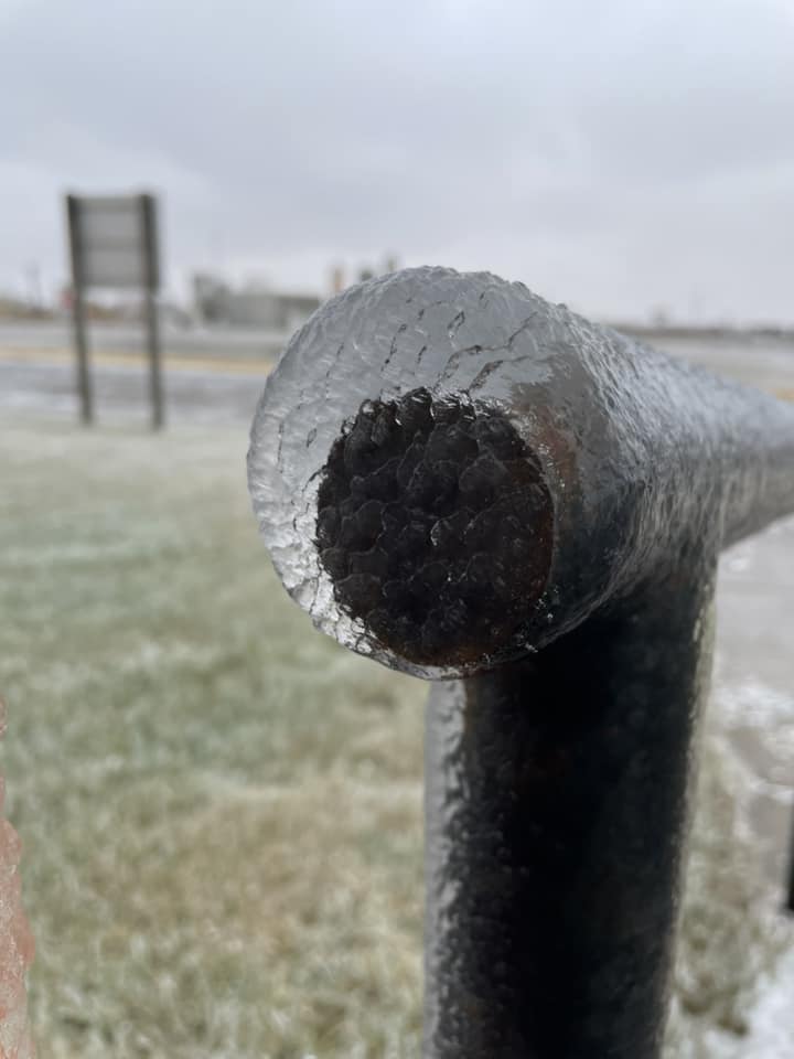
Ice coated fence and power lines in Hand County at Ree Hills. Courtesy of the Hand County Emergency Manager |
 |
 |
 |
 |
| Thick icing at the Ree Hills. Courtesy of the Hand County Emergency Manager |
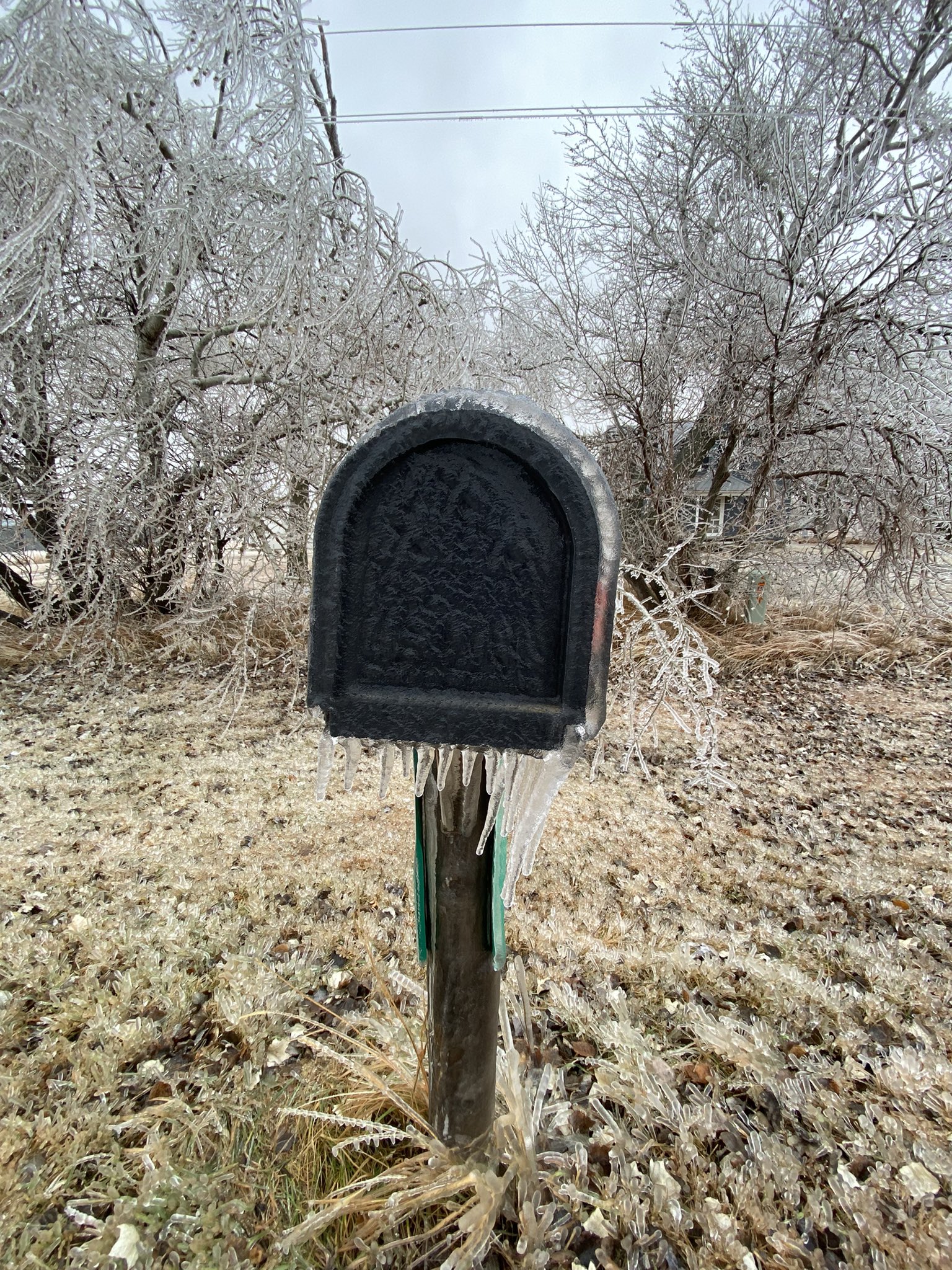
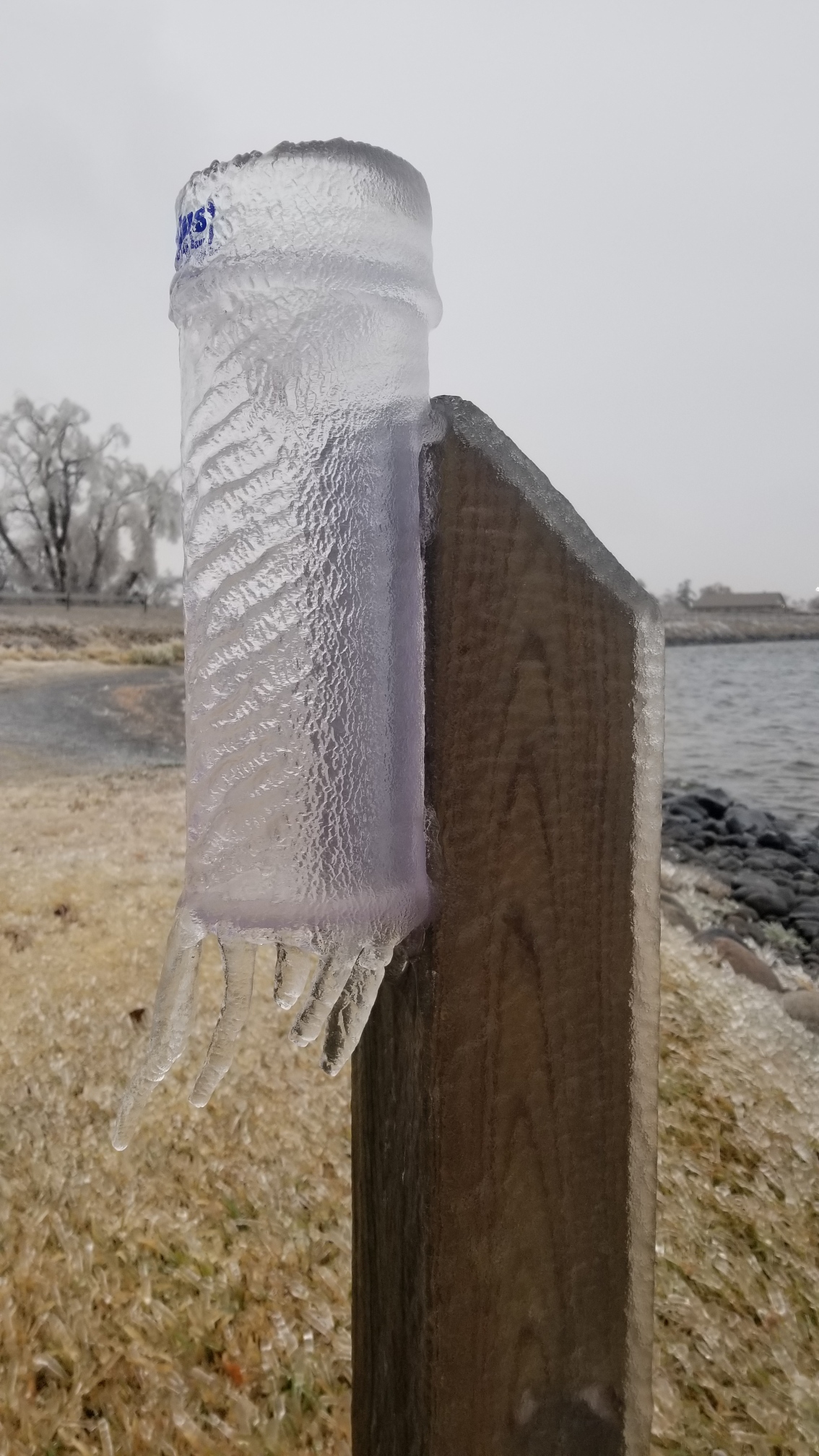
Northwest of Aberdeen, from an NWS employee | Ice at the NWS office, from an NWS employee | An icy mailbox. Photo courtesy of Laura Edwards |
 |
 |
 |
 |
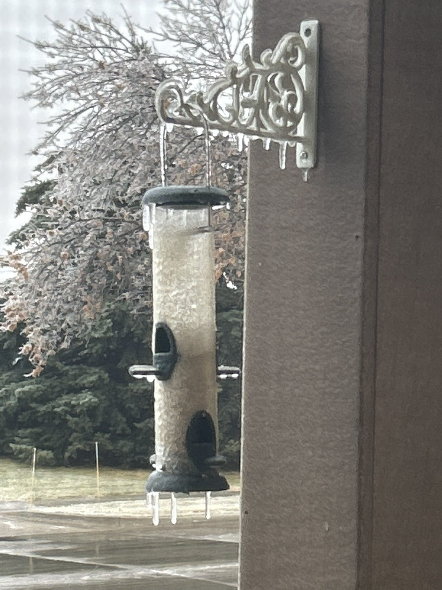
| Ice coated power lines at Mellette. Photo courtesy of Marc | Birdfeeder covered in ice, from an NWS employee | Iced CoCoRaHS rain gauge at Mina Lake, from an NWS employee | Near Norther State University. Photo courtesy of Stacy Bauer |
 |
 |
 |
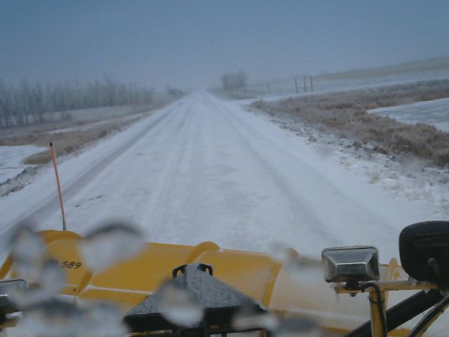 |
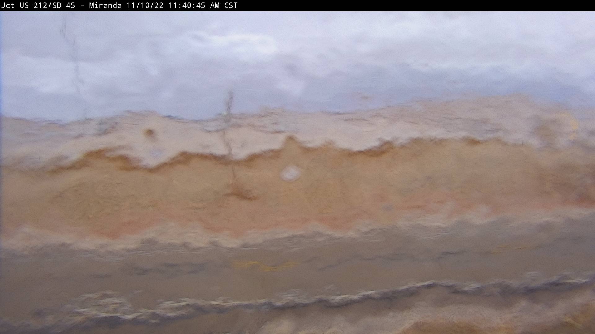
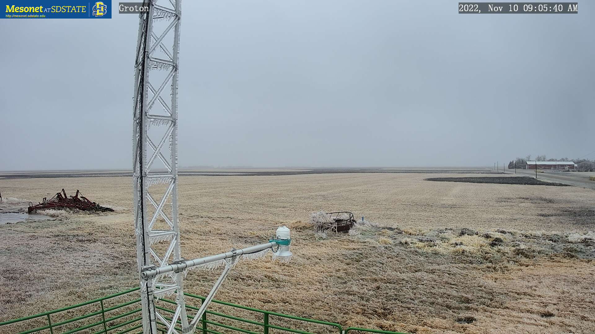
| Ice coated fence in Aberdeen. Photo courtesy of Heather Anderson Ramsay | Iced-over north-facing SDDOT webcam at Miranda. Image taken at 11:40am on the 10th | Icing at the SD Mesonet north-northeast of Groton. Image taken at 9:05am on the 10th | SDDOT snowplow camera showing trecherous roads near Eureka, taken during the afternoon on the 10th |
 |
 |
||
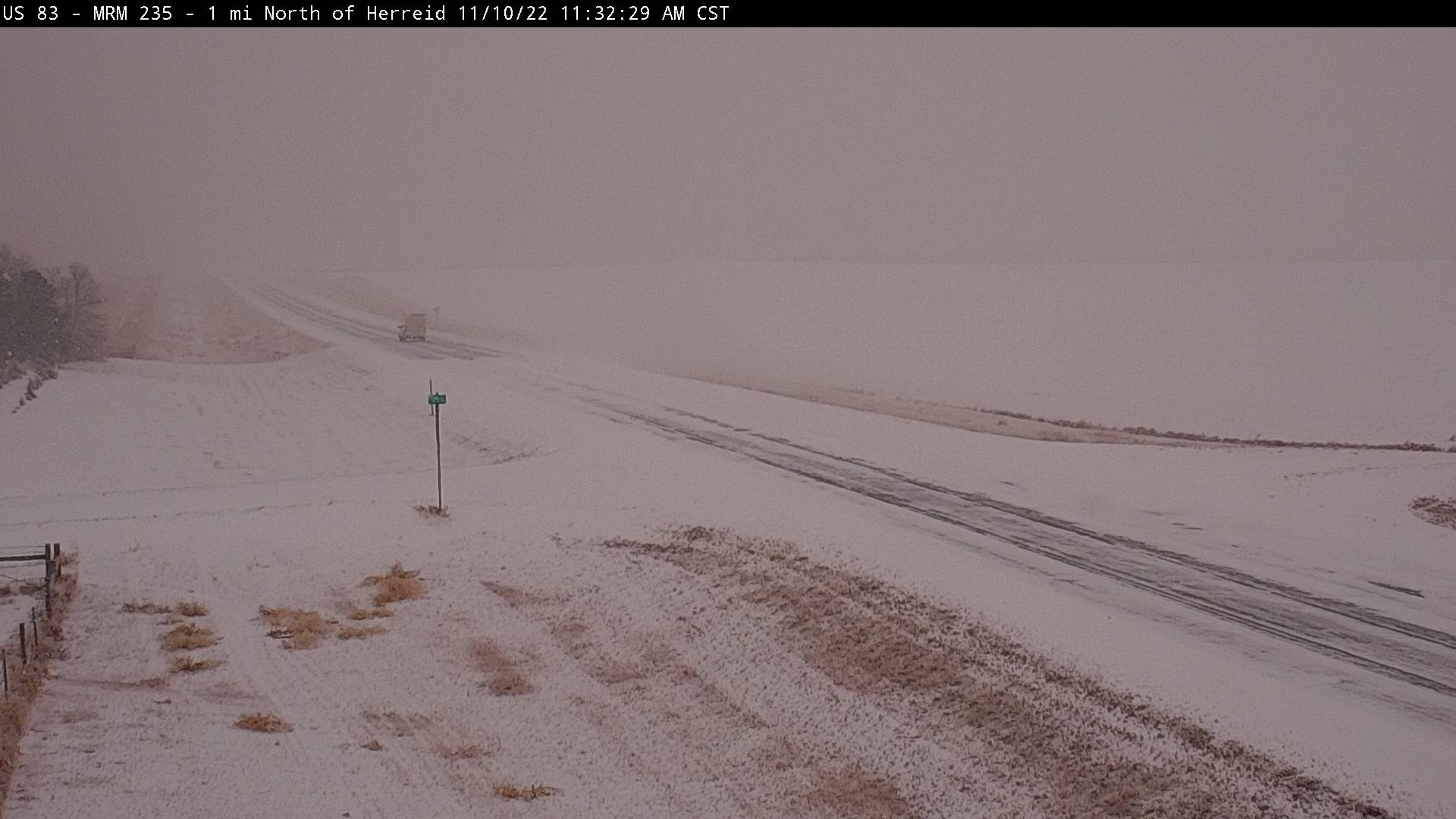
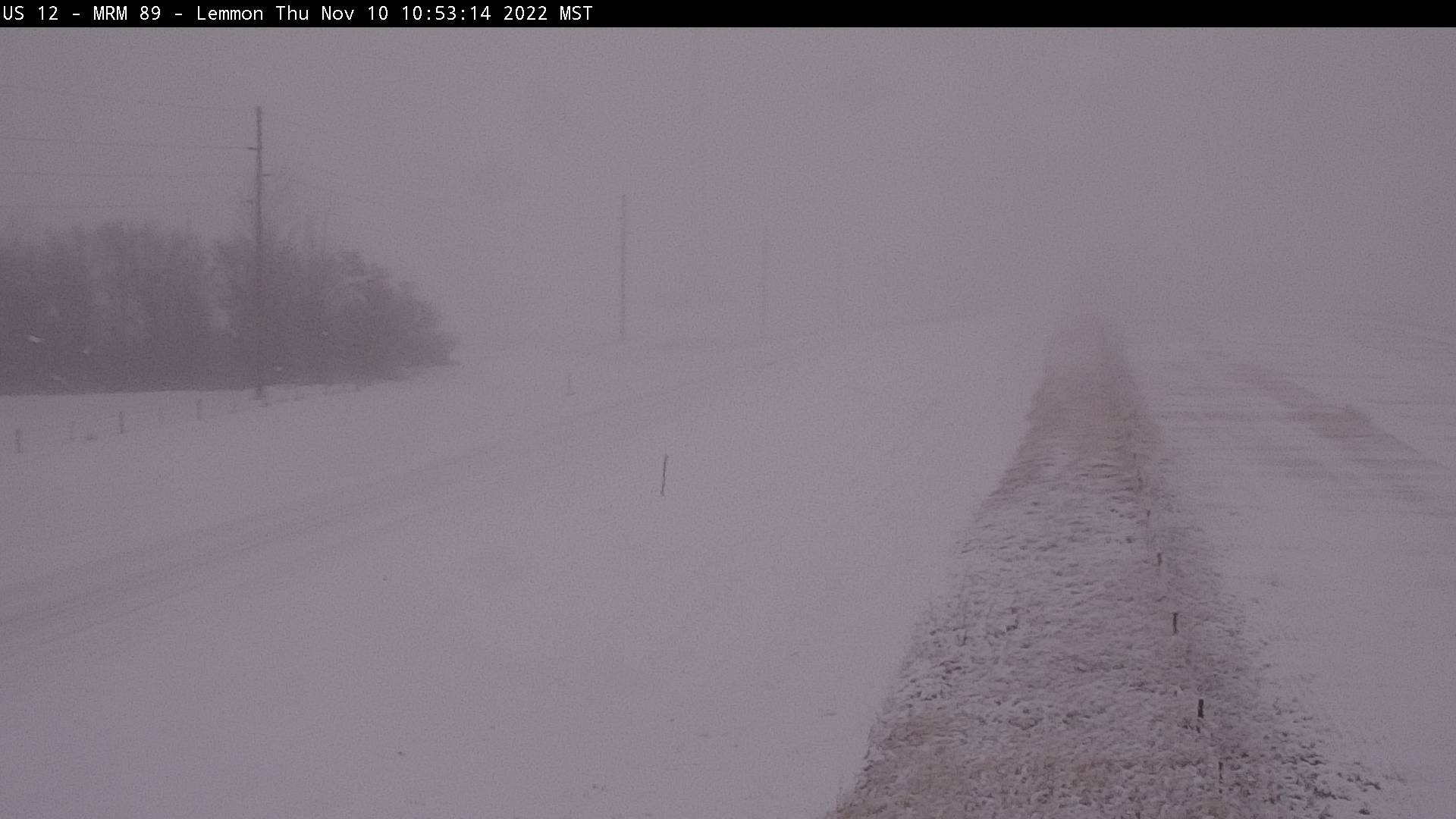
| SDDOT webcam image at Herreid, taken at 11:32am on the 10th | SDDOT webcam image at Lemmon showing significant visibility reductions, taken at 10:53am on the 10th |
Radar, Satellite
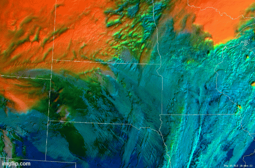
| This radar reflectivity loop with approximate precipitation type goes from 7pm 11/9 to 1pm 11/10. However, much of what displays as blue/snow was actually freezing rain or freezing drizzle, the exception being across north central South Dakota on the 10th. | ||
 |
||
|
Additional Information
 |
 |
 |
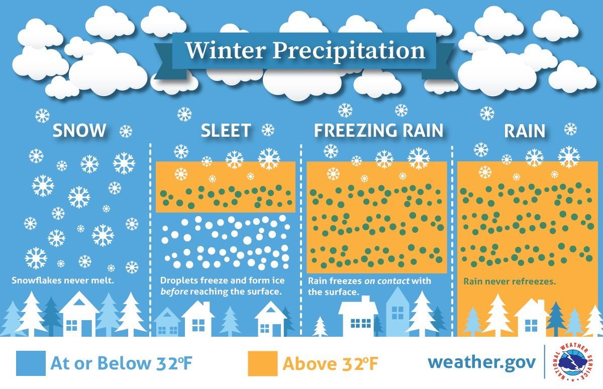 |
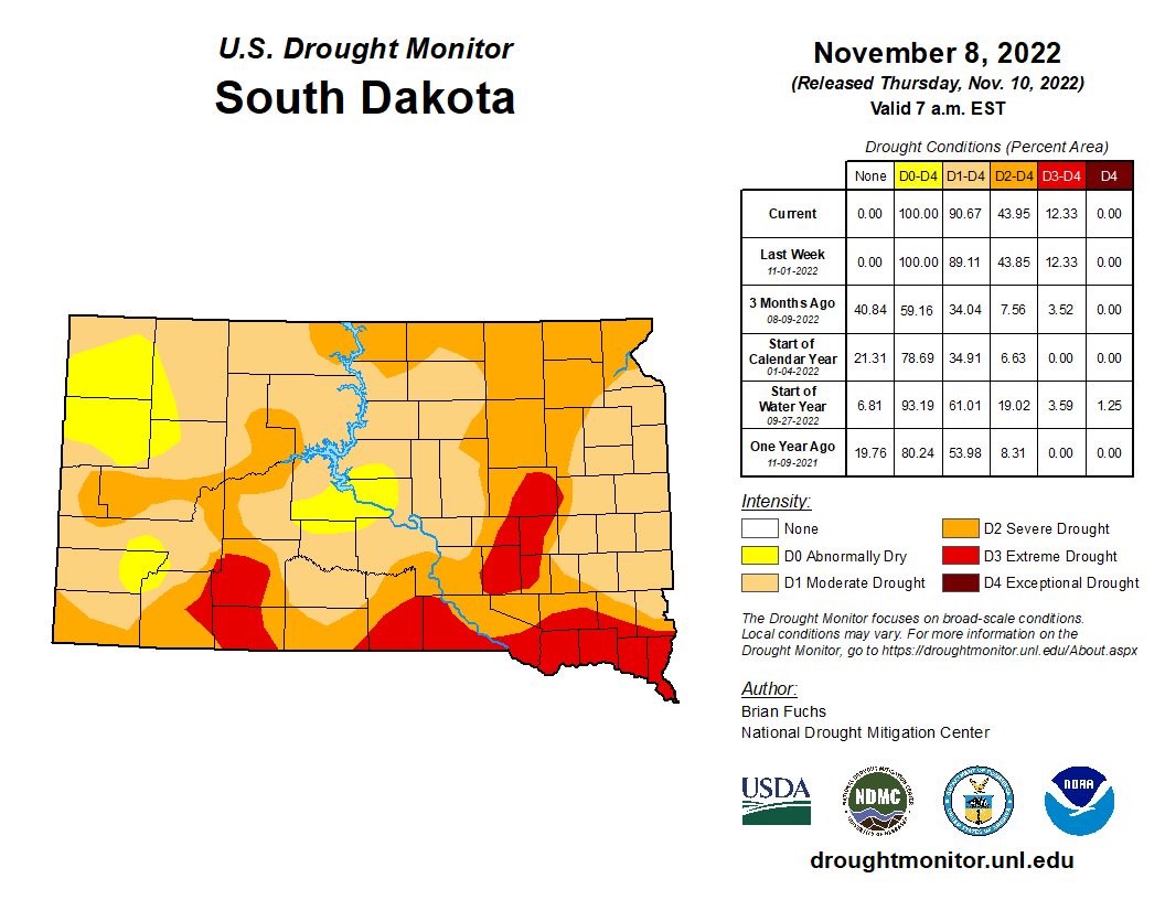
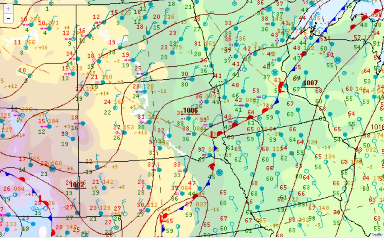
| Drought conditions leading up to the storm, valid on Nov 8th from the US Drought Monitor. | Drought conditions leading up to the storm, valid on Nov 8th from the US Drought Monitor. | Surface weather map at midnight on the 10th, showing a low pressure system over Sioux Falls. It would wrap warm air northwestward, resulting in a range of precipitation types. | An infographic explaining various precipitation types. |
 |
 |
 |
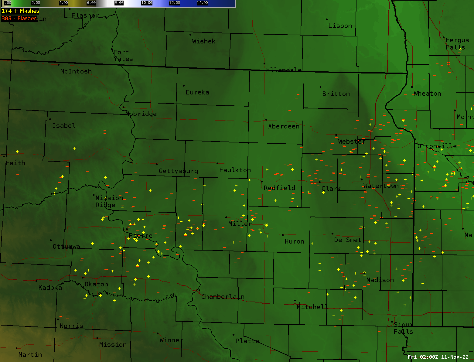 |
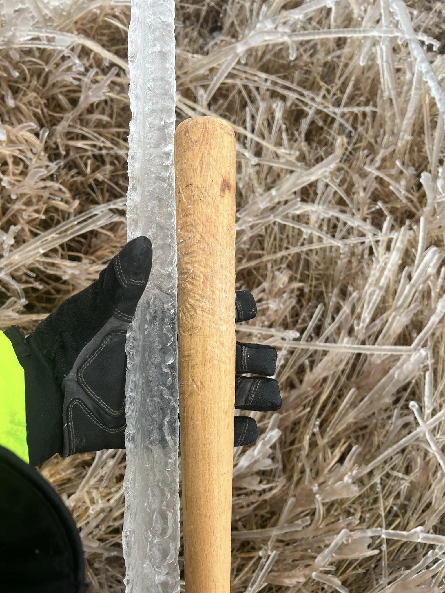
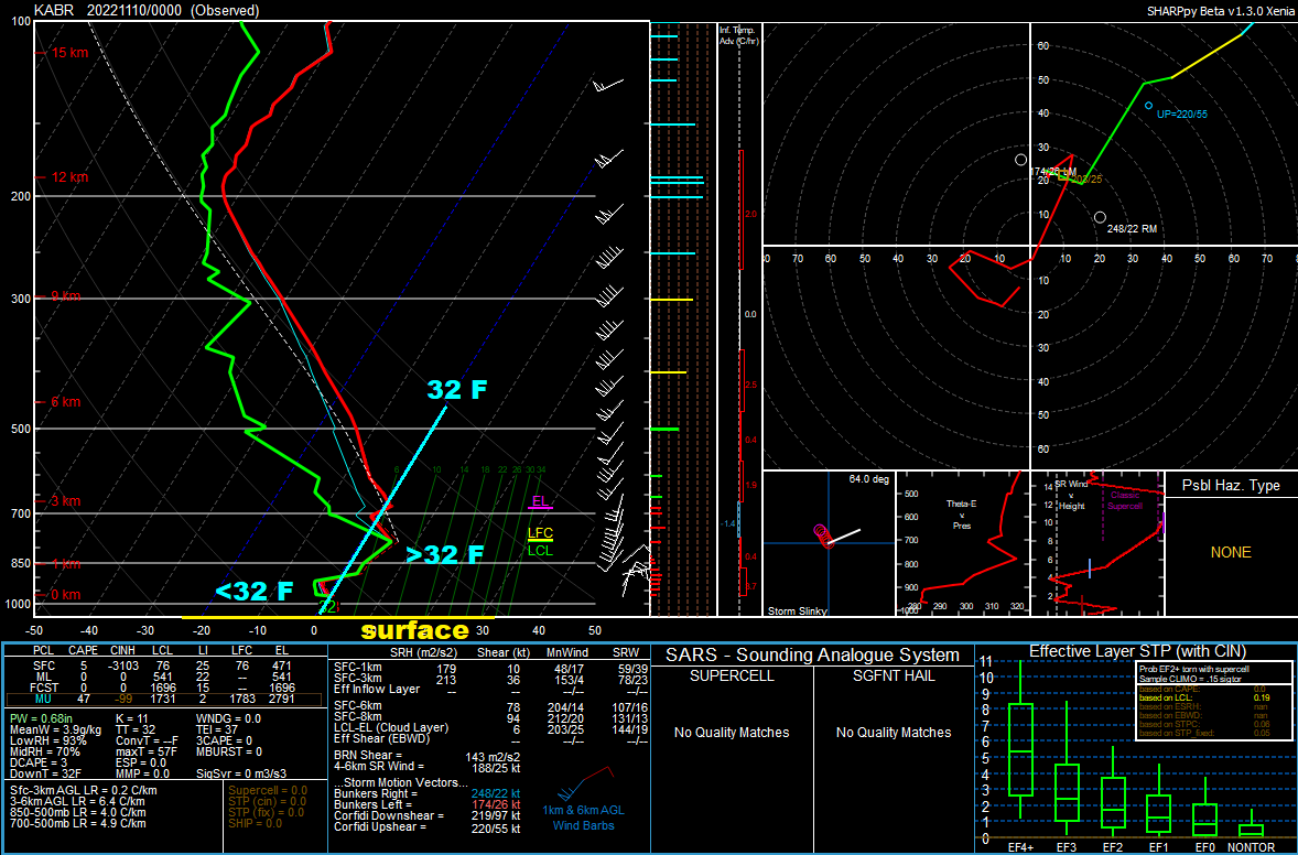
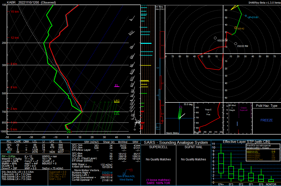
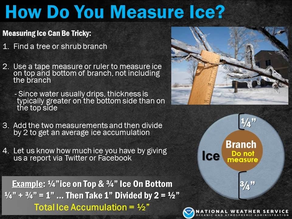
| A Skew-T plot produced from the weather balloon launch at 5pm on the 9th at Aberdeen. 1.) The higher up on the chart the higher up in the atmosphere, 2.) The red line plots temperature with height. Notice the above-freezing temperatures aloft? This is what led to the freezing rain. | A Skew-T plot produced from the weather balloon launch at 5am on the 10th at Aberdeen. Notice the warm air aloft has cooled. | Many of us know how to measure rain and snow, but ice is a bit more involved. | From the National Lightning Detection Network (NLDN), these are all of the cloud-to-ground lightning strikes (positive and negatively charged) over a 24 hour period ending at 8pm on the 11th. There were also many cloud-to-cloud lightning flashes with this system, not shown. |
 |
 |
 |
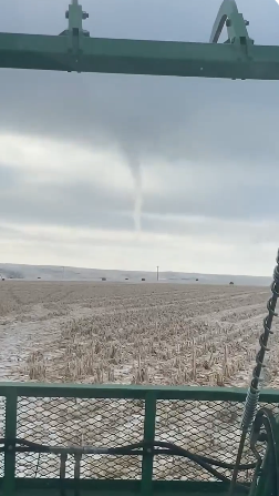 |
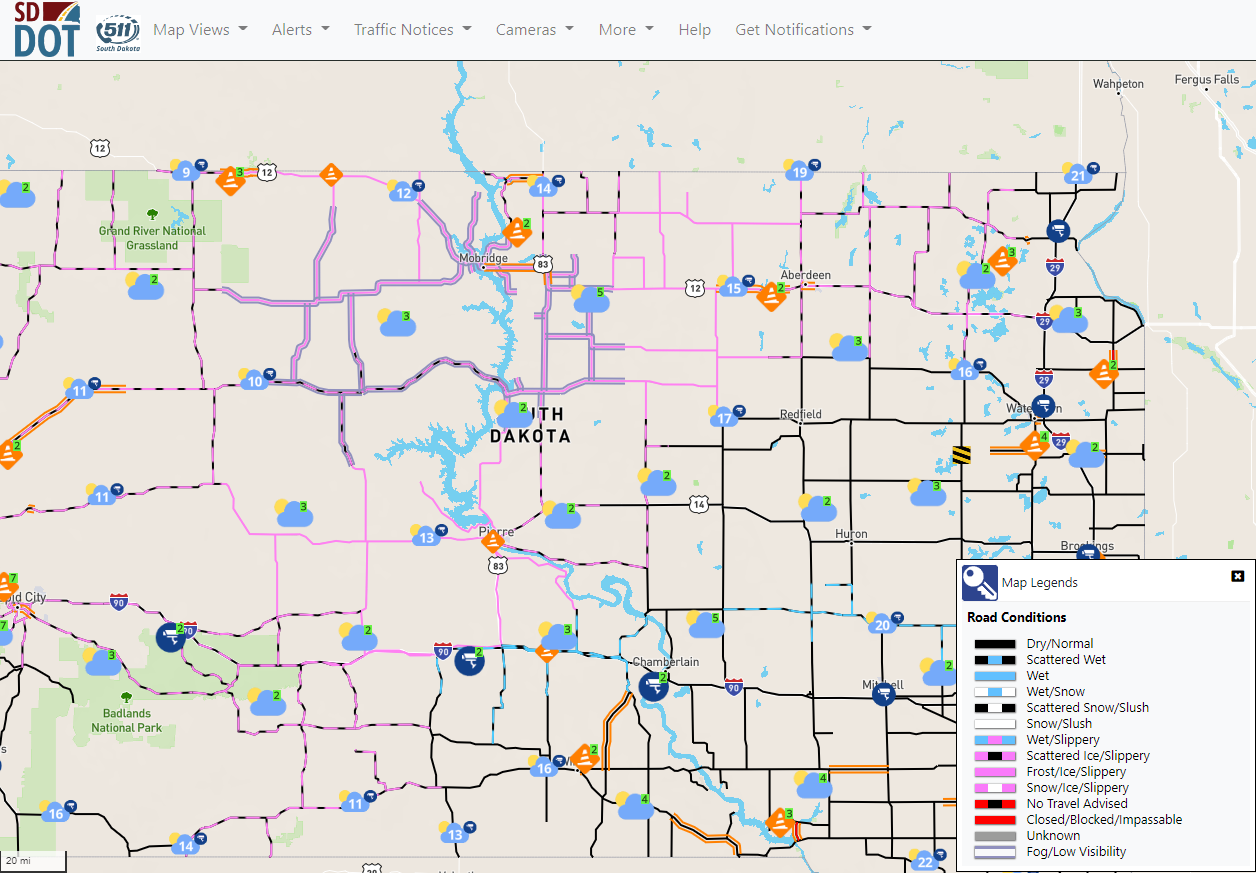
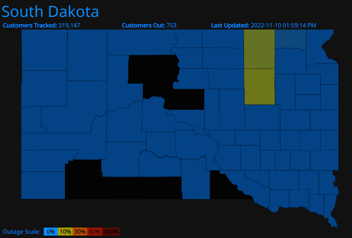
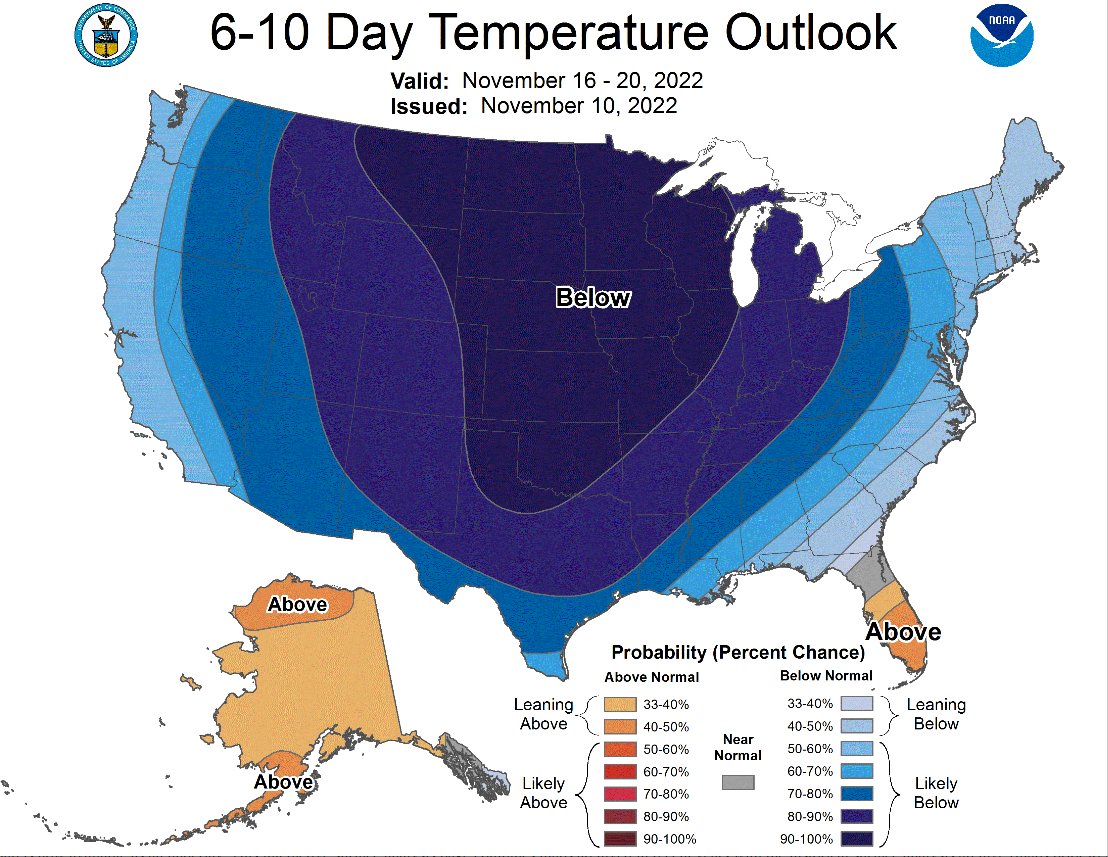
| Road conditions as of 7pm on the 10th, from SD511. Conditions improved only gradually over the following days. | Power outages were reported across portions of central and northeastern South Dakota for the days following the storm. This map is from poweroutage.us as of 2pm on the 10th, but is not a comprehensive accounting. | While warm beforehand, below to much below average air moved in on the backside of the winter storm, and remained in place and was forecast to remain in place for 10 days plus. In other words, nature did little to help with the ice removal to alleviate road conditions and power outage issues. | In addition to lake-effect snow, the relatively warm waters of the Missouri River induced several funnels on the afternoon of the 11th west of Gettysburg. Photo courtesy of Casey Cronin. |
Summaries from other NWS Offices
 |
Media use of NWS Web News Stories is encouraged! Please acknowledge the NWS as the source of any news information accessed from this site. |
|

