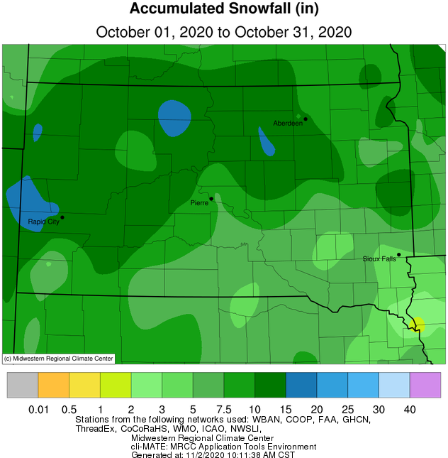
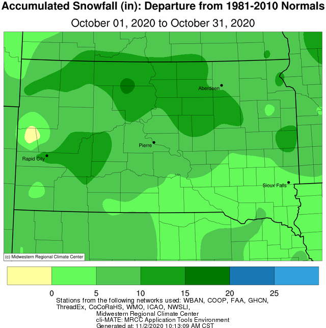
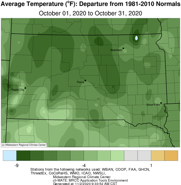
While beginning rather mild, October 2020 will be remembered for its cold and snow thanks to a record-laden period from the 19th through the 28th. Three separate storm systems combined to blanket the area under several inches of snow (as well as some ice across portions of central SD), and this anomalous snow pack helped to manifest very cold temperatures when compared to normal. On a whole, this was the 8th coldest October on record in Aberdeen and Kennebec, 7th coldest in Watertown, 6th in Wheaton, 5th in Pierre, Mobridge and Timber Lake, and 3rd Sisseton. In terms of a single day, when averaging the high and low together, Pierre and Sisseton observed their coldest October day on record on the 26th. Also on the 26th, Pierre and Mobridge observed their coldest October temperature on record. Regarding total October snowfall, this was the 6th snowiest on record in Watertown, 4th in Kennebec, 3rd in Pierre, 2nd in Aberdeen, and 1st at Mobridge, Sisseton, Wheaton and Timber Lake. Additional information regarding the numerous daily and monthly cold and snow records, and more, can be found here: https://www.weather.gov/abr/2020MidOctoberSnowstorms?fbclid=IwAR0C2EyWH9oyxXTcmXgwj1pu8Esg9vwYP2Uj9fqHNVAZO0bBpvA6_C7qODc. The vast majority of the snow had melted by the end of the day on the 31st. Despite the abundant snow, total precipitation for the month finished below normal, generally by between 0.1 and 1.0 inches, and all counties in our forecast area were classified as either D1 Moderate Drought or D0 Abnormally Dry by the US Drought Monitor as of Oct 27th.