A heat wave over the Southwest will intensify late week, peaking and expanding into the Intermountain West and northern High Plains this weekend. Severe thunderstorms and heavy rain are expected over portions of the Plains and Mississippi Valley tonight, which will shift to parts of the Upper Midwest and mid-Mississippi Valley Friday. Monsoonal showers and flooding persist in the Desert Southwest. Read More >
Overview
|
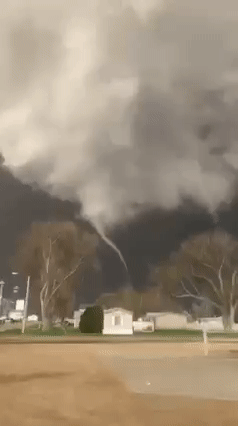
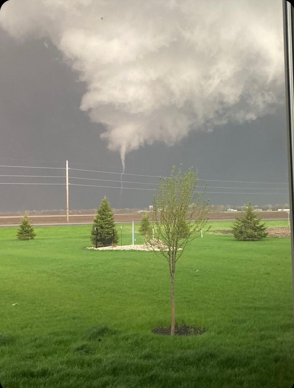
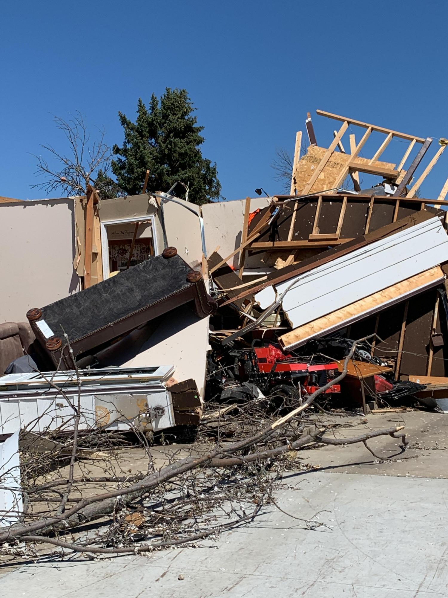
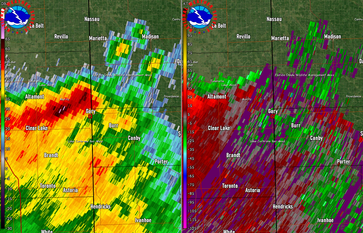
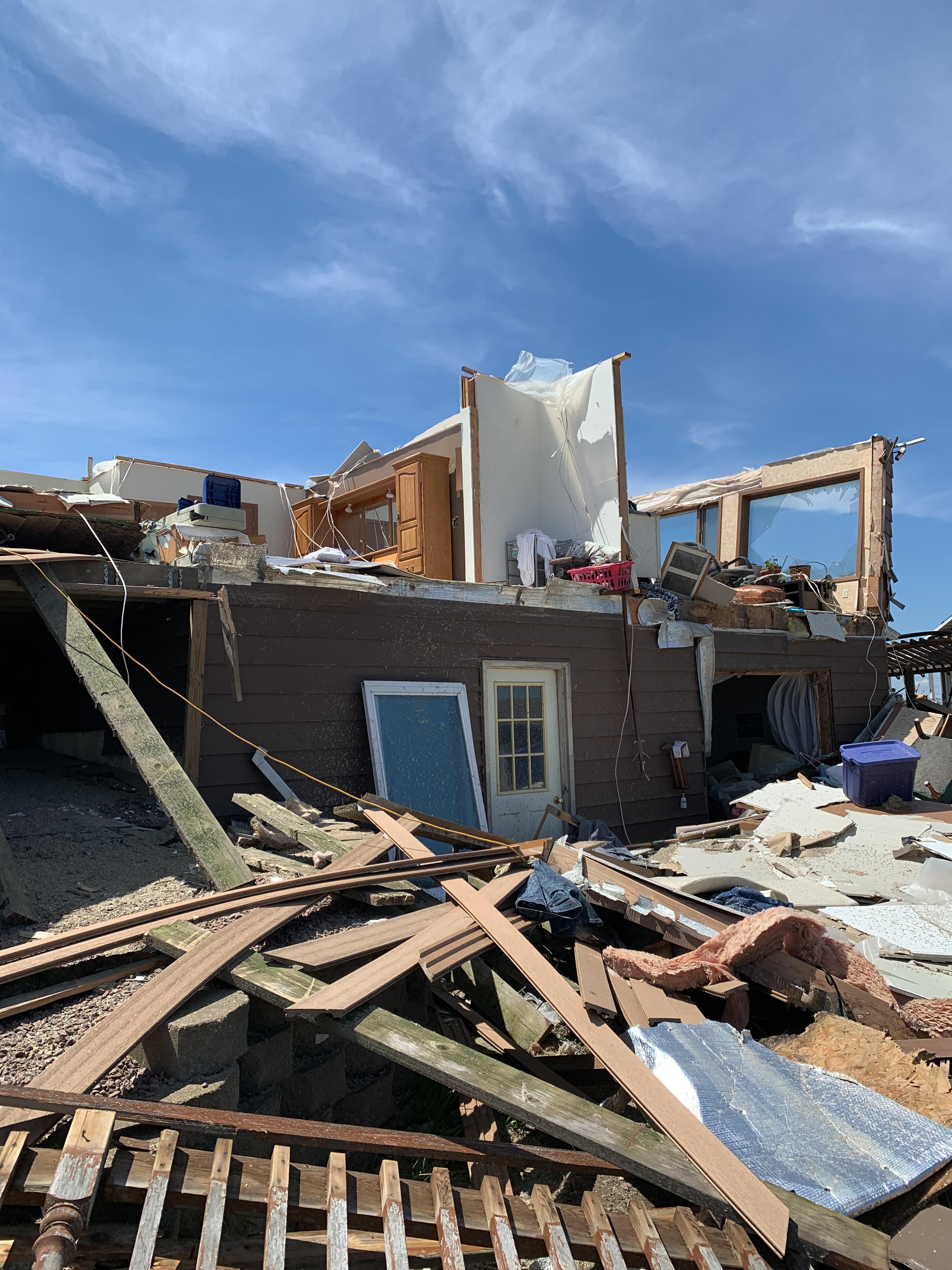
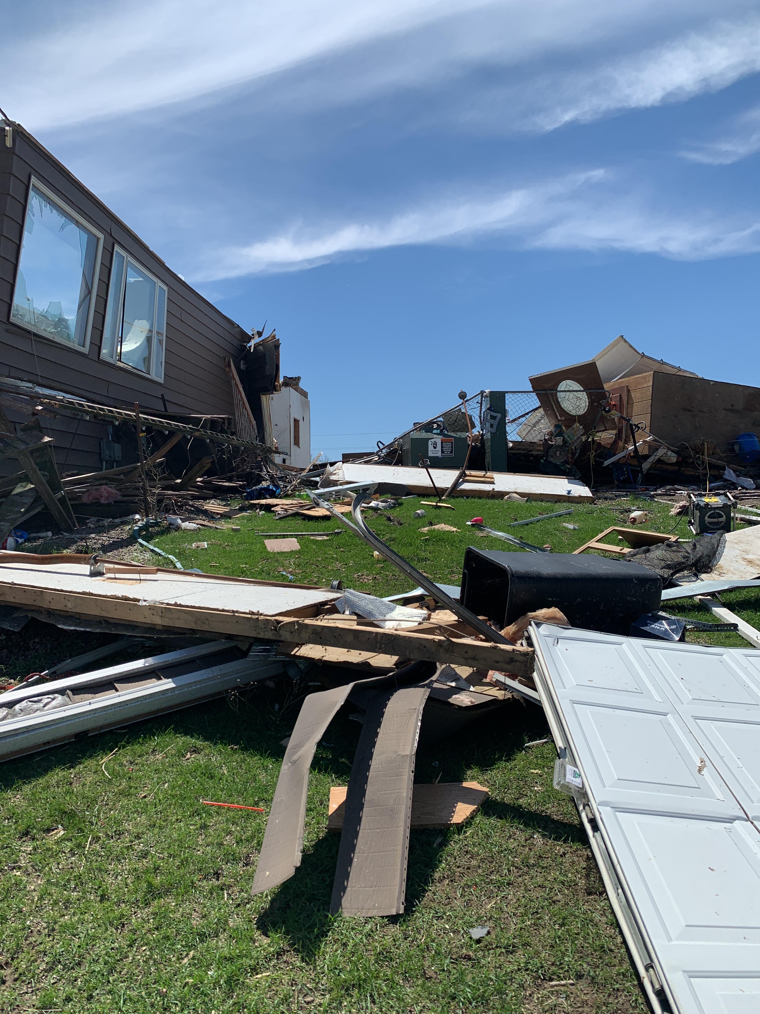
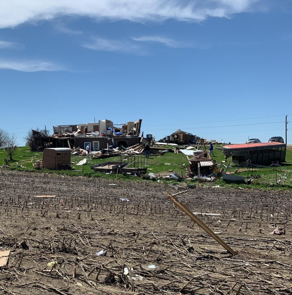
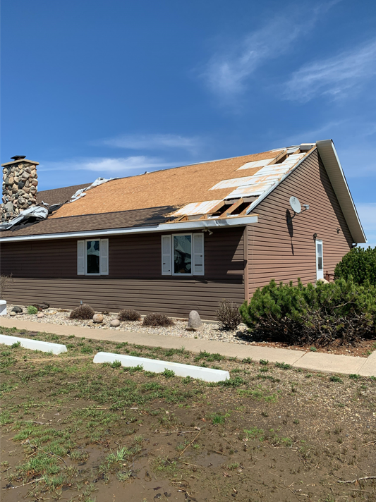
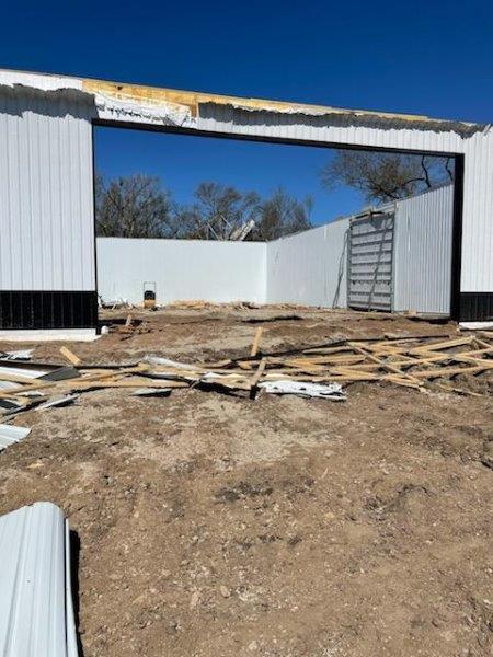
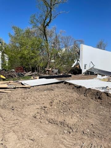
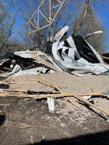
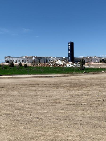
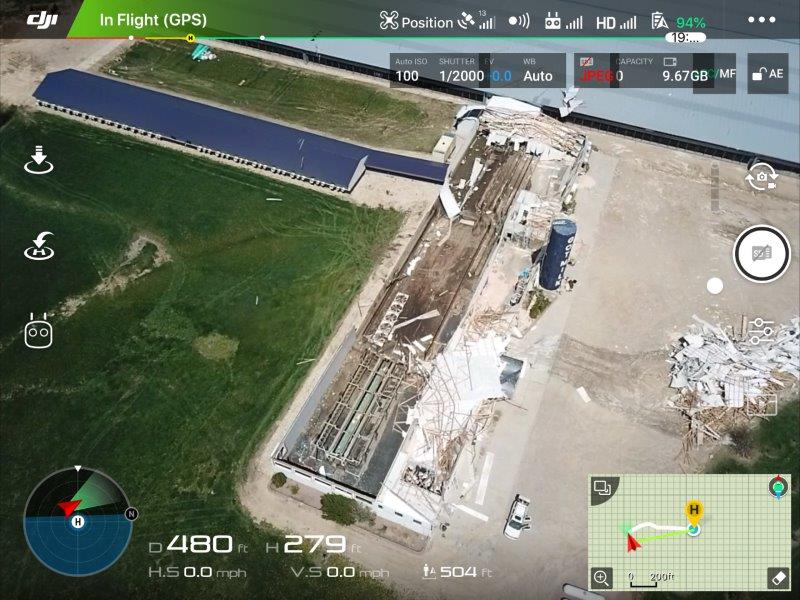
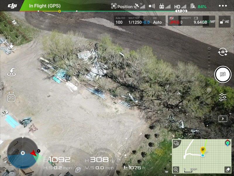
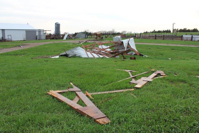
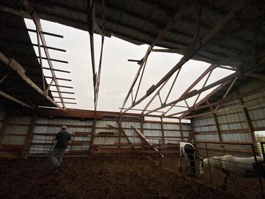
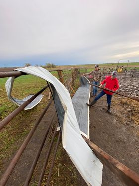
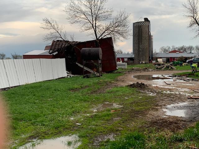
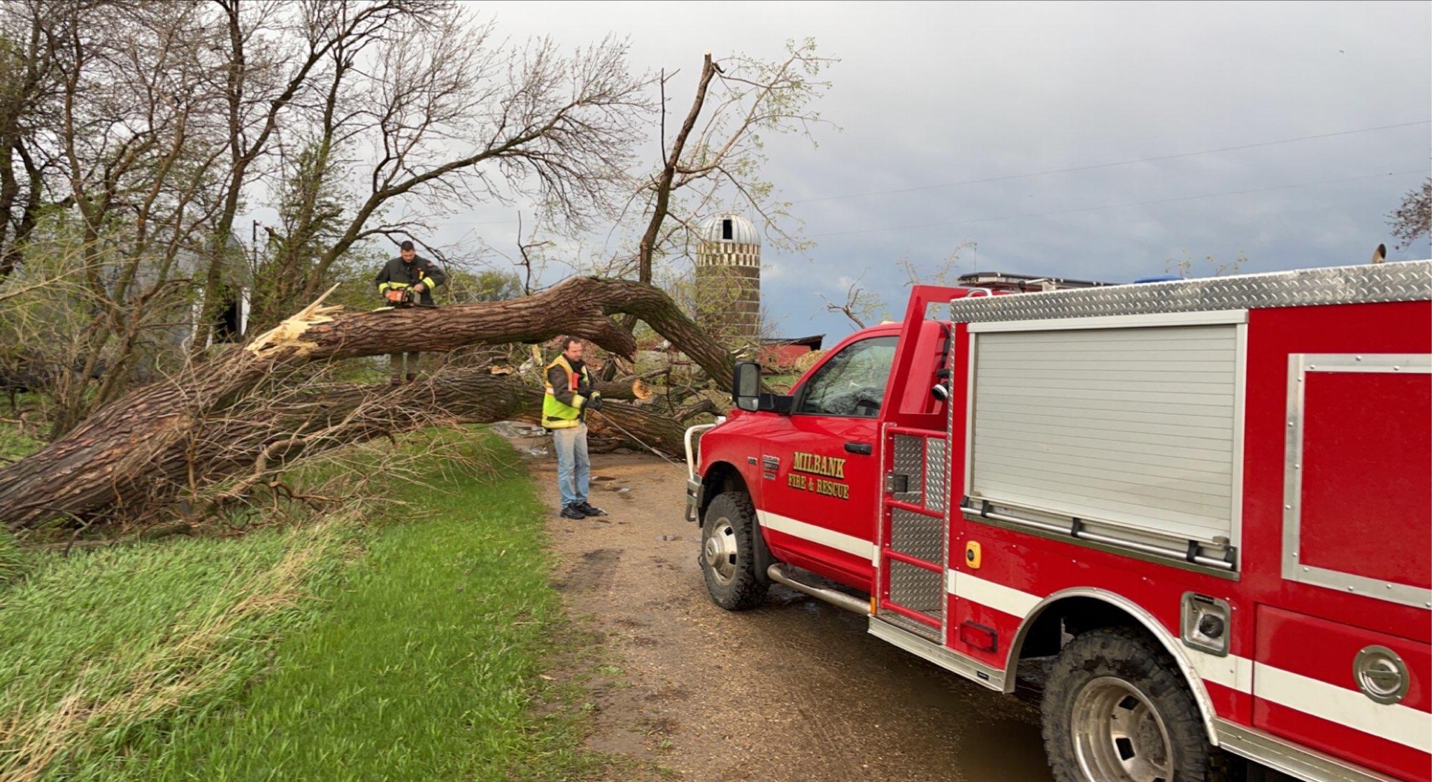
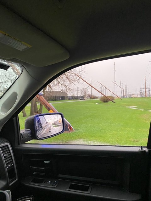
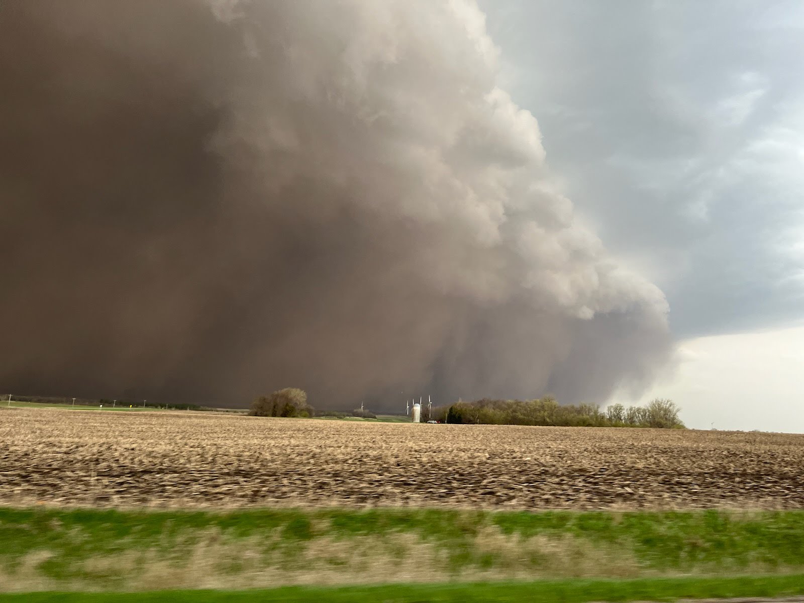
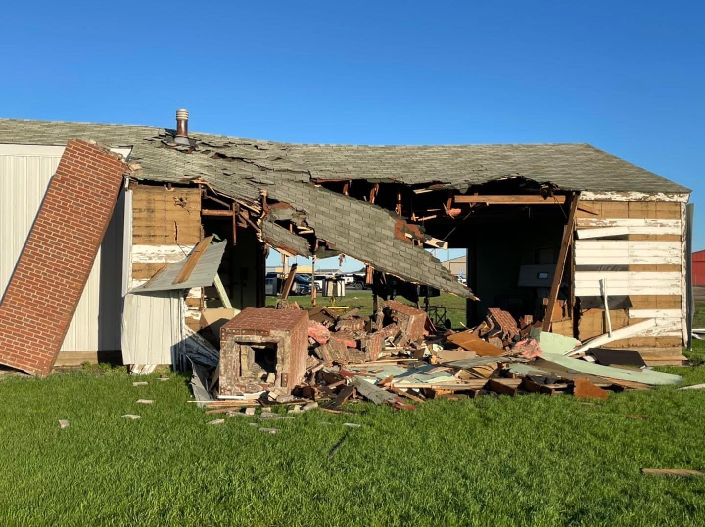
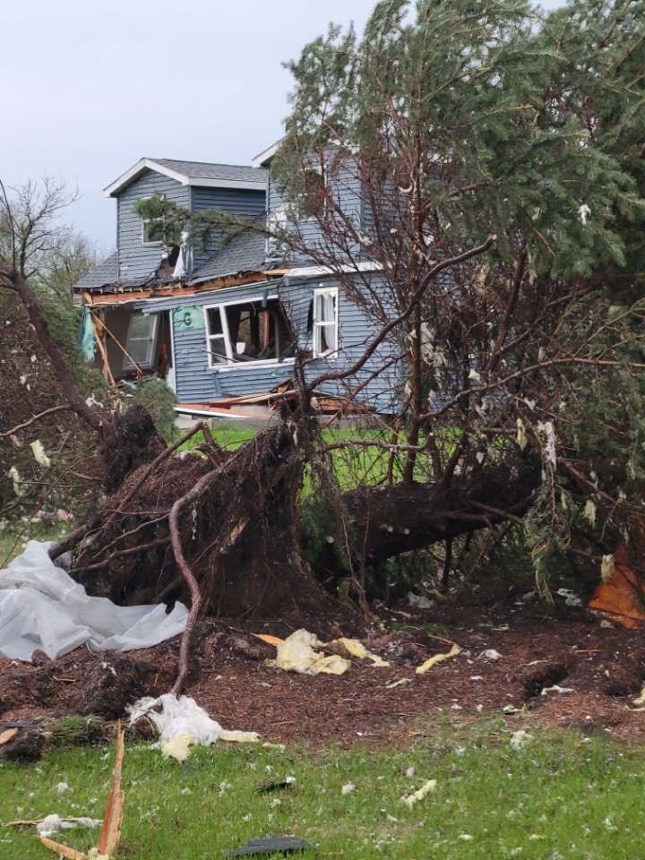
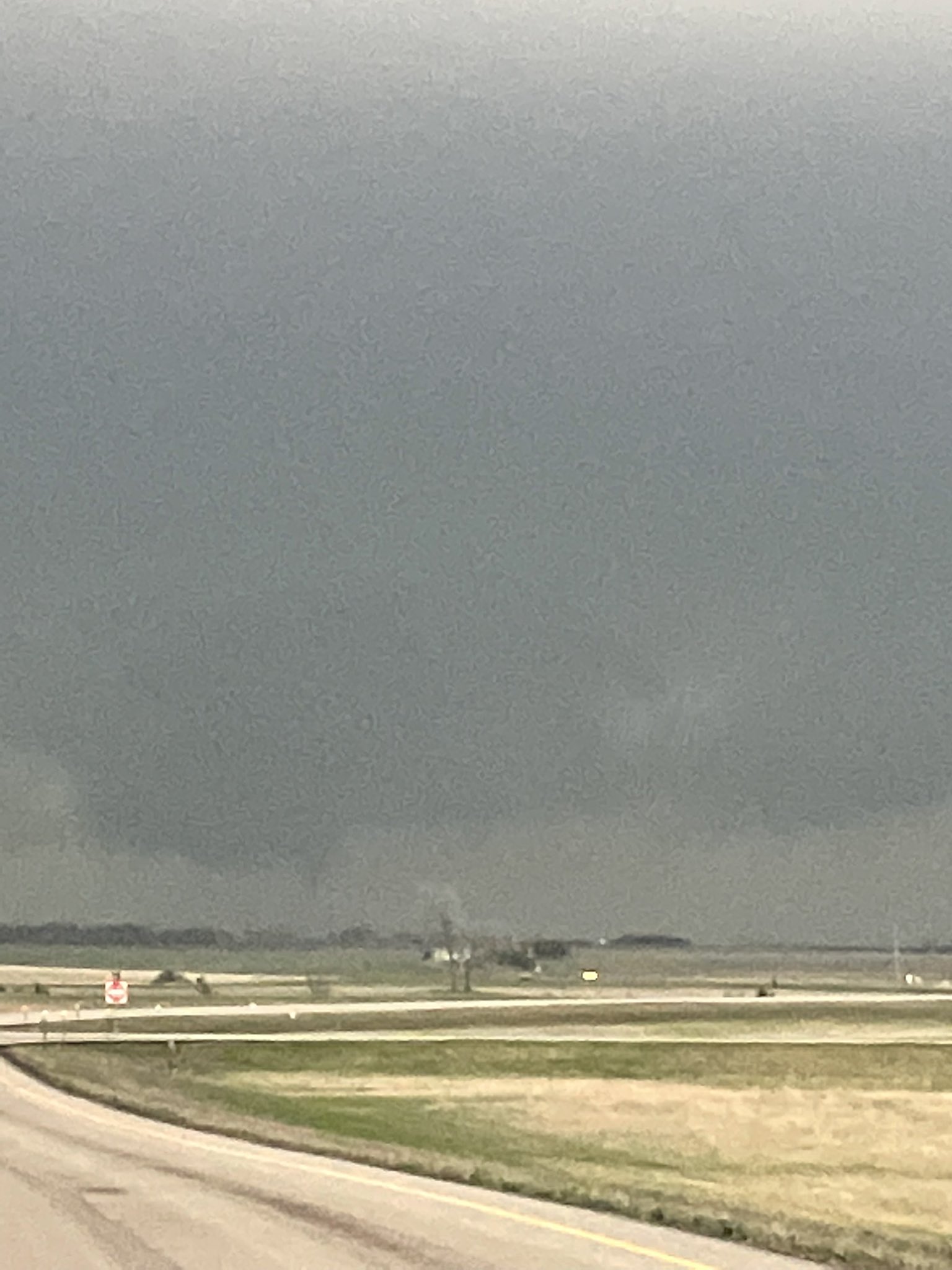
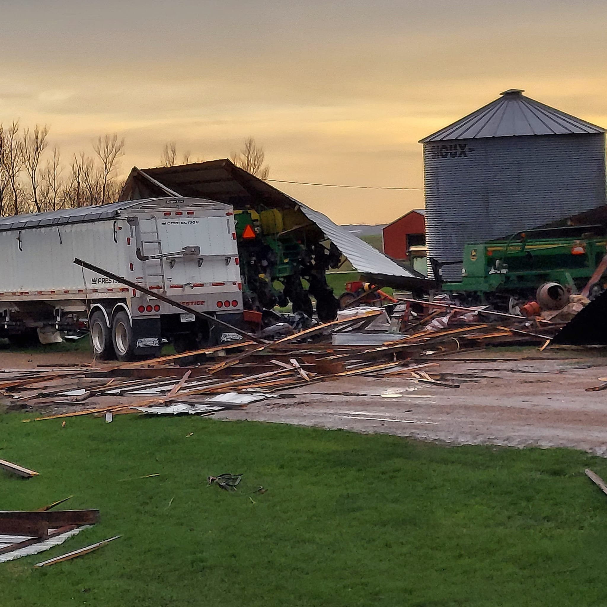
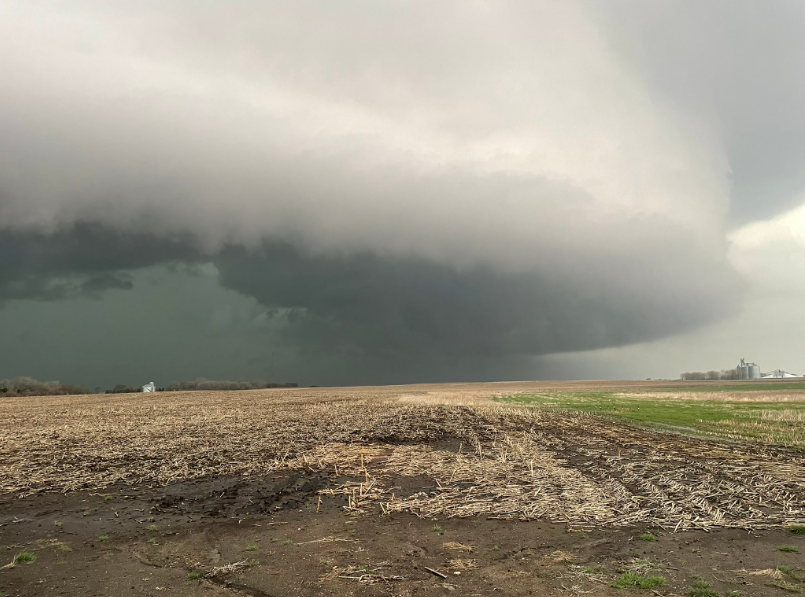
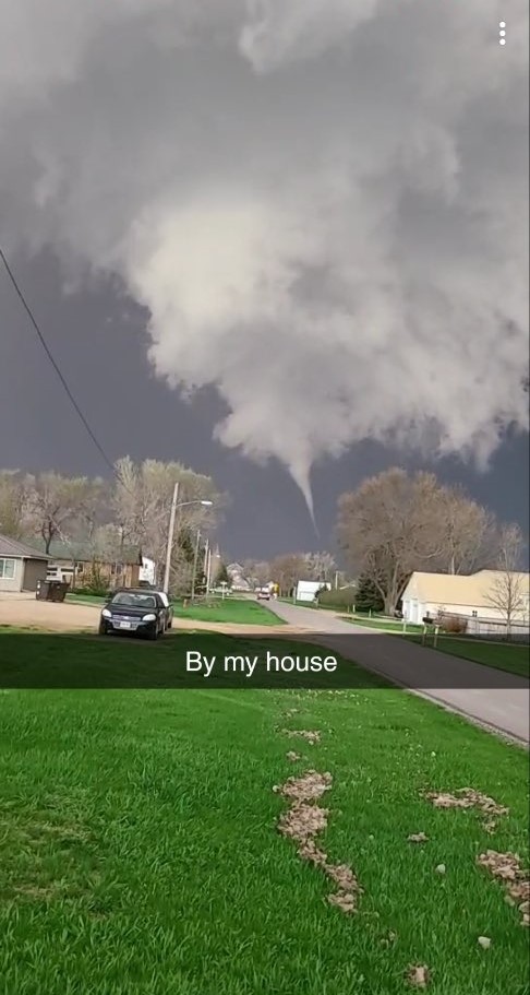
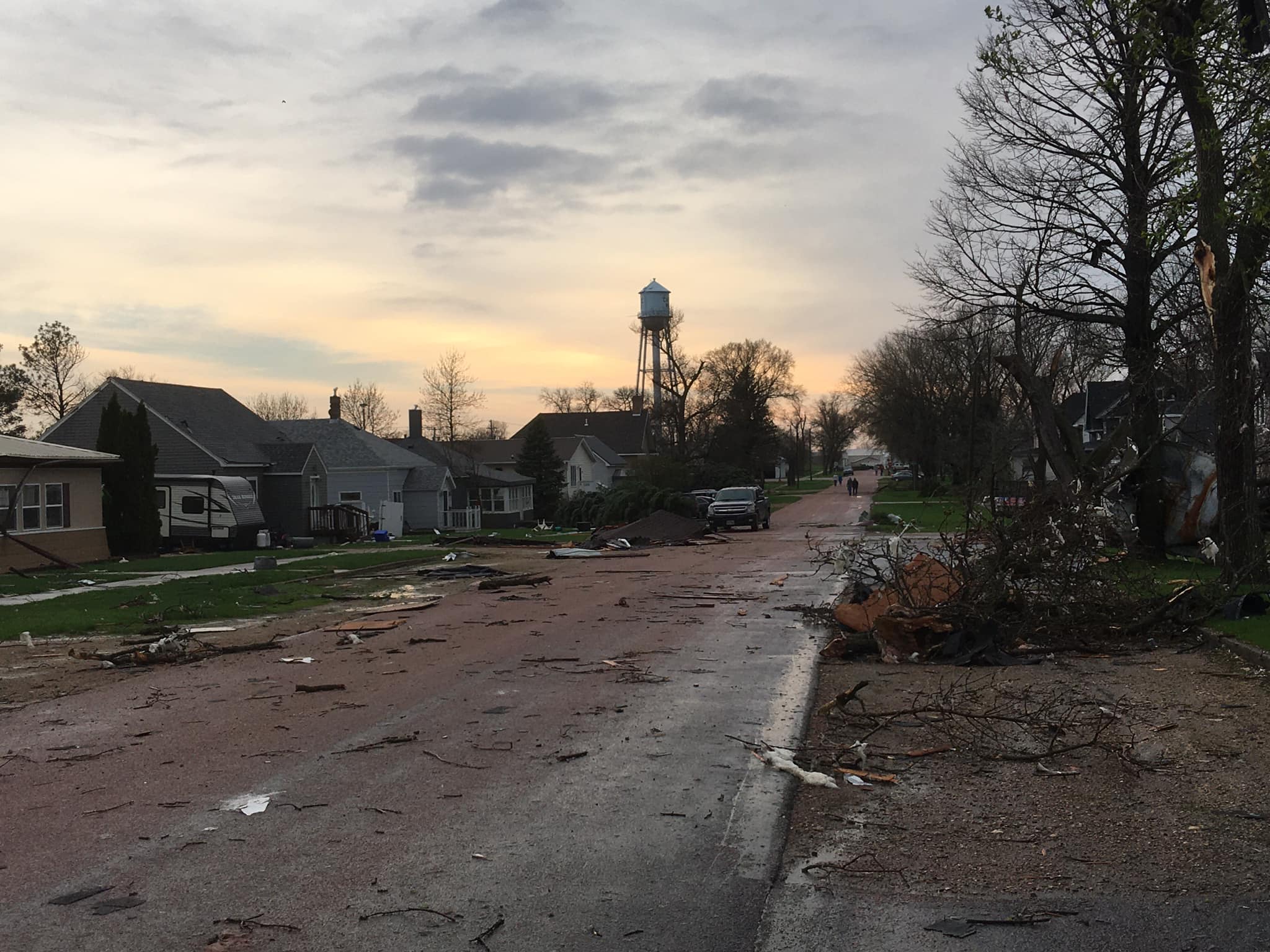
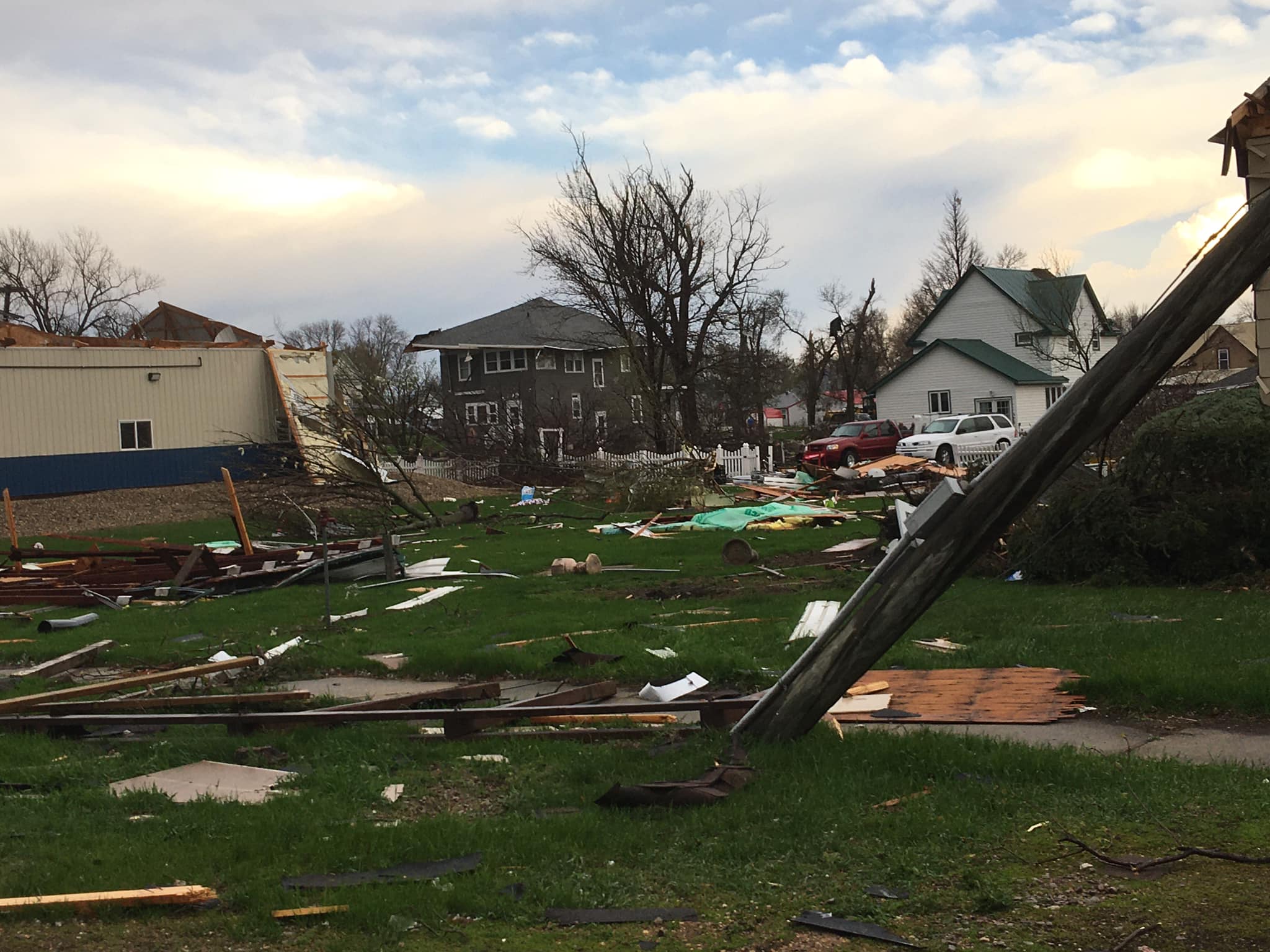
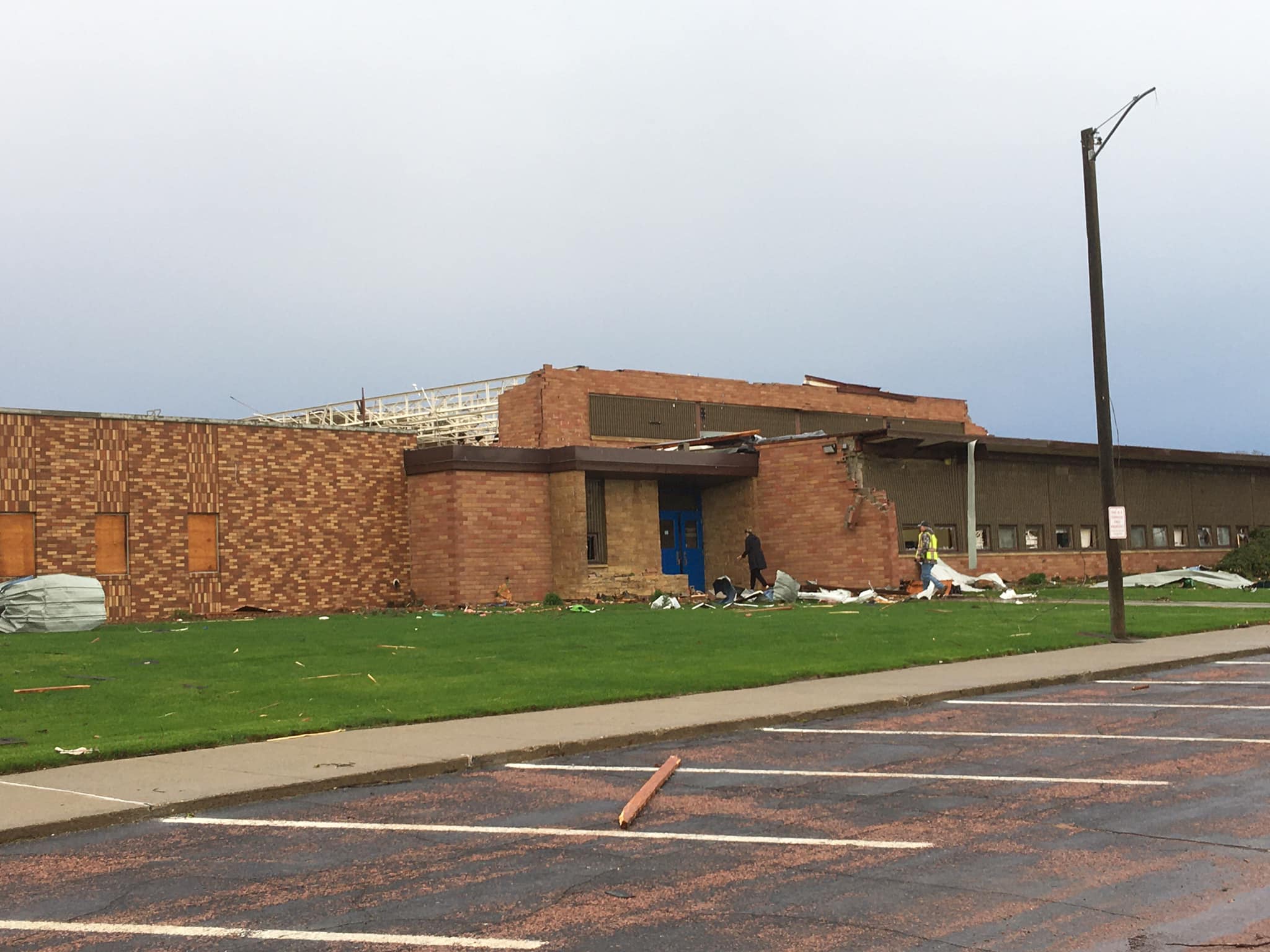
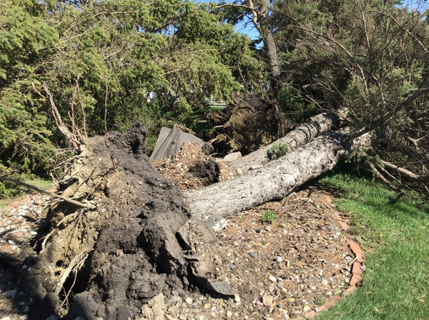
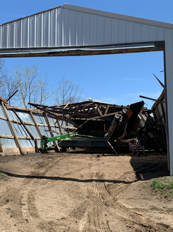
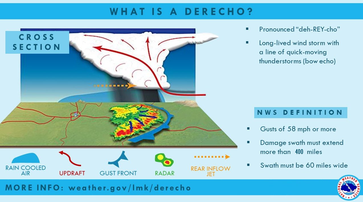
A particularly dangerous storm system known as a derecho moved through the Northern Plains during the late afternoon and early evening hours of Thursday, May 12th, including eastern South Dakota and west central Minnesota. Derechos feature unusually widespread wind damage, and this was the most extreme example on record in terms of the number of measured significant wind gusts. It raced north-northeastward at 50 to 70+ mph, and produced measured straight-line winds of between at 60 to over 100 mph. This is about the same as a category 1 hurricane (74 to 95 mph) and an EF0 to EF1 tornado (65 to 110 mph) over a large area. Significant blowing dust and visibility reductions were also reported, especially across southeastern South Dakota. Additionally, 34 tornadoes have been confirmed: 19 in Minnesota, 13 in South Dakota, and 1 in both North Dakota and Iowa. Some of the worst damage occurred in Hamlin and Deuel counties. An EF2 tornado, with wind speeds up to 120 mph passed through the town of Castlewood, SD. Many significantly damaged or destroyed structures resulted. Another farmstead south of Gary, SD was also devastated by a tornado. At this location wind speeds are estimated at 135 mph, which ranks it as a high end EF2 tornado. Widespread impacts resulted from this storm, including uprooted or snapped trees, significant property damage, power outages, tipped high-profile vehicles, as well as injuries and a couple fatalities across the region. On May 13th, South Dakota Governor Kristi Noem ordered a State of Emergency for storm response and ordered state personnel and resources to communities impacted by the damaging storms. A Presidential Disaster Declaration was later approved for South Dakota. The National Centers for Environmental Information, NCEI, determined this to be a billion-dollar disaster event. |
|
Tornadoes
|
Tornado #1 - Castlewood, SD
Track Map 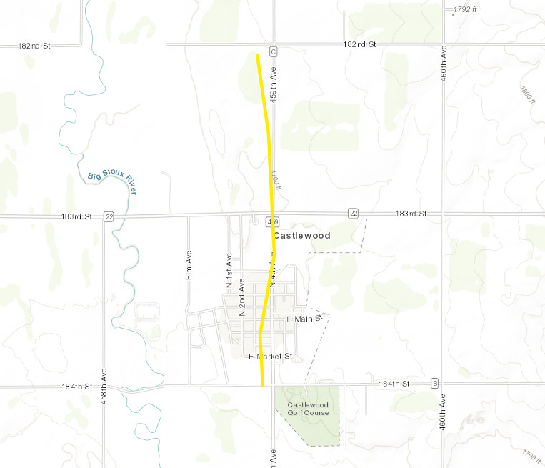 
|
||||||||||||||||
|
||||||||||||||||
|
Tornado #2 - 1 mi south of Gary, SD
Track Map 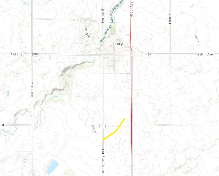
|
||||||||||||||||
|
||||||||||||||||
|
Tornado #3 - 6 mi WNW of Rauville, SD
Track Map 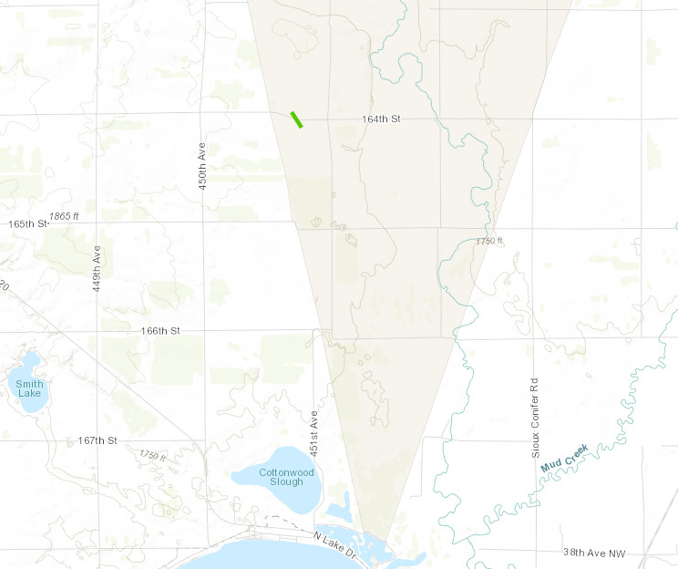
|
||||||||||||||||
|
||||||||||||||||
|
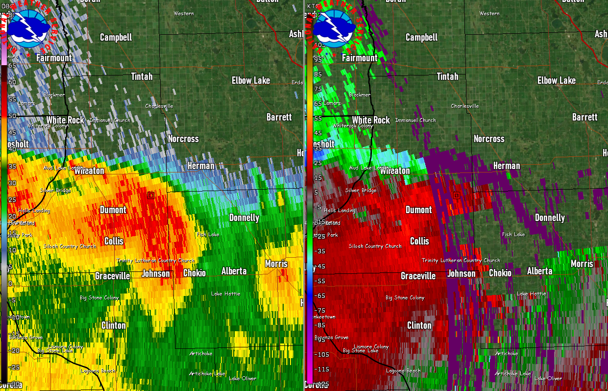
Tornado #4 - 5 mi east of Dumont, MN
Track Map 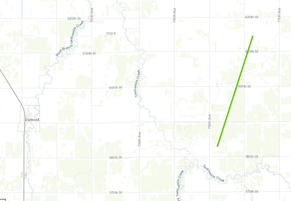
|
||||||||||||||||
|
||||||||||||||||
|
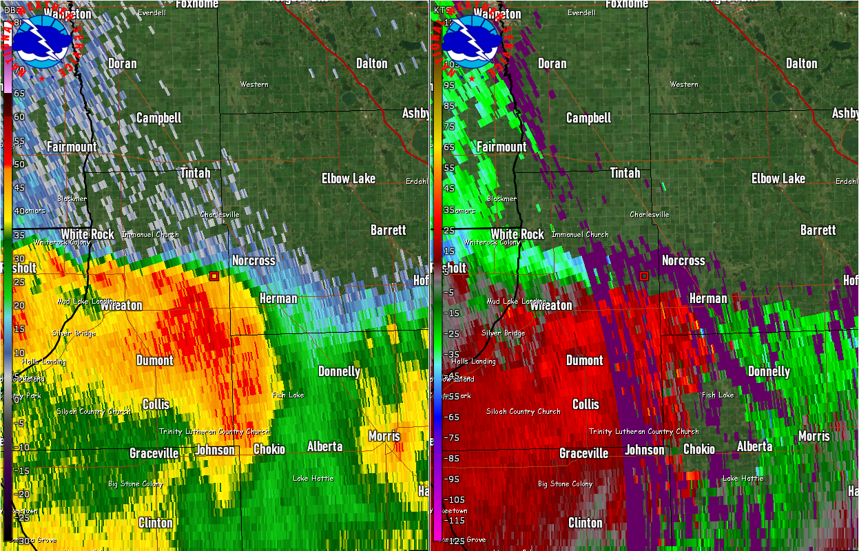
Tornado #5 - 4 mi NW of Norcross, MN
Track Map 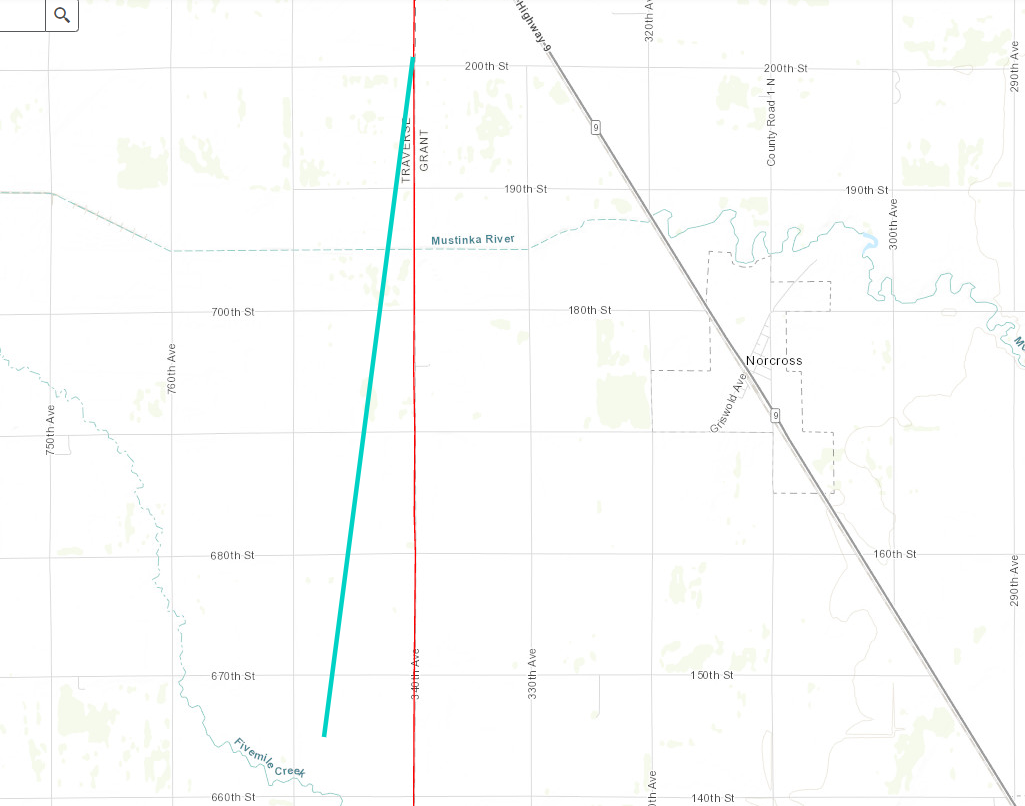
|
||||||||||||||||
|
||||||||||||||||
|
Tornado #6 - 1 m east of Tunerville, SD
Track Map 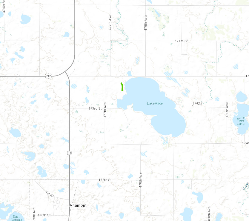
|
||||||||||||||||
|
||||||||||||||||
|
Tornado #7 - 7 mi south of Webster, SD
Track Map 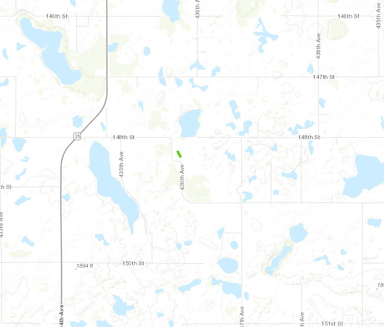
|
||||||||||||||||
|
||||||||||||||||
|
Tornado #8 - 4 mi WSW of Thomas, SD
Track Map 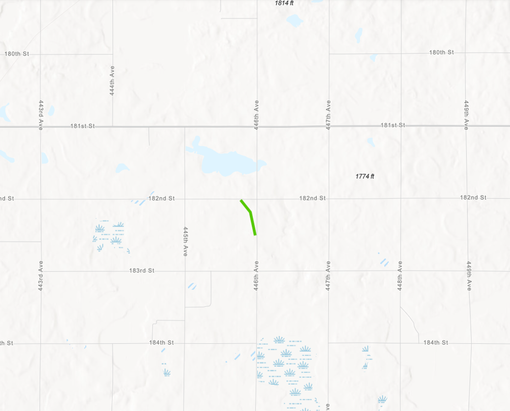
|
||||||||||||||||
|
||||||||||||||||
|
Tornado #9 - 3 mi ESE of Estelline, SD
Track Map 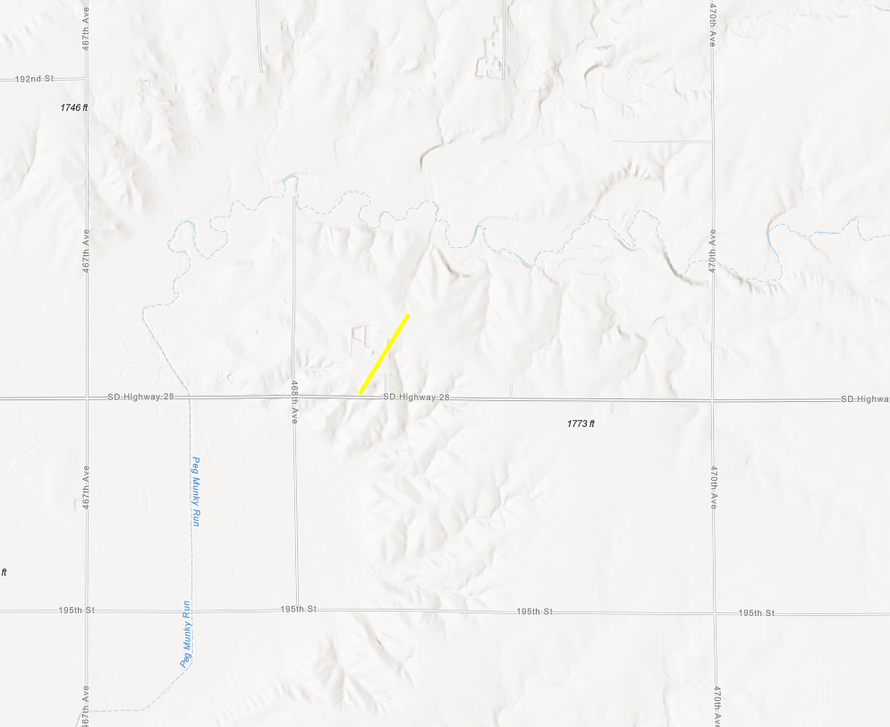
|
||||||||||||||||
|
||||||||||||||||
|
Tornado #10 - 3 N Garden City, SD
Track Map 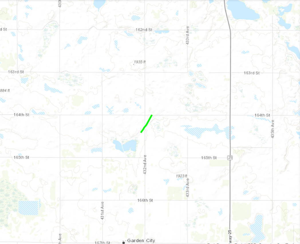
|
||||||||||||||||
|
||||||||||||||||
|
Tornado #11 - 4 mi NNW Naples, SD
Track Map 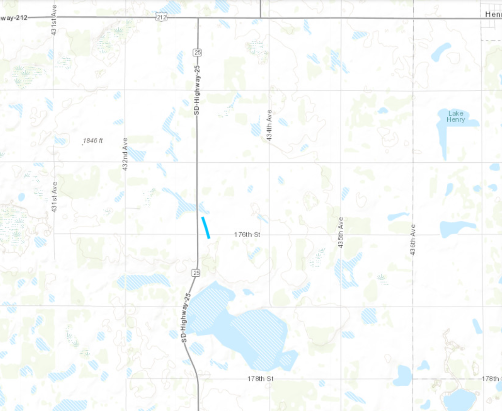
|
||||||||||||||||
|
||||||||||||||||
|
Tornado #12 - 5 mi NNE of Raymond, SD
Track Map 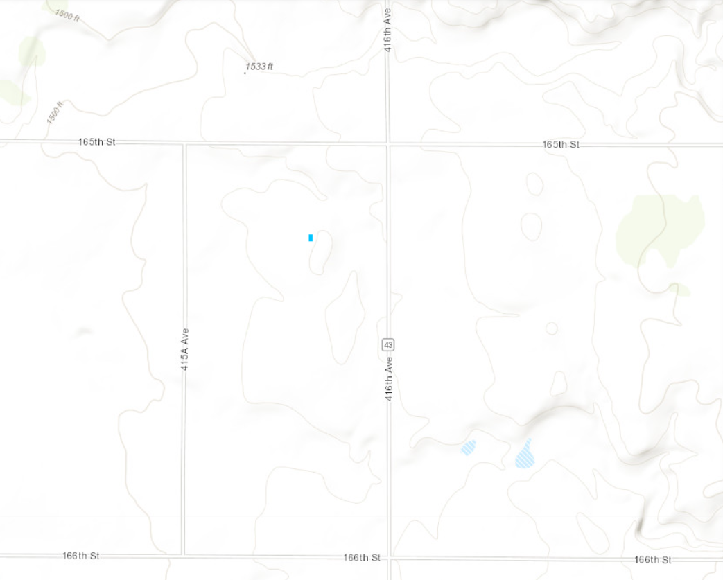
|
||||||||||||||||
|
||||||||||||||||
|
Tornado #13 - 2 mi NW of Gary, SD
Track Map 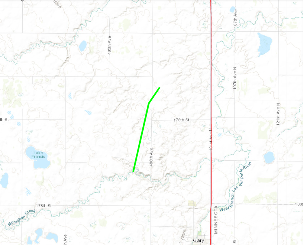
|
||||||||||||||||
|
||||||||||||||||
|
Tornado #14 - 2 mi NW of Nassau, MN
Track Map 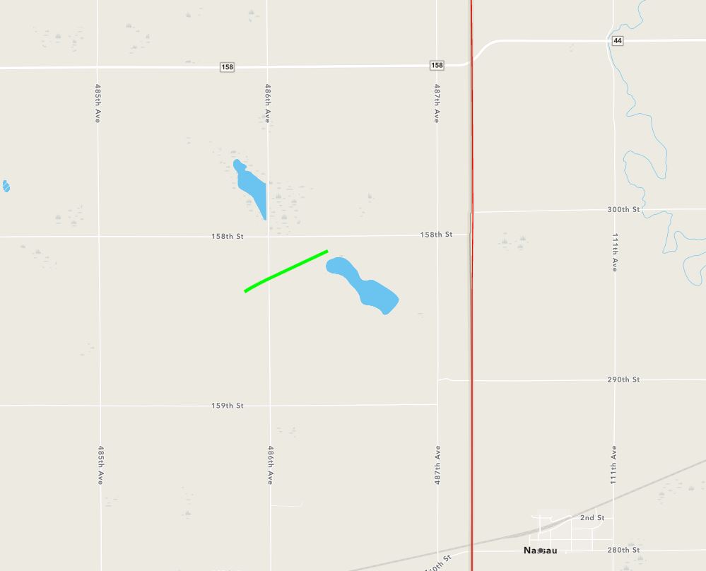
|
||||||||||||||||
|
||||||||||||||||
|
Tornado #15 - 1 mi NNE of Twin Brooks, SD
Track Map 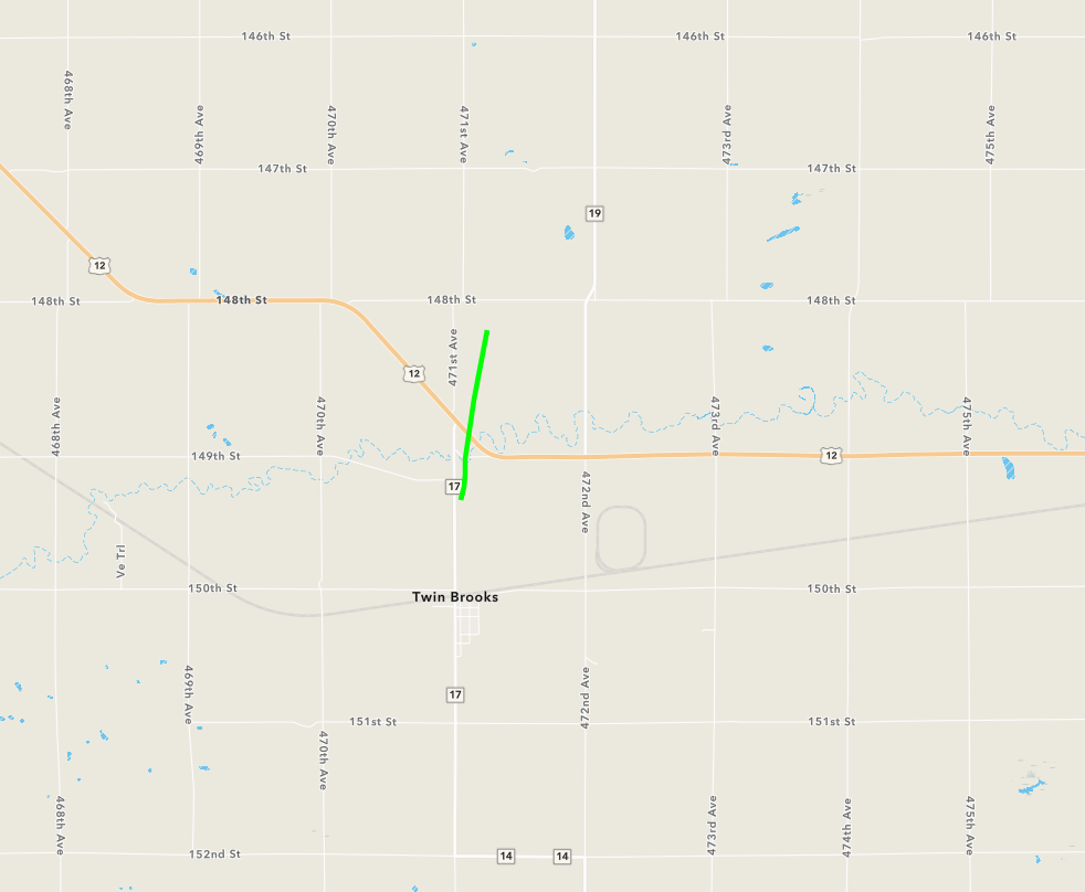
|
||||||||||||||||
|
||||||||||||||||
|
Tornado #16 - 5 mi S of New Effington, SD
Track Map 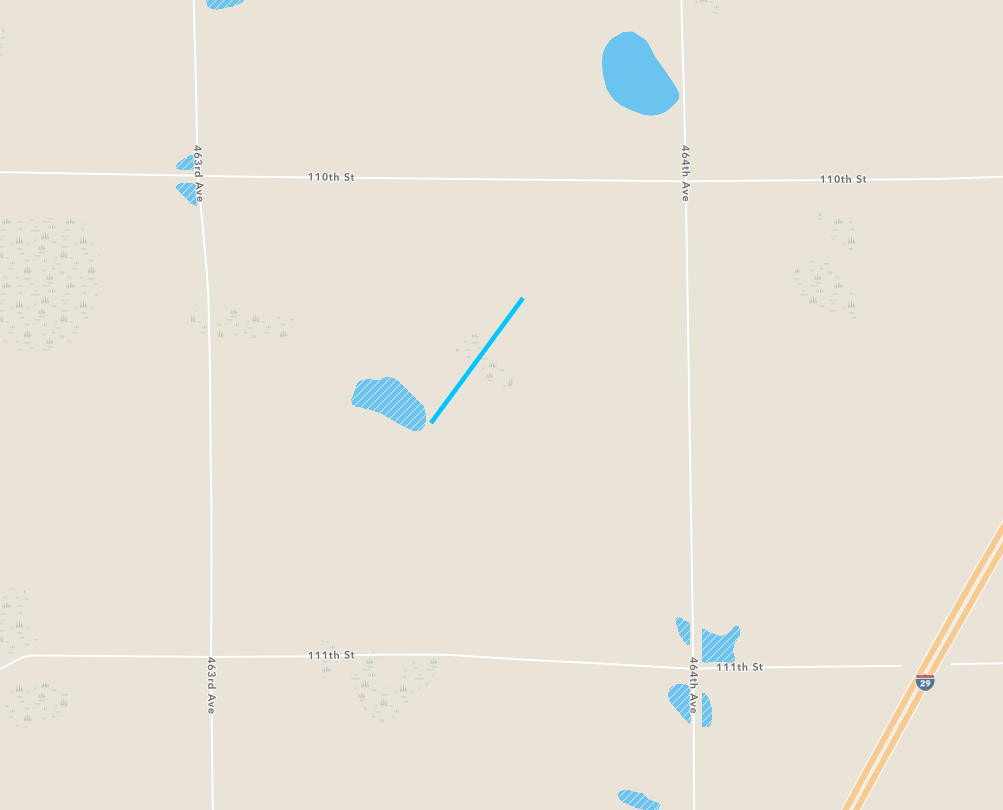
|
||||||||||||||||
|
||||||||||||||||
The Enhanced Fujita (EF) Scale classifies tornadoes into the following categories:
| EF0 Weak 65-85 mph |
EF1 Moderate 86-110 mph |
EF2 Significant 111-135 mph |
EF3 Severe 136-165 mph |
EF4 Extreme 166-200 mph |
EF5 Catastrophic 200+ mph |
 |
|||||
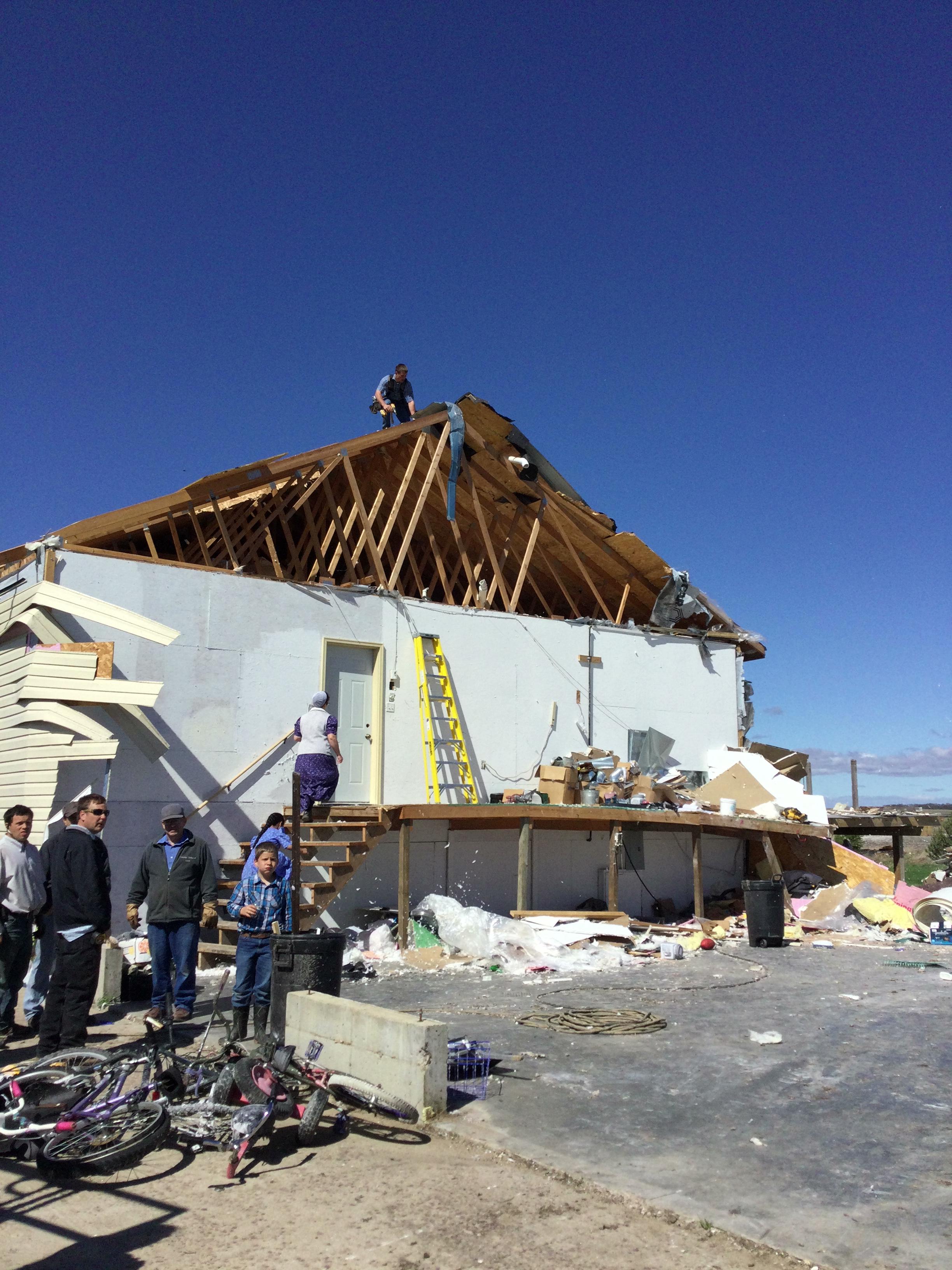
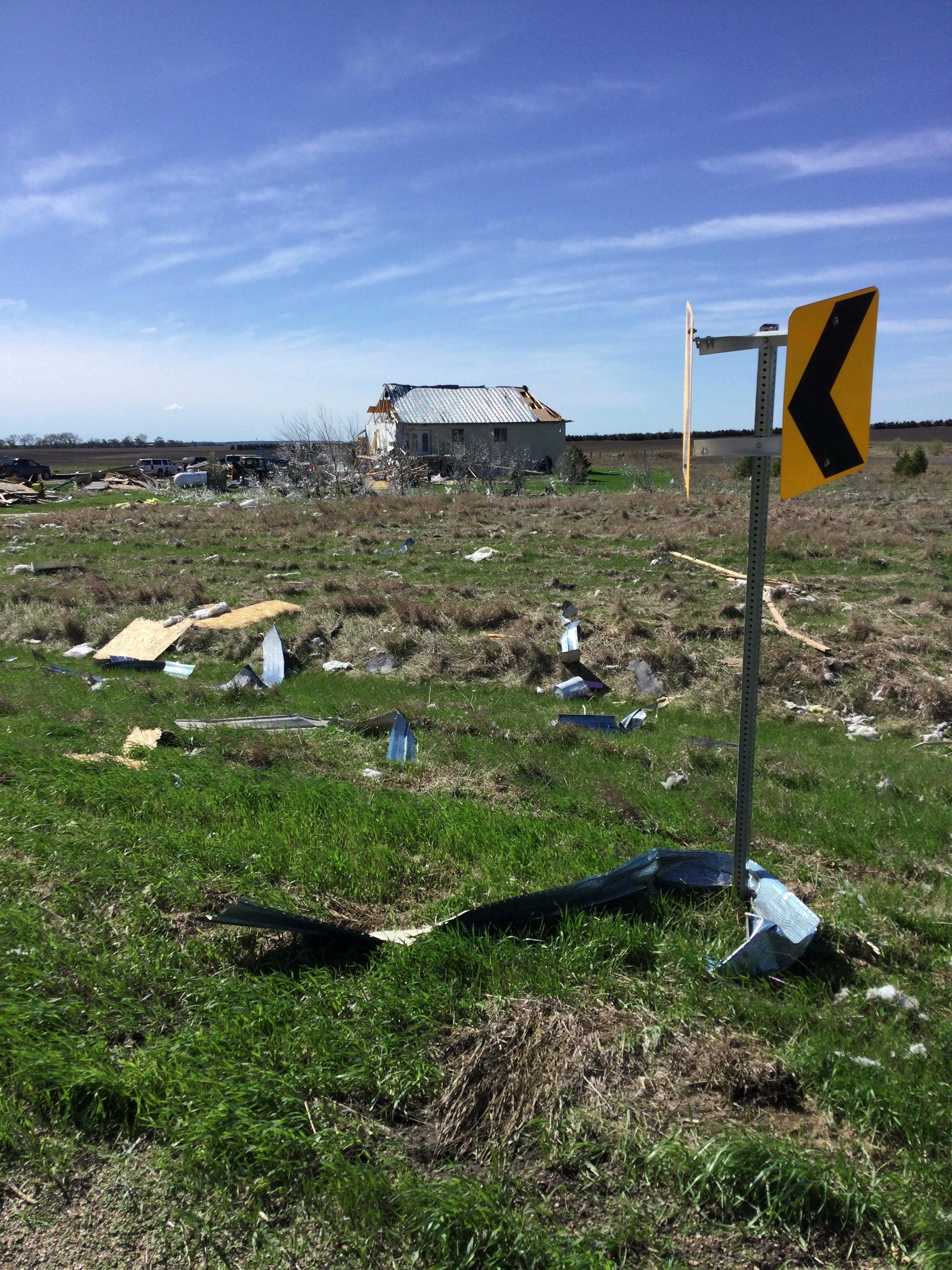
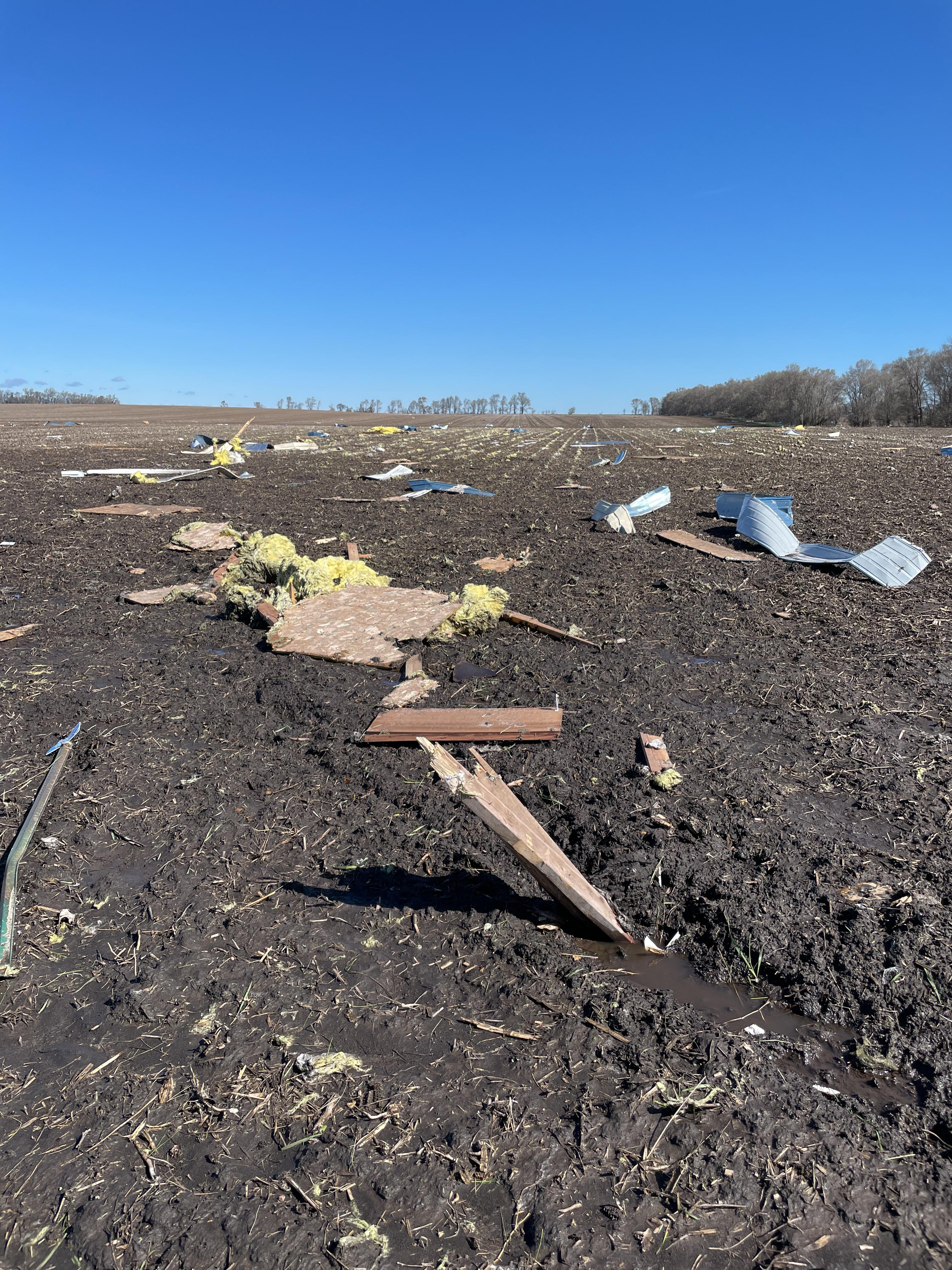
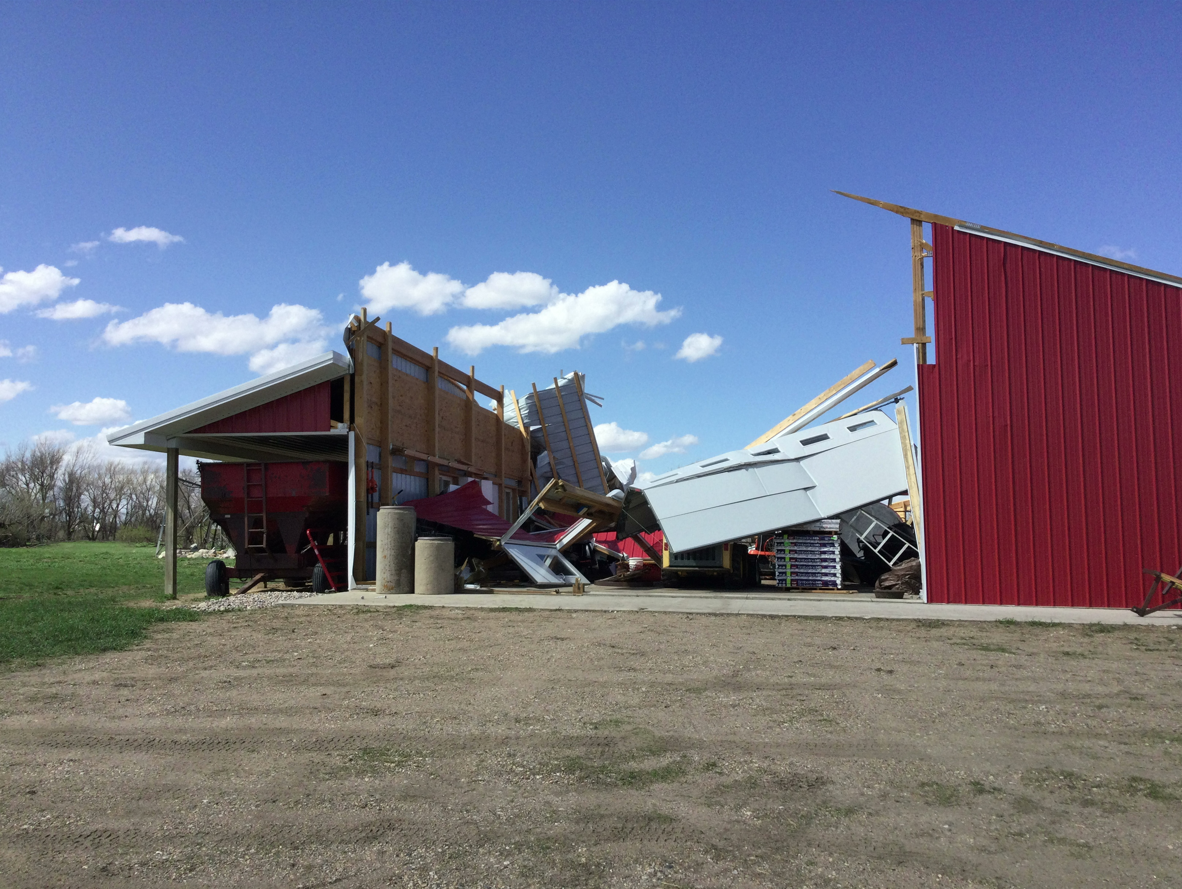
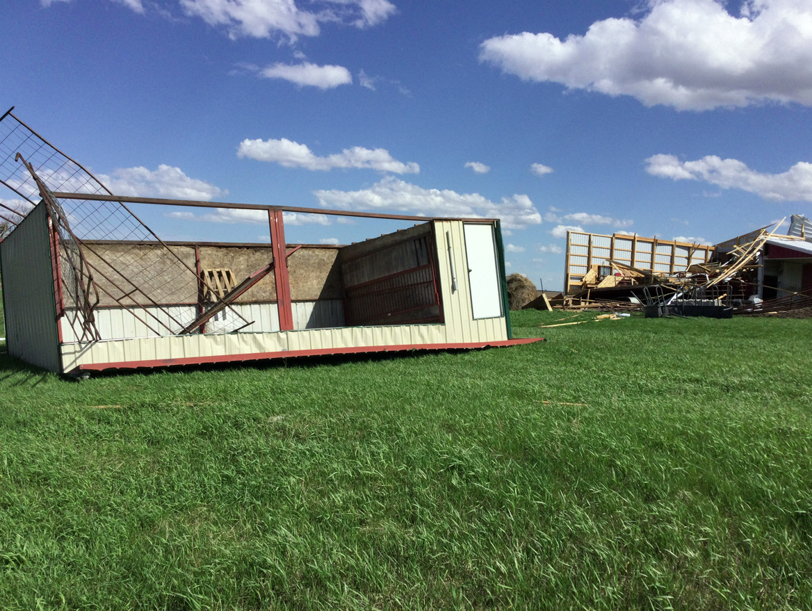
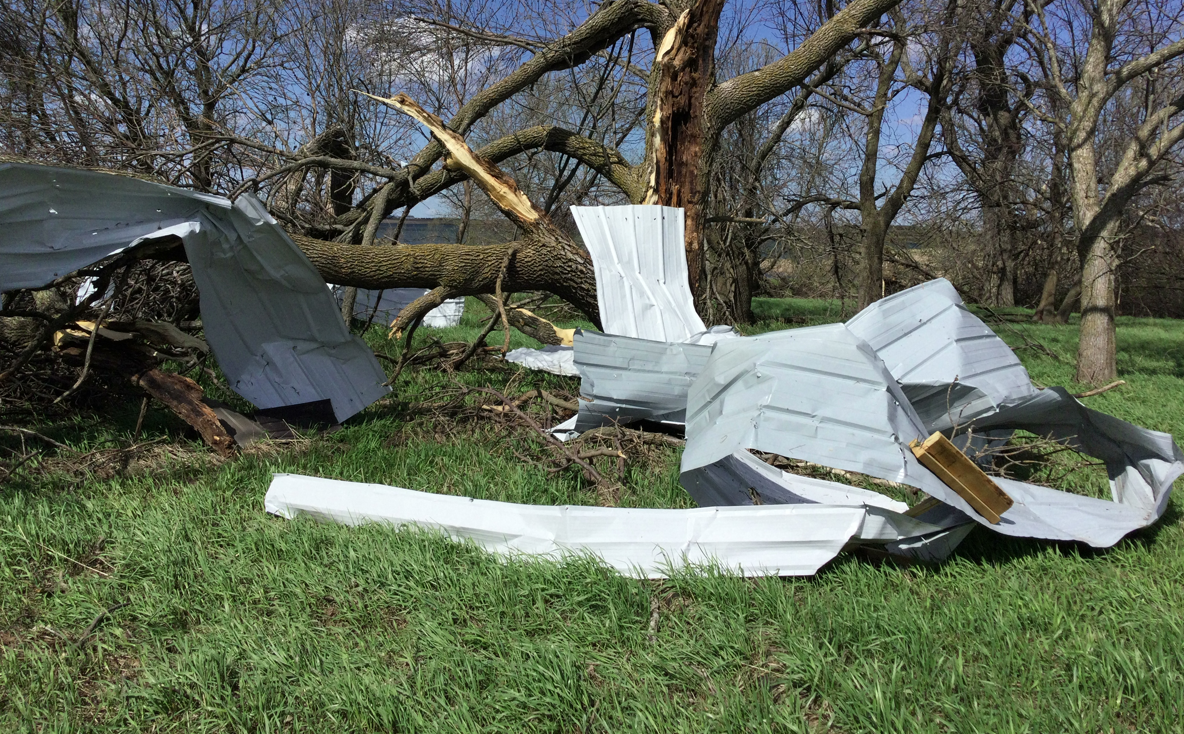
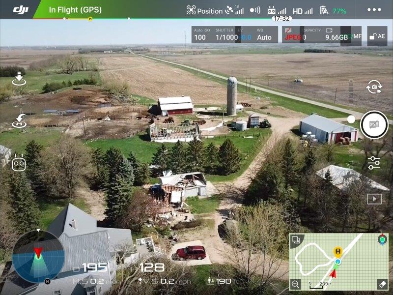
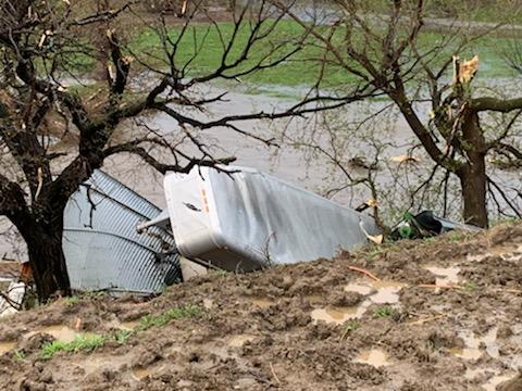
Photos & Video
Thank you to everyone who provided ground-truth during and after the storm. You are part of the process that aims to save life and property.
 |
 |
 |
|
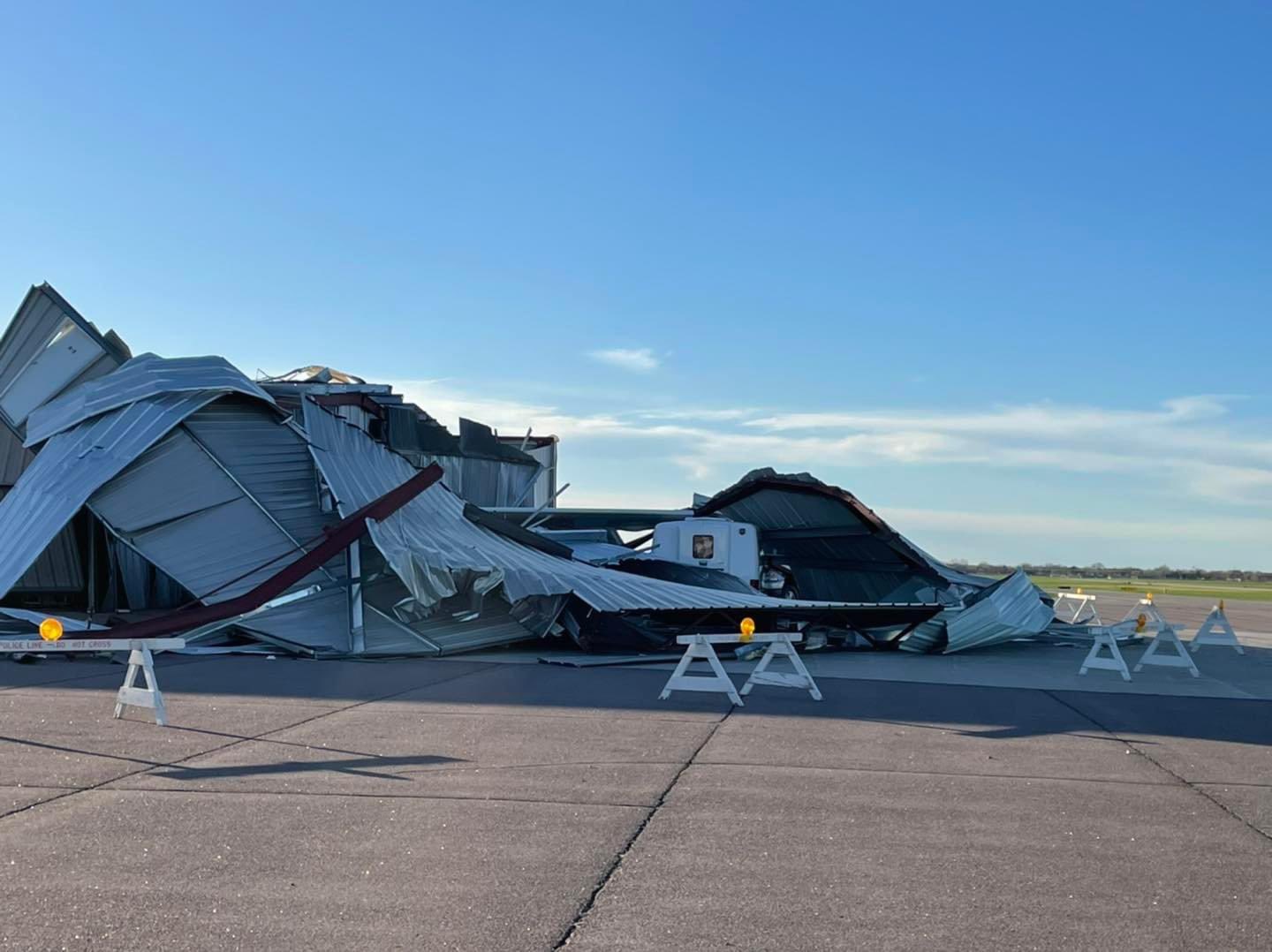
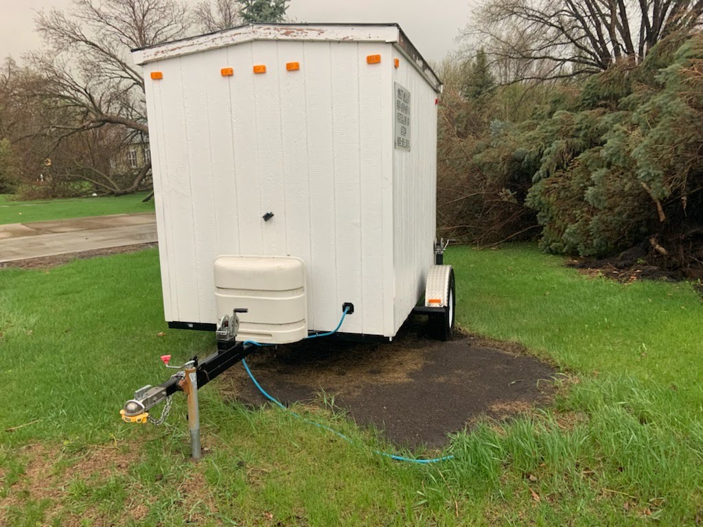
| Time lapse of the storm and dust as it approaches Sioux Falls, as seen from the airport. Video courtesy of NWS Sioux Falls | Near Astoria at 5:30pm, courtesy of Kyle Coners with the Astoria Fire Department. The dust seen here was blown in from the drought areas of southeastern South Dakota and northeastern Nebraska. | Tree damage at Lake Kampeska. Photo courtesy of Aaron Newns | Damage in Watertown. Photo courtesy of Alex Resel |
 |
 |
 |
 |
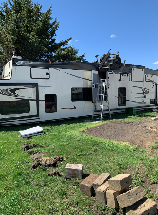
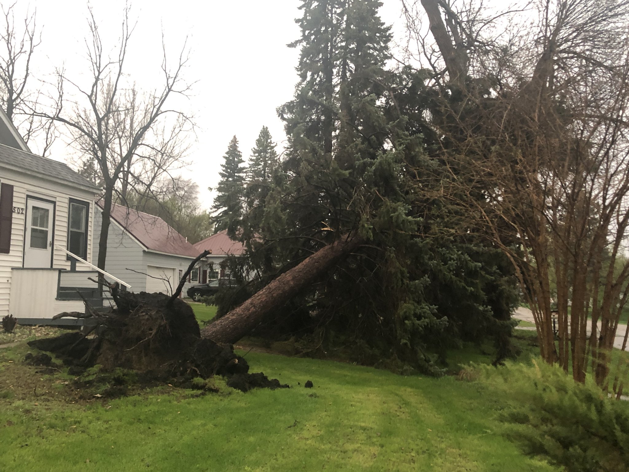
| Damage in Watertown. Photo courtesy of Alex Resel | One of several uprooted trees in Big Stone City. Photo courtesy of Ben Penner | Camper tipped at the Lake Traverse Resort. Photo passed along by Brent Nathaniel | Tornado damage in Castlewood. Photo courtesy of Brittany Davis |
 |
 |
 |
 |
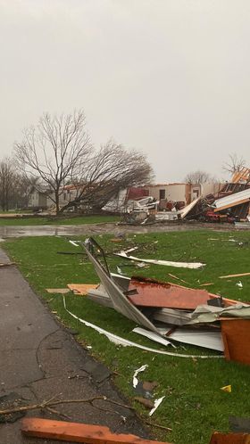
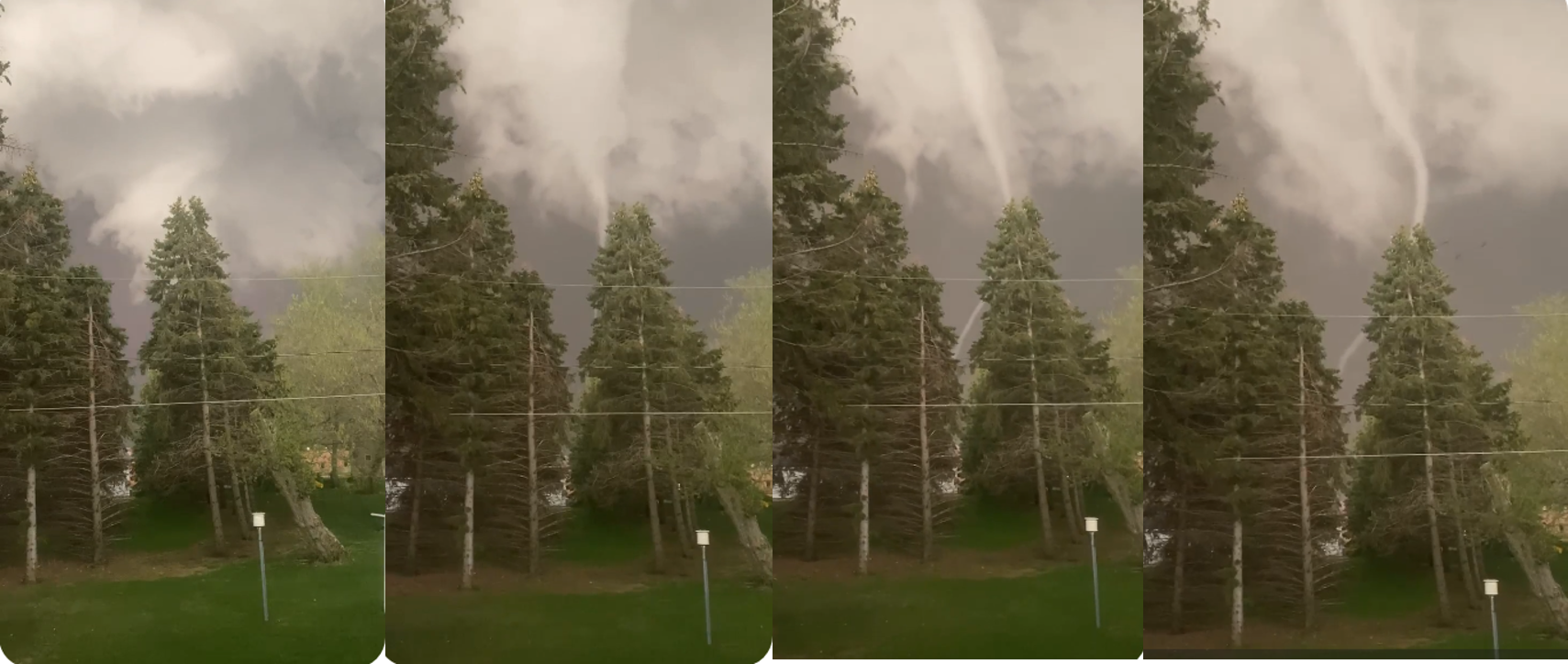
| Series of photos of the Castlewood tornado, courtesy of Brittany Davis | Tornado damage in Castlewood. Photo courtesy of Bailey and Jayce Zubke | Tornado damage in Castlewood. Photo courtesy of Kendall Nielsen | Tornado north of Sisseton. Photo courtesy of Cassidy Holth |
 |
 |
 |
 |
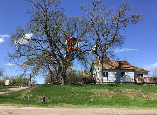
| Tornado north of Sisseton. Photo courtesy of Dillon Vogt | Damage west of Summit. Photo courtesy of Cheri Zirbel | Multiple billboards destroyed on I29 southeast of Watertown. Photo courtesy of Derek Thompson | The derecho's shelf cloud as seen looking west of Clark at 541pm. Photo courtesy of Justin Irlbeck |
 |
 |
 |
 |
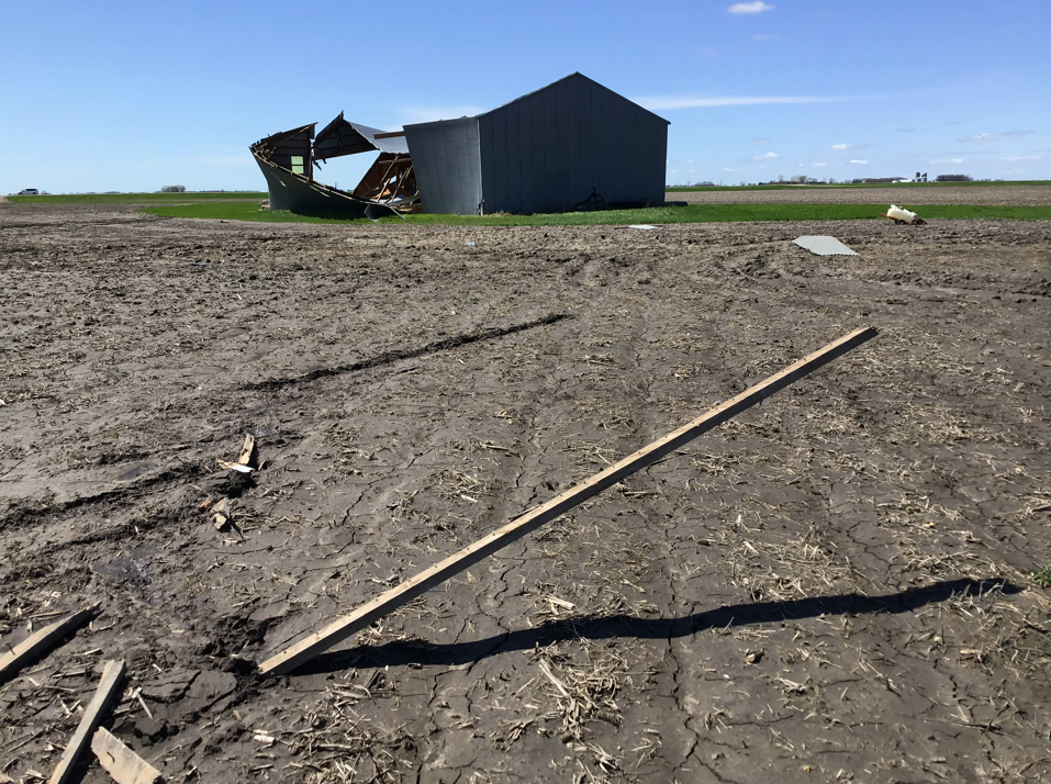
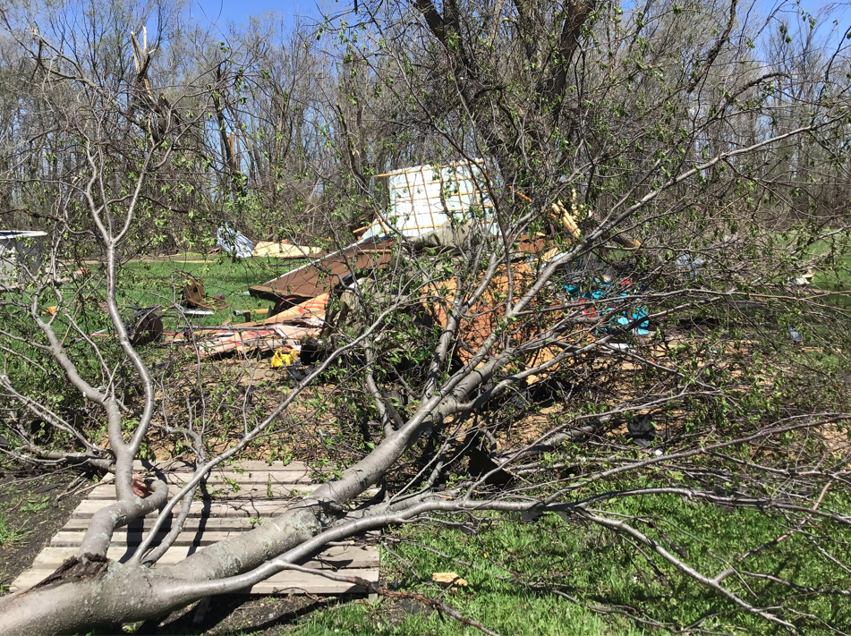
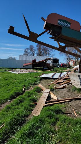
| Damage in Estelline. Photo courtesy of Matt Willis | Damage in Estelline. Photo courtesy of Matt Willis | Damage near Dumont. Photo courtesy of Steven Escher | Castlewood tornado. Photo courtesy of Troy Johnson |
 |
 |
.jpg) |
 |
| Damage at the Memorial Park in Watertown. Photo courtesy of Kari Blais Meyerink | Tornado damage in Castlewood. Photo courtesy of Chris Schmidt | Tornado damage in Castlewood. Photo courtesy of Chris Schmidt | Tornado damage in Castlewood. Photo courtesy of Chris Schmidt |
 |
 |
 |
 |
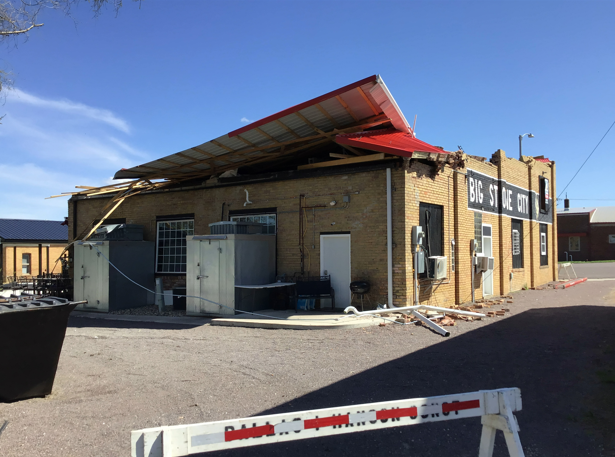
| Tornado damage in Castlewood. Photo courtesy of Chris Schmidt | Semi truck tipped in Big Stone County. Photo courtesy of the Sheriff | Damage in Big Stone City | Damage in Big Stone City |
 |
 |
|
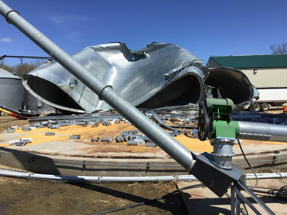
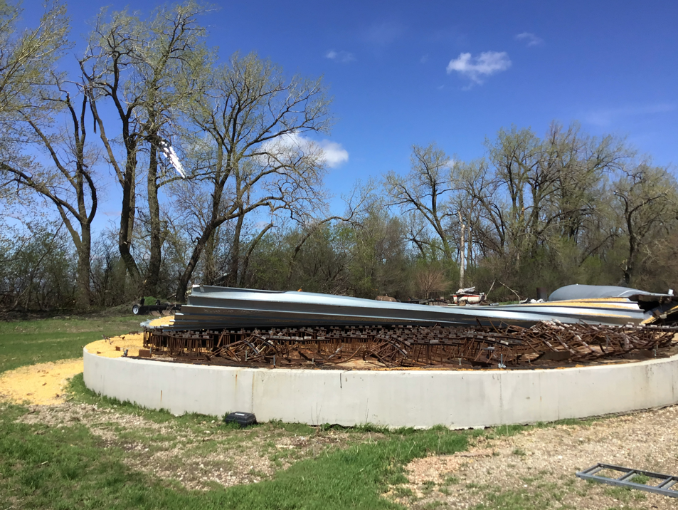
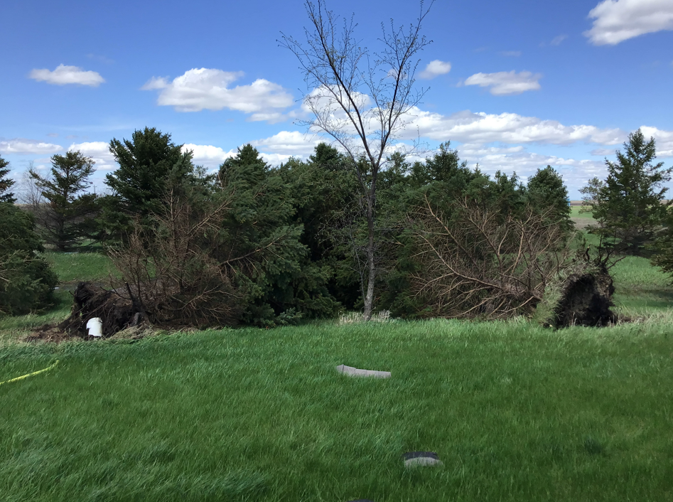
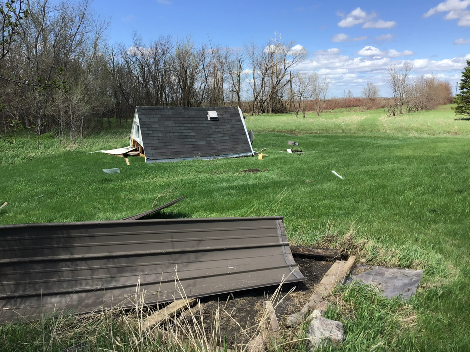
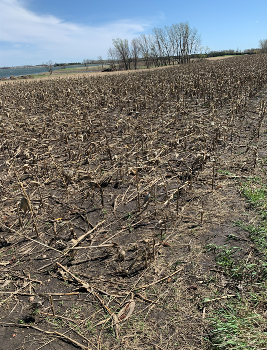
Countless other locations had significant damage from the storms as well. |
| An all-too common sight in Rosholt | Damage east of Clear Lake | Power line damage in Codington County. Photo courtesy of the sheriff. |
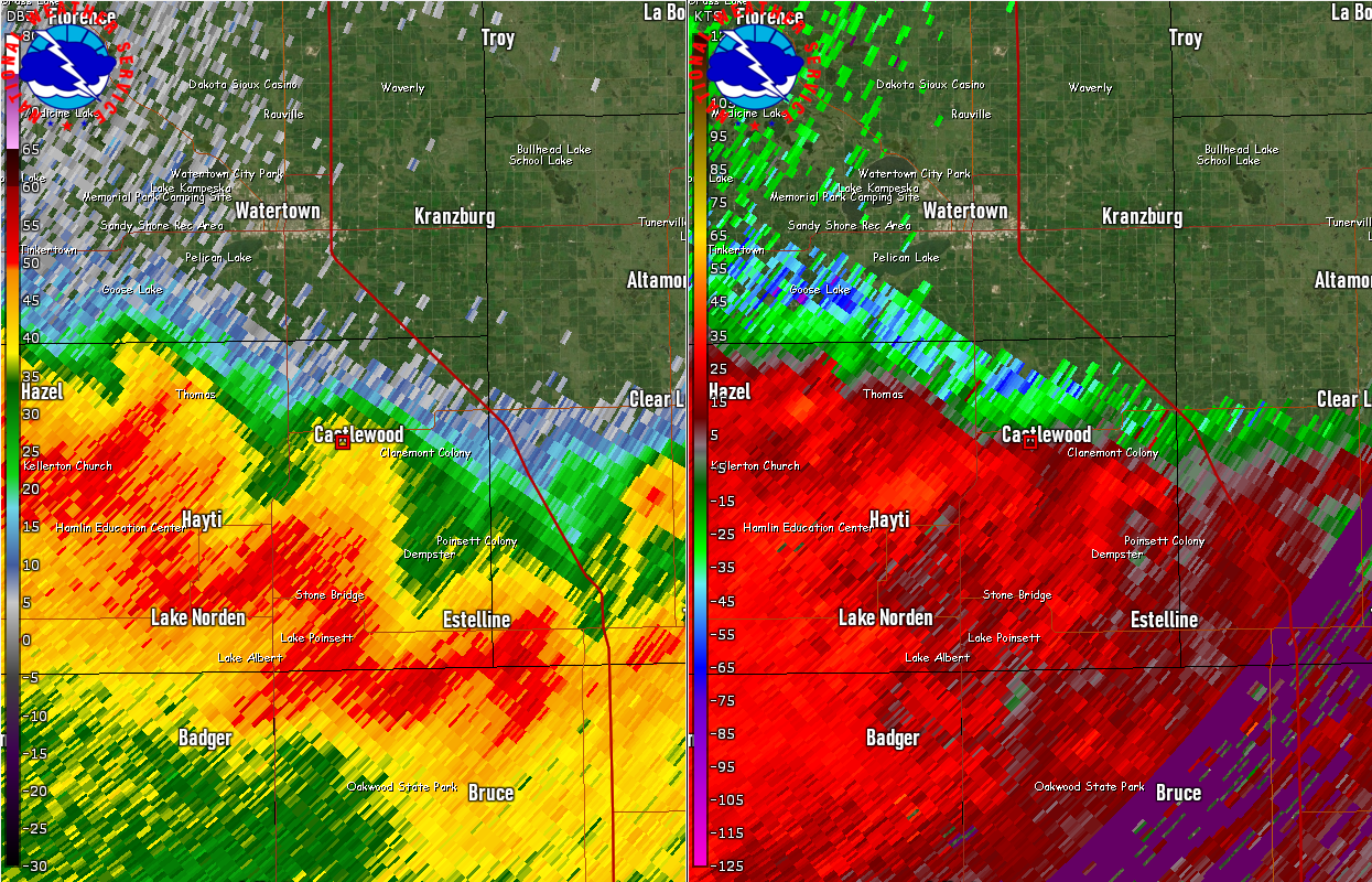
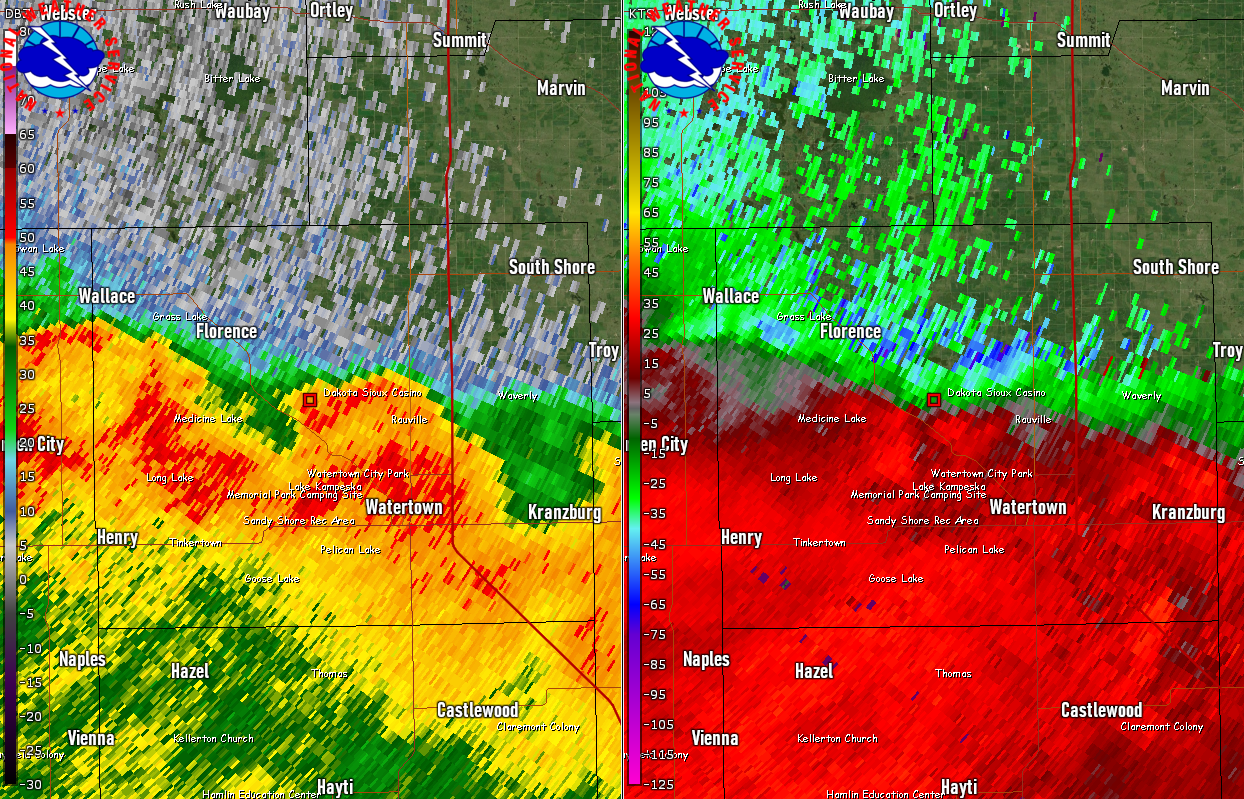
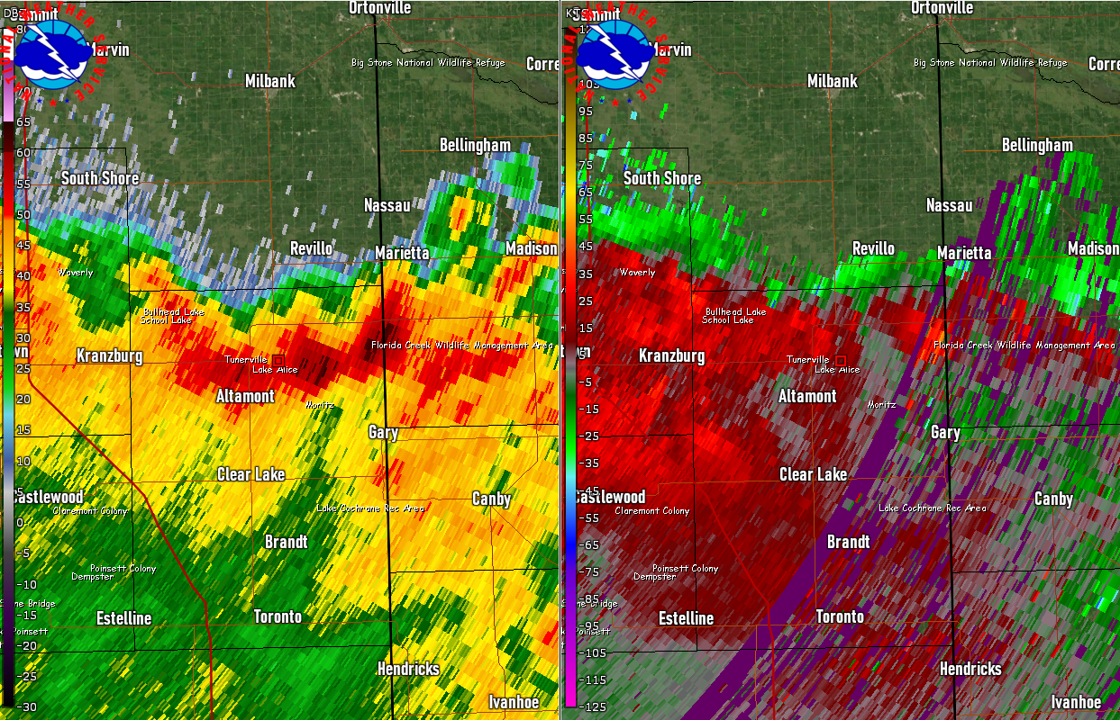
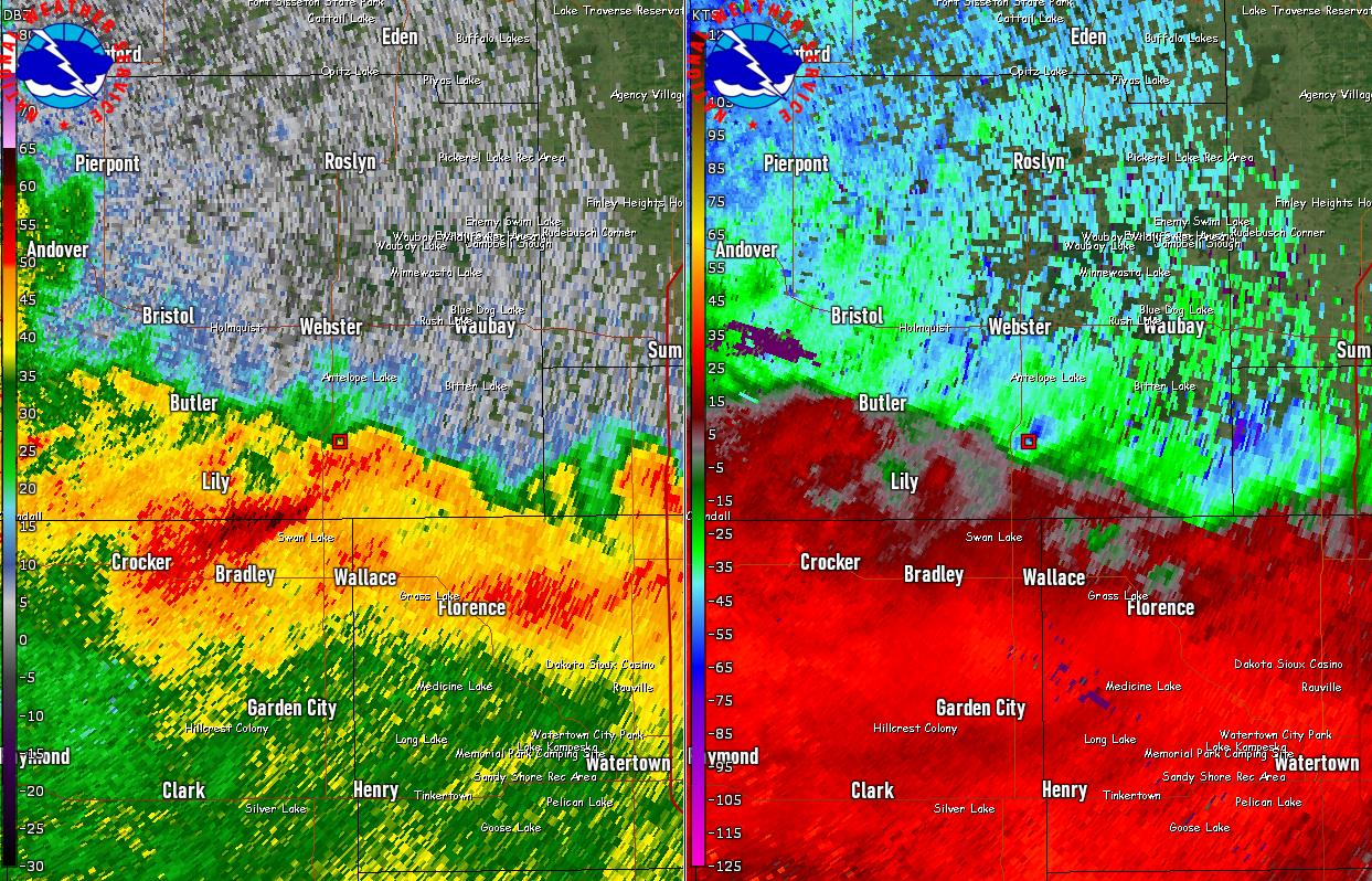
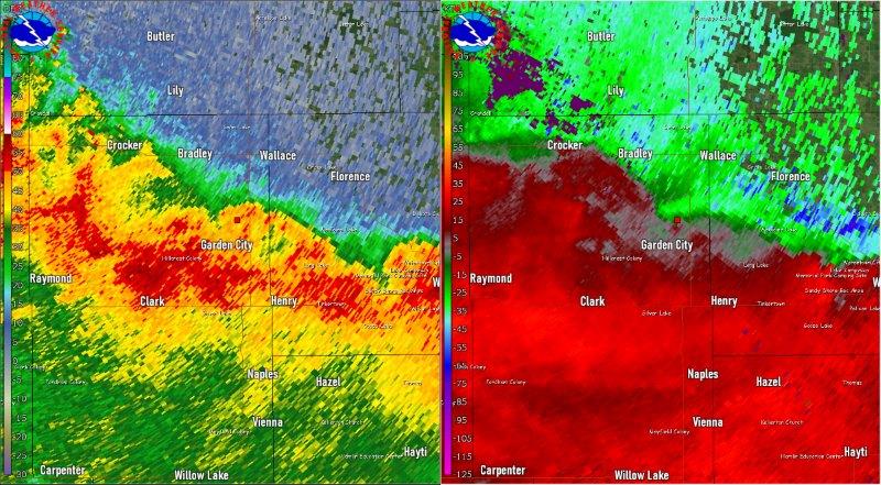
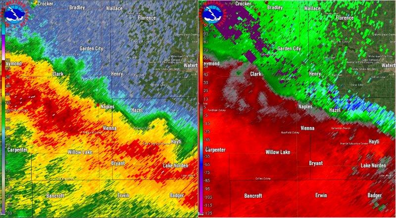
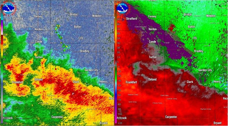
Radar & Satellite
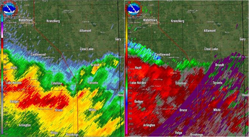
| Regional view - radar reflectivity of the derecho |
| State view - radar reflectivity of the derecho |
| GOES16 satellite and lightning data loop from 3 to 7pm |
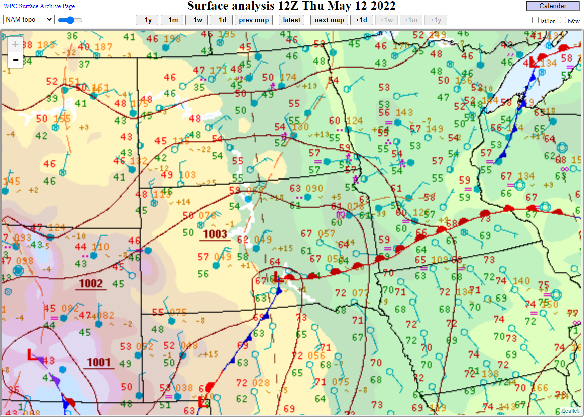
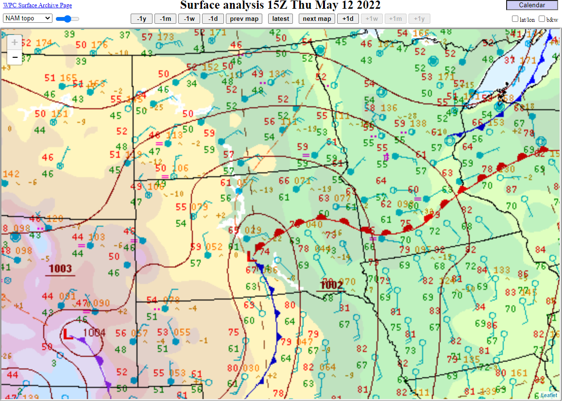
Environment & Rainfall
 |
 |
 |
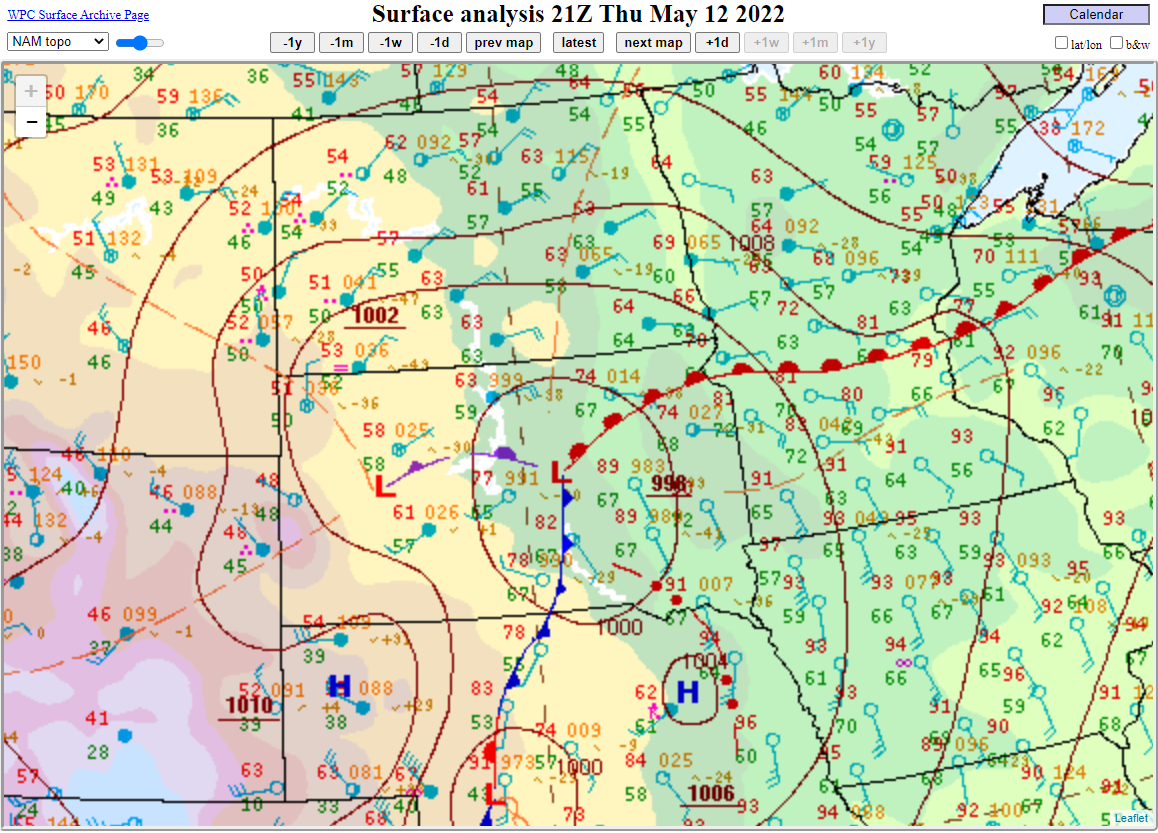 |
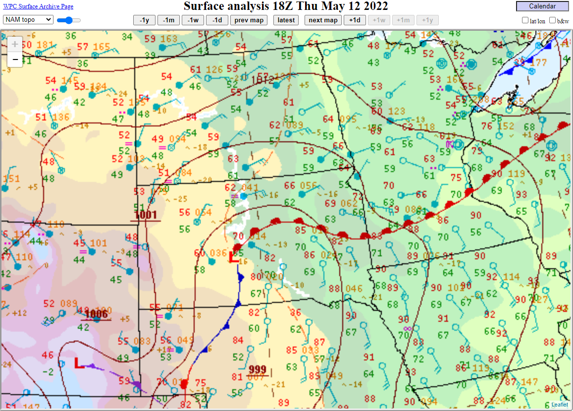
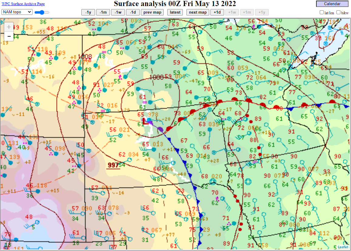
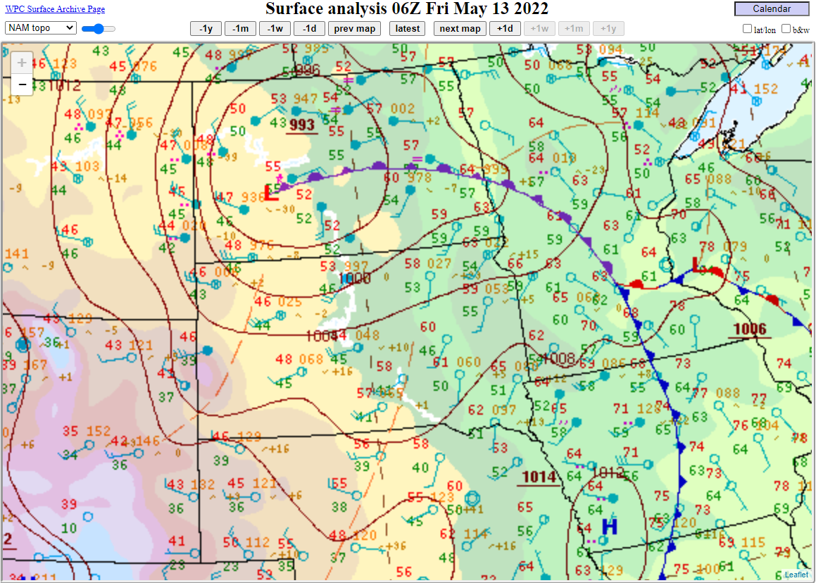
| Surface map at 7am, showing a deep low pressure system taking shape. | Surface map at 10am, showing widespread cloud cover north of the warm front (filled in blue circles). | Surface map at 1pm, showing cool air north of the warm front and summer-like air south of it (temperatures in the 80s and dewpoints around 70 F). | Surface map at 4pm, showing the front lifting north, with a line of storms across the eastern SD/NE border. |
 |
 |
 |
|
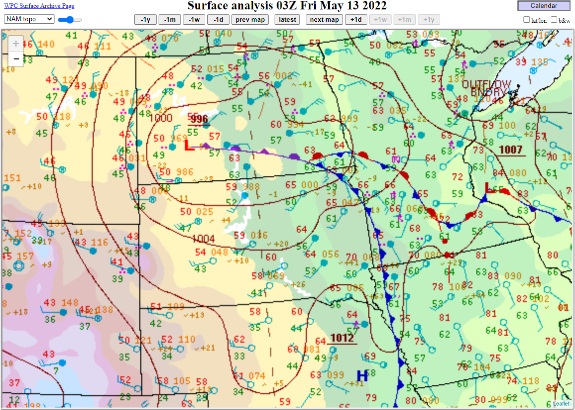
| Surface map at 7pm. Storms at this time were near or at the ND/SD border, along the warm front. | Surface map at 10pm, showing the low occluding and deepening. | Surface map at 1am, showing further deepening of the low, and strong surface winds. | |
 |
 |
 |
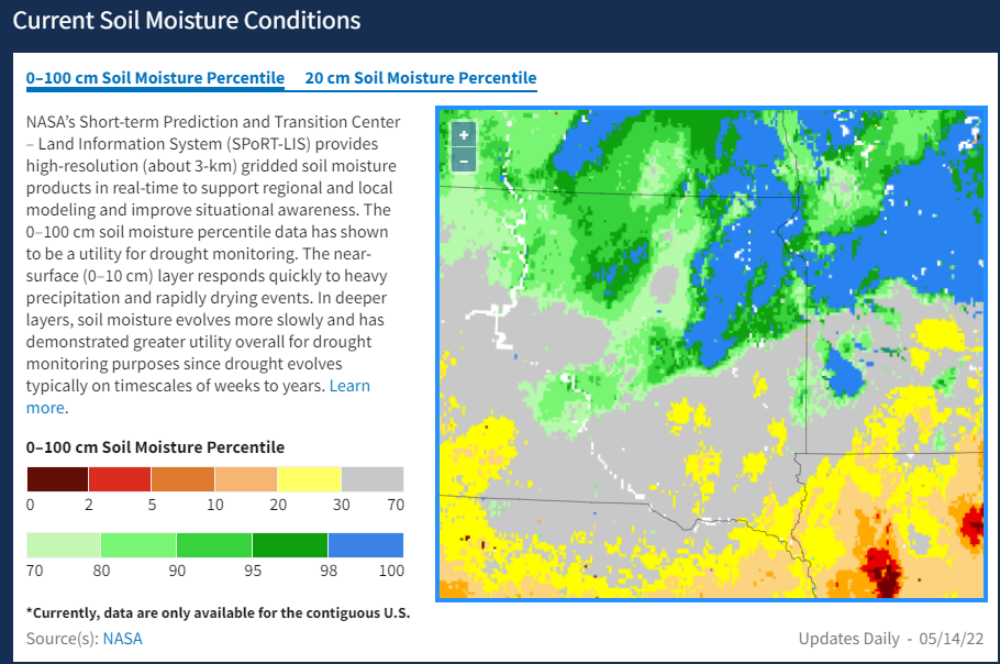 |
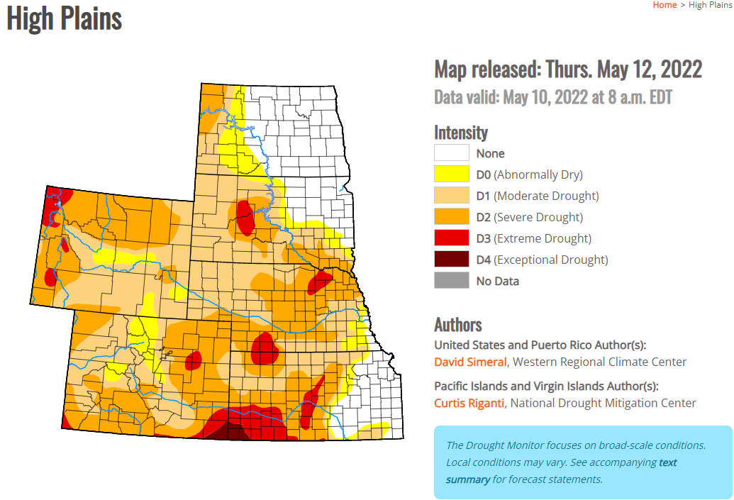
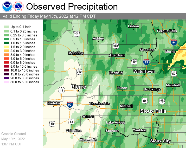
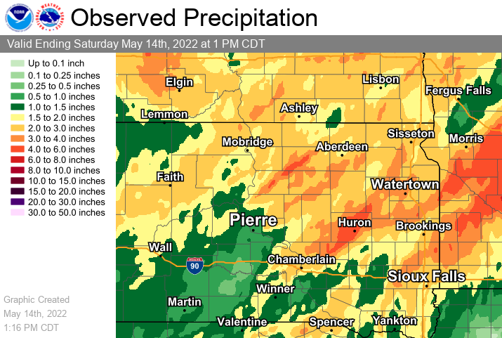
| US Drought Monitor valid as of Tuesday, May 10th. The derecho began across areas of Moderate to Extreme Drought across northeastern Nebraska and southeastern South Dakota, and this is where the storm's dust that many people observed came from. | Estimated observed 24 hour rainfall ending at noon on Friday, May 13th. While rain was heavy at times, storms moved very quickly which prevented larger rainfall totals. | Estimated observed 7 day rainfall totals ending on Saturday, May 14th. Much above average precipitation has been observed across eastern SD and west central MN this spring. This has led to flooding. | Due to all the recent rainfall, the May 12th derecho moved over very saturated soils, making trees more susceptible to uprooting in high winds. Find daily soil moisture information here. |
Storm Reports
 |
 |
 |
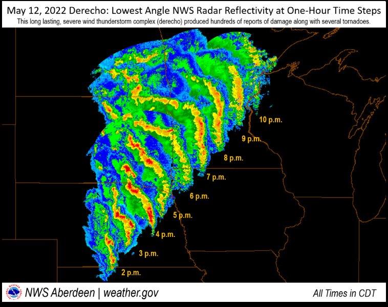 |
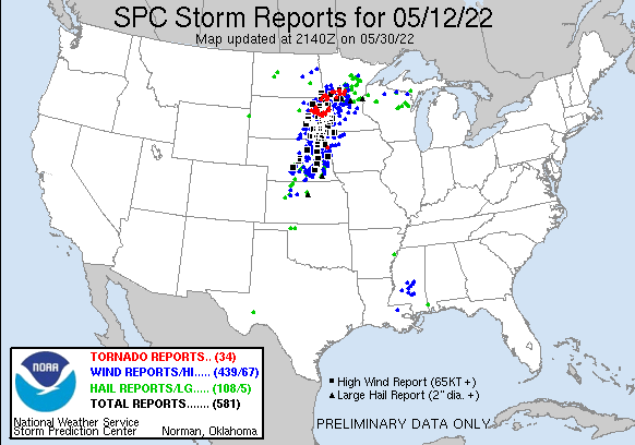
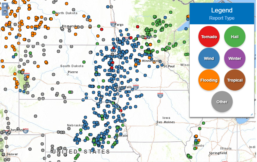
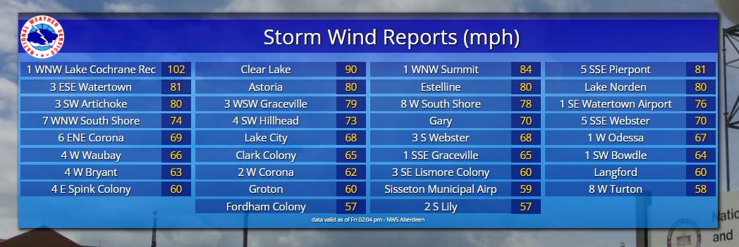
| A nation-wide view of severe storm reports. The density of wind reports (blue dots), and significant wind reports (black squares) is extreme. | A closer look at preliminary storm reports across the region. Visit this link for information about each report. | An exhaustive list of peak wind gusts measured by the NWS, SDSU Mesonet, DOT and personal weather stations across NWS Aberdeen's County Warning Area. Additionally, a 178 mph wind gust was measured at the top of a wind turbine around 300 ft high in the Lake Alice area of Deuel County. | May 12, 2022 Derecho: Lowest Angle NWS Radar Reflectivity at One-Hour Time Steps |
Historical Perspective
14 tornadoes were confirmed in South Dakota on May 12th, 2022. This was the largest single-day tornado outbreak in the state since May 5th, 2007 when 27 tornadoes were confirmed. By the end of May 2022, 29 total tornadoes had been confirmed during the month across South Dakota, which ranks tied 3rd for the most of any May since records began in 1950 (29 in 2007, 31 in 1985 and 42 in 1965). South Dakota averages 6.6 tornadoes during a typical May, and a total of 30 tornadoes each season (from 1991-2021).
17 tornadoes were confirmed in Minnesota on May 12th, 2022. This was the largest single-day tornado outbreak in the state since December 15th, 2021 when 24 tornadoes were confirmed. By the end of May 2022, 58 total tornadoes had been confirmed during the month across Minnesota, which ranks as the most for any May since records began in 1950 (27 in 2001, 24 in 1965), and as the second most in any single month behind only June 2010's 83. Minnesota averages 6.4 tornadoes during a typical May, and a total of 49 tornadoes each season (from 1991-2021).
 |
 |
 |
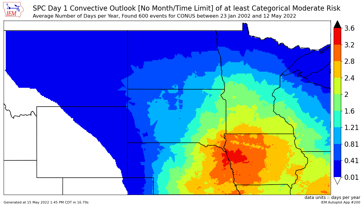 |
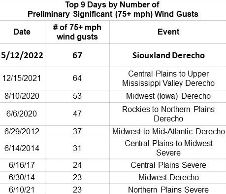
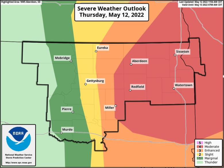
| Since 2004 when records began, no other day *nationwide* has observed more measured & recorded significant wind gusts (75+ mph) than May 12th, 2022. Preliminary stats from the SPC. | Derechos are fairly rare for any given location, so you may not have heard of the term before. Find more detailed information here and here. | A Moderate risk of severe weather from the Storm Prediction Center was in place across the area. Shown is the 11:56am forecast. | Moderate risks are only issued about 1 to 2 times on average each year across central & northeastern SD and west central MN. |
 |
 |
 |
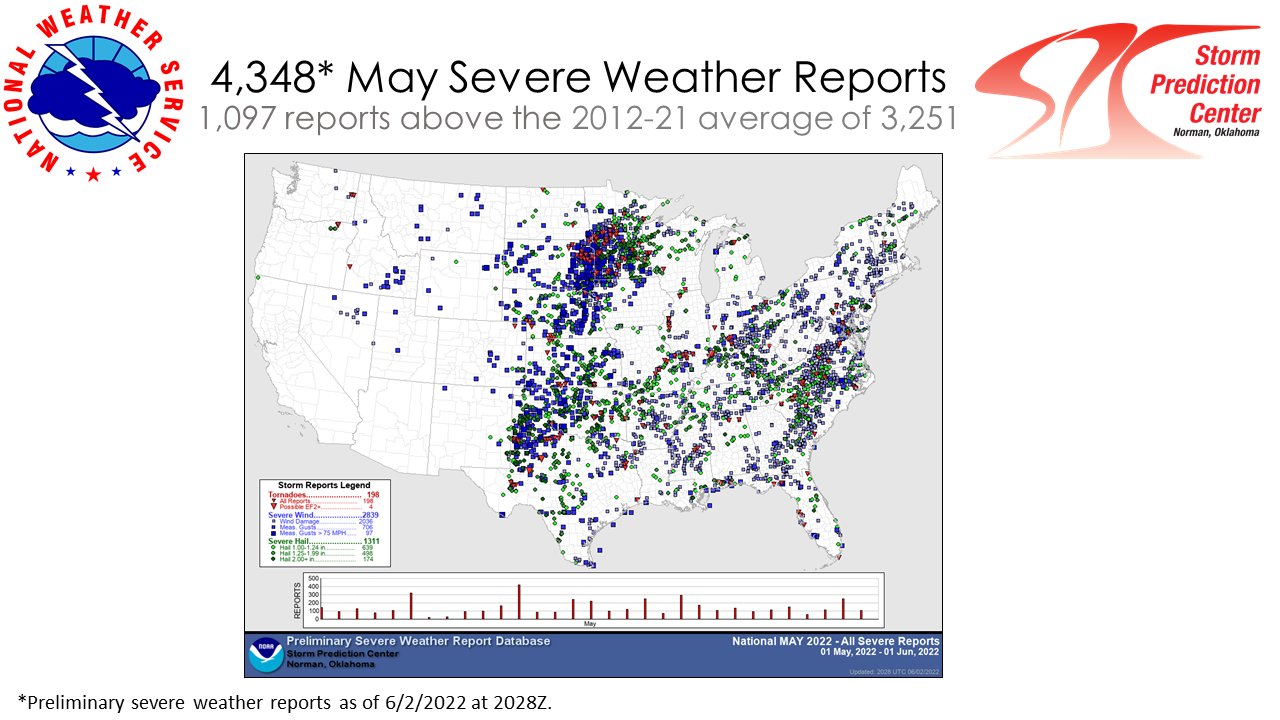 |
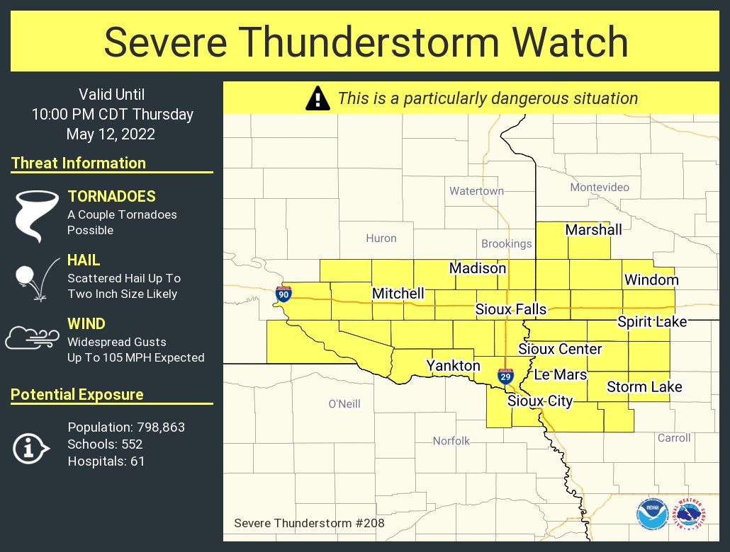
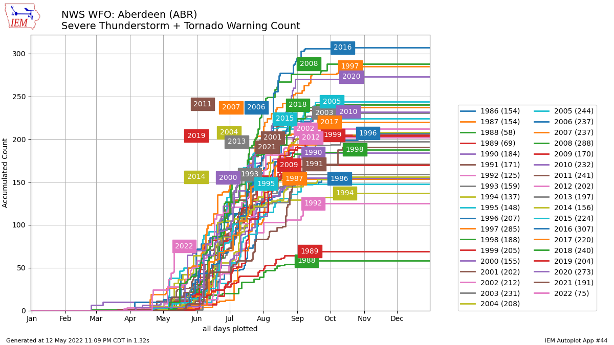
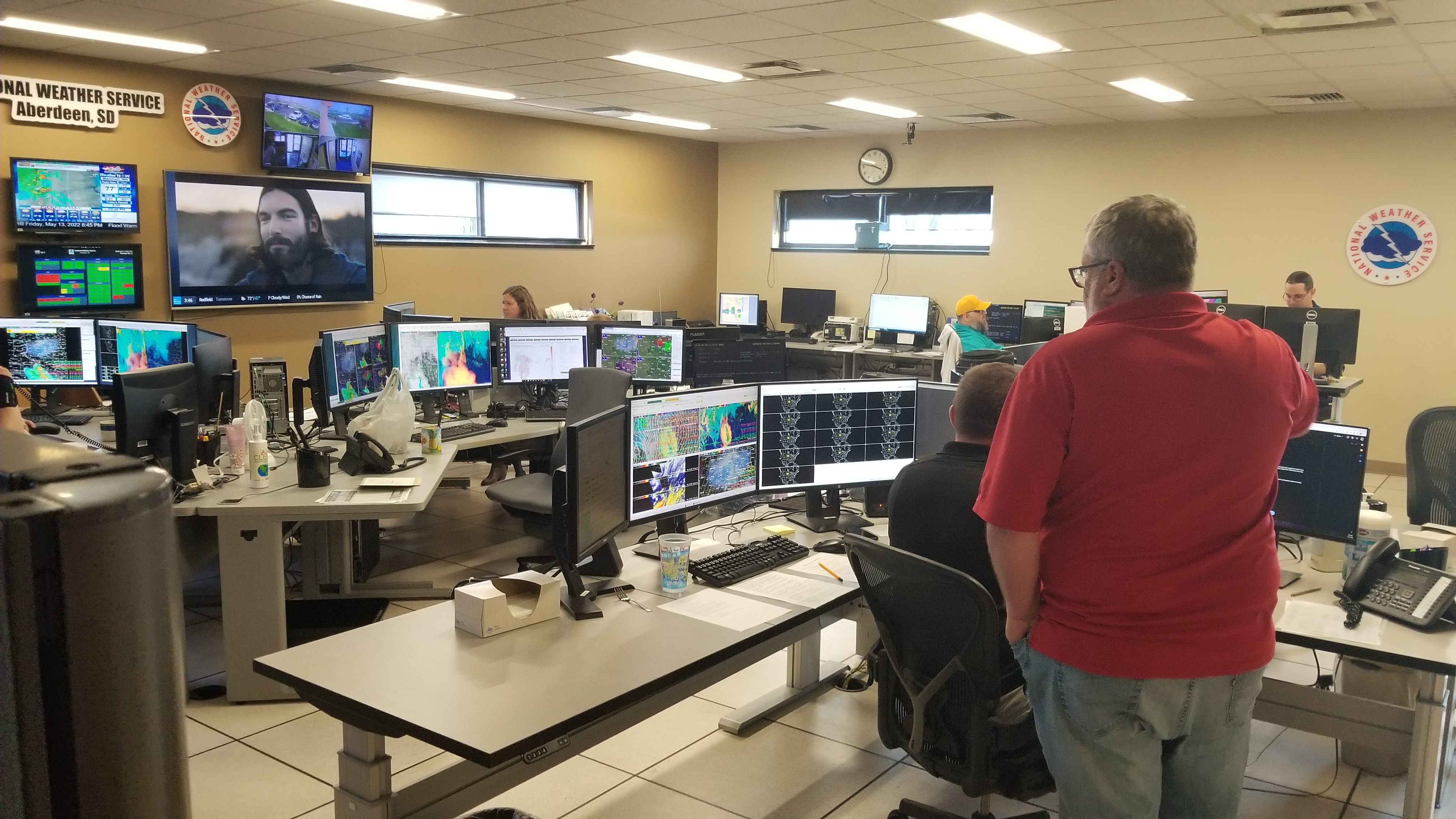
| A Particularly Dangerous Situation (PDS) Severe Thunderstorm Watch was in place across southeastern SD (tornado watch further north). These are issued in rare situations when particularly intense wind storms are anticipated. | NWS Aberdeen has issued more Severe Thunderstorm and Tornado Warnings (combined) through May 13th than any other year on record since 1986 (when records began): 75 of them. 2nd place was 2005 with 38 warnings. | NWS Aberdeen operations floor just prior to the start of the event for our forecast area, at 3:46pm May 12th | Preliminary storm reports as of June 2nd across the country for May 2022 |
 |
Media use of NWS Web News Stories is encouraged! Please acknowledge the NWS as the source of any news information accessed from this site. |
|