Widespread life-threatening flash and urban flooding will continue to pose a significant threat to life and property in south-central Texas. Catastrophic fiver flooding, with rapid rises on small streams, arroyos, and typically dry washes, is expected. Monsoonal showers persist across the Great Basin and Southwest with greatest flash flooding in southern Arizona. Read More >
Overview
|
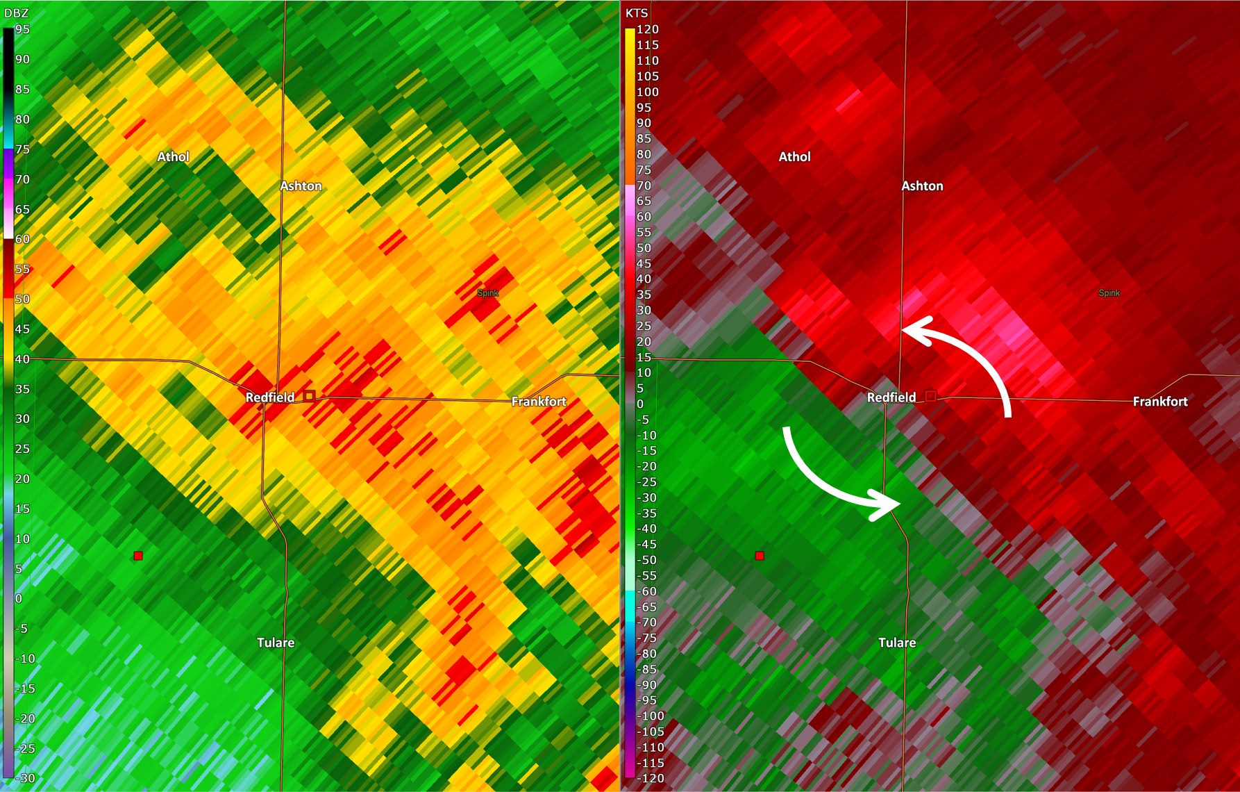
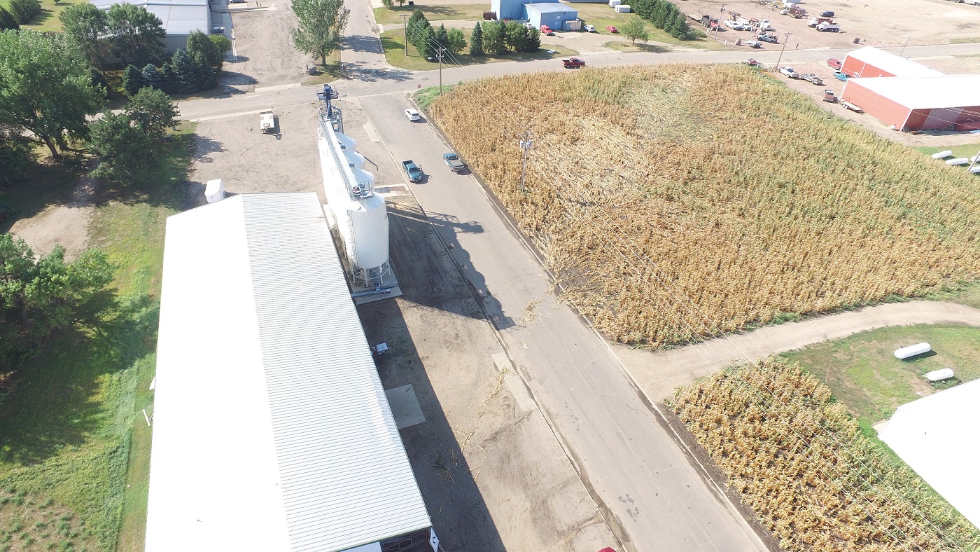
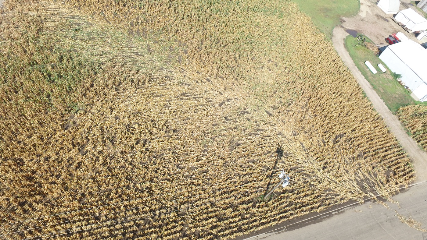
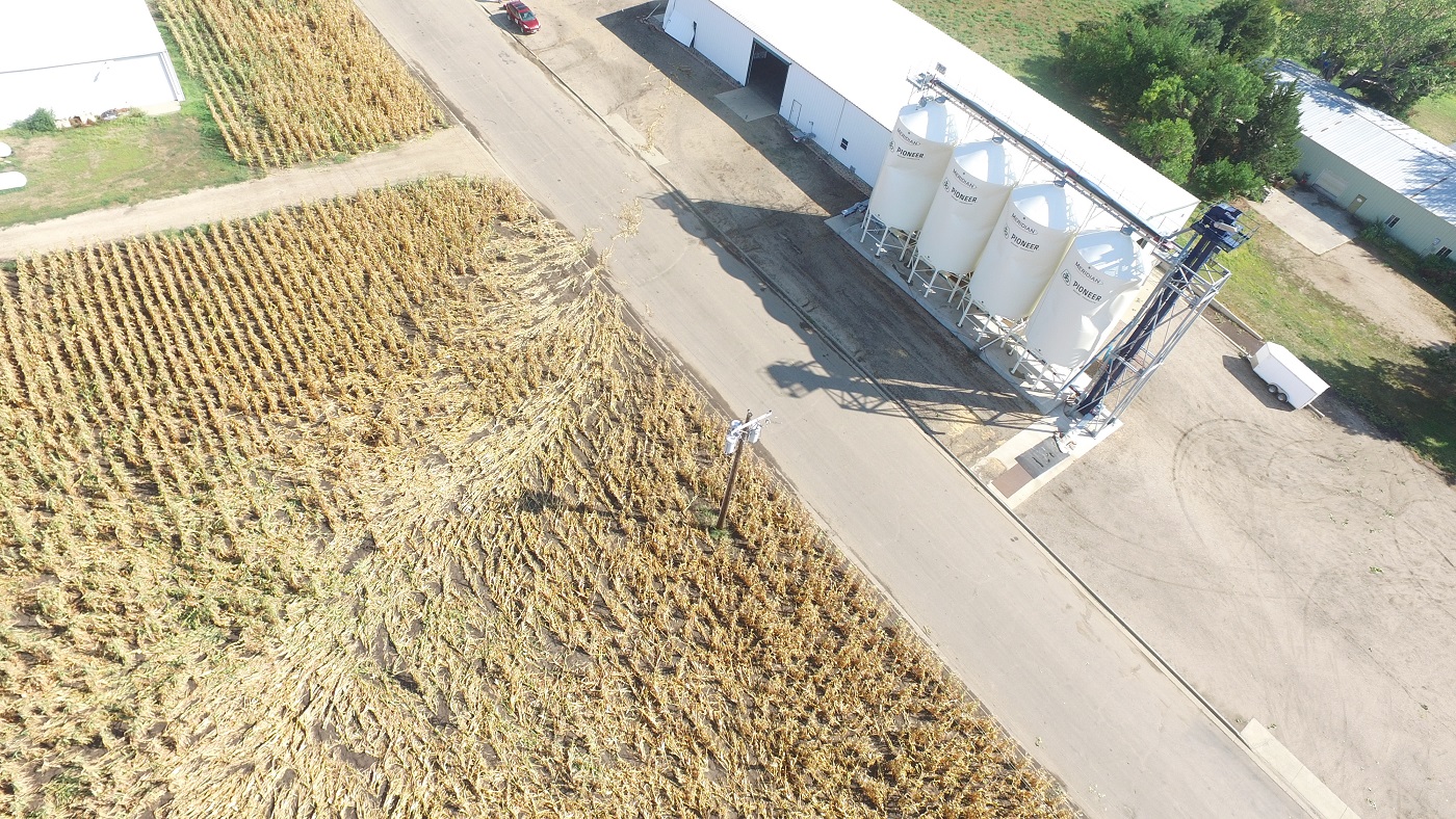
Severe thunderstorms impacted parts of central and eastern South Dakota on the evening of August 26, 2020 and again during the evening of August 27 and into the early morning hours of August 28, 2020. During the afternoon of August 26, supercell thunderstorms developed in western SD and produced numerous reports of hail exceeding the size of golf balls. The largest hailstone reported was the size of a baseball (2.75" in diameter) near Sansarc in Stanley County, SD. The next evening, another round of severe thunderstorms developed in western South Dakota during the evening of the 27th before traveling east across all of South Dakota into the early morning hours on the 28th. As the storms became more organized they produced strong straight-line winds as well as brief tornados. Numerous reports of straight-line winds over 70 mph were documented along with a peak wind gust of 104 mph. Six tornados also occurred in total. The severe winds along with the tornados damaged trees, buildings, campers, and crops. |
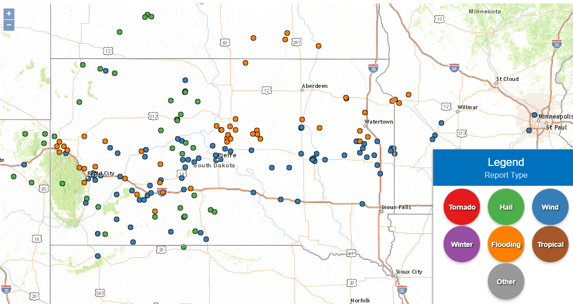 Storm Reports from August 26-28, 2020 (orange dots represent heavy rain and/or flooding reports) |
 |
 |
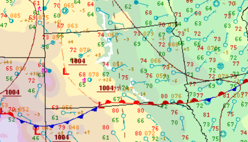 |
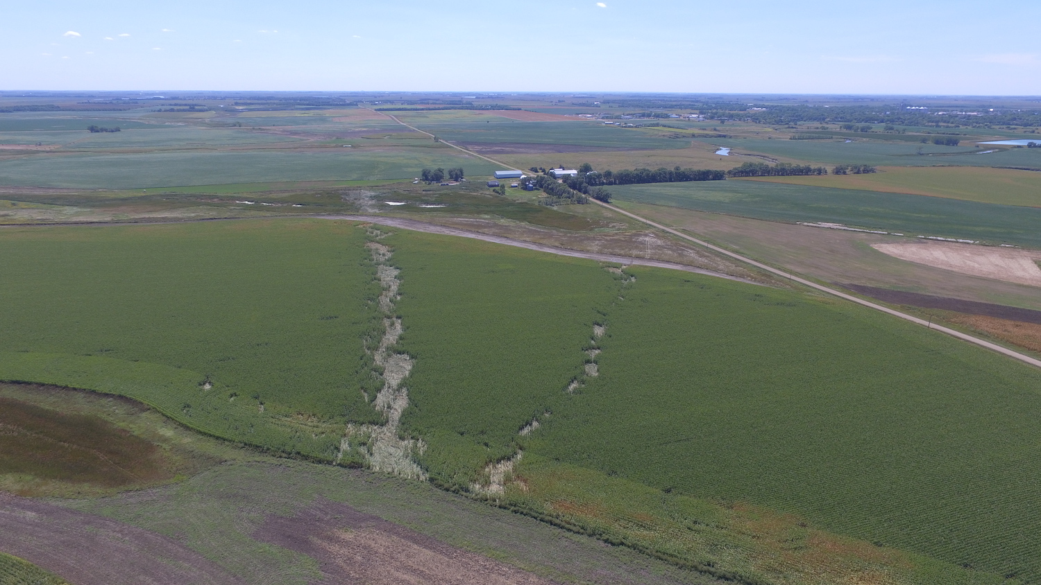
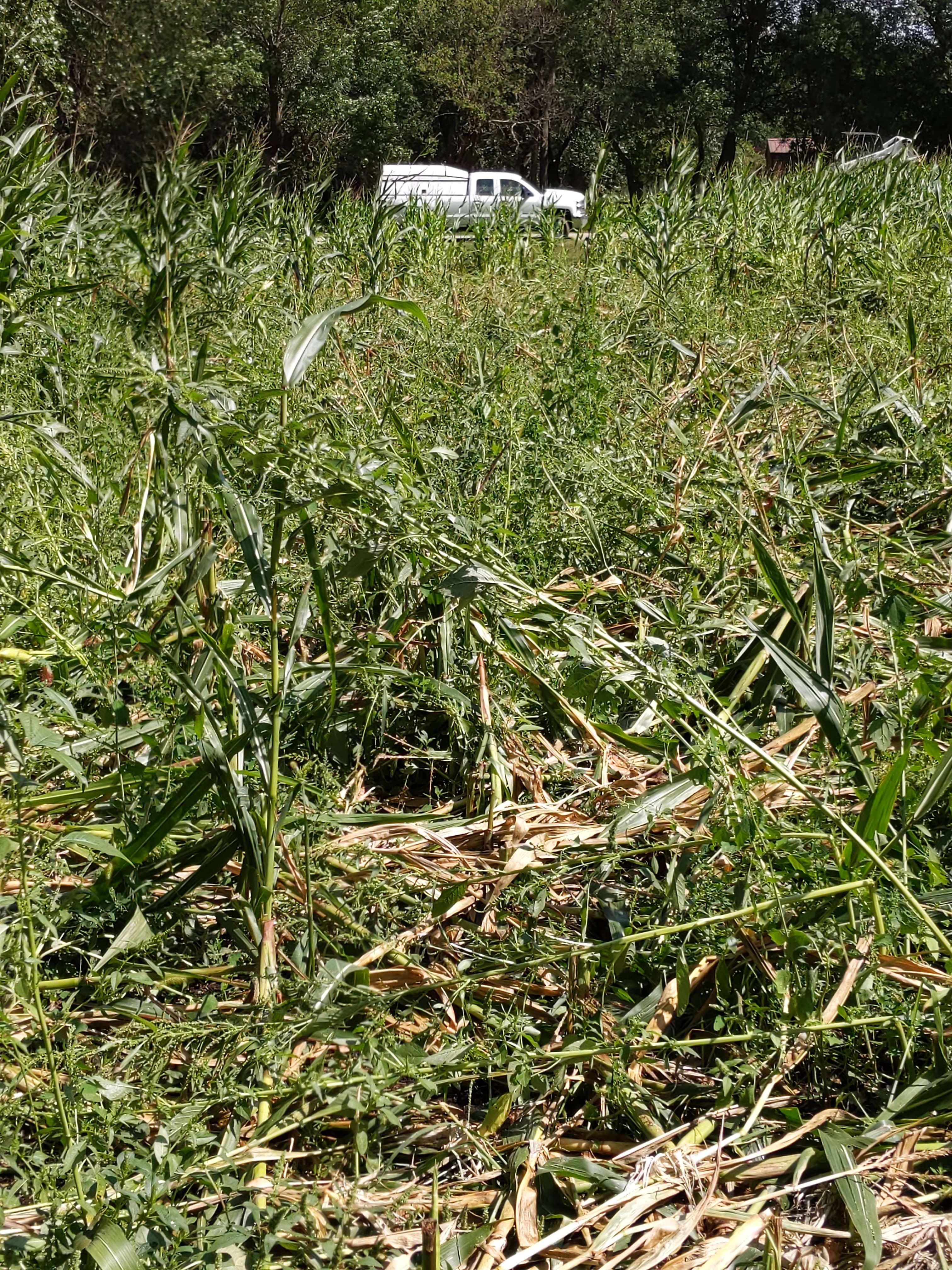
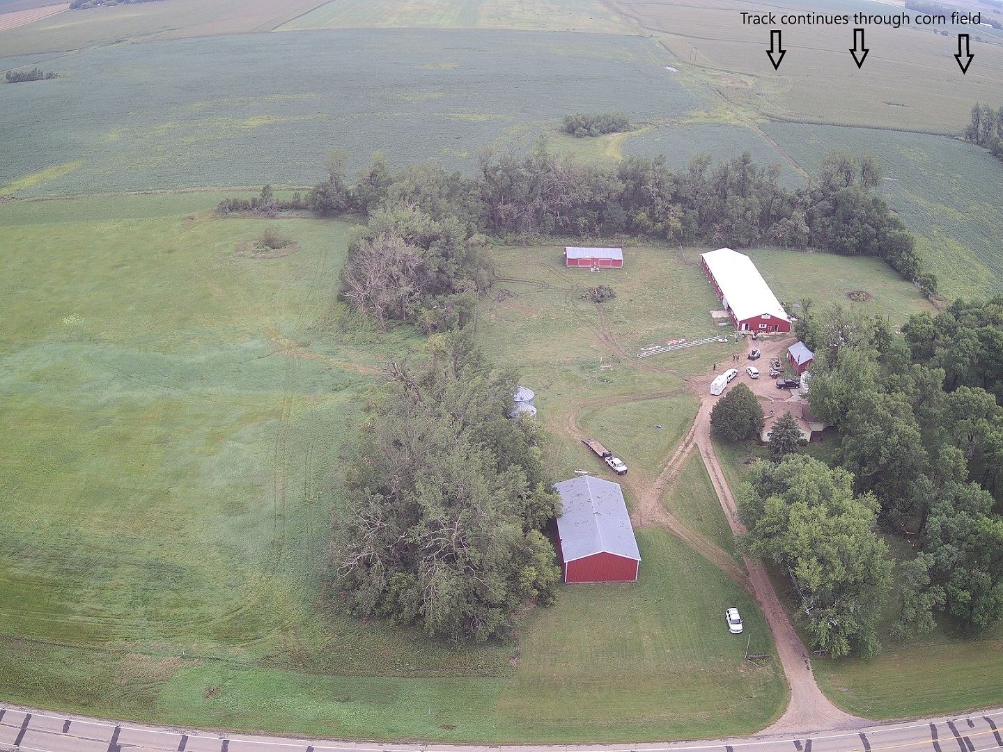
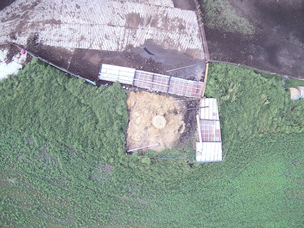
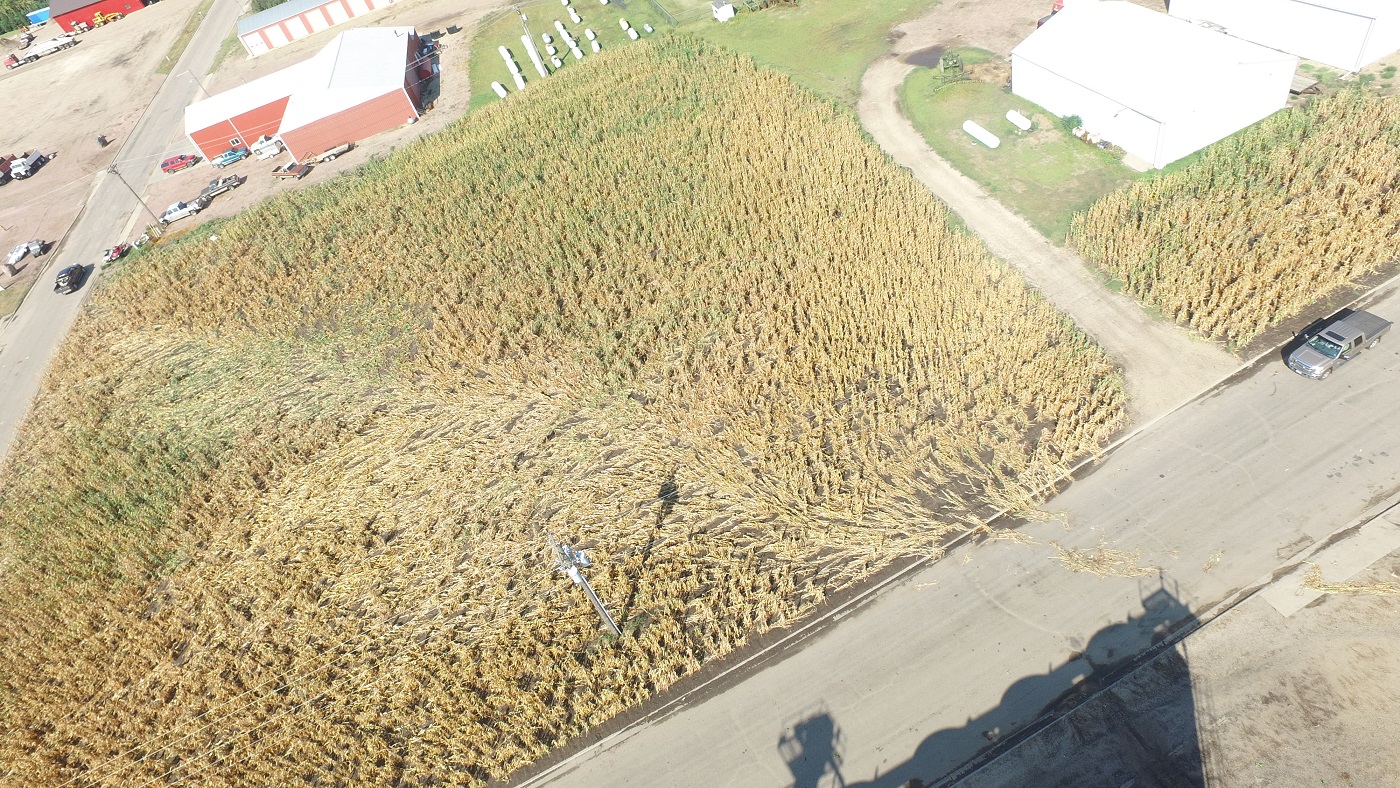
| Hail in Eagle Butte, SD on August 26, 2020 (Photo by Grady Kraft) | Tornado path through a corn field on the east side of Redfield, SD (Spink County EM & Planning and Zoning) | Surface weather map at 10pm on the 27th |
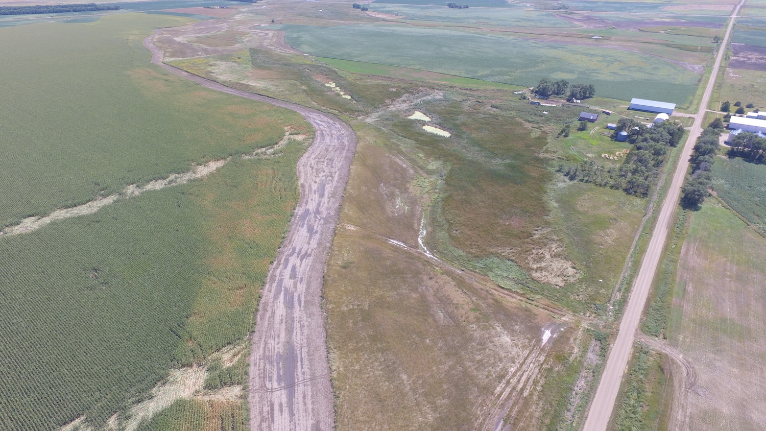
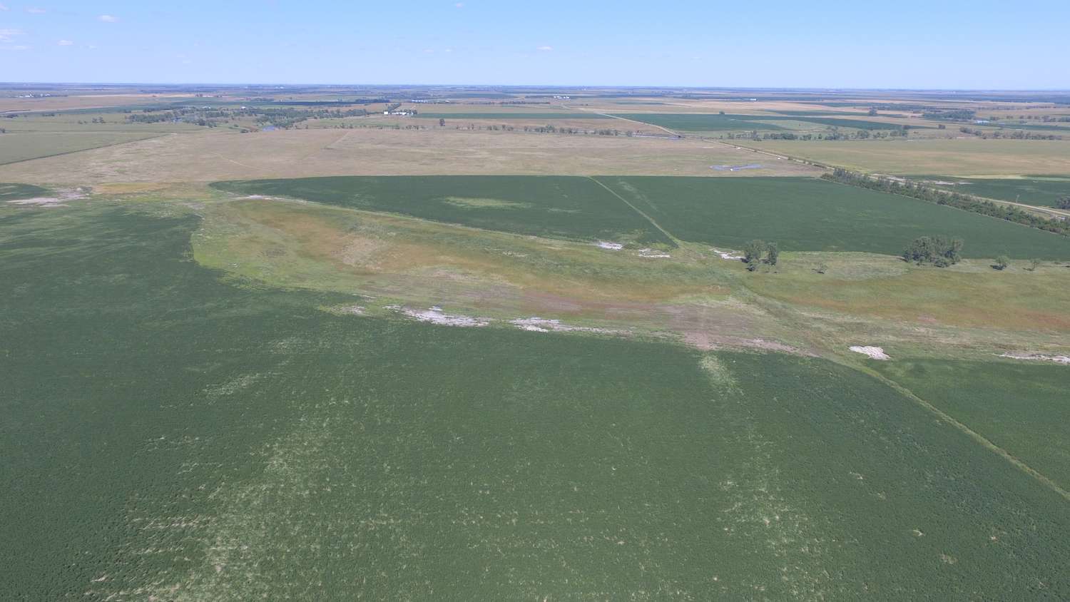
Tornadoes:
|
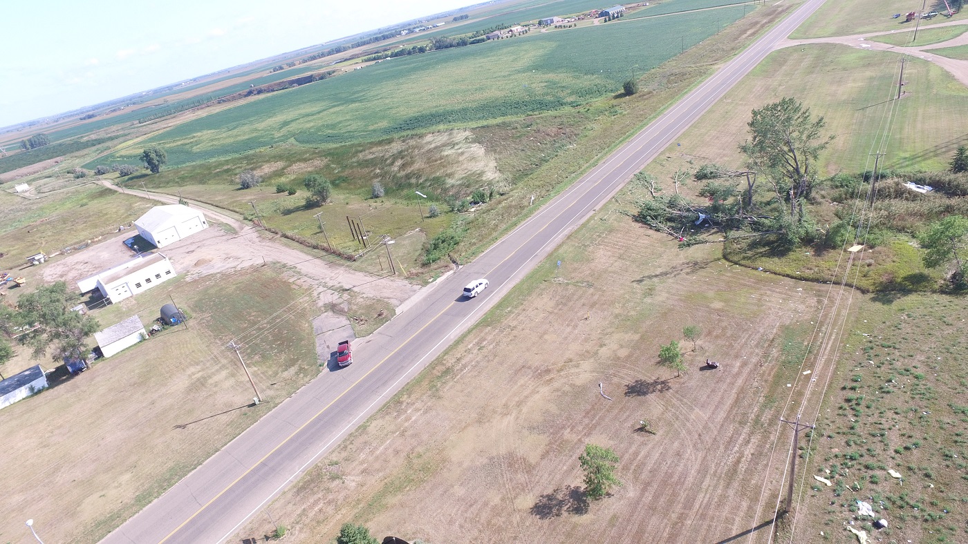
Tornado #1: 1 ESE Redfield
Track Map 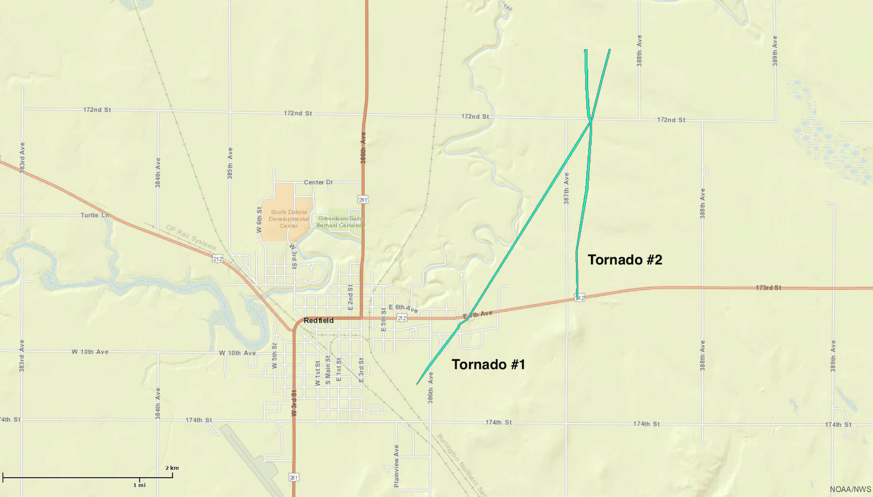 
|
||||||||||||||||||||||||||||||||||||||||
|
Tornado #2: 2 E Redfield
Track Map
|
||||||||||||||||||||||||
|
Tornado #3: 5 WNW Clear Lake
Track Map 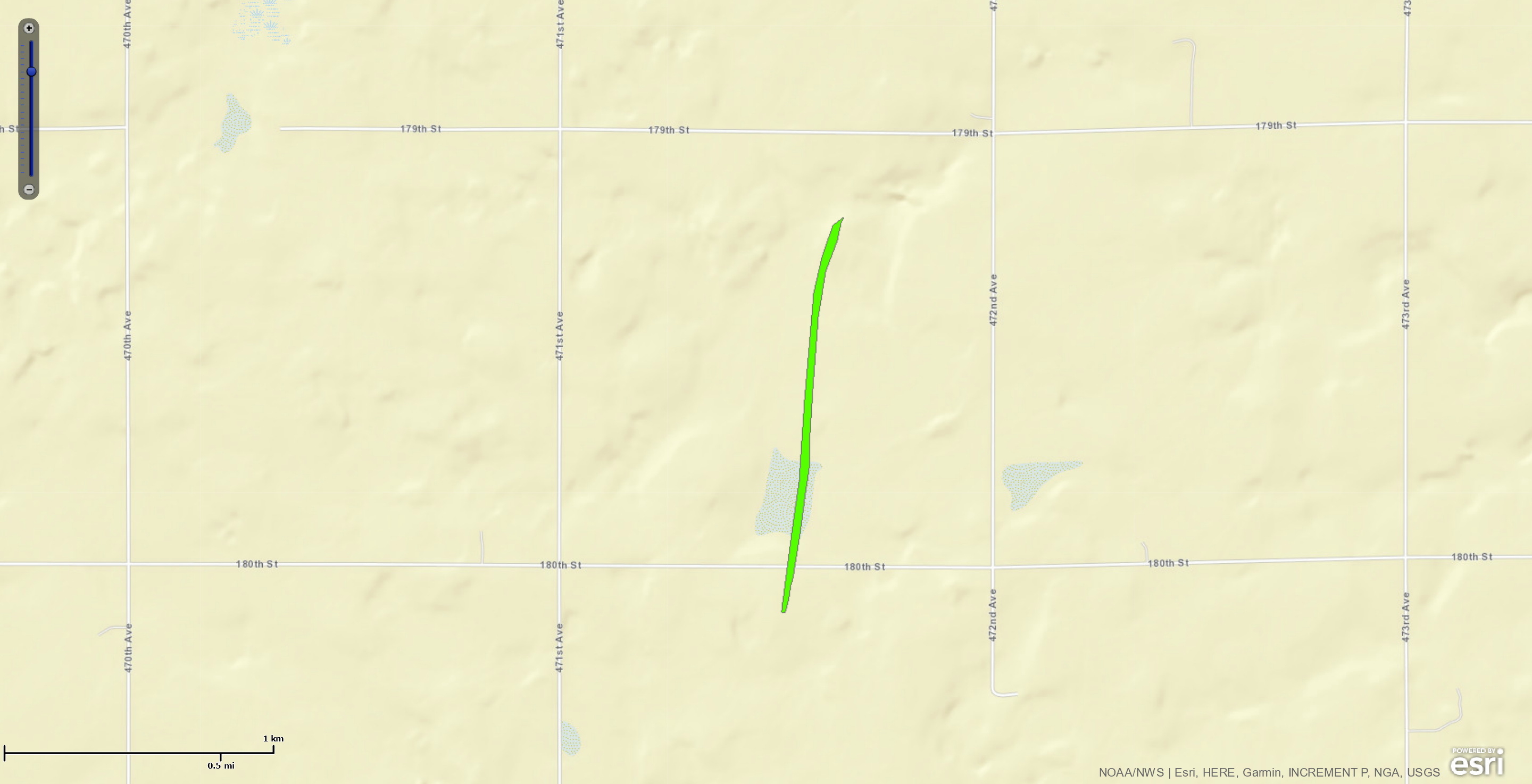
|
||||||||||||||||||||||||
|
Tornado #4: 6 W Clear Lake
Track Map 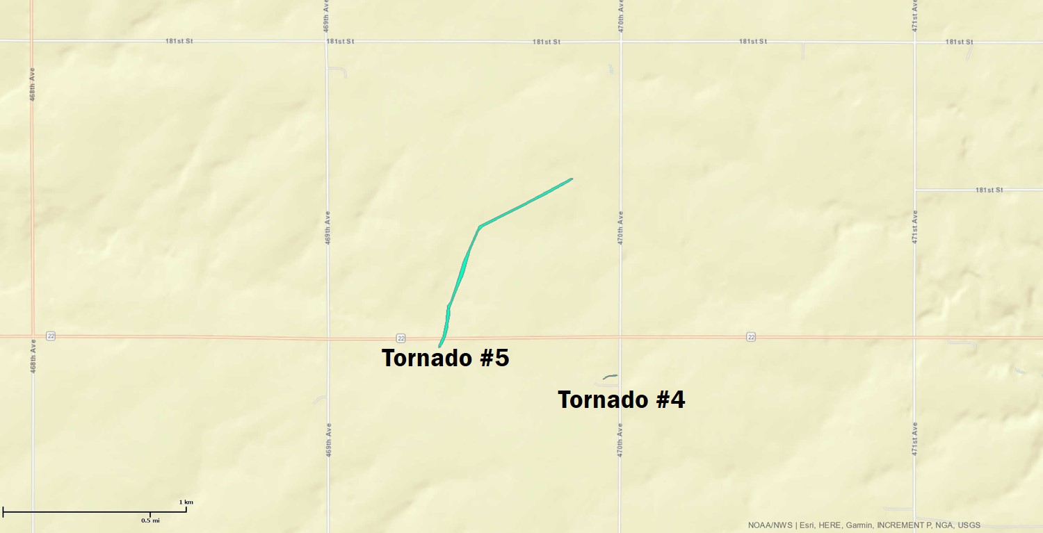
|
||||||||||||||||||||||||
|
Tornado #5: 6 W Clear Lake
Track Map
|
||||||||||||||||||||||||
|
Tornado #6: 9 SW Clear Lake
Track Map 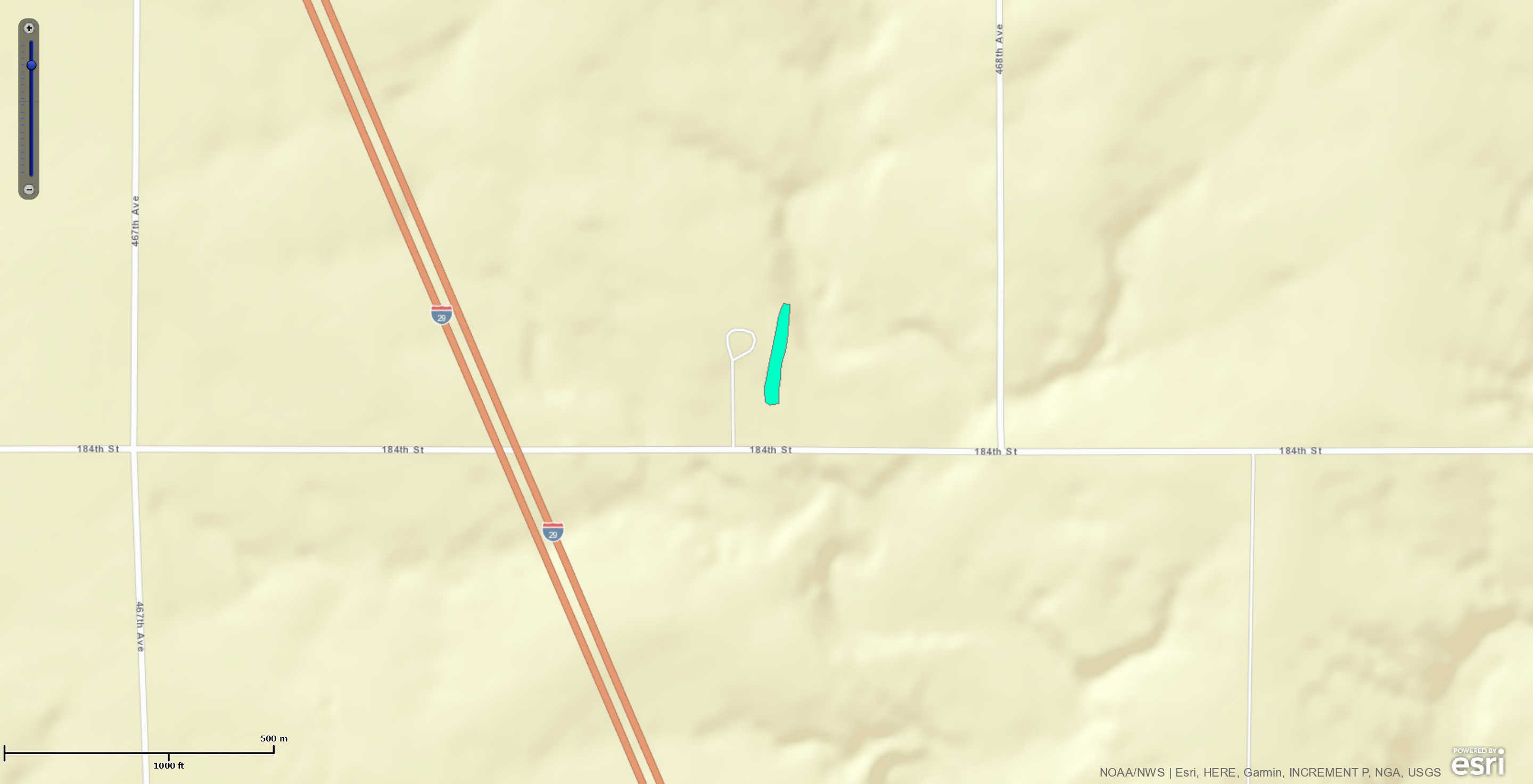
|
||||||||||||||||||||||||
| EF0 Weak 65-85 mph |
EF1 Moderate 86-110 mph |
EF2 Significant 111-135 mph |
EF3 Severe 136-165 mph |
EF4 Extreme 166-200 mph |
EF5 Catastrophic 200+ mph |
 |
|||||
The Enhanced Fujita (EF) Scale classifies tornadoes into the following categories:
August 26, 2020:
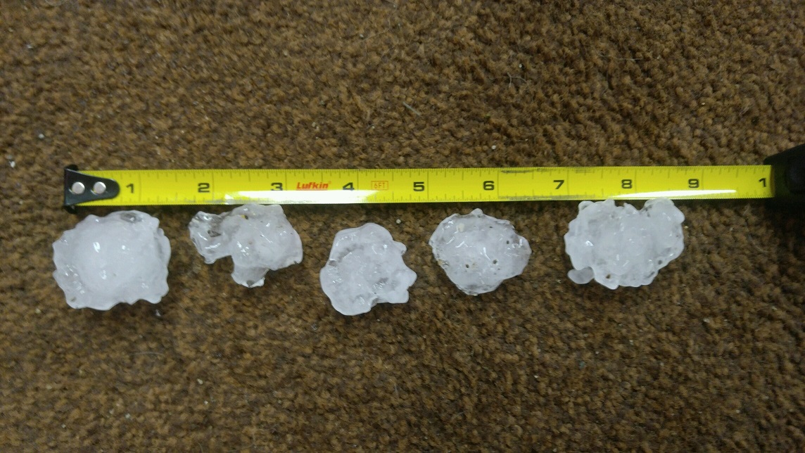
Find below a few images of the significant hail that fell across portions of central SD.
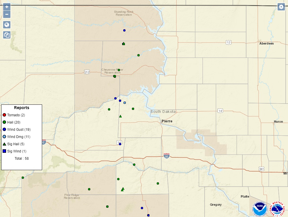 |
 |
 |
 |
| Storm reports from August 26, 2020 (SPC) | Hail in Eagle Butte, SD (Photo from Tonya White Bull) | Hail in Eagle Butte, SD (Photo from Tonya White Bull) | Timber Lake, SD hail (Photo by Kyle Nelson) |
 |
|||
| Hail in Timber Lake, SD (Photo by Lauren Kraft) | Radar loop of the supercell thunderstorms that produced hail up to baseballs. | Potential large hail areas |
PRELIMINARY LOCAL STORM REPORT...SUMMARY
NATIONAL WEATHER SERVICE ABERDEEN SD
1108 AM CDT THU AUG 27 2020

..TIME...   ...EVENT...      ...CITY LOCATION...     ...LAT.LON...
..DATE...   ....MAG....      ..COUNTY LOCATION..ST.. ...SOURCE....
            ..REMARKS..

0548 PM     HAIL             6 SW SANSARC            44.46N 101.13W
08/26/2020  E2.75 INCH       STANLEY            SD   PUBLIC
            TIME ESTIMATED. BROKE 6 WINDOWS ON NORTH AND
            WEST SIDE OF RESIDENCE.

0513 PM     TSTM WND GST     10 SW CHANTLER CREEK RE 44.39N 100.77W
08/26/2020  M53 MPH          STANLEY            SD   MESONET
            MESONET STATION 202 HAYES (SDDOT).

0445 PM     HAIL             8 ENE SANSARC           44.56N 100.89W
08/26/2020  E1.50 INCH       STANLEY            SD   PUBLIC
            TIME ESTIMATED.

0420 PM     TSTM WND DMG     9 N SANSARC             44.64N 101.05W
08/26/2020                   STANLEY            SD   PUBLIC
            ROOF TORN OFF ONE OUTBUILDING, A SECOND
            OUTBUILDING HAD NORTH DOOR BLOWN IN. TIME
            ESTIMATED.

0420 PM     HAIL             9 N SANSARC             44.64N 101.05W
08/26/2020  E1.00 INCH       STANLEY            SD   PUBLIC
            TIME ESTIMATED.

0417 PM     TSTM WND GST     13 NNW SANSARC          44.67N 101.14W
08/26/2020  M70 MPH          STANLEY            SD   MESONET
            MESONET STATION 168 FOSTER BAY (SDDOT).

0725 PM     HAIL             6 SSE OKATON            43.80N 100.87W
08/26/2020  E1.25 INCH       JONES              SD   PUBLIC
            TIME ESTIMATED.

0620 PM     HAIL             1 N TIMBER LAKE         45.44N 101.07W
08/26/2020  E2.00 INCH       DEWEY              SD   PUBLIC
            REPORT OF GOLFBALL AND LARGER.

0617 PM     HAIL             TIMBER LAKE             45.43N 101.07W
08/26/2020  E2.00 INCH       DEWEY              SD   PUBLIC
            UPDATE TO PREVIOUS REPORT.

0613 PM     HAIL             TIMBER LAKE             45.43N 101.07W
08/26/2020  E1.75 INCH       DEWEY              SD   PUBLIC
            RELAYED THROUGH SPOTTER.

0613 PM     TSTM WND GST     TIMBER LAKE             45.43N 101.08W
08/26/2020  E60 MPH          DEWEY              SD   PUBLIC
            RELAYED THROUGH SPOTTER.

0558 PM     HAIL             5 E WHITE HORSE         45.28N 100.79W
08/26/2020  E1.00 INCH       DEWEY              SD   PUBLIC
            TIME ESTIMATED.

0525 PM     HAIL             7 SSE ISABEL            45.30N 101.38W
08/26/2020  E0.88 INCH       DEWEY              SD   PUBLIC
            LARGEST WAS NICKLES, TIME ESTIMATED.

0430 PM     HAIL             5 NW PARADE             45.08N 101.16W
08/26/2020  E1.75 INCH       DEWEY              SD   PUBLIC
            TIME ESTIMATED. MULTIPLE SIZES BUT LARGEST
            WAS GOLF BALL. COVERED GROUND.

0406 PM     HAIL             EAGLE BUTTE             45.00N 101.24W
08/26/2020  E1.75 INCH       DEWEY              SD   TRAINED SPOTTER
            UPDATE TO PREVIOUS REPORT.

0402 PM     HAIL             EAGLE BUTTE             45.00N 101.25W
08/26/2020  E1.25 INCH       DEWEY              SD   TRAINED SPOTTER
            SLIGHTLY LARGER THEN QUARTERS.

0630 PM     TSTM WND GST     11 S BULLHEAD           45.61N 101.06W
08/26/2020  M59 MPH          CORSON             SD   MESONET
            MESONET STATION GRRS2 BULLHEAD 10 S.
            ESTIMATED TIME.
August 27-28, 2020
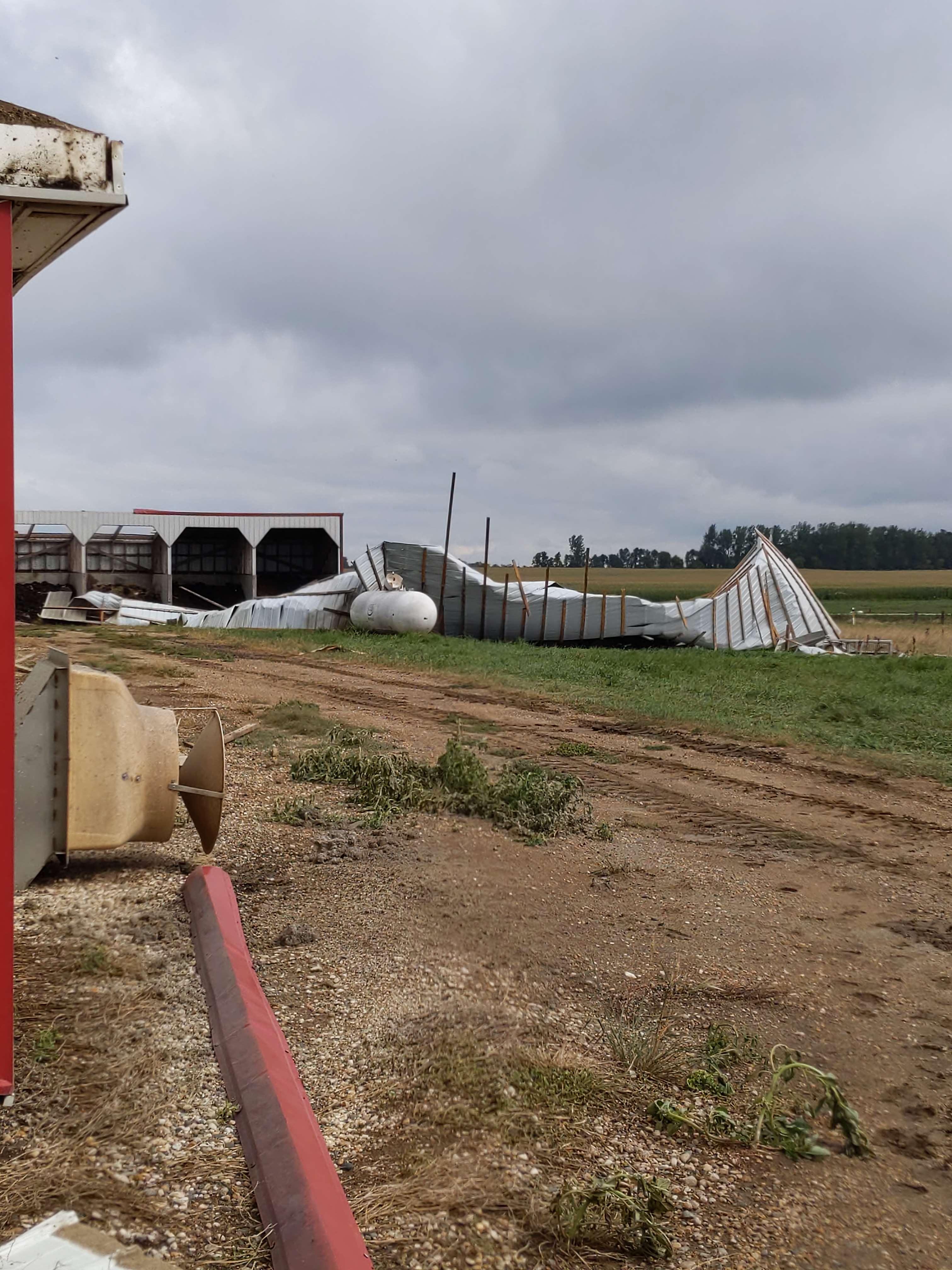
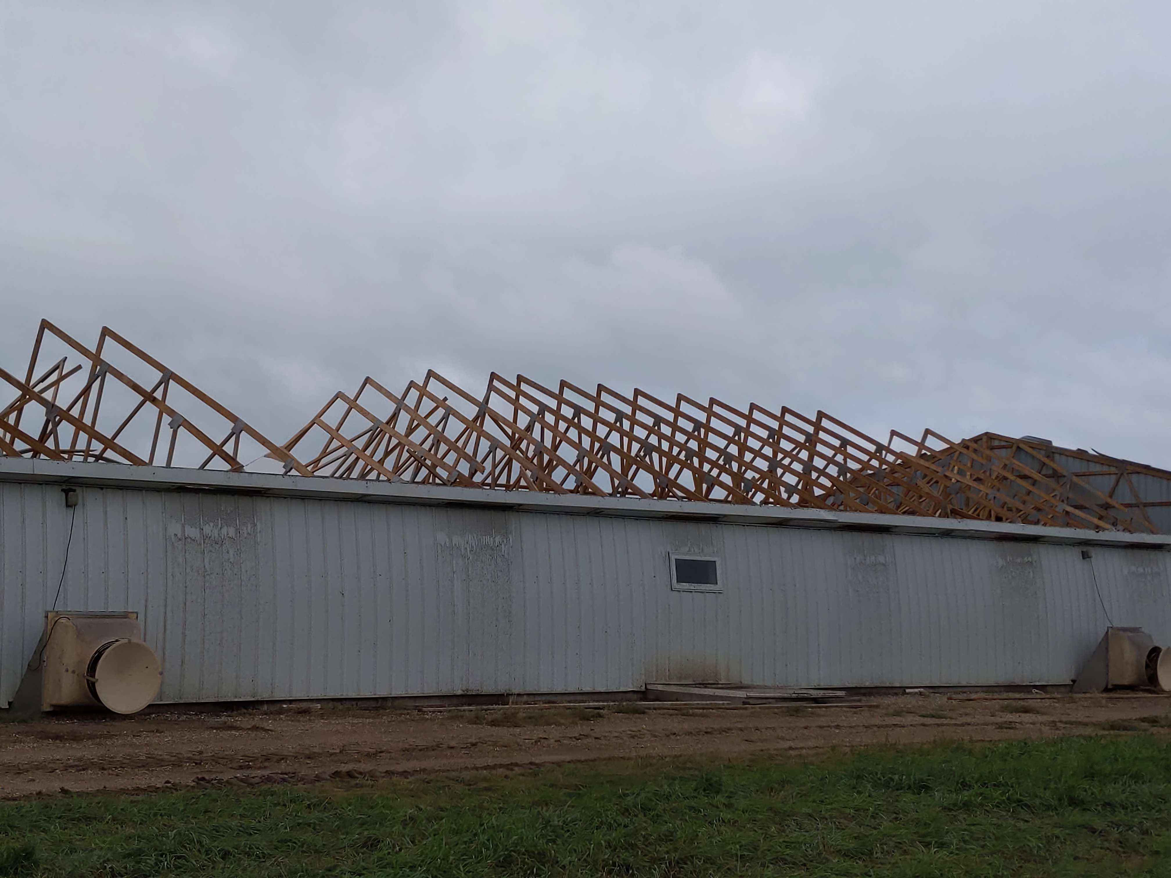
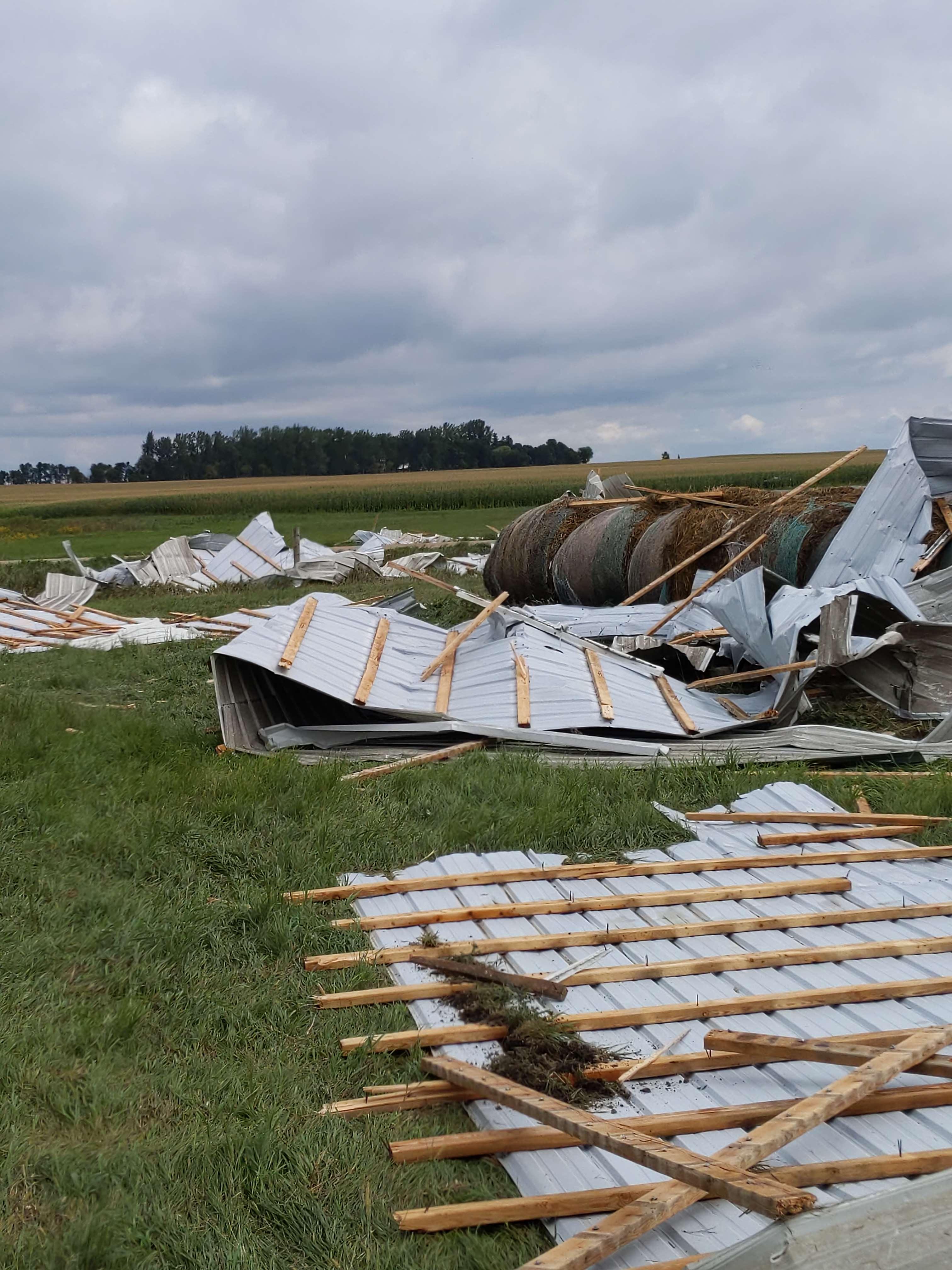
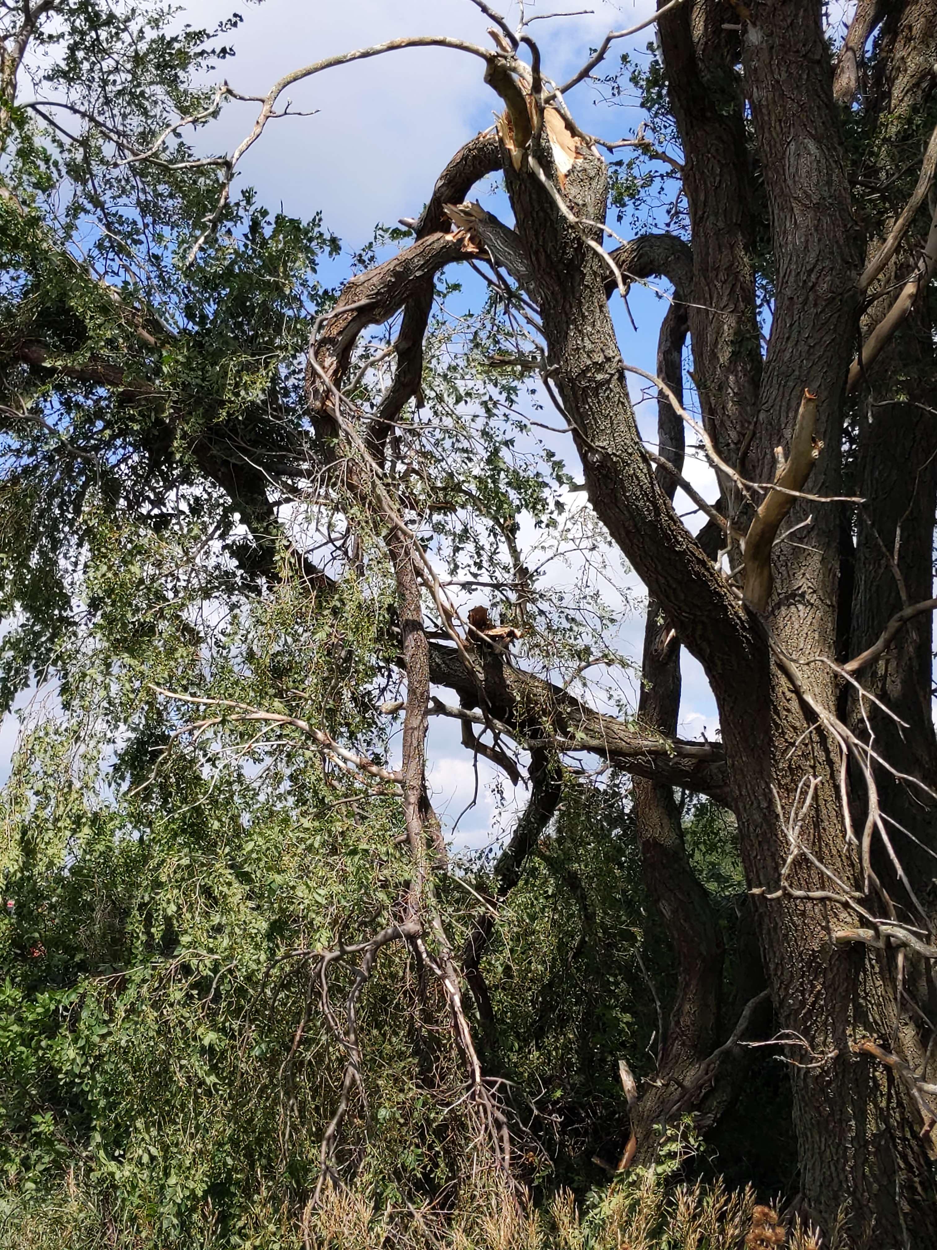
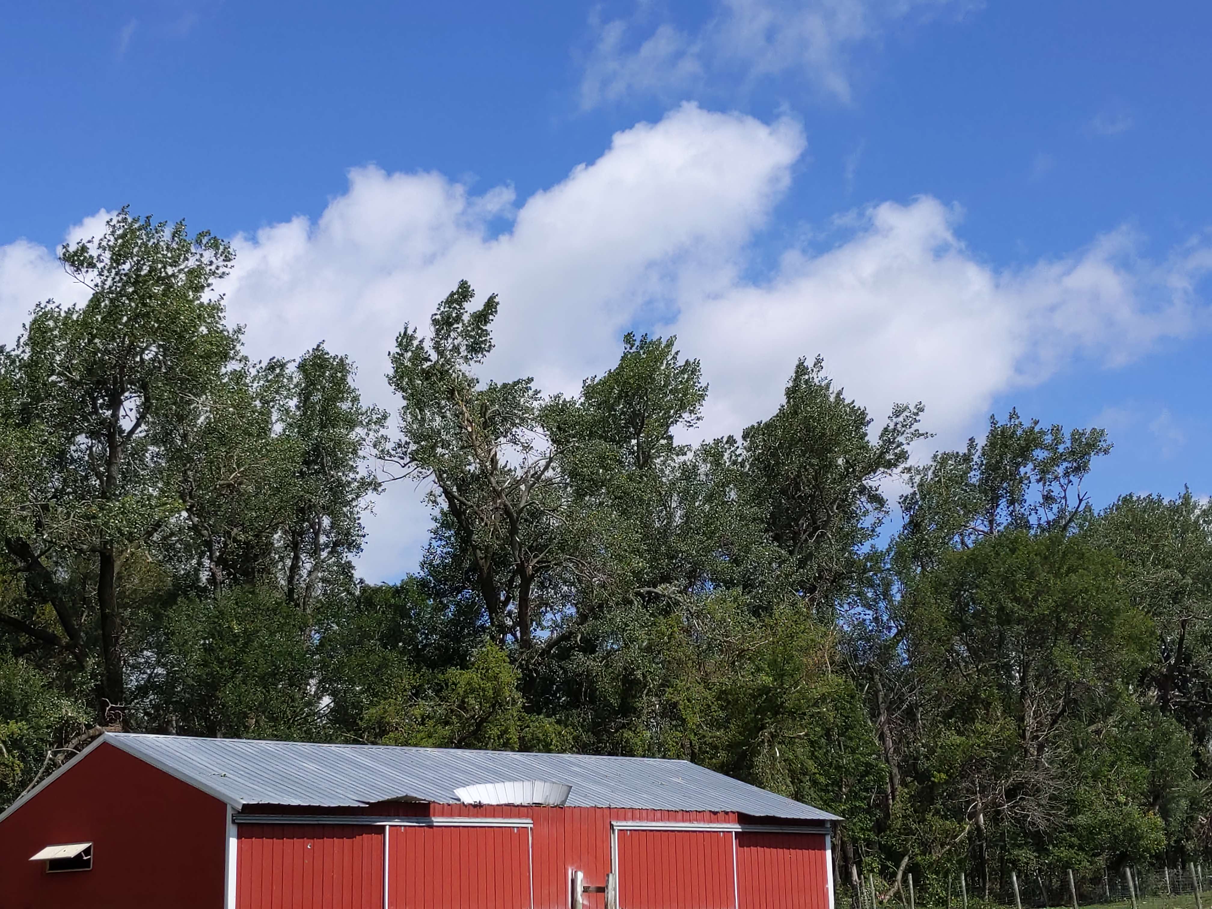
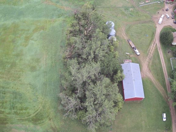
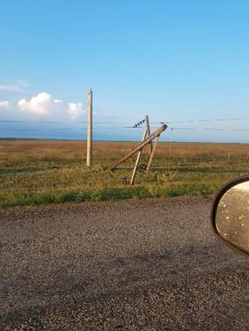
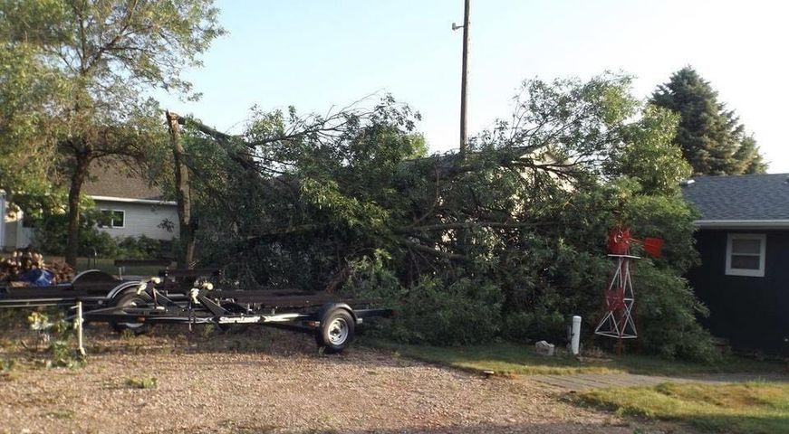
The severe thunderstorms that moved through central and eastern South Dakota during the late evening of the 27th and early morning of the 28th produced numerous wind gusts over 70 mph and caused damage to several outbuildings and trees.
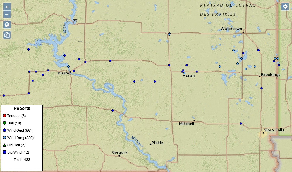 |
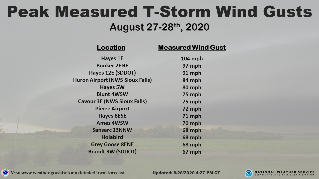 |
 |
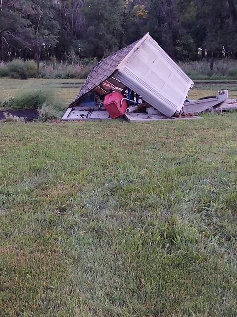 |
| Storm reports from August 27-28, 2020 (SPC) | Listing of highest measured wind gusts | Snapped power pole 4 miles WSW of Ames, SD, courtesy of Brad and Jolene Haun | Property damage 4 miles WSW of Ames, SD, courtesy of Brad and Jolene Haun |
 |
 |
 |
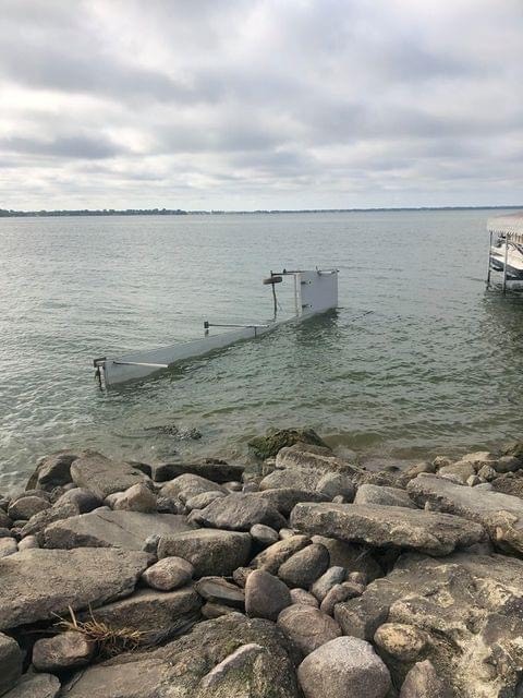 |
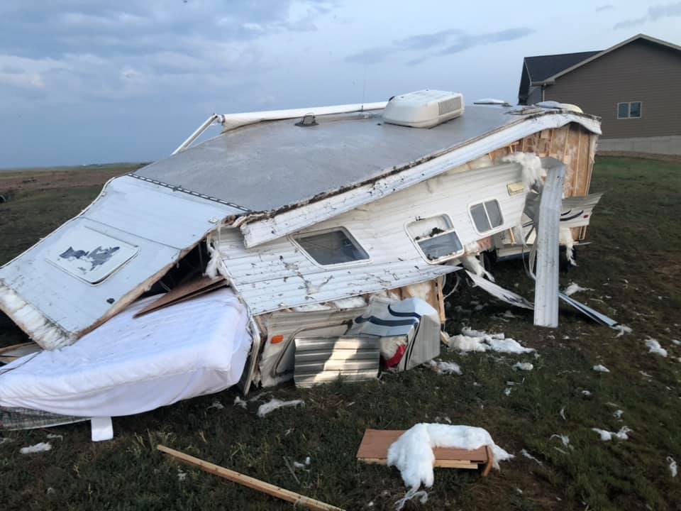
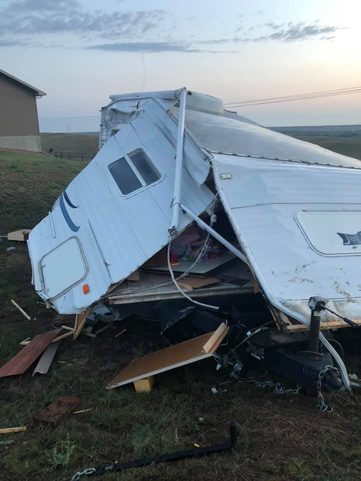
| Trailer damage from straight-line winds in Fort Pierre, courtesy of Brooke Mentele | Trailer damage from straight-line winds in Fort Pierre, courtesy of Brooke Mentele | Damage at Lake Poinsett. Photo courtesy of Vickie Barthel | Damage at Lake Poinsett. Photo courtesy of Vickie Barthel |
 |
|
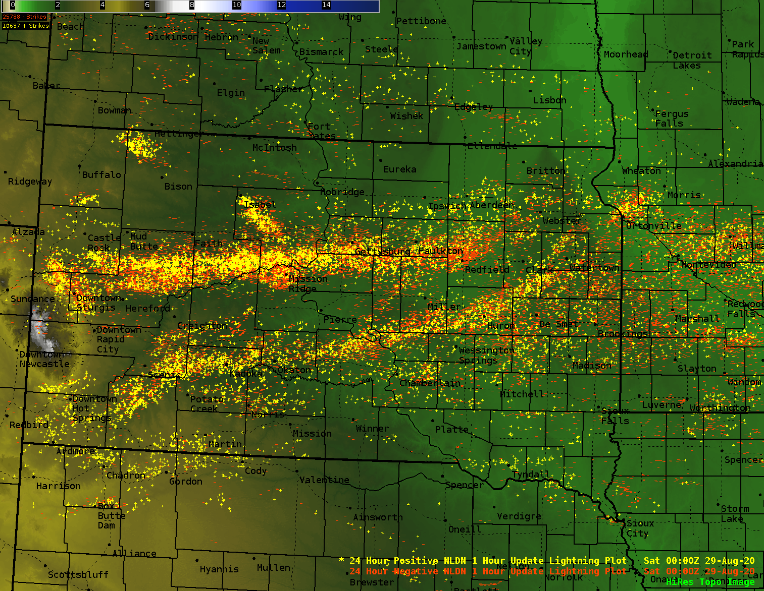
| Positive and negative lightning strikes from the event, from Vaisala's US National Lightning Detection Network | Radar loop of the storms that crossed South Dakota on August 27-28, 2020 |
PRELIMINARY LOCAL STORM REPORT...SUMMARY
NATIONAL WEATHER SERVICE ABERDEEN SD
529 PM CDT FRI AUG 28 2020
..TIME... ...EVENT... ...CITY LOCATION... ...LAT.LON...
..DATE... ....MAG.... ..COUNTY LOCATION..ST.. ...SOURCE....
..REMARKS..
1101 PM TSTM WND GST 1 E HAYES 44.37N 101.00W
08/27/2020 M104 MPH STANLEY SD PUBLIC
PERSONAL WEATHER STATION.
1100 PM TSTM WND GST 2 ENE BUNKER 44.25N 101.06W
08/27/2020 M97 MPH STANLEY SD PUBLIC
PERSONAL WEATHER STATION. RADAR ESTIMATED
TIME AND APPROXIMATE LOCATION.
1114 PM TSTM WND GST 10 SW CHANTLER CREEK RE 44.39N 100.77W
08/27/2020 M91 MPH STANLEY SD MESONET
MESONET STATION 202 HAYES (SDDOT).
1058 PM TSTM WND GST 5 W HAYES 44.37N 101.12W
08/27/2020 M80 MPH STANLEY SD PUBLIC
PEAK GUST FOR THIS PERSONAL WEATHER STATION.
1055 PM TSTM WND GST 5 W HAYES 44.37N 101.12W
08/27/2020 M78 MPH STANLEY SD PUBLIC
PERSONAL WEATHER STATION.
1143 PM TSTM WND GST 4 WSW BLUNT 44.50N 100.07W
08/27/2020 M75 MPH HUGHES SD MESONET
RWIS.
1135 PM TSTM WND GST 2 ENE PIERRE 44.38N 100.29W
08/27/2020 M72 MPH HUGHES SD ASOS
1109 PM TSTM WND GST 8 ESE HAYES 44.33N 100.87W
08/27/2020 M71 MPH STANLEY SD PUBLIC
PERSONAL WEATHER STATION.
1220 AM TSTM WND GST 4 WSW AMES 44.24N 99.15W
08/28/2020 E70 MPH HAND SD PUBLIC
DAMAGE TO OUTBUILDINGS, FENCING AND CROPS.
TIME AND WIND SPEEDS ESTIMATED.
1100 PM TSTM WND GST 13 NNW SANSARC 44.67N 101.14W
08/27/2020 M68 MPH STANLEY SD MESONET
RWIS.
1204 AM TSTM WND GST HOLABIRD 44.52N 99.60W
08/28/2020 M68 MPH HYDE SD PUBLIC
PERSONAL WEATHER STATION.
1139 PM TSTM WND GST 8 ENE GREY GOOSE 44.54N 100.19W
08/27/2020 M68 MPH HUGHES SD PUBLIC
PERSONAL WEATHER STATION.
0213 AM TSTM WND GST 7 NE ESTELLINE 44.66N 96.82W
08/28/2020 M67 MPH DEUEL SD MESONET
MESONET STATION 47 BRANDT (SDDOT).
1123 PM TSTM WND GST 1 S OKOBOJO CREEK REC A 44.59N 100.46W
08/27/2020 M62 MPH SULLY SD PUBLIC
PERSONAL WEATHER STATION. RADAR ESTIMATED
TIME.
0155 AM TSTM WND GST 3 WNW STONE BRIDGE 44.62N 97.11W
08/28/2020 M61 MPH HAMLIN SD PUBLIC
PERSONAL WEATHER STATION.
1152 PM TSTM WND GST 3 SE RELIANCE 43.85N 99.56W
08/27/2020 M58 MPH LYMAN SD MESONET
MESONET STATION 54 RELIANCE (SDDOT).
1241 AM TSTM WND GST 6 E DANFORTH 44.24N 98.77W
08/28/2020 M58 MPH HAND SD MESONET
RWIS.
1130 PM TSTM WND DMG FORT PIERRE 44.36N 100.38W
08/27/2020 STANLEY SD PUBLIC
TRAILER ROLLED AND DESTROYED. TIME AND
LOCATION ARE APPROXIMATE. PHOTO VIA SOCIAL
MEDIA.
1130 PM TSTM WND DMG 1 SSW OVERLOOK REC AREA 44.44N 100.39W
08/27/2020 STANLEY SD EMERGENCY MNGR
TREES DOWN. APPROXIMATE LOCATION AND TIME.
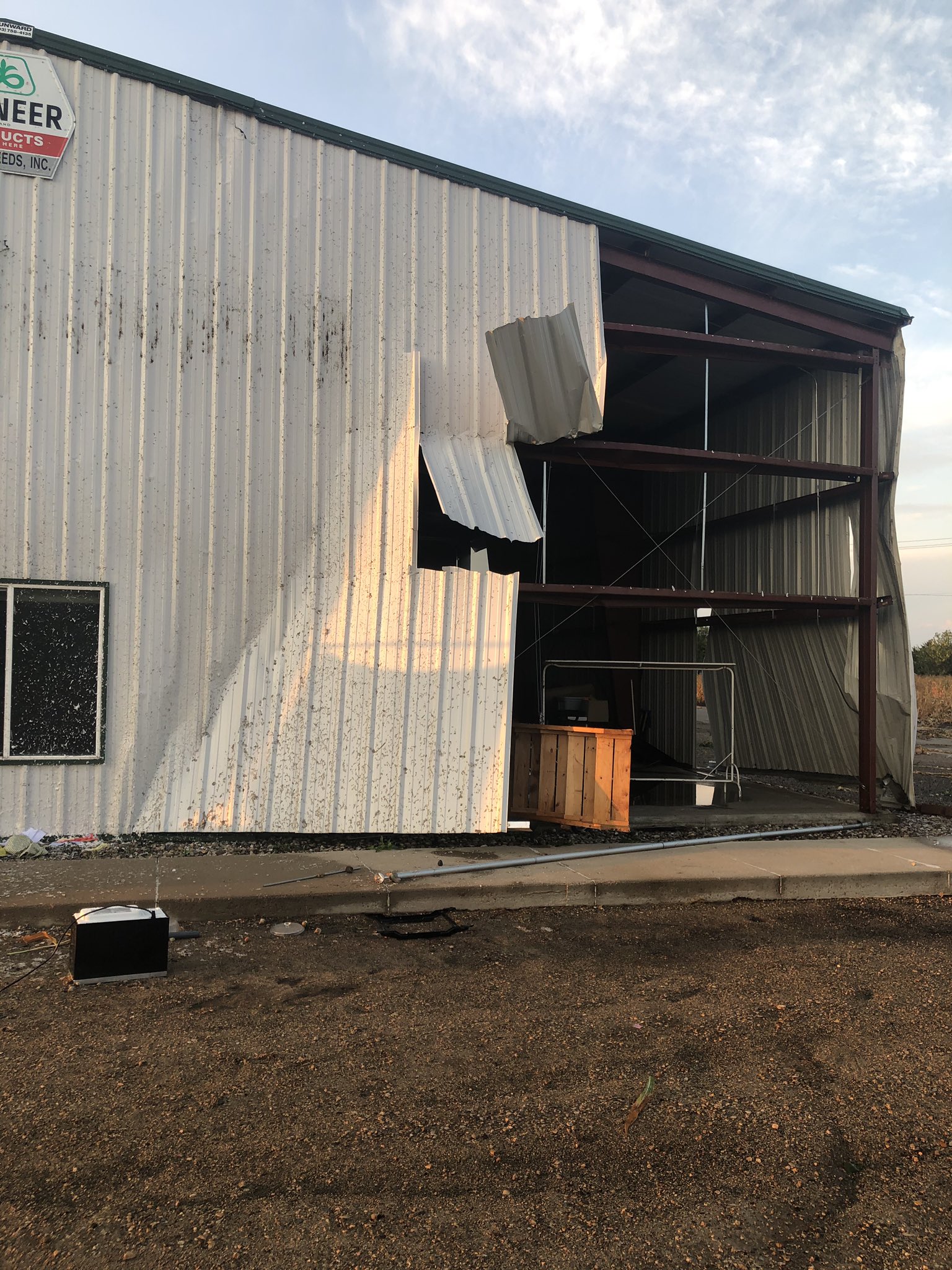
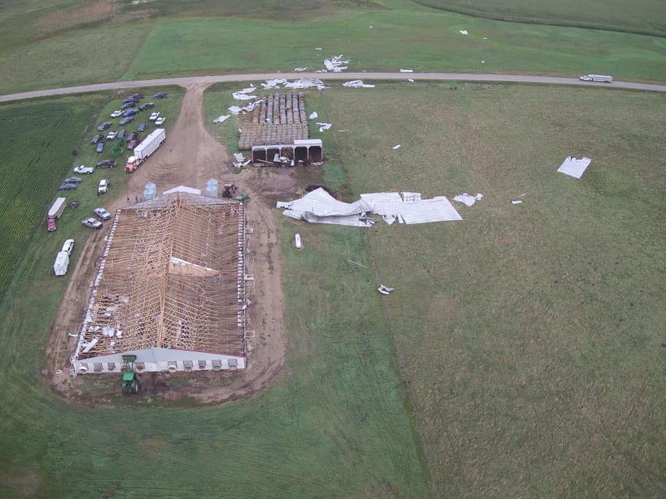
0100 AM TORNADO 1 E REDFIELD 44.87N 98.50W
08/28/2020 SPINK SD EMERGENCY MNGR
DAMAGE TO BUILDING WAS CONFIRMED TO BE A
TORNADO, WITH ADDITIONAL EVIDENCE FOR A
CIRCULATION IN AN ADJACENT CORN FIELD. THIS
IS AN UPDATE TO THE PREVIOUS REPORT OF WIND
DAMAGE. TIME IS ESTIMATED.
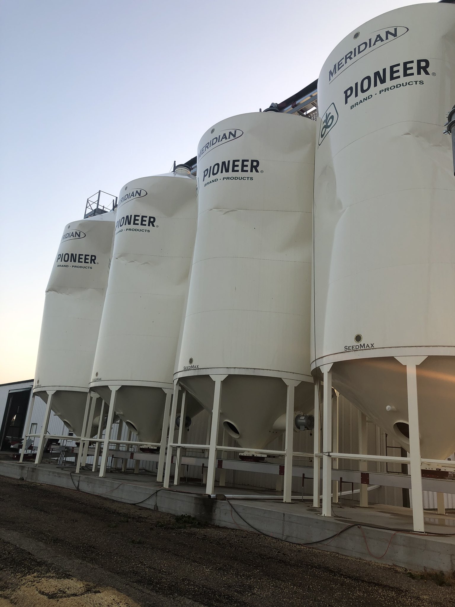
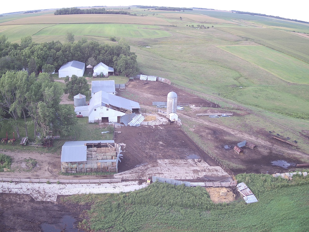
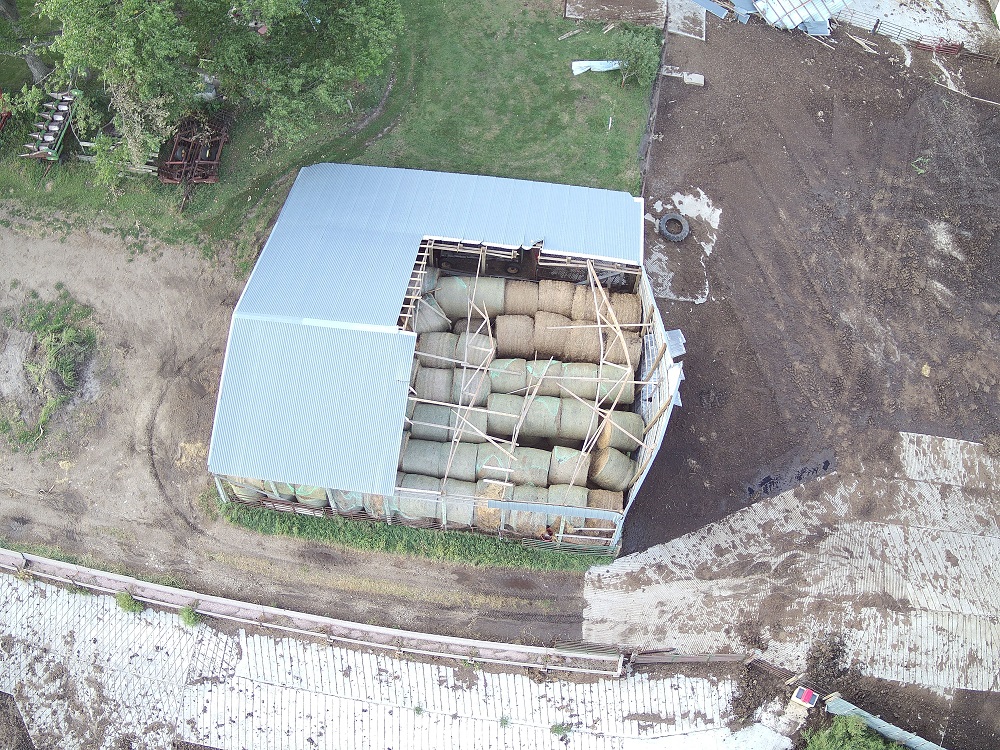
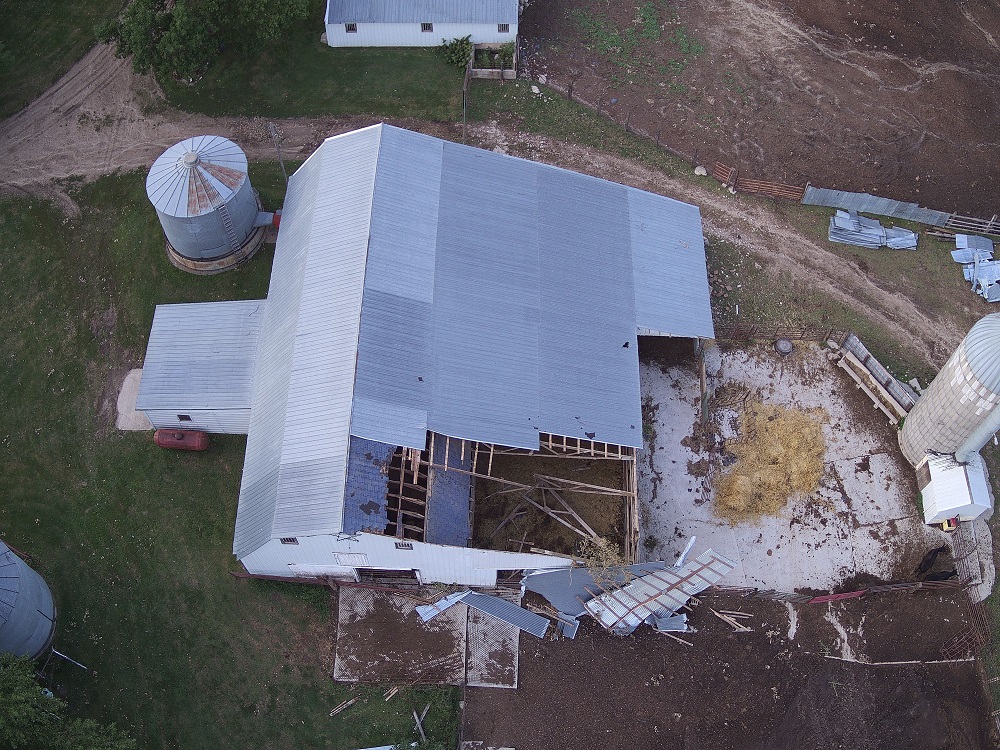
0100 AM TSTM WND DMG 1 ESE REDFIELD 44.87N 98.50W
08/28/2020 SPINK SD PUBLIC
STRUCTURAL DAMAGE TO AGRICULTURAL BUSINESS
BUILDING AND STORAGE SILOS. TIME ESTIMATED.
0100 AM TSTM WND DMG 2 E REDFIELD 44.88N 98.49W
08/28/2020 SPINK SD EMERGENCY MNGR
2 FOOT DIAMETER TREE DOWN. ESTIMATED TIME
AND APPROXIMATE LOCATION.
0150 AM TSTM WND DMG 4 ESE LAKE NORDEN 44.55N 97.14W
08/28/2020 HAMLIN SD PUBLIC
MINOR DAMAGE TO AWNINGS ON CAMPERS, TENTS
KNOCKED DOWN. VIA SOCIAL MEDIA. TIME
ESTIMATED.
0145 AM TSTM WND DMG 4 W HAYTI 44.66N 97.29W
08/28/2020 HAMLIN SD EMERGENCY MNGR
ROOF BLOWN OFF BUS BARN, DAMAGE TO DAYCARE
ROOF. ADDITIONAL TREE DAMAGE NOTED IN TOWN
OF HAYTI. TIME IS ESTIMATED.
0222 AM TSTM WND DMG 4 E ASTORIA 44.55N 96.46W
08/28/2020 DEUEL SD PUBLIC
SEVERAL TREES EITHER DAMAGED OR KNOCKED
DOWN, CALLER THINKS ITS STRAIGHT LINE WIND
DAMAGE. TIME IS ESTIMATED.
0220 AM TSTM WND DMG 2 ESE ASTORIA 44.55N 96.51W
08/28/2020 DEUEL SD PUBLIC
NUMEROUS TREES DAMAGED OR KNOCKED OVER,
APPEARS TO BE STRAIGHT LINE DAMAGE. TIME
ESTIMATED.
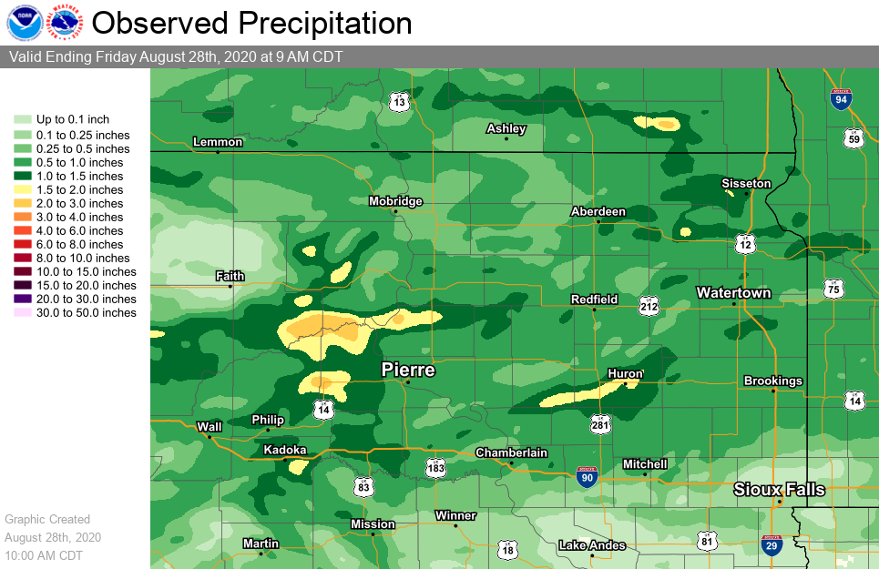
Rain Reports
Rainfall estimates from 9am August 26 to 9am August 28, 2020.
 |
Media use of NWS Web News Stories is encouraged! Please acknowledge the NWS as the source of any news information accessed from this site. |
|