Aberdeen, SD
Weather Forecast Office
Local and Regional Events:
December 29, 2005:
Heavy snow of 6 to 14 inches fell across parts of north-central and most of northeast South Dakota from the morning of the 29th through the early afternoon of the 30th. Big Stone and Traverse counties in west-central Minnesota had 7 to 8 inches of snow the evening of the 29th through the early afternoon of the 30th. Light rain and freezing rain fell before the snow, creating some slick roads which resulted in some accidents. Some snowfall amounts included 7 inches at Watertown, Big Stone City, and Artichoke Lake; 8 inches at Waubay, Browns Valley, and Wheaton; 9 inches northeast of Isabel and Hecla; 10 inches at Wilmot and Clear Lake; 12 inches at Milbank; and 14 inches at Summit.
U.S.A and Global Events for December 29th:
December 29, 1876:
The Pacific Express train was crossing the Ashtabula River in Ohio when the bridge collapsed. The bridge collapsed at 7:28 PM, during a snowstorm that left two feet of snow and produced 40 mph winds. The only railcar not to fall into the icy river below was the first locomotive.

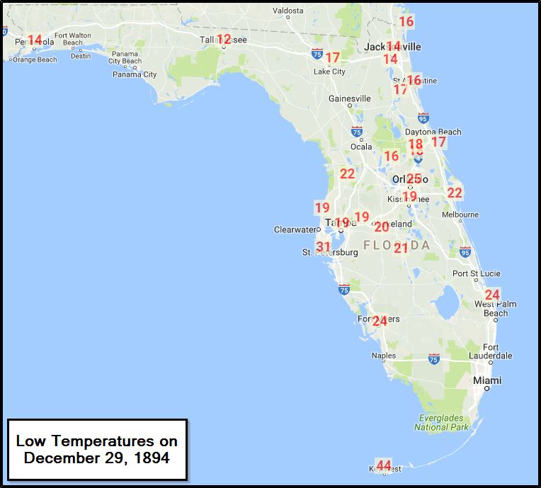
December 29, 1894:
Express A severe freeze hit Florida destroying fruit and causing considerable damage to trees.

US Dept of Commerce
National Oceanic and Atmospheric Administration
National Weather Service
Aberdeen, SD
824 391st Ave S.
Aberdeen, SD 57401-9311
605-225-0519
Comments? Questions? Please Contact Us.

