Weather History - October 6th
Local and Regional Events:
October 6, 1994:
During the late afternoon hours, a small tornado traveled for 3 miles along an intermittent path east of Browns Valley, damaging several buildings on a local farmstead. Another tornado touched down east of Wilmot, South Dakota, in Roberts County. The tornado was on the ground for eight miles and destroyed several small farm buildings, a garage, damaged farm machinery, blew down a grain bin, and uprooted several trees. Several hogs were killed when their shed was destroyed, and minor damage was done to some homes. The tornado drove a 6-foot long 1x6 piece of lumber through the center of a large tree limb.
U.S.A and Global Events for October 6th:
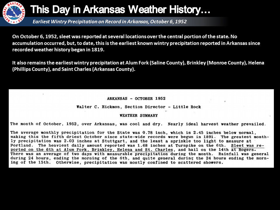
1952: Sleet fell at several locations, making it the earliest documented winter precipitation in Arkansas.
1967: A Canadian weather record one-day rainfall of 19.3 inches falls at Brynnor Mines at Ucluelet. Click HERE for more information from the website, Environment, and Climate Change Canada.
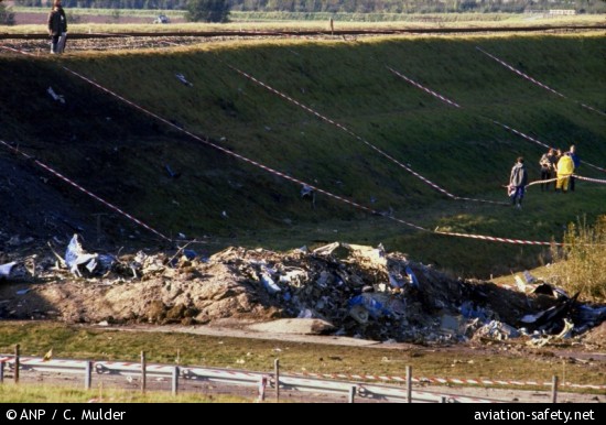
1981: The Netherlands' fourth-worst aircraft accident (at the time) occurred on this day. At 5:09 PM, the crew noted heavy rainfall in thunderstorms on the weather avoidance radar and received clearance to avoid this area. At 5:12 pm, the aircraft entered a tornado, which caused the right-wing to separate from the plane. All 17 occupants of the plane perished in the accident. The Accident description can be found HERE.
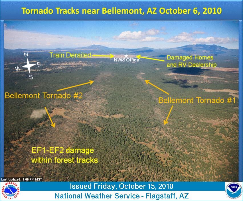
2010: A significant severe weather event struck northern Arizona with at least eight confirmed tornadoes. This event will go down in history as the most tornadoes to hit Arizona in a single day. An EF2 tornado was on the ground for 34 miles, ranking as the longest-tracked tornado in Arizona history. Click HERE for more information from the NWS Office in Flagstaff.

A home damaged by an EF2 tornado in Bellemont, Arizona. Image courtesy of the National Weather Service office in Flagstaff, Arizona.
2016: Around a half dozen tornadoes struck Kansas, including an EF-2 and EF-3 in Saline County. Click HERE for more information from the NWS Office in Witchita, Kansas.
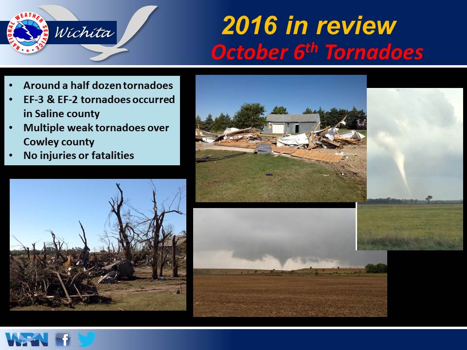
The image above is from a tweet by the NWS Office in Wichita, Kansas.
2016: The center of Category 4 Hurricane Matthew passed within 100 miles of Miami, Florida.
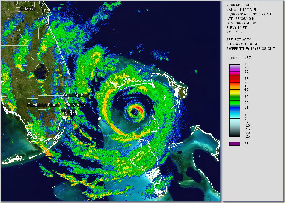
The image above is from Brian McNoldy, a Senior Research Associate at the University of Miami's Rosential School.
Click HERE for more This Day in Weather History from the Southeast Regional Climate Center.