Local and Regional Events:
October 9, 1964:
Record cold occurred on this day in 1964 across parts of central and northeast South Dakota with temperatures falling into the mid-teens to around 20 degrees at many locations. Sisseton had a record low of 20 degrees; Watertown had a record low of 16 degrees, with Kennebec recording the lowest temperature of 13 degrees on this day in 1964. Although not a record low, Aberdeen fell to 14 degrees.
October 9, 1980:
On this day in 1980, hot air streamed across central and northeast South Dakota as well as west-central Minnesota with highs mostly in the 80s. Record highs were established at Watertown with 86 degrees and both Wheaton and Sisseton with 87 degrees. One of the warmest temperatures across the area was 89 degrees at Kennebec.
U.S.A and Global Events for October 9th:
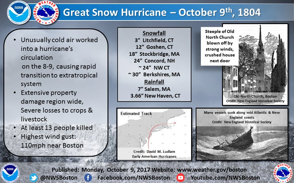
1804: The famous Snow Hurricane moved ashore near Atlantic City on this day. After briefly passing through Connecticut and into Massachusetts, cold air was entrained in the circulation with heavy snow falling between New York to southern Canada. Berkshires Massachusetts and Concord New Hampshire record two feet of snow with this hurricane. This storm produced the first observation of snow from a hurricane, but not the last. Hurricane Ginny of 1963 brought up to 18 inches (400 mm) of snow to portions of Maine. Click HERE for more information from the New England Historical Society.

The photograph above is the Old North Church in Boston. This second steeple was replaced after being toppled by the 1804 hurricane.

The graphic above is from a tweet by the NWS Office in Boston, MA.
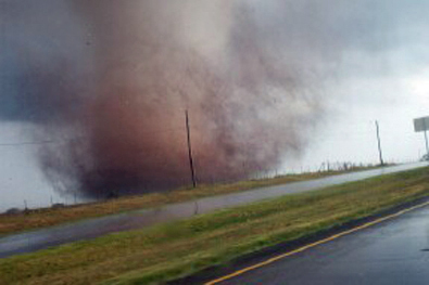
2001: An unusually strong fall outbreak of tornadoes spawned at least 23 twisters across parts of Nebraska and Oklahoma. Hardest hit was the town of Cordell, OK, but a 22 minute lead time led to an amazingly low casualty count: only nine injuries and no fatalities. Click HERE for more information from the NWS office in Norman, Oklahoma.

The image above was taken by a Kiowa County Deputy, Doug Beamon, one mile north of Cordell, OK at ~5:30 PM CDT on 10/09/2001.
2013: The Puglia region of southern Italy saw tornadoes on this day. Click HERE for more information for the website, Severe Weather Europe.
Click HERE for more This Day in Weather History from the Southeast Regional Climate Center.