Local and Regional Events:
September 9, 1961:
A young girl in Bullhead, Corson County, was killed by lightning on the afternoon while walking on the highway. Her little brother was slightly injured.
September 9, 1983:
High winds from the late evening into the early morning hours of the 10th blew through east central South Dakota damaging crops, downing hundreds of trees, breaking windows, damaging roofs and buildings, downing power poles and damaging vehicles. Gusts to 75 mph in Huron moved a semi-trailer a half block. Scattered power outages of up to 24 hours were reported in numerous areas as branches fell across power and telephone lines. Thirty power poles were downed in Kingsbury County alone. Corn, beans, and sunflowers suffered extensive damage in many areas with up to 50 percent losses reported. Gusts up to 90 mph were reported at Lake Poinsett, Lake Norden, and Estelline, where roofs and shingles were ripped from buildings and numerous windows, were broken. At Lake Poinsett, extensive damage was done to boats, docks, and automobiles.
U.S.A and Global Events for September 9th:
1775: The Independence Hurricane slammed into Halifax, Nova Scotia, Canada. Many ships were sunk and buildings demolished. 4,000 people died in what is considered to be Canada's deadliest hurricane disaster.
1821: A tornadic outbreak affected the New England states of Massachusetts, New Hampshire, and Vermont on this day. Five tornadoes reportedly touched down from this event. One storm in New Hampshire had a path width of a half mile and tracked an estimated 23 miles. This tornado killed at least six individuals, which could be the deadliest tornado in New Hampshire history. Click HERE for more information from archive.org
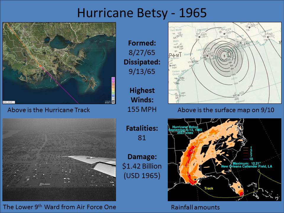
1965: Hurricane Betsy slammed into New Orleans on the evening of September 9, 1965. 110 mph winds and power failures were reported in New Orleans. The eye of the storm passed to the southwest of New Orleans on a northwesterly track. The northern and western eyewalls covered Southeast Louisiana and the New Orleans area from about 8 PM until 4 AM the next morning. In Thibodaux, winds of 130 mph to 140 mph were reported. The Baton Rouge weather bureau operated under auxiliary power, without telephone communication.
2013: Historical rainfall occurred in northern Colorado from September 9 to September 16 and resulted in severe flash flooding along the northern Front Range of Colorado and subsequent river flooding downstream along the South Platte River and its tributaries. The heaviest rain fell along the Front Range northwest of Denver on September 11–12.
Click HERE for more This Day in Weather History from the Southeast Regional Climate Center.

