Local and Regional Events:
September 28, 1951:
During the early morning hours, near-record to record cold covered central and northeast South Dakota as well as west-central Minnesota. Temperatures across the area fell into the upper teens and 20s. Aberdeen recorded a record low of 18 degrees; Kennebec dropped to 20 degrees, Pierre fell to 21 degrees while Timber Lake had a record low of 23 degrees. The overnight low in Mobridge was 23 degrees, 24 degrees at Watertown, and 26 degrees at Sisseton.
U.S.A and Global Events for September 28th:
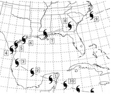
1837: The first recorded storm to rake the entire Texas coast was Racer’s Storm, named for a British sloop of war which encountered the system in the extreme northwestern Caribbean on September 28th. It is remembered as one of the most destructive storms of the nineteenth century due to its extreme duration and 2000 mile path of destruction.

The image above is courtesy of the Weather Prediction Center. The numbers next to the hurricane symbols are dates.
1874: A strong category 1 hurricane went by Charleston and Georgetown, South Carolina. The tide was unprecedented height, inundating the entire riverfront of the city of Charleston. Click HERE for a tweet by Cary Mock, Profesor at the University of South Carolina.
1929: A hurricane-spawned tornado hit Fort Lauderdale, Florida. While the path length of this estimated F2 tornado was 0.8 miles, it caused 16 injuries. Click HERE for a tweet from Tornado Talk.
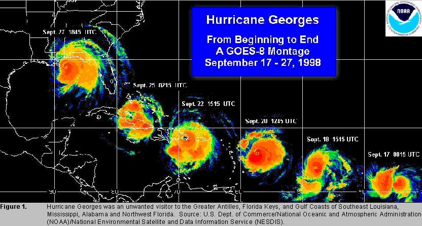
1998: On the morning of September 28th, Hurricane George made landfall near Biloxi, Mississippi with maximum winds of 110 mph and a minimum pressure of 964 mb, making it a Category 2 hurricane. After landfall, Georges moved very slowly across southern Mississippi and weakened to a tropical depression by the morning of the 29th when the center was about 30 miles north-northeast of Mobile, Alabama. The storm dissipated near the northeast Florida/southeast Georgia coast by the morning of October 1, 1998. Click HERE for more information from the National Weather Service Office in Mobile.

Click HERE for more This Day in Weather History from the Southeast Regional Climate Center.