A strong surface low pressure system developed over the high plains of Colorado on Saturday afternoon (2/9) then tracked northeastward across Nebraska and into southern Minnesota on Sunday (2/10). Significant moisture drawn up from the south interacted with a seasonably cold airmass over the Dakota's resulting in widespread snowfall beginning Saturday night. Moderate to occasionally heavy snowfall and increasingly strong winds continued on Sunday and Sunday night. The combination very strong north to northwesterly winds and snowfall resulted in widespread blizzard conditions over central and northeastern South Dakota, and west-central Minnesota from late Saturday night through early Monday. Visibility at many locations dropped below one quarter mile for several hours, with intermitent visibility reduced to near zero at times. Interstate 29 was closed from Sioux Falls to Fargo, and Interstate 90 was closed from Sioux Falls to Wall. Travel on other area roadways was difficult if not impossible. Snowfall amounts from this event were very impressive! The highest storm total snowfall amounts occurred over northeastern South Dakota, where 12" to 20" totals were common. A few locally higher amounts around 2 feet were also reported. Snowfall amounts decreased to the south and west - with totals in these areas generally ranging from 2" to 10". However, due to the significant blowing and drifting snow during blizzard events, accurate snowfall measurements were extremely challenging.
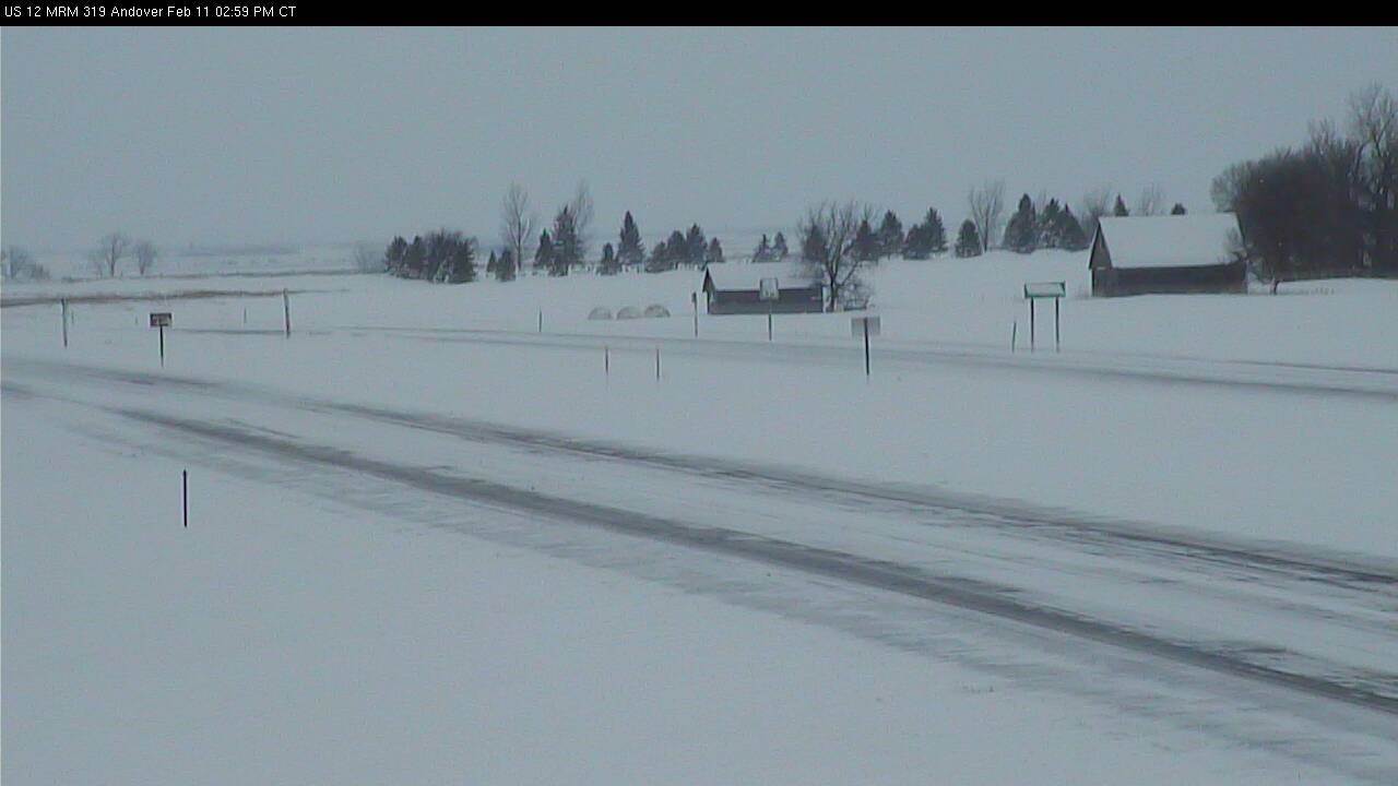
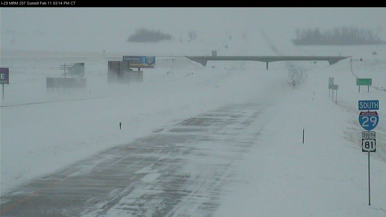
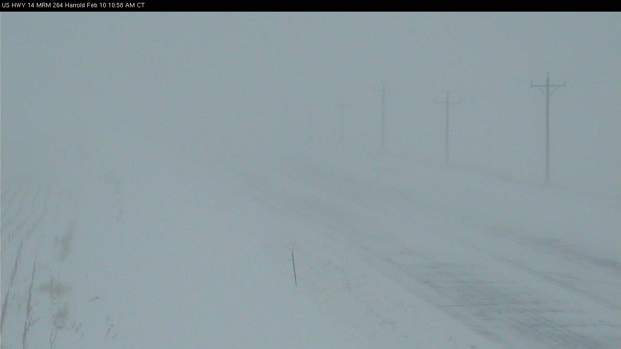
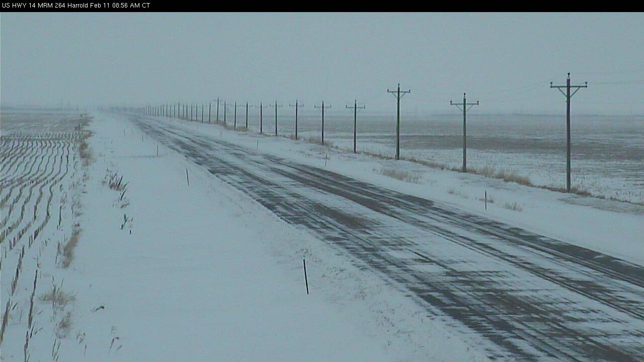
The images below depict the visibility restrictions on area roadways. Note the extreme reductions in visibility due to the blizzard conditions.
US Highway 12 - East of Aberdeen, SD (images courtesy of SDDOT)
 |
.jpg) |
Interstate 29 - Near Summit, SD (images courtesy of SDDOT)
 |
.jpg) |
US Highway 14 - East of Pierre, SD (images courtesy of SDDOT)
 |
 |
A graphical depiction and tabular listing of the preliminary snowfall reports are provided below.
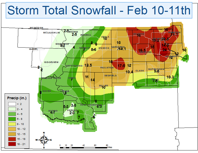
********************STORM TOTAL SNOWFALL********************
LOCATION STORM TOTAL TIME/DATE COMMENTS
SNOWFALL OF
/INCHES/ MEASUREMENT
MINNESOTA
...BIG STONE COUNTY...
ORTONVILLE 12.0 700 AM 2/11
ARTICHOKE 10.0 1011 PM 2/10
...TRAVERSE COUNTY...
WHEATON 17.1 700 AM 2/11
SOUTH DAKOTA
...BROWN COUNTY...
BATH 14.1 900 AM 2/11
NWS ABERDEEN 13.2 445 AM 2/11
WESTPORT 13.0 700 AM 2/11
...BUFFALO COUNTY...
GANN VALLEY 6.3 700 AM 2/11
...CAMPBELL COUNTY...
POLLOCK 2.5 706 PM 2/10
...CODINGTON COUNTY...
2 E WATERTOWN 11.8 700 AM 2/11
WATERTOWN 9.5 700 AM 2/11
...DAY COUNTY...
WEBSTER 15.3 1159 AM 2/10
PICKEREL LAKE STATE 15.0 800 AM 2/11
...DEUEL COUNTY...
CLEAR LAKE 10.3 700 AM 2/11
...EDMUNDS COUNTY...
ROSCOE 8.6 700 AM 2/11
BOWDLE 7.0 600 PM 2/10
...FAULK COUNTY...
1 S CHELSEA 15.0 700 AM 2/11
SENECA 12.5 700 AM 2/11
...GRANT COUNTY...
MILBANK 12.0 700 AM 2/11
...HAMLIN COUNTY...
HAYTI 7.5 700 AM 2/11
...HAND COUNTY...
MILLER 10.0 700 AM 2/11
...HUGHES COUNTY...
1 S PIERRE 6.5 700 AM 2/11
PIERRE 5.0 700 AM 2/11
...HYDE COUNTY...
12 N HIGHMORE 14.0 700 AM 2/11
...JONES COUNTY...
MURDO 4.7 700 AM 2/11
...LYMAN COUNTY...
KENNEBEC 7.0 641 PM 2/10
...MARSHALL COUNTY...
BRITTON 16.0 700 AM 2/11
...MCPHERSON COUNTY...
LEOLA 10.0 700 AM 2/11
...ROBERTS COUNTY...
WILMOT 24.0 700 AM 2/11
10 ENE SISSETON 20.3 700 AM 2/11
4 W SISSETON 19.2 700 AM 2/11
VICTOR 16.0 700 AM 2/11
SISSETON 14.5 700 AM 2/11
...SPINK COUNTY...
TURTON 17.5 700 AM 2/11
DOLAND 10.4 700 AM 2/11
...STANLEY COUNTY...
HAYES 8.0 700 AM 2/11
...SULLY COUNTY...
ONIDA 7.0 700 AM 2/11
...WALWORTH COUNTY...
SELBY 4.0 700 AM 2/10
MOBRIDGE 3.2 700 AM 2/11

