Numerous severe thunderstorms are expected across a broad region from the Ohio Valley to the Mid-Atlantic and Northeast States today into tonight. Swaths of damaging wind gusts are expected and some tornadoes are possible. Bertha is expected to bring tropical storm conditions to portions of the Gulf Coast from the Florida Panhandle westward to southeastern Louisiana later today and Wednesday. Read More >
The Arctic high pressure that settled across the Dakotas Wednesday, 14 January 2009, allowed for some extremely low temperatures Thursday morning. Below is a list of records for this date:
PUBLIC INFORMATION STATEMENT
NATIONAL WEATHER SERVICE ABERDEEN SD
1105 AM CST THU JAN 15 2009
...NUMEROUS RECORD LOW TEMPERATURES SET ACROSS THE AREA...
LISTED BELOW ARE CITIES WITH TODAY`S LOW...RECORD LOW AND
THE YEAR SET.
...CENTRAL AND NORTHEAST SOUTH DAKOTA...
TODAYS`S
CITY............TODAY`S LOW...RECORD LOW...YEAR SET
ABERDEEN...........-42...........-42.........2009
ABERDEEN CRN 35WNW.-34.............M............M
COLUMBIA 8N........-39...........-39.........2009
BOWDLE SDSU SITE...-35.............M............M
EAGLE BUTTE RAWS...-26.............M............M
FAULTON SDSU SITE..-25.............M............M
GETTYSBURG.........-25...........-32.........1972
HIGHMORE SDSU SITE.-26.............M............M
MARSHALL CO RAWS...-28 ............M............M
MILBANK............-32...........-32.........2009
MOBRDIGE...........-33...........-33.........2009
PIERRE.............-24...........-27.........1972
ROSCOE.............-32...........-37.........1972
POLLOCK............-47...........-47.........2009
REDFIELD...........-29...........-37.........1963
SISSETON...........-31...........-31.........2009
SOUTHSHORE SDSU....-34.............M............M
TURTON.............-38.............M............M
WAKPALA............-41.............M............M
WATERTOWN..........-34...........-35.........1972
WESTPORT...........-39.............M............M
WILMOT.............-26.............M............M
VICTOR.............-29...........-34.........1994
...WEST CENTRAL MINNESOTA...
CITY............TODAY`S LOW...RECORD LOW...YEAR SET
BROWNS VALLEY......-32...........-32.........2009
ORTONVILLE SE RAWS.-38.............M............M
WHEATON............-30...........-32.........1917
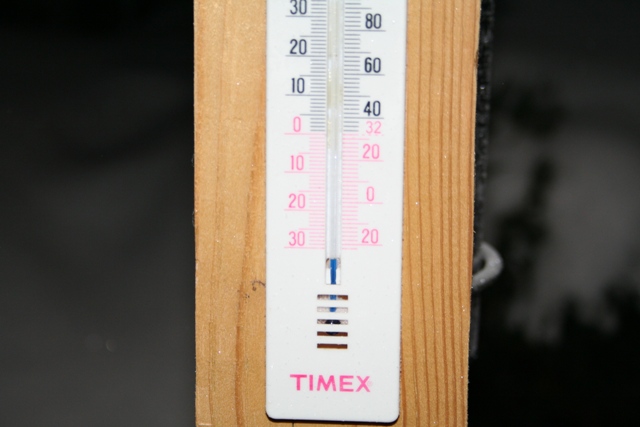
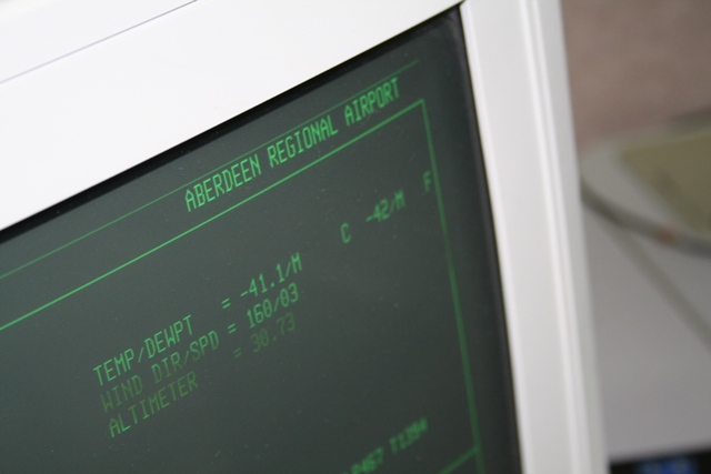
First: Many of us found out that its difficult to measure how cold it actually got at our house. Thankfully, there is a more accurate temperature sensor at the airport.
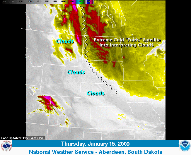
Satellite images can interpret these temperatures as cloud cover. This is an image from this morning, what we call an IR Satellite Image. Normally, the satellite "sees" heat coming off the earth which the forecaster can interpret as different types of cloud. Temperatures negative 30 and below are indicative of cirrus clouds which are typically characterized by thin, wisplike strands, often accompanied by tufts, and sometimes are so extensive that they are virtually indistinguishable from one another, forming a sheet of Cirrus called cirrostratus. Cirrus clouds are formed when water vapor freezes into ice crystals at altitudes above 8000 meters (26,000 ft). Obviously it was clear outside, but not if you trusted the satellite image from this morning.
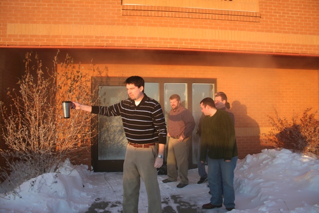
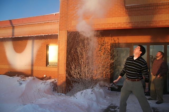
Have you ever heard of the rumor that hot water can freeze in mid-air when it is this cold? The images below show several meteorologists proving the experiment possible.