Aberdeen, SD
Weather Forecast Office
The combination of very strong southerly winds, low relative humidity, unseasonably warm temperatures, and tinder dry fuels led to numerous grass fires across central and eastern South Dakota on October 5-6, 2011.
Figure 1 below is a visible satellite picture from shortly after 2pm CDT (1901UTC) on Wednesday, October 5th. The red circles denote locations where grass fires were observed on satellite data. The streaks of white within the red circles are smoke plumes being pushed from south to north by the prevailing southerly winds. The other white areas (generally west of the Missouri River/Lake Oahe) are normal clouds - not smoke plumes.
Figure 1:
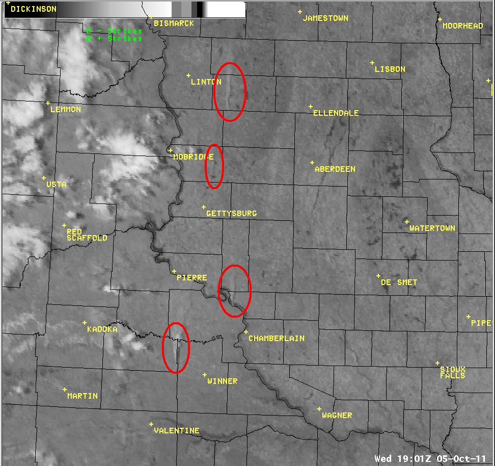
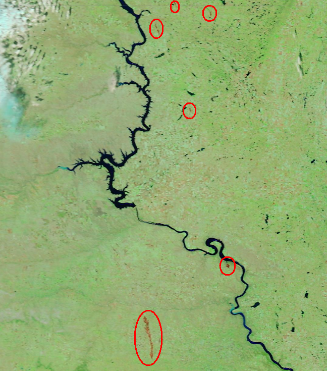
Figure 2 below is a very high resolution (250 meter) "false color" satellite imagery from the MODIS satellite valid from Friday afternoon, October 7th. The streaks of brown within the red circles are burn scars from a few of the larger prairie fires. The most significant burn scar is associated with the Okreek fire, which grew to over 17,500 acres in size near Mission, SD.
Figure 2:
US Dept of Commerce
National Oceanic and Atmospheric Administration
National Weather Service
Aberdeen, SD
824 391st Ave S.
Aberdeen, SD 57401-9311
605-225-0519
Comments? Questions? Please Contact Us.

