Widespread life-threatening flash and urban flooding continues in south-central Texas, with considerable flooding impacts possible across central Texas. Wildfire smoke is impacting air quality across much of the Great Lakes region into southern New England and the Mid-Atlantic. Monsoonal thunderstorms may produce isolated to scattered flash flooding across the Southwest into the Great Basin. Read More >
|
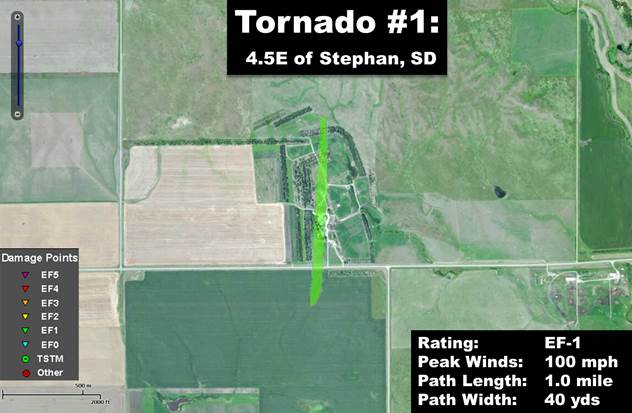
Central South Dakota Tornadoes: 18 June 2014
|
|
|
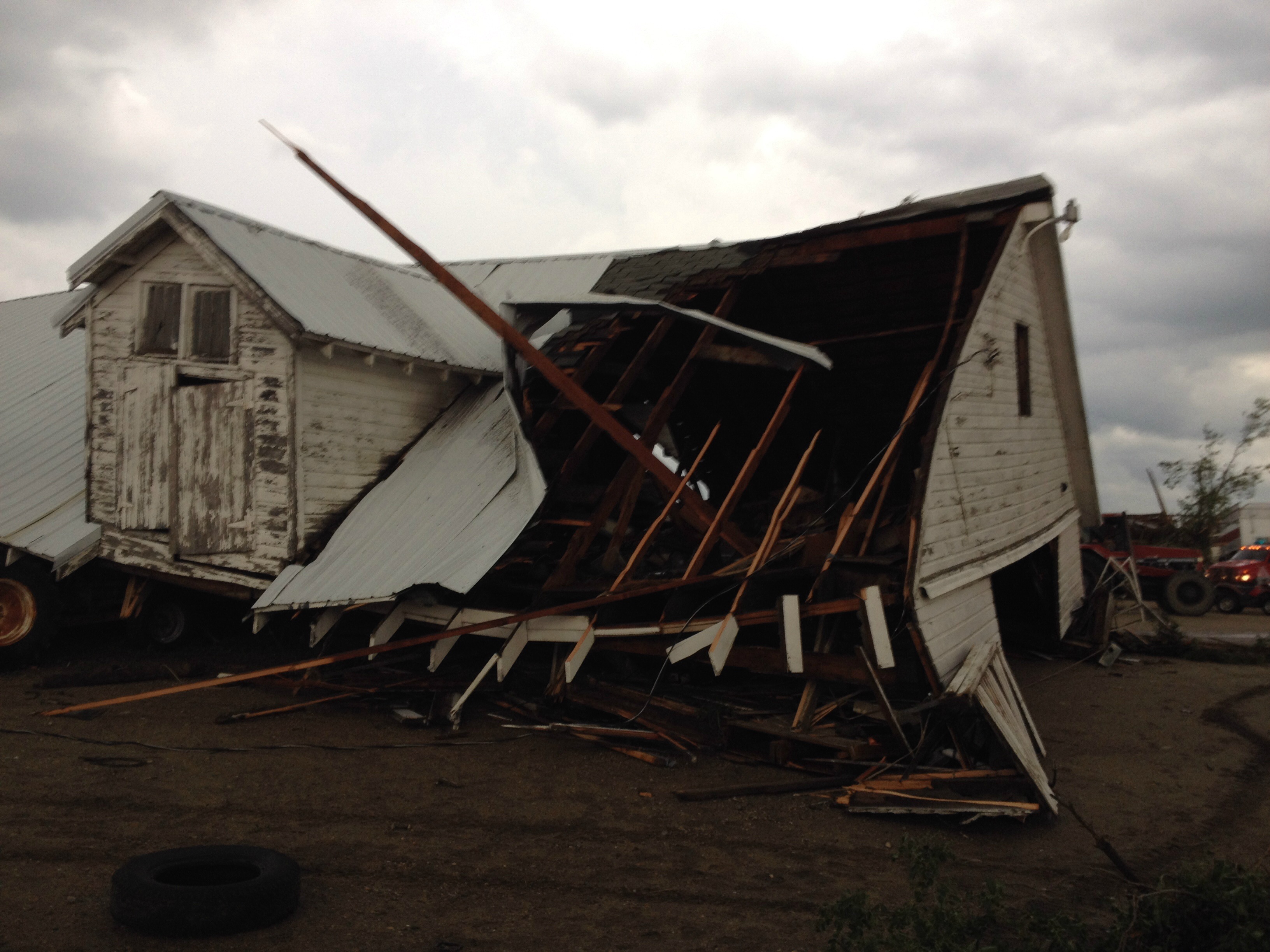
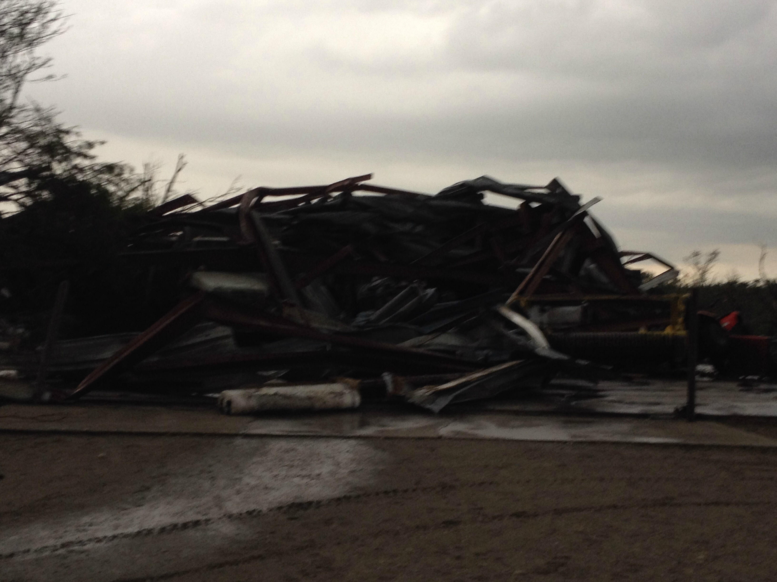
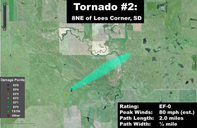
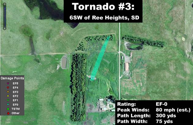
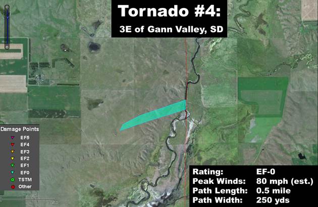
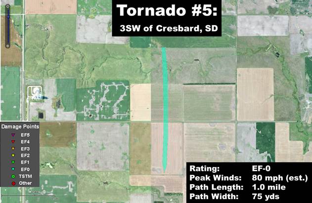
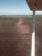
Summary/Highlights: During the late afternoon and evening hours of June 18th, 2014, a cluster of severe storms produced a total of five (5) tornadoes across portions of central South Dakota. While a majority of the tornadoes remained over ranchland and cropland, two farmsteads did sustain damage. The worst tornadic damage occurred on a farm just to the east of Stephan, SD, where EF-1 damage was surveyed. One other farm southwest of Ree Heights sustained EF-0 damage. A summary of each tornado event in the NWS Aberdeen forecast area and the approximate tornado track is provided below, along with any related photographs. For information on the Wessington Springs EF-2 tornado, please click HERE for a summary from the NWS in Sioux Falls. For information on the Alpena area EF-4 tornado, please click HERE for a summary from the NWS in Sioux Falls.
|
|
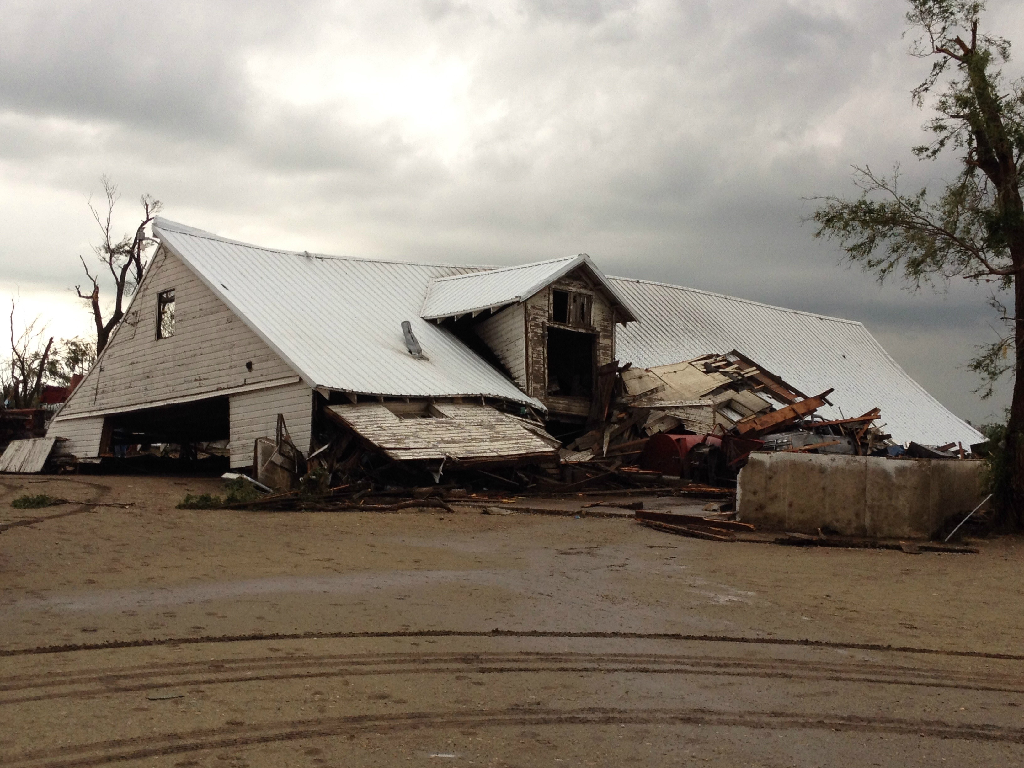
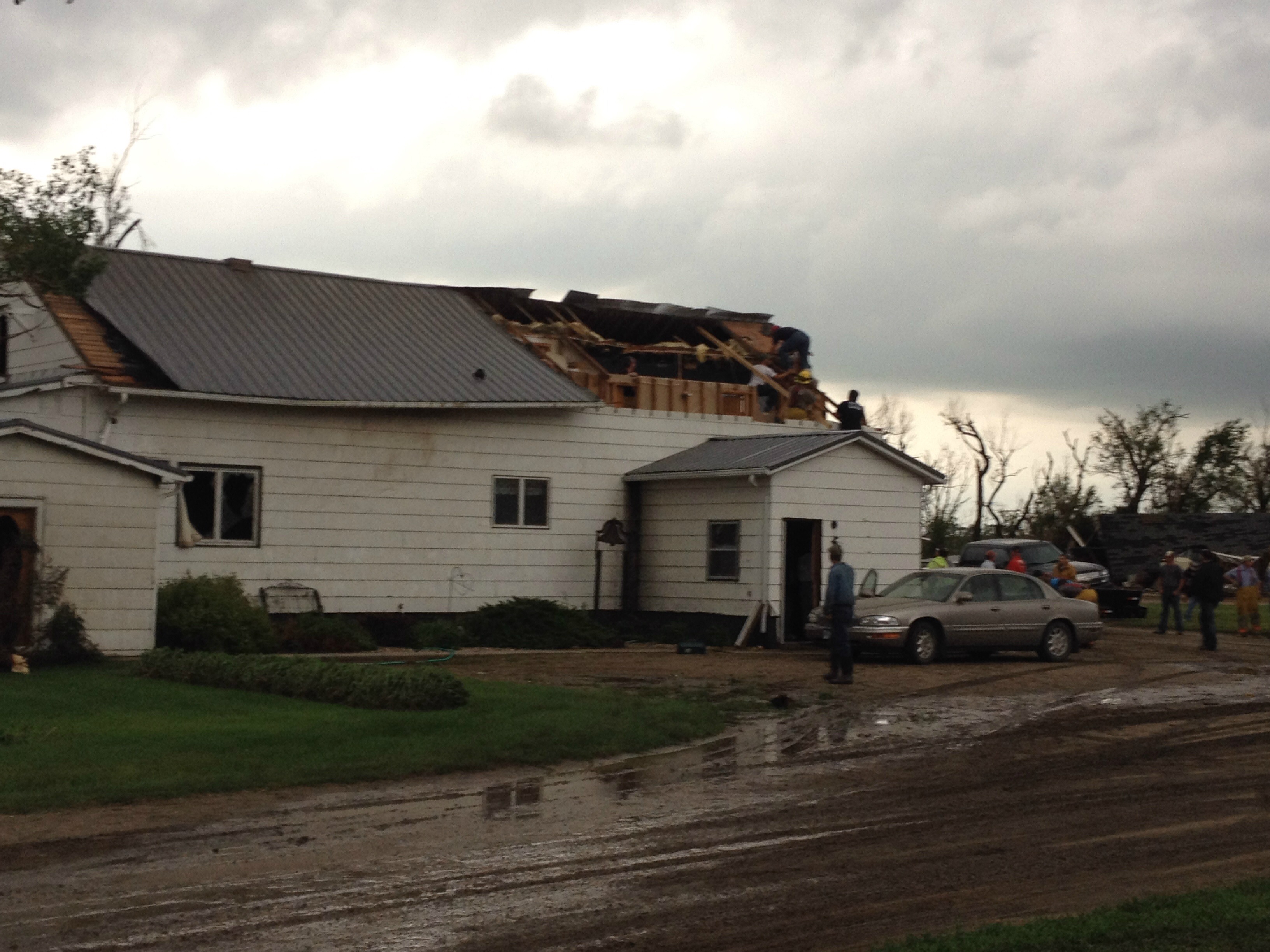
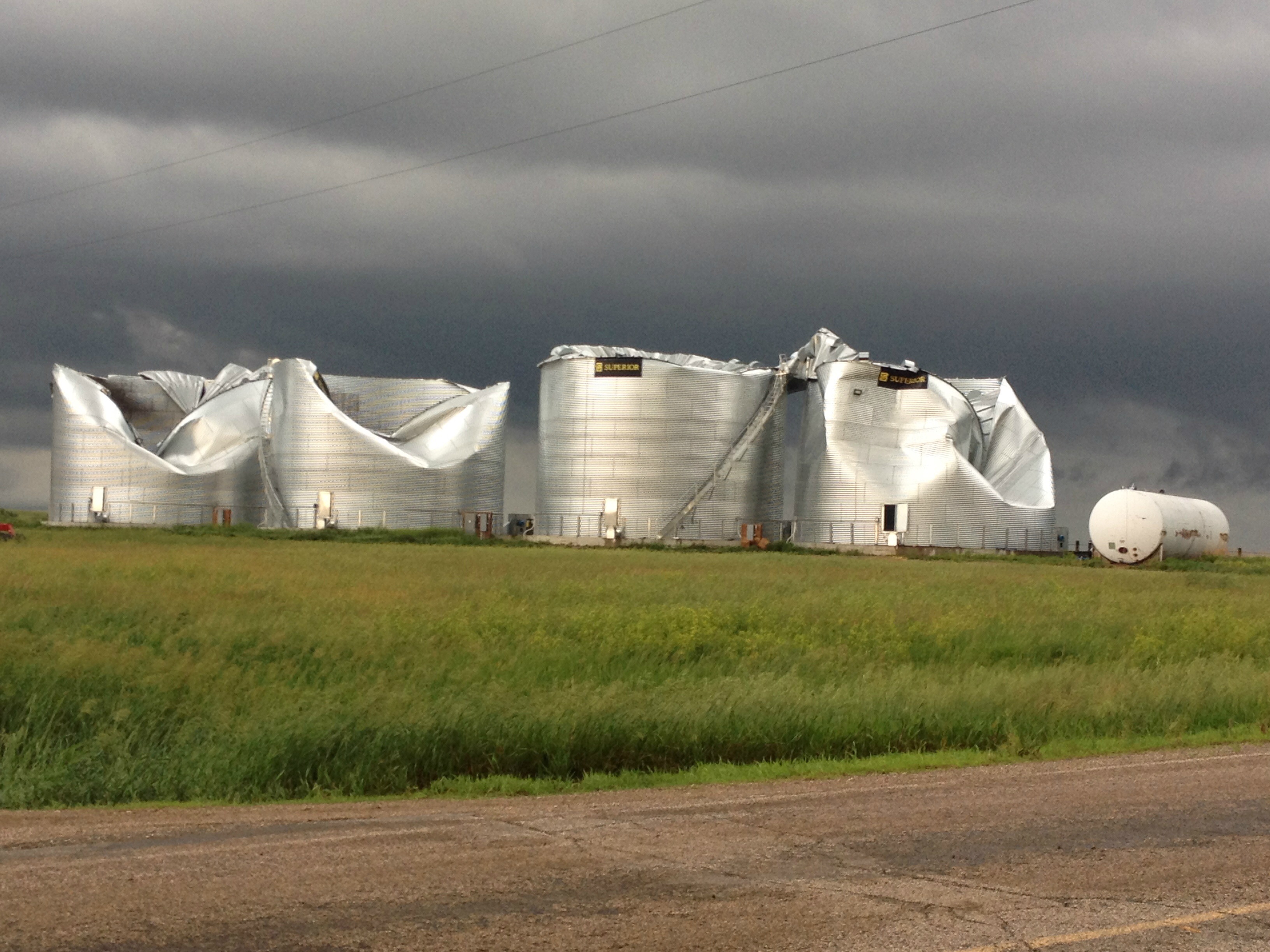
Damage Photos (click to enlarge):
|
|
|
|
|
|
|
|
|
|
|
|
|||||||||||
|
Damage Photos (click to enlarge):
|
|
|
|||||||||
|
|
|
|
|
|
|
|
|
|
|
|
|
|