Occasionally, this same process occurs over Lake Oahe in central South Dakota. The lake is sufficiently large (especially now that it is filled nearly to capacity) such that given the right atmospheric conditions and wind trajectory, clouds and snow showers can form downwind of the lake.
The combination of a very cold and unstable airmass, northwesterly winds in the low levels of the atmosphere, and an upper level disturbance produced several bands of “enhanced” snowfall downwind of Lake Oahe on Thursday, 3 December 2009. That day, the Oahe Dam reported water temperatures around 45F (7C), with model guidance indicating 850mb air temperatures around -15C (resulting in a delta T around 22C).
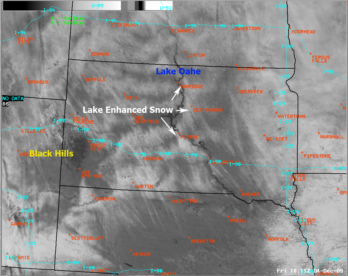
Below is a visible satellite picture from 1215pm CST Friday, 4 December 2009. The white over much of central South Dakota indicates areas light snow...with the brighter white “streaks” areas of heavier snowfall. Notable locations where somewhat heavier snowfall may have fallen were to the south/southwest of Pierre, and to the north/northeast of Mobridge. In these areas, the winds aligned parallel to the “fetch” or length of the lake such that more heat and moisture could be exchanged with the atmosphere. Those two areas are quite remote so unfortunately no snowfall reports where available.