Aberdeen, SD
Weather Forecast Office
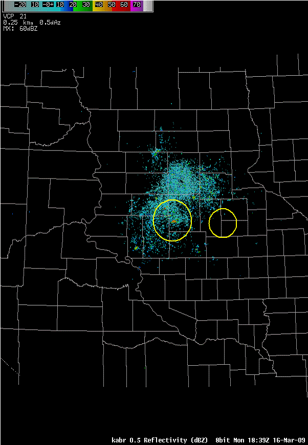
Thousands of geese have started their migration north making their way into South Dakota. As these birds fly over radar sites they can often be detected. One particular radar signature sometimes termed a “roost ring” was easily seen in radar images on March 16. A “roost ring” appears as birds leave their roost and fly into the air. The ring expands until birds begin dispersing and foraging.
The radar loop below shows a “roost ring” near the Cottonwood and Twin Lakes area in Spink County just south of Redfield. Another less distinguished “roost ring” can be seen near the Clark and Hamlin County borders. The radar loop starts at 1:44 PM CDT and ends at 2:40 PM CDT and the yellow circles highlight the two areas of interest.
Here's a more recent example, from March 2018.
.gif)
US Dept of Commerce
National Oceanic and Atmospheric Administration
National Weather Service
Aberdeen, SD
824 391st Ave S.
Aberdeen, SD 57401-9311
605-225-0519
Comments? Questions? Please Contact Us.

