
A Pacific storm will move across the Northwest U.S. through Thursday with low elevation rainfall, gusty winds, and mountain snows. A storm crossing the Northeast U.S. will continue gusty to high winds, scattered rain showers and limited snow showers into Thursday. Read More >
Overview
|
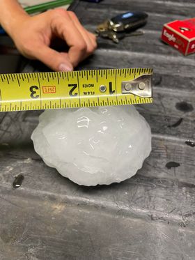
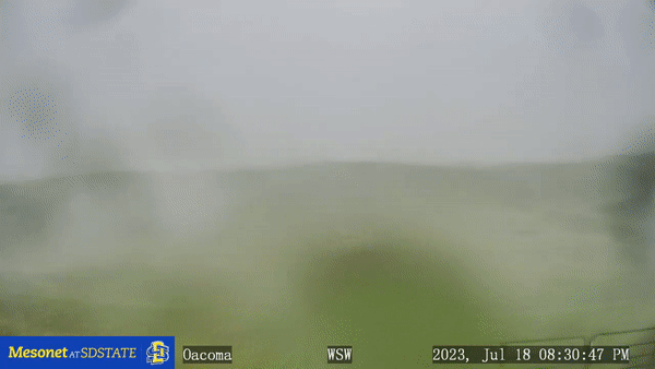
A warm front tracked from west to east across central South Dakota Tuesday afternoon, July 18th, which led to increasing temperatures into the upper 80s and low 90s as well as increasing moisture with dewpoints into the mid to upper 60s. Warm temperatures that also existed aloft along with weak forcing to get thunderstorms started resulted in relatively low potential for thunderstorms across central South Dakota. However, a few did manage to develop near the Missouri River around 5:30pm, and they quickly grew in strength as they took advantage of a favorable environment for severe weather, and became supercells (rotating thunderstorms). By 6:20pm, a supercell moved into Pierre and Fort Pierre, SD and began producing hail. There were numerous reports of baseball sized hail across the area, and even one larger than a softball, with an estimated diameter of 5.0". This hailstone is the largest on record in Hughes County (4.0" in Pierre 6/30/1997 and in Blunt 8/26/2018). In order for hail to get this large, it has to spend an extended amount of time lofted in the thunderstorm so it can gain layer after layer of ice. This is achieved by the thunderstorm's updraft - the stronger and larger the updraft, the larger the hail. Damage to vehicles, roofs, and other outdoor property resulted. This storm also produced a brief tornado about 11 miles south of Fort Pierre, just west of US Highway 83, around 6:45pm CDT. These storms then moved south and east through the evening, and continued to produce large hail as well as damaging winds. A wind gust of 100 mph was recorded just west of Oacoma at 8:15pm CDT via a Mesonet at SDSTATE weather station, and damage to power poles, trees, trailers and other property resulted in and around Oacoma. Heavy rain was observed into the night across southern Lyman County as well. |
 Estimated five inch diameter hailstone (Yes, hail can be round and smooth!) on the south side of Pierre along the Missouri River at 6:47 pm on Tuesday, 7/18/23. Photo taken by Lisa Woodward Harsma |
Hail, Wind & Tornado:
Hail
 |
 |
 |
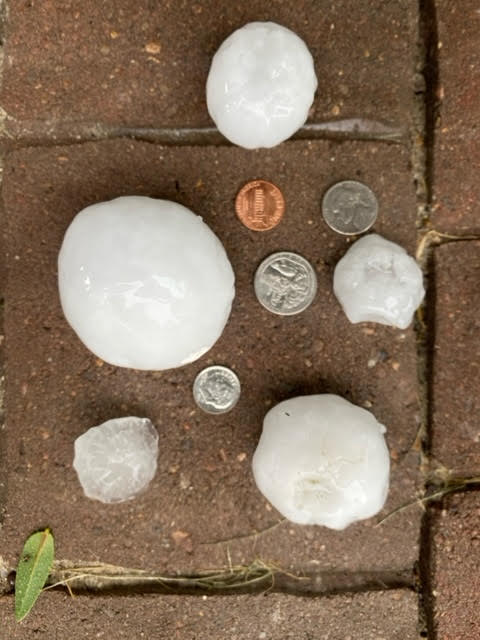 |
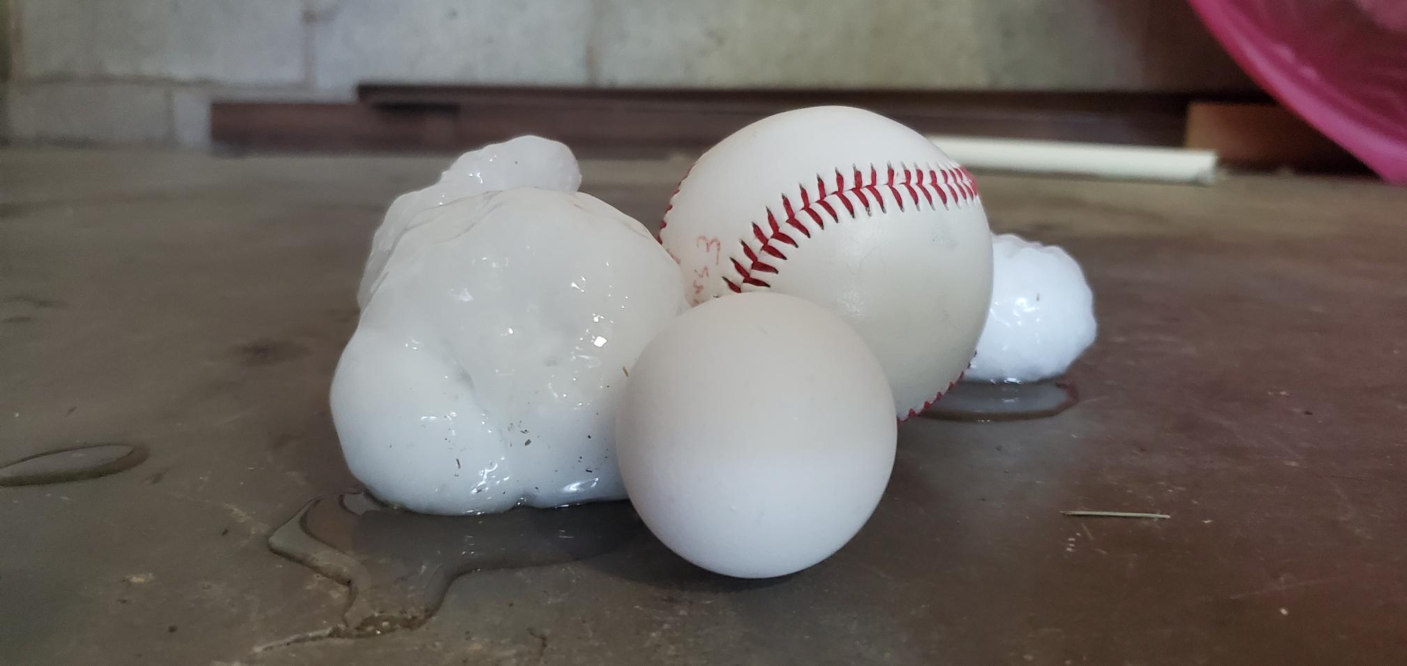
| Baseball sized hail in Pierre, SD at 6:25 PM. Photo from Alex Roeber | Large hail near the Pierre area. Photo from Sarah Eddy | Baseball sized hail in Pierre. Photo from John Hall | Hail in various sizes near Pierre. Photo from Sheriff Callahan |
 |
 |
 |
| Hail in Pierre. Photo from Tim Blow | Hailstone captured by Rae Herron in Pierre | An umpire holds baseball-sized hail that fell at the ballpark in Pierre. Photo from Brandon Carda |
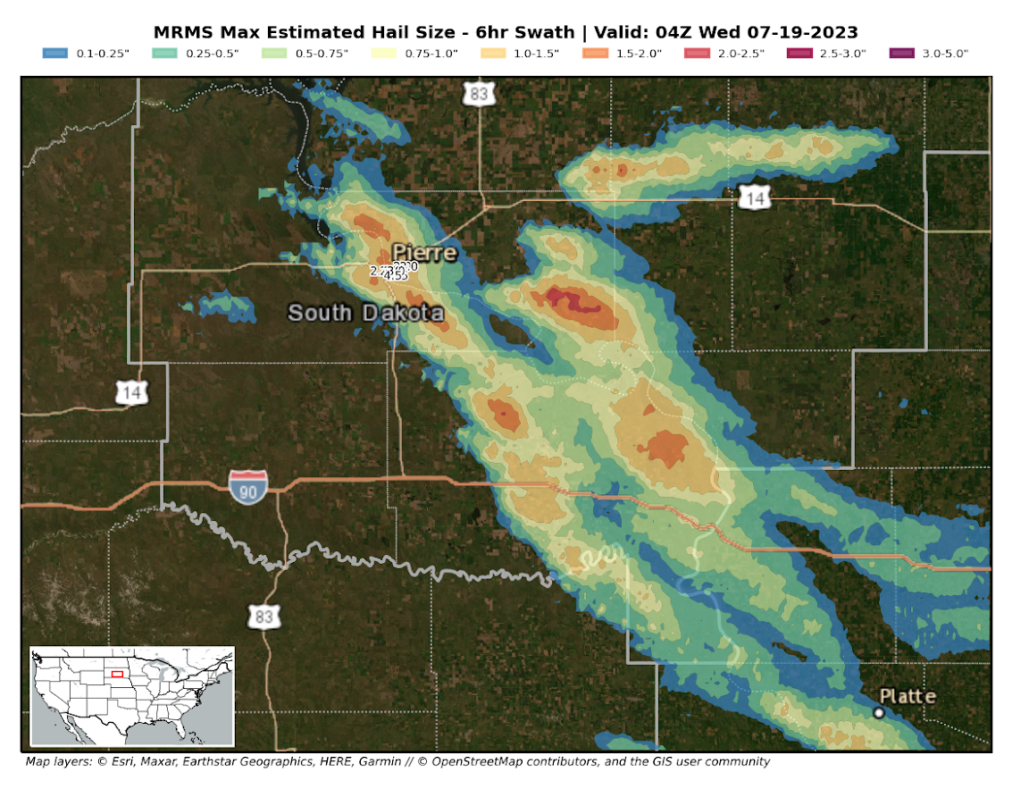
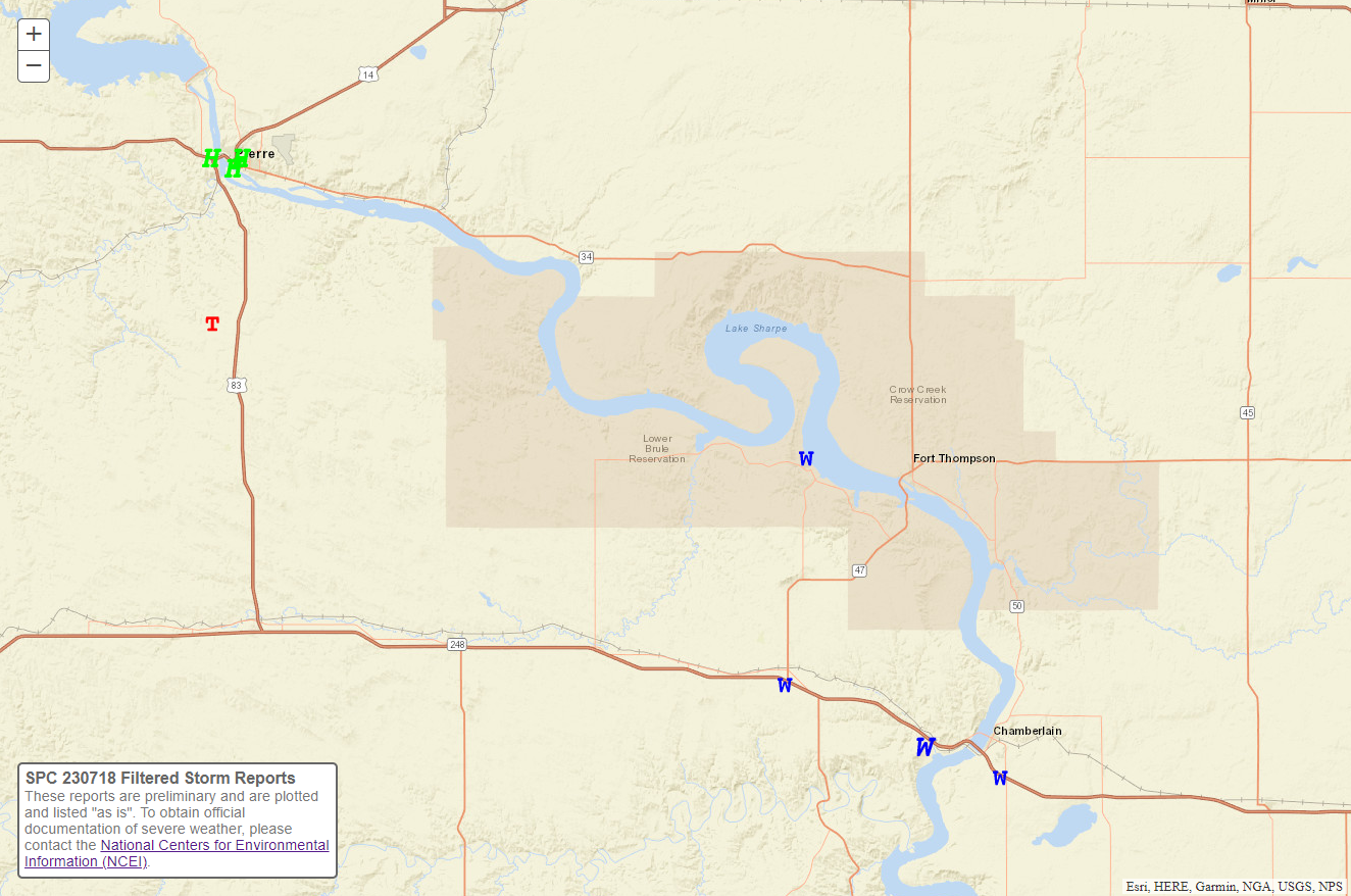
Below is a map of where hail is estimated to have fallen on the 18th, as well as the size. Supercell (rotating) thunderstorms were responsible for the severe weather, and while most tracked to the southeast across Hughes, Stanley and Lyman Counties, one did "split" and moved to the "left" across Hyde and Hand Counties.
Tornado & Wind
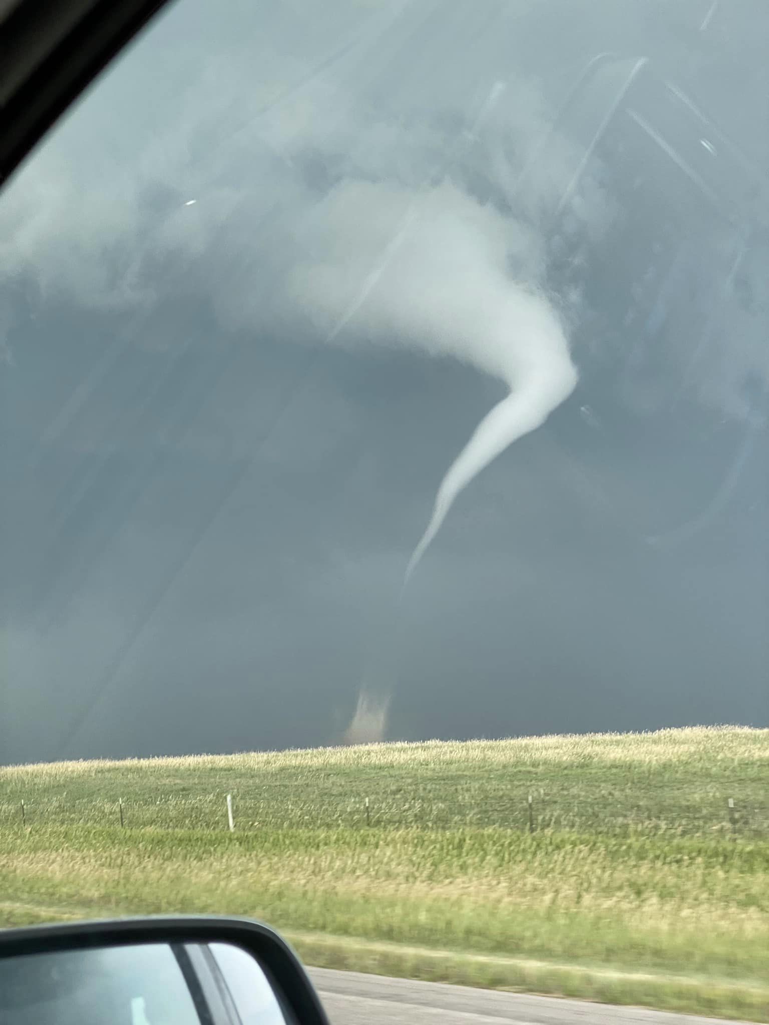
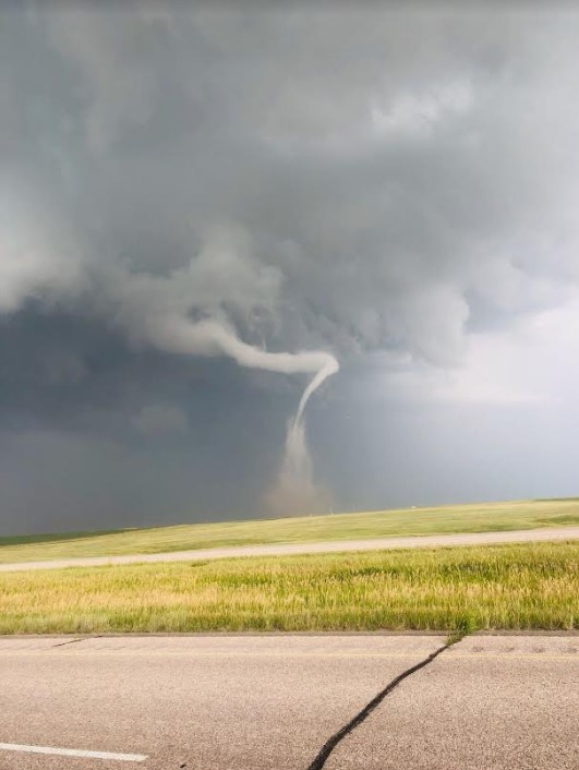
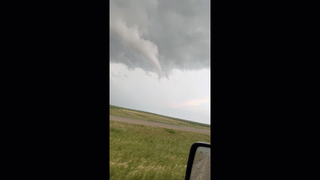
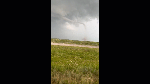
The supercell thunderstorm that produced significantly large hail in Pierre also spawned a tornado about 11 miles south of Fort Pierre around 6:45pm CDT.
 |
 |
 |
 |
| Tornado south of Fort Pierre on Highway 83. Photo from Anne Beckwith | Tornado 10-13 miles south of Pierre around 6:45 pm. Photo from Jaxon Jungwirth |
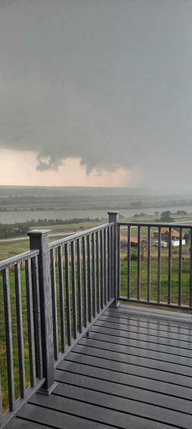
Funnel spotted. Photo take 1 mile west of the Cattleman's Club Steakhouse east of Pierre. Photo courtesy of Lori Butler. |
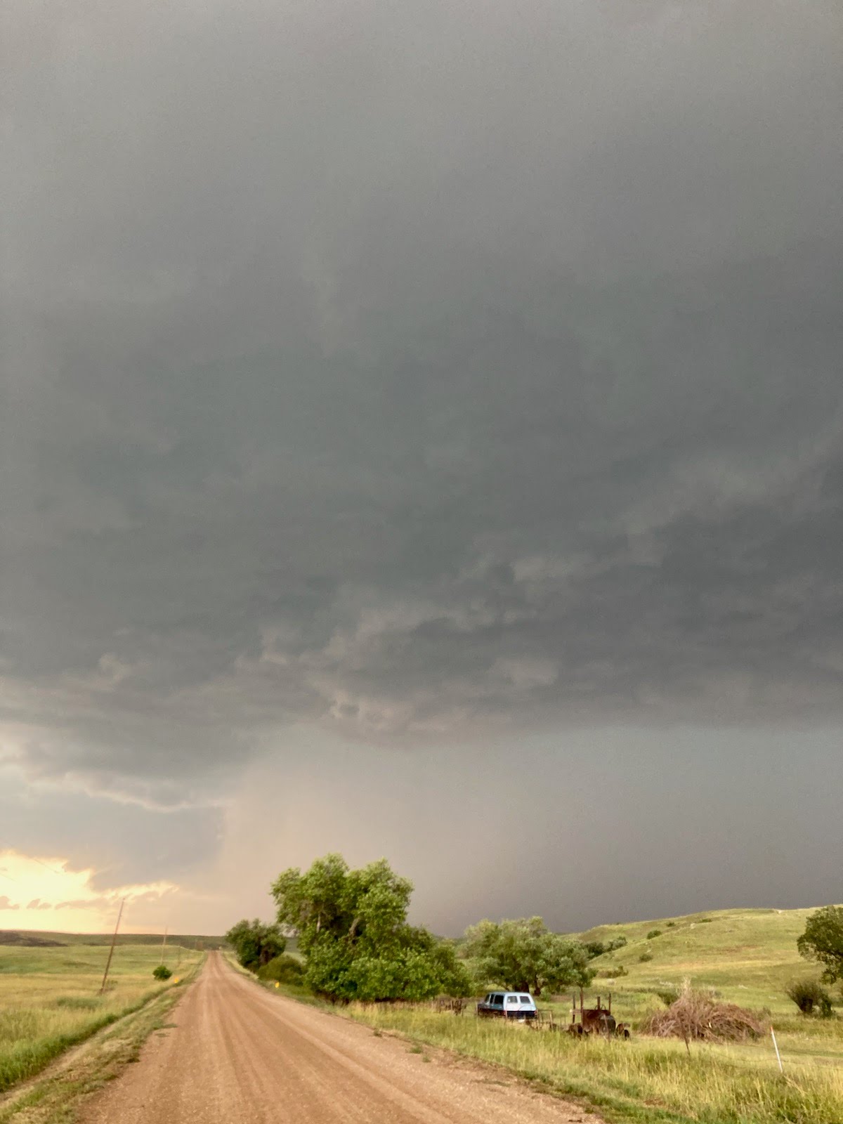
Storm approaching De Grey, as seen on Highway 34 at 6:55pm. Photo courtesy of Lisa Etzkorn. |
 |
 |
| Tornado Touchdown Video by Willie Dvorak of Jim River Guide Service | Tornado End Video by Willie Dvorak of Jim River Guide Service |
 |
 |
|
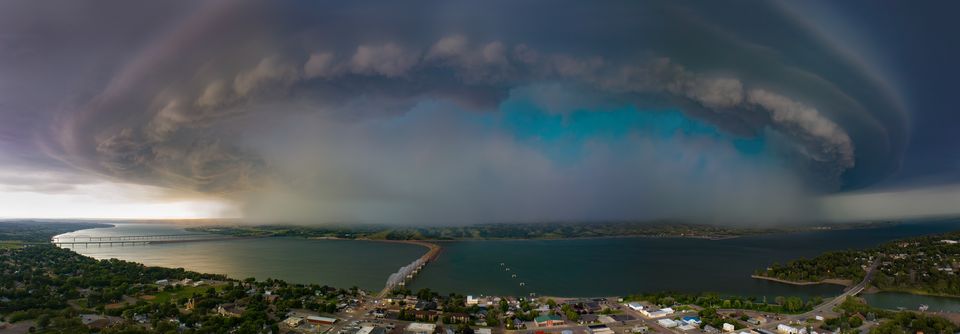
Drone footage of supercell from Chamberlain, looking west around 8:18 pm. Photo from Ezra Moore, Aerial 605 |
View from the Mesonet at SDSU Oacoma station that measured a 100 mph wind gust at 8:15 PM |
Storm Reports
Find an interactive map of storm reports on July 18th, 2023 here.
| WFO | Report Time | County | Location | State | Event Type | Magnitude | |
| ABR | 7/18 6:37 PM | Hughes | Pierre | SD | HAIL | 1 | |
| ABR | 7/18 6:40 PM | Hughes | Pierre Regional Airport | SD | HAIL | 2 | |
| ABR | 7/18 6:40 PM | Hughes | 1 W Pierre Regional Air | SD | HAIL | 2 | |
| ABR | 7/18 6:40 PM | Hyde | 4 N Holabird | SD | HAIL | 1 | |
| ABR | 7/18 6:43 PM | Hughes | Pierre | SD | HAIL | 3 | |
| ABR | 7/18 6:43 PM | Hughes | Pierre | SD | HAIL | 1.75 | |
| ABR | 7/18 6:45 PM | Hughes | Pierre | SD | HAIL | 2.75 | |
| ABR | 7/18 6:45 PM | Stanley | Fort Pierre | SD | HAIL | 2.75 | |
| ABR | 7/18 6:45 PM | Stanley | 11 S Fort Pierre | SD | TORNADO | ||
| ABR | 7/18 6:47 PM | Hughes | Pierre | SD | HAIL | 5 | |
| ABR | 7/18 6:56 PM | Hughes | 1 ESE Pierre | SD | HAIL | 2.5 | |
| ABR | 7/18 7:00 PM | Hyde | 9 NNE Highmore | SD | HAIL | 1.75 | |
| ABR | 7/18 7:00 PM | Hughes | Pierre | SD | HAIL | 3 | |
| ABR | 7/18 7:18 PM | Hughes | Pierre | SD | HAIL | 3 | |
| ABR | 7/18 7:29 PM | Lyman | 6 E West Bend Rec Area | SD | TSTM WND GST | 64 | |
| ABR | 7/18 7:40 PM | Lyman | 5 SW Lower Brule | SD | HAIL | 1 | |
| ABR | 7/18 7:45 PM | Lyman | 3 W Lower Brule | SD | TSTM WND GST | 70 | |
| ABR | 7/18 7:48 PM | Lyman | Lower Brule | SD | TSTM WND GST | 64 | |
| ABR | 7/18 8:05 PM | Lyman | 2 WNW Oacoma | SD | TSTM WND DMG | ||
| ABR | 7/18 8:05 PM | Lyman | 1 S Reliance | SD | TSTM WND DMG | ||
| ABR | 7/18 8:15 PM | Lyman | 2 W Oacoma | SD | TSTM WND GST | 100 | |
| ABR | 7/18 8:16 PM | Lyman | Oacoma | SD | TSTM WND DMG | ||
| ABR | 7/18 8:28 PM | Lyman | 3 SE Reliance | SD | TSTM WND GST | 71 | |
| ABR | 7/18 8:49 PM | Lyman | 5 SW Kennebec | SD | HAIL | 1.5 | |
| ABR | 7/18 10:51 PM | Lyman | 8 NW Iona | SD | HAIL | 0.5 |
Radar
Here are radar reflectivity loops for the storms that produced up to 5" hail in Pierre (left) and a measured 100 mph wind gust just west of Oacoma (right). For a deeper dive on satellite data associated with these storms, visit this summary page by the CIMSS Satellite Blog.
 |
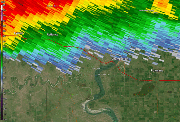 |
| Radar reflectivity from 5:58 pm to 7:16 pm on 7/18 | Radar reflectivity from 7:49 pm to 8:41 pm on 7/18 |
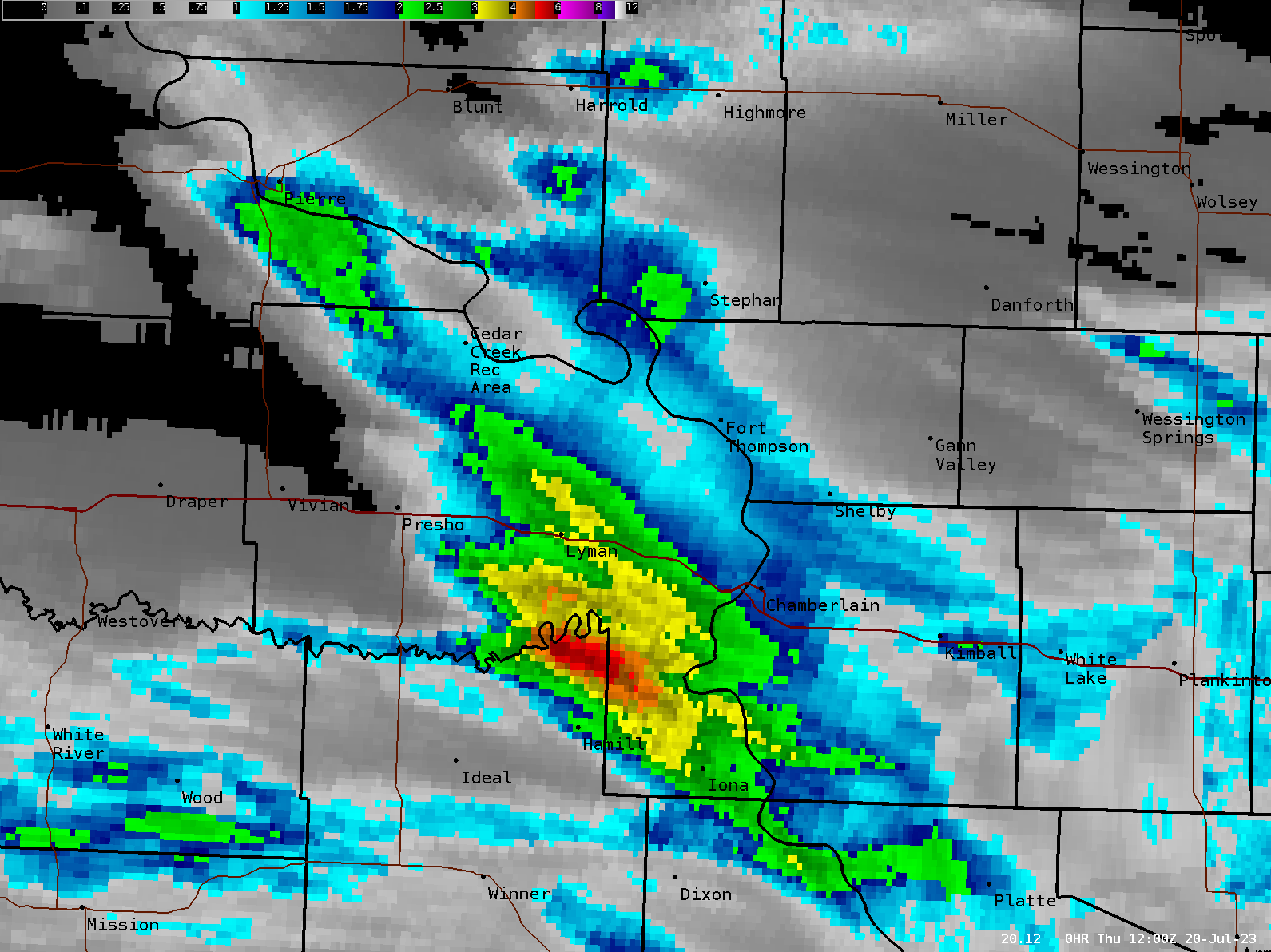
Rainfall
Storms developed and then re-developed over southern Lyman County on the 18th, leading to excess rainfall with estimated totals of 3 to 5 or more inches locally. Below is a map of radar-estimated rainfall over the past 48 hours as of 7am 7/20/2023
Historical Perspective
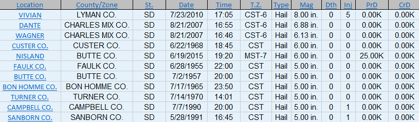
Softball (4.5" in diameter) size or larger hail has only been recorded 42 times in South Dakota since records began in 1950. This means on average, South Dakota observes softball sized hail or larger once every 1.74 years.
 |
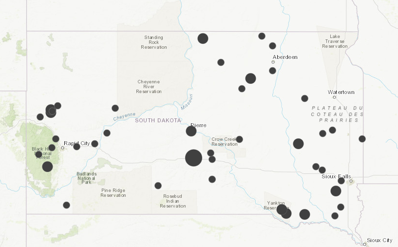 |
| This is a list of all hailstones larger than softballs on record in South Dakota. Information from the Storm Events Database via the National Centers for Environmental Information |
Map of all softball (4.5") or larger diameter hailstones on record across South Dakota since records began in 1950. KEY: Smallest dots = 4.5" hailstones, Medium sized dots = 5-7" hailstones, Largest dot = 8" Vivian Hailstone |
 |
Media use of NWS Web News Stories is encouraged! Please acknowledge the NWS as the source of any news information accessed from this site. |
|

