Aberdeen, SD
Weather Forecast Office
What a Difference A Day Makes!
Thursday April 23rd: A unseasonably warm airmass produced several record high temperatures over north-central and northeastern South Dakota as temperatures soared into the 80s and 90s with bright sunshine. Below is a list of a few cities that recorded a new record high temperature.
| City | New Record High | Previous Record | Year of Previous |
| Aberdeen | 90F | 87F | 1994 |
| Mobridge | 89F | 87F | 1990 |
| Pierre | 88F | 87F | 1990 |
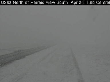
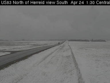
Friday, April 24th: In the wake of a potent cold front temperatures on Friday afternoon were nearly 50 degrees colder than Thursday!!! In addition, a narrow but potent band of snow dropped visibilities down to one half mile at times. Even with the very warm temperatures the previous day, a slushly accumulation of snow occurred over portions of north-central South Dakota. The images below were taken from Herried, SD between 1pm and 130pm Friday afternoon. Welcome to Spring in the Dakota's!
 |
 |
US Dept of Commerce
National Oceanic and Atmospheric Administration
National Weather Service
Aberdeen, SD
824 391st Ave S.
Aberdeen, SD 57401-9311
605-225-0519
Comments? Questions? Please Contact Us.

